Around Basel – Eiserne Hand with historical boundary stones

Boundary stones tell stories. Where I live, they tell us about the history of the Regio Basilienis. One example are the historical boundary stones along the “Eiserne Hand” (“Iron Hand”) at Riehen.

The “Iron Hand” looks more like a finger. It belongs to Riehen and reaches into Germany, between Lörrach-Stetten and Inzlingen. The “Iron Hand” is about 1.7km long and 50m-300m wide. The boundary line encompasses 3.5km overall (red line around “Herrenwald” and “Maienbühl”). 

Source: Swiss Topo and my own photos

More than 40 boundary stones mark the border along the “Eiserne Hand”. I show some stones on the map above. The oldest stone is from about 1500. 


The oldest boundary stone with the red bishop’s crook, about 1500

The oldest boundary stone (#61, about 1500) is nicknamed “Bischofstein“ (Bishop’s Stone). In 1500, the Bishop of Basel resided in Basel, and Riehen was one of his possessions. The stone shows the red bishop’s crook on the Swiss side. It is the only red bishop’s crook along the “Eisernen Hand”. The black bishop’s crook below is the coat of arms of the CITY of Basel that we will see on all the other boundary stones.


Coats of arms of the Schönau family NORTH of the “Iron Hand”

On the German side of the Bishop’s Stone #61 from about 1500, we see the coats of arms of the noblemen of Schönau. 

Stone #61 is on the northern border of the “Eisernen Hand” (towards Stetten which is located north of the “Iron Hand”).

Towards the north, the Schönau family marked more boundary stones, such as #51 from the year 1600,…  

… and stone #59 from 1700.

The Schönau were a powerful noble family in the Black Forest. The city of Stetten uses the three rings of the Schönau family in their coat of arms today. 


Coats of arms of the Reichenstein family SOUTH of the “Iron Hand”

Along the southern border of the “Eiserne Hand” (towards Inzlingen, located south of the “Iron Hand”), I find five stones with the coats of arms of the noblemen of Reichenstein. They owned Inzlingen as a fief. The years I identified are 1717, 1737 und 1752. 

Examples are the stone #69, with no year, …

… the stone #70 from 1737, …

… and the stone # 71 from 1739.

This is the view of the German settlement Inzlingen that once belonged to the Reichenstein family; I took the photo from the path aolng the border of the “Iron Hand”, in the rain.

By the way: The coat of arms of the Reichenstein family can also be found along the boundary path behind the Chischona and on Reichenstein Castle at Arlesheim. 


Boundary stones marked by the Grossherzogtum Baden (Grand Duchy of Baden) (1806-1918)

From 1806 to 1918, the German area bordering the “Eiserne Hand” was called Grossherzogtum Baden (Grand Duchy of Baden). That is why we find the coat of arms of the Grand Duchy with the slanting red bar on yellow background (years I found are 1830/40/42/48/56).

The most beautiful boundary stone is #54 from 1842 with the crown.

The other stones just show the red bar on yellow background such as #65 (no year, I assume mid 19th century).

Later the Grand Duchy invested less effort and marked their stones just with “GB” for “Grossherzogtum Baden”. I found nine stones with “GB” with the years 1888, 1898 and 1900 engraved. This is stone #71a from 1888.

By the way, boundary stones with the red bar or the letters “GB” are found along all the borders of Basel with Germany, for instance also on the Chrischona. 


Republic of Baden from 1918 to 1945

From 1918 to 1945, Baden was a Republic; from this time, I found one boundary stone, #60, marked with „RB“ (“Republic of Baden). 


Unified as Baden-Württemberg from 1952

In 1952, the German area bordering the “Eiserne Hand” was unified to Baden-Württemberg. I found two boundary stones from 1954 showing a plain “D” on the German side. 


The “turning point” marked by the “Dreieckstein” (“triangle stone”)

The “turning point” of the Eiserne Hand is marked by the so-called “Dreieckstein“ (“triangle stone”), stone #64 from 1717. Here the German communities Lörrach-Stetten and Inzlingen meet the Swiss community Riehen.


The black bishop’s crook of the City of Basel on the Swiss side

On the Swiss side, Riehen was acquired by the bishop of Basel in1270. After the reformation of 1529, Riehen remained with the city of Basel. The city of Basel has always marked their side of the “Eiserne Hand” with the (black) bishop’s crook, and the crooks vary in shape. Here are some examples. 

The city “owning” the black bishop’s crook can be seen from the boundary path along the “Eiserne Hand”. 


Boundary stones tell stories; they tell us about history

Boundary stones tell stories. Where I live, they tell us about the history of the Regio Basilienis. One example are the boundary stones along the “Eiserne Hand” or “Iron Hand”: On the German side they mark the evolution from the possesions of the noblemen of Schönau and Reichenstein (family coats of arms) to the Grand Duchy of Baden (elaborate representations of the coat of arms – slanted red bar on yellow background – and plain “GB”). Later the duchy became the Republic of Baden (RB). Now we border the German state of Baden-Württemberg (plain “D” on the stones). On the Swiss side the stones illustrate the evolvement of Basel as the bishop’s residence (with the red bishop’s crook, before 1529) to the protestant city of Basel (with the various black bishop’s crooks). 

The “Iron Hand” is just one example of historical boundary stones. There are may more examples, such as the Benkenspitz (border with France), the trail to the Schauenburger Fluh (border between Basel and Solothurn) or the border of the Prince Bishopric of Basel such as above Biel-Benken. And – there are many more boundary stones waiting to be explored.

May some of you decide to discover the stones of the “Eiserne Hand” and later turn to the borders with other cantons, with France, with Germany or check, where the historical Prince Bishopric of Basel has left marks. The small monuments are hidden in forests and fields around Basel and they speak to us.  We just have to listen to them.


Sources:

  • Wiki  entries about the Eiserne Hand, about Stetten, about the Grossherzogtum and the Republic of Baden
  • Homepage of Stetten and Baden,
  • Information website of the Wasserschlosses Inzlingen,
  • Working material (Arbeitsmaterialien) Heimatkunde Riehen.


Around Basel: Augusta Raurica from the craft house to the temple of Grienmatt

So far we have explored the Roman city of Augusta Raurica, first its history and the city centre. Then we moved on to more “remote sights” and investigated the Roman Castrum and the show room under the church at Kaiseraugst.

Now, we visit the other more “remote” sights of Augusta Raurica, including the animal park.

On the plan of the Roman remains, our next destinations are: 10 (craft house), 14-17 (brick manufacture, town wall, tomb, east gate, animal park), 18 (cloaca and cellar), 12 (outer amphitheatre) and 11 (Grienmatt temple). Further remains of the town wall can be seen south of (12) crossing the motorway.  


Source: Tourism map on homepage of Augusta Raurica


The craft house complex (Gewerbehaus, 10)

Next to the noisy main road (Kantonsstrasse), the ruins of three houses have been preserved, one being a former fullery (Tuchwalkerei) and one a former restaurant. Panels make the ruins come to life. This is what the craft house complex might have looked like in Roman times…

… and these are some of the ruins that remained from the restaurant.

The craft house complex was bordering the old Roman road connecting Rhaetia with Gaul. I start to dream of the passers-by that entered the restaurant here to have a beer (“cervisia” in Latin) and a meal.  


The brick manufacture (Ziegelei, 17)

Ruins of a brick manufacture are in the residential area Liebrüti.

The Romans used baked clay for tiles and bricks. They were particularly useful for their heating installations. The Romans had standardized the production, as the explanatory panel explains.

The factory is closed. I look at the ruins through the mirroring glass.


The tomb (Grabmonument, 15)  

A few meters south from Liebrüti is the area with the tomb (15), the east gate (14) and the animal park (16).

These are the remains of the tomb.

As the panel explains, the tomb monument was round, about 5m high and covered, a bit like a tea kettle.

Next to the tomb I admire, how the Romans built their bridges. Some sandstone building blocks are on display.

Again, everything is documented carefully to bring the ruins to life.  


The east gate (Osttor, 14)

This is what the east gate once looked like. Constructing the defensive wall around Augusta Raurica had started in the late first century AD, but the walls had never been completed. Even the east gate was not really a gate, but just two towers.

This is one of the two towers.


South of the residential area Liebrüti and close to the brick factory, part of the eastern fortification wall has been preserved.

South of the amphitheatre (12) the motorway cuts through the town wall. On the southern bank of the motorway, one part of the fortification wall has been carefully marked, just in front of a traffic sign.  


I have to admit, it took me some time to identify the wall across the scrubs. Furthermore I have to admit that I must have passed by this historical monument hundreds of times in my car without noticing it. Again I am impressed, how well marked it is and how well explained it is on the panel that I now discovered on the way to the outer amphitheatre.


The animal park (14)

Near the east gate, the small animal park must be the kids favourite. It is a collection of ProSpecieRara animals that allude to the animals the Romans once had. The black pigs love the warm sun.

The geese walk around their pond, chattering at me. The Romans valued them much, because their chattering once saved Rome (387 B.C., when Celts tried to conquer the Capitoline Hill, the geese chattered and warned the citizens of Rome).

There are some Roux du Valais, a species of sheep that was saved from extinction thanks to ProSpecieRara. They look at me from behind the fence. 


The peacock seems to have a nap. Pretty complicated to lie down with all these feathers.

I have visited this charming small animal park so many times. I have watched the kids admire the animals so many times. And only recently, I have discovered the pink panel that explains the origins and the use of the animals. For instance, rich Romans held a peacock in their garden, because it is a beautiful animal. They also liked to eat the meat and used the feathers as a fan or as decoration.


Yes, every time I return to Augusta Raurica, I discover something that I have not taken notice of so far. The archaeologists have done an encompassing job of documenting it all.

I meet the guardian looking after the animals. I ask him, whether he is an archaeologist that also looks after the animals (perhaps it is his hobby), and he answers: “No, no, there also “normal” people working for the Augusta Raurica Foundation, not only archaeologists.” Nice.


Water channel (cloaca) and cellar(18)

These panels in the middle of the open field point to the water channel (cloaca) and to the cellar under the former Roman baths in the upper city centre. In the background we see the modern residential area Liebrüti.

Not much is visible from the central baths built in the 1st century AD, only the channel that drained the water from the baths. The floor is made from sandstone and the walls are covered with limestone, as the panel explains.

The cellar under the former baths belonged to a house that was here, before the baths were built. The niches were used to place goods.


History Path

Not far from the water channel and the cellar, I reach the Roman history path. I enter through the gate…

… and see a long, long path, lined with more than 30 panels laid out along a time line. The panels explain, how Augusta Raurica evolved as part of the Roman empire. 

To study the panels will be the focus of another visit. 


“New” amphitheatre outside of the city (12)

From the history path, it is not far to the amphitheatre that was built outside of the city centre of Augusta Raurica in the 2nd century AD.

There is a picnic place here – the archaeologists think beyond archaeology. I do not know of many amphitheatres with picnic places – this is unique. I took this photo on a sunny November day; I liked to observe the families with kids enjoying their barbecued sausages amidst the ancient ruins.


Temple Grienmatt (11)

My last stop today is the “Temple Grienmatt”. Well, “Grienmatt” is not the Roman name. “Grienmatt” can be translated to “pebble meadow”, as “Grien” means “pebbles” in Swiss German.

The panel says that it is difficult to interpret this temple. It seems that the cows do not notice, how reputable their environment is.  


Thank you, Munatius Plancus, for having founded Augusta Raurica, and thank you, Augusta Raurica Foundation and archaeologists, for telling us about it

I now have looked at Augusta Raurica in five blogs:

I have to thank you, Lucius Munatius Plancus, for having founded Augusta Raurica (even, if it is not completely sure that you have founded it and even, if Roman warriors do not really wear pink leggings with golden laces, as presented in the city hall of Basel…).

Furthermore I thank all the members working for the Augusta Raurica Foundation that have made the ancient ruins come to life, carefully preserving them, documenting them, making them accessible to visitors, and – making them fun for visitors by setting up picnic places and organizing events for families, for children and for all those that are interested in our Roman ancestors. Not to forget the guardians that care for the animals in the small animal park which is certainly a kids favourite.


Sources:

Kaiseraugst again – the show room under the church St. Gallus

Whenever I return to Augusta Raurica, I find something that is new to  me. Recently I have discovered the Roman sewage channel and nearby the show room under the Church St. Gallus.

It was by looking at the brochure about treasure hunting for children, that I found out about the Roman sewage channel. 

Source: “Finde den Schatz – Schnitzeljagd im Kastell Kaiseraugst”, brochure for children acquired in the museum of Augusta Raurica

When I visited the sewage channel in June 2021, I also found the entry to the show room with the bath and rests of the church from late antiquity.


The Roman sewage channel

The sewage channel emerges from the fortification wall above the Rhine river, near the church.

Berger (p. 335) and the panels say that the sewage channel was built for the Roman Castrum in the late 3rd century AD.

In Roman times, the smell might not have been too welcoming  here.

Steps invite visitors. To the left of the sewage channel exit, I see a door. I enter and I am in the show room under the church and under the adjacent church garden.


Overview of the show room with bath and remains from early Christianity

On my first visit, I saw just ruins and heard Roman street noise and some church music. I returned later, after having read in Berger (p. 335ff). The following two on site panels help me understand best, what I see: The ground plan shows the area of the show room in faint pink, and the upright projection gives a perspective view of the ruins in front of the “reconstructed” model of the early Christian church from around 400 AD (late antiquity).  

Source: Two panels in the show room (it is amazing, how everything is documented carefully, take your time to go through it).

In the show room we see the private bath (black/red 1-4 and a,b,c) and remains related with the early Christian church St. Gallus and with Christianity (dark blue, 5,6, X; we do not see 7). The sewage channel (purple, 8) runs through the show room, before reaching the exit in the fortification wall.


The bath – the private bath of the bishop?

Why a bath, so close to the church? The panels explain that the bath has been built after 400 AD, when “normal” people could no longer afford a private bath. Perhaps it was the bath of the bishop and of the clergymen (see panel in the show room). This hypothesis is supported by the fact that the early Christian church St. Gallus from the late 4th century AD was large and hence important. If there was a bishop, he would have lived behind the fortification wall on the right hand (western) side of his bath. However, though some sources mention bishop Justinian around 400 AD, the first proven bishop is Ragnacharius around 600 AD (Facciani, p.173 and 178f); it might well be that he moved his seat from the Castrum to Basel. A lot of guessing. What seems pretty sure is that the pool (c) in the bath was not a baptismal font, as some archaeologists suggested earlier. Facciani rejects the hypothesis of a baptismal font based on plausible arguments (Berger, p.337f). For instance, there is no direct access from the church to the font, very impractical. 

This is room number 4. According to the panels it was a corridor; Berger (p.337) says, it could also have been the changing room of the bath, called Apodyterium.

In the corner we can see the sewage water channel (8).

From the corridor (4) people entered the Tepidarium (warm room, 1) using the door marked by the black gate; the threshold (a) has been preserved. Very difficult for me to see the threshold, but I trust the archaeologists.

Next comes the Caldarium or hot room (2). Two columns and tubes of the floor heating remain in the right hand edge. As a matter of fact, we stand on the base of the floor heating today; the “real” floor was above the pile of tiles (pilae). 

I am puzzled. Only now I notice the labels under the ceiling. So far, I had just looked at the ruins below me and not at the signs above me… 

As the label indicates, we see a wonderfully preserved duct (b) that takes heat from the heating room (Praefurnium) into the hot room (2). I stand, where the heating room must have been before. 

Behind the hot room (2) and the heating conduct (b), there is the water tank or pool (c). There have been debates about this pool that in the 1960-ies was identified as a baptismal font, but this hypothesis was rejected by Facciani later. 


The remains related with the early Christian church

The use of the site as an early Christian church started at the latest after 400 (as the panels say).

This is the northern annex to the apsis of the early Christian church (5). The sewage water channel (8) can be seen here as well. 

Part of the marl ground of the annex has been preserved (see above in the left hand lower corner and below).

From 700 AD onwards, people were buried next to the church. A grave from the 8th/9th century reaches into the show room.

Only now I notice the description on the left hand side. The curators of Augusta Raurica think of everything carefully.


The exhibition on the east wall of the bath (X)

The exhibition on the east wall of the show room explains the early days of Christianity, shows examples of tomb slabs from the necropolis outside the castrum and tools as well as jewellery from early Christianity.

A Christian community existed in the Castrum already in the 4th century AD (The Roman emperor Konstantin had legalised Christianity in 313 AD). Until about 700 AD, the people were buried in the necropolis outside the city. This is one example of a tomb slab from the 7th century, with a cross engraved.

The combined tooth picker and ear spoon with the sign for Christ belonged to a Roman officer (about 350 AD, part of the silver treasure of Augusta Raurica). I imagine him using this tool…


Good-bye Castrum for now

I leave the show room through the door, where the Rhine appears full of water after the heavy rain falls of this summer 2021. 

I feel like reading in Berger about what I have seen. I find a table in the restaurant Adler in the main street of Kaiseraugst. 

The crowned eagle of the Habsburgians decorates the entry, as Kaiseraugst has belonged to Vorderösterreich until the Congress of Vienna (1815).

The meal served at the restaurant Adler is delicious: Risotto with Taleggio cheese and pears and a Greek yoghurt with nuts, figs and honey. Sure, I will return to this restaurant and also to Kaiseraugst and the Castrum.   

We will visit more “remote” sights of Augusta Raurica in my next blog.

Sources:

  • Website of Augusta Raurica
  • “Salve – Plan”, Augusta Raurica 2019.
  • Guido Facciani et alii: “Die Dorfkirche St. Gallus in Kaiseraugst. Die bauliche Entwicklung vom römischen Profangebäude zur heutigen christkatholischen Gemeindekirche”, Forschungen in Augst, Band 42, Augst 2012.
  • Ludwig Berger (Editor), “Führer durch Augusta Raurica”, Schwabe Verlag Basel 2012; contributions by Thomas Hufschmid, Sandra Ammann, Ludwig Berger und Peter-A. Schwarz, Urs Brombach
  • Panels on site in the show room

Around Basel: Augusta Raurica – Castrum or Kaiseraugst – first visits

Kaiseraugst near the Rhine is, where the Roman Castrum Rauracense was established around 300 AD. The people retreated here to withstand the growing attacks of the Germanic tribes from the north. In the charming village centre of Kaiseraugst, we find remains of the Castrum and of late antiquity.


A look at the map to see, where the Castrum is

This is the map of Augusta Raurica, “our” Roman city, with the centre and the more “remote” sights, amongst them Kaiseraugst or the Castrum.  


Source: Tourism map on homepage of Augusta Raurica

The brown line shows the whole city of Augusta Raurica, with the centre (numbers 1-7, e.g. forum, theatre, museum) and the more “remote” sights Kaiseraugst (19-21, baths, castrum wall and church), 10 (craft house), 14-17 (brick manufacture, tomb, east gate, animal park), 18 (cloaca and cellar), 12 (outer amphitheatre) and 11 (Grienmatt temple).

After having looked at the history and legends around Augusta Raurica and after having visited the centre of the Roman city, we next look at Kaiseraugst with the Castrum near the Rhine, leaving other more remote sights for later.


Mouth of the Ergolz, the river that marks the border between the cantons Aargau and Baselland  

After about an hour of cycling from my home, I arrive near the mouth of the river Ergolz. Well, I do not intend to continue to Rotterdam or Nantes, as Eurovelo proposes. Let us start our tour around Kaiseraugst here.

When I am here for the first time, it is November 2020. The school boat is practicing on the Ergolz and on the Rhine.

At this place, the Ergolz is the border between the cantons Baselland (to the west, village Augst) and Aargau (to the east, village Kaiseraugst).

This is the view of the power station in the Rhine; left, the Ergolz flows into the Rhine, and I stand under the golden leaves of an “Argovian” oak tree.

Now I have zoomed in the power station.

The buildings of the power station are in Germany. It is possible to cross the dam to Germany, on foot or by bike. 

The book edited by Berger contains a map that shows three Roman bridges, one of them above the modern power station. Two more bridges crossed the Rhine, where Kaiseraugst is located today.  

I walk through the park along the Rhine. Now, in November, it is in hibernation, the benches are being overhauled. This bench says: “I am under renovation and will appear shining all new in two months time.”

Also the swimming pool near the camping site is awaiting the next summer.

Where the park ends, I start my round tour to the Roman past. The Roman sights are well marked.

I have to follow the column with the brown arrow to discover the Roman Castrum.


Part of the defensive Castrum walls has been preserved (see map #19)

The western defensive walls of the Roman fortress or Castrum have been preserved. 

We can see the layout of the Roman western gate on the pavement. The main street of the modern village centre of Kaiseraugst starts here, and this was also the main street of the Castrum.

The panel provided by the Augusta Raurica Foundation shows, what the Castrum might have looked like with the western gate (left) and the surrounding wall and ditch. 

The Thermae or Rhine Baths are highlighted on this panel.


Thermae or the Rhine Baths, where the Romans met (20)

What looks like the entrance to an underground garage behind the community centre is the access to the Rhine Baths (Thermae). 

Under the ground, the bath rooms have been preserved, some cold, some warm, and one hot. I stand on the base of the floor heating (hypocaust). We cannot see the heated “real” floor, where the Romans walked. It has disappeared.

The panels explain that in the warm or tepid rooms, the Romans would sit, chat, have light meals and play games. 

The vitrine explains that wooden sandals were needed to walk in the hot bath – here, the floor was hot!

I wonder, how well I would have seen my hair in this mirror to fix the hair pin. 

It is amazing, with how much care the baths have been set up to give the visitors a picture of Roman life. The access to this gem is free.


The village church St. Gallus (see map #21) – early residence of the bishop of Basel?

So far, I had never taken notice of the church St. Gallus at Kaiseraugst. Now I discover it with Guido Facciani. On the cover page of his document, he shows, how the building evolved from Roman times until today. In Roman times, it was a profane building, then it became a meeting hall with an apse that, probably in the 4th century, was remodelled to become the first church (Facciani, p. 149/173). I always admire, how archaeologists can read ruins. 

Some say that the church St. Gallus was the seat of the bishopric “Raurica”. However the existence of the bishop mentioned for the 4th century, Justinian, cannot be confirmed (Facciani, p. 173). The first proven evidence of a bishop goes back to 600 AD: Sources mention Ragnacharius as the bishop of Augustudinae et Basiliae (Facciani, p. 178, Vita des Eustasius). Facciani suggests that Ragnacharius started his mandate at the Castrum Augusta Raurica/Kaiseraugst and then moved to Basel (Facciani, p.179).

Facciani found evidence of an early Romanic church built in the 10/11th century (Facciani, p.180). The church was rebuilt again in the 14th century (after the Basel earthquake, Facciani, p. 183). The tower has been preserved from that time.

In the 18th century, the church was renovated adding baroque elements (Facciani, p. 185). Is the “undulating” gable of the nave not almost too graceful above the bricks marking the edges of the nave and being so close to the tower from the 14th century?

By the way, the baroque façade is inclining towards the Rhine, as the ground is sinking here.


Why is Kaiseraugst called Kaiseraugst?

I had always wondered, why Kaiseraugst is “Kaiser”-Augst or “Imperial”-Augst. Perhaps due to the Roman emperors? No, it is due to the Habsburgians. They were emperors or “Kaiser” and they acquired Kaiseraugst in 1442 to become part of “Fore” Austria (Vorderösterreich). In the Congress of Vienna (1815), Kaiseraugst became part of the canton Aargau and Switzerland. Across the Ergolz is “plain” Augst that had been acquired by Basel and now belongs to the canton Baselland.  


Fortification to protect the bridge (22)

I am back in June 2021. The ferry across the river Rhine runs. In his work life, the captain headed cargo ships between Basel and Rotterdam. Now retired, he still works on the river Rhine managing and running the ferry of Kaiseraugst. He even offers Fondue evenings on his boat. Very creative. I might consider that.

We enter the ferry and ride to the German side of the Rhine, where the Romans had built this fortification to protect their bridges across the Rhine. 

Remains of the three northern towers (inland) can still be seen, the territory above the Rhine collapsed.

A signpost guides us to the remains of the fortification called “Römischer Brückenkopf”.

We follow the small path and find the three towers amidst trees and bushes. This is one of them.

Through the trees, we can see Kaiseraugst and the Saint Gallus church. Storks are breeding in the nest on the church tower.

Having returned to the Swiss side, we admire the white swans that do not take any notice of us.

They are cleaning their feathers, how beautiful. 

Let us return to Kaiseraugst to visit the show room between the church St. Gallus and the Rhine in the next blog. 

Sources:

  • Website of Augusta Raurica
  • “Salve – Plan”, Augusta Raurica 2019.
  • Guido Facciani et alii: “Die Dorfkirche St. Gallus in Kaiseraugst. Die bauliche Entwicklung vom römischen Profangebäude zur heutigen christkatholischen Gemeindekirche”, Forschungen in Augst, Band 42, Augst 2012.
  • Ludwig Berger (Editor), “Führer durch Augusta Raurica”, Schwabe Verlag Basel 2012; contributions by Thomas Hufschmid, Sandra Ammann, Ludwig Berger und Peter-A. Schwarz, Urs Brombach

Around Basel: The centre of the Roman city Augusta Raurica

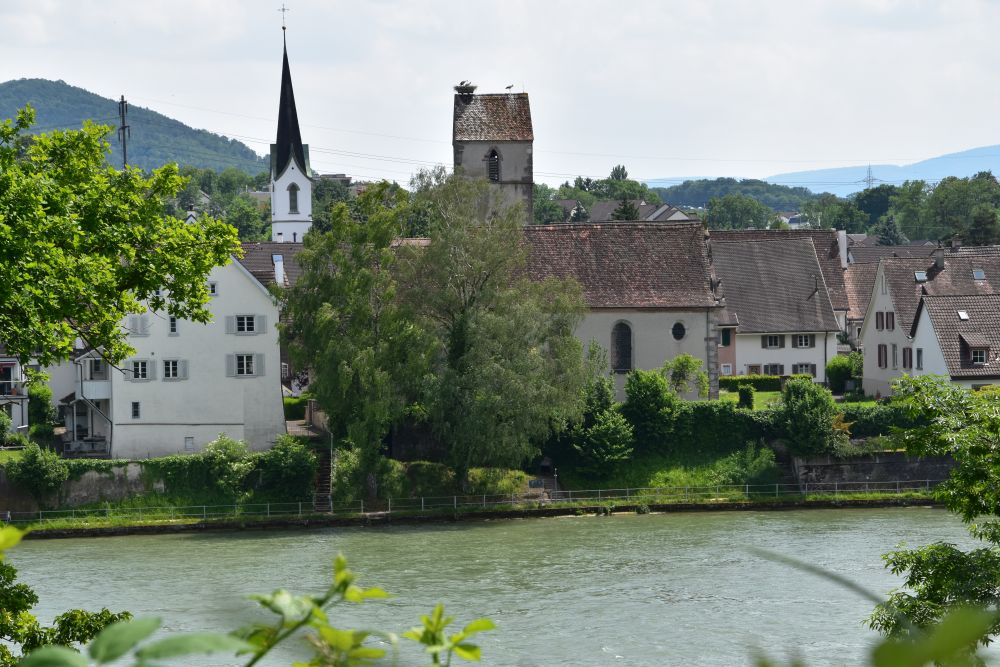
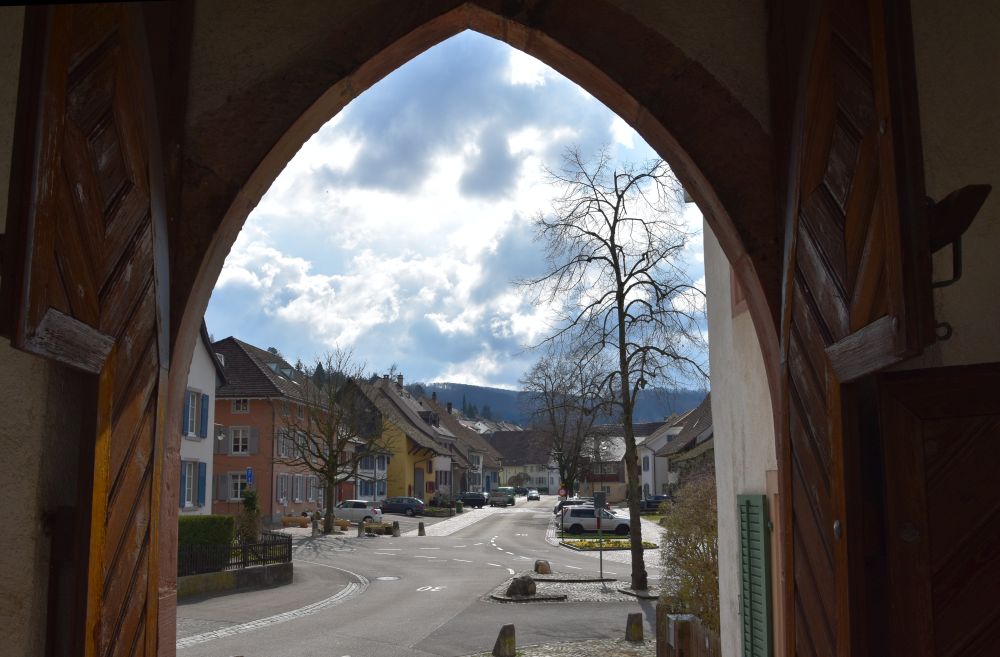
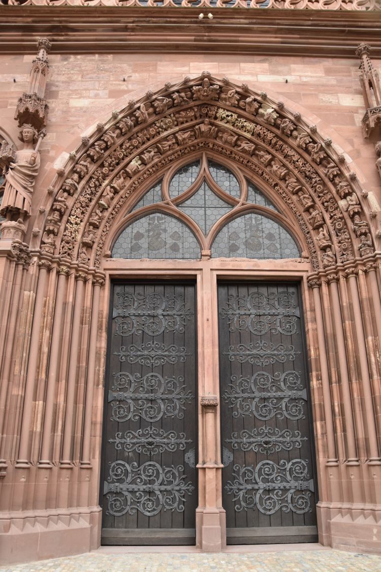
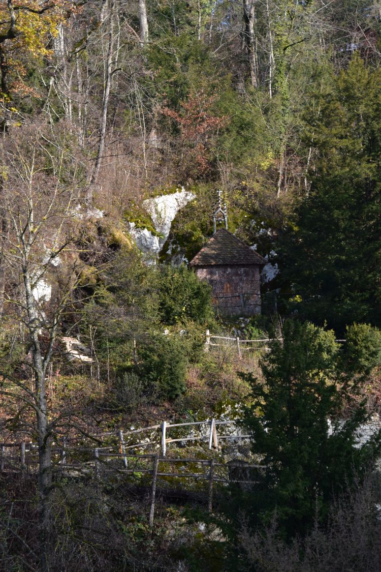
After having looked at the foundation legend and history of Augusta Raurica, we now walk through the centre of the Roman city of Augusta Raurica, and I will convey some of my personal impressions. I return regularly to Augst. For instance, I was here in November 2020, again in spring and once more in summer 2021. And I will soon return again.


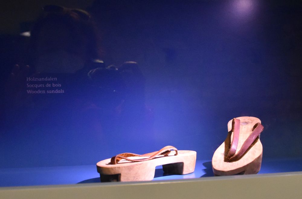
The museum with the rich Roman treasure

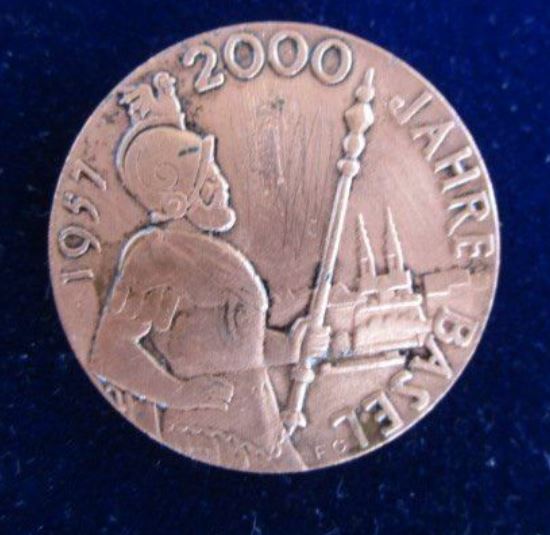
This poster stands right near the central parking. It shows citizens in the 1960’s that hold silver plates in their hands.

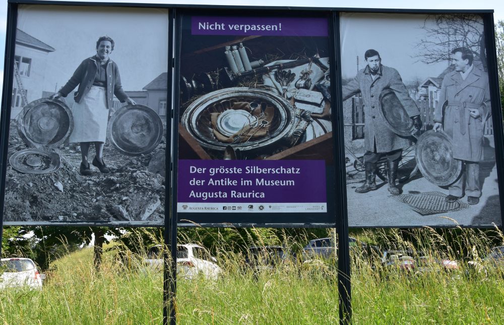
“Do not miss it!” the panel says, “the largest silver treasure of the ancient world in the museum of Augusta Raurica.” I assure you, the silver treasure IS impressive. It is already amazing, how it was discovered! In the 1960’s, a digger accidentally uncovered the treasure, when preparing a field for construction, and the operator did not notice what he had uncovered. People from the village found the treasure later. Some kept their findings (that happens even in Switzerland) and some took them to the museum. Most of the stolen silver pieces were given to the museum later (this is nevertheless Switzerland). The archaeologists assume that in the 4th century AD, a Roman citizen, scared by the attacks of the Germans coming from the north, hid his silver treasure in a wooden box, which remained under the ground for about 1600 years, until the digger came in the 1960’s.

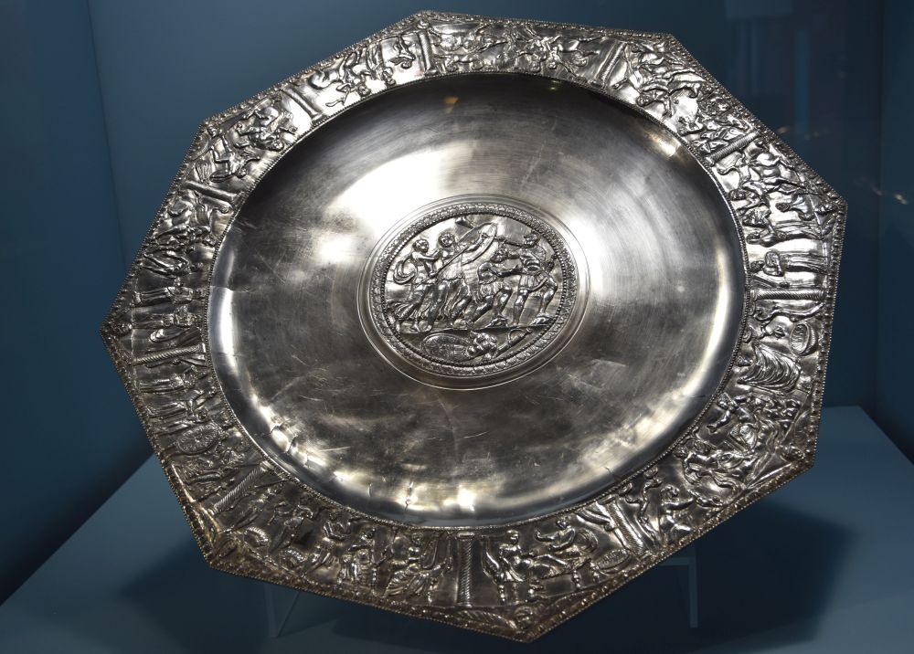
The treasure is on permanent display in the museum. I pick out two examples. This is the so called “Archilles platter” from 330-340 AD. 

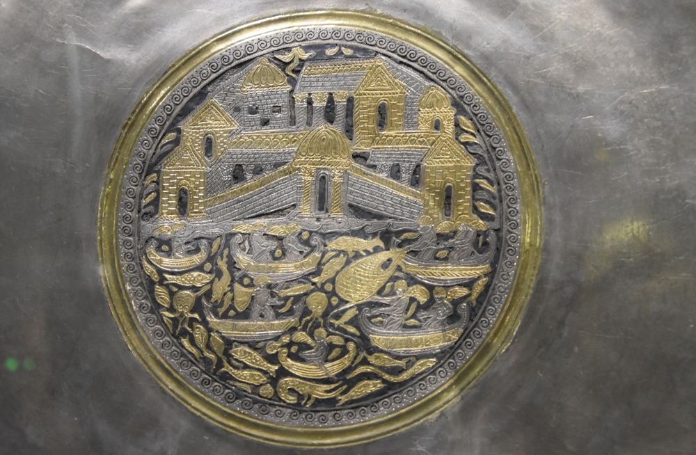
The following platter shows a villa near the sea (330-350 AD). Whenever I visit the museum, I say hello to this finely engraved medallion showing the sumptuous villa and the fish in the sea with the people in the boats hunting them. In the middle, there is even an octopus.

In addition, the museum illustrates what a Roman atrium house looked like.

This is the dining table. 

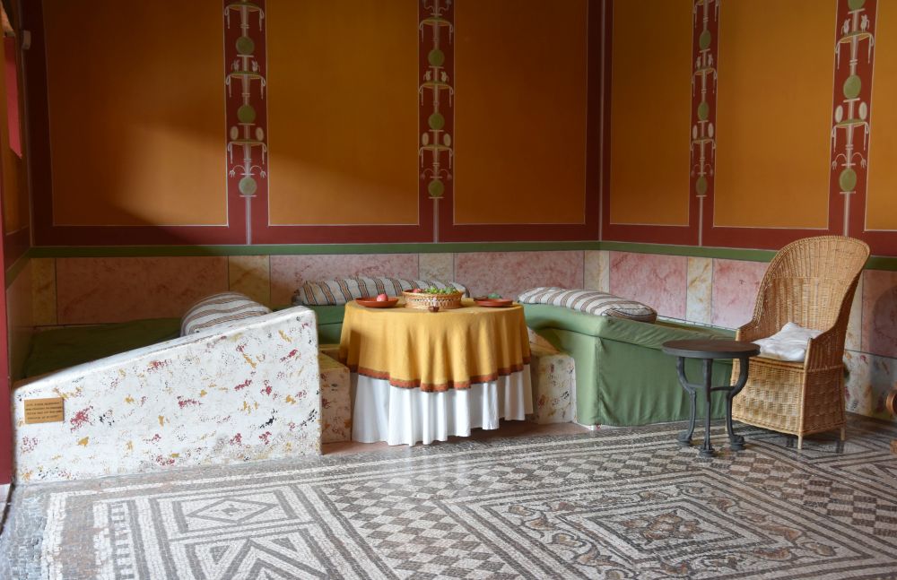
The Romans used to eat lying around the table (called “accubare”). When lying, you can eat more than when sitting on a chair “compressing” the stomach. I am just not sure, how authentic the cane chair is… but I trust the curators of this museum.

In Ravenna, I found the Last Supper, where Jesus and the disciples eat the “Roman way” (photo taken by me in Sant’Apollinare Nuovo).

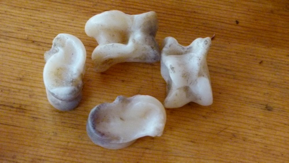
The atrium house conveys details of Roman life such as these bones with a wooden “booklet” explaining, how to play with them.

I came across such bone games in Mongolia in 2014. These were goat bones, we used for playing. In addition, the Mongolians use sheep bones for playing.

At the end of the atrium house tour, the coach illustrates how the Romans travelled. There are some places around Basel, where the prints of coach wheels can be seen on the Roman paths cut into rock (for instance above Flüh).  

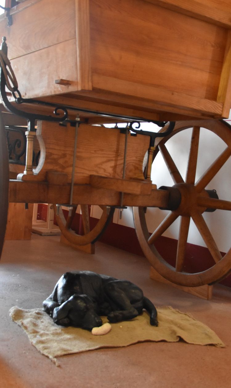
Recently, the curators have added the black dog lying on the sack with the sausage in front of the nose. Whenever I return to this museum, I find some small detail added with much care. 

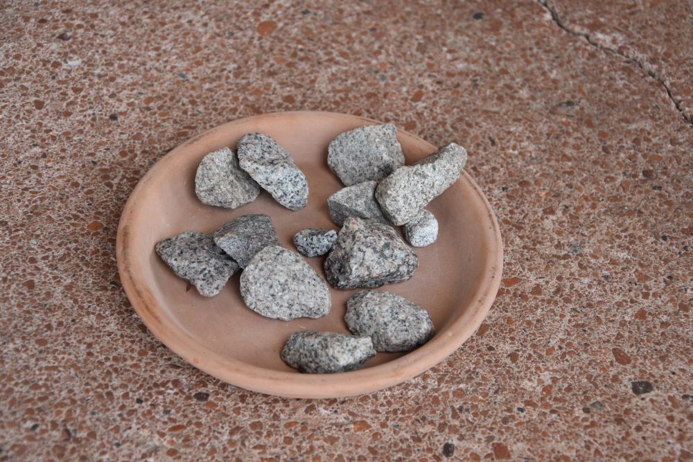
Just outside the museum, I notice an earthen plate with small stones. What is this? Has someone lost these stones? But – in a plate? 

I look around and, nearby, I discover this triangle, divided into numbered fields. 

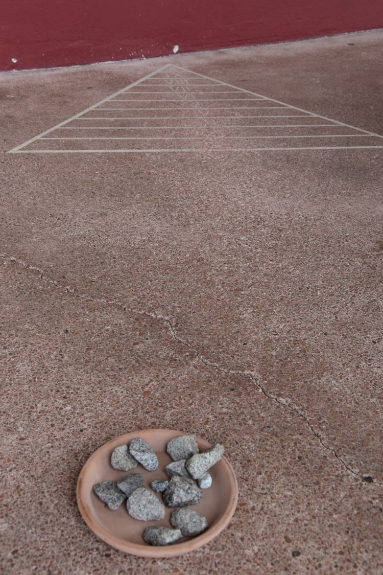
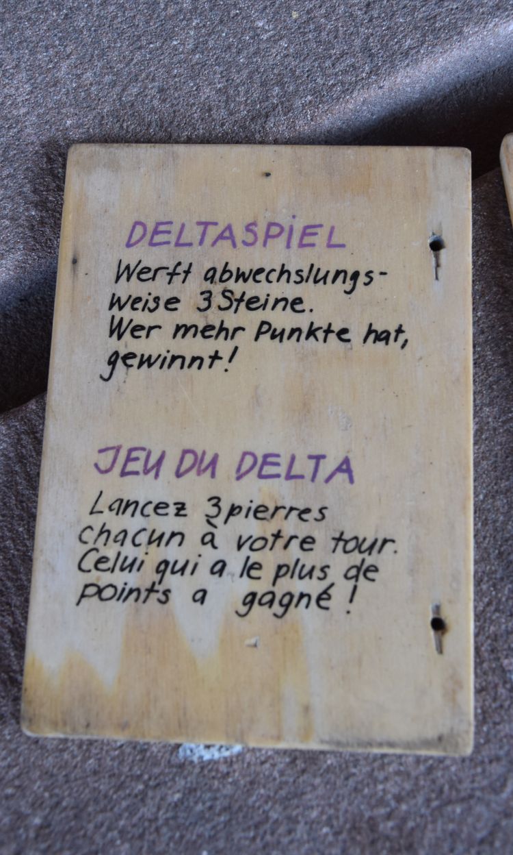
Ah, here it is, the wooden booklet lays out the rules of the delta game, the Deltaspiel. You have to throw three stones in turn, and the winner is the one who achieves the highest sum of numbers.

At Augusta Raurica, children are welcome at all places! I do enjoy discovering such small details.


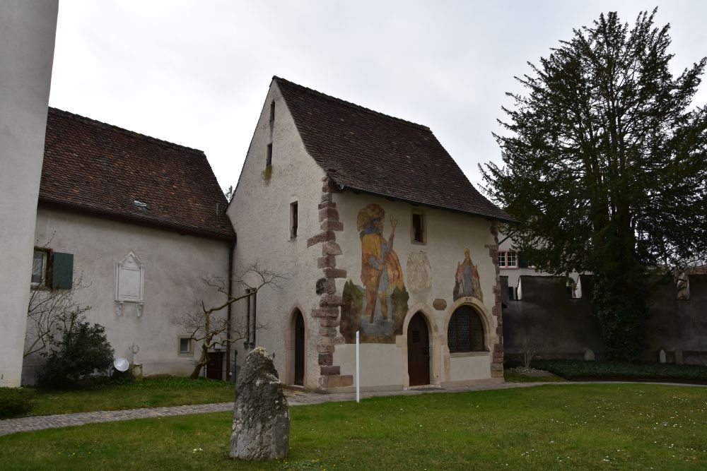
The theatre “of nine towers”, the temple “Schönbühl” and the taberna

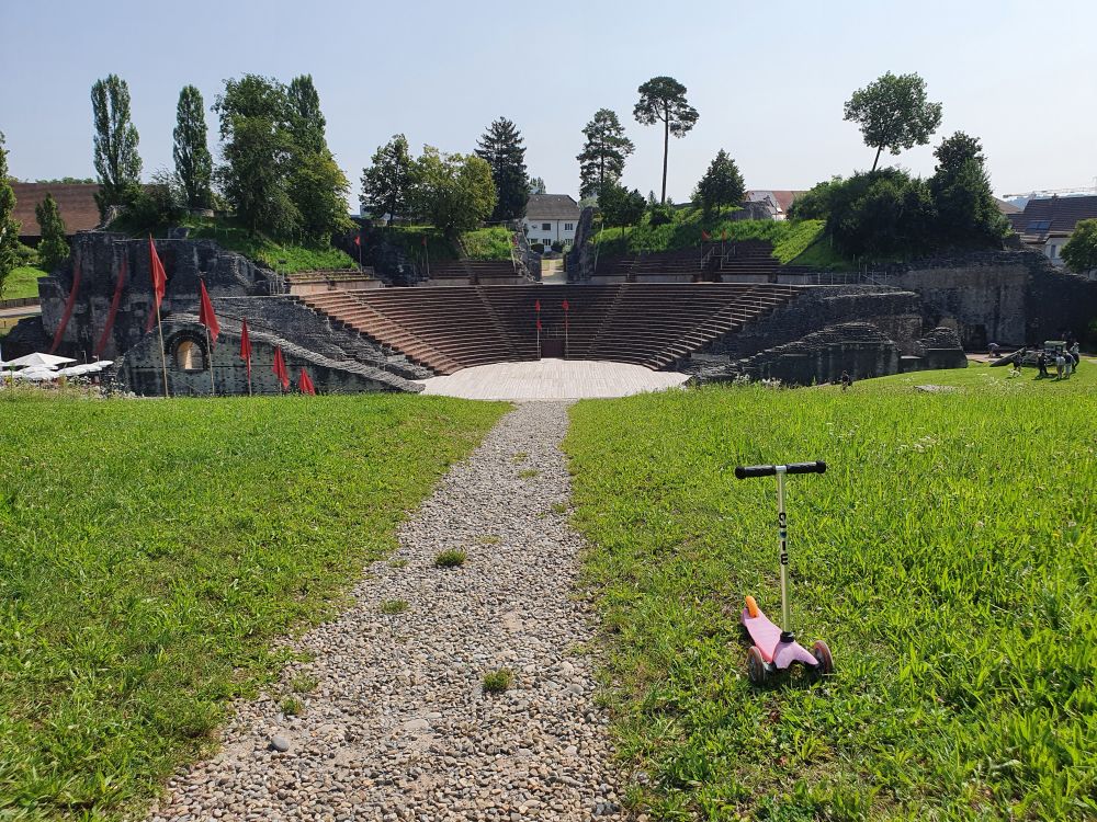
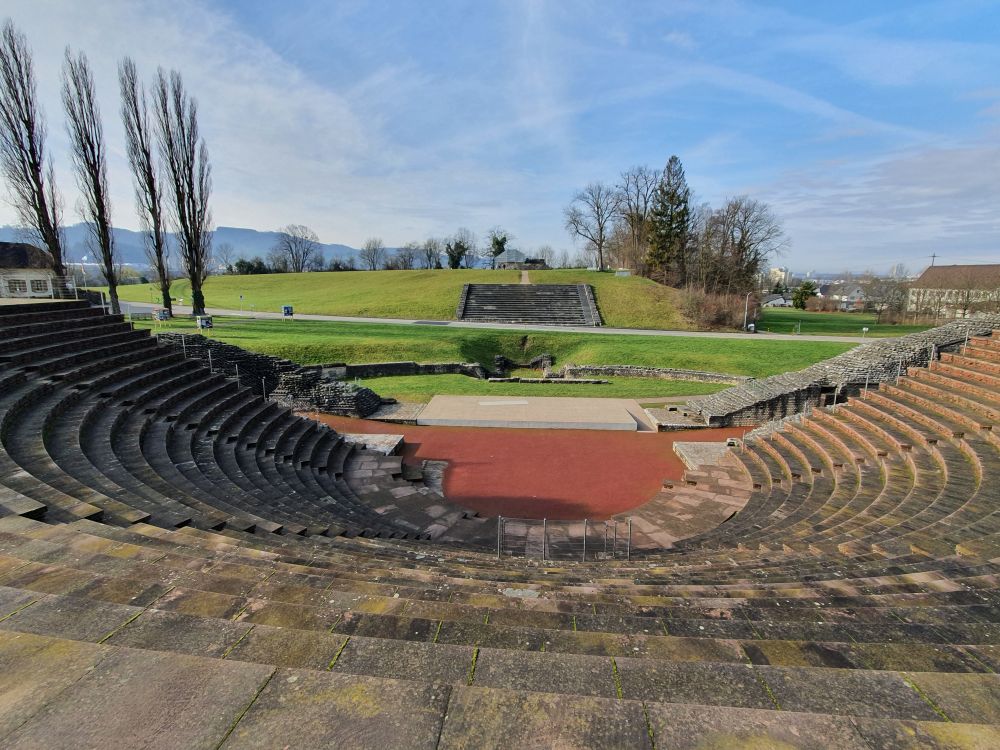
The central theatre is the dominant place at Augusta Raurica, just next to the museum. To get a good view of the theatre, I usually climb the hill across called Schönbühl with the “Schönbühl” temple (well, “Schönbühl” is not the Roman name, but this is, what it is called today). Carefully the panels are set up to explain all the details about the theatre and the construction periods (see left hand side).  

The citizens of Augusta Raurica reconstructed their theatre a third time around 200 AD. It was a scenic theatre and accommodated for 10-12’000 spectators. The constructors of the theatre made use of the slope across the Schönbühl hill. The sidewalls rounding off the spectator area (cavea) were open in the  middle – the archaeologists are quite sure of this and assume that the theatre and the “Schönbühl” temple were connected such that spectators could watch temple services from the theatre (Berger, p. 113).

When I return mid July 2021, red flags decorate the place. The summer program is on, until mid-August. The footboard in the foreground indicates that some parents show Augusta Raurica to their young son or daughter, and they may now be visiting the temple behind us. They are not alone, many families walk around Augusta Raurica, especially during the summer school holidays.

Having climbed the spectator area (cavea) of the theatre we look across the Sichelen valley to the Schönbühl hill and the “Schönbühl” temple.

Just across the theatre is the taberna with the oven. Berger, p. 226, says, that a family house was planned here. The owner and the foundation of Augusta Raurica agreed swap of territories to preserve the taberna with the oven and make it publicly accessible. The oven is from the mid-3rd century AD. Though the place has been named “taberna” or “restaurant”, the excavators believe, it was rather a private house with a workshop that perhaps sold food as a side business (Berger, p. 230). 


Around the forum, the main square

The beginning of the forum “meadow” has been marked by this wooden construction. Perhaps this is , where the forum temple was. A stork nest has recently been added under the middle arch (another nice detail new to me). 

It is difficult to imagine this meadow to be the main forum. Berger, p.46, gives me an idea: The western part was the sacred area with the temple, while, at the opposite end, the public area was closed up by the basilica and the curia (the latter looks like an apsis). Bordering the forum are various insulae or blocks of houses, laid out as rectangular as the hill allows. In the background, the theatre and the “Schönbühl” temple can be seen; due to the topography, the ensemble does not form a straight line as in other Roman cities. 

The victory column must have formed the south east corner of the so called insula 9 (block of houses bordering the sacred area to the right of the forum). Victoria carries the globe on her head. This column is a copy of the original (Berger, p.9). 

On the forum, the July/August summer activities have been installed with much care and taking into regard the hygienic requirements of the Covid pandemic, however, with some eye twinkling. “Desinfectus hygiena” is understood by everybody, no knowledge of Latin required. 

From the forum, parts of the curia have been preserved and partially restored. “Roman puppets” stand around and by looking into binoculars, you can see them in the forum, as it was about 2000 years ago.

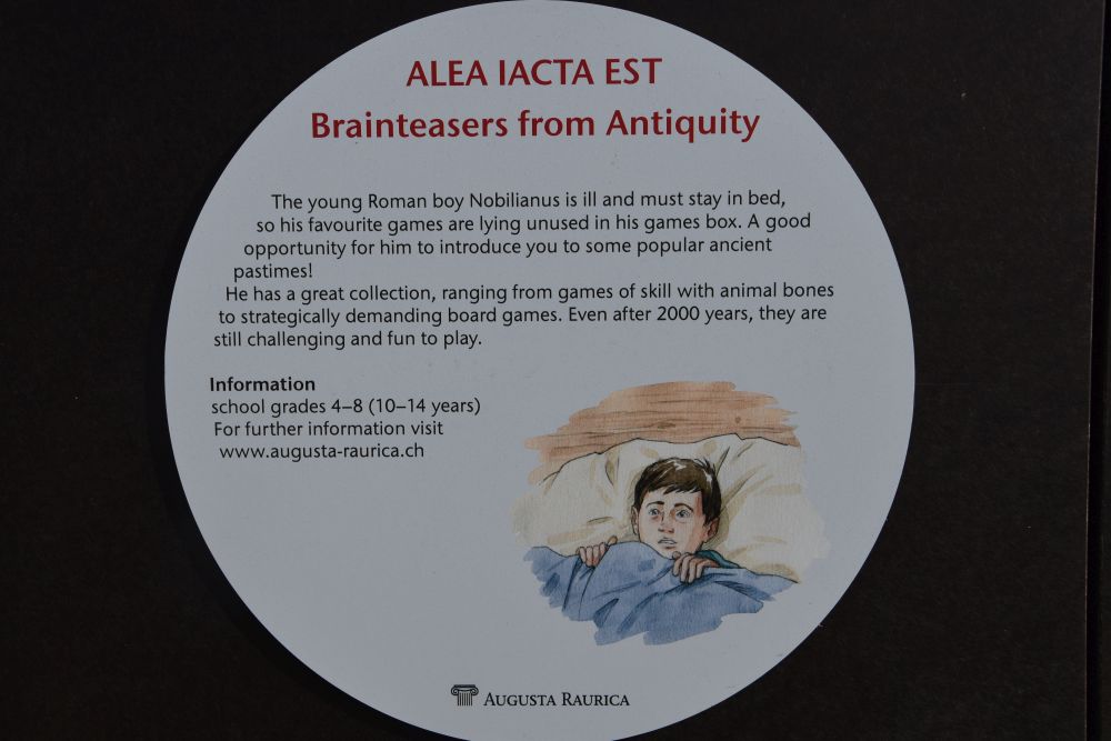
Next to the curia I discover some cupboards that hold games for children from 10 to 14 years. The kids are invited to accompany poor boy Nobilianus who is ill and needs distraction. In various languages, among them in English. 

Under the curia, there is a cellar with mosaics. Many of them are currently being restored, amongst them also my favourite one (my photo from 2013).

It is the so-called “Gladiatorenmosaik” that shows a fish pond which is fed by the water game in the jug, as the panel explains. One of the jug handles has been repaired somewhat oddly.

During the current “summer activities”, the cellar has become a workshop for people and children who want to create their own mosaics. Children will never feel bored at Augusta Raurica.

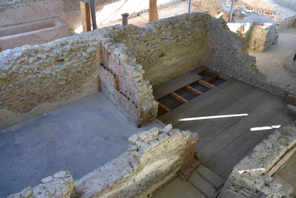
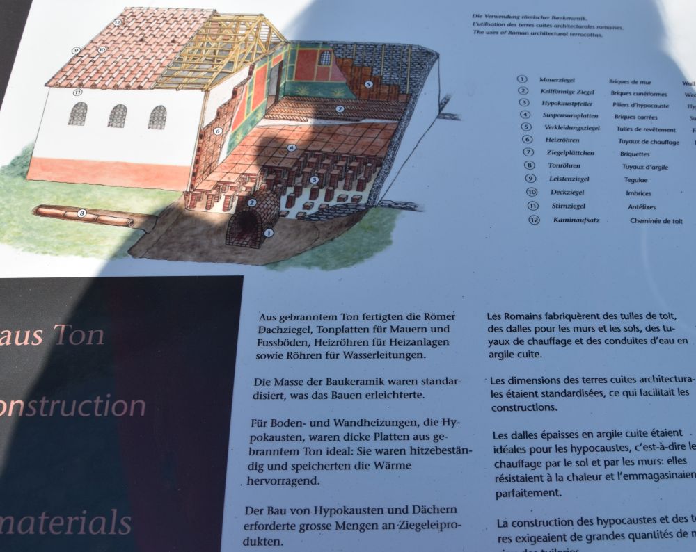
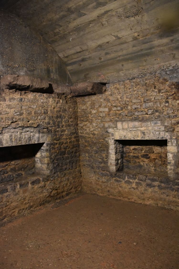
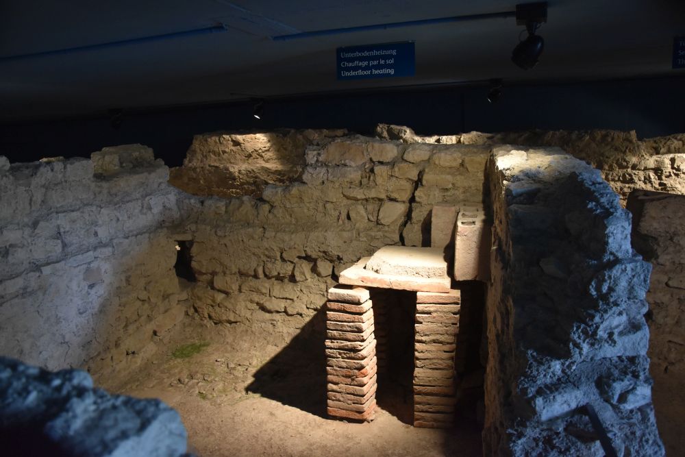
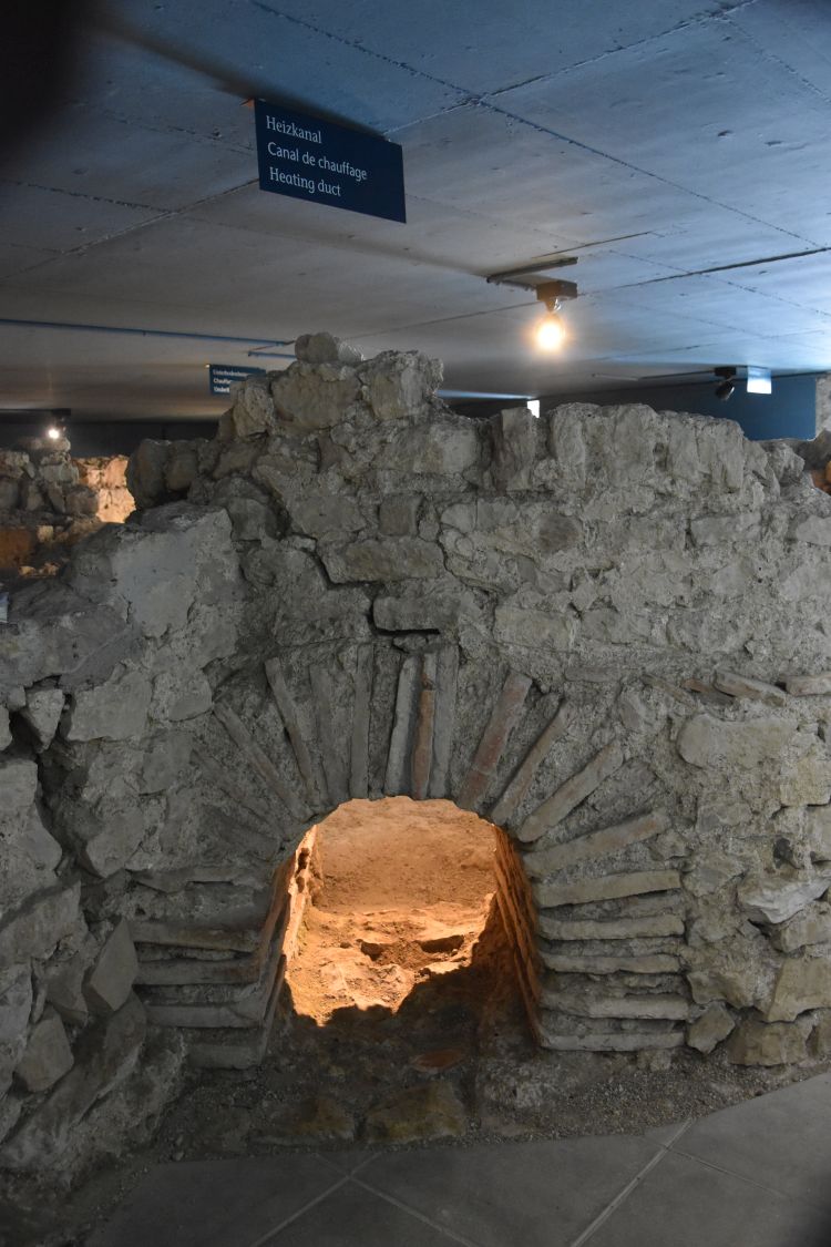
What always impresses me is the elaborated floor heating system of the Romans, the hypocaust. Behind the forum in the slopes of the Viola valley, such a hypocaust has been preserved.  Presumably, it once heated a dining room of 9.5mx6.6m (panel on site and Berger, p. 231).

The raw material for the heating was wood charcoal; the fire was made in the praefurnium or heating room. Hot air circulated in the space under the floor between the columns (pilae). It was like an underground tiled stove, as Berger, p. 232, writes. 

The heating was discovered in 1941, when tank traps were installed here. Surprises await everywhere in Augst.


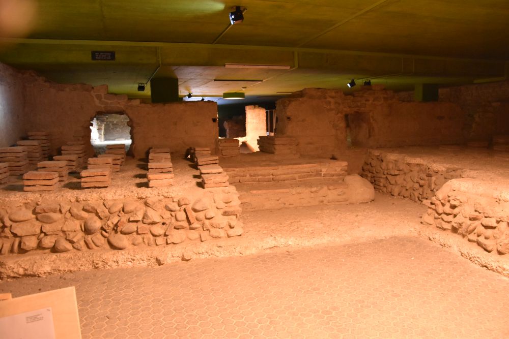
Baths at the Violenried 

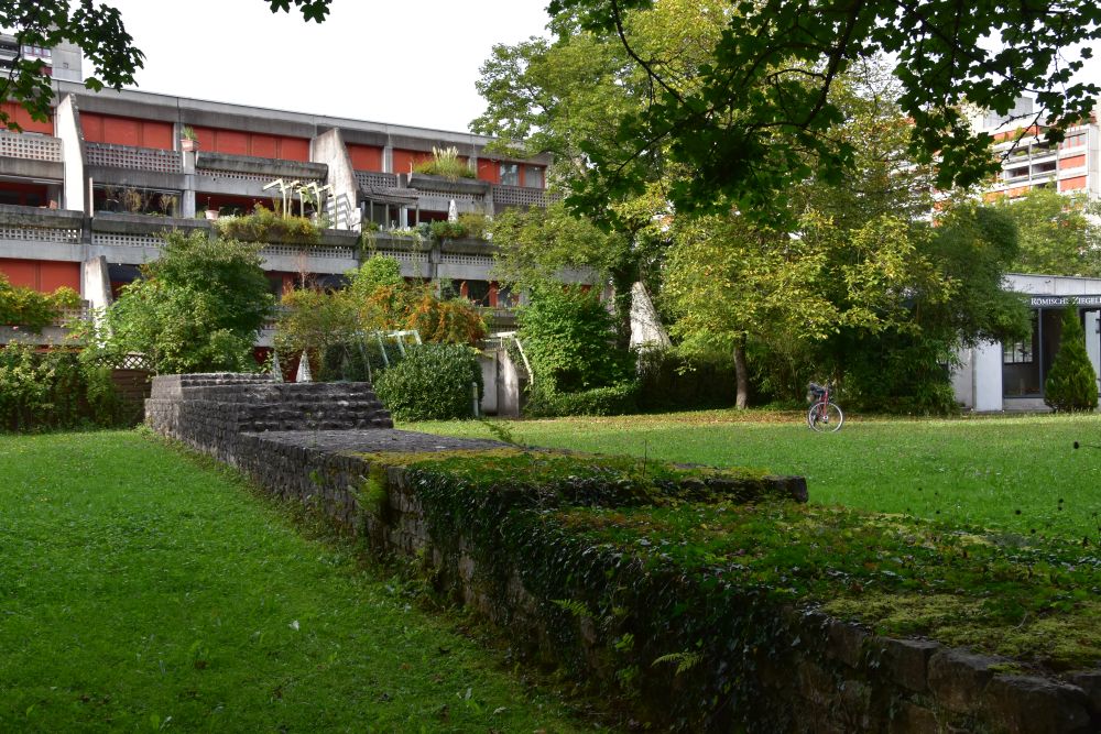
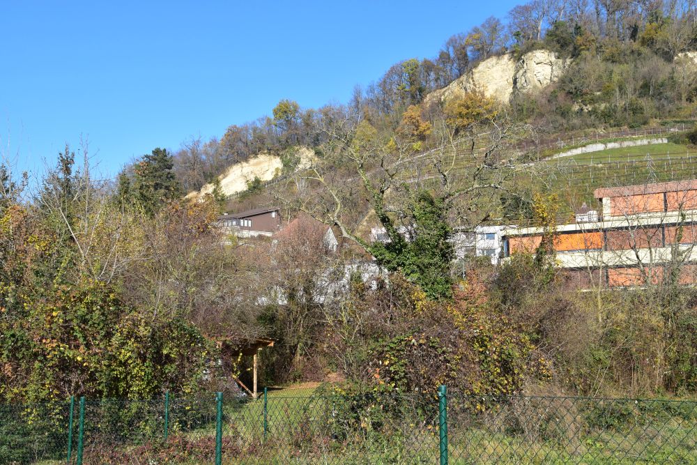
In fact discovering parts of Augusta Raurica sounds like a detective story to me. Anyone who owns land here is bound to find remains of the Roman city, when digging up the earth.

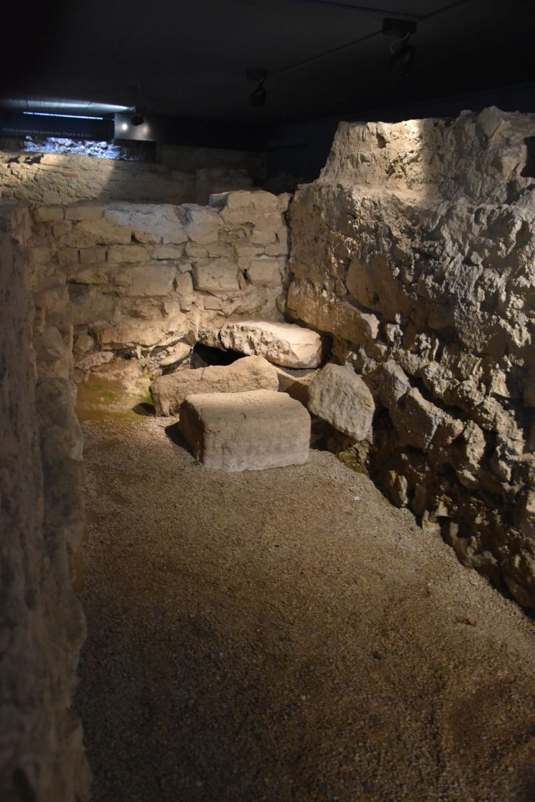
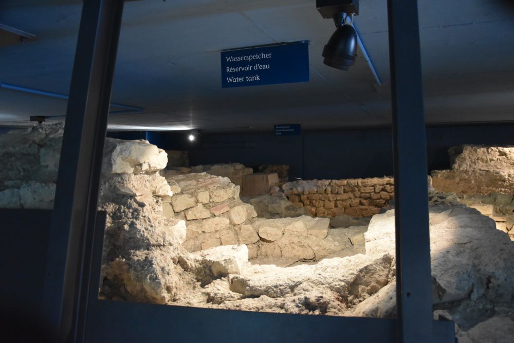
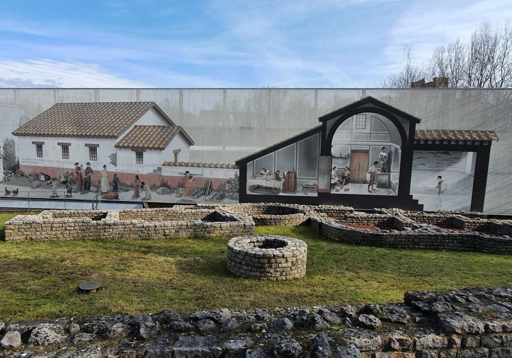
The enterprise E. Frey AG runs a quarry at Augst. The eastern part of the Kastelen hill (one third of the hill) has disappeared; on the hill, there was an area of insulae (blocks of houses) that were probably more upscale. When E. Frey AG intended to move away more ground, it soon became clear that they are about to destroy the baths of the Viola valley (Violenried) and a well preserved groundwater well with the underground well-house. The community of Augst agreed to swap territory with E. Frey AG, and now this area is open to the public. The signpost directs visitors to the underground well-house. 

The photo below shows the baths area in the year 2000, as presented by Berger, p. 160. The round groundwater well (Sodbrunnen in German) can be seen in the middle of the photo. You access the underground well-house using the comfortable stairs at the bottom of the photo. A bubbling noise welcomes you in the well-house. The curators make it all clear to us the well-house has to do with water. One of the theories is that this groundwater well provided the Viola bath with water (Berger, p. 161).

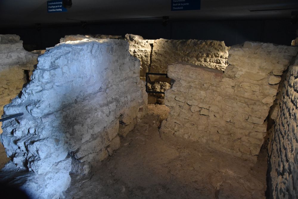
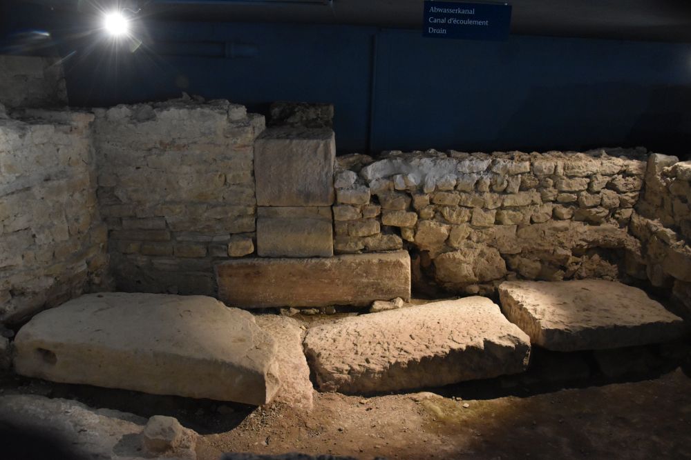
Reading more carefully, I learn that the areas marked by red marl above were heated by the hypocaust system. These were the tepid and hot water rooms of the Viola bath. There were two praefurniums or heating rooms here, a large one to the left of the warm bath rooms and a small one to the right of the oval shaped sudatorium (sweating room). The two other “grey” rooms next to the sudatorium have served some economic purposes, as the archaeologists assume. These two “grey” rooms are above the dark and narrow tunnel that gives access to the underground well-house under the fountain. 

The entry area to the Viola bath was behind the thin wall on the left hand side of the photo above. In addition, there were some blocks of houses behind this thin wall.

On the thin wall, a digitised reconstruction painting has been installed that illustrates life behind this wall (Berger, p. 160). I took the photo of the painting from the gallery across.

On the painting illustrating life behind the wall, a man is being massaged in the cold water room. People change clothes in the middle. One man has gone down the steps to have a cold bath in the piscina. To the left, life in the streets is presented: Roman citizens, children and animals.

In the foreground, we see the remains that have been preserved for the public. Behind the groundwater well (round shape), the hot rooms are marked by red marl. The oval shape sudatorium is sided by the small heating room to the left. The larger rooms to the left served some economic purposes. 

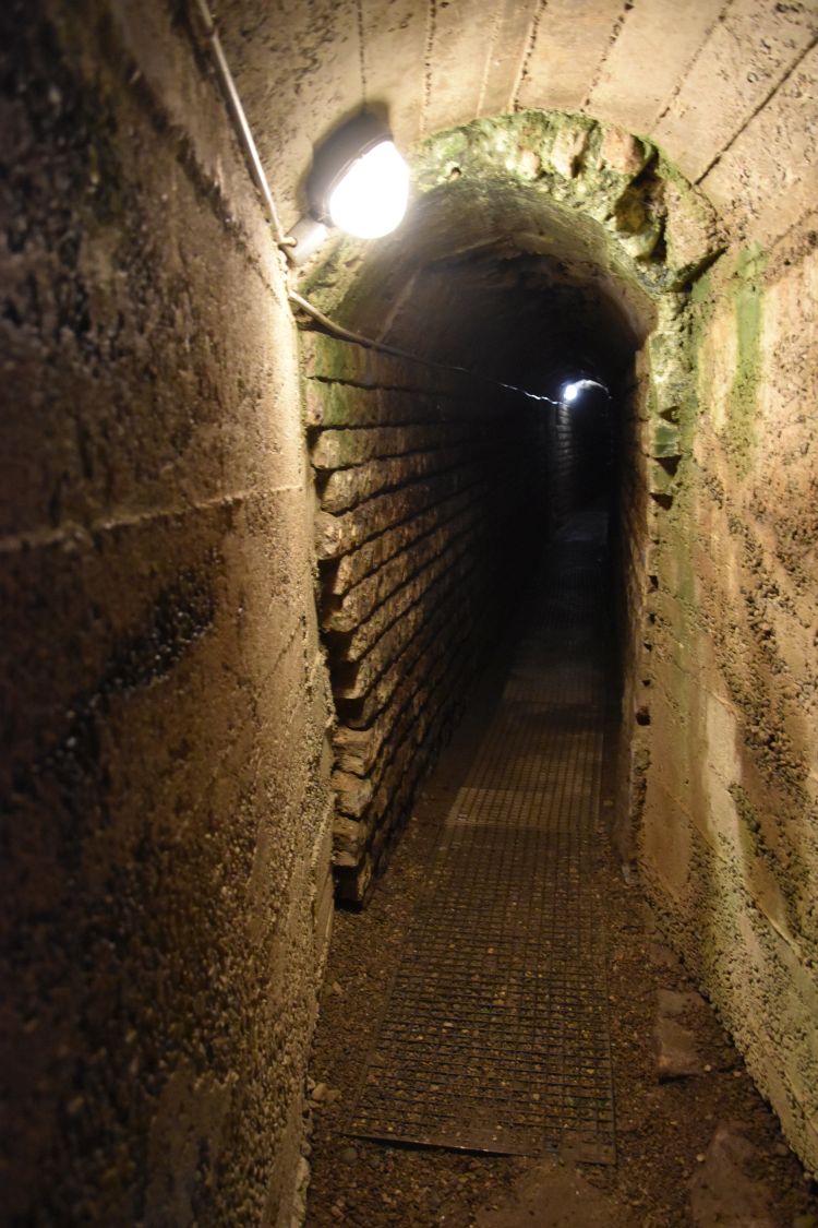
I must admit that only now, reading in the book edited by Berger and writing this blog, I understand that the underground well-house is exactly under that round fountain in the middle of the photo. I do not understand, why this was not clear to me before, but for us non-archaeologists it is difficult to interpret the Roman foundation walls in the open landscape.

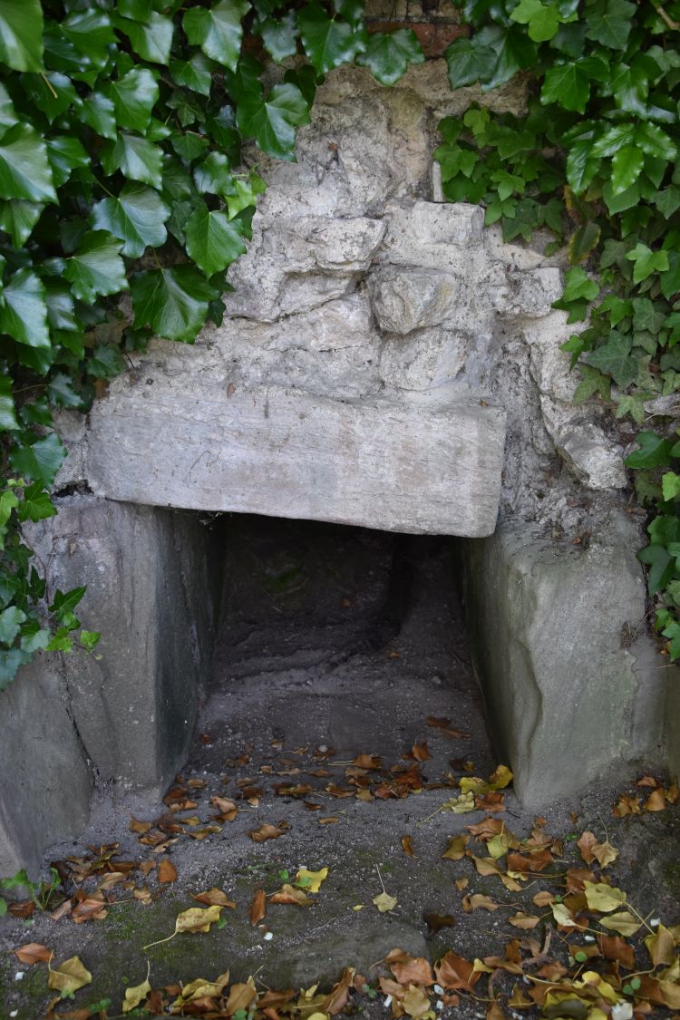
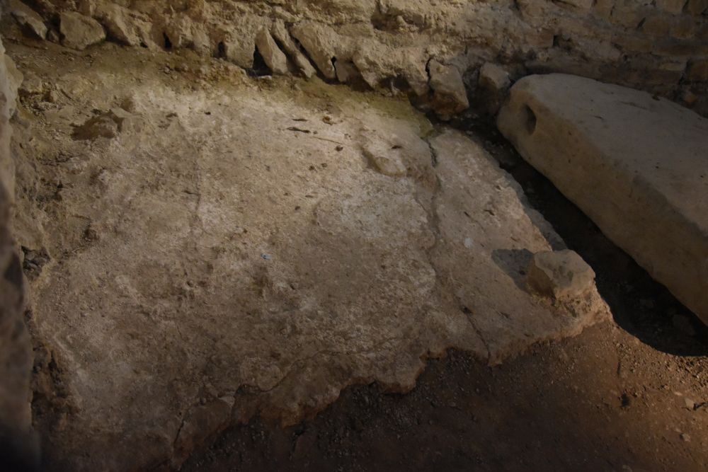
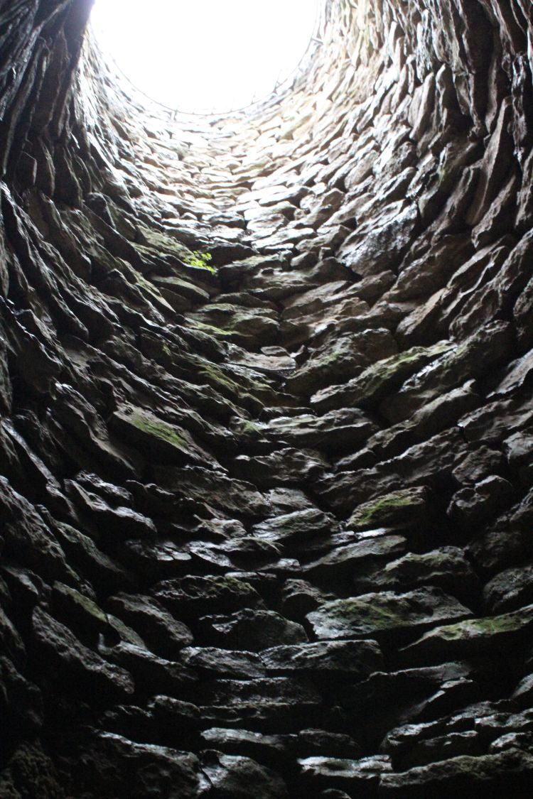
This is the view of the round opening of the fountain from below, from the underground well-house.

According to Berger, p. 162, it is not clear, whether the Viola bath was a small public bath or a luxurious private bath belonging to a wealthy citizen. The larger main central bath area was farther south and has not been explored and preserved as thoroughly as the Viola bath. 


Good-bye for now

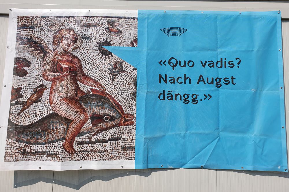
This advertisement of the summer activities at Augusta Raurica is a welcoming invitation: “Where do you go to? To Augst, of course”, mixing up Latin with German and Swiss German. The short Swiss German expression “dängg” can be translated by “where else do you think I am going to?” 

I will surely soon return to Augusta Raurica to check out some more details and to see, what has changed in the meantime. In addition, I will later publish my third blog about the sights that can be found more remotely around the centre of Augusta Raurica. 


Sources:

  • Explanation panels on site
  • Ludwig Berger, “Führer durch Augusta Raurica”, Schwabe Verlag Basel 2012, with contributions by Thomas Hufschmid, Sandra Amman, Ludwig Berger, Peter-A. Schwarz and Urs Brombach
  • Website of Augusta Raurica

Around Basel – Augusta Raurica. Foundation legend and history

One of my favourite destinations near Basel is the Roman city Augusta Raurica. It is carefully restored and panels explain all the places of interest to make the Roman times revive. The homesite of Augusta Raurica gives an excellent overview of “our” Roman city and the activities provided to children and adults.

Let us explore Augusta Raurica in three blogs:

  • the foundation legend with Lucius Munatius Plancus and the history of the Roman city,
  • the city centre with the museum, the “inner” theatre with the temple Schönbühl and the forum,
  • the more “remote” sights from Kaiseraugst to the “outer” amphitheatre. 


The foundation legend with Lucius Munatius Plancus; it happened 2064 years ago 

It is said that Lucius Munatius Plancus is the “founder” of the city of Basel, well not precisely of Basel, but of nearby Augusta Raurica. Under Cesar, Munatius was a successful Roman army commander in Gaul. During the turmoils after Cesar’s assassination in 44 BC, he managed to keep his position in the noble society, even under the emperor Augustus. I believe that this sometimes required sitting on the fence. 

The inscription on the tomb of Munatius in Gaeta (Naples) says that he founded Augusta Raurica in 44 BC. In the 16th century, Munatius was reinterpreted to be the founder of Basel; his statue stands in the courtyard of the city hall of Basel.

Hans Michel from Strasbourg sculptured the statue of Munatius in 1580 and donated it. Around that time, the theatre in the centre of Augusta Raurica had been uncovered (Facciani, p.18), which might have motivated Michel from Strasbourg to create his Munatius. 

Let us compare Michel’s Munatius with the representation of the Roman warrior of the days of Cesar (“Res Romanae”, p. 46). 

Look at the shoes, the plaid and the helmet – not exactly the same. Furthermore, Munatius wears something like leggings, pink with golden laces. Very peculiar, and also not really an outfit typical of Romans.

To top it all, Hans Michel has decorated the helmet of Munatius with a basilisk. Basilisks already “existed” in Roman times (Plinius the Elder mentioned them), but the basilisk of Basel was born in the 15th century, when a cock laid an egg (well, this is also a legend). Ever since, basilisks have proudly carried the coat of arms of Basel, and they are present all over in Basel, for instance decorating fountains or, as we see, topping the helmet of Munatius (see my earlier blog about Basel and the basilisks).

It is unclear, whether Lucius Munatius Plancus founded Augusta Raurica or re-established the former Celtic settlement, where the centre of Basel is today (on the Münsterhügel, remains of the earlier Celtic oppidum have been uncovered). Furthermore construction work at Augusta Raurica started later than the reported date of foundation, not in 44 BC, but around 15 BC. Although Basel seems to be older than 2064 years, the legend continues to be told: Lucius Munatius Plancus is the founder of Basel, and that happened 2064 years ago.

Why 2064 years ago?

In 1957 or 64 years ago, Basel celebrated its 2000 years’ anniversary. Then I was 6 years old, and I remember, how proud I was of the long tradition of “my” city, when watching the parade. The mayor of Gaeta had come to Basel, as the tomb of Munatius Plancus is in Gaeta. The anniversary medal shows Lucius Munatius Plancus with the basilisk on his helmet – I found various such medals on sale on ebay.

Well today, we have to add 64 to 2000, which means, Munatius Plancus founded Basel 2064 years ago. Now, Basel would celebrate its 2064th anniversary. We have learnt that these 2064 years are not exactly a historical fact. Nevertheless, in 1956, Basel found 2000 years to  be a good opportunity to celebrate, and I do hope, we will have more such opportunities soon again. 


The history of Augusta Raurica: A thriving city for some 200 years and around 300 AD a fortress near the Rhine

After construction had started in 15 BC, Augusta Raurica became a thriving trading and commercial city with about 15’000 inhabitants. The border of the Roman empire was 200km north, far away from the border with the “dangerous” Germanic tribes. 

The model in front of the central Roman theatre shows, what the city looked like around 200 AD.

We can see the central theatre opposite of the temple of Schönbühl and, out of town, the “outer” amphitheatre. 

Hence, Augusta Raurica disposed of the usual amenities of a Roman city: Forum, theatres, baths and blocks of houses allowing to live and do commerce. The city decayed in the 3rd century AD, due to growing pressure from the north. To defend themselves, the Romans built the Castrum (fortress) bordering the Rhine, where Kaiseraugst is located today. 

Now, many ruins of the once flourishing city Augusta Raurica as well as of the later Castrum near the Rhine have been excavated and documented. 

Source: SALVE_Tourismusplan_2020.indd (augustaraurica.ch) 

It is the Foundation Pro Augusta Raurica that promotes the Roman heritage performing research, conservation, documentation and education. I am impressed, how well the ruins are presented and how well they are explained on the panels. Access is free, except for the museum. Signposts allow to find the places of interest. 

Let us walk around the centre of Augusta Raurica and visit the more remote sights around the centre in my next blogs. 

Sources:

Around Basel – the church Saint Nicholas of Lausen, another “hidden” gem

Cycling from Liestal to Lausen on the winding bike road, I discover the belfry of this small church.


“Oh, they seem to have a pretty church at Lausen”, I say to myself.

The door is open and invites me to enter. What a wonderful, solemn and cosy atmosphere inside. The choir has been decorated with frescoes…

… and under the gallery,…

… some sofas invite to sit down and…

… let the children play with toys and books in the corner.


To find out more about this gem, I read the small guide of the GSK or Gesellschaft für Schweizerische Kunstgeschichte written by Heyer in 1974. 


Beautiful frescoes from the 15th century

In the middle of the 15th century, the Romanesque church burnt down. It was reconstructed and in 1450, the choir was completely painted with frescoes. Two frescoes dominate, the Crucifixion scene and the legend of Saint Nicholas.

The crucifixion occurs in a building indicated by columns and arches. Mary and John are coated in cloths that are richly pleated. Christ has his eyes closed and the representation of his body is stylized.

it is unusual that the crucifixion occurs inside a building. Based on this, Heyer (p. 11) concludes that the master artist of Lausen might have been influenced by early Renaissance representations that also place the crucifixion inside buildings. Oh yes, I remember one such fresco from Santa Maria Novella at Florence. It is Masaccio’s Holy Trinity (1427/28).

The east window in the choir shows the Crucifixion scene as well. It is from 1430/1440, hence older than the frescoes in the choir, and Christ with Maria and John are more compact.

The crucifixion scene in the window is sided by the church fathers Ambrosius and…

… Augustinus.

Above are medaillons with angels indicating the names of the evangelists.

As the church is consecrated to Saint Nicholas, a legend of his appears in the choir as well. He is giving some gold coins to three poor girls in order to protect them from being sold to the brothel. Saint Nicholas stands to the right in the vestibule handing his gift over to the girls that have come together in the second hall. The father stands close to the left border and can hardly be seen. The protagonists are grouped skilfully, the fresco is full of energy.

Let us look back at the choir with the crucifixion and…

… with the legend of Saint Nicholas. 

The unostentatious communion table, I suspect, is from the 17th century, as mentioned by Heyer, p.6. In the background is the priest’s chair from 1707. 

The spandrels of the choir arch are decorated with the Annunciation scene. To the left, we see the red dress of archangel Gabriel and to the right, the building in which Mary is kneeling under the Holy Spirit represented as a pigeon. Unfortunately the entry to the pulpit has destroyed much of this fresco.

Another small detail: the turned stand next to the stairs leading to the pulpit is, I assume, the guéridon acquired in 1706 that Heyer mentions. Modestly, various treasures are decorating the choir.

Let us return to the fresco with the Annunciation. It is not the first time that I see the Annunciation scene appear in the spandrels above the access to the choir.

At about the same time as the church of Lausen, the chapel of Saint Servatius in Upper Bavaria was decorated with frescoes in 1440, and also here, the Annunciation scene is in the spandrels above the access to the choir: Archangel Gabriel is on the left hand side and tells Mary to the right that she will give birth to Jesus. 

Furthermore in the marvellous Saint Mary church at Pontresina, the Annunciation has been fitted into the spandrels above the entry to the choir. These frescoes are from 1495.

Heyer suggests that the side walls of the choir might have been decorated with the apostles; this is Jacob, just next to the Crucifixion scene. 

Church father Gregor appears in the northern window of the choir, wearing his pontifical dress and the tiara, and he holds a book in his hands.

This is the view from the gallery back into the church and the choir.

The frescoes on the choir wall show the Nativity of Christ to the left and – perhaps – the Adoration of the three Magi on the right. However, they are difficult to discern (Heyer, p.7).

The three combined chairs to the right are from the 17th century. The four oak columns in the nave have been worked using an axe and have been added in 1616. From the same year is the pulpit, made in early Renaissance style by a carpenter from Liestal. 

Next to the pulpit we find the fresco of Saint Barbara with a palm leaf and her attribute, the tower. 

Together with Jacobus in the window, the frescoes in the nave are younger than the ones in the choir, as Heyer presumes (p.8). The person kneeling below Barbara could be the donator of the frescoes in the nave.

Beautiful frescoes are hiding in unostentatious Lausen! As Heyer, p. 11, says, the frescoes have been painted by a grand craftsman and they are of high artistic value. I do agree with him.


Short summary of the construction history

The Saint Nicholas church is located far outside of the centre of Lausen. In Roman times there was an estate here and later a Frankish village, Bettenach. The people from Lausen call it “Urlausen“. 

  • 8/9th century: Foundations excavated indicate that a – smaller – early medieval church existed.
  • 11th century: A second church was built in Romanesque style.  From that time the norther entry door has been preserved as well as two small windows next to the gallery.

  • 15th century: The Romanesque church burnt down. It was reconstructed with higher walls and the rectangular choir as well as with a wooden ceiling. In 1450, the choir was decorated with the frescoes. 
  • 1564: After the Reformation, the frescoes were whitewashed. 
  • 17th century: In 1616/17, the church was renovated. The wooden ceiling was replaced, the four wooden columns were added. Furthermore, carpenter Peter Baschin from Lausen created the early Renaissance pulpit that can be accessed from the choir. In 1685, the gallery was renovated. Windows were added and removed again and again.

  • 1874: The frescoes were discovered and carefully restored. 
  • 1971/72: The monument conservator of Baselland, H.R. Heyer, guided the renovation. So far unknown frescoes were laid open. Shortly afterwards, in 1974, Heyer wrote the brochure for the Gesellschaft für Schweizerische Kunstgeschichte.

Based on Heyer’s brochure, I studied the Saint Nicholas Church. Note that I am not an art historian – I just love such works of art that have been preserved for centuries.  


Saying good-bye to the marvellous church of Saint Nicholas

So far, I had known the village Lausen as an exit from the near highway. Now, in April 2021, one of the vaccination centres is at Lausen. To check out beforehand, where this centre is, I went there by bike. And this is, how I accidentally discovered this gem of a church, the Saint Nicolas church of Lausen.

To round off my visit, I stroll through the cemetery. I will return to enjoy the solemn and cosy atmosphere of this country church again and show it to my friends.

Sources: H.R. Heyer, “Die Kirche von Lausen”, Schweizerischer Kunstführer, herausgegeben von der Gesellschaft für Schweizerische Kunstgeschichte, Basel 1974.

Around Basel: The fortified Church of Saint Arbogast at Muttenz

The fortified church of Saint Arbogast at Muttenz is a gem, with the frescoes creating a solemn atmosphere and with the defensive wall surrounding it. Let us explore this gem!


The beginnings of the Church of Saint Arbogast 

In the 8/9th century, the first church is constructed under the direction of the bishopric Strasbourg. It is dedicated to Saint Arbogast, the first bishop of Strasbourg; he lived around 600. The second church follows around 1100.

In the mid 12th century, the third church is built in Romanesque style. From that time, we see the Romanesque front choir.

In addition, some of the 12th century ashlars have been uncovered, as here on the northern wall of the nave. 


The lords Münch-Löwenberg (14th century) and Münch-Eptingen (15th century)

In the 14th century, after the Basel earthquake of 1356, the lords of Münch-Löwenberg renovate the church. They make the main choir rectangular (there was an apsis before). 

They reconstruct the vault of the front choir topping it with the coat of arms of the Münch-Löwenberg (two monks and two lions), and there are monks and lions along the ribs of the vaults. 

Since 1939, the lion of the Münch-Löwenberg has decorated the coat of arms of Muttenz, sitting on top of what stands for the three castles on the Wartenberg above Muttenz.

In addition to the works at the choirs, the Münch-Löwenberg enlarge the nave to the west and to the south.

In the 15th century, the Münch-Eptingen are the lords of Muttenz. In 1420, they enlarge the church tower marking it with their coat of arms, the alliance of the Münch (monk) with the Eptingen (eagle; today the coats of arms of the villages Pratteln and Eptingen). 

In 1430, the Münch-Eptingen surround the church with the defensive wall and two gate towers. The coat of arms of the Münch, a monk, is on the northern gate tower, above the entry. 

Around 1450, the Münch-Eptinger have the nave and the front choir painted with frescoes. Two frescoes have been preserved, the Arbogast legend and the Resurrection niche. 

The Arbogast legend decorates the front choir. The son of king Dagobert, Siegbert, has been killed, when hunting. Dagobert takes his son to Arbogast and asks him to wake up his son (first painting); on the second painting, the son lifts his head. 

The so-called apostle medaillon above the door is from the fourteenth century. The ashlars behind the chairs and to the left of the door are from the 12th century.

The so-called resurrection niche on the northern wall of the nave is the second 1450 fresco that has been preserved.


Under Basel (pledged to Basel in 1470 and administered by the Saint Peter Canon, since 1515 owned by Basel)

Around 1470, Muttenz reports into Basel. The Münch need money and they pledge Muttenz to Basel. The Saint Peter Canon administers Muttenz and sponsors the church. In 1504, the canon makes the nave higher enhancing the space available for frescoes. In 1507, the canon decides to redo the paintings, while integrating and renovating the legend of Arbogast and the Resurrection niche. The northern wall shows the Passion of Christ and the southern wall is dedicated to the life Maria and Christ. This is the southern wall. The best preserved fresco shows the flight to Egypt. 

The bottom part of the south, west and north wall contains a long fresco with the apostles surrounded by letter bands. This is Matthew (Matheus), and in the upper left corner we discern the year 1507. 

The wooden ceiling has been made by carpenter Ulrich Bruder from Basel, also in 1504. 

All frescoes are whitewashed a few years later, as Basel joins the reformation and Muttenz has to follow. In the late 19th century, the frescoes will be rediscovered. 

In 1618 the baptismal font is added; it stands in the front choir, now, in early spring, behind branches of magnolia. 

In 1630, the gallery is constructed, and two new windows are cut into the north and south wall of the nave, while closing up the one former window. The organ is from 1976. Hidden behind the gallery and the organ is the fresco of the Last Judgment. Accessing the gallery is not allowed. 


Outside the church: The ossuary house

In the late 15th century, the Saint Peter Canon add the ossuary to the garden and have it painted in 1513.  

To the left, Saint Christopher carries Jesus that is becoming heavier and heavier,…

… the Archangel Michael is in the middle,… 

… and, to the right, the Virgin of Mercy (Schutzmantelmadonna) protects the faithful under her coat.

Inside are the Last Judgment and the legend of the thankful dead persons (a knight always prays for the souls of the dead, when passing the cemetery. One day, he is attacked by bandits. The dead persons come to his aid and the bandits run away). I will have to ask for the key one day to see the frescoes inside the ossuary. 


The border stones of Muttenz

Along the defensive wall, there are border stones. According to the panel, they once marked various properties and some marked the border of Muttenz.  

Here are some of the border stones zoomed in.


Good-bye Muttenz and Arbogast Church, for now

This is the view from the south gate into the village. The church is surrounded by the well preserved village centre. 

Yes, to my opinion, Muttenz deserves the Wakker award that it received in 1983. I like to return to Muttenz again and again.


Background Information: Summarizing the history of the St. Arbogast Church

Beginnings

  • 8th/9th century: First church, built under the direction of the diocese Strasbourg. Named after Arbogast, the first  bishop of Strasbourg (around 600).
  • About 1100: Second church.
  • Mid 12th century: Third church with apsis. Today we can still see the Romanesque front choir and some Romanesque ashlars in the front choir and outside on the north wall of the church.


Under the lords of Münch-Löwenberg (14th century) and the lords of Münch-Eptingen (15th century)

  • 1359: The Münch-Löwenberg restore the church after the Basel earthquake of 1356. They replace the apsis by the rectangular choir, they enlarge the nave to the west and to the south, and they reconstruct the Romanesque front choir marking the vaults with their coat of arms (monk and lion).
  • 1420: The Münch-Eptingen enlarge the belfry and insert their coat of arms on the western edge (monk and eagle).
  • About 1430: The Münch build the defensive wall (7m high, two gate towers, protection of the villagers) and add their coat of arms on the north gate tower (monk).
  • 1450: The Münch paint the nave, the front choir and the choir (the Arbogast legend and the Resurrection niche have been preserved).


Under Basel (from 1470 pledged to Basel and administered by the Saint Peter Canon, from 1515 owned by Basel)

  • 1504: The Saint Peter Canon makes the nave higher and covers it with a wooden ceiling (Ulrich Bruder, carpenter from Basel).
  • 1507: New walls need new frescoes. The Canon has the church repainted, whereby preserving the Arbogast legend and the Resurrection niche.
  • 1513: The ossuary, built after 1470, is decorated with frescoes.
  • 1529: Muttenz joins the reformation. All frescoes are whitewashed.


1600 until today

  • 1618: Baptismal font. It stands in the front choir.
  • 1630: Gallery and two new windows in the north and south wall of the nave, replacing the former one window on each wall. One floor and the pointed roof are added to the belfry.
  • 1880/81 and 1972-74: Renovations. 

This layout of the Arbogast church illustrates the building history.

Source: Hans-Rudolf Heyer und Ernst Murbach, “Dorfkirche Muttenz”, p. 3, my own comments and colours added.


More background: The history of Muttenz from early medieval times until today

  • 793 Muttenz is mentioned as the profane property of the Chapter of Strasbourg. 
  • 1320 The noble family Münch are fief holders, first the Münch-Löwenberg, followed in 1420 by the Münch-Eptingen.
  • 1470 The Münch pledge Muttenz to Basel; Muttenz is administered by the Saint Peter Canon.
  • 1515 Basel owns Muttenz.
  • 1527 Muttenz joins the reformation.
  • 1833 When Basel divides up into two half cantons, Muttenz joins Baselland (Basle Country).
  • 1900 Muttenz is a village with 2500 inhabitants.
  • 1939 The coat of arms of Muttenz contains the lion of Katharina of Löwenburg, the wife of Konrad Münch, 1324-78.
  • 1983 Muttenz is granted the Wakker award for preserving the village centre surrounding the fortified Arbogast church.
  • Today (2020), Muttenz counts about 17’000 inhabitants. 


Sources:


Around Basel: The Cathedral of Arlesheim – harmonious Rococo

The church of Arlesheim is called “Cathedral” or, in German, “Dom”. Until some years ago, I had always wondered, why. Oh sure, the “Arlesheimer Dom” was more richly decorated than other churches around here. Moreover, it was surrounded by palaces, but why is there a Cathedral in the suburb Arlesheim, so close to Basel with its own Cathedral, the Münster?

Let us dive into history to understand why – and then let us look at this Rococo gem. 


Why is there a Cathedral at Arlesheim? 

Up to 1529, Basel with its Cathedral or Münster was the seat of the Basel Bishopric. Then, the city of Basel joined the reformation. The “Basler Münster” became a protestant church, and the bishop had to leave “his” city with “his” Cathedral. The bishop ended up residing in Pruntrut (Porrentruy) and his Chapter moved to Freiburg in Breisgau, some 50km north of Basel. At that time , Breisgau belonged to Austria (Vorderösterreich). However, in 1677, Louis XIV conquered Freiburg (during the winter pause in the Franco-Dutch War) and occupied it until 1698. In 1679, the bishop of Basel, Johann Konrad I von Roggenbach (1656-1693), decided to move his Chapter from Freiburg to Arlesheim, which was part of the Roman-Catholic Bishopric of Basel.

In 1660, Bishop Roggenbach marked the border in the forest above Arlesheim. This is his coat of arms.

Roggenbach marked the border of the Prince-Bishopric “against” the protestant town of Basel. 

This is border stone number 67 and above, we find another such stone, number 70. When walking in the area, I like to show the stones to my friends. 

The existence of the vineyard Schlossberg may have supported the decision to move the Chapter to Arlesheim. The church always needs wine for the worship, or – in addition – anyway.

This is the view of the vineyard Schlossberg and the ruin Birseck belonging to the mystic landscape park Ermitage.


The construction of the Cathedral of Arlesheim (first built in 1679-81, then reconstructed in 1759-61)

Immediately from 1679-81, Bishop Roggenbach and his Chapter built the Cathedral of Arlesheim in Baroque style. Later, from 1759 to 1761, it was reconstructed to become the elegant Rococo church that we see today. The architects were Bagnato father and son. Appiani painted the frescoes, and Pozzi created the stucco work. All were from the Ticino or near Italy (see Georg Carlen).

One of the targets of the Cathedral reconstruction was to bring more light into the nave. The artists succeeded, I believe: The frescoes and the stucco work shine solemnly in the sun.

The organ adds to the solemnity. Built by Johannes Andreas Silbermann from Strassbourg in 1761, it has been restored in 2006. 

It was Bishop Joseph Wilhelm Rinck von Baldenstein (1744-1762) who initiated the reconstruction of the Cathedral of Arlesheim in 1759. Also this bishop marked his borders. One example is this “Rinckenstein” above Ettingen (border with Solothurn).

His coat of arms appears in the cartouche topping one of the choir stalls…

… and above the entry.


The frescoes are dedicated to Immacculate Maria and commemorate the royal sponsors Henry II and Kunigunde 

The sponsor of the Cathedral of Basel was emperor Henry II with his wife Kunigunde. The couple decorates the wall next to the main portal. The emperor presents the model of the Cathedral of Basel, as it was built around 1000 AD.

Bishop Rinck von Baldenstein and the members of his Chapter – might have felt homesick for the Cathedral of Basel that their predecessors had to leave in 1529, when the city became protestant: The royal couple Henry II and Kunigunde appears on the altar fresco, but other than in Basel, the couple presents the new Cathedral to Mary.

The royal couple presents it to Mary of Victory that wears a white dress and a blue plaid. She places her right foot on the neck of the snake and she presents Jesus that uses his cross to pierce the head of the snake. Mary and Jesus are joining their forces to fight the snake or the Satan that stands for the evil. 

The Cathedral of Arlesheim is dedicated to Immaculate Mary, as the inscription above the choir indicates: “Divae Virgini sine labe conceptae” (to the Divine Virgin conceived without original sin).

Also the Cathedral of Basel was dedicated to Mary. She once stood on the pedestal at the main gate, but was destroyed during the iconoclasm and since then the pedestal has remained empty.

Mary is the central figure of the main fresco in the nave. She stands on a white cloud. Above her are Christ and God Father. Above them all is the Holy Spirit as a pigeon surrounded by rays of light. The divine scene is painted in soft colours. 

The continents have assembled to praise Mary, and the “real” world is painted in powerful colours. Directly under Mary is Europe, flanked by America and Africa to the left, and by Asia to the right:

  • Europe is represented as a person (Europa) that embraces and protects the Church (represented as a statue with a gloriole). Europa wears the crown of the Holy Roman Empire of German Nation. A varlet climbs up the stairs carrying the sceptre and the imperial orb (Reichsapfel). A light emerges from Christ, and Europa redirects it to an Italian peasant woman that asks to free her child from the original sin inherited from Adam and Eva (they stand behind the peasant woman, painted in soft colours). 
    The Satan (Lucifer) recedes from the Church and Europa pointing his torch downwards. Armed persons and the defensive wall highlight the strength of Europe.
  • To the left, the lions, the crocodile, the elephant and the dark colour of the people indicate that we are in Africa, the feather decoration of the woman in the cart might stand for America. 
  • To the right, I recognize Asia from the umbrella, from the turban of the boy in front of the trunk and from the camels that follow the parade. The stucco work integrates with the fresco, as the stucco vase seems to belong to the incense holder of the woman that might be the personification of Asia. 

The fresco in the choir shows Mary’s Ascension. She sits on clouds that are carried upwards by angels. The apostles stand around the empty tomb. “Josephus Appiani Pinxit” (Appiani has painted it) has been written on the sarcophagus. 

Also near the choir is the scene of the Annunciation, where Archangel Gabriel tells Mary (in the blue coat) that she will give birth to Jesus. 

Directly under the organ, we see Saint Cecilia. She is a martyr from Roman times and the patron of music and of the musicians. A good match with the beautiful organ which is the only Silbermann organ left in Switzerland. 

On the side walls of the choir are the scenes of the Foot Washing and… 

… of the Last Supper. 

These two frescoes may have been carried out by Appiani’s workshop (“The Cathedral Arlesheim”, p.24).


The stucco decoration is in harmony with the frescoes

The stucco decoration made by Pozzi is Rococo or “style rocaille”, a term that alludes to mussels (coquilles).

The stucco decoration gives airiness to the nave. 

I include some photos of the putti that carry symbols of Mary, the pure lily,…

… the ring of stars,…

… and this might be the tower of David.


Additional artefacts: Choir stalls, marble and Odilia

During the reconstruction of the Cathedral in 1759-61, Peter Schacherer from Rheinfelden contributed the carpenter’s work, such as the choir stalls and…

… the wooden entry door.

The small balcony is made out of marble from Italy. 

Also the columns framing the altar are made from Italian marble. 

Odilia is the patron of the blind (meaning those who cannot see “outside” nor “inside”).  The gothic statue of Odilia from 1450 has been made from limewood. 

Around 700 AD, Odilia was the abbess of the monastery Niedermünster (Odilienberg) in the Alsace. The bishop of Basel acquired Arlesheim from Niedermünster in 1239. There is a legend that tells us, Odilia hid from her father in a cave and some say, this happened in one of the caves above Arlesheim. The former parish church of Arlesheim was devoted to Odilia and the parish of Arlesheim still carries her name.


The Cathedral of Arlesheim is a worthy successor or “younger sister” of the Cathedral of Basel

When working at this blog, I began to understand the connections between the two Cathedrals of Arlesheim and Basel. The patrons of both Cathedrals are Henry II and his wife Kunigunde. The royal couple had originally sponsored the Cathedral of Basel around 1000 AD. On the altar in Arlesheim, the same royal couple asks Mary to now protect the new Cathedral.

Both Cathedrals have been dedicated to Mary, but in the protestant Cathedral of Basel, the statue of Mary at the main portal has been destroyed and has never been restored (the pedestal at the main gate is empty; there is still a statue of Mary in the gable). In Arlesheim, Mary is the main theme of the frescoes and the stucco decoration, and she also stands above the entry gate.

With its two towers, the main façade of the Cathedral of Arlesheim somewhat evokes the façade of the Cathedral of Basel.

Until the reformation (1529), the members of the Bishop’s Chapter lived around the Cathedral Square (Münsterplatz) in Basel.

Until the French revolution (1792), the members of the Bishop’s Chapter resided around the Cathedral Square in Arlesheim.

The two Cathedrals from different times, built for the Bishop of Basel and his Chapter, are so close: The distance between the Cathedral of Basel and the Cathedral of Arlesheim is about ten kilometers. The “older” Cathedral of Basel has been completed shortly before 1500 (originally consecrated in 1019, it had to be reconstructed after having been damaged severely by the 1356 earthquake). The “younger” Cathedral of Arlesheim is from the late 18th century. The Romanesque and Gothic style from 1000-1500 in Basel contrasts with the Rococo style from the late 18th century at Arlesheim. I like both interpretations: I like the long history that the first Cathedral of Basel (“Basler Münster”) presents. And – I like the harmoniously soft atmosphere around Mary that the Chapter and the Bishop created in their second Cathedral at Arlesheim. I conclude that the Cathedral of Arlesheim is a worthy successor or “a younger sister” to the Cathedral of Basel. I believe, the Bishop and his Chapter have done an excellent job to reinvent their Cathedral in Arlesheim.  

Two gems so close to one another!

Sources:

Around Basel: The Rheintalflexur – some background information and observations

Let me now follow up on the Rheintalflexur or “Rhine Valley flexure”, reading more about it and observing it in nature.

Let us do so after having thought about the earthquake of 1356 and the emergence of the Rhine Rift Valley (Rheintalgraben).


Gathering information about the geology of the Rheintalflexur 

In the lecture notes provided by the Basel university, I found this geological cross section of the Rheintalflexur from the Wartenberg (via Muttenz) to the Bruderholz. The sediments bent are shown here, and they flexed, when the crystalline basement cracked down.

The Rheintalflexur is rather exotic in the Rhine Rift Valley. At the flexure, the fractures are about 1000m deep, whereby farther north the rift slid down up to 4000m. While extension had caused the cracking of the rift valley, compression seems to act now at the Rheintalflexur (Laubscher, 1971, p. 157). We are at the southern end of the rift valley, where it turns to the west to form the Belfort gap, and somehow the rift had to “find a way” to complete the “turning” which lead to a complex pattern of small cracks. The Tafeljura echoed that with the fractions of the Wartenberg and the Adler.


The “Schänzli”: Building the highway tunnel allowed to explore the “Rheintalflexur”

This often cited graph of Buxtorf illustrates, how steeply the layers bend under the Schänzli (he assumed the fault to be reverse). The tunnel of the highway T18 going south to the Birseck was built exactly here, at the Schänzli.

Source: Hans Laubscher, 1971

Below we see the cross section of the highway tunnel  “Schänzli” that «sits» on the fault line and reaches into the layers of lime stone that are almost vertical here. Stairs allow now to enter and observe the geological activity (left). 

Source: Website “Heimatkunde Muttenz

During the excavation for the tunnel, the almost vertical layers of lime (Hauptrogenstein) were temporarily uncovered (right).

Let us now go out and shoot some photos to illustrate the tracks of Rheintalflexur. 


The Rheintalflexur at the Birs

The concrete pier of the wooden bridge at Münchenstein crossing the river Birs sits on the Rheintalflexur. Between the two pillars, we can see, how the  sediment layers are inclined. 

Just above the bridge there is the cataract formed by the slanting sediment layers of the flexure. 

I remember that I stood here with our geography teacher more than fifty years ago and he talked about the flexure.

Before taking these photos, I looked for the flexure walking up and down along the Birs; people kept on asking me, whether I had seen the kingfisher. The kingfisher? “No”, I replied, “I look for the “Rheintalflexur””. “You look for what?” – and  then I had some long conversations. May be, one day I should also look for the kingfisher.

Beyond the Rheintalflexur the Tafeljura cracked into “pieces”, and the Wartenberg was tilted (see the geological cross section above). The tilted layers of the Wartenberg “ditch” can be seen at various places. This is a photo from the quarry above the vineyards. Or is it here, where part of the landslide broke off in 1952? 

A dog sniffs at my shoes. The lady asks me: “Do you  take a photo, before it all slides down?”. And then she continues: “The slopes are very unstable here, a gap keeps on appearing that is being closed again and again to “hide it”. We have built our house on rocks, after having consulted a geologist. At the Wartenberg, you should never build a house without consulting a geologist.” Okay, well I had never planned to build a house here, my mum had always warned me about the Wartenberg…


More signs of the Rheintalflexur: The quarry above Münchenstein

Above Münchenstein, in the quarry “Blinden”, the bending sediments of the Rheintalflexur are also uncovered. 

The quarry is no longer in use. It has become a romantic nature reserve, even with a picnic place (as there are lots of them around Basel, some even providing free firewood).

During my next walk on the Bruderholz, I discover the quarry across, above Münchenstein. I have never noticed it from here, though having been here hundreds of times. Yes, we notice, what we have read about and thought about before! Not only, when travelling to other countries, but also, when walking around home.


Looking for the”Rheintalflexur in the landscape park “Ermitage” – not really successful

The Ermitage of Arlesheim is a marvellous landscape park, first established in 1785 and reconstructed in 1811. I have blogged about it in 2015 at the occasion of the park’s 230th anniversary.

The heart of the landscape park is under the Birseck castle. This castle is a ruin, integrated into the Ermitage, as every “proper” landscape park must have a ruin. A maze of footpaths zigzags up and down the rocky slope under the castle. The wall of the so-called “carousel square” stands out at the foot of the hill. 

Some 150 million years ago, this hill was part of a riff at the shore of the former Tethys sea, long before the Rhine Rift Valley emerged (40 million years ago). Many natural caves emerged later that create an exceptional atmosphere to the park.

I could not find identify the flexure around the Ermitage. May be the rock above the “carousel square” is part of it? Erich Plattner’s “Höhlen der Ermitage” does not help either, as what he calls “geological cross section of the Ermitage” seems to be farther north (from the Predigerhof across Arlesheim to the Hinteri Ebni, p. 47).  

Not really successful. Anyway, I do love to stroll through this magnificent landscape park that hides many surprises such as the hut of the “Waldbruder” or “brother of the woods”. Now, in winter, his hut can be seen from far.

The architects of the Ermitage created their landscape park with a lot of phantasy, and I keep on discovering new details.


The “Rheintalflexur” at the Hornfelsen (Dinkelberg)

The Rheintalflexur can be seen above Grenzach (already in Germany) at the Hornfelsen,…  

… where in particular the “lowest” rocks are bending clearly downwards. 

Also here I have been so many times before and have never noticed the flexure. 

I would love to find a book about the geological phenomena around Basel explaining them and informing, where they can be seen in nature. A book for interested hikers such as our group of Nordic Walkers. 


Hans Laubscher, Das Problem von Rheintalflexur und Tafeljura, Eclogae Geologicae Helvetiae, 64 (1971), Heft 1; http://doi.org/10.5169/seals-163976 

Peter Huggenberger, Lecture Notes “Jura Tektonik”, Department of Environmental Sciences, University of Basel (Überblick (Di ) Teil 2 Tafeljura (Do ) – PDF Free Download (docplayer.org)

Erich Plattner, ” Die Höhlen der Ermitage bei Arlesheim”, Speleo Projects 2014.