Cross country skiing in Goms with extreme weather conditions

As a child, I had always dreamed to be “snowed in”, when the school ski camps were about to come to an end. This would have given us some additional days free from school. But at school times, it never happened. Now, more than 50 years later, end of January 2021, I am forced to stay at Oberwald in the Goms because of too much snow. Now this dream has come true.

With a friend of mine, I have booked a few nights in the family owned Hotel Furka at Oberwald.

Snowfall has been announced. However, we are confident that we are water- and “snow”-proof. 


Wonderful conditions on our first day, Tuesday

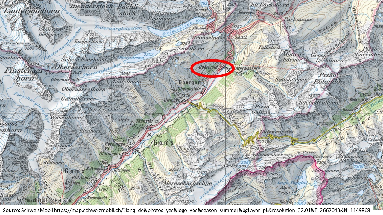
On Tuesday, we arrive at Oberwald via Andermatt using the car transport through the Furka Tunnel. 

The sun shines and the air is fresh and chilly. We run from Oberwald to Niederwald. The snow conditions are beautiful and we do all the detours on the way, except the last one just before Niederwald; there are exactly 9 minutes left, until the train leaves at Niederwald. We rush to the train station and we make it on the train back to Oberwald.

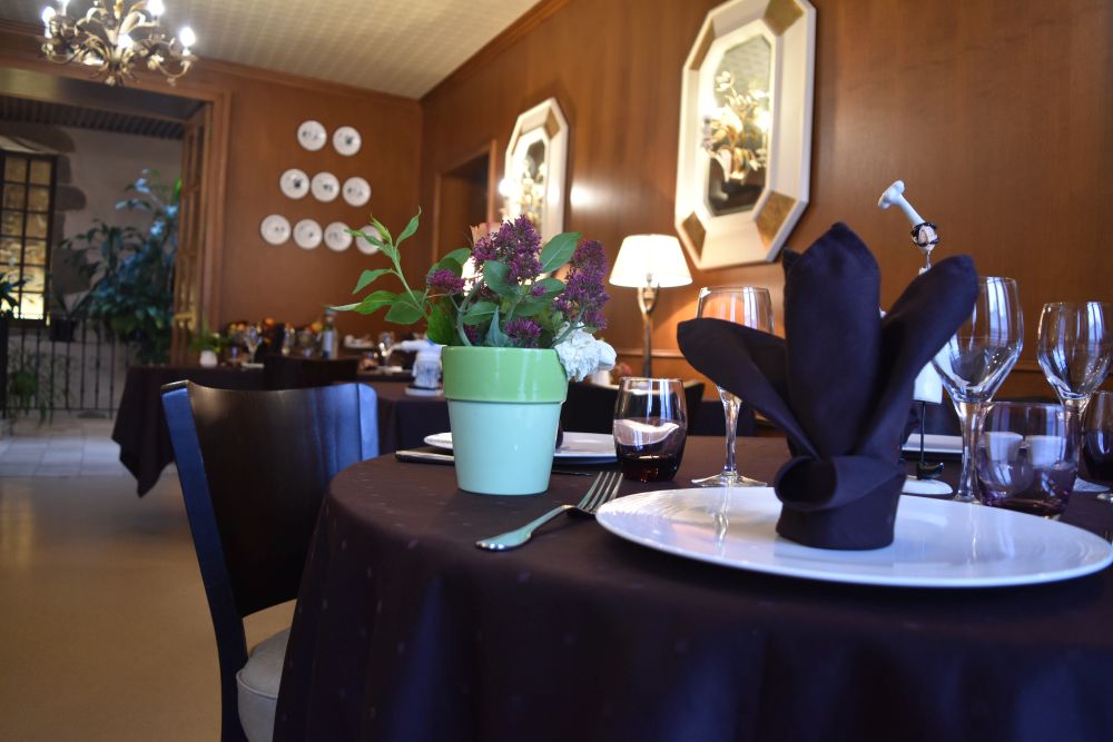
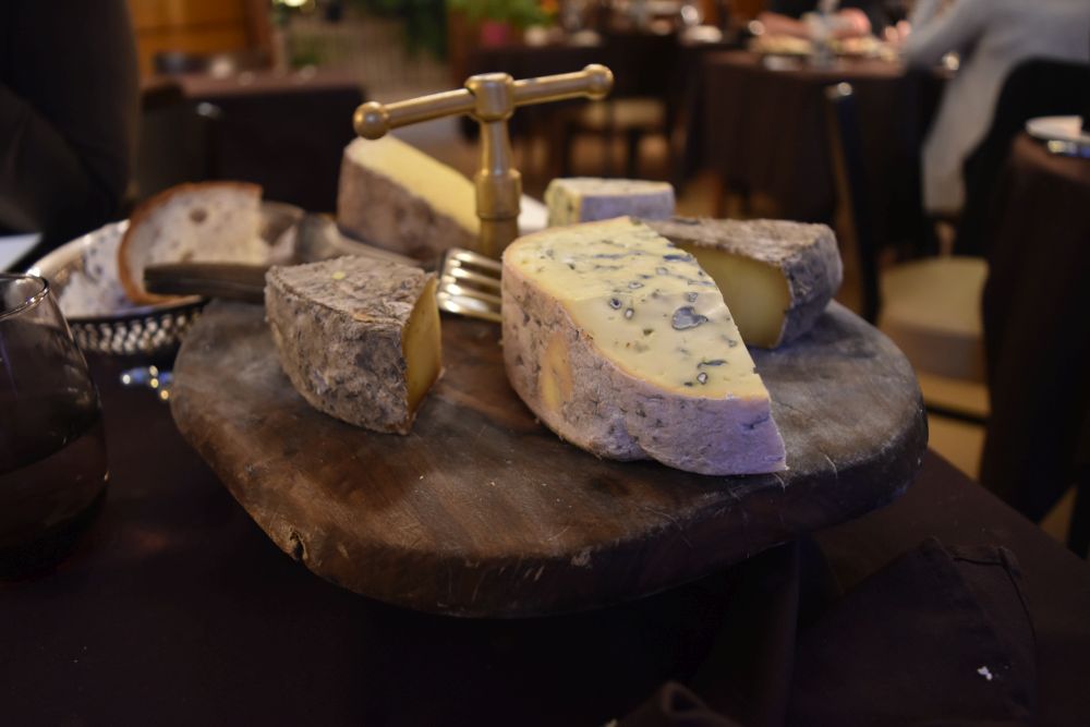
At the hotel, we enjoy an excellent glass of Heida (local wine from the canton, related with Traminer) and a delicious meal. 


Snow fall has started and cross country runs are filling up with snow on Wednesday

An area of deep pressures approaches England to bring precipitation and, in the mountains, heavy snowfall. 

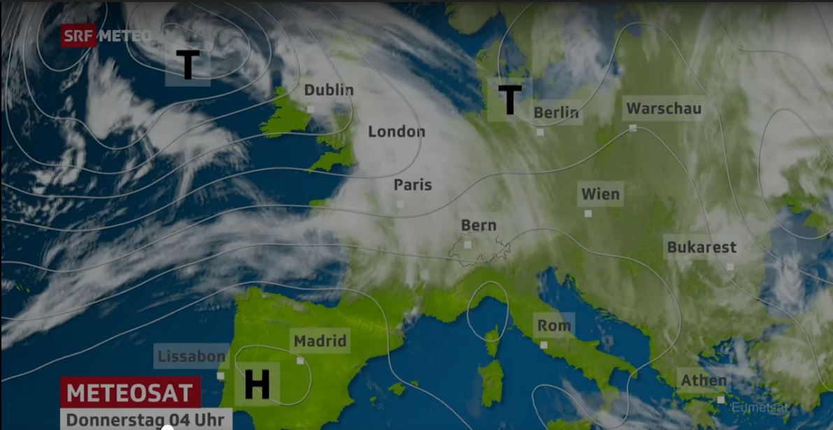
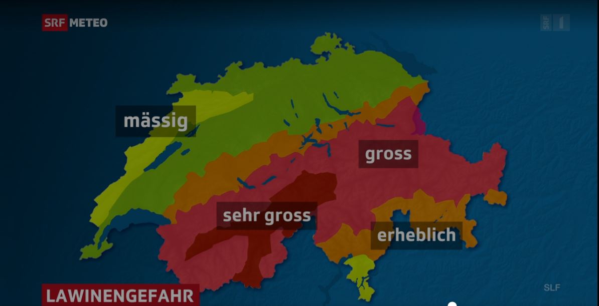
This is the SRF METEO weather map of Thursday. The snow starts falling on Wednesday. We run down to Münster, find that the tracks are filling up more and more with snow and return back to Oberwald. 


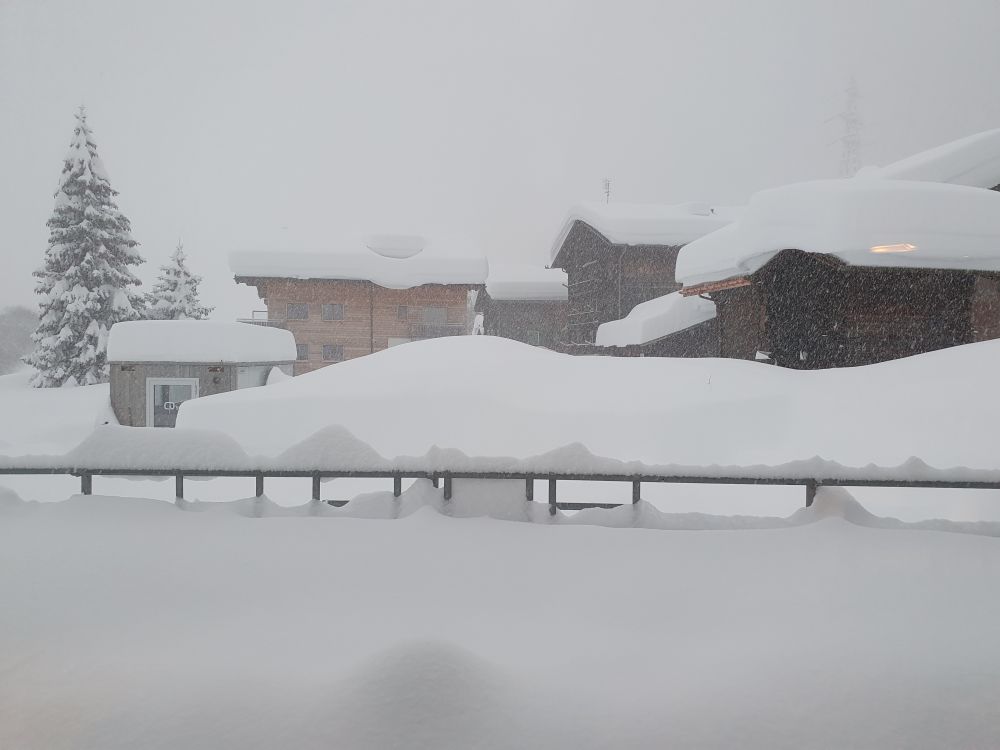
We wake up on Thursday with lots of snow around us, all runs are closed and the danger of avalanches is high

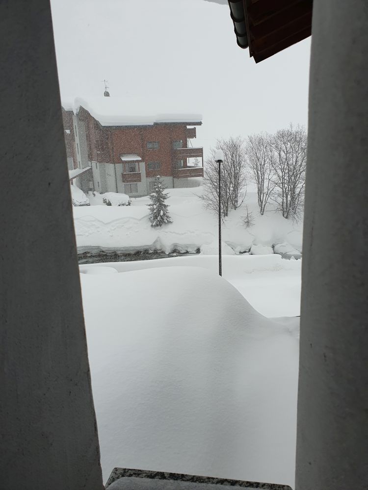
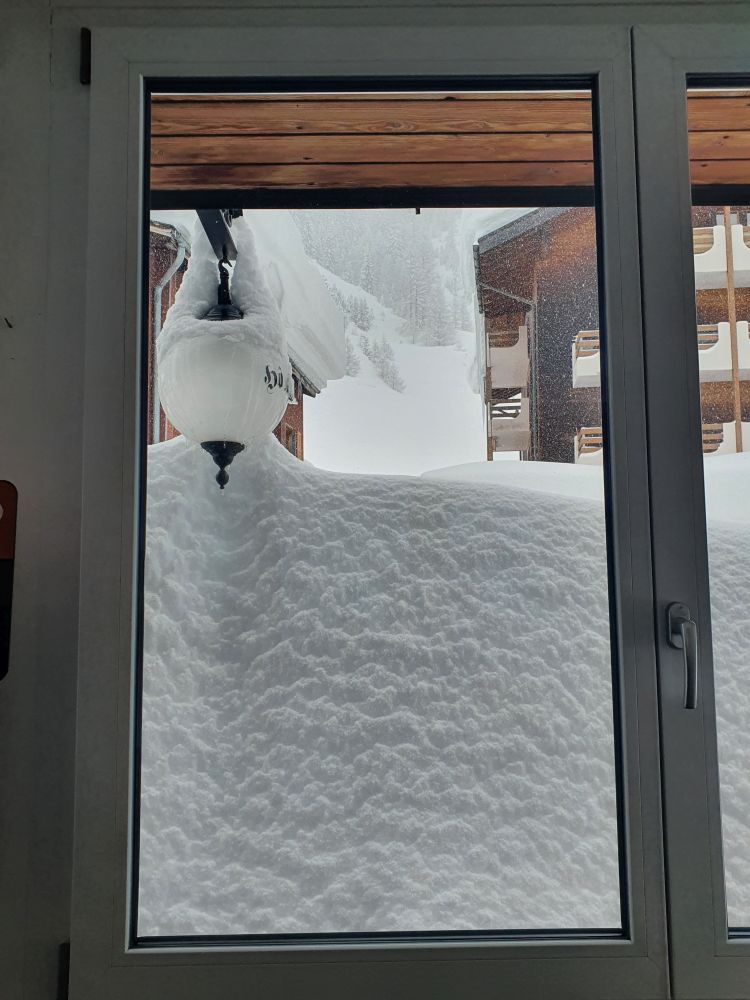
Taking a shower on Thursday morning, I find this view from my bathroom window.

This is the view from the breakfast room. 

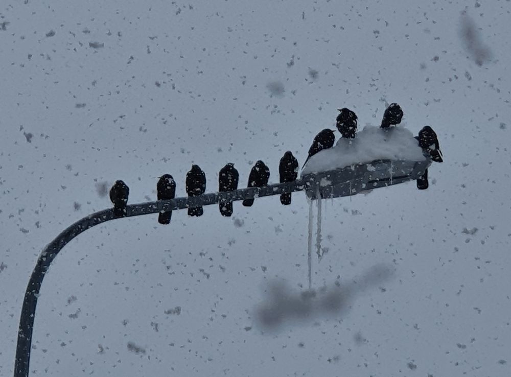
The lamp indicating that we are in the Hotel Furka is buried under snow. 

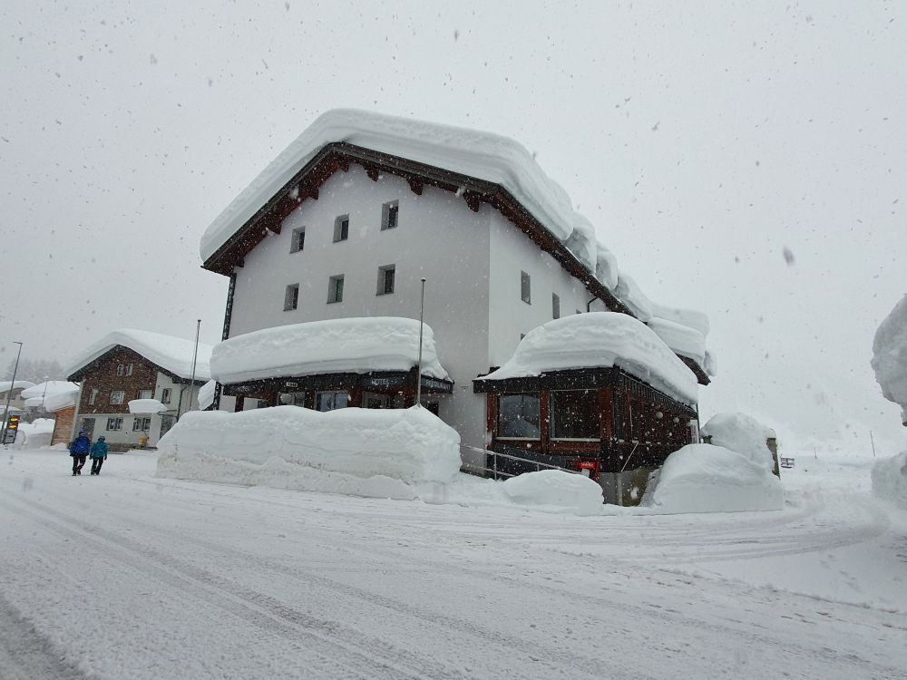
The hotel manager serves our breakfast and informs us about the status of the cross country runs, snow shoe trails and walking trails: Everything closed, as the colour “red” indicates. 

About 60-80cm of fresh snow had fallen from Tuesday evening until today, Thursday morning. The danger of avalanches is 4 which means “high”. At 4, roads and railway tracks are in danger. The roads are closed and the trains have stopped working. 

Later the danger of avalanches switches to “sehr gross” (5 = very high), which is the highest level. Several avalanches went down during the day, even cutting into the unstable old snow layers.

No, we cannot get out of Oberwald. We are locked up. Fifty years ago, as a child, I had always dreamed to be “snowed in”, when the ski camps were about to end; it never happened. Now my “old” dream comes true.

Our plans for the next two days: Walk around Oberwald, take some photos and – read. 


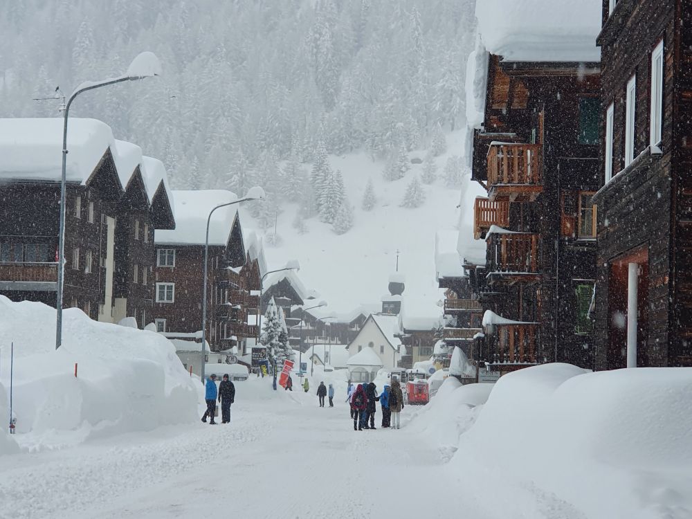
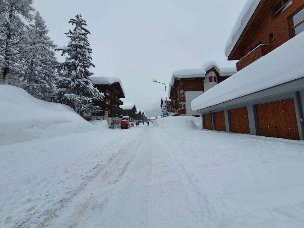
Snow impressions taken in the village Oberwald

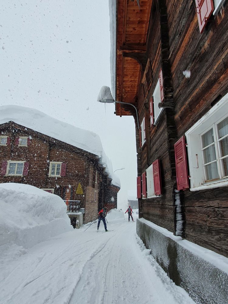
All guests of Oberwald are locked up. The main street is busy with people walking up and down. 

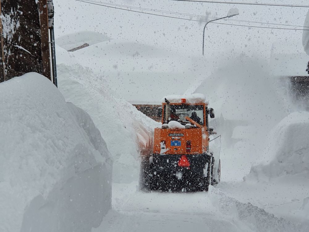
Snow ploughs are working hard to free the main street from the heaps of snow.

It is getting more difficult for them, where the streets are narrower.

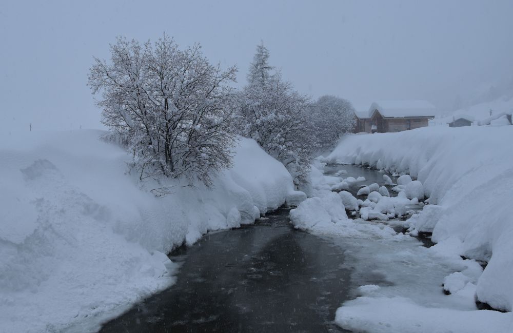
A lorry takes snow to the Rotten and drops it into the creek.

Cars can barely be seen under the snow. 

Fortunately, my car is in the hotel garage.

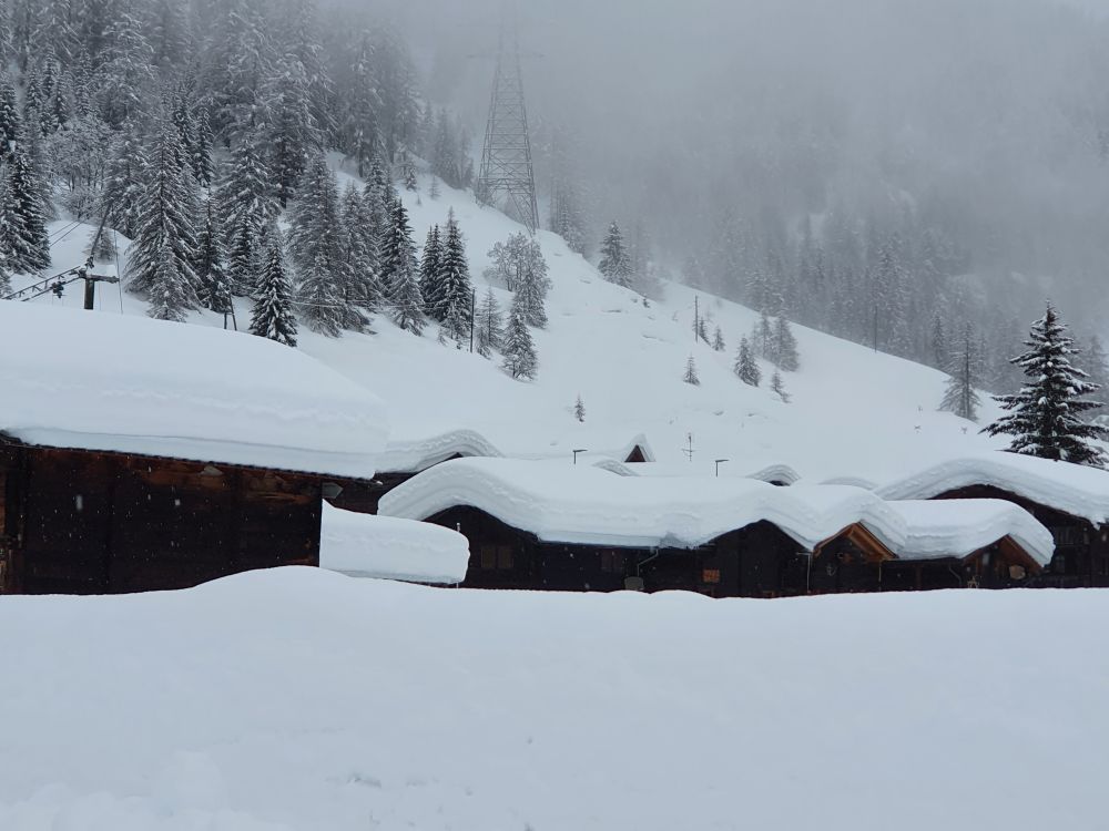
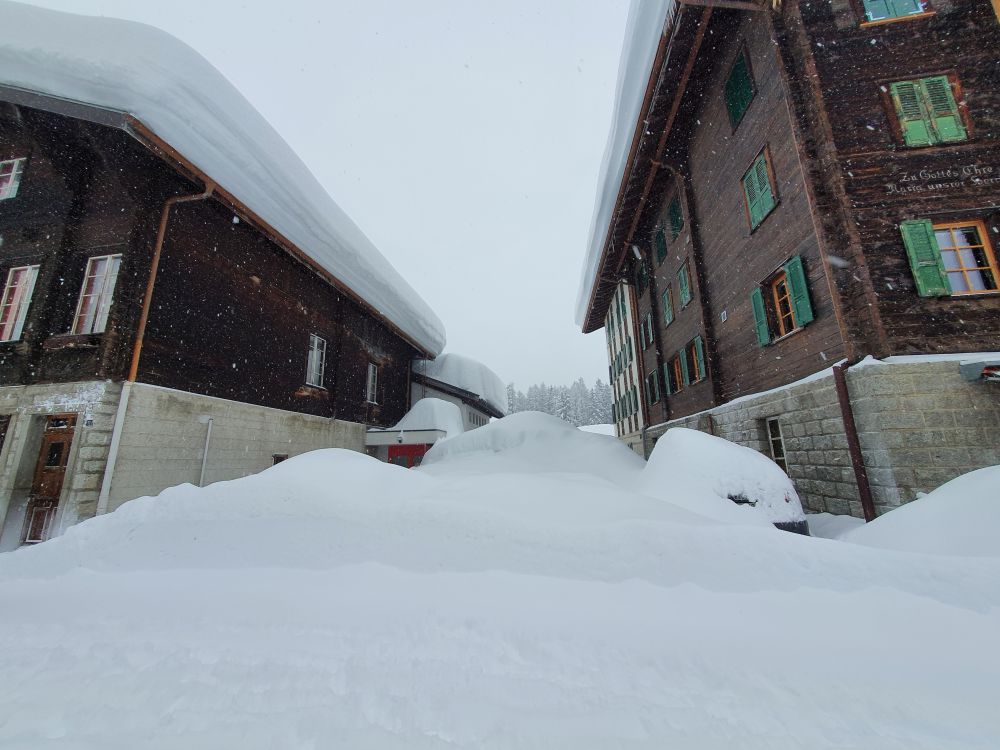
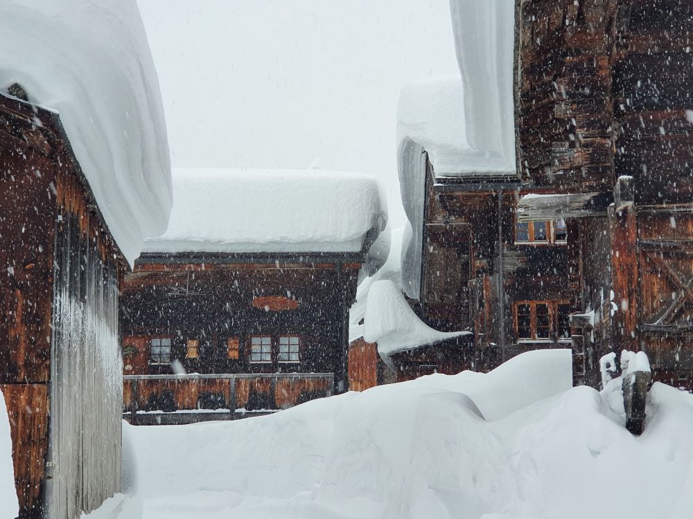
The snow covering these two roofs…

… gives a very snowy perspective.

A small path has been cut out to access the barn.

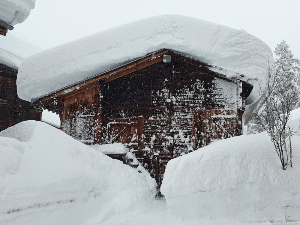
The roofs have to carry much snow and more is expected.

The black crows (or choughs) congregate on the street lamp.

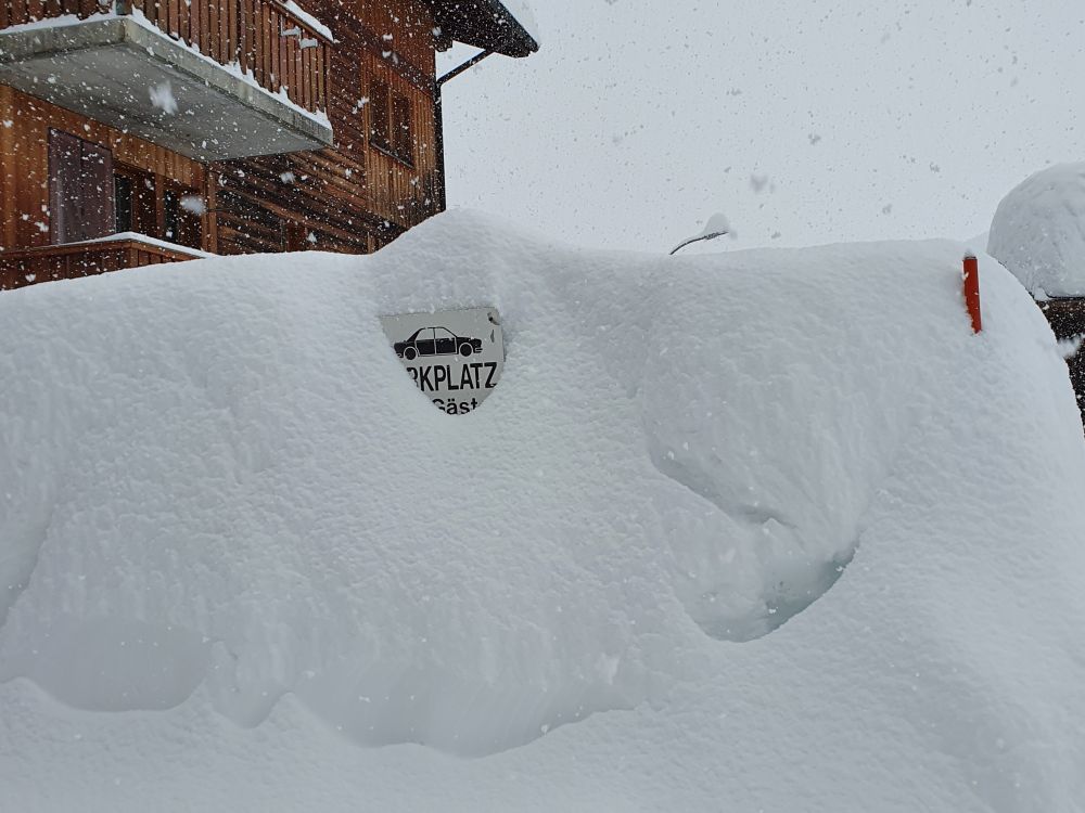
The access to this hotel parking can barely be seen.

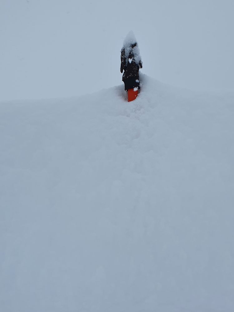
Some attentive person has put this glove on to the red street marker such that the owner has a chance to find it.

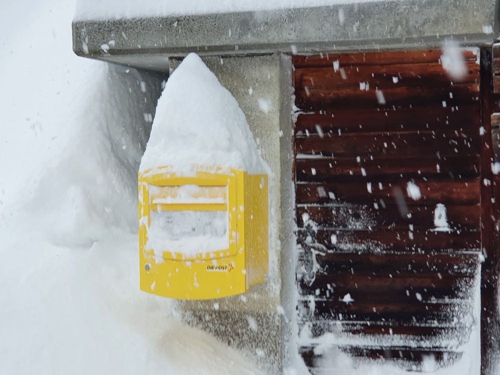
Will this mailbox ever be emptied now?

The streets are being used by skaters.

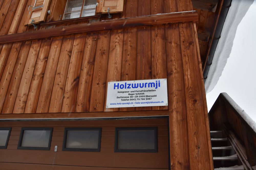
The carpenter with the name “Holzwurmji” (woodworm) looks closed today.

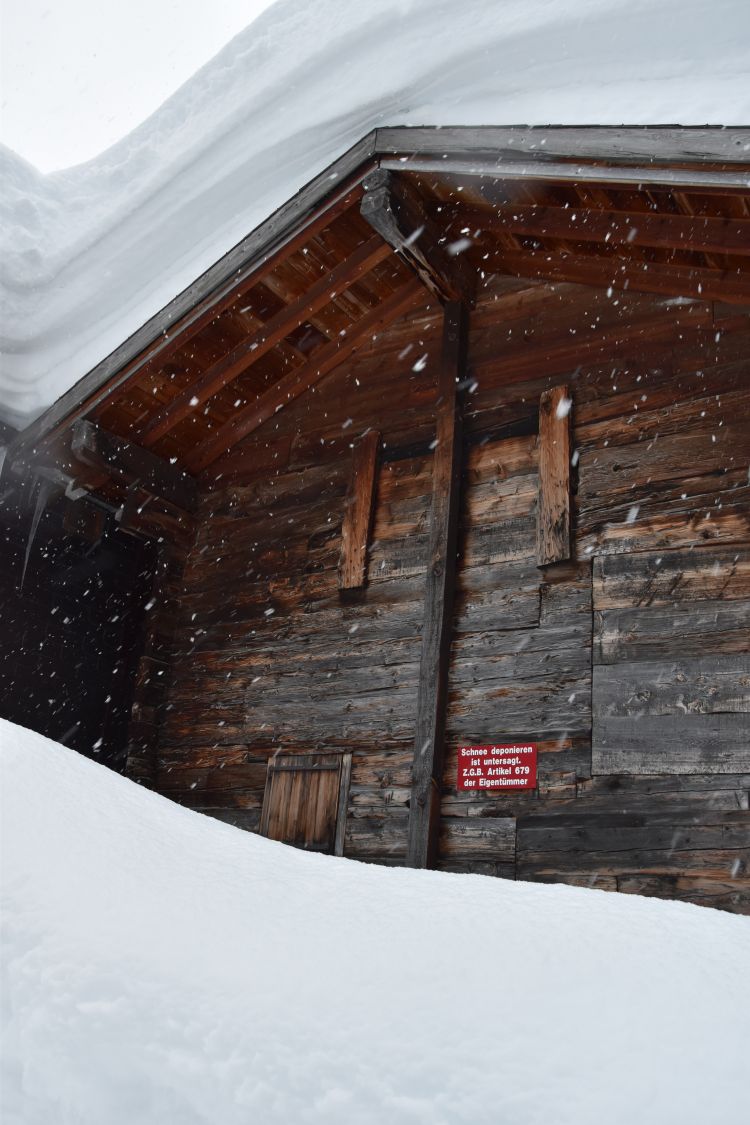
Depositing snow is forbidden, as the red plate indicates… well, the snow ploughers only had the option to disobey the order.

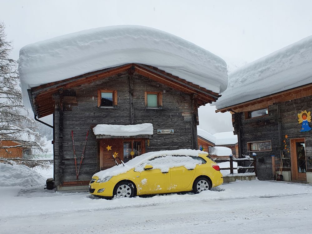
The Murmeli (house with the name “little marmot”) has already worked hard to free the car and the road has been groomed in the meantime. I wonder, whether this small house can carry the weight of the snow. 

Someone has started to take the load of snow off the roof.

I return to our Hotel Furka to do some reading. 


Around Oberwald, the world ends soon

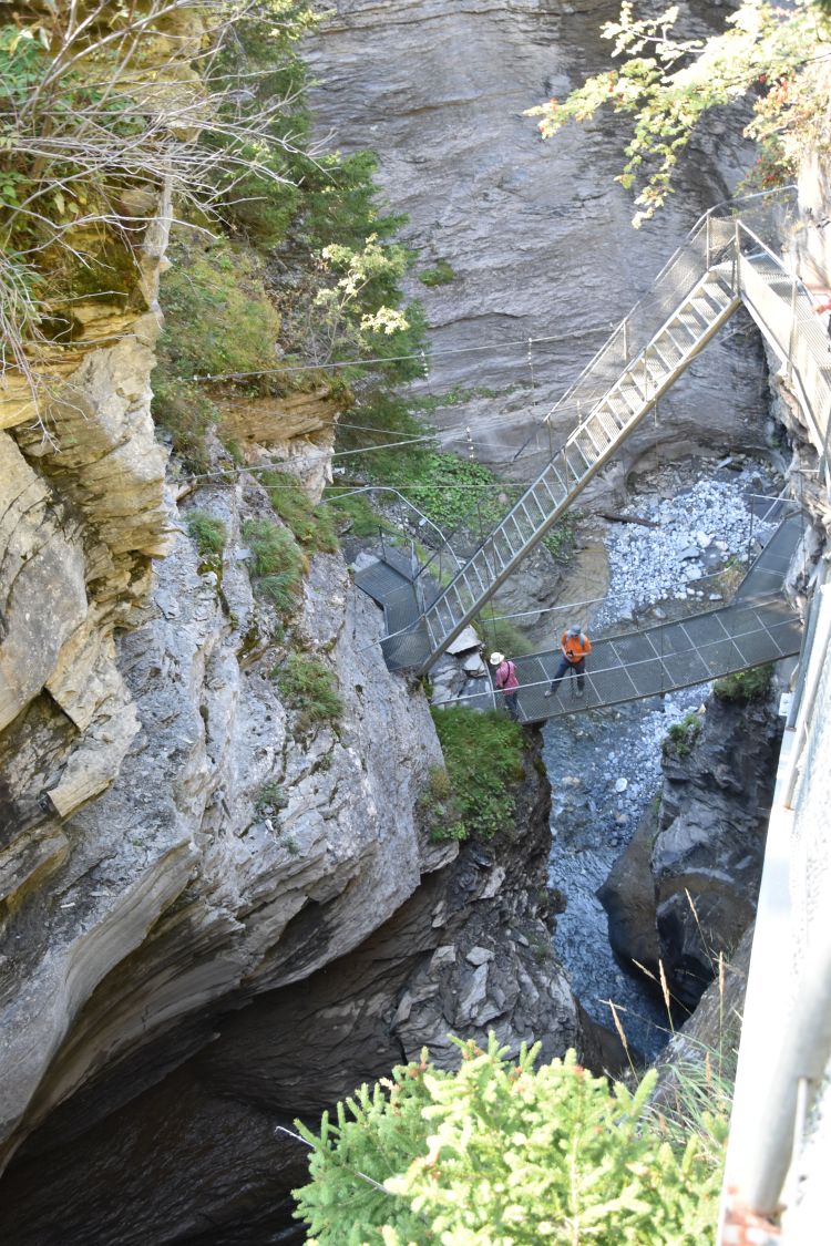
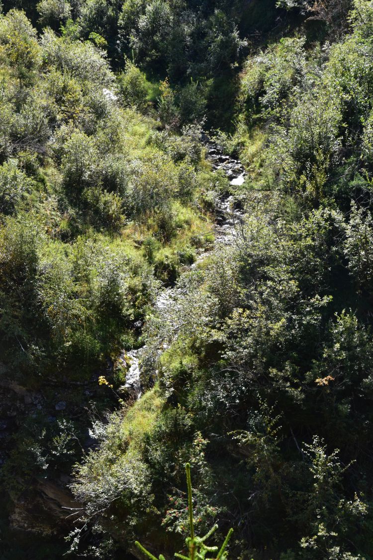
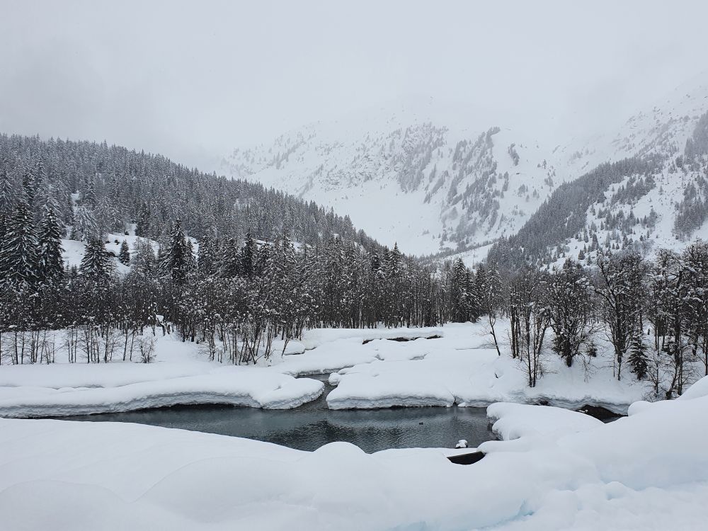
A short walk along the Rotten creek…

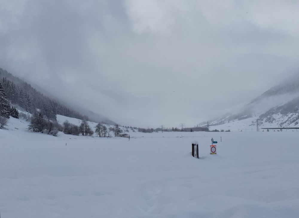
… ends after some 500m.  Danger of avalanches (Lawinen). You are not allowed to continue on foot or by car.

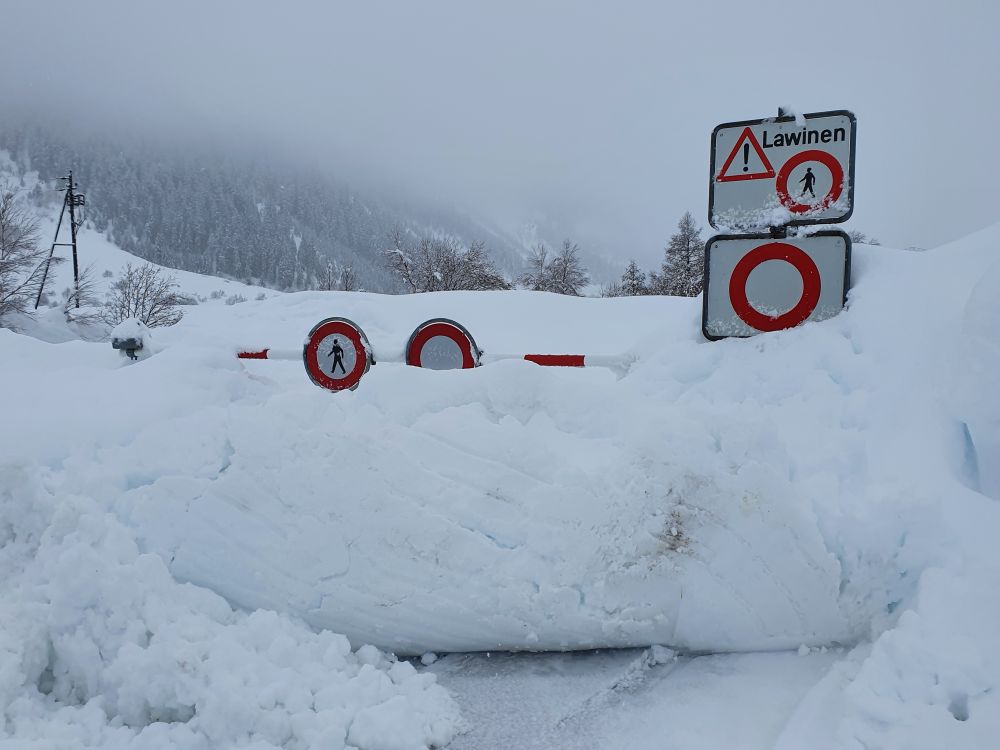
The cross country runs are closed – do not go beyond this point some 200m outside of Oberwald. 

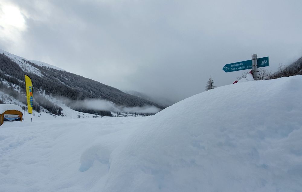
The access from our hotel to the cross country runs ends in heaps of snow. 

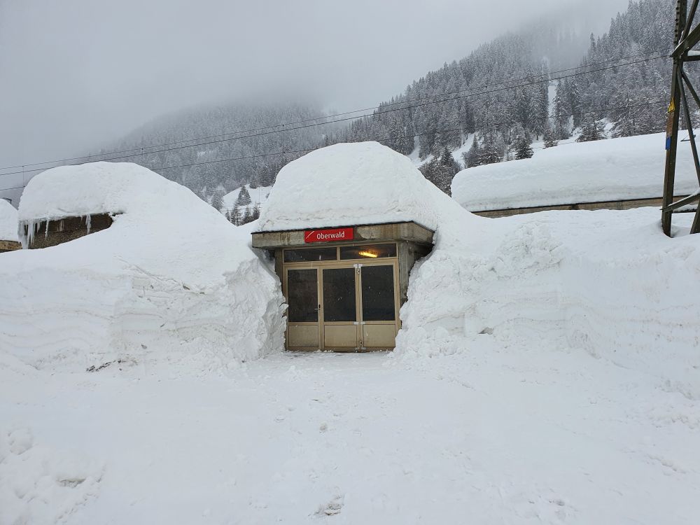
The train station is closed; the trains are not running any more.

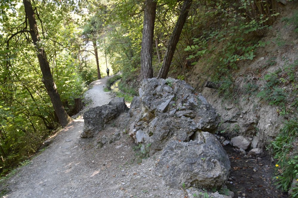
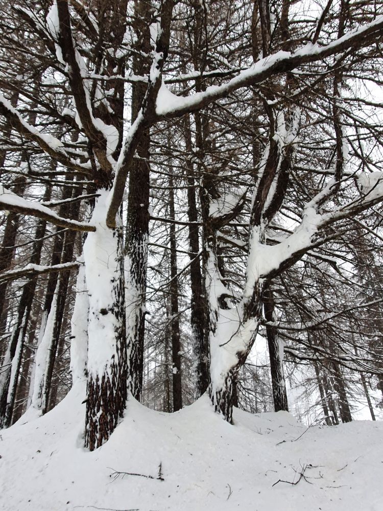
Only a small part of the forest behind Oberwald is open for walkers.

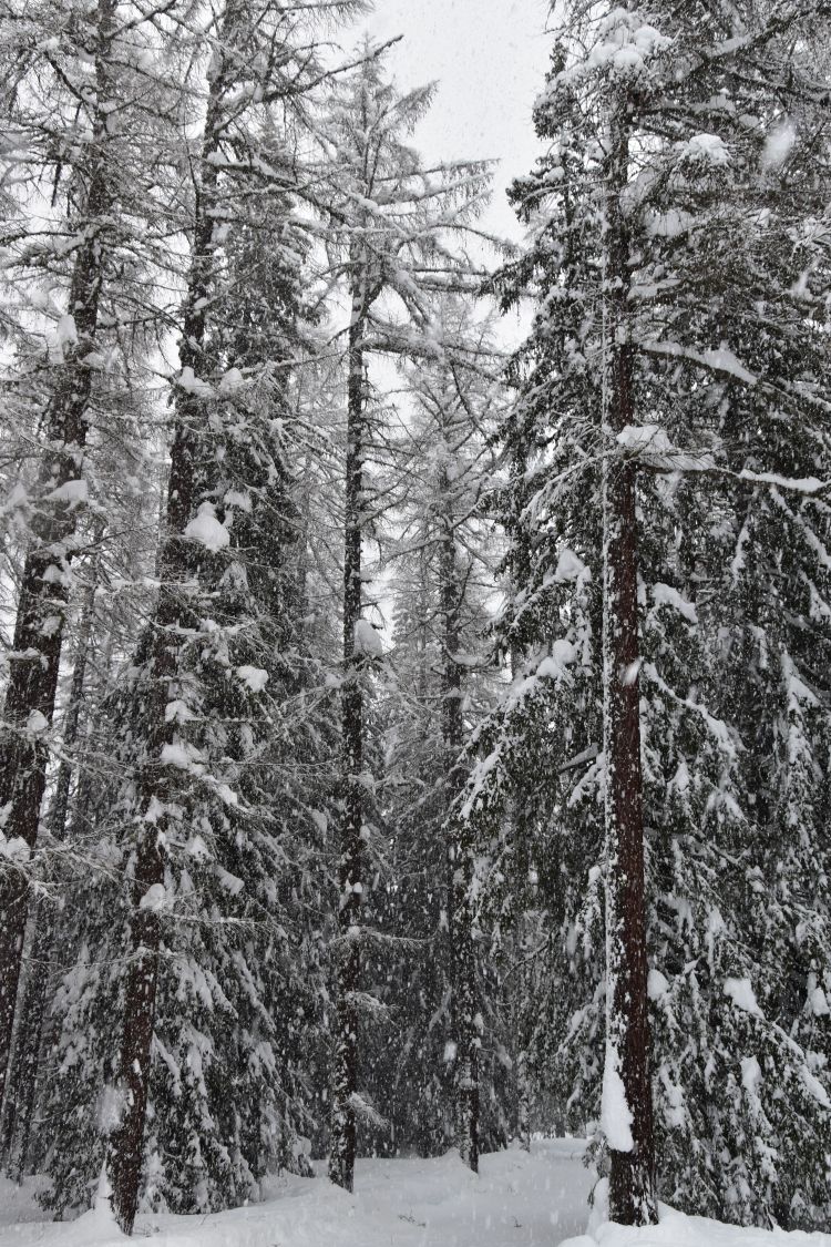
The fir trees are bending under the wet snow – it is close to zero degrees.

I enjoy the patterns painted by the snow.


In between, the sun comes out for a moment

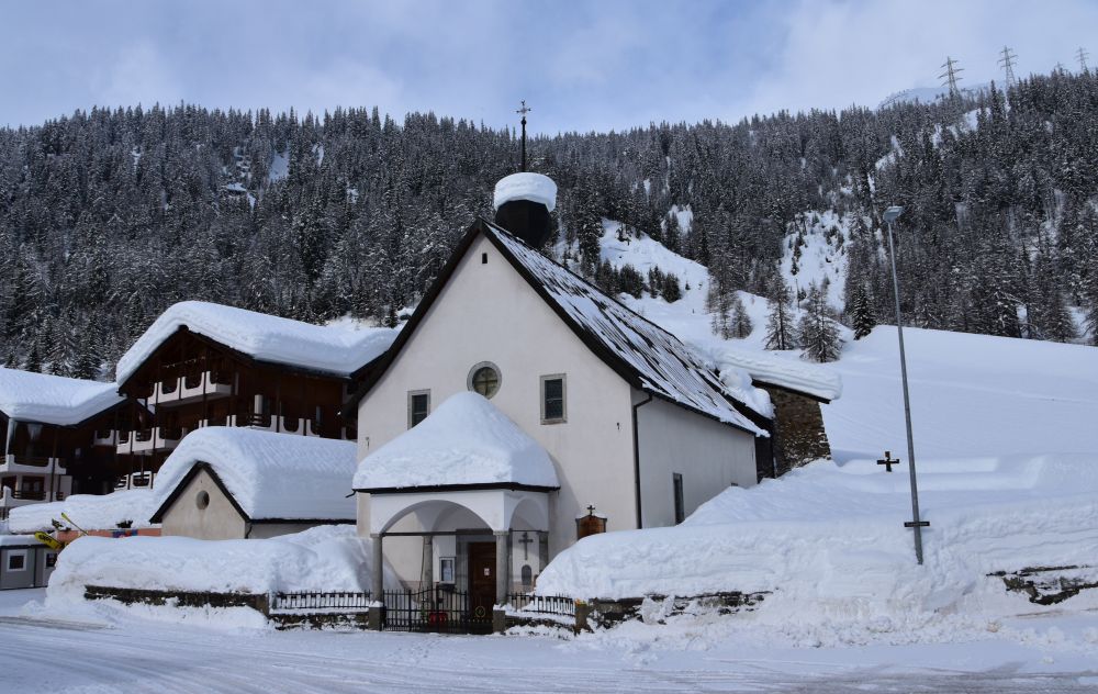
Just for a short time, the snow fall stops and the sun comes out. The Tällistock appears behind Oberwald. 

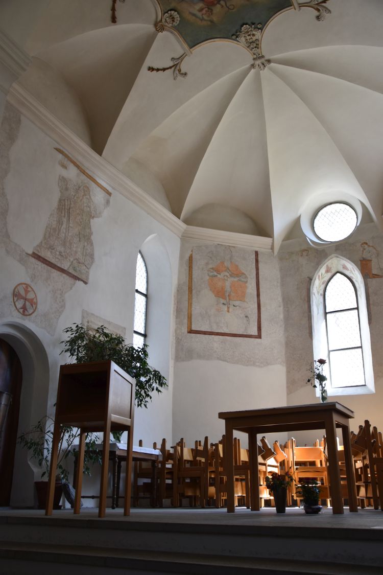
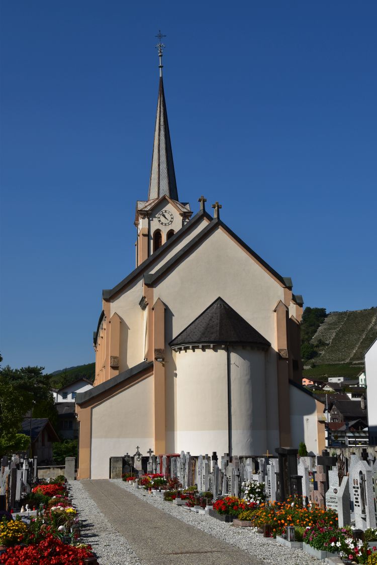
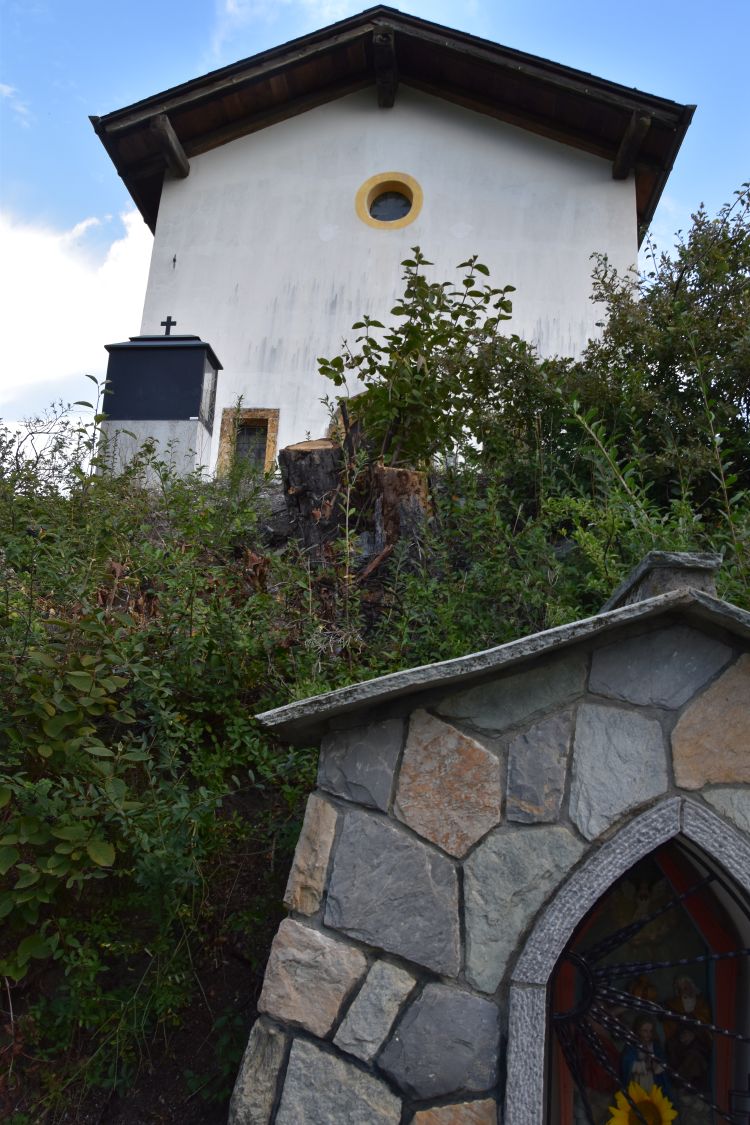
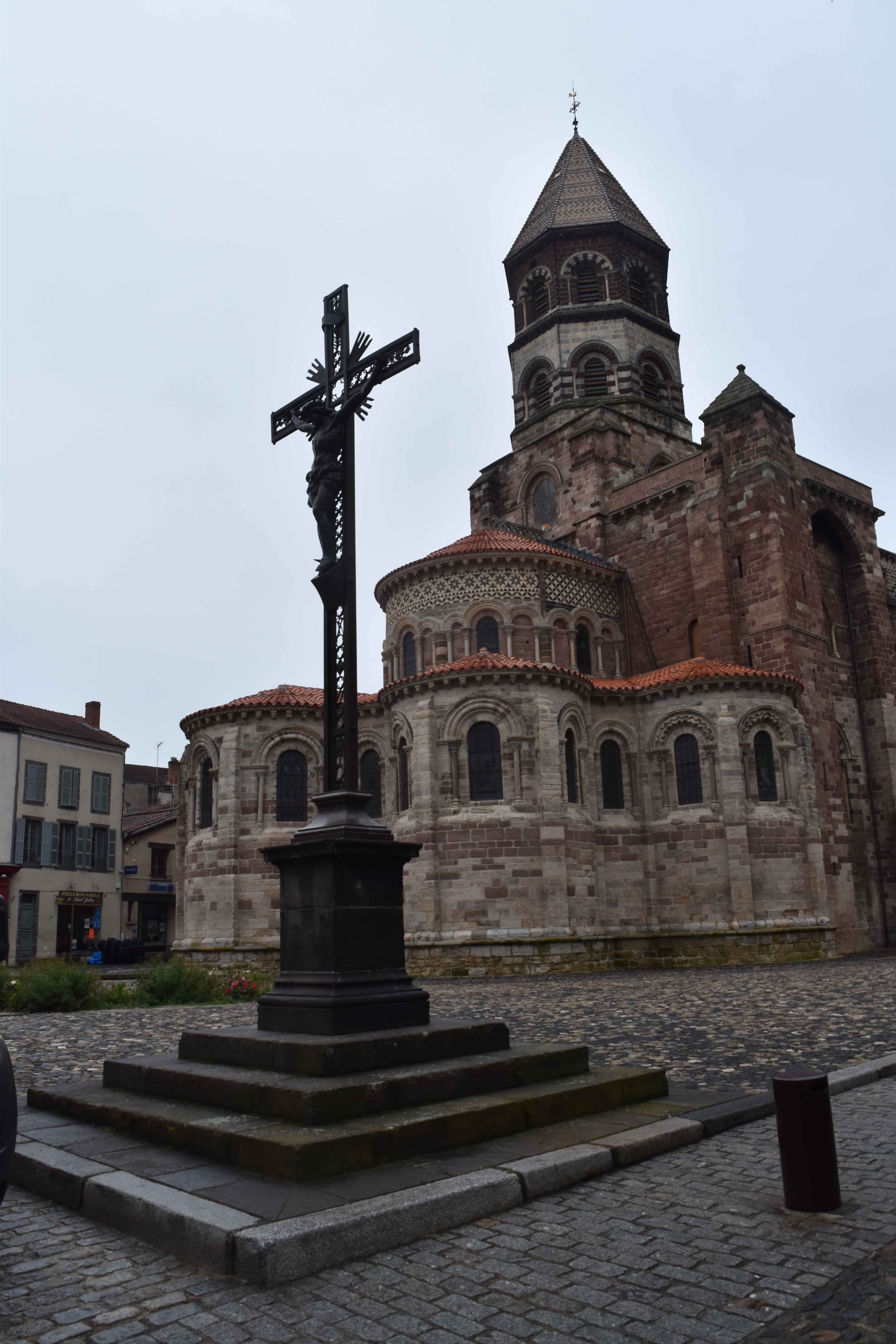
The church of Oberwald shines in the sun.


On our last two days, Saturday and Sunday, we can take out our cross country skis again

On Saturday, the forest run above Oberwald has partially opened up providing a small loop of about 2 to 3 km.

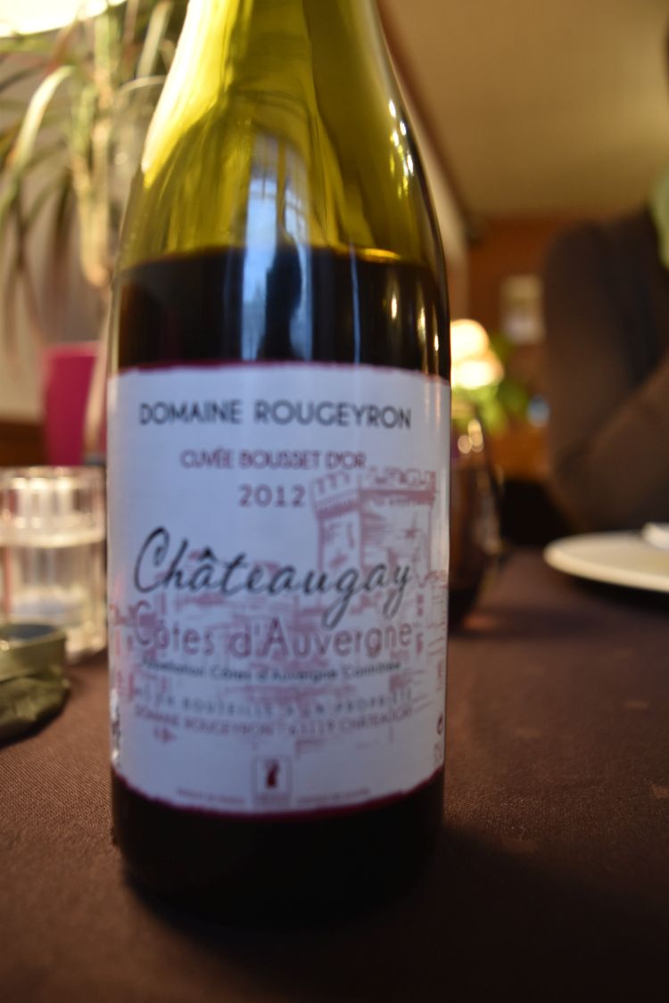
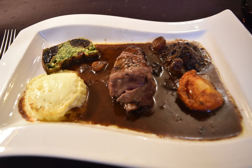
After having looped seven times, I return to the hotel. At the dinner table we see that all the other guests have left today, Saturday. At 4pm the last part of the road westwards to Brig had been announced to open again, which it did. We hear reports about a severe traffic jam – bothersome. We feel happy to have stayed at Oberwald for another night. We enjoy our dinner with the local wine Johannisberg (called Sylvaner elsewhere). We finish the evening with a Vieille Apricotine. Delicious.

The next day, the Rottenloipe has been groomed again. The sun is out. Beautiful winter conditions.

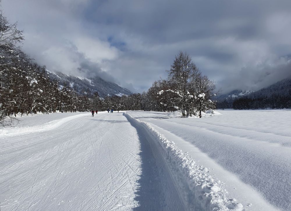
We go for a run in the morning, have some take away lunch and leave with the 14:35 train through the Furka Tunnel that has opened up today as well. 3 hours later, we are back in Basel. It is raining. It almost feels like spring and the deep winter of the Goms seems to be far away. Great to have experienced that.  

Four days at Salgesch – discovering Leukerbad, the underground lake and the Pfynwald

In September 2020, we spent four days at Salgesch. In my former blog, I have already talked about discovering Salgesch and the area around it.

Let us now move a little farther away, to Leukerbad, to the underground lake Saint-Léonard near Sion and to the Pfynwald or Forêt de Finges.

Source: Google Maps


Leukerbad – discovering the hot springs

On our second day at Salgesch, we visit Leukerbad, located on 1400m above sea level surrounded by an amphitheatre of steep rocks. Crossing these steep rocks, the Gemmipass connects Leukerbad in the Valais with Kandersteg in the Bernese Alps.

Emerging from these steep rocks, the Dala has eroded a deep gorge above Leukerbad. We explore it using the so-called “Thermal-Springs Gangway”.

I  hear a a rattling noise. My friend uses the rope winch to pull up a bucket from the well basin far below. The water in the bucket and hence in the well below us is warm, almost hot.

This is one amidst 65 hot springs in the Dala canyon, as this panel tells us: The yellow-brownish area follows the Dala, and it is here, where the 65 hot springs of Leukerbad have their sources. Some of them have temperatures up to 51 degrees.

The water emerges in the Dala canyon, after having been heated up at 500m below sea level. Originally it is rain water from the mountains east of Leukerbad (Torrenthorn and Majinghorn) that takes about forty years to seep deeply into the soil, where it is heated up to emerge in this canyon. Already the Romans made use of the hot springs of Leukerbad – the hottest in Switzerland.

Now I understand, why the gangway along the Dala gorge is called “Thermal-Springs Gangway” (Thermalquellen-Steg).

A series of ladders take us out of the impressive Dala canyon.

Looking at the creeks and meadows nearby, I can hardly believe that this narrow and steep canyon is so close.

In the warm sunshine, we eat our sandwiches at the romantic green lake Majing…

… with some branches in it.

We return to Leukerbad. Strolling through the village, we touch the water emerging at the fountains – most of it is warm, one fountain is even hot.

We visit the church of Leukerbad. The original choir is from the late 15th century. Some frescos have been restored such as the crucifixion at the back. In the late 19th century, the church was enlarged and the old choir became a side chapel.

We round off our day at the Alpentherme enjoying the gorgeous view of the mountains in the outside pool, while being massaged by bubbling jets.


The underground lake Saint-Léonard

On our third day, the sky is cloudy and temperatures are cooler. Just right for a visit of the underground lake Saint-Léonard that I had always wanted to see one day.

At the entry gate, we have to rush. A few seats are still free in the boat, and we can immediately join the next tour that is about to start. Ladders lead down to the cave. The boat takes us along the lake that is some 300m long and 20m wide. At the end, we find another boat…

… and the trouts swimming around with agility and indicating that the water quality is good.

The guide explains to us that the underground lake has been discovered in 1943. At that time, the water level was much higher. An earthquake of 5.6 on the Richter scale made the water level go down. In 1949, the cave was opened to the public.


The Pfynwald / Forêt de Finges

Below the village Varen, the Rhone (called “Rotten” in the Upper German speaking Valais) meanders along the Pfynwald (on the left side of the valley, photo taken from the road to Leukerbad). In the upper forest, the place names are in German and in the lower forest, they are in French, as the language border between the French and the German language crosses the Pfynwald.

The Pfynwald is a nature reserve, and it is one of the largest contiguous pine forests in the Alps.

With astonishment, we notice quite some birch trees amidst the pine trees.

South of the Pfynwald are the Illgraben (canyon of the Ill creek) and the Illhorn (the corresponding mountain peak). Very steep and rough here.

The Bhutan bridge crosses the canyon of the Ill creek. The suspension bridge symbolizes the link between the languages (French and German) and between different cultures (Alps and Himalaya).

This bridge was engineered in Bhutan and implemented by a construction company of the Valais, guided by an engineer of Bhutan. It was an interesting cooperation, where both sides learnt from one another. This is what the panel on the other side of the bridge explains.

The Buddhist sanctuary, a “chort”, greets hikers at the foot of the bridge. It has been built and blessed by Bhutanese Lamas from France.

After a two hours’ walk in the forest, we return to Salgesch to have our last wine tasting at the cellar of our winegrower and to eat a delicious Raclette at the restaurant Barrique in the centre of the city.


Enjoying the balcony of our BnB

The south facing balcony of our BnB with the view of the Pfynwald (forest) and the Illhorn (mountain peak) was a great place to be in the early morning, when the sun rises behind the glass wall…

… or when it rises behind the clouds.

After our last late summer evening on the balcony, we say good-bye to Salgesch and the Valais. We leave it using the Grimsel, one of the passes that the Alemanni used to migrate to the Upper Valais a 1000 years ago. We think of returning to Salgesch next year, when we will have run out of wine from the Valais once again.


Soruces:
Hans-Ed. Fierz David, “Über die Leuker Thermalquellen…“, Zürich 1942.
Panels along the Thermalquellen -Steg
André Beerli, “La Suisse Inconnue: Valais”, TSC and Shell Switzerland, oJg.

Four days at Salgesch – hiking in and around the vineyards

In September 2020, I stayed four days at Salgesch. With a friend, we had booked a studio in the beautiful BnB Vino Veritas.

Source: Google Maps

Let us start by exploring the village centre of Salgesch and walking above Salgesch along the Suone (water channel) to the Raspille canyon.

Salgesch – the centre

Salgesch is surrounded by vineyards that form kind of an amphitheatre above the village.

Some vineyards are very steep.

The centre of Salgesch is pretty with houses typical of the Valais…

… such as the wine museum.

In the 13th century, Saint John’s association (also called the Order of Malta) founded a hospital at Salgesch. Presumably due to that, the main church is dedicated to John the Baptist.

John the Baptist appears on the stained windows. Here, he is dressed in his fur coat and accompanied by the Agnus Dei.

The benches demonstrate that Salgesch is connected with vines.

The bakery and many vineyards at Salgesch are owned by families with the name “Mathier”. Old family traditions. Also “my” winegrower is called Mathier. He sells all the traditional wines of the Valais such as Petite Arvine, Amigne, Heida (white) or Cornalin, Humagne Rouge (red) as well as the “usual” grapes Chasselas (called Fendant here), Sylvaner (called Johannisberg here), Gamay (the Beaujolais grape), Pinot Noir (the Burgundy grape, often blended with Gamay, which is called Dôle) or Shiraz (the Côte du Rhone grape). We will benefit from tasting their wines.

Along the Suone above the vineyards to the creek La Raspille

When walking uphill through the vineyards towards Varon, we enjoy the widening view. Through the vines, we can see the Rhone valley with Salgesch below us.

We catch the Mengis Suone, which is a water channel that is fed from the Raspille; now it is without water.

Such water channels are in use in the whole Valais. They are called “Suonen” in the German speaking Upper Valais and “bisses” in the French speaking Middle and Lower Valais. It is assumed that building these water channels goes back to the 14th century, when cattle breeding came up that required pasture land providing hay as winter forage (see Gilbert A. Rouvinez, p. 5).

The canyon of the Raspille is the language border between German (Upper Valais) and French (Lower and Middle Valais).

On the French speaking side we follow the water channel that leads to Sierre.

Panels explain the geology, biology and culture. On the French speaking side of the Raspille, the text comes first in French and then in German. One panel clarifies the reason for the large barren area above Salgesch, called “Blatta”, which is bordered by steep rocks on the top. In the last Ice Age, the Rhone valley was filled with ice. When the glacier retreated, this slope became unstable. It ended with a huge landslide that broke off from the rocks and slid down over the “Blatta” to create small hills in the valley that are good for winegrowing.

From below, we can see two lines of trees on the “Blatta”; they indicate, where the water channels are: The Menings Wasserleitu (the “small” lower channel) and the Grossi Wasserleitu (the “large” upper channel).

Where the Raspille reaches the bottom of the Rhone valley, water erosion created spectacular pyramids.

The water cemented the pebbles and chalk rocks from the landslide, some parts more, some parts less; the harder parts resisted the subsequent erosion and remained as pyramids.

The pyramids gave their name to one range of wines of our wine grower Mathier: “Les Pyramides”. We learnt that, when degusting at their winery.

The chapel Maria of Seven Sorrows (Kapelle Maria Sieben Schmerzen)

On a small hill, the chapel Maria of Seven Sorrows guards over Salgesch.

The small and steep Way of the Cross winds up to the chapel. It is not possible to get there by car.

The chapel is closed…

… and we enjoy the view of the Rhone valley with the Pfynwald from here.

Post Scriptum: Why is the canton Valais called “Valais” and why is it bi-lingual?

Back at home, I wonder, why the Valais is called “Valais” and why it is bi-lingual with French spoken in the Lower and Middle Valley up to the Raspille/Pfynwald, while in the Upper Valais, the people speak German. They are difficult to understand by us whom they call “Üsserschwiizer” or “Outer Swiss people”. Here is a short summary of what I found.

After 1000 B.C, Celts immigrated to the secluded Rhone valley and called it just “valley” (Nant in the Celtic language). The Rhone valley is indeed secluded, surrounded by rough mountains in the north, east and south. The Rhone valley only opens to the Lake of Geneva in the west. The Romans conquered the area in 57 B.C. and named it “Vallis” (=”valley” in Latin). They romanized the Celts, and until the eight century, their variety of the Latin language evolved to something called Franco-Provençal (also “patois” which translates to “dialect”). In the 6th century, the Burgundians and later the Francs conquered the Valais, while north from here, Alemannic tribes slowly migrated into the Bernese Alps.

Until the 9th/10th century, Franco-Provençal was spoken in the Lower, Middle AND Upper Valais. Village names in the Upper Valais tell us about that: “Geschinen” comes from “Casina”, and “Gestelen” originates from “Castiglione” (Meyer, p.3).  In the 9/10th century, the Alemannic tribes from the Bernese Alps immigrated into the Upper Valais, probably using the Lötschenpass, the Gemmipass and the Grimselpass. They “imported” the Alemannic Dialect, as it was spoken in the Bernese Alps. Now I understand, why I hear similarities between the dialects of the Bernese Alps and the Valais (which I both do not always understand easily).

Around the year 1000, the king of High Burgundy handed over the Upper and Middle Valais to the bishop of Sitten/Sion, and at about the same time, the Savoyards conquered the Lower Valais along with some places in the other parts of the Valais. They strived to subdue the whole Rhone valley or Valais. However, they met resistance. In the 14th century, the Alemannic people from the Upper Valais were inspired by the will of freedom of the original Swiss cantons, and they took over the lead to fight against the Savoys. The Alemannic speaking Upper Valais conquered the Middle Valais up to Sitten. The bishop had to give special rights to the German speaking people from the Upper Valais for supporting him against Savoy.

In 1475, an army from the Upper Valais, assisted by the original Swiss cantons (“Eidgenossen”), defeated the Savoys near Sitten. The French speaking Lower Valais became a subdued area of the Upper Valley (“Untertanengebiet”; many original cantons had such subdued zones). The German language was now the ruling language in the Valais, while the French language had the stigma of being related with the enemy, Savoy. The prevalence of the German language lasted until 1798.

In 1798, inspired by the French Revolution, the French speaking people from the Lower and Middle Valais demanded their rights and the German speaking people granted them more rights, however, too late. Napoleon conquered the Valais and made it a French province in 1802; in 1810 it became the Département du Simplon. Now, under Napoleon, the French language dominated.

In 1815, during the Congress of Vienna, the Valais joined Switzerland. From now on French and German formally had equal rights, which was confirmed in 1844, when French and German became both approved national languages in Switzerland. However, the majority of people living in the new canton Valais spoke French and therefore French dominated over the German language. With the construction of the Lötschberg tunnel in 1913, the Upper Valais moved “closer” to German speaking Bern which gave the German speaking people of the Valais more self-confidence again.

Since the 1960’s, the tensions between the language groups have decreased and cross-language communication has improved.

Sources:
Gilbert A. Rouvinez, “Balades le long des BISSES du VALAIS”, 180 Editions 2020.
Jean-Pierre Meyer, “Zur Geschichte des Sprachverlaufs im Wallis”, PDF o Jahrgang
André Beerli, “La Suisse Inconnue: Valais”, TCS Suisse et Shell Switzerland, without date
Further reading: Excellent blog by the Freizeitfreunde.

Auvergne – France at its best

There we are on the road again… Our target is the North of Spain near Tarragona. Ursula has a friend that owns an appartment near Tarragona. We drive to Martigny first to get the key and then we drive through France with an overnight stop.

.

 Martigny is worth a visit, with the Fondation Giannada and its chapels

Ursula joins me in Zurich. We drive to Martigny in the Valais to see the exhibition of Zao Wuu Ki in the Fondation Giannada. Beautiful, I like his abstract paintings – each of them reminding us of a landscape – a sun rise, a salar lake or a sea shore with waves in the background.

Then I show Ursula the windows in the protestant chapel painted by Hans Erni, when he was 103 years old.

DSC_0015 small

We read about the other catholic chapel and the paintings of the monk Kim en Joong.  Ursula sees that he has also made the windows of the Basilica St. Julien in Brioude in the Auvergne. This is about half way to Tarragona. We decide to stay overnight at Brioude.

.

On the road to Brioude

We drive along the lake of Geneva in France. This is the view of the Swiss side of the lake.

DSC_0017 small

Then we head to Bourg-en-Bresse and the Auvergne, crossing one valley after the next on the motorways… up and down… up and down.

.

Brioude – a charming French town with the hotel de la Poste

Brioude is located on the St. Jacob’s pilgrimage route.

DSC_0027 small

It is one of these cosy and quiet country towns that I love France for.

DSC_0028 small

The tourist office shows us the hotels… and seems to recommend the Hotel de la Poste. “Two stars, but very good,” she says. How true. We find a friendly reception and a comfortable room in the annexe.

DSC_0093 small

.

The Basilika of St. Julien on the site where he was murdered

The center of Brioude is the Basilika St. Julien from the 11th century built at the place where Julien had been decapitated by Roman soldiers. The style is  Romanesque. This is the view from outside with the tower of 56m.

image

The nave…

DSC_0045 small

… and one of the 37 windows made by Kim en Joong in 2008. They give a solemn atmosphere to the inside of the church. We would like to visit the catholic chapel with his windows in Martigny, when back.

DSC_0050 small

There are old frescoes on the columns and in the chapels of the choir.

DSC_0067 small

Returning to our hotel we come across a bakery with this very French foto of the fifties or sixties in the last century. Very French… and welcoming.

DSC_0088 small

.

The superbe dinner in the cosy restaurant of the Hotel de la Poste

The hotel is a gem. In it, we find one of these home like restaurants that I only know from France.

DSC_0094 small

Ursula feels like the menu with two main courses, and I join her. I order this local Gamay from the region of Auvergne – it is a perfect match with the regional meal.

DSC_0095 small

The first dish is poultry terrine. Our main course is beef with potatoes au gratin and a spinach pie. Delicious.

DSC_0098 small

The selection of local cheese like Bleu d’Auvergne or Saint Néctar are also a good match with the Gamay.

DSC_0099 small

A rhubarber cake – lightly made – with a ball of coconut ice cream top our meal. “This is a “trouvaille””, Ursula says, “one of the best meals I have had in France.”

We sleep well in our quiet and comfy annexe and in the morning enjoy breakfast buffet prepared with care and love – all fresh regional products of the Auvergne.