Near Zürich: Altendorf and its wonderful chapel St. Johann

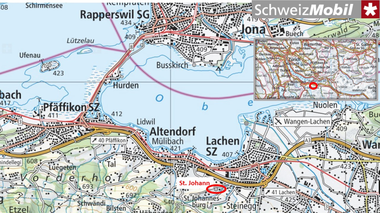
2020 has been a peculiar year. Instead of going to foreign countries, I travelled to the past finding my classmates of primary school. Three of them I met in Altendorf, located on the southern side of the upper lake of Zurich, in the canton of Schwyz. 

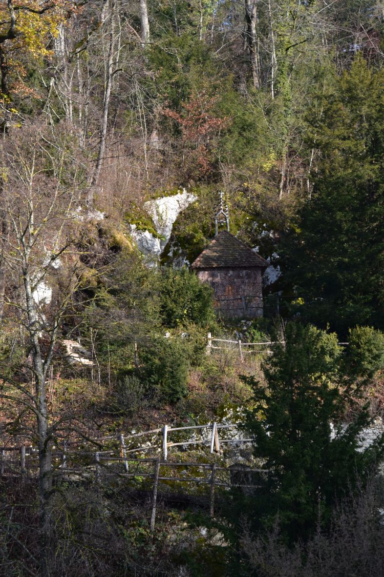
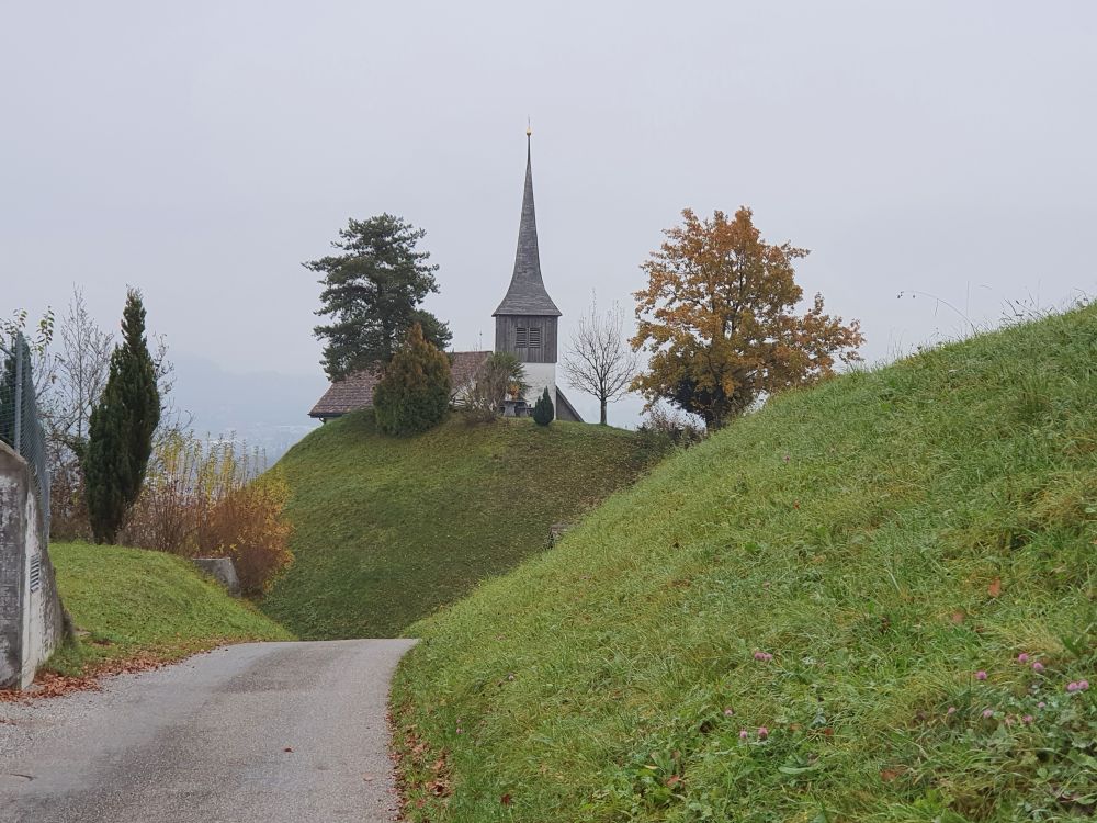
Let me tell you, what I have learnt about Altendorf and about its charming chapel Saint John. 


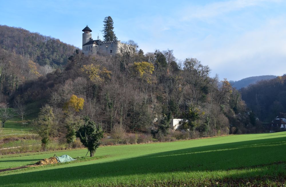
Altendorf, so far unknown to me, is worth a detour for its chapel Saint John and its restaurant Johannisburg

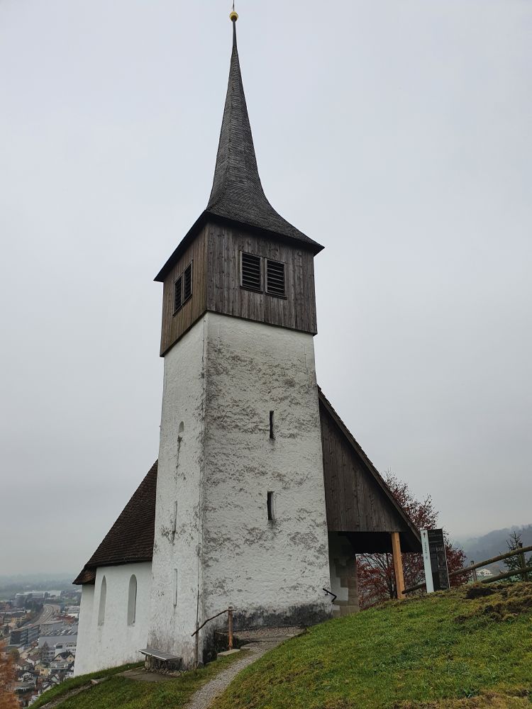
So far, I have not heard of Altendorf. Yes, when driving to the mountains on the highway, I have sometimes noticed the small church on the hill, and now I learn, it is named after Saint John (Kapelle St. Johann). 

With three of my class mates, I have an excellent lunch in the posh restaurant Johannisburg…  

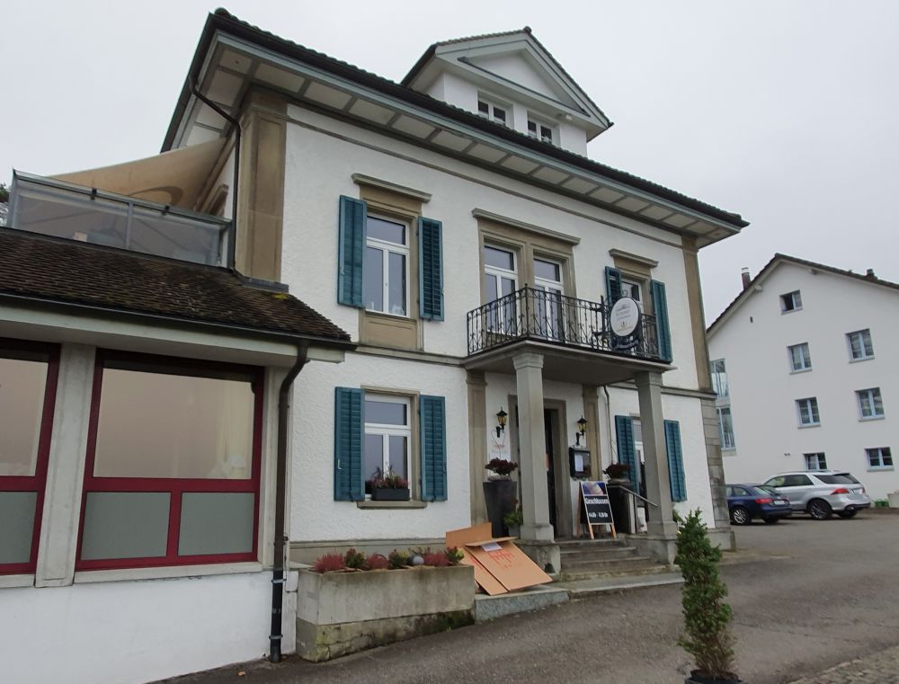
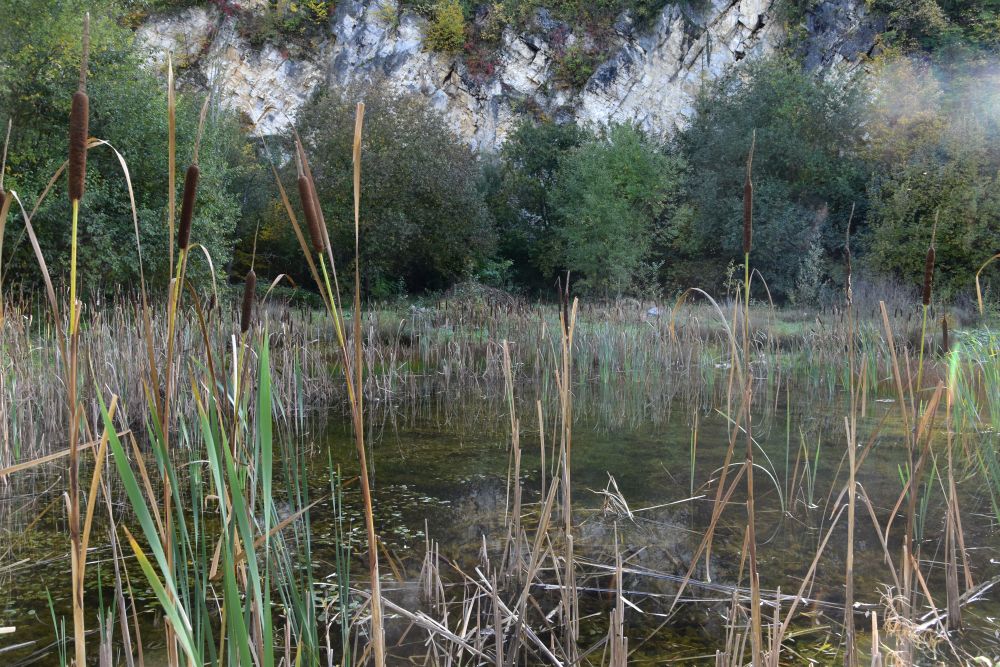
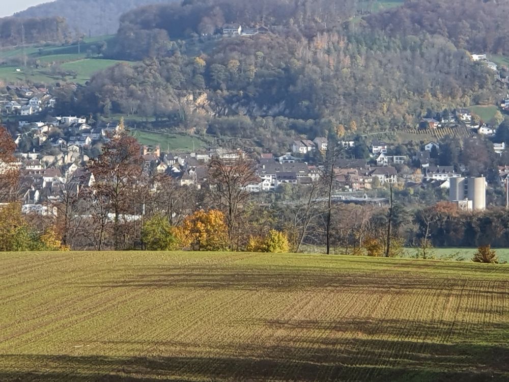
… with  a gorgeous view of the lake of Zurich.

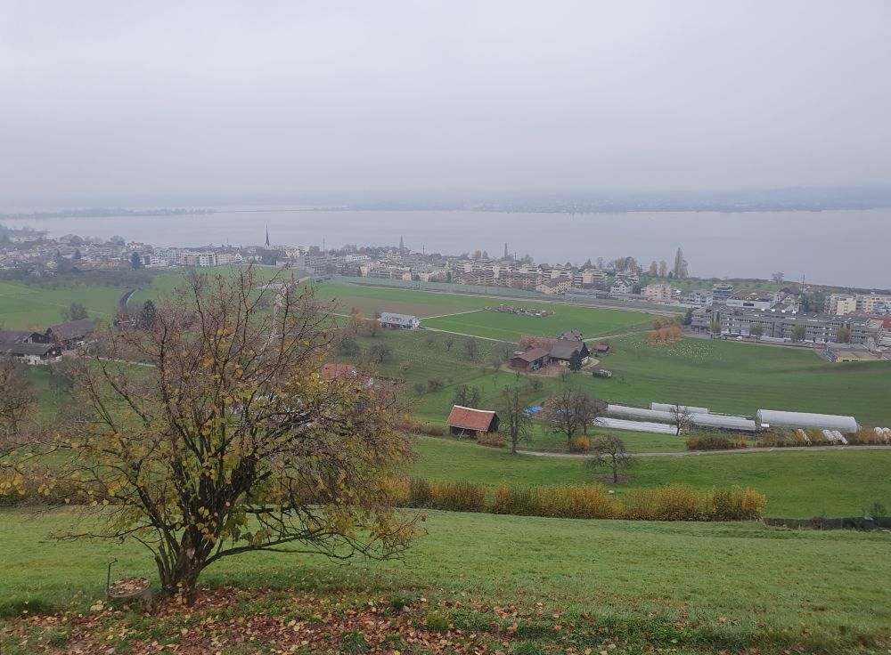
Well, I have to admit, today the view disappeared in the fog that sometimes lasts long around Zurich. I may have to come back on a sunny summer day to enjoy the sunset in the bar under the roof of the restaurant and then enjoy the excellent cooking of the restaurant. 


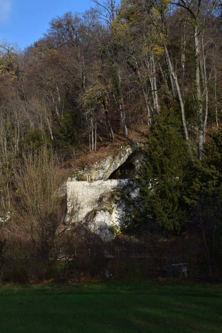
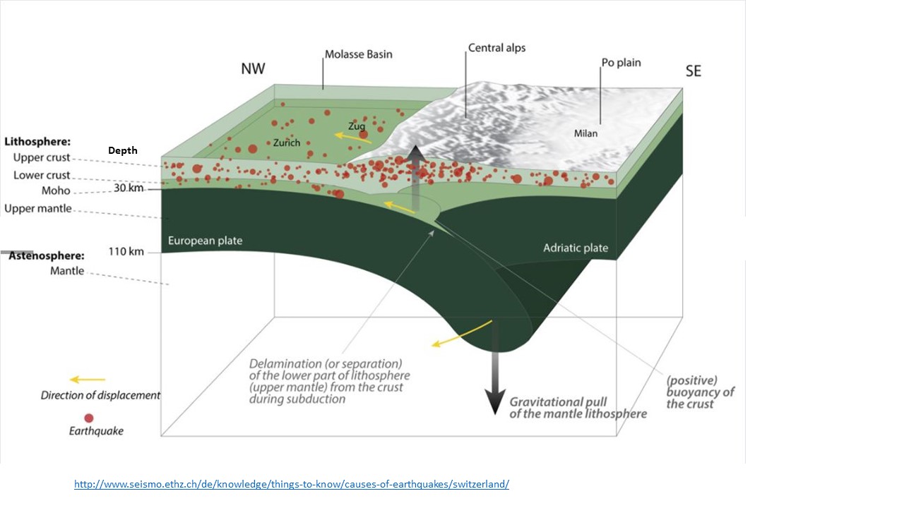
Altendorf is the “old village” of the noblemen of Rapperswil – its history in a nutshell

In 972, Otto II confirms that Rhaprehteswilare belongs to the monastery of Einsiedeln. In the 11th century noblemen settle in the fortification, located on the hill above Rhaprehteswilare. The fortification is called Johannisburg, and they call now themselves “Rapperswil”. 

In the 13th century the noblemen of Rapperswil decide to move to the northern side of the lake, more strategically located at the pilgrim’s path. They call the new settlement “Rapperswil”, while “old Rapperswil” becomes “Vetus Villa Rapperswile”. It keeps its fortification “Johannisburg” and now owns a church, St. Michael.

In 1350, the Habsburgians marry-in to the family of Rapperswil. They perform an attack in Zurich (Zürcher Mordnacht). As a revenge, the people from Zurich destroy both old and new Rapperswil. The fortification of old Rapperswil will not be reconstructed. 

In 1405, the canton Appenzell conquers old Rapperswil. It is later transferred to the canton of Schwyz and today belongs to Schwyz.

In the 15th century the village “old Rapperswil” is known under the name of “to the old village” or “zu dem alten dorfe” which later becomes “Altendorf”.

The coat of arms, a rose, reminds of the noblemen of Rapperswil that once were based here.


The chapel St. Johann – the history

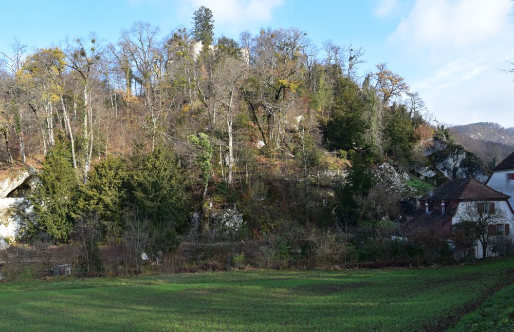
The chapel St. Johann was built at the location of the fortification that had been destroyed by Zürich. The choir forms 7/8th of a circle and stands on the foundation of a former tower. The hill hides more walls of the former fortification.  

1370/1380: The round choir with the gothic window at the east wall is being built. The northern window has a rounded arch.

End 15th century: The nave (1476) and the tower (1483) are attached to the round choir (the years are marked at the doors to the chapel and to the tower). The floor of the nave slants by a meter due to the location on the hill. In 1476, the chapel is certified in official documents.


Gothic altars in the church – gems from the beginning of the 16th century

The altars in the church are gems from the early 16th century. 

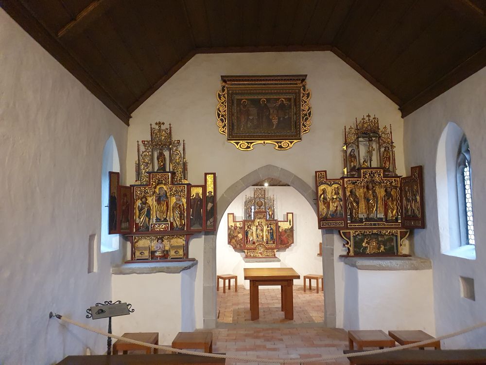
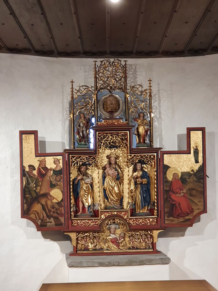
Behind the entrance to the round choir is the main altar. It is from the same workshop as the altar to the left, while the altar to the right is from a different workshop. Above the entrance to the choir are three portraits.

The themes of the main altar in the choir are Maria with Jesus (in the middle) and two saint Johns, Saint John the Baptist and Saint John the Evangelist. Both might be the patrons of the chapel with the name “Saint John”. John the Baptist (with the Agnus Dei or Holy Lamb) flanks Maria to her left. The left panel shows his decapitation and his head is above Maria. John the Evangelist stands to the right of Maria, and the panel illustrates him writing the Apocalypse on the island of Patmos. Above are two neo-Gothic figures, Saint George (left) and Archangel Michael (right). Below, in the predella is Notburga von Bühl with her nine children, all born on one day. 

In the nave, the left altar is dedicated to Saint Vitus (a martyr from Sicily who died around 300). However, Vitus only appears at the bottom in the predella, suffering his martyrium. In the middle are the virgin (Maria) with child and Saint Anne (the mother of Maria). They are surrounded by various saints: To their left is Bartholomew (with his knife) and to their right Verena (with a jar). On the left panel are Leonhard (with a chain, patron of the prisoners) and Nicholas (with the bishop’s crook). On the right panel are Oswald (with the cup and the raven) and Laurentius (with the grill).  Above this congregation of saints stands Antonius Eremita of Egypt (around 300).

The right hand altar in the nave is dedicated to Saint Wolfgang. He stands in the middle of the altar. He was bishop of Regensburg (972-994), and I am astonished to see him here. But then I learn that, for some time, he lived nearby in the monastery of Einsiedeln, as a monk. Wolfgang is surrounded by various saints: Petrus (left, with key), Andreas (right, with cross), Catherine and a bishop (left panel, Catherine with the palm leaf), Margarita and Antonius Eremita (right panel). Below in the predella, Apollonia is suffering her martyrium. Above all is the crucifixion group with Maria, Magdalena and the apostle John. 

The portraits above the entrance to the choir show Saint John the Baptist (with the Holy Lamb) to the left, Antonius Eremita in the middle and Quirin von Neuss to the right. 

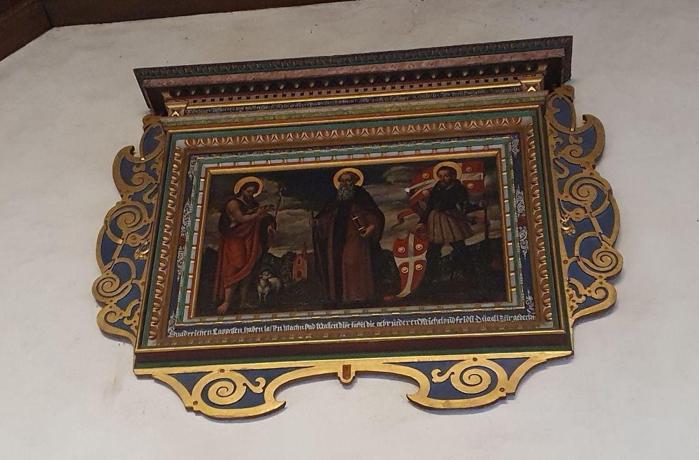
These three saints are asked for help during pandemic times, I read in Jöger’s brochure.

Saint John the Baptist is said to cure from bad luck and illness.

I have met Antonius Eremita at the impressive Isenheim Altarpiece of Colmar, where he resists the temptations by the demons, and these demons show signs of ergotism. The hospital brothers of Saint Anthony cured people suffering from ergotism. Ergotism was called the “Antonius fire” and it was deemed to be an epidemic.

Quirin von Neuss was decapitated in Rome in the 2nd century. After having converted to Christianism, he performed miracles and is invoked in case of various diseases, among them the pest. His relics are at Neuss in Germany. 

The right persons are assembled here, as we encounter our pandemic of the 21st century. I intensely look at the portraits and hope – it was November then – that we will be able to cut the number of corona cases down by December. Now, in December, the numbers are still high. I look at these saints again – now on the photo – and wish that the upcoming vaccines will be handled efficiently such that we will start to come out of this pandemic by the middle of this year. 


Sources:
Albert Jöger, «Altendorf SZ, Pfarrkirche und Kapellen», Gesellschaft für Schweizerische Kunstgeschichte, Bern 1983 
http://www.eichinger.ch/eichifamilyhom/Reisen/Jakobsweg/Appenzellerweg/Kapelle_StJohann.htm


Around Basel: The Rheintalflexur – some background information and observations

Let me now follow up on the Rheintalflexur or “Rhine Valley flexure”, reading more about it and observing it in nature.

Let us do so after having thought about the earthquake of 1356 and the emergence of the Rhine Rift Valley (Rheintalgraben).


Gathering information about the geology of the Rheintalflexur 

In the lecture notes provided by the Basel university, I found this geological cross section of the Rheintalflexur from the Wartenberg (via Muttenz) to the Bruderholz. The sediments bent are shown here, and they flexed, when the crystalline basement cracked down.

The Rheintalflexur is rather exotic in the Rhine Rift Valley. At the flexure, the fractures are about 1000m deep, whereby farther north the rift slid down up to 4000m. While extension had caused the cracking of the rift valley, compression seems to act now at the Rheintalflexur (Laubscher, 1971, p. 157). We are at the southern end of the rift valley, where it turns to the west to form the Belfort gap, and somehow the rift had to “find a way” to complete the “turning” which lead to a complex pattern of small cracks. The Tafeljura echoed that with the fractions of the Wartenberg and the Adler.


The “Schänzli”: Building the highway tunnel allowed to explore the “Rheintalflexur”

This often cited graph of Buxtorf illustrates, how steeply the layers bend under the Schänzli (he assumed the fault to be reverse). The tunnel of the highway T18 going south to the Birseck was built exactly here, at the Schänzli.

Source: Hans Laubscher, 1971

Below we see the cross section of the highway tunnel  “Schänzli” that «sits» on the fault line and reaches into the layers of lime stone that are almost vertical here. Stairs allow now to enter and observe the geological activity (left). 

Source: Website “Heimatkunde Muttenz

During the excavation for the tunnel, the almost vertical layers of lime (Hauptrogenstein) were temporarily uncovered (right).

Let us now go out and shoot some photos to illustrate the tracks of Rheintalflexur. 


The Rheintalflexur at the Birs

The concrete pier of the wooden bridge at Münchenstein crossing the river Birs sits on the Rheintalflexur. Between the two pillars, we can see, how the  sediment layers are inclined. 

Just above the bridge there is the cataract formed by the slanting sediment layers of the flexure. 

I remember that I stood here with our geography teacher more than fifty years ago and he talked about the flexure.

Before taking these photos, I looked for the flexure walking up and down along the Birs; people kept on asking me, whether I had seen the kingfisher. The kingfisher? “No”, I replied, “I look for the “Rheintalflexur””. “You look for what?” – and  then I had some long conversations. May be, one day I should also look for the kingfisher.

Beyond the Rheintalflexur the Tafeljura cracked into “pieces”, and the Wartenberg was tilted (see the geological cross section above). The tilted layers of the Wartenberg “ditch” can be seen at various places. This is a photo from the quarry above the vineyards. Or is it here, where part of the landslide broke off in 1952? 

A dog sniffs at my shoes. The lady asks me: “Do you  take a photo, before it all slides down?”. And then she continues: “The slopes are very unstable here, a gap keeps on appearing that is being closed again and again to “hide it”. We have built our house on rocks, after having consulted a geologist. At the Wartenberg, you should never build a house without consulting a geologist.” Okay, well I had never planned to build a house here, my mum had always warned me about the Wartenberg…


More signs of the Rheintalflexur: The quarry above Münchenstein

Above Münchenstein, in the quarry “Blinden”, the bending sediments of the Rheintalflexur are also uncovered. 

The quarry is no longer in use. It has become a romantic nature reserve, even with a picnic place (as there are lots of them around Basel, some even providing free firewood).

During my next walk on the Bruderholz, I discover the quarry across, above Münchenstein. I have never noticed it from here, though having been here hundreds of times. Yes, we notice, what we have read about and thought about before! Not only, when travelling to other countries, but also, when walking around home.


Looking for the”Rheintalflexur in the landscape park “Ermitage” – not really successful

The Ermitage of Arlesheim is a marvellous landscape park, first established in 1785 and reconstructed in 1811. I have blogged about it in 2015 at the occasion of the park’s 230th anniversary.

The heart of the landscape park is under the Birseck castle. This castle is a ruin, integrated into the Ermitage, as every “proper” landscape park must have a ruin. A maze of footpaths zigzags up and down the rocky slope under the castle. The wall of the so-called “carousel square” stands out at the foot of the hill. 

Some 150 million years ago, this hill was part of a riff at the shore of the former Tethys sea, long before the Rhine Rift Valley emerged (40 million years ago). Many natural caves emerged later that create an exceptional atmosphere to the park.

I could not find identify the flexure around the Ermitage. May be the rock above the “carousel square” is part of it? Erich Plattner’s “Höhlen der Ermitage” does not help either, as what he calls “geological cross section of the Ermitage” seems to be farther north (from the Predigerhof across Arlesheim to the Hinteri Ebni, p. 47).  

Not really successful. Anyway, I do love to stroll through this magnificent landscape park that hides many surprises such as the hut of the “Waldbruder” or “brother of the woods”. Now, in winter, his hut can be seen from far.

The architects of the Ermitage created their landscape park with a lot of phantasy, and I keep on discovering new details.


The “Rheintalflexur” at the Hornfelsen (Dinkelberg)

The Rheintalflexur can be seen above Grenzach (already in Germany) at the Hornfelsen,…  

… where in particular the “lowest” rocks are bending clearly downwards. 

Also here I have been so many times before and have never noticed the flexure. 

I would love to find a book about the geological phenomena around Basel explaining them and informing, where they can be seen in nature. A book for interested hikers such as our group of Nordic Walkers. 


Hans Laubscher, Das Problem von Rheintalflexur und Tafeljura, Eclogae Geologicae Helvetiae, 64 (1971), Heft 1; http://doi.org/10.5169/seals-163976 

Peter Huggenberger, Lecture Notes “Jura Tektonik”, Department of Environmental Sciences, University of Basel (Überblick (Di ) Teil 2 Tafeljura (Do ) – PDF Free Download (docplayer.org)

Erich Plattner, ” Die Höhlen der Ermitage bei Arlesheim”, Speleo Projects 2014.

Around Basel: The geology and causes for the earthquake of Basel


In my former blog, I have talked about the severe 1356 earthquake of Basel. Some 6.2 to 6.4 on the Richter scale, as Laubscher, 2006, says. We have seen the presumed destructive impact of the earthquake in the southern Rhine Rift valley, based on historical reports. 


Source: Werner Meyer, “da verfiele Basel überall”, Schwabe Verlag Basel 2006, p. 67

Red denotes castles destroyed and not rebuilt and blue shows castles or cities strongly affected, but rebuilt. Yellow are minor destructions or none, always according to the historical reports analyzed. 

To understand more of the geological facts causing the earthquake, let us follow up on these questions:

  • How did the Rhine Rift Valley come into existence?
  • What is peculiar about the southern end of the rift valley (around Basel)?
  • So, what might be the cause for the seismic activity around Basel and for the 1356 earthquake?


A glance at the southern end of the Rhine Rift Valley, around Basel

Basel is located at the southern end of the Rhine Rift valley. To get a feeling for that, let us first have a glance at four photos.

(1) Looking north from the eastern end of the Blauen Chain (Eggfluh), we can see the Birseck with the Gempen Plateau to the right and the Black Forest in the background. 

(2) Now we are on the Gempen Plateau in the Tabular Jura (Tafeljura near Hofstetten) and look westwards across the Birseck and the hills of the Sundgau, up to the faint blue line of the Vosges (Vogesen), with the highest peak being the Grand Ballon (France).

(3) Here I am in Germany on the foothills of the Schwarzwald/Black Forest (Markgräflerland) and look south at Basel, with the Gempen Plateau to the left and the folded chains of the Jura in the middle background, including the Blauen to the right.

(4) The fourth photo I took from the Remel at the western end of the Blauen looking northwards across the Sundgau to the Vosges (France). Basel is at about 20km to the right (east).

Yes, Basel is located at the southern end of the Rhine Rift Valley, surrounded by hills and mountains.


How did the Rhine Rift Valley come into existence?

The Rhine Rift Valley emerged long before the unfolding of the Alps and the Jura unfolded. This is a simplified description. 

  1. 150 to 200 million years ago, there was the sea called Tethys that deposited sediments on the ground, on the crystalline basement.
  2. About 40 million years ago, everything was lifted up which resulted in the basement and the sediments to break apart and slide downwards several thousand meters. 
  3. The Vosges and the Black Forest emerged, and in front of them foothills (Sundgau and Markgräfler Land). The volcano “Kaiserstuhl” erupted some 15-19 Mio years ago.
  4. The sediments from the sides were eroded filling the trough and uncovering the crystalline basements of the Vosges and the Black Forest. The mountains reach about 1500m, the base of the trough, filled with the sediments, is at around 250m above sea level.  

The four stages overlapped in time.

Source: My owns drawing to grasp the verbal descriptions on https://www.regionatur.ch/Orte/Naturraeume-Flusslandschaften/Oberrheinische-Tiefebene (very much simplified)


What is peculiar about the southern end of the rift valley (around Basel)?

The Rhine Rift Valley ends some 20kms south of Basel. The trough formation turned left (westwards) to form the Belfort gap and to continue as the Rhône-Saône Rift Valley up to the Mediterranean. 

The Dinkelberg and the Tabular Jura (Tafeljura) belong to the Black Forest, and they are lower. When the trough formed, their sediments bent down forming the so-called “Rheintalflexur” and more such flexures arose such as the Landskronflexur.  

Source: My own rough drawing to understand the descriptions on https://www.regionatur.ch/Orte/Naturraeume-Flusslandschaften/Oberrheinische-Tiefebene (very much simplified)

Later, 10 to 2 million years ago, the Alps and the Jura Chain (Faltenjura) were unfolded, and they covered part of the “old” Tabular Jura by some 5kms. This is called “reverse faulting”.

The Alps and the Jura were unfolded, when the European plate slid under the Adriatic/African plate. This is a simplified model of the collision of the two plates.

Source: Website ETH Zurich, knowledge about earthquakes

Laubscher points out that the plate border is not a “straight line”, but it stretches along 2000km, from the Atlas mountains in Africa to the Alps; Basel lies at the northern edge of this plate border “zone”. The convergence is still going on today: The European Plate pushes from North West and the Adriatic/African Plate from South East.


So, what might be the cause for the seismic activity around Basel and for the 1356 earthquake?

Let us recall the controversy I came across about the reasons of the earthquake of 1356 (as stated in my former blog):

  • At high school, I understood from our teacher, the Rhine Rift Valley and in particular the “Rheintalflexur” had caused the earthquake of 1356. The Birseck is, where in Meyer’s map much of the historically reported severe damages seem to have been reported, but not all. 
  • Hans-Peter Laubscher, “Zur Geologie des Erdbebens von Basel 1356” (in Werner Meyer, “Da verfiele Basel überall”, Schwabe Verlag Basel 2006) says that the seismic activity around Basel is probably the result of the convergence of the African and the European tectonic plates that “waked up” various fault lines around Basel. This would explain the fact that further serious damages had been reported beyond the Birseck, Blauen and Gempen.

Laubscher presents this map of the rift valley, along with the fault lines he is aware of and the pressures going on.

Source: Hans Peter Laubscher, “zur Geologie des Erdbebens von Basel 1356”, in Werner Meyer, “Da verfiele Basel überall”, Schwabe Verlag Basel 2006

As I understand Laubscher’s explanations, some fault lines such as the Rheintalflexur have been caused by the emergence of the Rhine Rift Valley (150-200 Mio years ago), but some other fault lines are much older, from 250-280 Mio years ago; at that time another earlier rift valley emerged (so called “permo-carbon trough”, see also Huggenberger), leaving “older” disturbances such as the Mandach-Monbéliard and the Mont-Terri. Laubscher says that the (older and newer) fault lines around Basel can be reactivated under new pressures. 

The convergence of the European and the African plates is such a “newer” source of pressure (see the arrows showing the pressures executed by the plates). Still today, the plates converge at 8mm/year. Most of this convergence is currently being absorbed south of the Alps, where the seismic activity is much higher than north of the Alps. The Rhine Rift Valley fault lines and the older disturbances (such as the Mandach-Monbéliard or Mont-Terri lines) are areas of weaknesses that can react, when the tectonic plates of Africa and Europe rub against each other. Laubscher believes that this was the reason for the earthquake in 1356: The lesions around Basel reacted to the convergence of the tectonic plates (p.212). As a matter of fact, the pattern of damages reported historically pretty much follows the (older) Mandach-Monbéliard and Mont-Terri disturbances. In case the destructions reported historically are not complete and there were more destructions north of the “Meyer’s ellipse”, then the Rheintalflexur with its north-south orientation could also have made their contribution, as Laubscher points out. 

On the geological map, arrows indicate the pressures along the Mont Terri Line and the Rheintalflexur. There is convergence (double arrows facing each other) as well as some sideward pushing (single arrow). The complex pattern of pressures is due to the fact that the convergence of the European and the African plate does not act at a right angle upon these fault lines. This makes predictions about seismic activity expected around Basel difficult. 

While Laubscher says that at Basel severe earthquakes happen less often than south of the Alps, “less often” does not exclude another serious earthquake to happen again. In 660 years, the geology has not changed that much, when I think of the millions of years that count in geology. As my mum, the geologist, had rightly pointed out to me, when I was nine years old. 

Well, I am not a geologist and I may not have consulted the latest research results. I have interpreted the sources I had at hand, and the basic story with the tectonic plates and the faults activated by their rubbing against one another causing earthquakes makes sense to me.  

Due to the pandemic of this year 2020, I will continue to walk mostly around Basel in the next months. It is amazing, how much I discover so close to my home. I intend to follow up on the geological evidence of the flexures around Basel. What I also always find amazing, are all these border stones along the hiking paths and in the woods that tell us about the world history that the area around Basel was part of. Being confined at home opens the eyes for what is so near. 


Sources: