Around Basel: The Rheintalflexur – some background information and observations

Let me now follow up on the Rheintalflexur or “Rhine Valley flexure”, reading more about it and observing it in nature.

Let us do so after having thought about the earthquake of 1356 and the emergence of the Rhine Rift Valley (Rheintalgraben).


Gathering information about the geology of the Rheintalflexur 

In the lecture notes provided by the Basel university, I found this geological cross section of the Rheintalflexur from the Wartenberg (via Muttenz) to the Bruderholz. The sediments bent are shown here, and they flexed, when the crystalline basement cracked down.

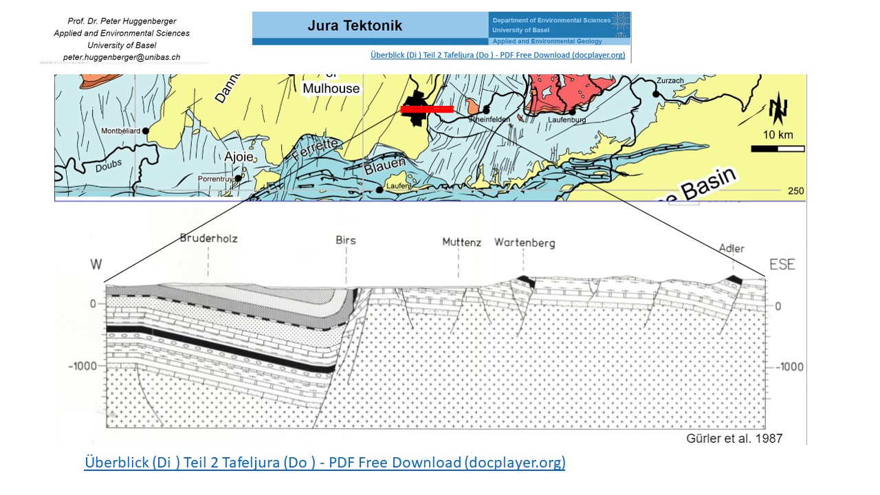
The Rheintalflexur is rather exotic in the Rhine Rift Valley. At the flexure, the fractures are about 1000m deep, whereby farther north the rift slid down up to 4000m. While extension had caused the cracking of the rift valley, compression seems to act now at the Rheintalflexur (Laubscher, 1971, p. 157). We are at the southern end of the rift valley, where it turns to the west to form the Belfort gap, and somehow the rift had to “find a way” to complete the “turning” which lead to a complex pattern of small cracks. The Tafeljura echoed that with the fractions of the Wartenberg and the Adler.


The “Schänzli”: Building the highway tunnel allowed to explore the “Rheintalflexur”

This often cited graph of Buxtorf illustrates, how steeply the layers bend under the Schänzli (he assumed the fault to be reverse). The tunnel of the highway T18 going south to the Birseck was built exactly here, at the Schänzli.

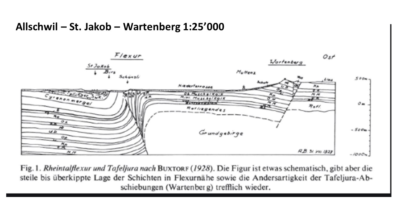
Source: Hans Laubscher, 1971

Below we see the cross section of the highway tunnel  “Schänzli” that «sits» on the fault line and reaches into the layers of lime stone that are almost vertical here. Stairs allow now to enter and observe the geological activity (left). 
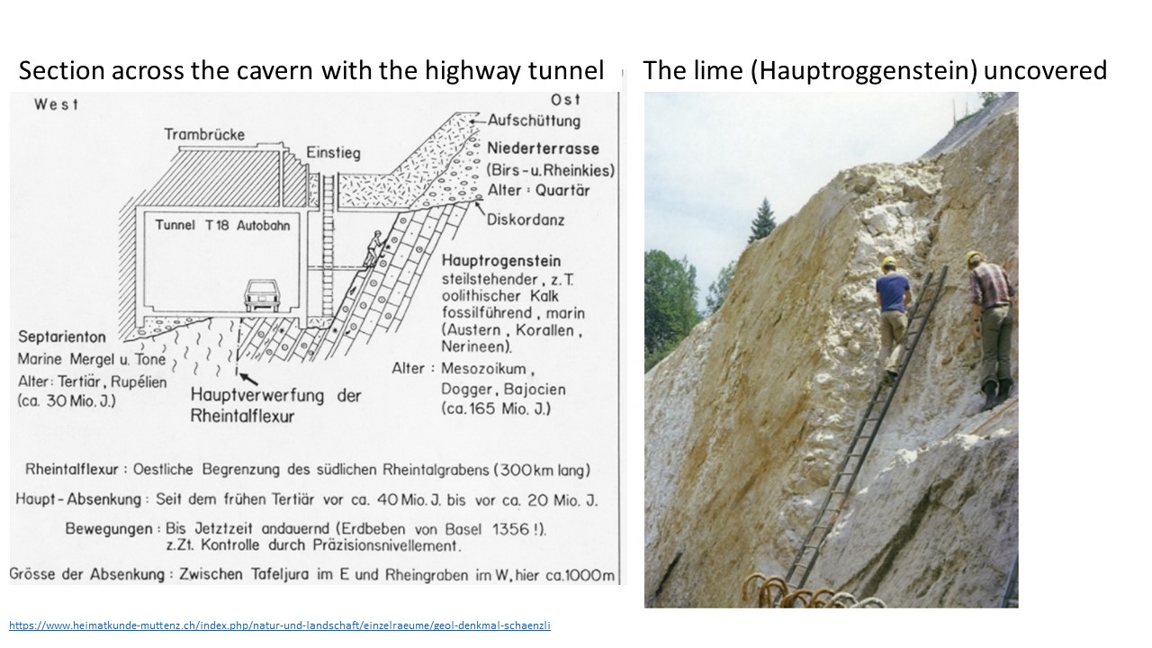
Source: Website “Heimatkunde Muttenz

During the excavation for the tunnel, the almost vertical layers of lime (Hauptrogenstein) were temporarily uncovered (right).

Let us now go out and shoot some photos to illustrate the tracks of Rheintalflexur. 


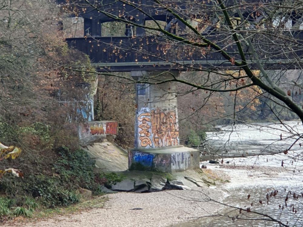
The Rheintalflexur at the Birs

The concrete pier of the wooden bridge at Münchenstein crossing the river Birs sits on the Rheintalflexur. Between the two pillars, we can see, how the  sediment layers are inclined. 

Just above the bridge there is the cataract formed by the slanting sediment layers of the flexure. 

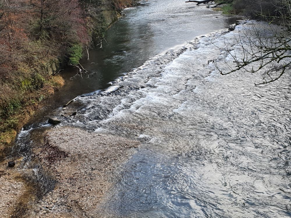
I remember that I stood here with our geography teacher more than fifty years ago and he talked about the flexure.

Before taking these photos, I looked for the flexure walking up and down along the Birs; people kept on asking me, whether I had seen the kingfisher. The kingfisher? “No”, I replied, “I look for the “Rheintalflexur””. “You look for what?” – and  then I had some long conversations. May be, one day I should also look for the kingfisher.

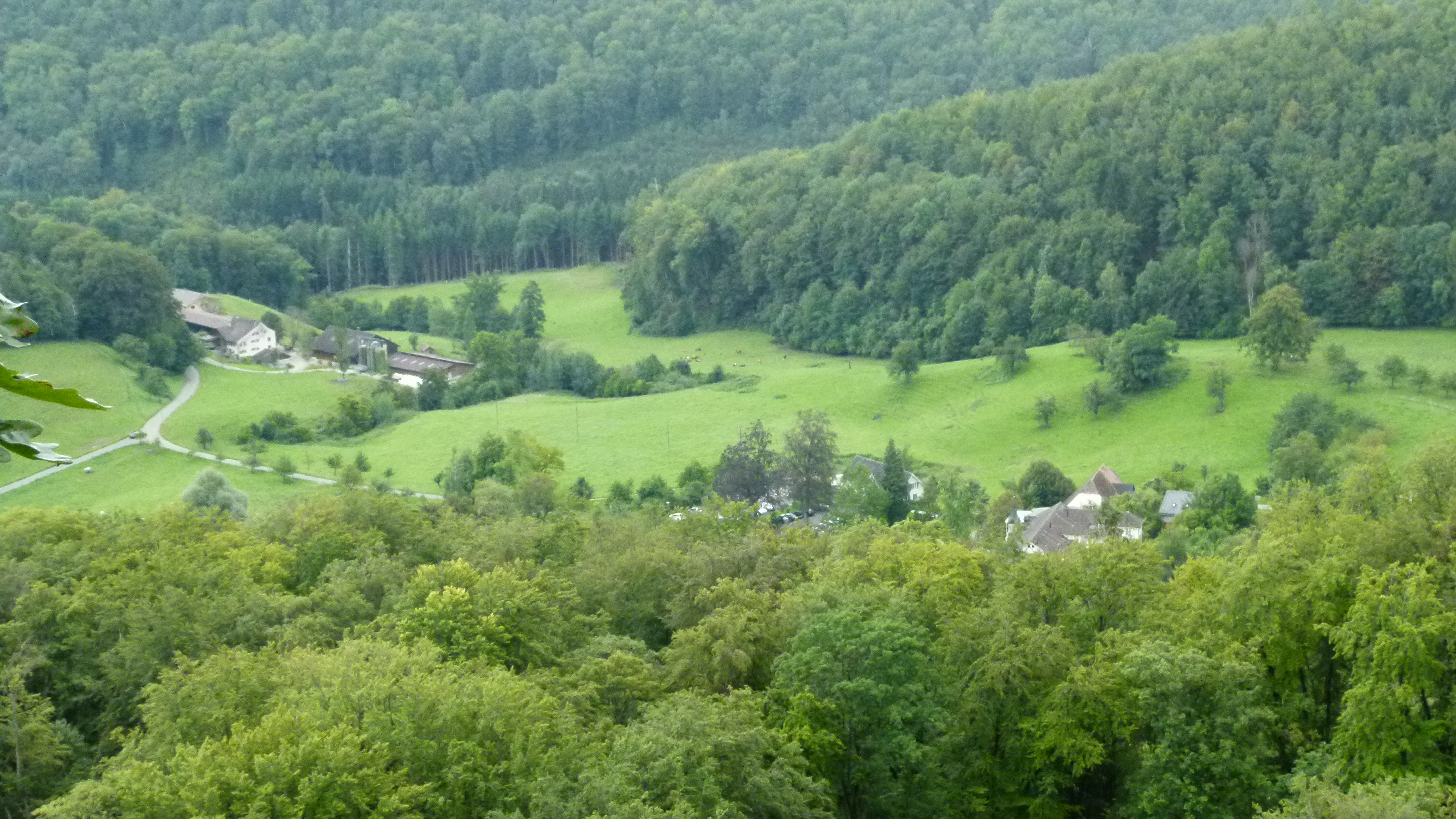
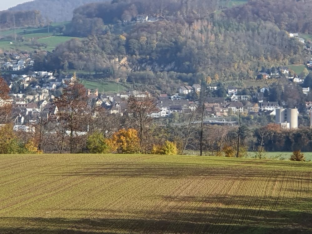
Beyond the Rheintalflexur the Tafeljura cracked into “pieces”, and the Wartenberg was tilted (see the geological cross section above). The tilted layers of the Wartenberg “ditch” can be seen at various places. This is a photo from the quarry above the vineyards. Or is it here, where part of the landslide broke off in 1952? 

A dog sniffs at my shoes. The lady asks me: “Do you  take a photo, before it all slides down?”. And then she continues: “The slopes are very unstable here, a gap keeps on appearing that is being closed again and again to “hide it”. We have built our house on rocks, after having consulted a geologist. At the Wartenberg, you should never build a house without consulting a geologist.” Okay, well I had never planned to build a house here, my mum had always warned me about the Wartenberg…


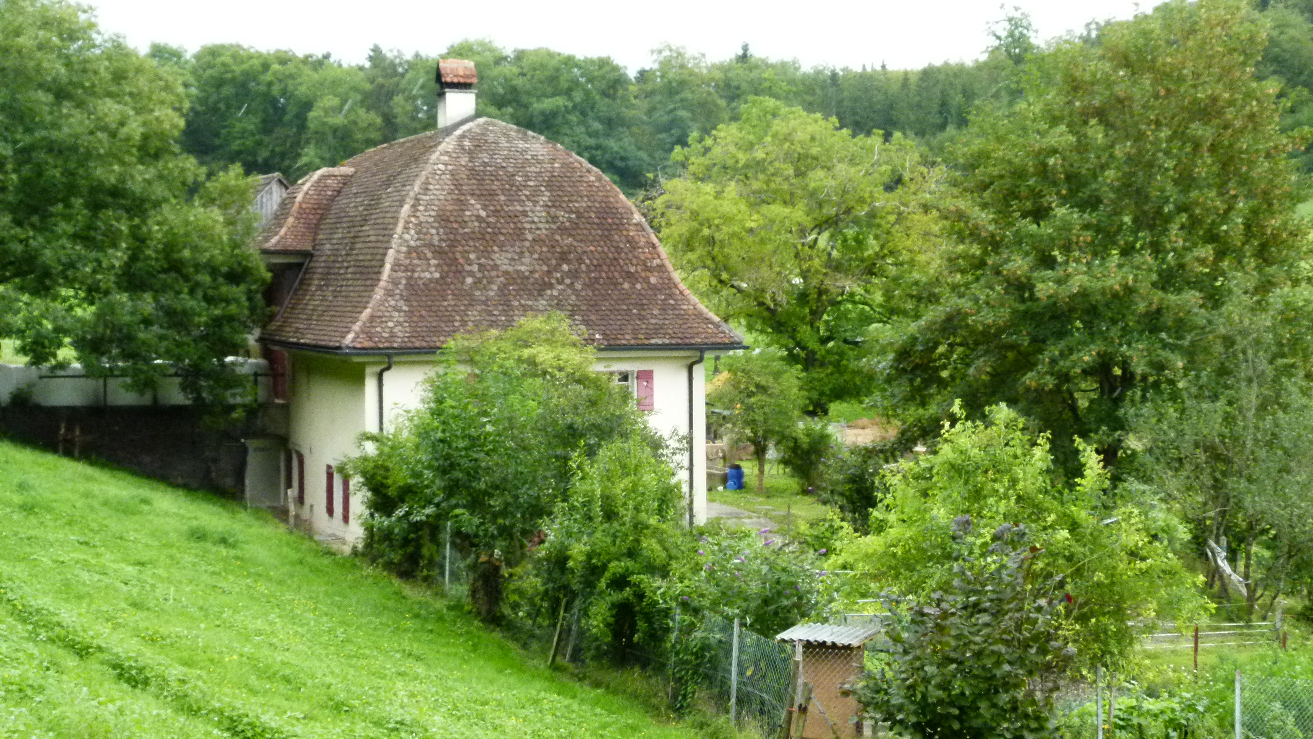
More signs of the Rheintalflexur: The quarry above Münchenstein

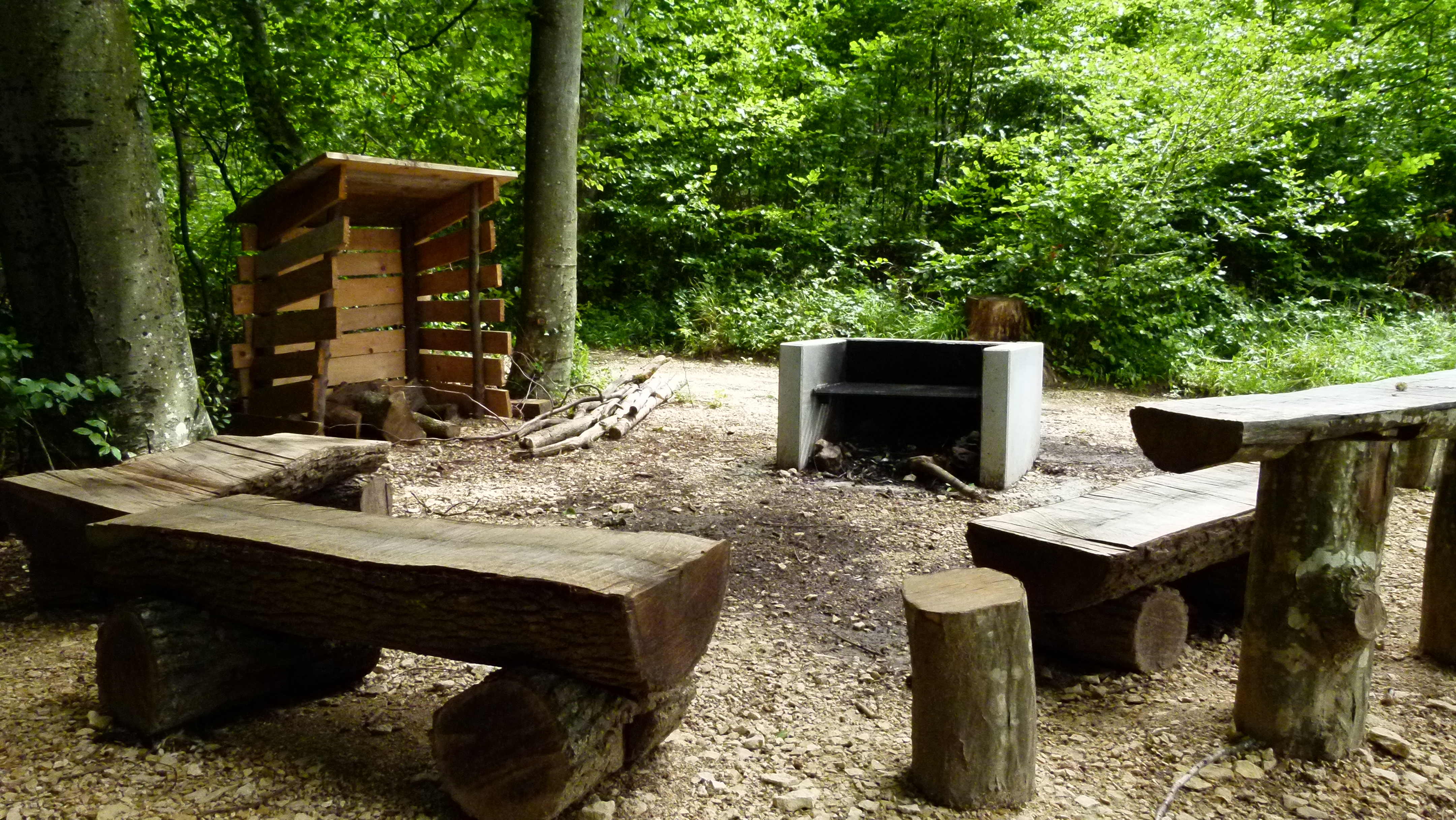
Above Münchenstein, in the quarry “Blinden”, the bending sediments of the Rheintalflexur are also uncovered. 

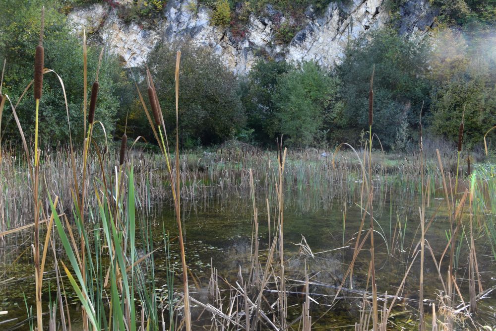
The quarry is no longer in use. It has become a romantic nature reserve, even with a picnic place (as there are lots of them around Basel, some even providing free firewood).

During my next walk on the Bruderholz, I discover the quarry across, above Münchenstein. I have never noticed it from here, though having been here hundreds of times. Yes, we notice, what we have read about and thought about before! Not only, when travelling to other countries, but also, when walking around home.


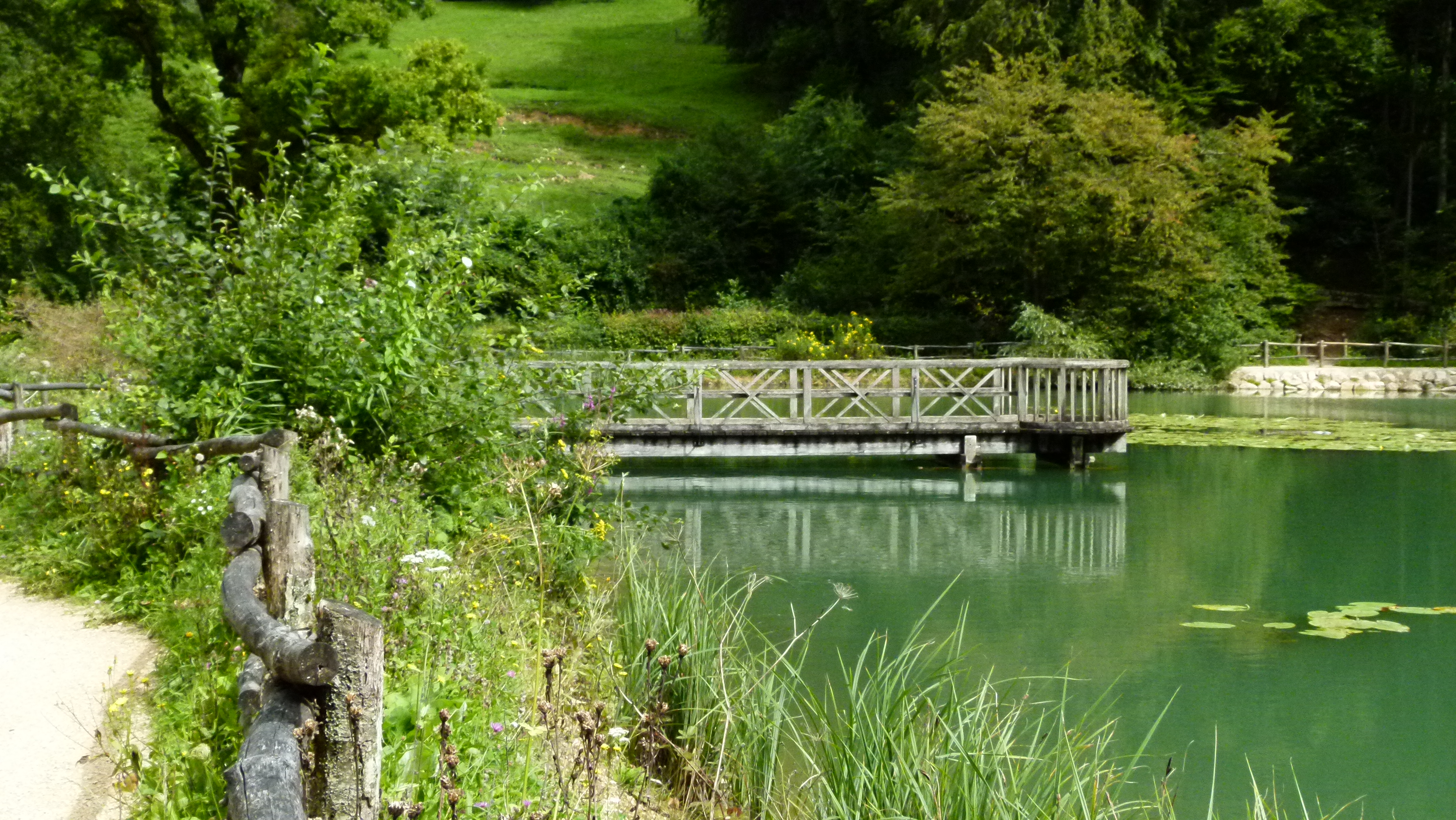
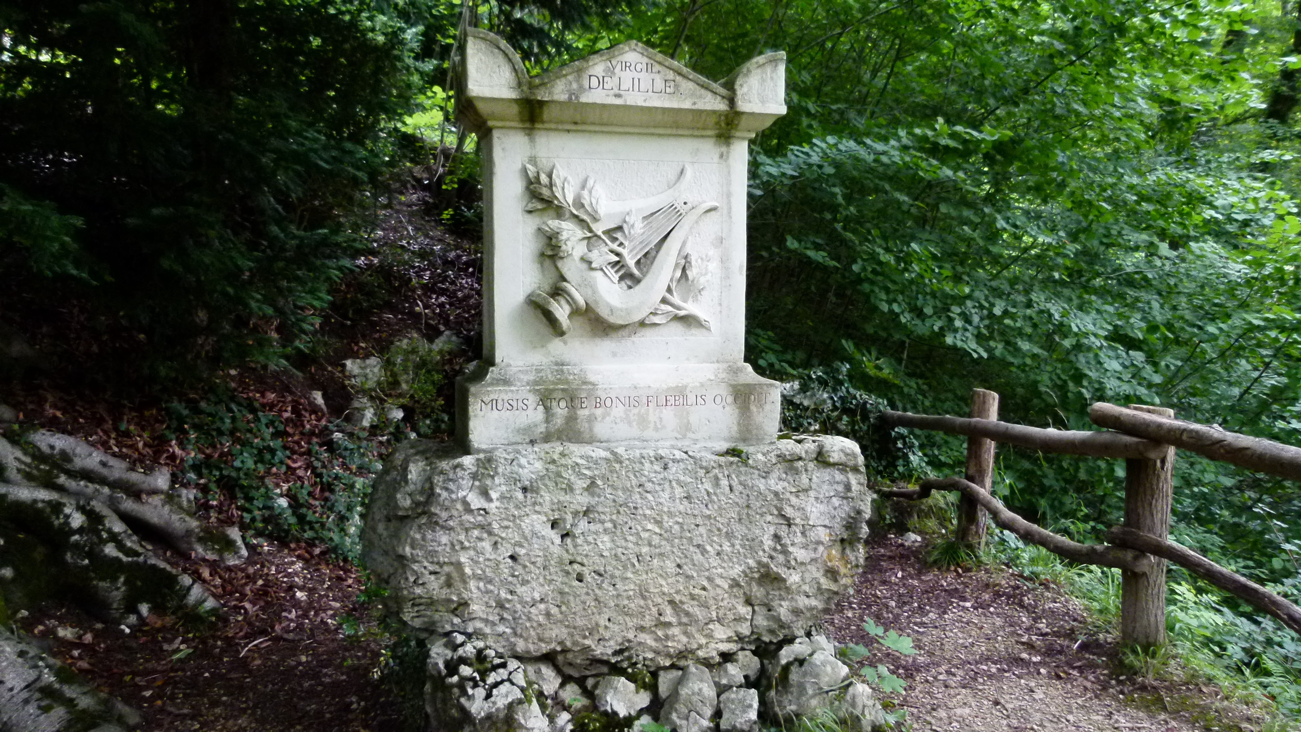
Looking for the”Rheintalflexur in the landscape park “Ermitage” – not really successful

The Ermitage of Arlesheim is a marvellous landscape park, first established in 1785 and reconstructed in 1811. I have blogged about it in 2015 at the occasion of the park’s 230th anniversary.

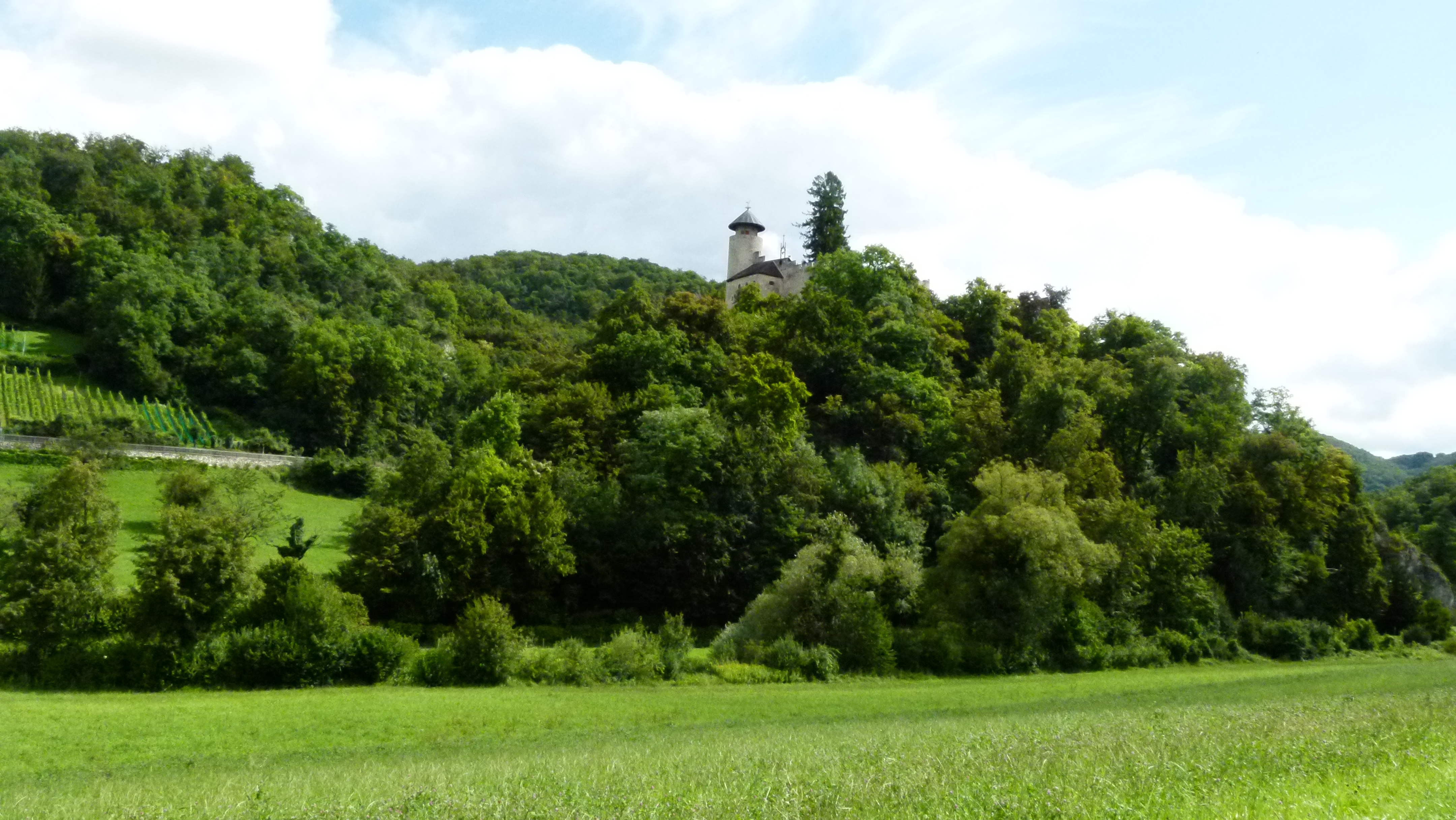
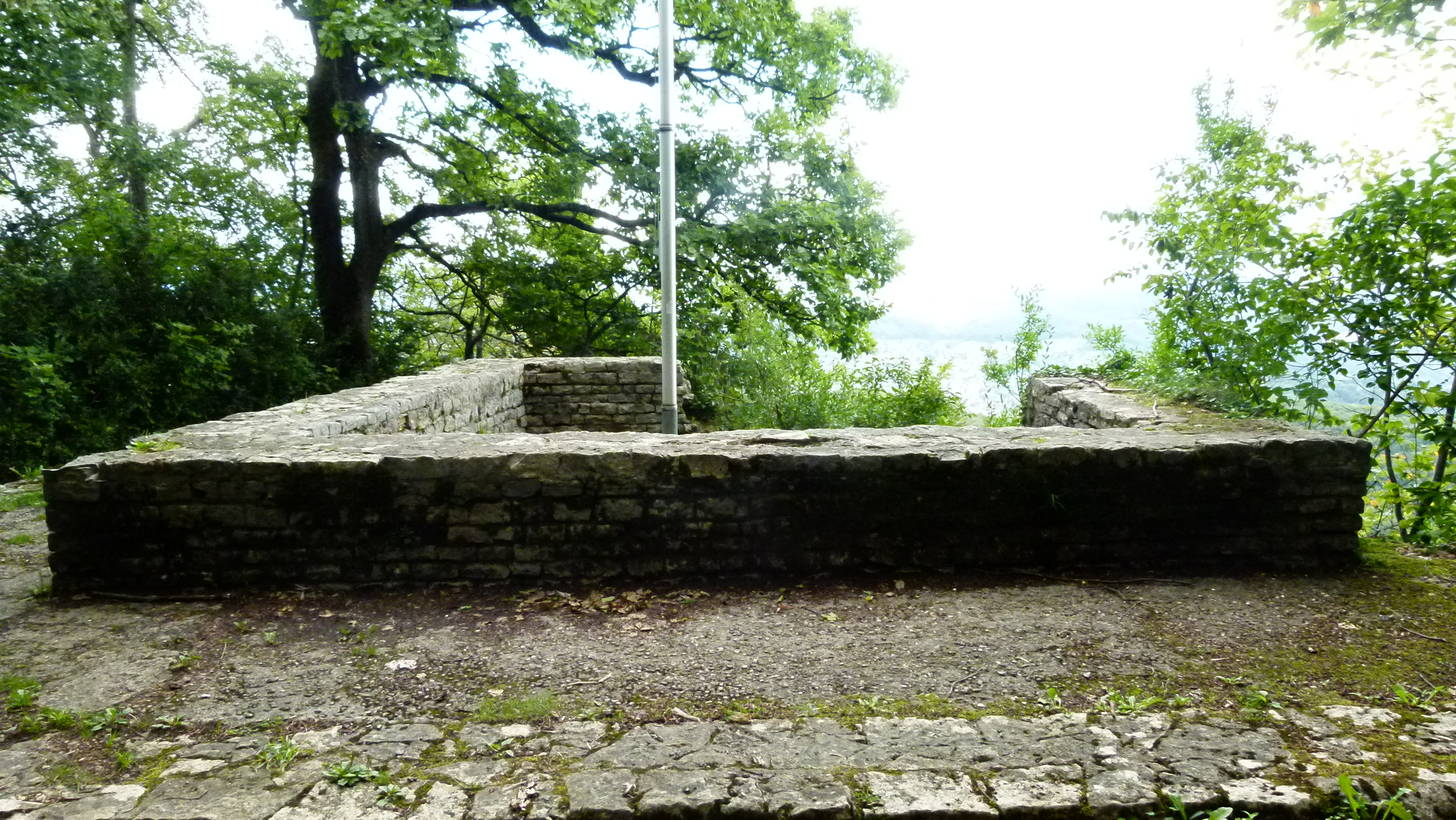
The heart of the landscape park is under the Birseck castle. This castle is a ruin, integrated into the Ermitage, as every “proper” landscape park must have a ruin. A maze of footpaths zigzags up and down the rocky slope under the castle. The wall of the so-called “carousel square” stands out at the foot of the hill. 

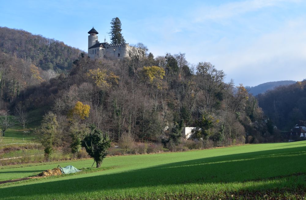
Some 150 million years ago, this hill was part of a riff at the shore of the former Tethys sea, long before the Rhine Rift Valley emerged (40 million years ago). Many natural caves emerged later that create an exceptional atmosphere to the park.

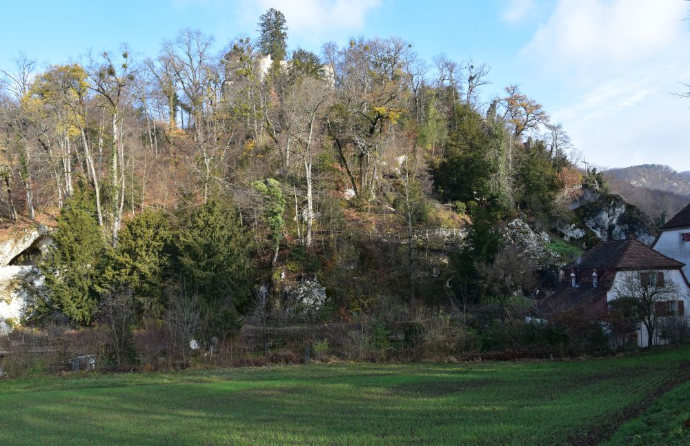
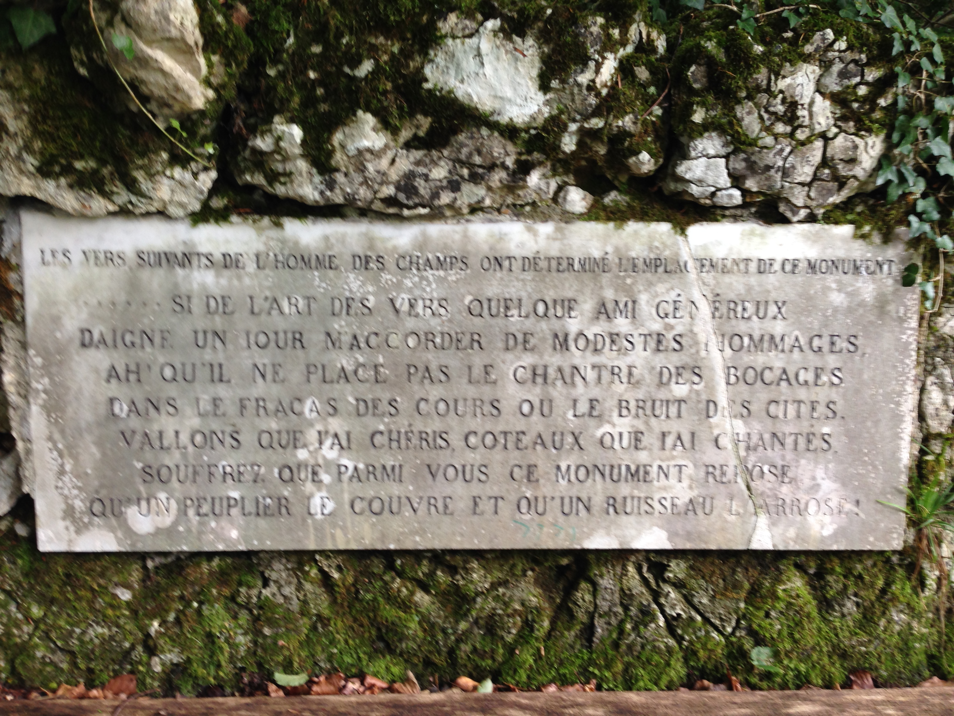
I could not find identify the flexure around the Ermitage. May be the rock above the “carousel square” is part of it? Erich Plattner’s “Höhlen der Ermitage” does not help either, as what he calls “geological cross section of the Ermitage” seems to be farther north (from the Predigerhof across Arlesheim to the Hinteri Ebni, p. 47).  

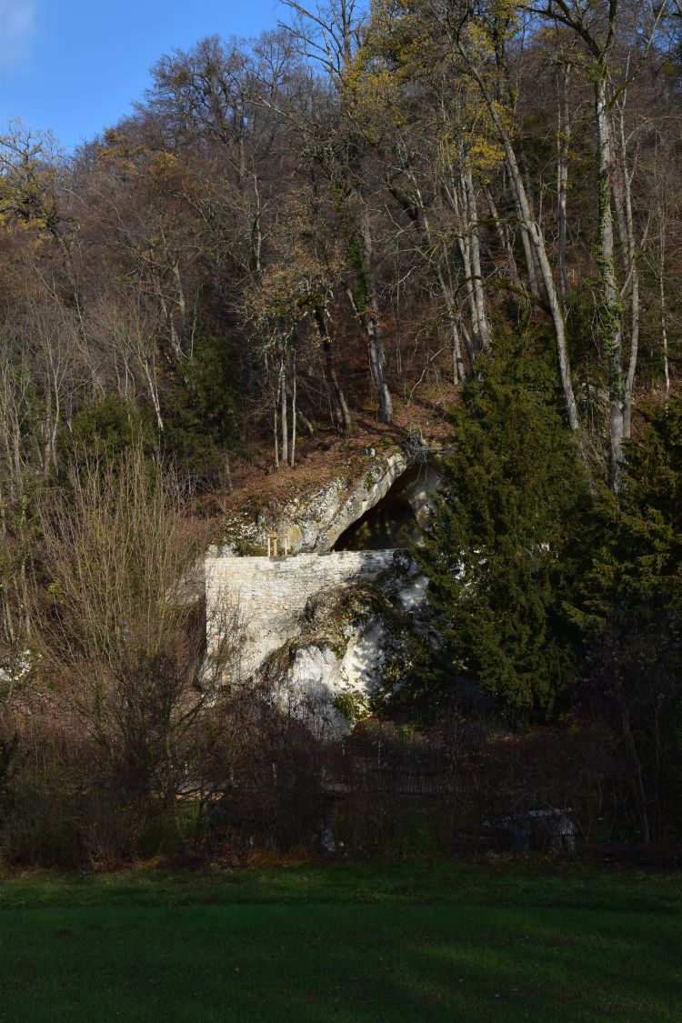
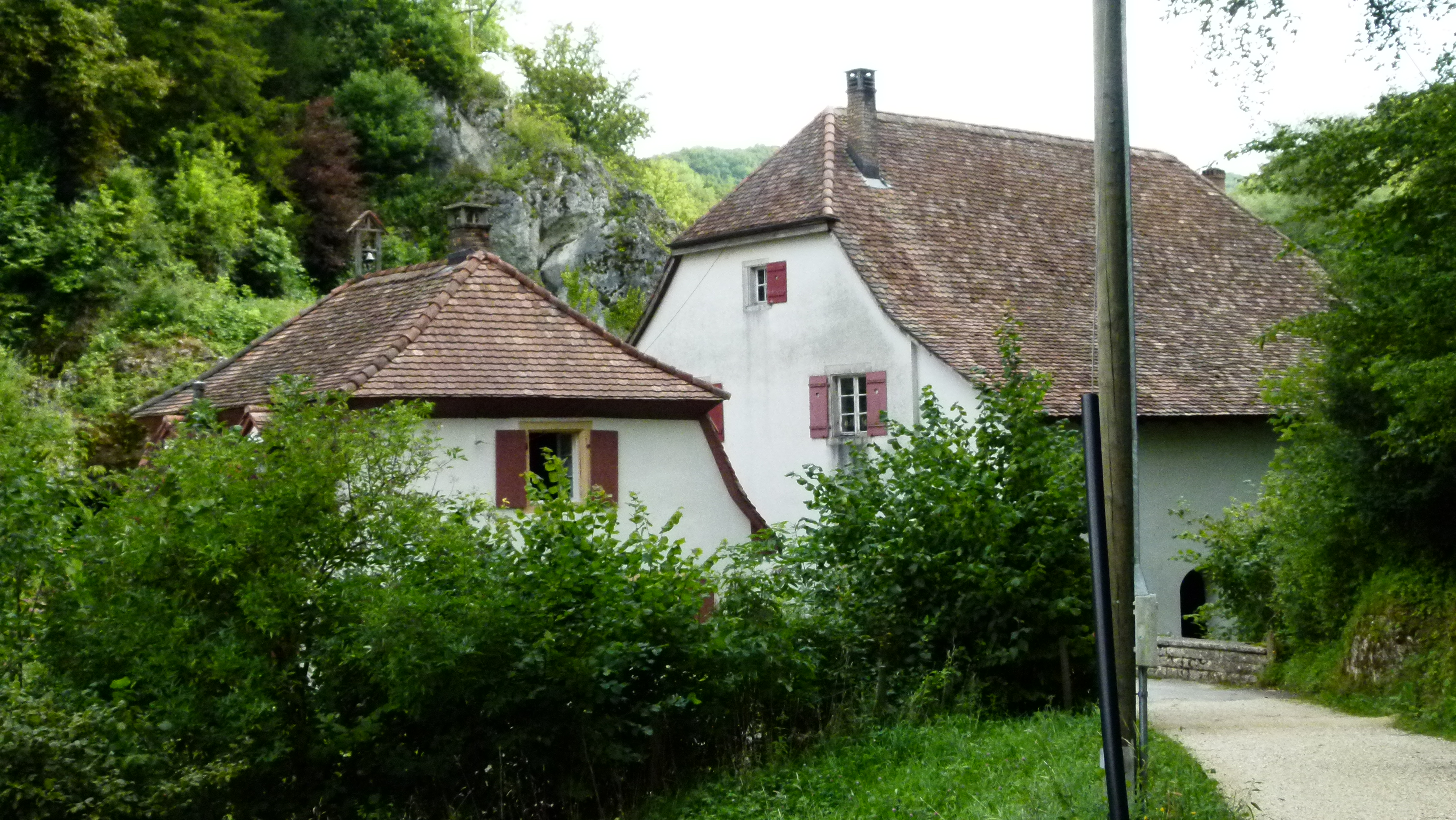
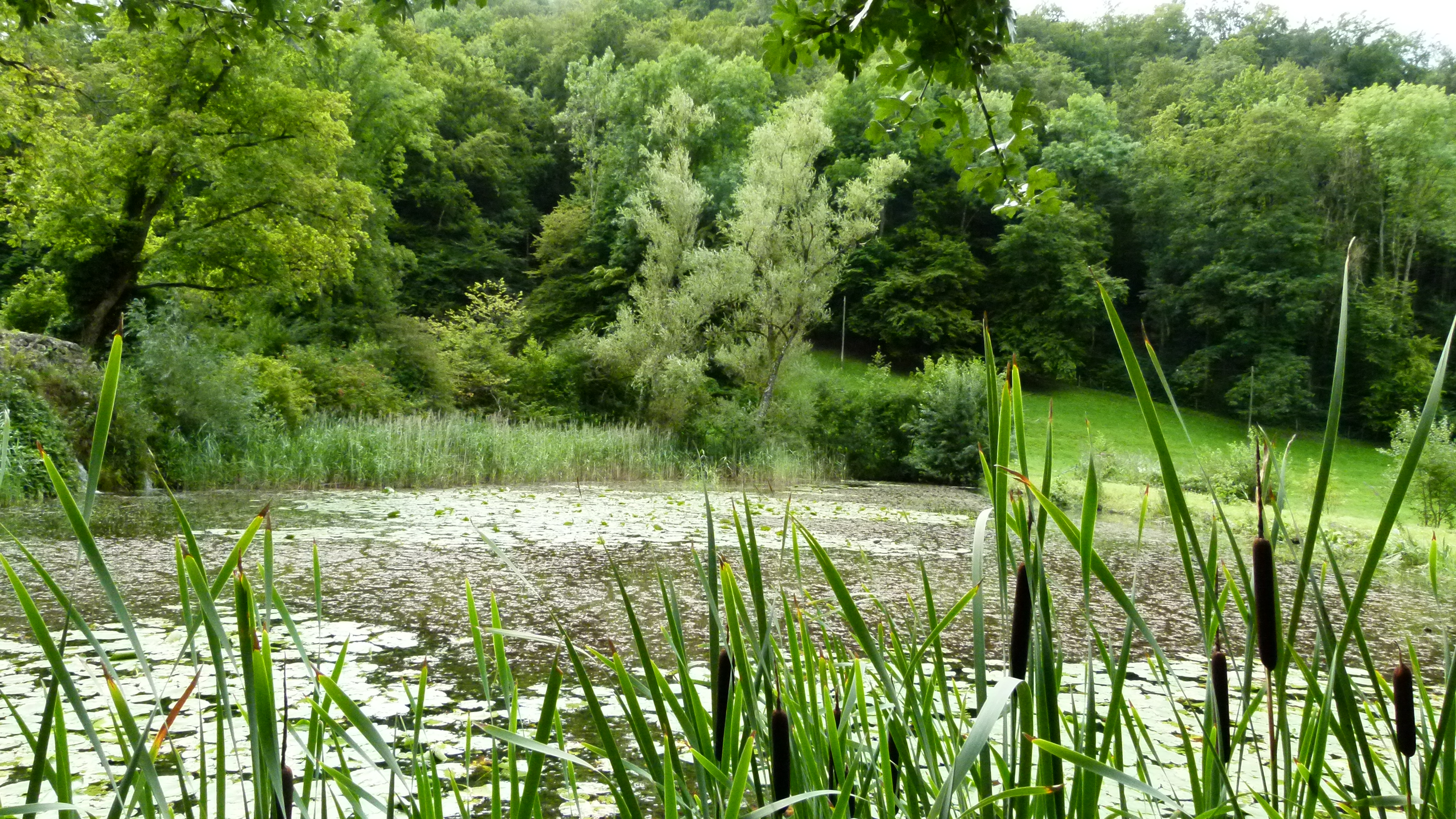
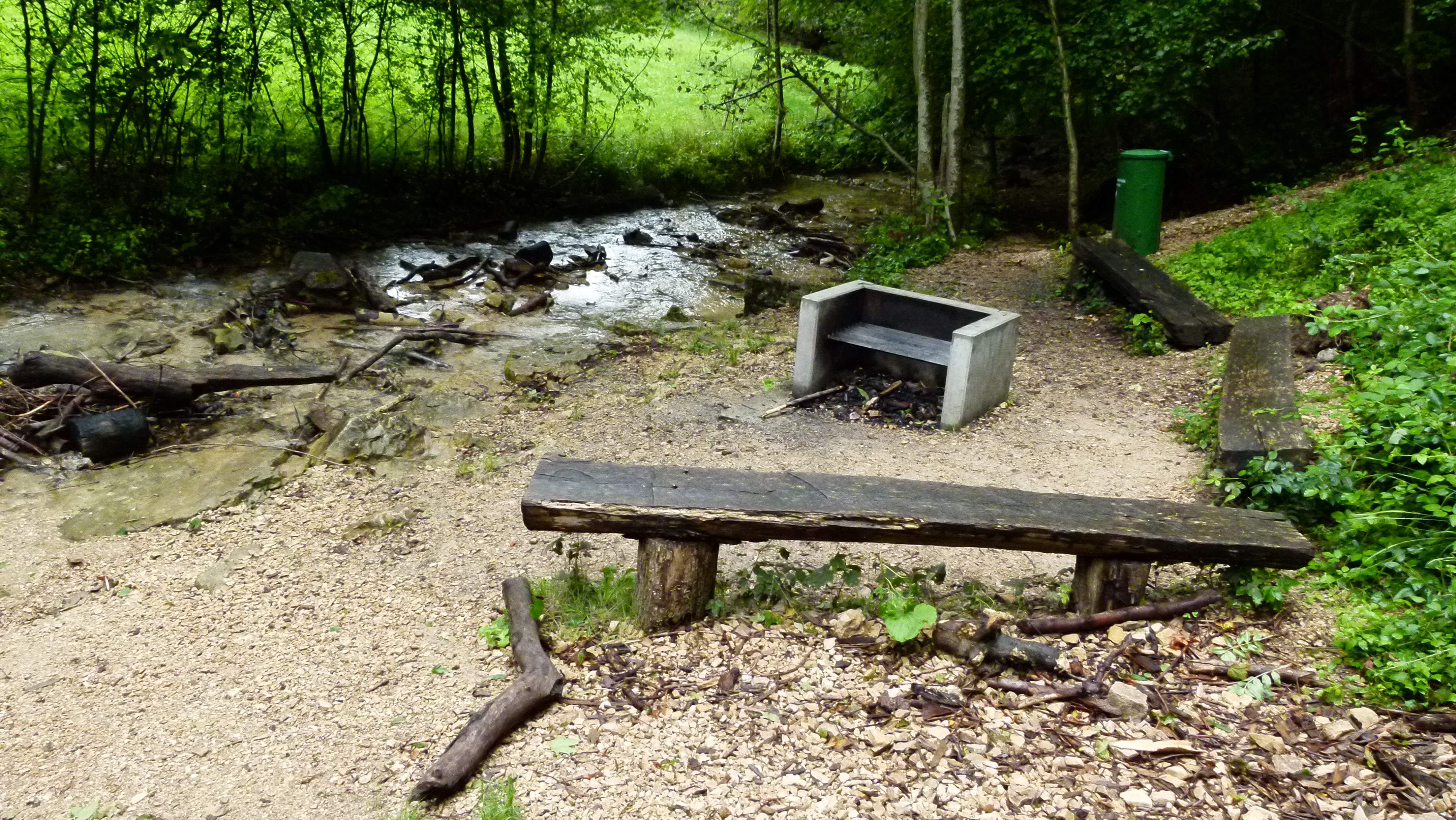
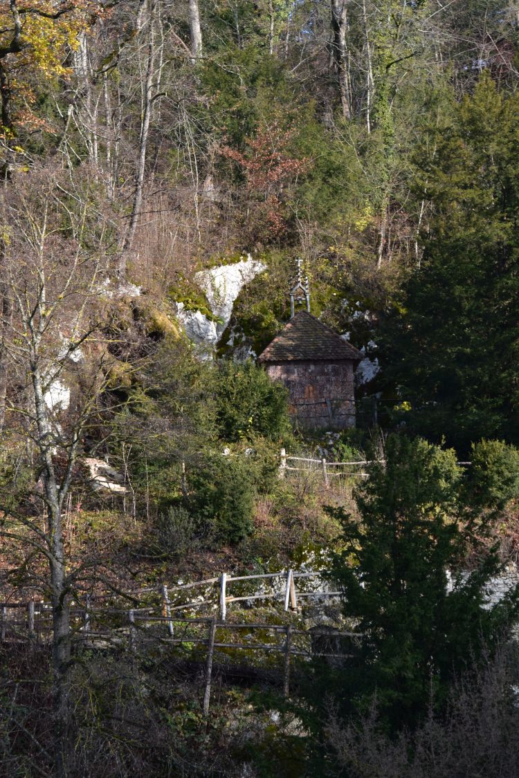
Not really successful. Anyway, I do love to stroll through this magnificent landscape park that hides many surprises such as the hut of the “Waldbruder” or “brother of the woods”. Now, in winter, his hut can be seen from far.

The architects of the Ermitage created their landscape park with a lot of phantasy, and I keep on discovering new details.


The “Rheintalflexur” at the Hornfelsen (Dinkelberg)

The Rheintalflexur can be seen above Grenzach (already in Germany) at the Hornfelsen,…  

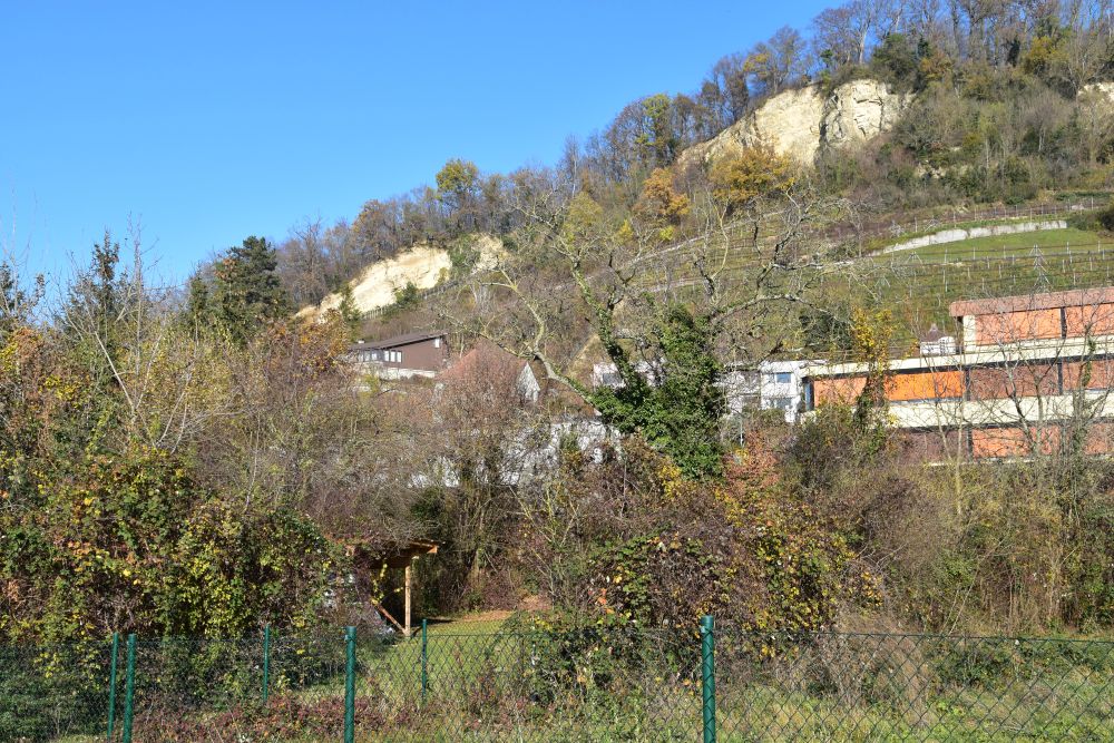
… where in particular the “lowest” rocks are bending clearly downwards. 

Also here I have been so many times before and have never noticed the flexure. 

I would love to find a book about the geological phenomena around Basel explaining them and informing, where they can be seen in nature. A book for interested hikers such as our group of Nordic Walkers. 


Hans Laubscher, Das Problem von Rheintalflexur und Tafeljura, Eclogae Geologicae Helvetiae, 64 (1971), Heft 1; http://doi.org/10.5169/seals-163976 

Peter Huggenberger, Lecture Notes “Jura Tektonik”, Department of Environmental Sciences, University of Basel (Überblick (Di ) Teil 2 Tafeljura (Do ) – PDF Free Download (docplayer.org)

Erich Plattner, ” Die Höhlen der Ermitage bei Arlesheim”, Speleo Projects 2014.

On the road – discovering so much around Basel: To the southeast (I)

Discovering treasures, while being forced to just walk around Basel

As from April to August some surgeries forced me to stay at home, I walked and walked discovering and rediscovering gems around Basel. Here are some of them in the southeast of Basel, starting with a first selection.

This map shows the hill of Wartenberg (between Muttenz and Pratteln) and the long stretched mountain plateau of the Gempen southeast of Basel. The Gempen belongs to the Tabular Jura.

Kartenbc

Source: Bundesamt für Landestopographie 213T – Basel

.

The Ermitage – the romantic landscape garden near Arlesheim

The Ermitage is a romantic English style landscape garden in the Gobenmatttal above Arlesheim (in English also: Hermitage). The garden dates from 1785, was destroyed by Napoleon in 1793, and has since been renovated repeatedly.  The Birseck castle (also destroyed by Napoleon) is part of the garden.

P1060138

Along the Gobenmatt creek, there are a few houses. The entrance is marked by an aqueduct, the former mill and the house of the gardener with the  annex that was used to produce tobacco for some time (“Tabakstampfe”).

P1060140

There are three ponds. The first pond is small…

P1060141

… and it is fed by a small rocky waterfall.

P1060145

The second pond is larger. It is full of memories for me. When I was a child, my grandmother often took me to the Ermitage. In her huge bag she always carried old bread, and we stood on this wooden platform to feed the carps. I was surprised to find the wooden platform unchanged, but feeding the carps is no longer allowed. What do kids do today – do they play carp feeding on their iPhones?

P1060142

The rocky hill under the castle Birseck hosts attractions such as caves and hermits cells – I visited the monument for Jacques Delil (also called Virgil de Lille). He translated Virgil and he was a nature poet. After the revolution in France, he emigrated to Basel and wrote “les hommes du champs” that contains this wish: “If anyone would devote a monument to me, it should be under a poplar and near a creek.” He returned to France later and died in Paris in 1814 (Wikipedia ). Basel remembered his wish and erected this monument below the castle ruins..

P1060146

His wish is written on a slab that stands behind the monument

IMG_0629

It was the two Austrians with their Nordic Walking group that took me back to the Ermitage after many, many years. Arlesheim makes a nice target point with its magnificent cathedral (Dom). Our group enjoyed lunch in the friendly restaurant Rössli.

In case it would stop raining (it has been raining all July and August this year), I propose this picnic spot – it is just above the Ermitage in a romantic setting bordering the Gobenmatt creek. Of course it provides a luxury barbecue grill, as most barbecue places around Basel do.

P1060165


On the way to Schönmatt: The farm that looks like a boat: Ränggersmatt.

A third class road (Schönmattstrasse) leads from Arlesheim to the Schönmatt on the Gempen plateau. On the way there is the farm “¨Ränggersmatt“. In the late 18th century a man called Renker owned a small house on this meadow. In 1821 Conrad von Andlau built the farm with this hipped roof (Walmdach) that reminds me of a boat.


P1060150

Behind the Ränggersmatt I find another great picnic area… the wood is already waiting to be used for the next barbecue.

P1060156

And behind this picnic spot the Grenzweg (“border trail”) to the Schauenburg starts.

.

The trail following the border between  two cantons and leading to the Schauenburger Flue

Yes, I have been on this trail before. I always came here with Ernst, and we balanced our mountain bikes over wet blocks of stone, when heading to the Gempen (Schartenfluh). I then always wondered, what these “stone blocks” were, but we never stopped to look at them more closely. The trail was slippery and needed caeful attention from us bikers. When I came here as a Nordic Walker, guided by my friends from Austria, they pointed out to me that this is the border between the canton of Rural Basel (Baselland) and the canton of Solothurn.

P1060160

And they showed to me that some of these boundary stones are old… this one is from 1660. 1660 – this was long before 1833, when Basel split into Basel Town (Baselstadt) and Rural Basel (Baselland), when the farmers revolted. In 1660 there was just one canton of Basel ruled by Basel Town. Hence, the boundary stone shows the emblem of Basel Town: It is a bishop’s crook with the handle looking left – and it is black on white (the color has faded here).

P1060157

The emblem of Rural Basel is also a bishop’s crook, but the handle looks to the right and is red. The inhabitants of the two Basel will vote about being reunified soon. Some parties in Rural Basel are against the reunification, as the red (rural) bishop’s crook on this poster says defending himself against the black crook attacking him.

P1060242

Wait a minute, what has happened to the emblem on this boundary stone of 1667. Also 1667 was long before 1833. Hence the crook has to be of  “Basel Town” with the handle pointing left. Yes, the crook’s handle is directed to the left, but someone has painted it red to make it look more like Rural Basel, But it is not quite right… Rural Basel would have to exchange all border stones….

P1060161

.

A Gallo-roman temple on the Schauenburger Flue

Another Nordic walking tour with Andreas took me to the Schauenburger Fluh above Frenkendorf. On the edge of the rock (Fluh in German or Flue in Swiss German) was a Gaelic and later a Roman temple. Not much is left  of it.

P1060162

On www2.rzgm.de, I find the detailed history of temples made for circumambulation (Umgangstempel) that could be found in Roman towns and also in salient locations such as wells, lakes or hills – the temple on the Schauenburger Fluh being one of the most extreme examples – built directly above the rock.  This is what historians think it looked like.

Umgangstempel_Schauenburg

Source: www2.rzgm.de

And this foto shows the cliffs from below (from Alt Schauenburg).

P1060238

Below the cliff is the hotel and restaurant Bad Schauenburg. When working for Ciba-Geigy and Roche in the 1980/90s, I spent some time here participating in brainwaves, enjoying the excellent food and the hotel in this quiet setting.

P1060164

.

There are more treasures around Basel

These were some of the treasures southwest of Basel. There are more… and I will continue to write about them. Looking back I just wonder why I knew so little about my homeland.


A Swiss in Petersburg – Ermitage or Эрмитаж

The overwhelming palace and museum

Eventually I decide to visit the Ermitage again; I have been there with Ernst eleven years ago, and I was not convinced whether I would like to see it. Too many memories.

I dive into the palace around eleven, climb the superbe Jordan staircase, receive some guidance from Ludmilla and take the detailed Lonely Planet map under my arm. It is so easy to get lost in this maze! I always make sure that I know, where I am and where I want to navigate to next. And I plough my way through all these tourist groups that follow a guide; the most inventive guide was a young and tall man who just holds his arm full of tattoos into the air. He was easy to spot.

The first floor with hidden and unhidden treasures

I first stopped by at the hidden treasures. These are impressionists that the red army took back from private collections in Germany. No fotos allowed in here.

IMG_0118

IMG_0120

I then admire the handsome Potemkin, one of the lovers of Catherine the Great, and stroll through the luxurious Great Hall and Malachite Hall.

IMG_0127

IMG_0129

I enjoy the hanging garden and the mosaik in the Pavillon Hall.

IMG_0134

Now the density of tourists and groups is getting higher and higher. They all admire Rembrandt’s pictures in the room reserved for him. Interesting that in the war, the Russians had evacuated this collection and just left the frames here. The flamish artists, the Italian artists, and again a high density if tourists; I am now in Leonardo da Vinci’s room. Two Madonna pictures are here, and I am again astonished, how small they are.

IMG_0159

The next point of high tourist density is in front of Michelangelo’s statue – no foto from here. I admire the architect who set up the rooms in this palace… curtains and wall paintings are always a perfect match, and each room has a different color. Here is the yellow room.

IMG_0168

A short break on the first floor

The Ermitage is missing out on a great business opportunity which is to sell food and drinks to the tourists that spend long hours here and surely are getting hungry. There is a cafeteria on the first floor with a short queue and a very small selection of rubber sandwiches and snacks like Mars or Bunty. I eat a salami-cheese sandwich that is a bad match to all the luxury and pieces of art in this palace. I eat it sitting at the base of a column, as there are no chairs available.

After my break, I visit the Egyptian department with the mummies and sarcophags. I miss out on the treasure gallery.

IMG_0171

Now to the third floor with the impressionists

It already astonished me eleven years ago that the Ermitage hides away these gems, the impressionists and Picasso, and how well the tourists find them nevertheless, climbing some small and ugly stairs to the sober third floor. The gems are displayed in plain rooms with a low ceiling, and they are just great, Renoir, Matisse, Monet, Manet and also Picasso. I sadly stand in front of the dancers of Matisse remembering, how much Ernst enjoyed them, and now he is  with me in my heart.

IMG_0179

I stroll up and down these rooms several times and then move to the exhibitions of Japanese, Chinese and more Asian pieces of art, in particular along the silk road that some Russian travellers and scientists explored. I will be at some places of the silk road later this year, in Mongolia.

IMG_0192

Back on the second floor admiring the luxury of the zars

I round off the visit by walking through the royal rooms admiring the elicit furniture and decoration. Yes, Nikolai II did not like this luxury so much and prefered his  smaller and more cosy palace in Zarskoe Selo.

IMG_0198

Now my legs feel like “Weggli” which means literally like “rolls” (in Russian: дереянные ноги). When we Swiss say “Wegglifiess”, we mean that we can no longer walk two more steps. No wonder, I have walked through the Ermitage for four hours now. Nevertheless there is another 15 minutes’ walk ahead of me, before I will tackle my next Russian lesson.