About 660 years ago, Basel was hit by an earthquake. With 6.2 to 6.4 on the Richter scale, it was one of the strongest earthquakes that we know of in Switzerland, perhaps even the strongest.
At primary school, I first learnt about the earthquake of Basel
It was at primary school around 1960 that I first heard of the earthquake of Basel. In our “Heimatkundebuch” (book about local history and geography), we wrote down the poem that describes the year 1356 in medieval German interpreting the Roman numbers (MCCCLIIIIII).

This translates to: A ring with its thorn, three horseshoes selected , a carpenter’s ax and some jugs, at that time Basel was destroyed all over.
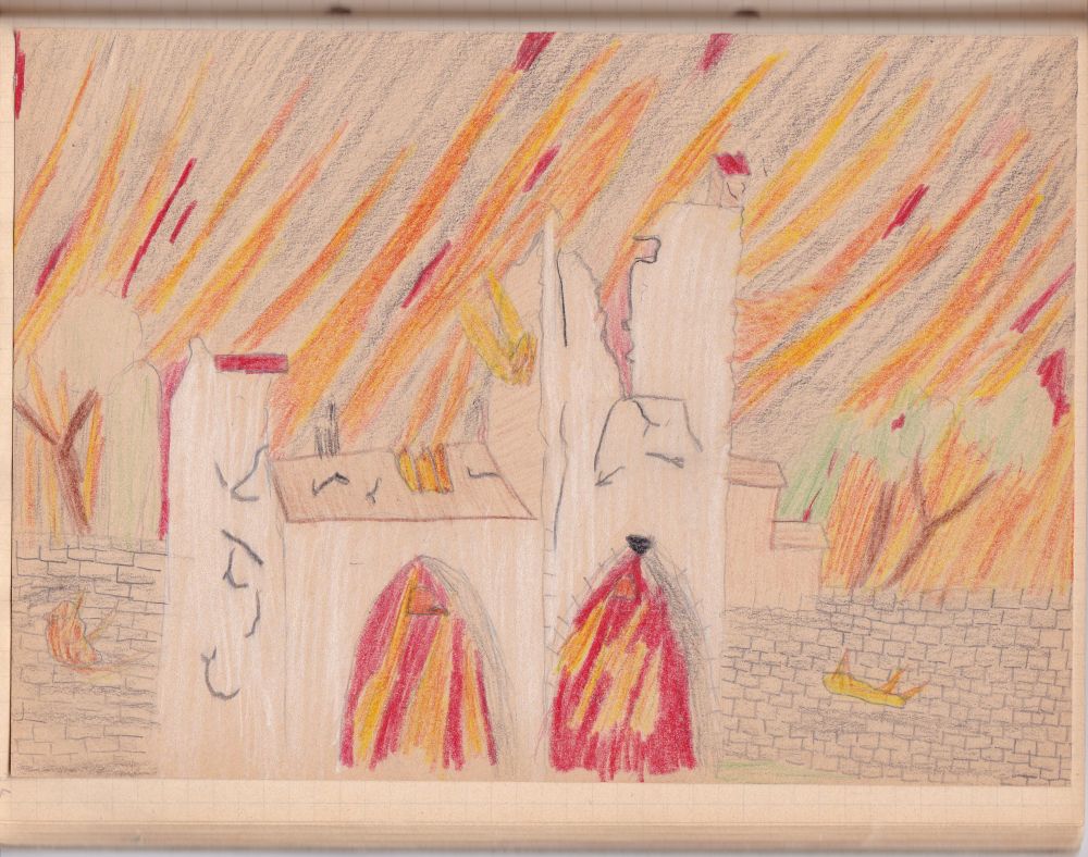
It was not so much the earthquake that damaged the city, but the subsequent fire, caused by open fireplaces in the houses and by burning candles in the churches (Werner Meyer: “Da verfiele Basel überall”, Schwabe Verlag Basel, 2006, p. 54f). This is how I imagined the fire devastating the city, when I was about nine years old.
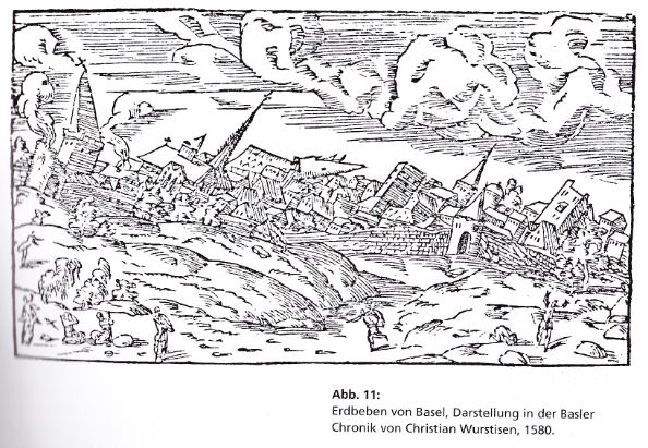
Phantasy is “allowed”. See, how Wurstisen imagined the earthquake in 1580 (Meyer, p. 53).
I remember that our teacher reassured us: “This earthquake happened centuries ago. Today nothing like that will occur again.” I returned home and told my mum about the earthquake and that she should not worry about it, as it will not happen again. My mum, being a geologist, frowned at me: “Come on, the geology here is still the same, such an earthquake might happen again, any time.” Not very reassuring for me, but my mum was right. And she did not like untrue statements.
The earthquake made a deep impression on me. I felt with bishop Johannes who, on the way from Delsberg to Basel, visited the damaged castle of Pfeffingen and was able to find his godchild safely protected under two blocks of stone. Our teacher read the story to us and we summarized it in an essay for our “Heimatkundebuch”. This is my essay, also full of phantasy.

Was this a legend? No, there is historical evidence available. Immediately after the earthquake, the prince-bishop of Basel, Johannes Senn (1335-1365), rode from Delsberg (or perhaps from St. Ursanne) to Basel, stopping by at the severely damaged castle Pfeffingen to participate in the rescue operation of his godchild (Meyer, p.113).
Here you can see the castle of Pfeffingen above the trees in the right hand foreground. Strategically well placed above the Birseck valley, it has been rebuilt after the earthquake. Across to the right is the Gempen plateau (with the greyish cliff lines). The blue mountains in the background are the southern Black Forest. I am standing on the Eggfluh that forms the eastern edge of the Blauen Chain and I look to the north.

I want to know more about the destructive impact of the earthquake and about the underlying geology.
The destructive impact of the earthquake – historical evidence
“Our Burgenmeyer” analyzed the historical reports about the earthquake of Basel and illustrated them in this map: The castles definitely destroyed appear in red. Blue denotes the castles (circle) or cities (squares) that were heavily damaged and then reconstructed, and yellow indicates castles (triangles) or cities (squares) that were not or only slightly affected.
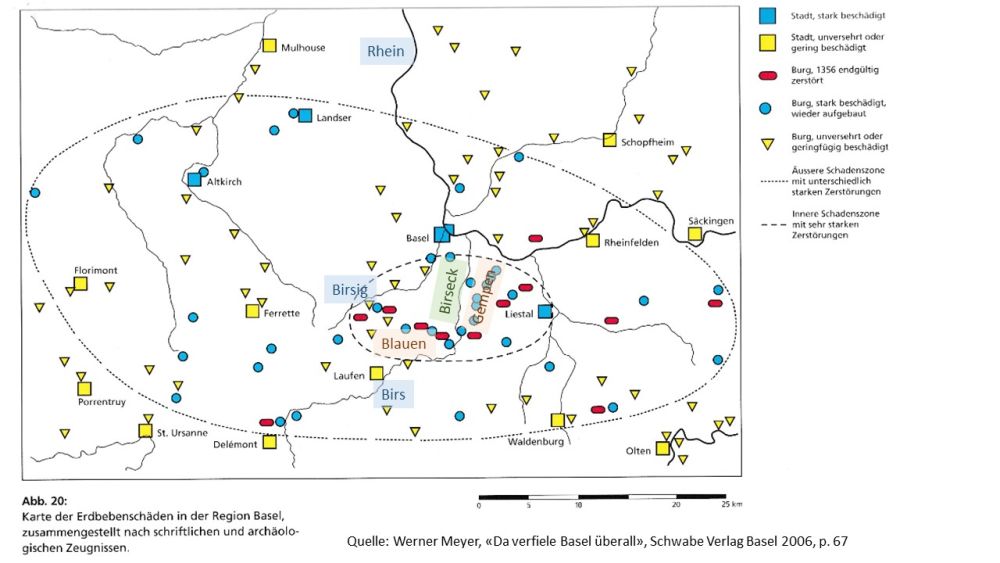
Source: Werner Meyer, “da verfiele Basel überall”, Schwabe Verlag Basel 2006, p. 67
The damages reported formed an ellipse about 85kms wide, whereby the most severe damages occurred within a narrower ellipse about 45kms wide, the centre being south of Basel: In the Birseck, in the valley of the Birsig to the west and on the Gempen Plateau to the east; it is here, where the colours red (destroyed and not rebuilt) and blue (heavily damaged and reconstructed) dominate.
What might have been the reasons for the earthquake of 1356?
- At high school, our teacher told us that the Rhine Rift Valley had caused the earthquake and that the epicentre was where the “Rheintalflexur” or “Rhine valley flexure” bends down from the Gempen into the Birseck. The Birseck is, where in Meyer’s map much of the severe damages seem to have been reported, but not all.
- Hans-Peter Laubscher, “Zur Geologie des Erdbebens von Basel 1356” (in Werner Meyer, “Da verfiel Basel überall”, Schwabe Verlag Basel 2006) says that the seismic activity around Basel is probably the result of the convergence of the African and the European tectonic plates that “wakes up” various fault lines around Basel. This would explain the fact that further severe damages occurred beyond the inner ellipse around Birseck, Blauen and Gempen, as the southern end of the Rhine Rift valley is full of disruptions.
To understand more about this controversy, I will check some geological facts in my next blog.
Source: Werner Meyer: “Da verfiele Basel überall”, Schwabe Verlag Basel, 2006

Fascinating. I do enjoy your blogs. Your mum was of course right, there is no reason (as far as we know) why another Basel earthquake should not occur again. I am forwarding your blog to a friend in California who has fear of the “next big one”
[…] my former blog, I have talked about the severe 1356 earthquake of Basel. Some 6.2 to 6.4 on the Richter scale, as […]
[…] us do so after having thought about the earthquake of 1356 and the emergence of the Rhine Rift Valley […]