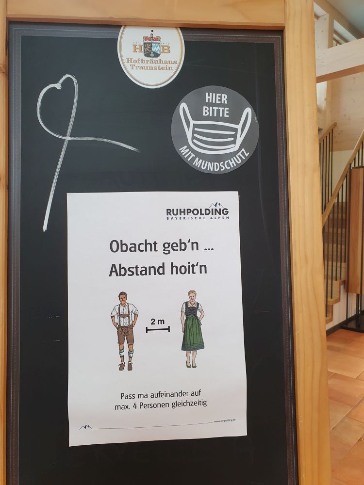
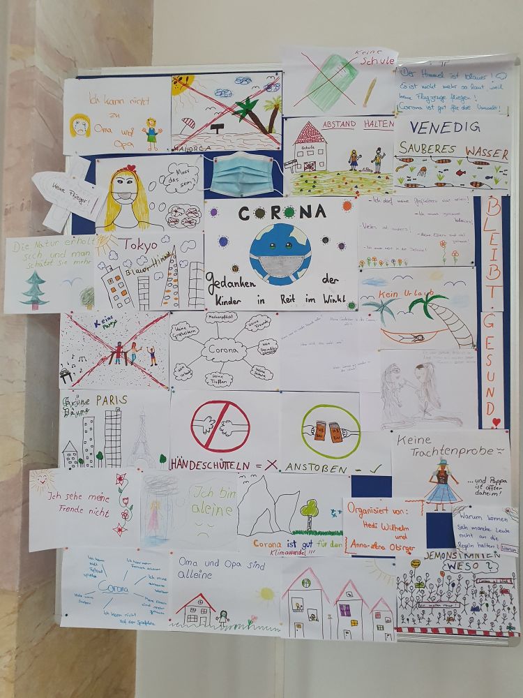
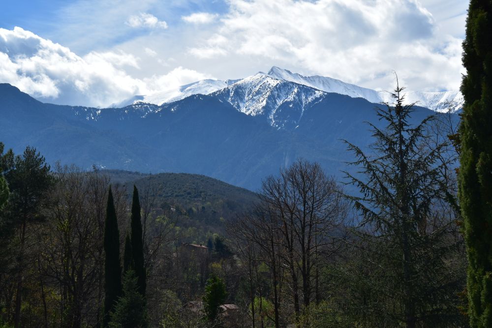
Now in March/April/May 2020, the virus stopped me from being on the road. I am at home. After all, I am 65+…
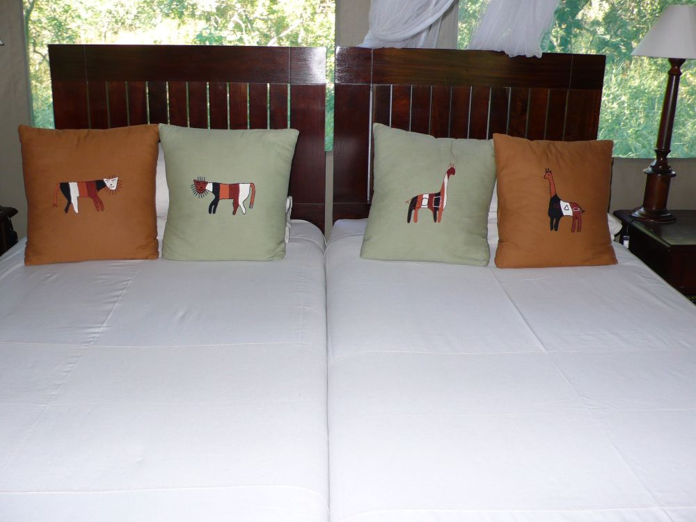
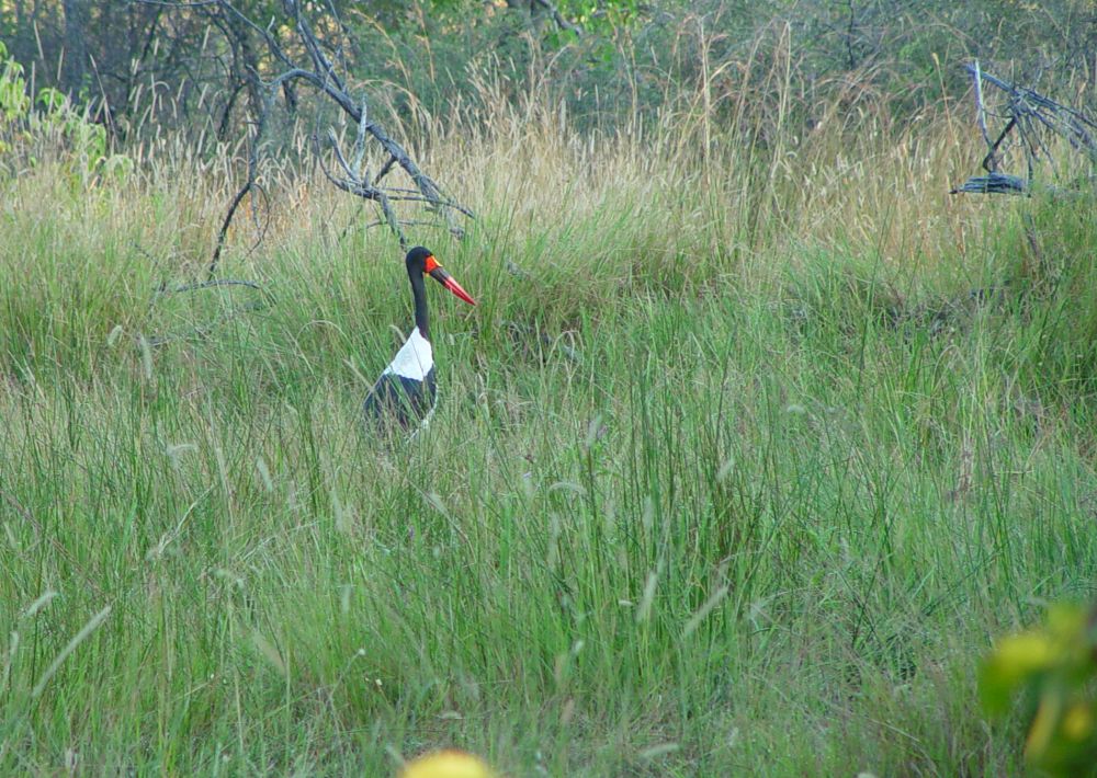
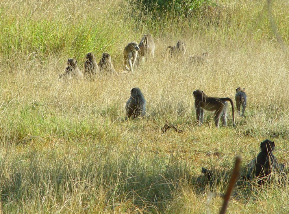
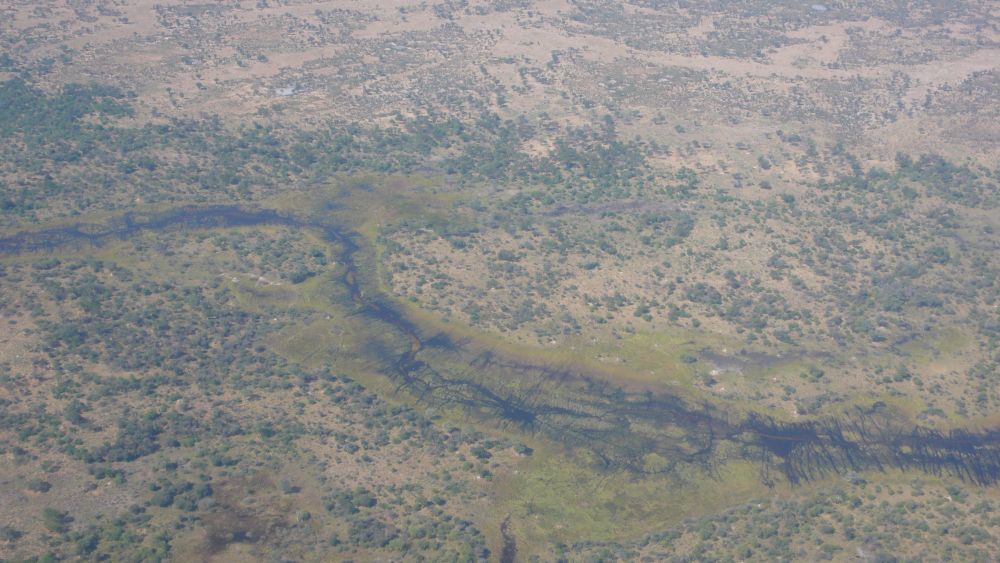
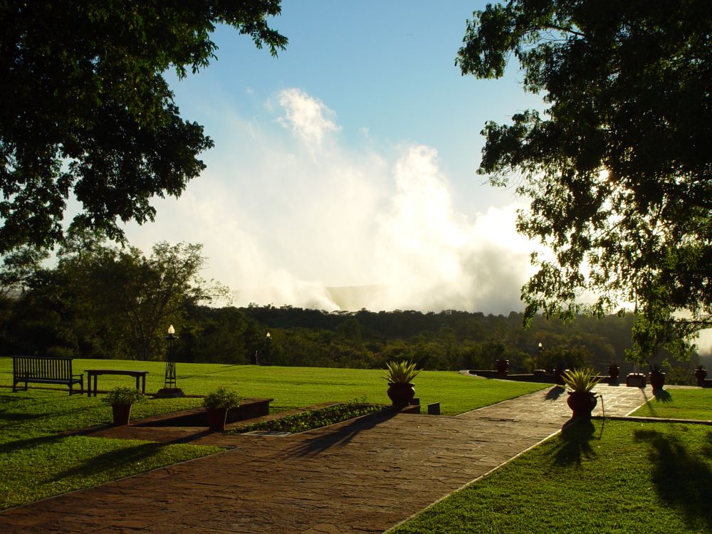
My home tells me stories – I just have to listen: This is the photo gallery that reminds me of the Victoria Falls, Botswana and Namibia, where I was with Ernst in April/Mai 2008.

I have already told you about our adventures at the Victoria Falls and in Botswana. Let me continue with the last stage of our 2008 Africa adventure, about Namibia.
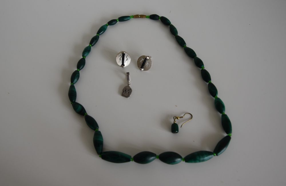
These souvenirs remind me of Namibia: The green neckless with the ear rings (I lost one of the ear rings unfortunately) and the silver studs with elephant hair and the matching pendant.

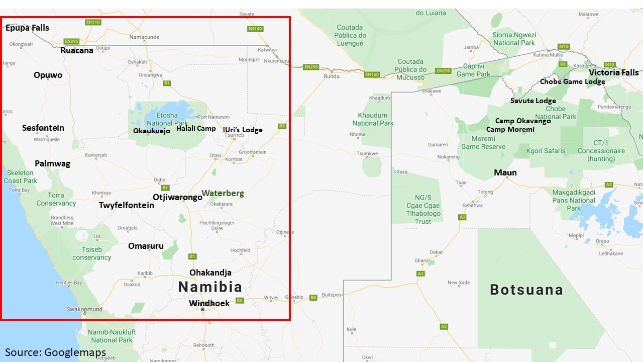
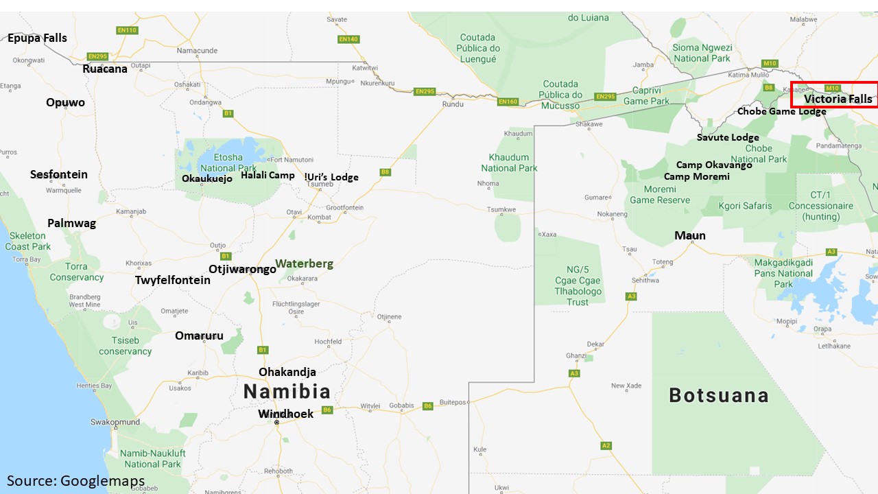
These were the points we visited: Windhoek – Ohakandja – Otjiwarongo – Waterberg – !Uri’s Lodge – Etosha Park with Halali Camp and Okaukuejo Camp – Twyfelfontein – via Opuwo to the Epupa Falls – via Epembe to the Ruacana Falls – via Palmwag, Omaruru and Ohakandja back to Windhoek
.
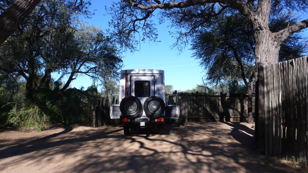
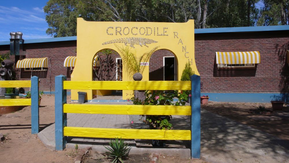
Picking up our camper from Britz at Windhoek, planning our tour in Okahandja and visiting the crocodile farm
We overnight in the friendly Hotel Steiner (still exists in 2020), stroll through Windhoek (a city with some German touch), pick up our four-wheel drive camper from Britz and do some shopping: We need food and some interfaces to charge our camera, GPS and laptop in the camper.
Then we drive to Ohakandja, which is 100km north of Windhoek, to plan our tour and get settled in our new mobile home. My first camper dinner, Broccoli, steaks and pasta, tastes rather dull, because I only have salt and pepper to flavour it. Ernst comforts me: “Camper meals taste like that, do not worry.” Hm, Ernst is so patient, but I will look for more spices in the next days.

We take a shower in the chilly morning… fortunately the manager of the camping site has heated up the donkey that gives us warm water.
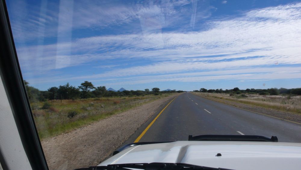
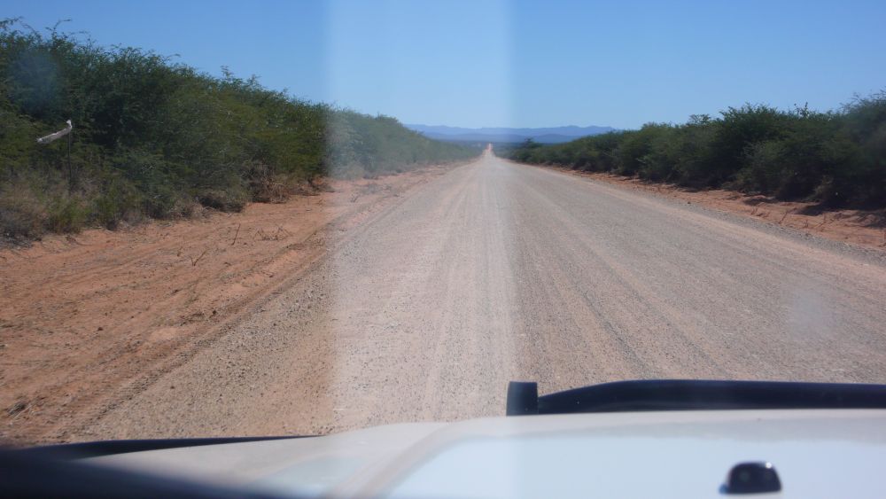
Our next destinations will be the Waterberg and the Etosha Park. The main road going out to the north of Windhoek is straight.

In Otjiwarongo we visit the crocodile farm – it still exists today. It is a place for breeding crocodiles and in addition, it is a tourist attraction with a restaurant attached.

A guide gives us explanations: In this huge pond of about 800’000l, there are seven adult males and about 120 female crocodiles. They live about 80 years. The animals eat until May, and then they do no longer eat for the rest of the year – what an interesting diet schedule.

Each female lays about 40 eggs, hence 4800 eggs in total; 80% of the young crocodiles survive. There is a baby crocodile house, then the young animals are in larger ponds.

Our guide tells us to approach the pond carefully. We try, but as soon as the young crocodiles see us, they rush into the water. They grow for three to four years and then they are ready to be used for leather production.
The artificial wild life park on the Waterberg
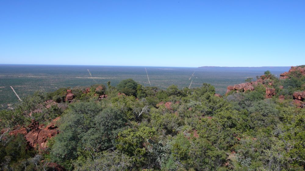
After a delicious ostrich and kudu steak in the Otjibamba Lodge (still exists), we leave the main highway and turn east to get to the Waterberg. It is a flat top mountain. We go for a walk. We have a wonderful view of the plane looking south…

… and come across this beautiful spider hanging in the air above our footpath. Yes, there are also beautiful small animals in Africa!

We then reach the cemetery of the Herero people that died in the battle against the Germans in 1904… this genocide is a blot in German history that makes me feel bad.
Our neighbours at the camping site are uncle Jürgen and his nephew. They give us a screwdriver and Ernst repairs one of our cupboards, mumbling that he had forgotten his Victorinox knife. “Look, I have taken this small knife with me that I had noticed lying around in our house”, I say. Ernst’s face brightens up: “Oh, great, this is my officer knife!” – I am happy that Ernst is happy about this find…
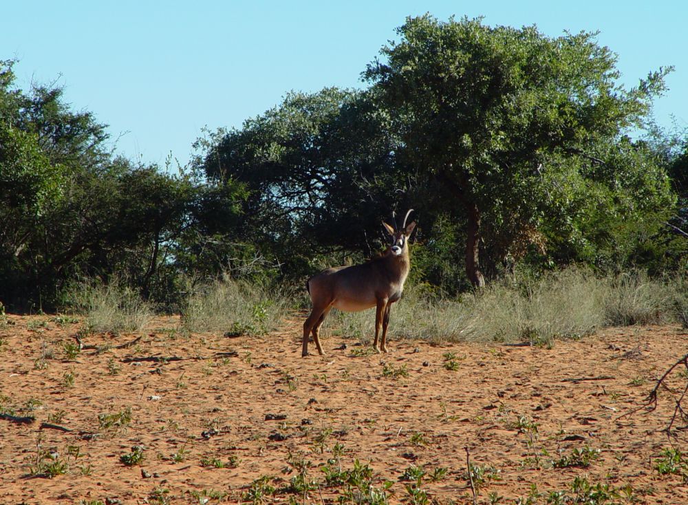
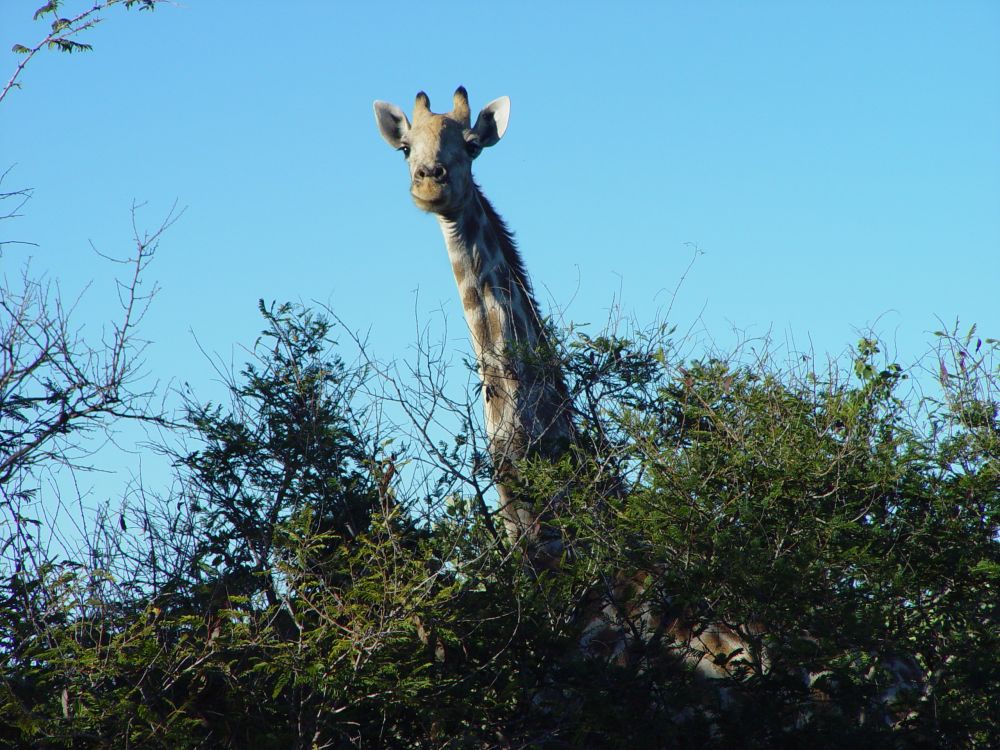
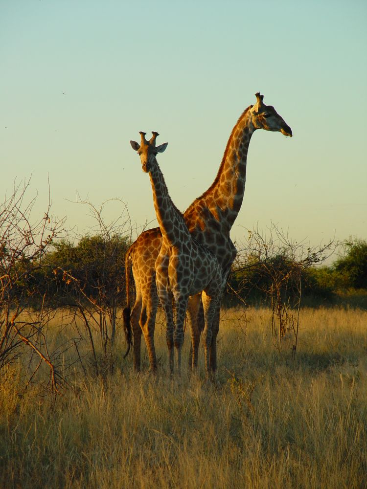
With uncle Jürgen and his nephew, we book a game drive to the plateau of the Waterberg. It is a wildlife reservation area with artificial water holes. The water is pumped up to the plateau. Some of the water holes have shelters to watch the animals without disturbing them. There is a variety of wildlife here such as giraffes, zebras, antelopes, leopards, cheetahs, buffaloes or rhinos. Our guide is called Peter. He drives far on the plateau, but all we see are two oryx antelopes (this is one of them),…

… some giraffes, this one keeps the overview,…

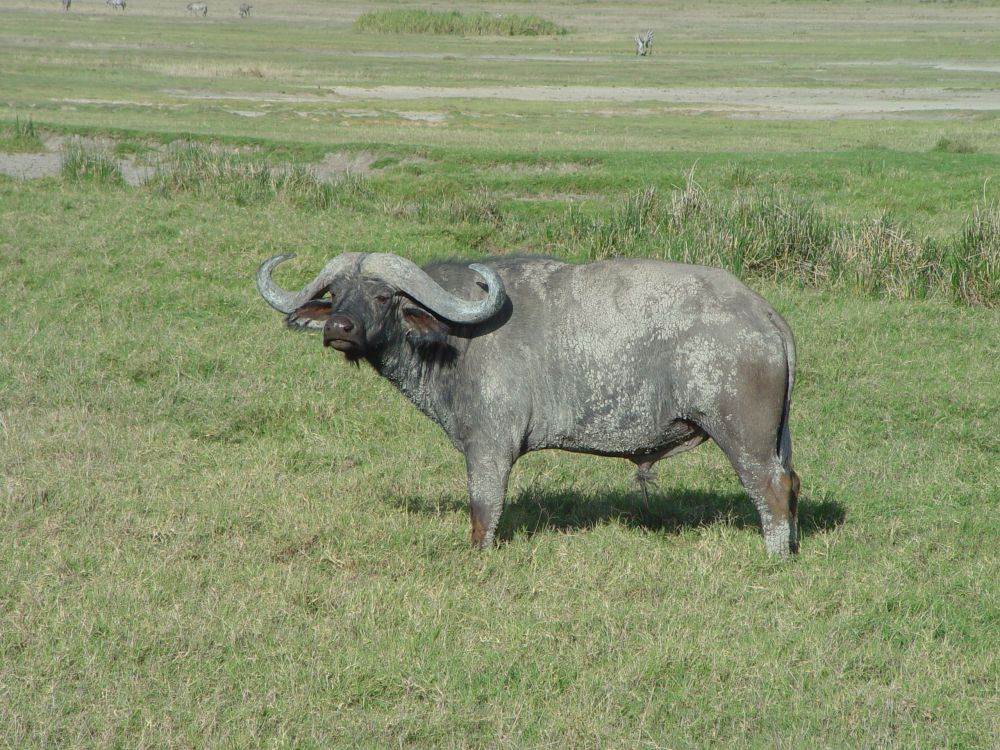
… and later we see two buffaloes from far – they stay in the bushes and do not dare come to the waterhole.
While we drive back in the chilly evening, I reflect about this reservation area. As long as the artificial water holes have water, it may be good for the animals to live here. And as long as tourism keeps on going, the park earns money to finance the pumps that take the water up to the plateau. But what happens, when Namibia has no more money to maintain this artificial park? Those were my reflections in 2008. Now we are in 2020, and tourism has stopped due to the pandemic. Will Namibia be able to care for the animals on this otherwise barren plateau? I hope so, because these animals have nowhere else to go. And I do hope for this place that tourism will revive soon again.
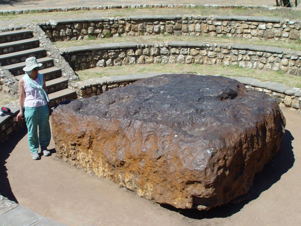
The meteorite and the luxurious lodge on the way to the Etosha Park
We drive around the Waterberg on a pebbly road, do some shopping at Grootfontein, where I find marjoram and some broth cubes that will add more flavor to our camper meals.

We look for the meteorite. My “Reise Know” says that the meteorite is 80% iron and hit the earth 80’000 years before our calendar system started; Hence now, in 2020, the meteorite is 82020 years old ;-).

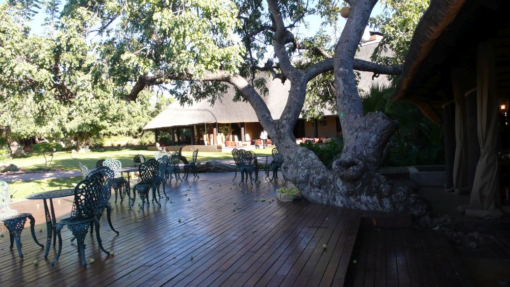
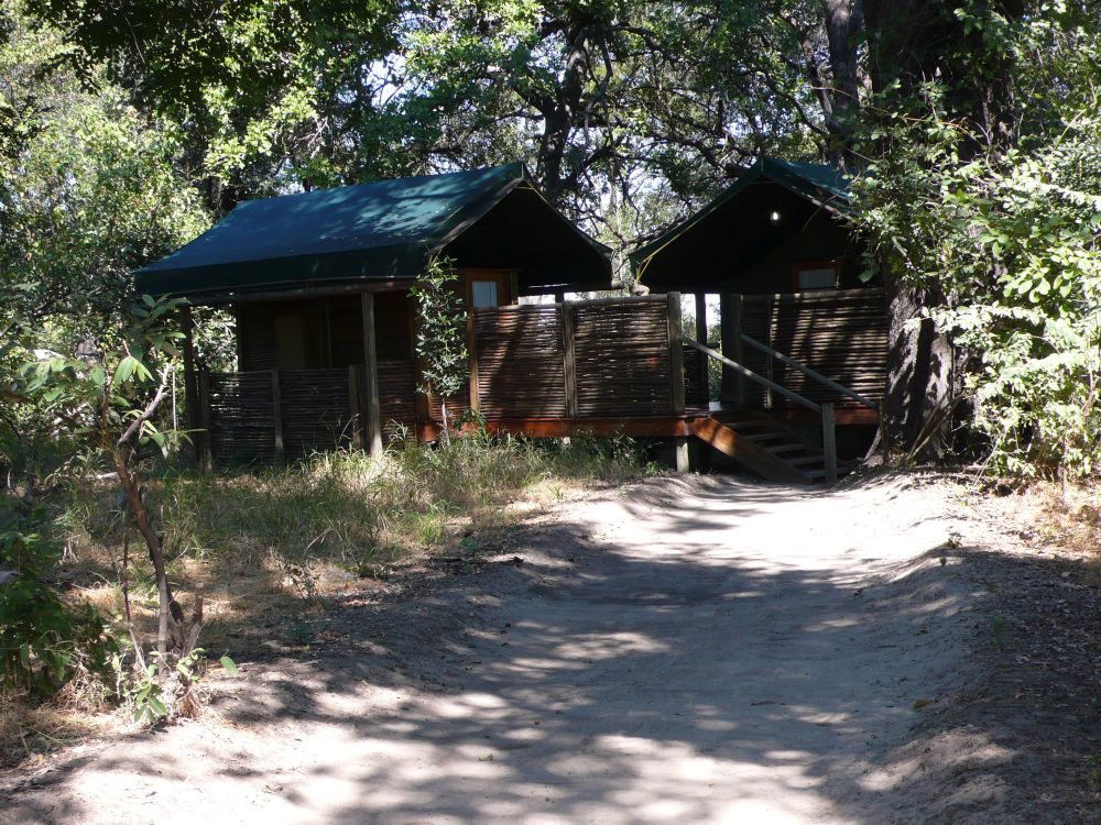
We stop at !Uri’s Safari Lodge near Tsumeb. The lodge looks inviting. We decide to sleep in a bungalow and enjoy some luxury. The “!” of “!Uri” is one of the three glottal stops of the Khoisan language that the Damara people speak here.
The manager shows me his wine cellar under a trapdoor. He has bought it with the lodge, and he asks me about the wines. I see wines from South Africa and tell the manager that he should sell (or drink) the 5 to 10 year old white wines (Sauvignon, Chardonnay) soon, but can keep some of the red Cabernet Sauvignons for 20 years, if needed. For dinner, we reserve a half bottle of Pinotage, a grape crossbreed that only exists in South Africa (Pinot and Cinsault). We have it with Kudu steaks and its cherry like taste is a good match. Then we retreat to our luxury bungalow, lay down in the canopy bed and close the mosquito net curtains.

The terrace is full of Marula fruits. For breakfast we have delicious marmalade made of them – the whole breakfast is excellent and very soigné.
The Etosha Park – great for wildlife watching (no, no, not the Etosha House in the Basel Zolli)
Our next destination is the Etosha Park. Jean-Claude calls from Basel and wants to know, where we are. Etosha? He checks the Internet: “Etosha House?” “No”, Ernst laughs, “not the Etosha house in the Zoo of Basel (called Zolli), no, we are in Namibia, in the REAL Etosha Park.” – “Aha, okay…”.
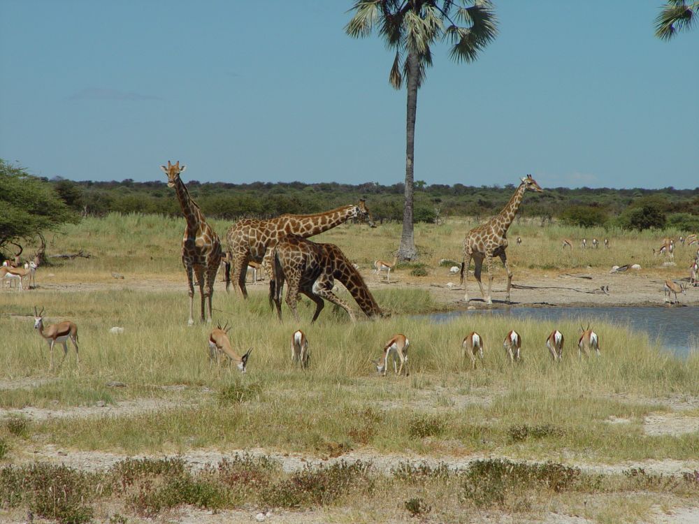
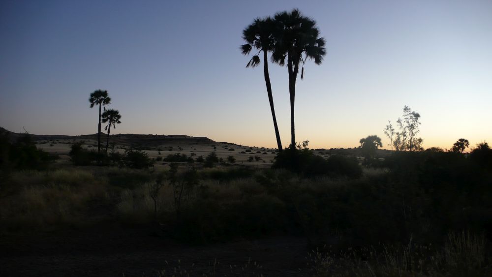
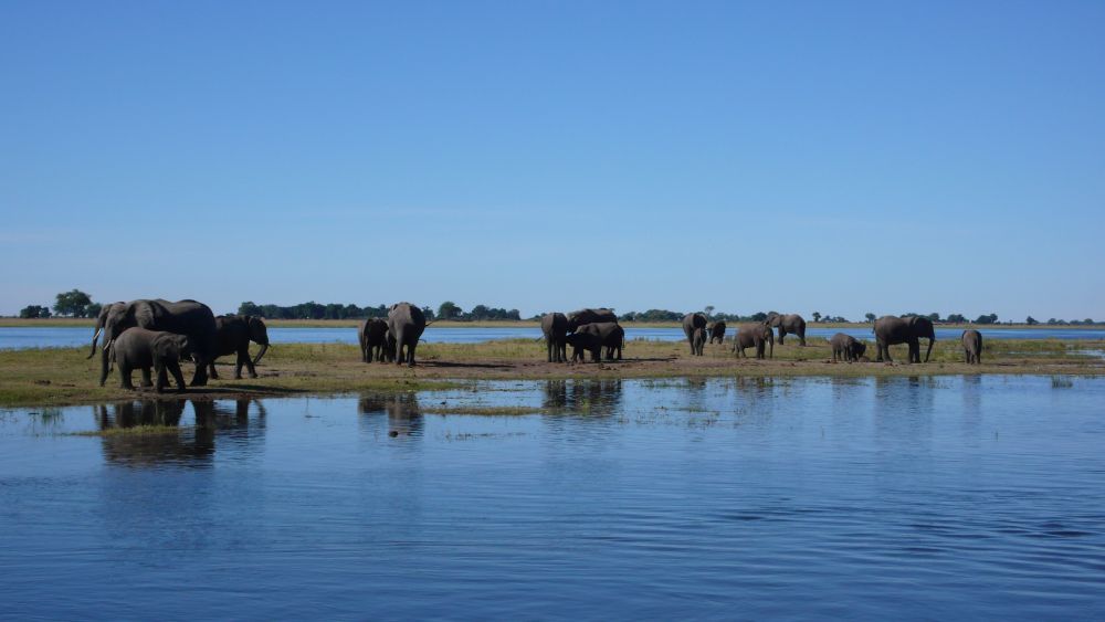
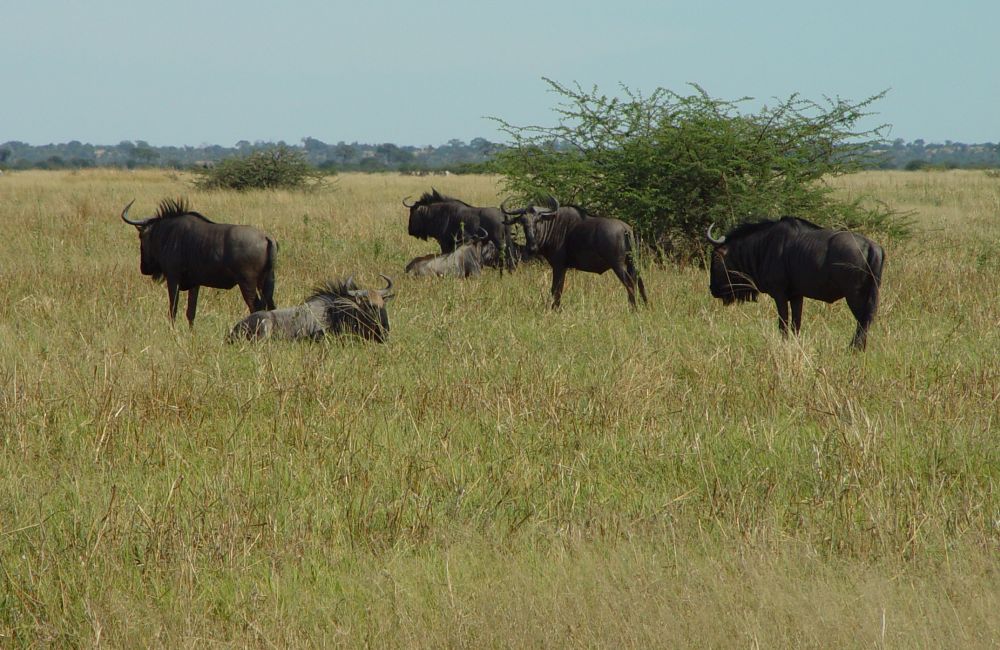
We enter the park from the east and stop at Twee Palms (the water hole of the “two palm trees”; there is just one branch of the second palm tree on the photo). About 15 giraffes are here – how difficult it is for them to drink water! A herd of fine springboks, zebras, gnus, herons… we cannot get enough watching.

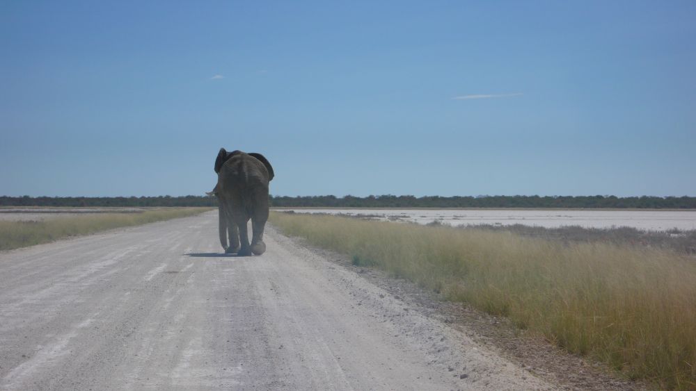
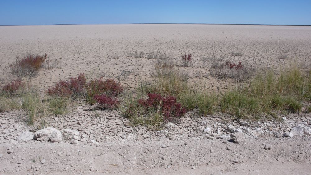
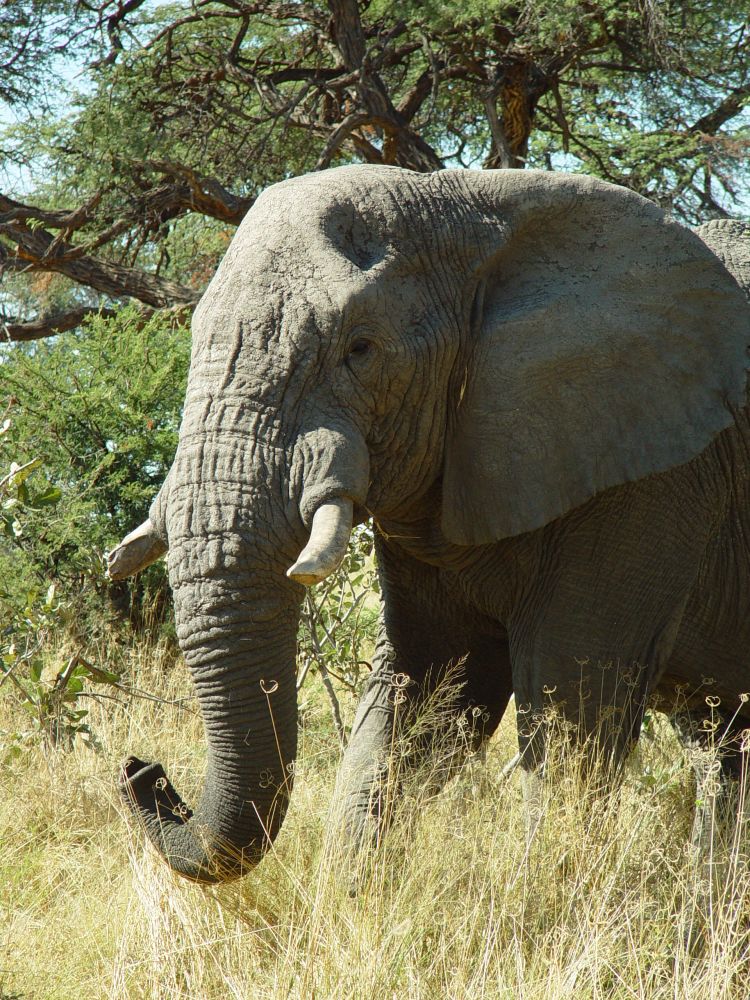
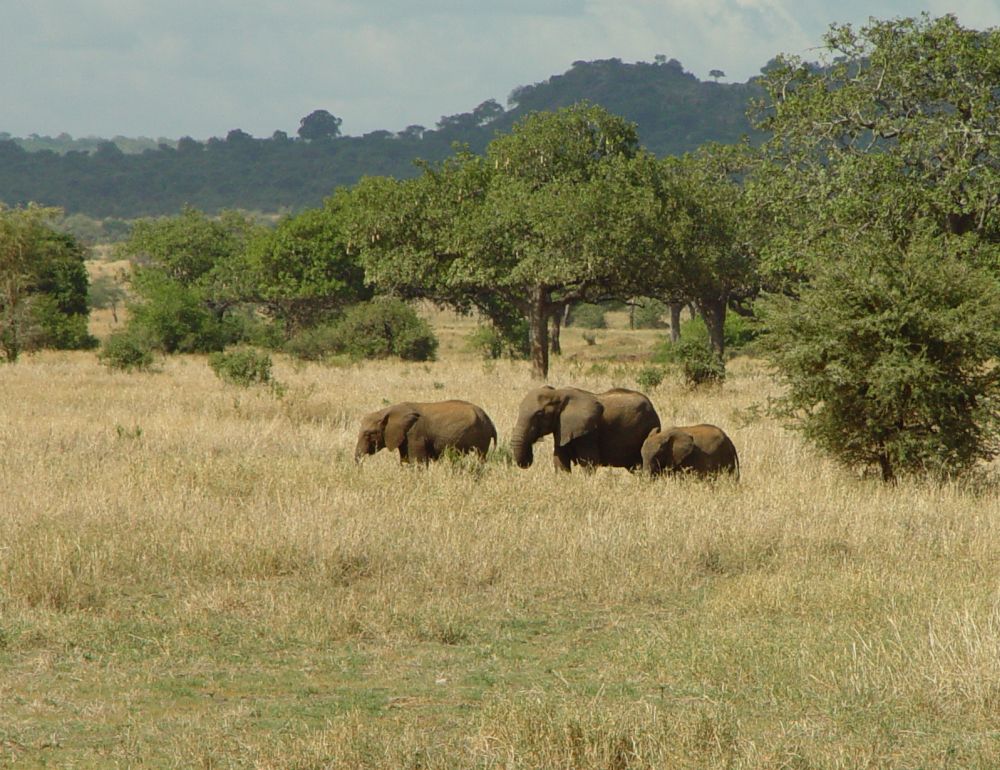
We are at the Fisher’s Pan in the east most part of the Etosha park. The pan is dry now. A road leads through the pan. An elephant is walking in front of us. Our car approaches the elephant from behind. It does not like that, turns back and threatens us, pulling up his trunk and waving his large ears. We back up and keep distance. When the elephant reaches firm land, Ernst honks quickly, the elephant trumpets loudly and runs into the bushes – I am surprised, how fast this clumsy looking animal runs.

We look back at the Fisher’s Pan…

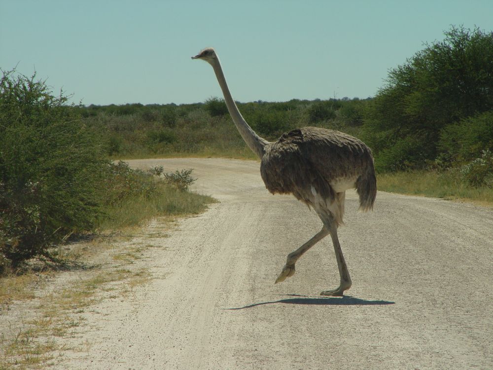
… let the ostrich cross the road…

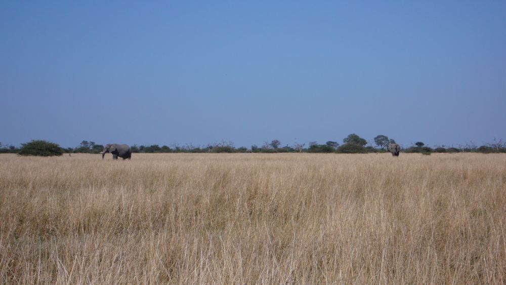
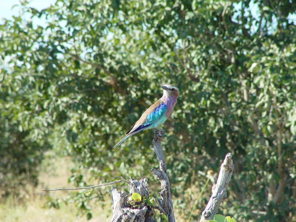
… and see much more wild life (elephants, turtles, zebras, oryx, gnus, lilac breasted rollers, herons, bustards) – this is a populated park.
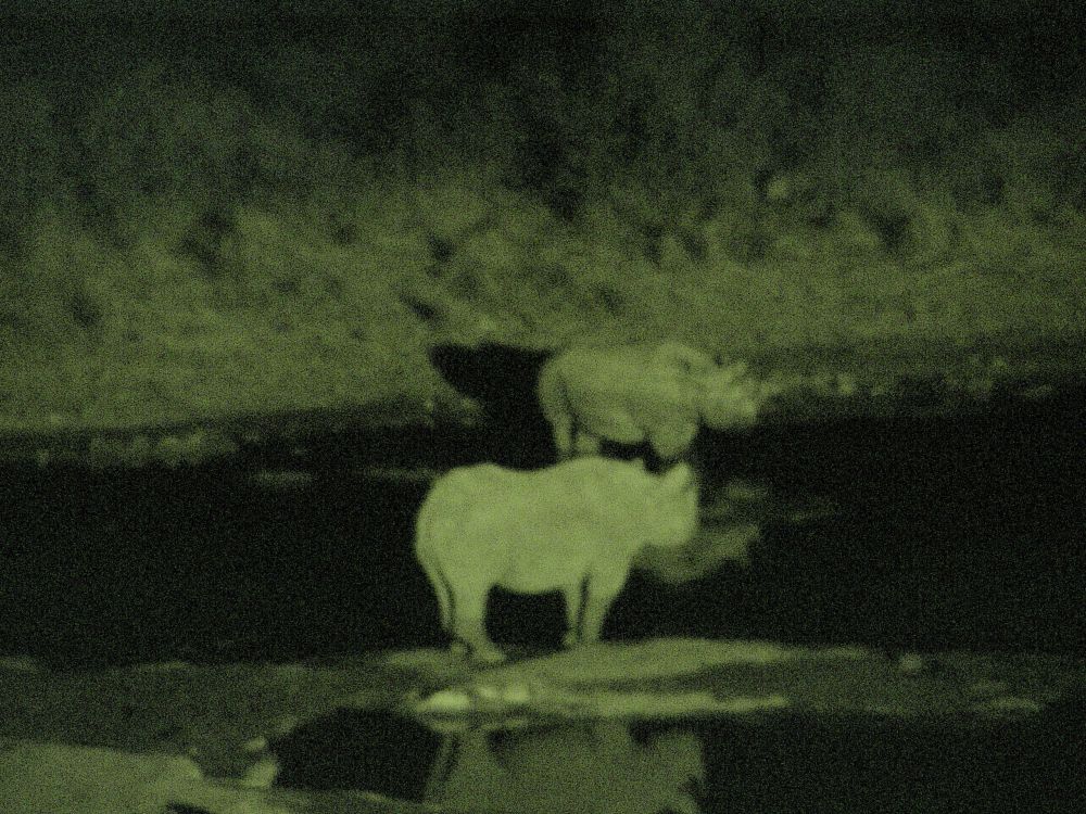
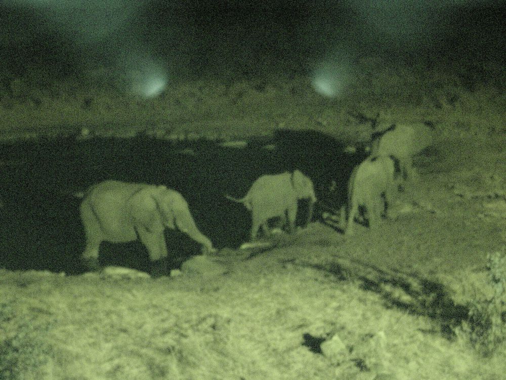
We have reserved two nights in the center of the park, in the Halali Camp, and settle at slot number 43. After dinner (now more tasty with the spices from Grootfontein), we go to the artificial water hole near our campsite. There is a platform with benches, like in an amphitheatre. Two rhinos are drinking water (Ernst mumbles something about trying out the infrared program of our camera).

Then we hear loud trumpeting. About 15 elephants emerge from the bush. They drink water, play with one another, stalk in the shallow pond and keep distance to another rhino that joins them with its offspring. Even elephants stay aside, when rhinos are around.

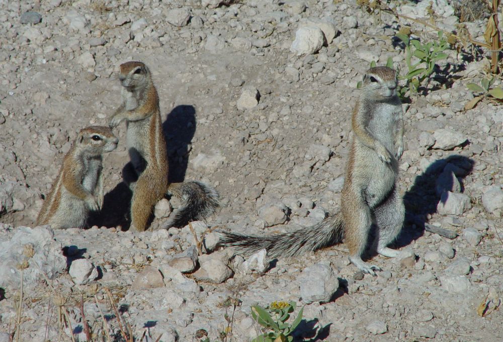
The next morning, we try the track in the southern part of the Etosha park which is called “rhino drive”. There are trees and bushes. We find this pretty ground squirrel…

… and these cute suricates,…

… but no rhinos, as the name of the drive would suggest.
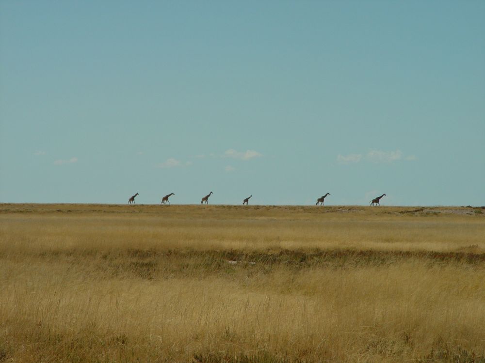
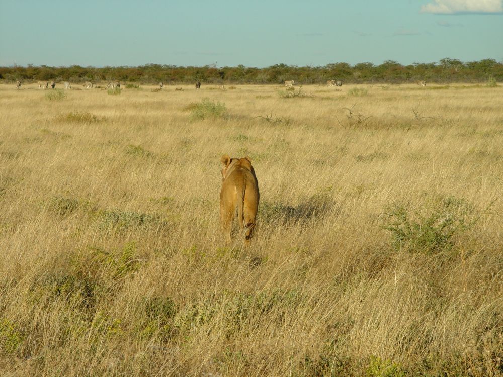
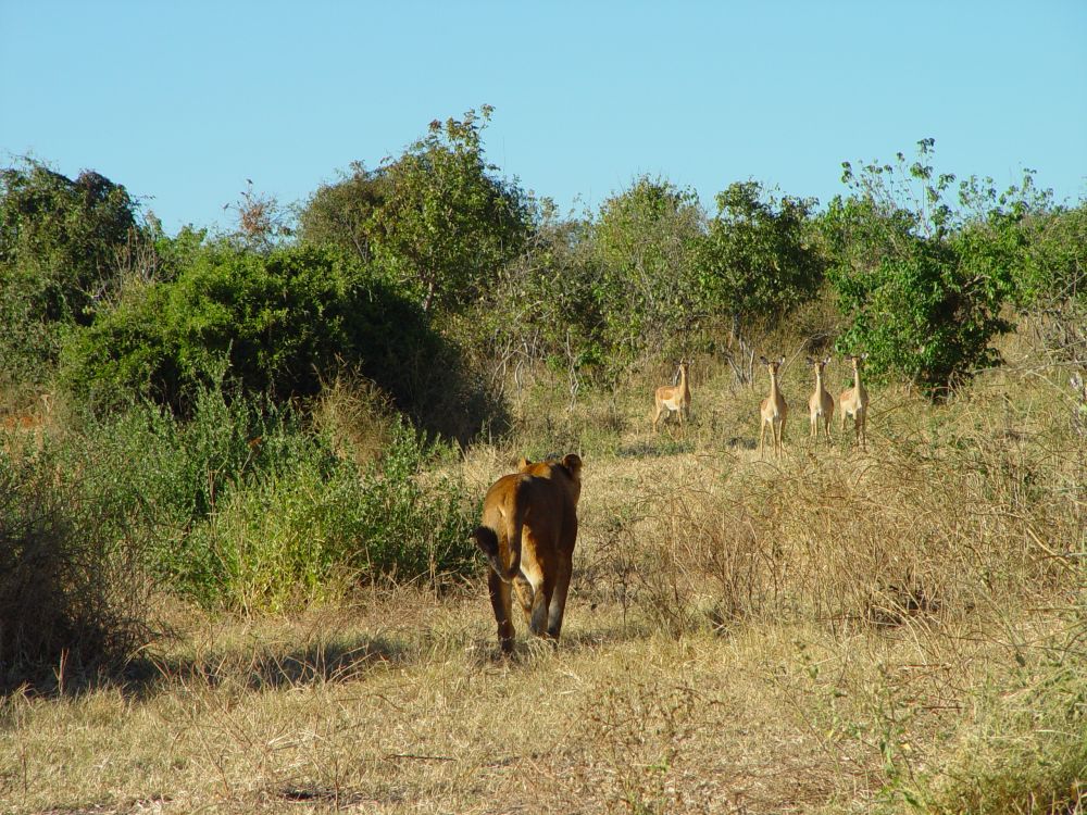
We turn north to the Etosha Pan. There are less bushes here and the animals can be seen well such as these giraffes against the horizon,…

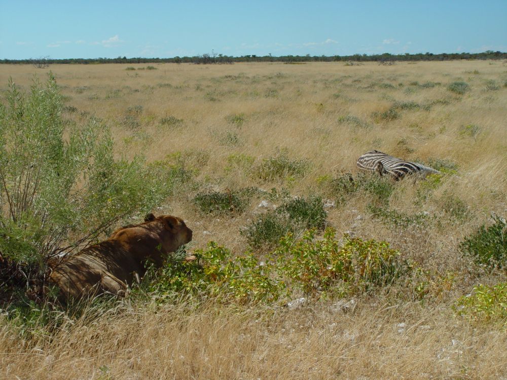
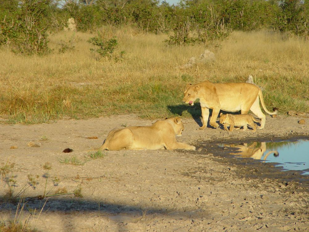
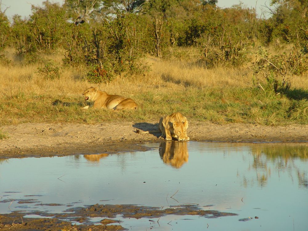
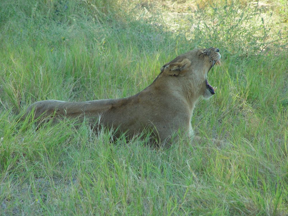
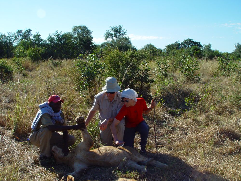
… and the lion lady with the zebra kill.

In the afternoon, we return to see, what this lion lady does. The lady is still there, but soon gets up and walks towards the forest, carefully observed by the grazing zebras.

We go back the next morning – no lion lady, and where the zebra kill has been before, there is nothing left – vultures and hyenas have eaten it all.
We continue westwards, take photos of these elegant oryx antelopes and…

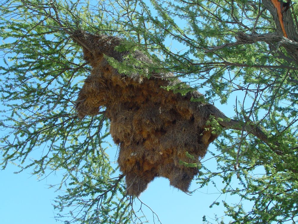
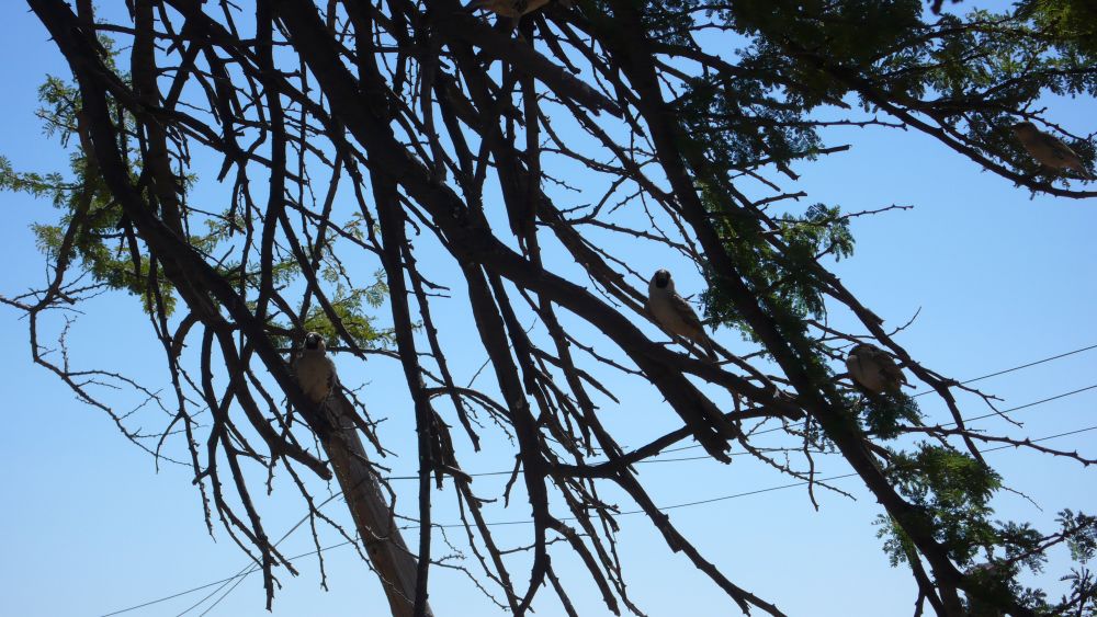
… stop at a parking lot that is extremely noisy from all the twittering of the bayas that have woven this huge nest (Webervögel).

They belong to the family of sparrows and are very social.

We reach the ghost forest with these odd looking bottletrees.

The eastern part of the Etosha Park ends soon here. The eastern part is for visitors with cameras. The western part is for visitors with rifles that shoot animals at artificial water holes… scary for me. I now understand that, in earlier times, the habitat of the animals was much larger than the Etosha park. The animals migrated to the ocean, when looking for food and water, but now they are locked in the Etosha Park. In a way, this park is a large zoo. If I understand it correctly, the Serengeti is a much more sustainable wild life reservation concept, where the animals can migrate as they have always done.
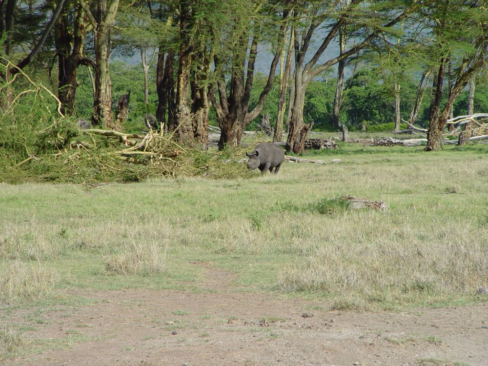
We stop at the Okaukuejo Camp, still in the Etosha Park, and find a place to spend one more night. Also this camp has an artificial waterhole, where we can observe hyenas, zebras, springboks, elephants and the black rhino that slowly, slowly approaches the waterhole, while all other animals get out of the way. The black rhino is the one with the pointed mouth (Spitzmaulnashorn), as opposed to the white rhino (Breitmaulnashorn) with the broad mouth which is called “wyd mond” in Afrikaans. The Anglo-Saxons heard “wyd” and made “white” out of that – white rhino. Consequently, the “other” rhino must be “black” – black rhino, they may have thought. But both rhinos are neither white nor black, they are just grey.
I do like the water hole of the Okaukuejo Camp. We return in the evening and see more rhinos, jackals and a wild cat.
After three wonderful days we leave the Etosha Park, drive to Outjo to reload our gas tank (for cooking) and to do some shopping. We find an excellent butcher, where I buy Biltong (dried meat pieces, a convenient picknick), steaks and the house spice mixture for barbecues and vegetables to add even more flavour to our camper meals.
Then we continue to Twyfelfontein.
Barren landscape and rock paintings in and around Twyfelfontein
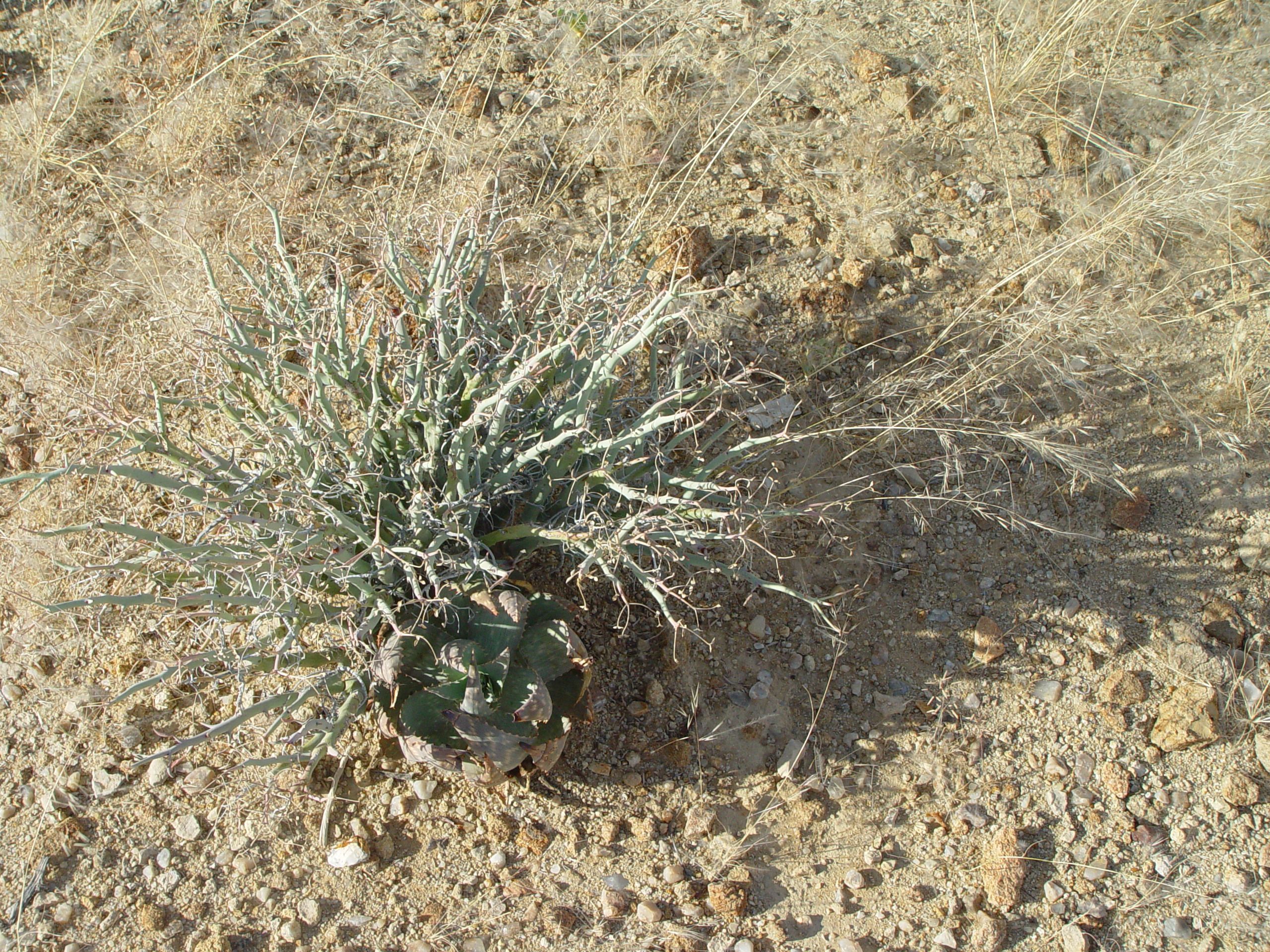
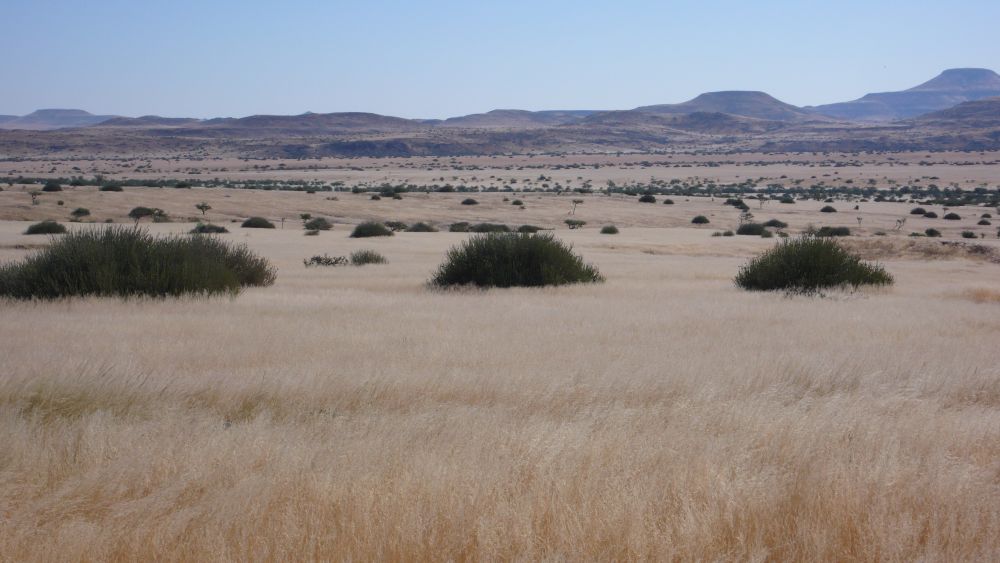
Damaraland in the west of Namibia is dry and barren…

… with yellow meadows, some green bushes and blue mountains.

We sleep in a community camp that is managed by Damara people. The steak we have bought in Outjo is excellent and the butcher’s house mixture of spices is perfect. Now, my camper dinners do no longer taste dull at all.
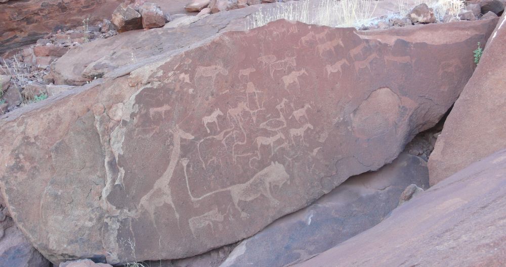
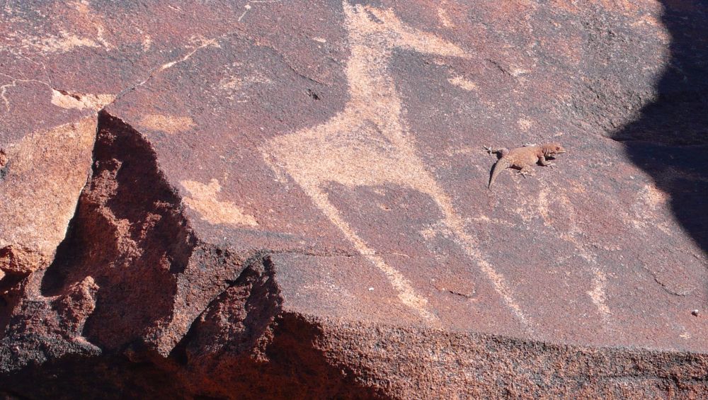
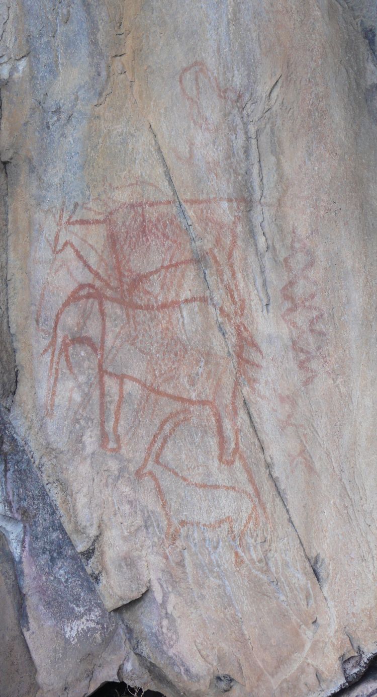
We stop at Twyfelfontein, which is a park with rock paintings. Thekla shows them to us. I can see a giraffe, a lion and various antelopes. The tail of the lion is angled and ends as a hand – interesting.

The small gecko looks for the sun, right where the rock paintings are.

Thekla speaks the Damara language. It belongs to the Khoisan languages that use three glottal sounds. She clicks three times, and it always sounds different. We give it a try, but we can do no more than one poor click. To get an idea, look at this San man talking Khoisan.
After having seen Twyfelfontein, we drive to the doline Wondergat, where Ernst sees this beautiful grasshopper.

Driving North to the Epupa Falls
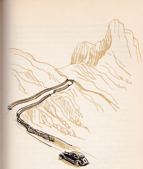
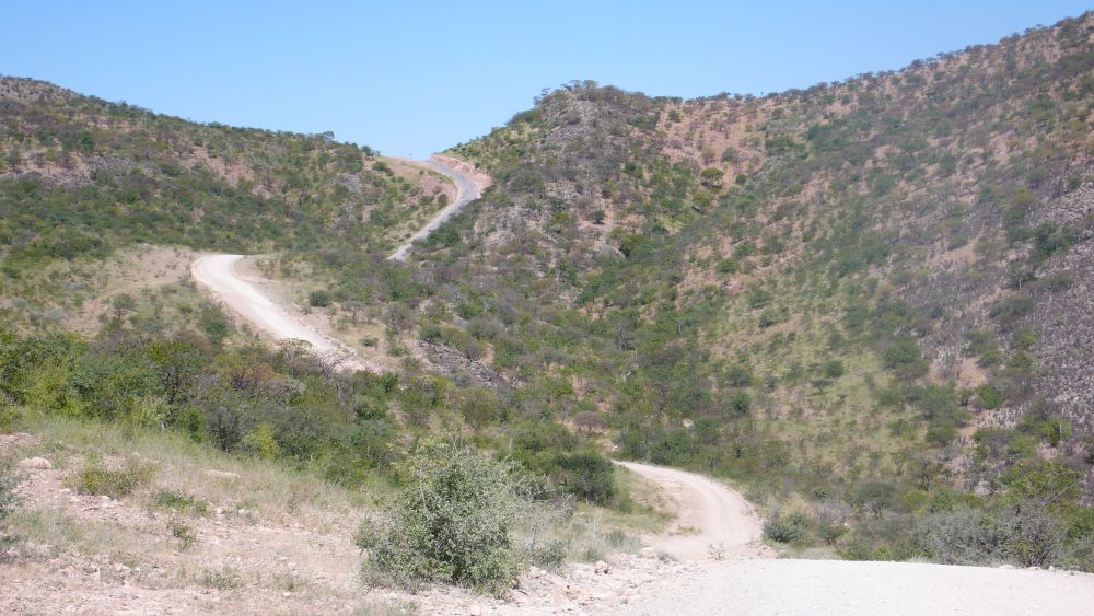
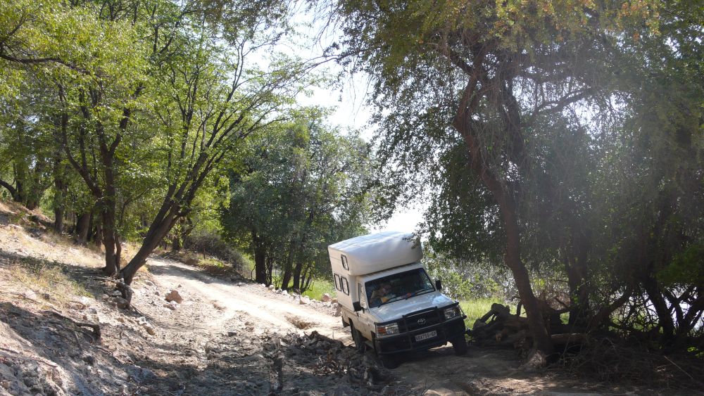
Now Ernst looks for some adventures on challenging roads. We drive north, first on good roads and then on pebbly roads…

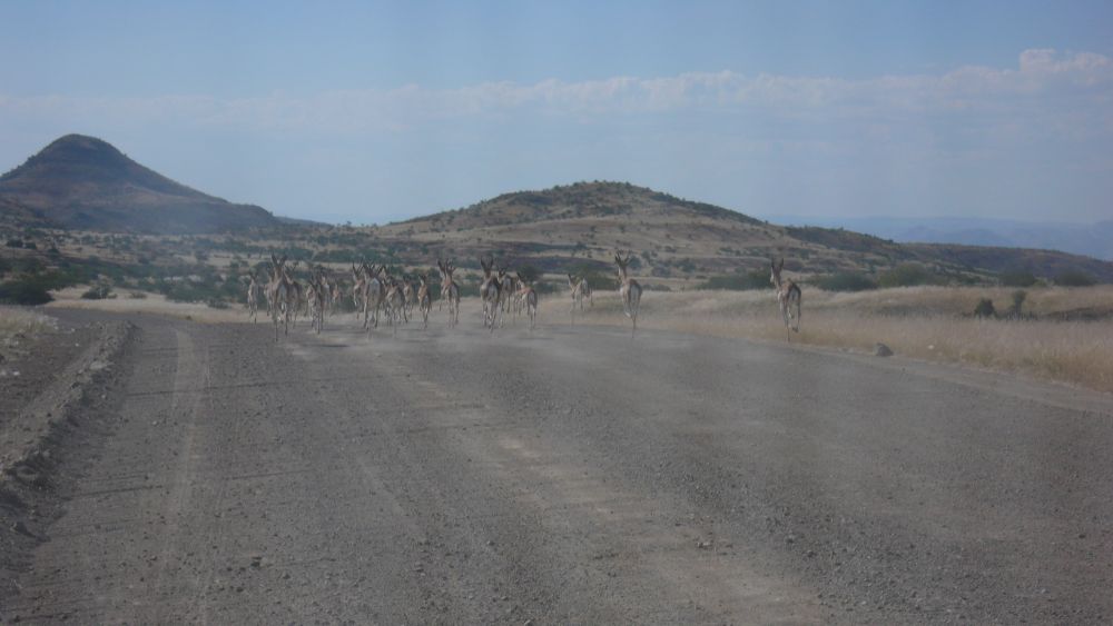
… some springboks run ahead of us. From time to time, they jump up high. We wait to give them time to get off the road.

We stay overnight in Sesfontein and then head north to Opuwo. We have to cross some hills on rough roads,…

… drive up the Joubert pass (easy, it has been paved going up)…

… and are now on 1300m on a high plateau with Himba villages.
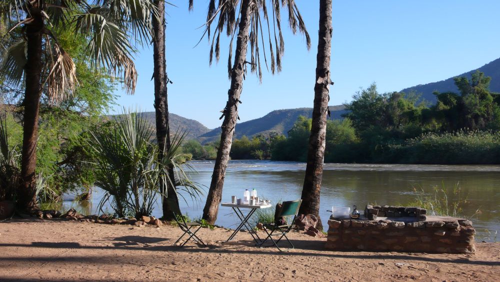
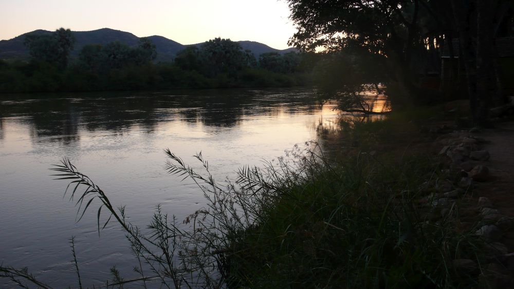
The last kilometers to the Kunene river are challenging with pointed pebbles and river crossings. We advance slowly. At the Kunene river, we settle in the Omarunga Lodge & Campsite (still exists in 2020), with a view of the river. We eat in the restaurant of the Lodge & Site and Ernst invites some students for dinner – he says that he has been invited by some elderly business man, when he was a student a long time ago and now, he wants to give it back. We have a wonderful evening with the students – they study chemistry.

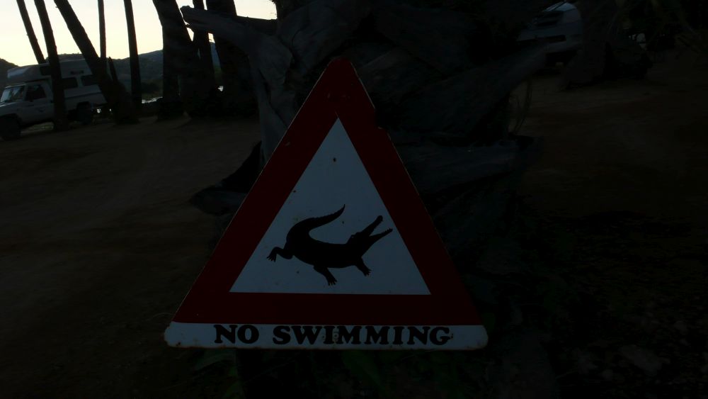
Across the river Kunene is Angola.

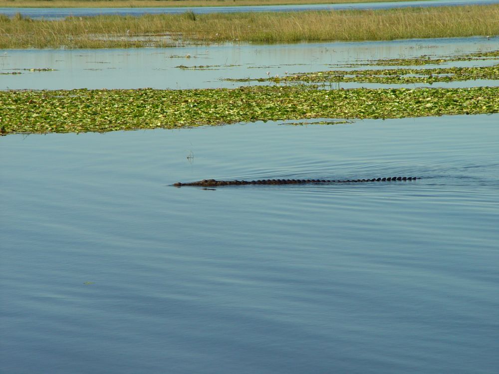
Swimming is forbidden here; there are crocodiles. At the reception, I hear that one of the crocodile has a name, Lucy. Lucy has not been seen for some time now, but there are more crocodiles, beware.

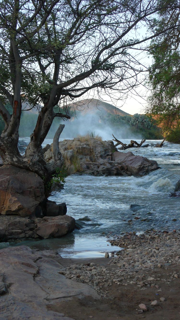
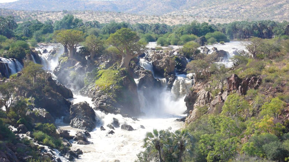
We walk along the Kunene river…

… to the Epupa Falls. The water flows around Baobab trees.

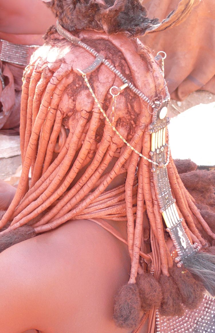
Jacy takes us to the Himba village. Jacy is a Himba that went to school in Opuwo and now guides tourists. We are hesitating. We do not want to “look at” people, we want to LIVE the countries that we visit; 15 years ago in Myanmar, we had rejected visiting tribes. But Jacy was nice and we thought, like this, he earns some money and for the Himba, we had some corn flour as a gift.

Jacy explains to us that the Himba use redwood paste to care for their skin, and that it takes three days to make these artful plaits. The Himba belong to the Herero people and have kept their traditional way of life – so far.

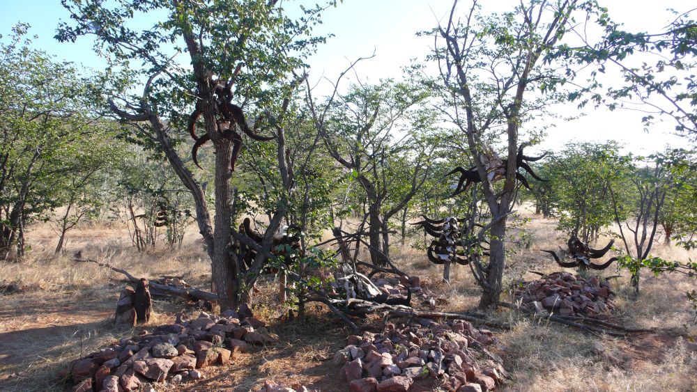
These are the graves of the Himba. They worship their ancestors. It is a holy place. All three of us stay at distance meditating. The more noble a man or a woman were in life, the more bull horns decorate his or her grave, for men showing upwards, for women showing downwards.

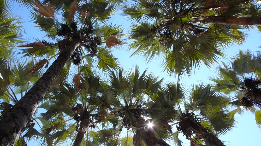
We have our last “Kunene dinner” and our last “Kunene breakfast” under the palm trees near the river.

The next morning, we will drive to the Ruacana Falls. Again, there are challenging roads ahead of us.
Adventurous drive to the Ruacana Falls and returning to Windhoek
We drive back the same way from the Kunene river to Epembe and then turn left to Swartsbooisdrift.
“Road washed away”, our Tracks of Africa on the GPS warns us. This is the “road washed away”. Ernst overcomes the obstacle splashing through the water.

This is our next larger obstacle. Ernst masters it as well, while I get out of the car to take the picture.

Our rear mirror is dirty after all these rough roads with obstacles. We have had our off-road adventures and Ernst is happy about that.

The Ruacanafalls are retained by a barrage. With an altitude of 80m, these waterfalls must have been impressive before. The powerstation of the Ruacana Falls has been completed in 1978 and covers more than 60% of Namibia’s energy consumption, our Lonely Planet says. In 2012, more turbines were added, as Wikipedia says.

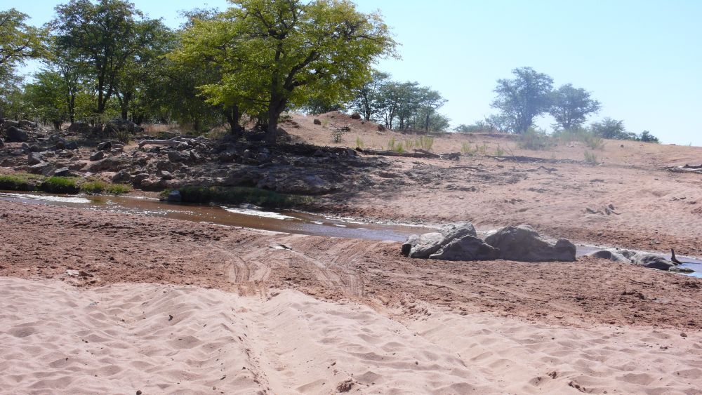
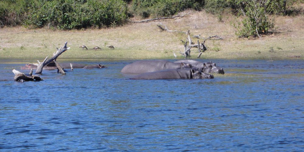
We overnight at the camping site near the so-called hippo pool (which is part of the power station system). We settle near the river. Ernst studies all the tracks around our camper to make sure, no dangerous animals or snakes are here. There is one track that he cannot identify (we have a book for that). It turns out, these are the paw prints of the friendly dog of the camping site that joins us wagging the tail.

In the morning, I fall down the ladder of our camper and spill the breakfast yoghurt. The dog tries the yoghurt, does not like it at all and walks away. A huge grasshopper comes and loves the yoghurt, while a prepare a second yoghurt portion.
Then we take an easier route back to Opuwo. In the hot afternoon sun, we have a puncture, hard work – together, we manage to change the wheel. Then we stay overnight in Palmwag. Sitting at our dinner table, we enjoy this beautiful evening ambiance.

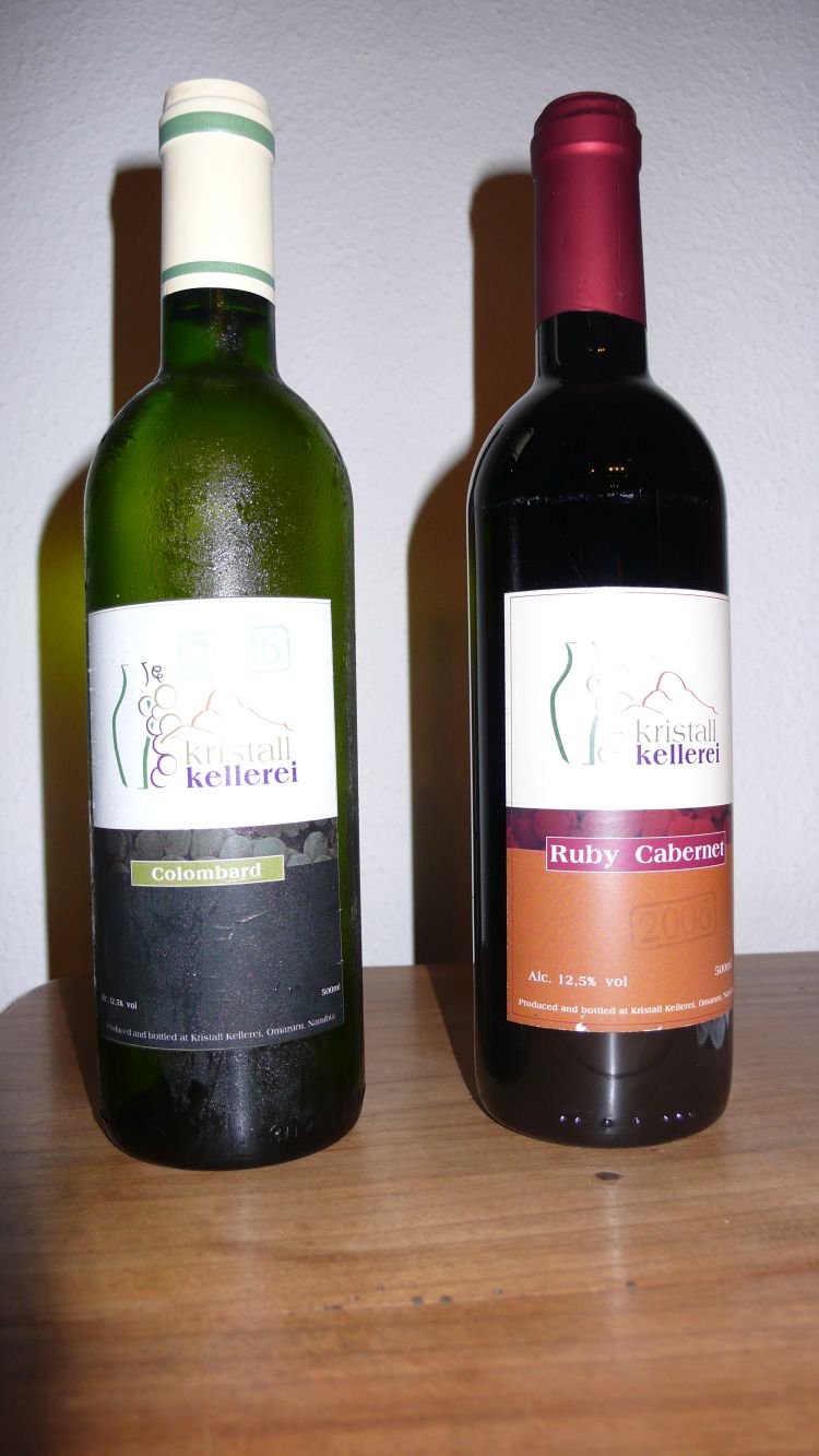
On the way back to Windhoek, we stop at the Kristall Kellerei of Mr Kluge in Omaruru. He owns about 4ha of vineyards. He grows Ruby Cabernet (red) and Colombard (white). We buy two small bottles from each. Then we stop at Okahandja for our last camper night in Namibia and have one small bottle of Ruby Cabernet with our barbecue. What a nice farewell dinner.

The other bottles we take home. I keep one bottle of Kluge’s Ruby Cabernet in my cellar. I do not know, whether now, in 2020, it is still drinkable, but it makes a somewhat melancholic souvenir of these four wonderful weeks with Ernst in Africa, 12 years ago.
Now, in 2020, I read in the Internet that the Kristall Winery belongs to Michael Weder who makes a much valued Brandy (Nappa) from the Colombard Grape.
Background information about Namibia: Khoisan speaking peoples, Bantu tribes, the German colonialization in the 19th century, protectorate of South Africa in 1920, independent in 1989
Peoples that speak the Khoisan click languages: San bushmen, Nama and Damara (this San man talks Khoisan and this is a step by step lesson about clicking).
- The SAN (now 3% of the population of Namibia): About 8000 years B.C. pottery appeared – probably the San had settled then – they were hunters and collectors. The SAN or bushmen are small, gracefully built, have a bright (yellowish-brown) skin, high cheekbones and their hair looks like “peppercorns”. The rock paintings in Twyfelfontein may originate from that time, but it is not proven.
- The Nama (now almost 5% of the population) lived as nomadic cattle breeders. They are a bit taller than the San, and have the same bright skin colour, cheekbones and “peppercorn” hair. Because their click language sounded like stuttering to the Europeans, they called them “Hottentotten”. The origins of the Nama are not clear. Either they descended from the San or they immigrated from East Africa and mixed up with the San. The mightiest Nama tribe, the Orlaam, immigrated from the cap region. They had learnt how to use firearms from the European settlers.
- The Damara (or Dama, now 7% of the population) have always been a sedentary group that also speaks Khoisan. Other than the Nama and the San, they are black (and proud of that). Their origin is not clear.
Tribes that speak Bantu Languages
About 2000-2500 years ago, the first Bantu speaking tribes immigrated. Today, the two main Bantu tribes in Namibia are the Herero (about 7% of the population) and the Ovambo (about 50% of the population).
- The Herero immigrated to North Namibia and later to East Namibia and Botswana in the 14th or 15th century – their legends say that they are from East Africa. They were cattle breeders and nomads. The Himba that now live in North West Namibia belong to the Herero.
- The Ovambo (or Vambo) came from East Africa in the 16th/17th century. They were sedentary farmers and cattle breeders. Traditionally their culture was a matriarchy, which changed, when adopting Christianity. They had a king that leased the land to his subordinates for their lifetime. The Ovambo live primarily in the north of Namibia and in southern Angola.
European colonialists (whites – now 7% of the population; there is also a coloured population of about 8%, which includes the Basters of Rehoboth)
The Portuguese landed at the coast in 1485, but did not stay. In the 17th century the Dutch started to explore the coast line. In 1844 Germans evangelized the Herero, while the Finns cared about the Ovambo. The English annexed the Walwis Bay in 1878, because they were interested in Guano which are excrements of seabirds used to produce fertilizer and explosive substances. In 1883 Adolf Lüderitz from Germany bought the port Angra Pequena from a Nama chieftain which became then Lüderitzland. Fights between the Nama and the Herero “motivated” the Germans to send troups, first 23 soldats, then more. They built fortifications and promoted commerce and mining. The Germans founded Windhoek in 1890. Namibia became a German protectorate. German farmers settled and the Germans agreed about the borders with the other colonial rulers of the area around 1890. This included the so-called Caprivi Strip, a thin band of land bordering Botswana in the north up to the Zambesi river. The idea was to use the Zambesi river to access German East Africa (today Tanzania) by boat on the Zambesi and via the Indian Ocean. This was, however, impossible; from the Caprivi Strip downstream the Zambesi is not navigable because of the Victoria Falls.
The German farmers settling in Namibia expelled the Herero from the fertile plains. The Herero retreated to the Waterberg and revolted. The Germans lost their freshly established estates and backed up to Windhoek. Reinforced, the Germans hit back. At the battle of the Waterberg in 1904, the Herero were vanquished and those that survived escaped to the desert, where many of them died of thirst. 80% of the Herero perished – this is a genocide. The Germans apologized 100 years later and made a reparation payment.
After World War I the Germans lost their colonies. Namibia became a protectorate of South Africa. Many German farmers stayed in the country and expanded their farms. The native tribes were confined to less fertile “home lands”, a process that was completed in 1963.
Namibia struggled for independence from South Africa, but South Africa continued to rule over Namibia, despite the UNO resolution 435 from the 1960’s. In 1983, the UNO recognized the SWAPO (South West Africa’s people Organization, dominated by the Ovambo) and, supported by Cuba, the SWAPO fought in Angola and in the north of Namibia. In 1989 Namibia became independent. The first president, Nujoma, was an Ovambo chieftain. He strived for peaceful solutions in his multi-ethnic nation which was symbolized with the flag of Namibia: The osprey stands for vision, two oryx antelopes for courage.

Source: Wikipedia, https://en.wikipedia.org/wiki/Coat_of_arms_of_Namibia#/media/File:Coat_of_arms_of_Namibia.svg
Nujoma ruled for 15 years. He was followed smoothly by Ovambo (or SWAPO) chieftain Hifikepunye Lucas Pohamba until 2015. Then, smoothly again, Hage Gottfried Geingob took over (also from the SWAPO and with a long international experience outside Namibia). I do wish all the best to this multi-ethnic country. For the people and for the animals, I hope that tourists will come again after the pandemic.
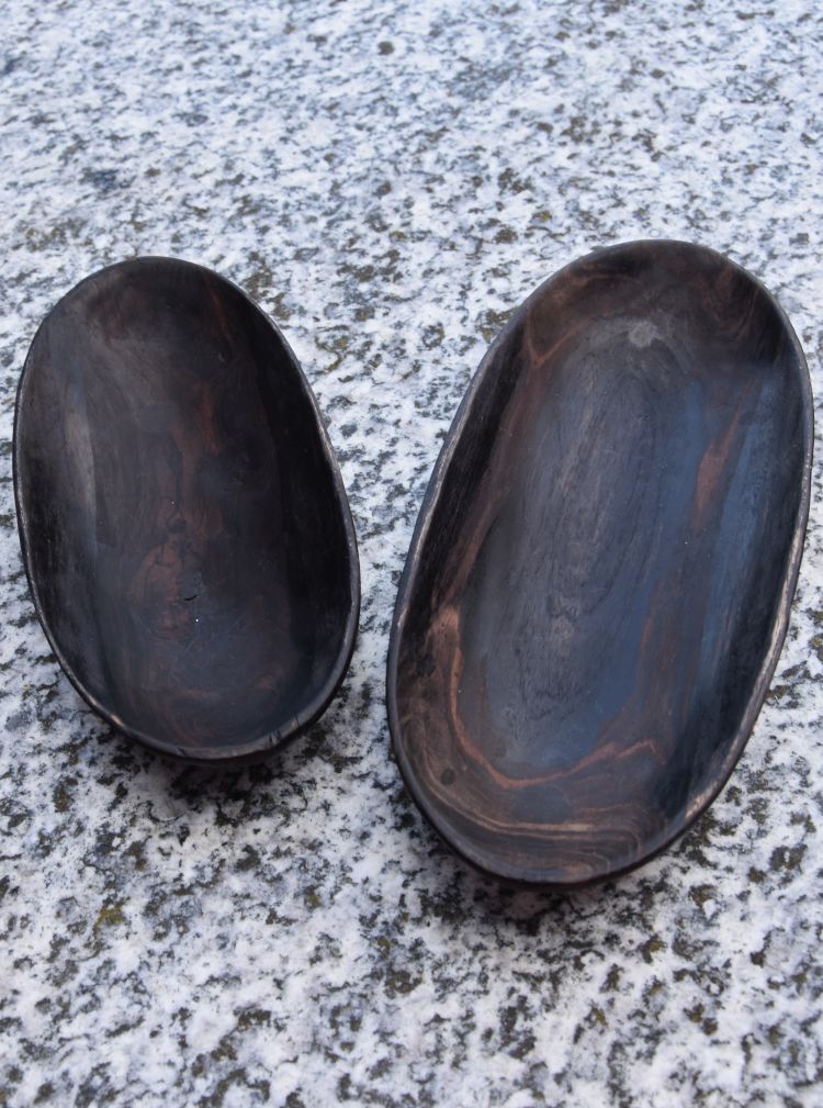
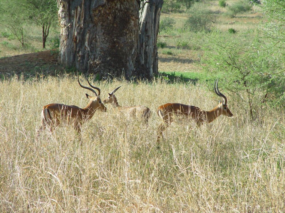
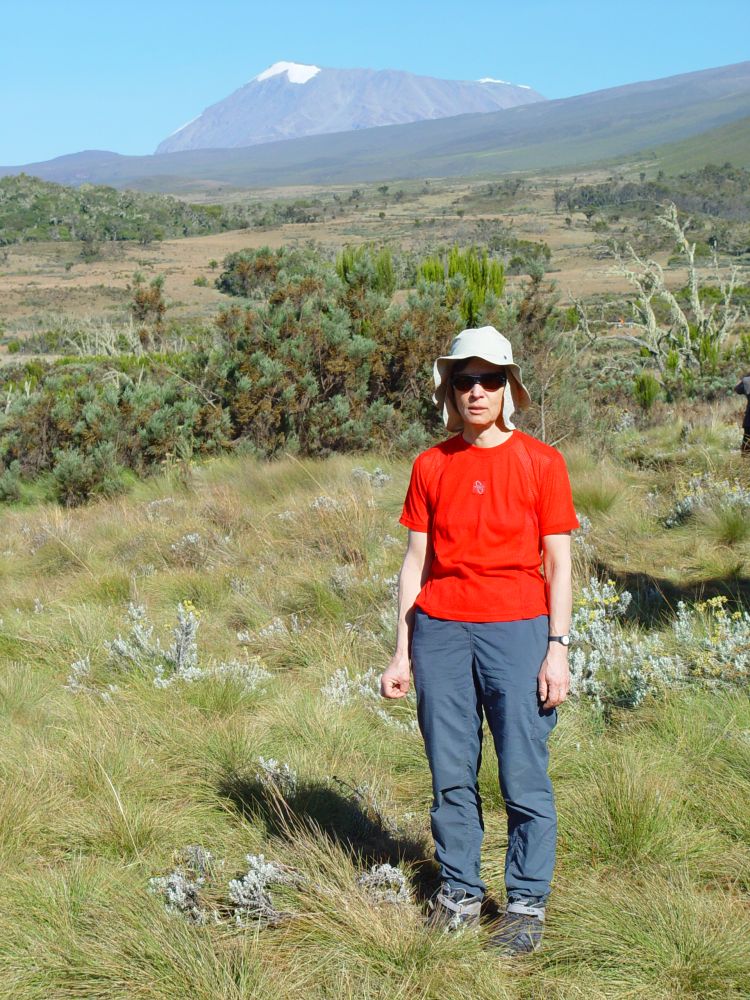
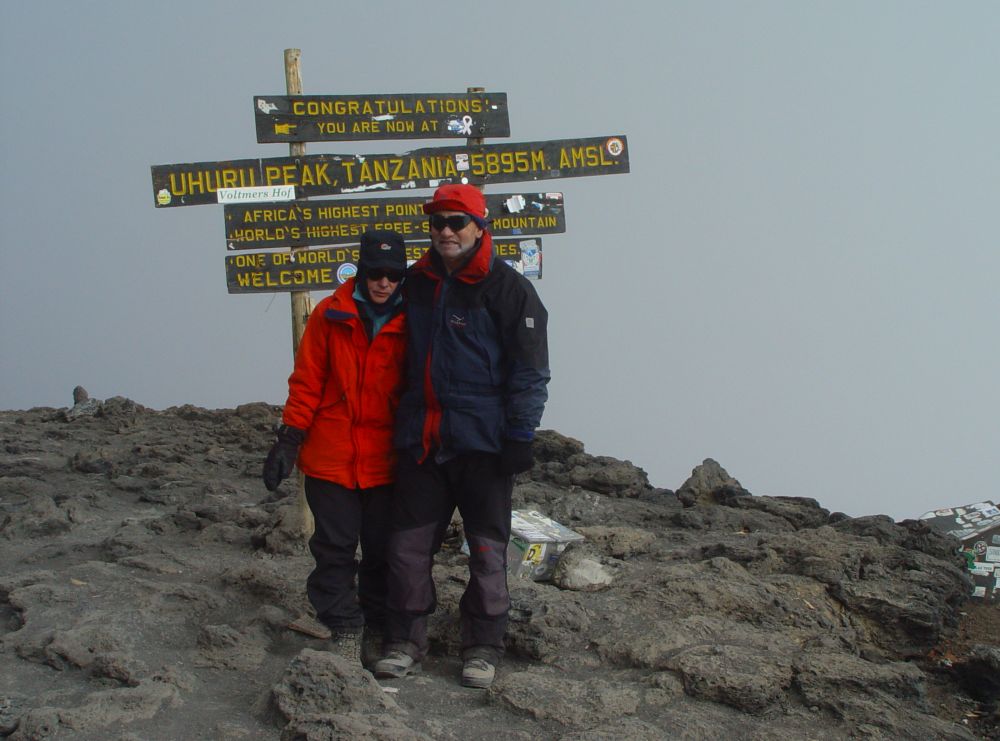
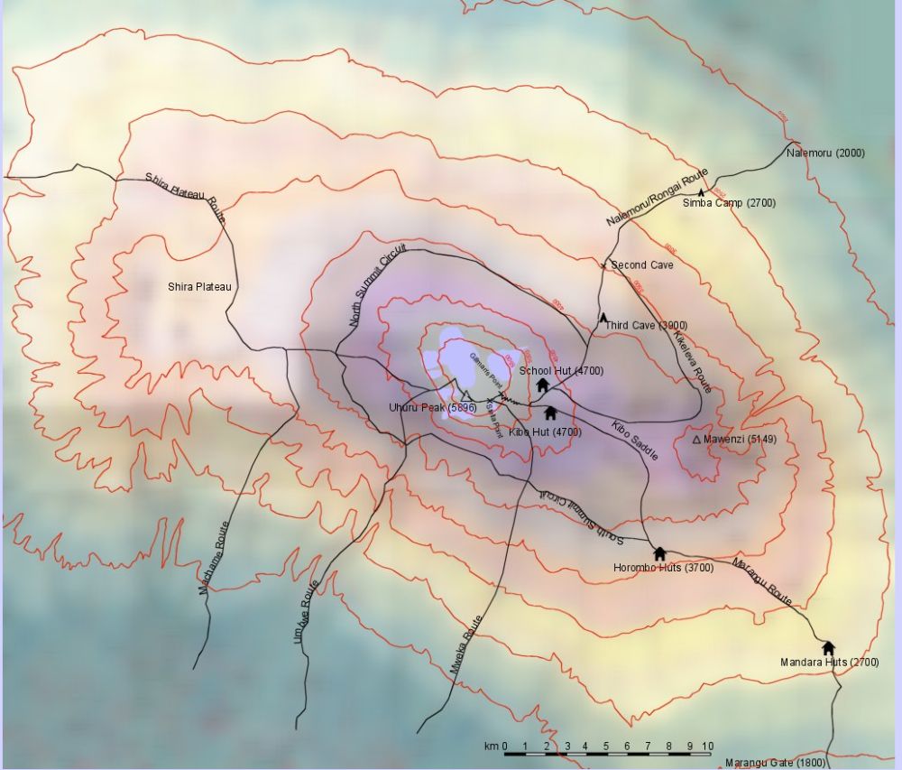
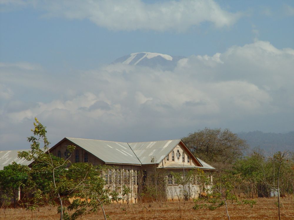
Former blogs about stories that my home tells me: The Schefflera plant that reminds me of having climbed the Kilimanjaro with Ernst and the ebony wood bowls that remind me of the safaris in Tanzania (2006), “Map of Etosha”, Namibia Wildlife Resorts, Honeyguide Publications
Sources: Paula Hardy et alii, “Botswana & Namibia”, Lonely Planet 2007; Daniela Schetar et alii, “Namibia”, Reise Know-How, Markgröningen 2007; Duncan Butchart, “Wildlife of the Okavango, Struik Nature 2000; my own travel report, “Südwestafrika – Zimbabwe, Botswana, Namibia”.


