Kaiseraugst again – the show room under the church St. Gallus

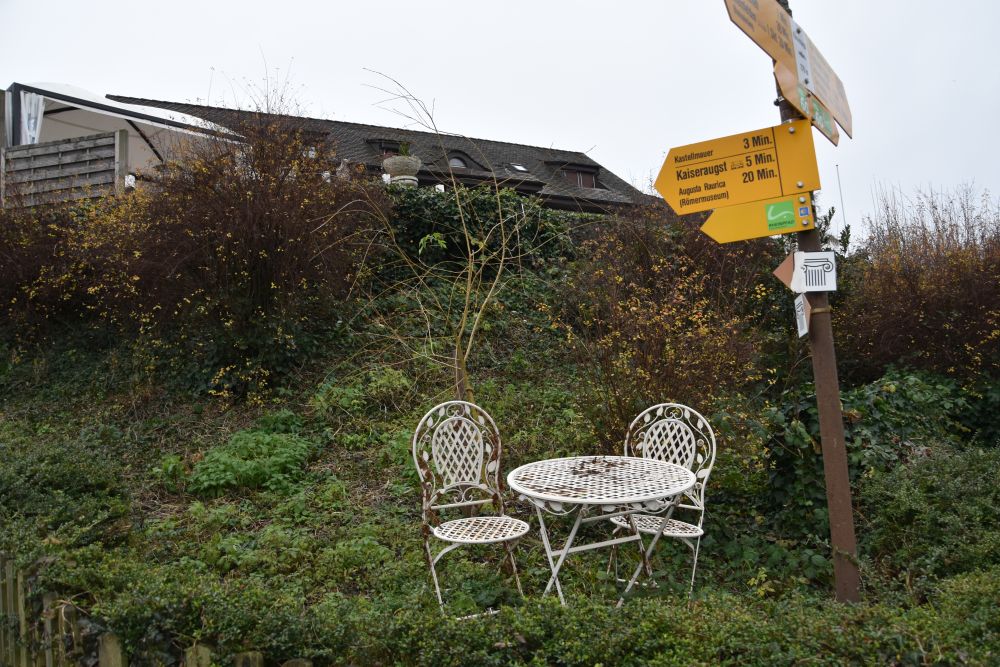
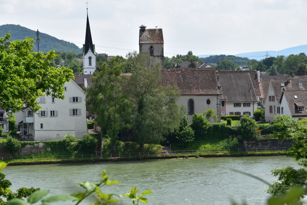
Whenever I return to Augusta Raurica, I find something that is new to  me. Recently I have discovered the Roman sewage channel and nearby the show room under the Church St. Gallus.

It was by looking at the brochure about treasure hunting for children, that I found out about the Roman sewage channel. 

Source: “Finde den Schatz – Schnitzeljagd im Kastell Kaiseraugst”, brochure for children acquired in the museum of Augusta Raurica

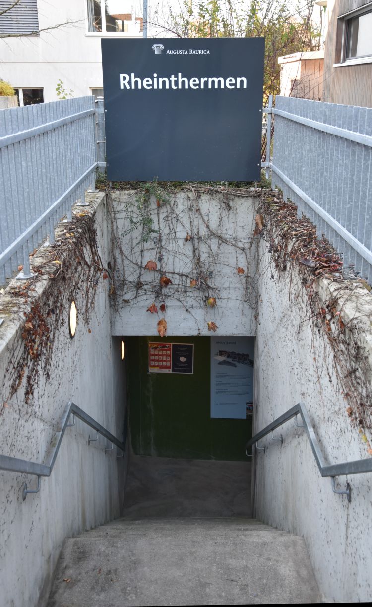
When I visited the sewage channel in June 2021, I also found the entry to the show room with the bath and rests of the church from late antiquity.


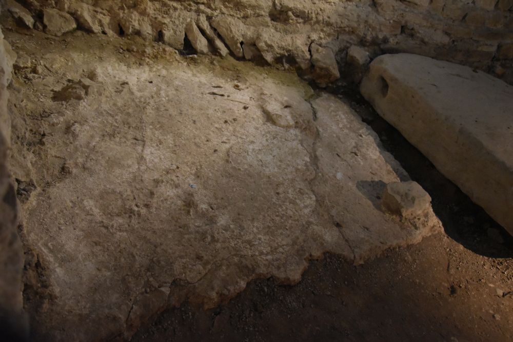
The Roman sewage channel

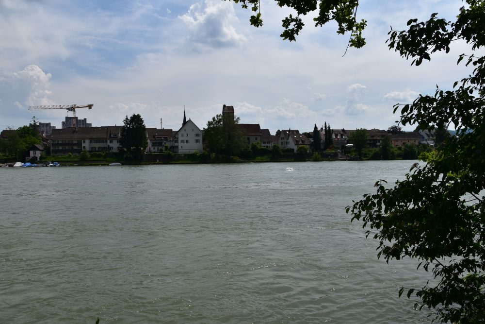
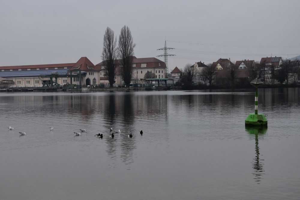
The sewage channel emerges from the fortification wall above the Rhine river, near the church.

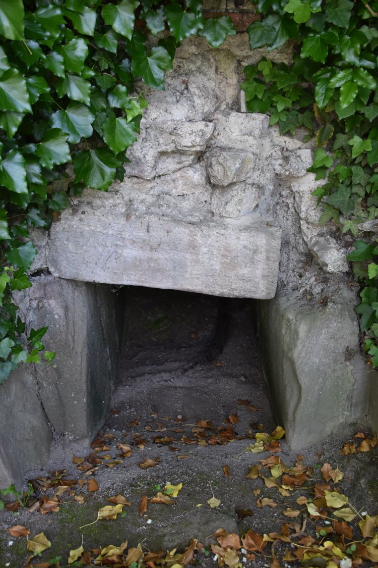
Berger (p. 335) and the panels say that the sewage channel was built for the Roman Castrum in the late 3rd century AD.

In Roman times, the smell might not have been too welcoming  here.

Steps invite visitors. To the left of the sewage channel exit, I see a door. I enter and I am in the show room under the church and under the adjacent church garden.


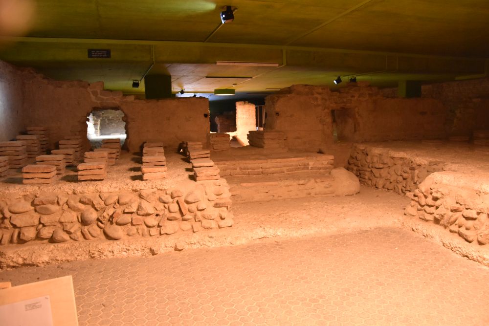
Overview of the show room with bath and remains from early Christianity

On my first visit, I saw just ruins and heard Roman street noise and some church music. I returned later, after having read in Berger (p. 335ff). The following two on site panels help me understand best, what I see: The ground plan shows the area of the show room in faint pink, and the upright projection gives a perspective view of the ruins in front of the “reconstructed” model of the early Christian church from around 400 AD (late antiquity).  

Source: Two panels in the show room (it is amazing, how everything is documented carefully, take your time to go through it).

In the show room we see the private bath (black/red 1-4 and a,b,c) and remains related with the early Christian church St. Gallus and with Christianity (dark blue, 5,6, X; we do not see 7). The sewage channel (purple, 8) runs through the show room, before reaching the exit in the fortification wall.


The bath – the private bath of the bishop?

Why a bath, so close to the church? The panels explain that the bath has been built after 400 AD, when “normal” people could no longer afford a private bath. Perhaps it was the bath of the bishop and of the clergymen (see panel in the show room). This hypothesis is supported by the fact that the early Christian church St. Gallus from the late 4th century AD was large and hence important. If there was a bishop, he would have lived behind the fortification wall on the right hand (western) side of his bath. However, though some sources mention bishop Justinian around 400 AD, the first proven bishop is Ragnacharius around 600 AD (Facciani, p.173 and 178f); it might well be that he moved his seat from the Castrum to Basel. A lot of guessing. What seems pretty sure is that the pool (c) in the bath was not a baptismal font, as some archaeologists suggested earlier. Facciani rejects the hypothesis of a baptismal font based on plausible arguments (Berger, p.337f). For instance, there is no direct access from the church to the font, very impractical. 

This is room number 4. According to the panels it was a corridor; Berger (p.337) says, it could also have been the changing room of the bath, called Apodyterium.

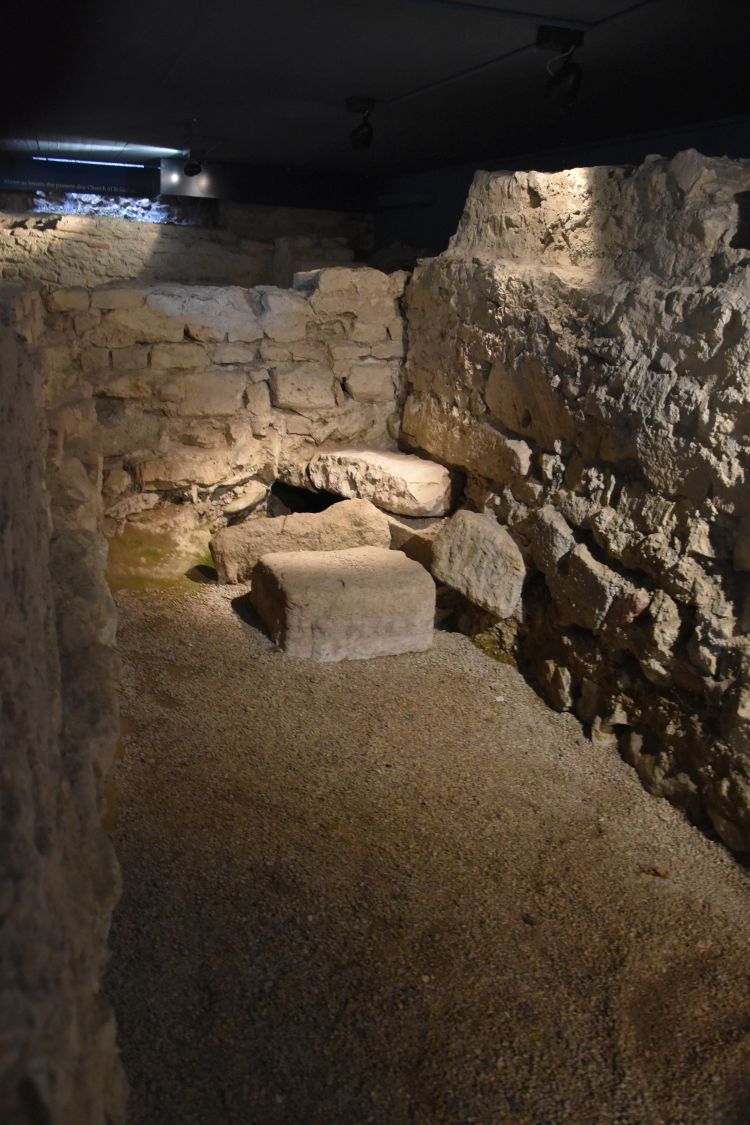
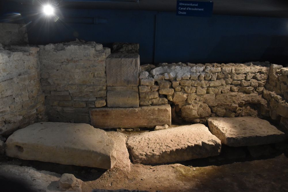
In the corner we can see the sewage water channel (8).

From the corridor (4) people entered the Tepidarium (warm room, 1) using the door marked by the black gate; the threshold (a) has been preserved. Very difficult for me to see the threshold, but I trust the archaeologists.

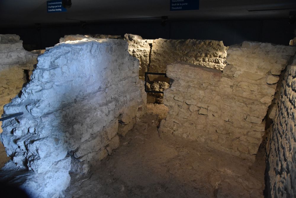
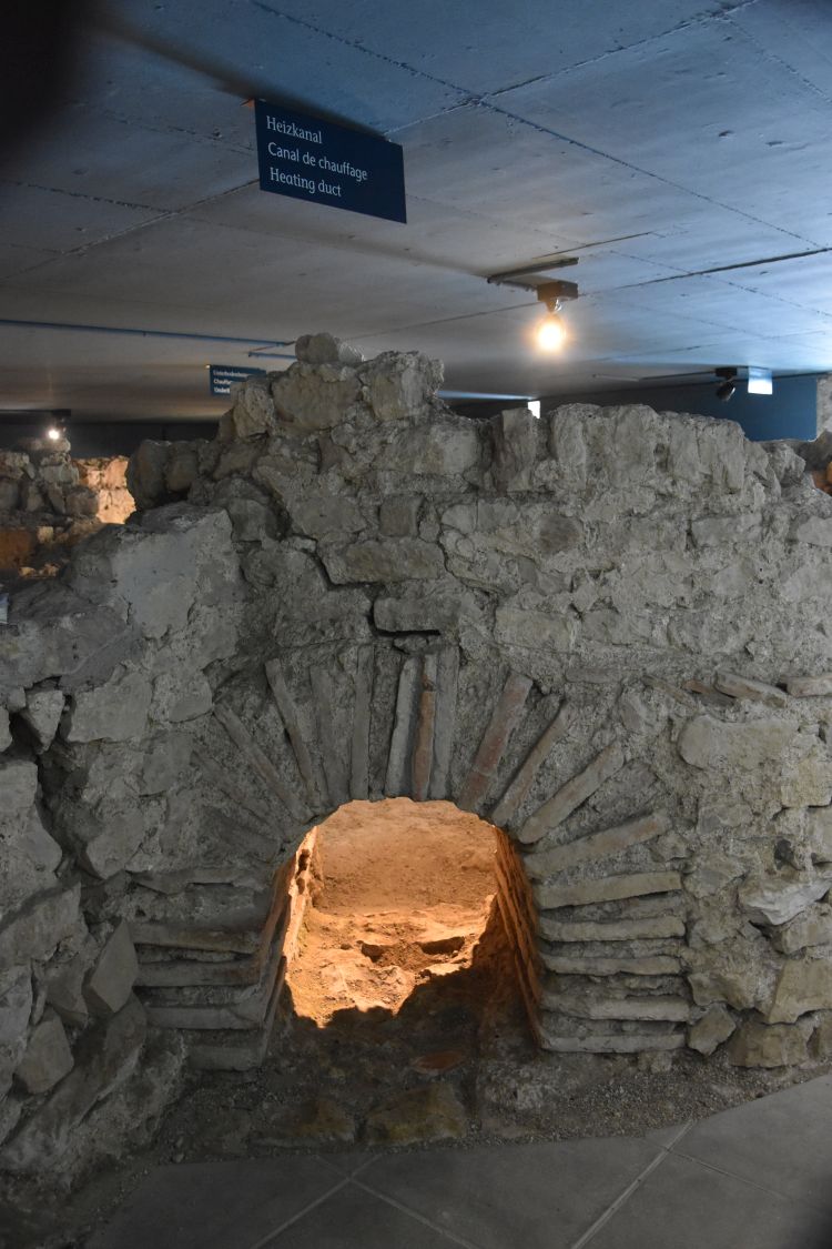
Next comes the Caldarium or hot room (2). Two columns and tubes of the floor heating remain in the right hand edge. As a matter of fact, we stand on the base of the floor heating today; the “real” floor was above the pile of tiles (pilae). 

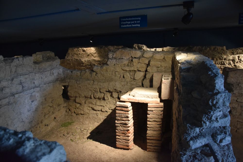
I am puzzled. Only now I notice the labels under the ceiling. So far, I had just looked at the ruins below me and not at the signs above me… 

As the label indicates, we see a wonderfully preserved duct (b) that takes heat from the heating room (Praefurnium) into the hot room (2). I stand, where the heating room must have been before. 

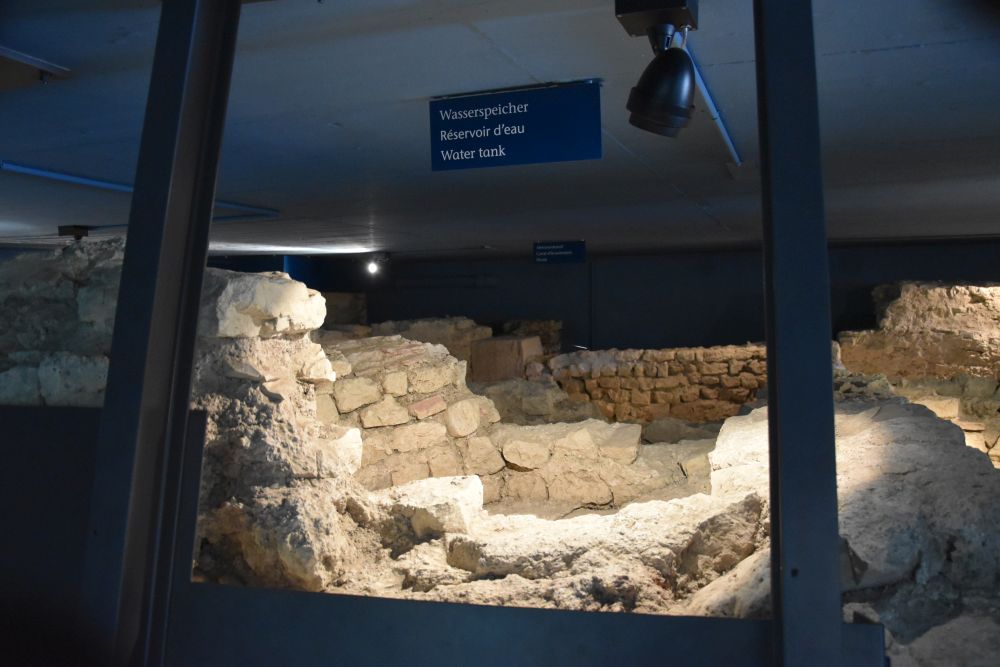
Behind the hot room (2) and the heating conduct (b), there is the water tank or pool (c). There have been debates about this pool that in the 1960-ies was identified as a baptismal font, but this hypothesis was rejected by Facciani later. 


The remains related with the early Christian church

The use of the site as an early Christian church started at the latest after 400 (as the panels say).

This is the northern annex to the apsis of the early Christian church (5). The sewage water channel (8) can be seen here as well. 

Part of the marl ground of the annex has been preserved (see above in the left hand lower corner and below).

From 700 AD onwards, people were buried next to the church. A grave from the 8th/9th century reaches into the show room.

Only now I notice the description on the left hand side. The curators of Augusta Raurica think of everything carefully.


The exhibition on the east wall of the bath (X)

The exhibition on the east wall of the show room explains the early days of Christianity, shows examples of tomb slabs from the necropolis outside the castrum and tools as well as jewellery from early Christianity.

A Christian community existed in the Castrum already in the 4th century AD (The Roman emperor Konstantin had legalised Christianity in 313 AD). Until about 700 AD, the people were buried in the necropolis outside the city. This is one example of a tomb slab from the 7th century, with a cross engraved.

The combined tooth picker and ear spoon with the sign for Christ belonged to a Roman officer (about 350 AD, part of the silver treasure of Augusta Raurica). I imagine him using this tool…


Good-bye Castrum for now

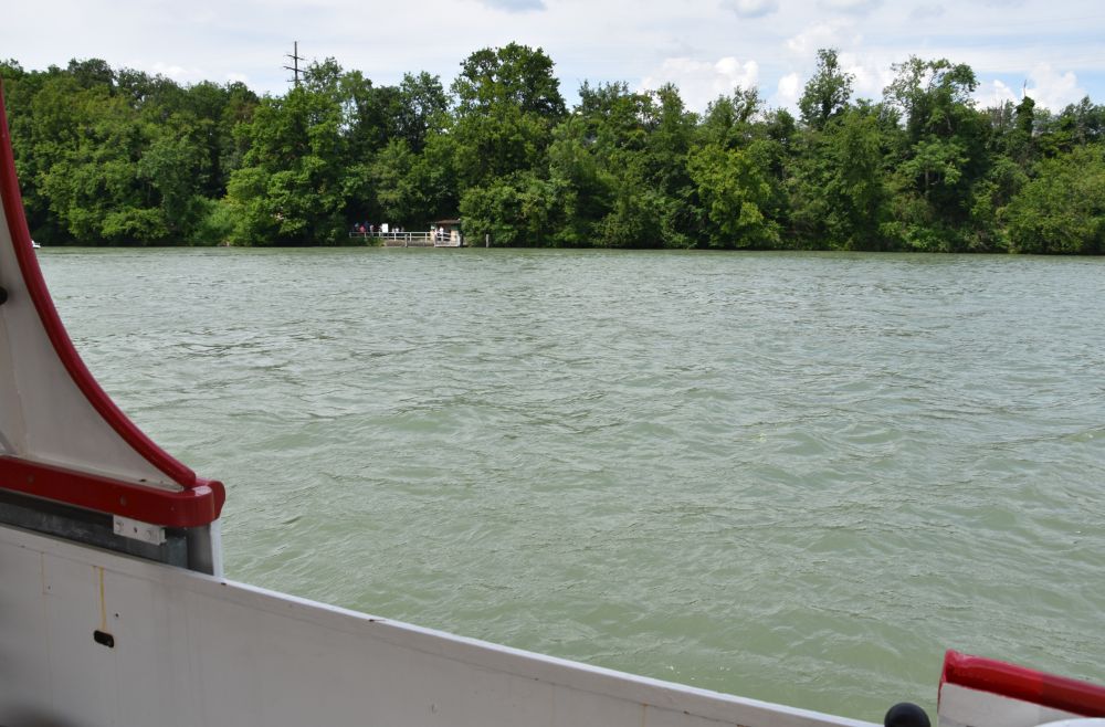
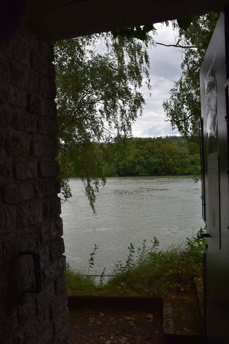
I leave the show room through the door, where the Rhine appears full of water after the heavy rain falls of this summer 2021. 

I feel like reading in Berger about what I have seen. I find a table in the restaurant Adler in the main street of Kaiseraugst. 

The crowned eagle of the Habsburgians decorates the entry, as Kaiseraugst has belonged to Vorderösterreich until the Congress of Vienna (1815).

The meal served at the restaurant Adler is delicious: Risotto with Taleggio cheese and pears and a Greek yoghurt with nuts, figs and honey. Sure, I will return to this restaurant and also to Kaiseraugst and the Castrum.   

We will visit more “remote” sights of Augusta Raurica in my next blog.

Sources:

  • Website of Augusta Raurica
  • “Salve – Plan”, Augusta Raurica 2019.
  • Guido Facciani et alii: “Die Dorfkirche St. Gallus in Kaiseraugst. Die bauliche Entwicklung vom römischen Profangebäude zur heutigen christkatholischen Gemeindekirche”, Forschungen in Augst, Band 42, Augst 2012.
  • Ludwig Berger (Editor), “Führer durch Augusta Raurica”, Schwabe Verlag Basel 2012; contributions by Thomas Hufschmid, Sandra Ammann, Ludwig Berger und Peter-A. Schwarz, Urs Brombach
  • Panels on site in the show room

Around Basel: Augusta Raurica – Castrum or Kaiseraugst – first visits

Kaiseraugst near the Rhine is, where the Roman Castrum Rauracense was established around 300 AD. The people retreated here to withstand the growing attacks of the Germanic tribes from the north. In the charming village centre of Kaiseraugst, we find remains of the Castrum and of late antiquity.


A look at the map to see, where the Castrum is

This is the map of Augusta Raurica, “our” Roman city, with the centre and the more “remote” sights, amongst them Kaiseraugst or the Castrum.  


Source: Tourism map on homepage of Augusta Raurica

The brown line shows the whole city of Augusta Raurica, with the centre (numbers 1-7, e.g. forum, theatre, museum) and the more “remote” sights Kaiseraugst (19-21, baths, castrum wall and church), 10 (craft house), 14-17 (brick manufacture, tomb, east gate, animal park), 18 (cloaca and cellar), 12 (outer amphitheatre) and 11 (Grienmatt temple).

After having looked at the history and legends around Augusta Raurica and after having visited the centre of the Roman city, we next look at Kaiseraugst with the Castrum near the Rhine, leaving other more remote sights for later.


Mouth of the Ergolz, the river that marks the border between the cantons Aargau and Baselland  

After about an hour of cycling from my home, I arrive near the mouth of the river Ergolz. Well, I do not intend to continue to Rotterdam or Nantes, as Eurovelo proposes. Let us start our tour around Kaiseraugst here.

When I am here for the first time, it is November 2020. The school boat is practicing on the Ergolz and on the Rhine.

At this place, the Ergolz is the border between the cantons Baselland (to the west, village Augst) and Aargau (to the east, village Kaiseraugst).

This is the view of the power station in the Rhine; left, the Ergolz flows into the Rhine, and I stand under the golden leaves of an “Argovian” oak tree.

Now I have zoomed in the power station.

The buildings of the power station are in Germany. It is possible to cross the dam to Germany, on foot or by bike. 

The book edited by Berger contains a map that shows three Roman bridges, one of them above the modern power station. Two more bridges crossed the Rhine, where Kaiseraugst is located today.  

I walk through the park along the Rhine. Now, in November, it is in hibernation, the benches are being overhauled. This bench says: “I am under renovation and will appear shining all new in two months time.”

Also the swimming pool near the camping site is awaiting the next summer.

Where the park ends, I start my round tour to the Roman past. The Roman sights are well marked.

I have to follow the column with the brown arrow to discover the Roman Castrum.


Part of the defensive Castrum walls has been preserved (see map #19)

The western defensive walls of the Roman fortress or Castrum have been preserved. 

We can see the layout of the Roman western gate on the pavement. The main street of the modern village centre of Kaiseraugst starts here, and this was also the main street of the Castrum.

The panel provided by the Augusta Raurica Foundation shows, what the Castrum might have looked like with the western gate (left) and the surrounding wall and ditch. 

The Thermae or Rhine Baths are highlighted on this panel.


Thermae or the Rhine Baths, where the Romans met (20)

What looks like the entrance to an underground garage behind the community centre is the access to the Rhine Baths (Thermae). 

Under the ground, the bath rooms have been preserved, some cold, some warm, and one hot. I stand on the base of the floor heating (hypocaust). We cannot see the heated “real” floor, where the Romans walked. It has disappeared.

The panels explain that in the warm or tepid rooms, the Romans would sit, chat, have light meals and play games. 

The vitrine explains that wooden sandals were needed to walk in the hot bath – here, the floor was hot!

I wonder, how well I would have seen my hair in this mirror to fix the hair pin. 

It is amazing, with how much care the baths have been set up to give the visitors a picture of Roman life. The access to this gem is free.


The village church St. Gallus (see map #21) – early residence of the bishop of Basel?

So far, I had never taken notice of the church St. Gallus at Kaiseraugst. Now I discover it with Guido Facciani. On the cover page of his document, he shows, how the building evolved from Roman times until today. In Roman times, it was a profane building, then it became a meeting hall with an apse that, probably in the 4th century, was remodelled to become the first church (Facciani, p. 149/173). I always admire, how archaeologists can read ruins. 

Some say that the church St. Gallus was the seat of the bishopric “Raurica”. However the existence of the bishop mentioned for the 4th century, Justinian, cannot be confirmed (Facciani, p. 173). The first proven evidence of a bishop goes back to 600 AD: Sources mention Ragnacharius as the bishop of Augustudinae et Basiliae (Facciani, p. 178, Vita des Eustasius). Facciani suggests that Ragnacharius started his mandate at the Castrum Augusta Raurica/Kaiseraugst and then moved to Basel (Facciani, p.179).

Facciani found evidence of an early Romanic church built in the 10/11th century (Facciani, p.180). The church was rebuilt again in the 14th century (after the Basel earthquake, Facciani, p. 183). The tower has been preserved from that time.

In the 18th century, the church was renovated adding baroque elements (Facciani, p. 185). Is the “undulating” gable of the nave not almost too graceful above the bricks marking the edges of the nave and being so close to the tower from the 14th century?

By the way, the baroque façade is inclining towards the Rhine, as the ground is sinking here.


Why is Kaiseraugst called Kaiseraugst?

I had always wondered, why Kaiseraugst is “Kaiser”-Augst or “Imperial”-Augst. Perhaps due to the Roman emperors? No, it is due to the Habsburgians. They were emperors or “Kaiser” and they acquired Kaiseraugst in 1442 to become part of “Fore” Austria (Vorderösterreich). In the Congress of Vienna (1815), Kaiseraugst became part of the canton Aargau and Switzerland. Across the Ergolz is “plain” Augst that had been acquired by Basel and now belongs to the canton Baselland.  


Fortification to protect the bridge (22)

I am back in June 2021. The ferry across the river Rhine runs. In his work life, the captain headed cargo ships between Basel and Rotterdam. Now retired, he still works on the river Rhine managing and running the ferry of Kaiseraugst. He even offers Fondue evenings on his boat. Very creative. I might consider that.

We enter the ferry and ride to the German side of the Rhine, where the Romans had built this fortification to protect their bridges across the Rhine. 

Remains of the three northern towers (inland) can still be seen, the territory above the Rhine collapsed.

A signpost guides us to the remains of the fortification called “Römischer Brückenkopf”.

We follow the small path and find the three towers amidst trees and bushes. This is one of them.

Through the trees, we can see Kaiseraugst and the Saint Gallus church. Storks are breeding in the nest on the church tower.

Having returned to the Swiss side, we admire the white swans that do not take any notice of us.

They are cleaning their feathers, how beautiful. 

Let us return to Kaiseraugst to visit the show room between the church St. Gallus and the Rhine in the next blog. 

Sources:

  • Website of Augusta Raurica
  • “Salve – Plan”, Augusta Raurica 2019.
  • Guido Facciani et alii: “Die Dorfkirche St. Gallus in Kaiseraugst. Die bauliche Entwicklung vom römischen Profangebäude zur heutigen christkatholischen Gemeindekirche”, Forschungen in Augst, Band 42, Augst 2012.
  • Ludwig Berger (Editor), “Führer durch Augusta Raurica”, Schwabe Verlag Basel 2012; contributions by Thomas Hufschmid, Sandra Ammann, Ludwig Berger und Peter-A. Schwarz, Urs Brombach