On the road through the Pyrenees: Coll d’Ares and around

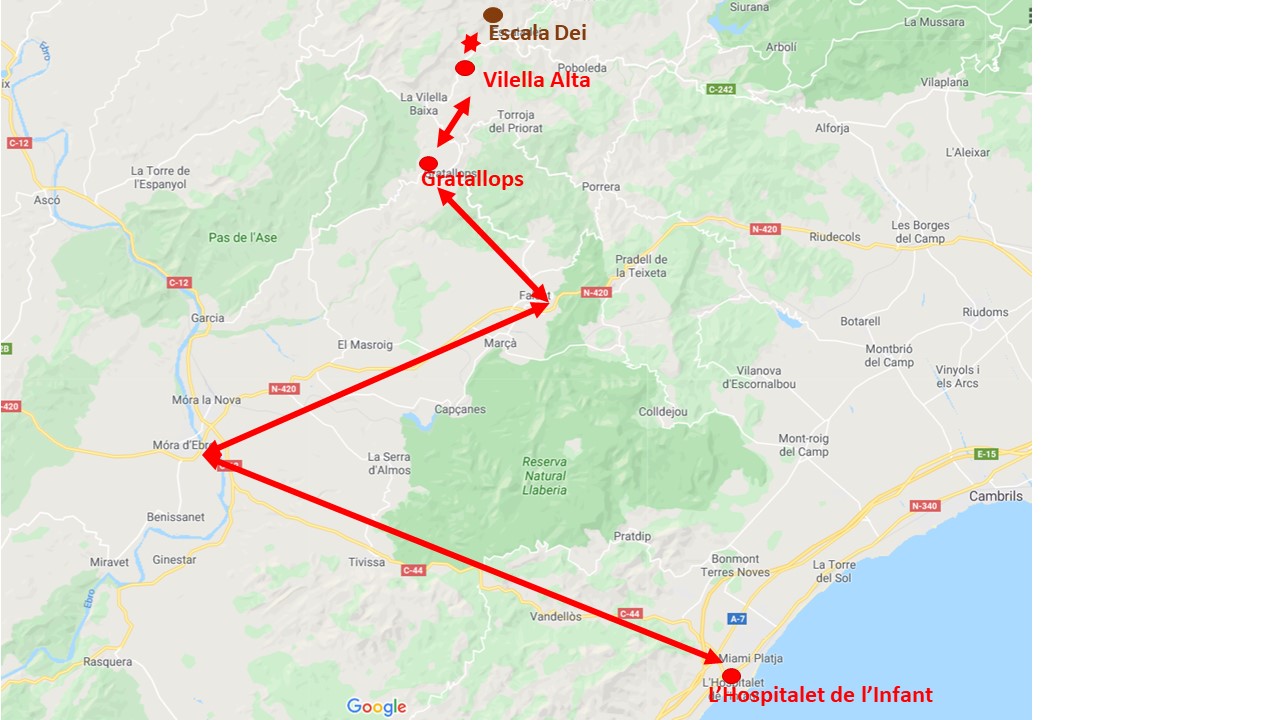
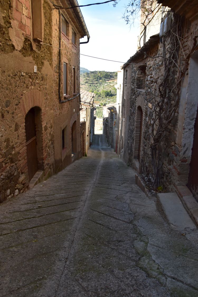
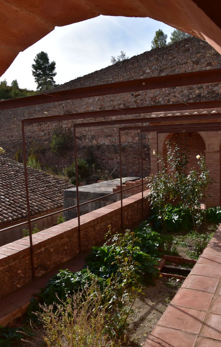
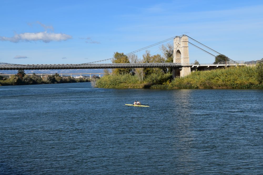
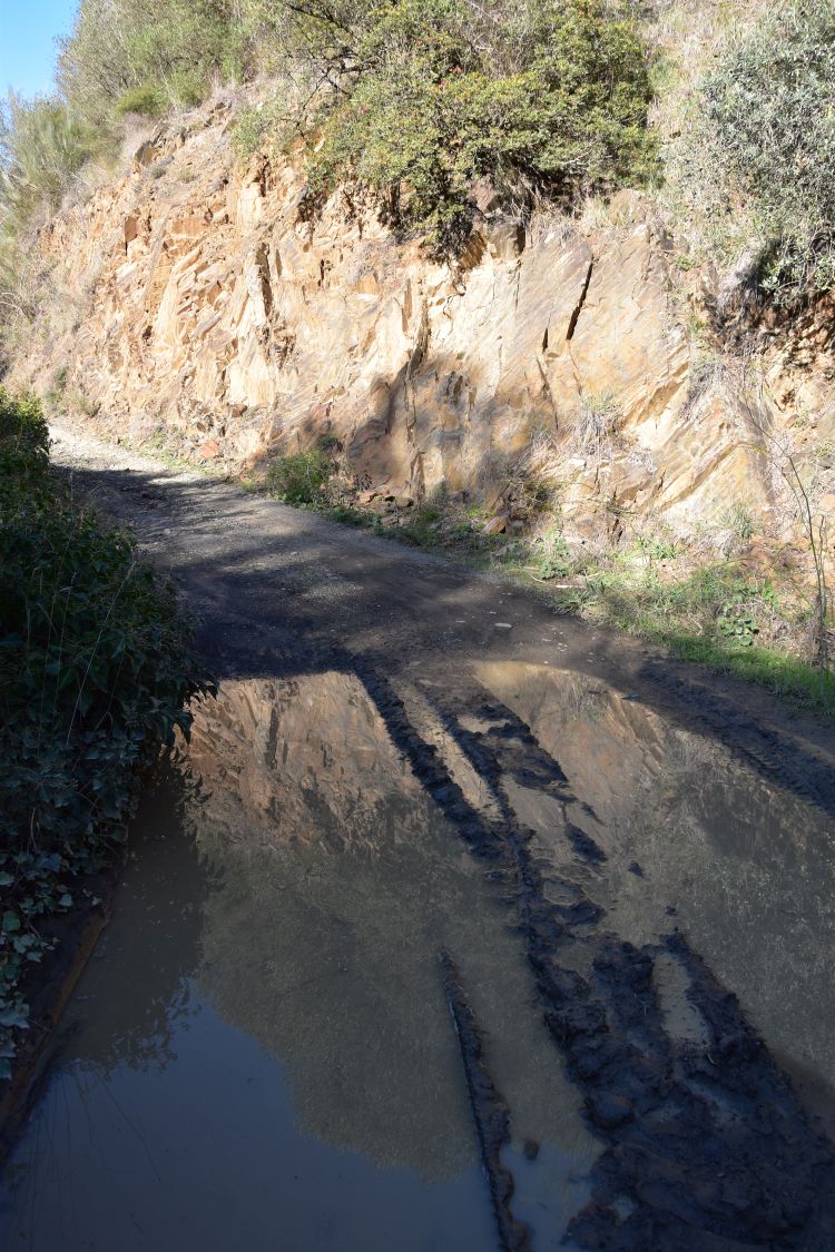
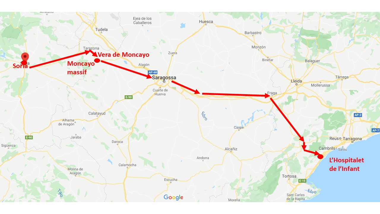
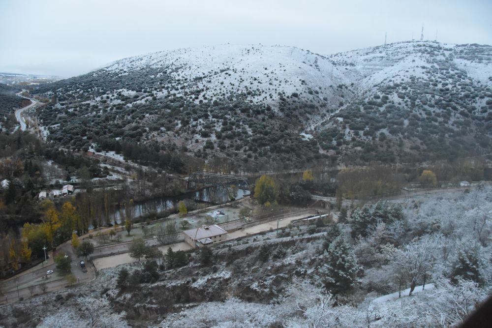
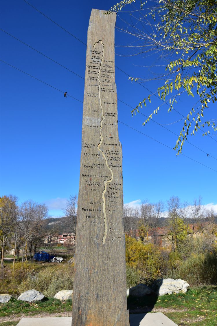
It is November 2019. After having spent two weeks in the appartment of our friends in L’Hospitalet de l’Infant, we now return to Switzerland. Our first overnight stop will be in Narbonne and we take the route along the river Ter to the Coll d’Ares. It is our third time here; we have crossed the Coll d’Ares in November before, in 2016 (fog on the pass) and in 2017 (Ripoll and Prats-de-Molló, view of the Pyrenees). In 2019 we see St. Joan de les Abadesses. And we know, there will be more to explore along this route.
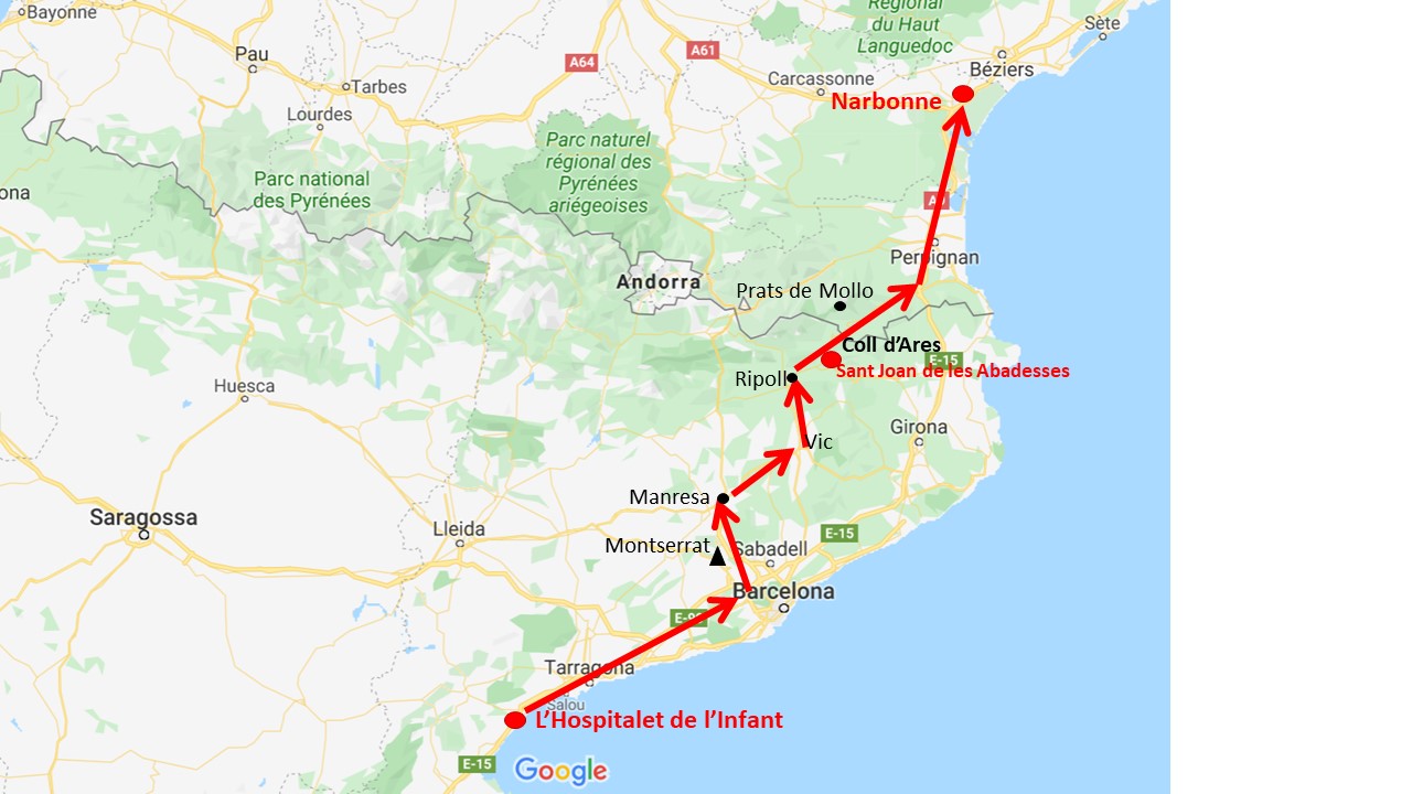
Source: Googlemaps


Coll d’Ares – now our third time – we were here in the fog in 2016, in sunshine in 2017 and now, 2019, again

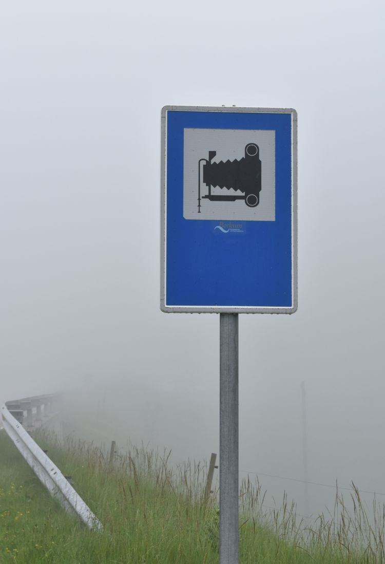
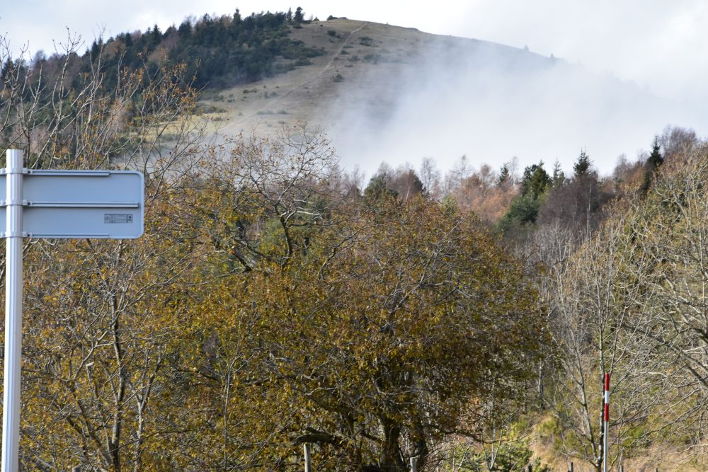
In November 2016 there was fog on the Coll d’Ares.

This viewpoint is recommended to photographers. In 2016, there was not much to see, let alone to take a picture of – except the sign in the fog.

End November 2017 we give the Coll d’Ares a second try. The viewpoint is no longer in the fog and we can see the pass height behind the hint to photographers.

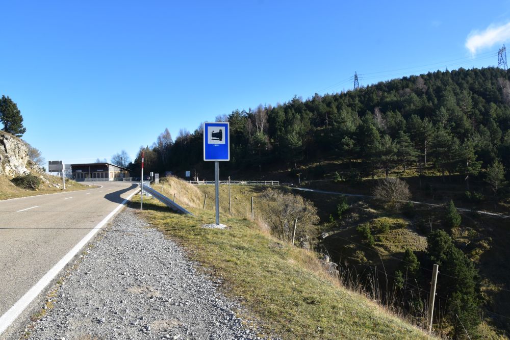
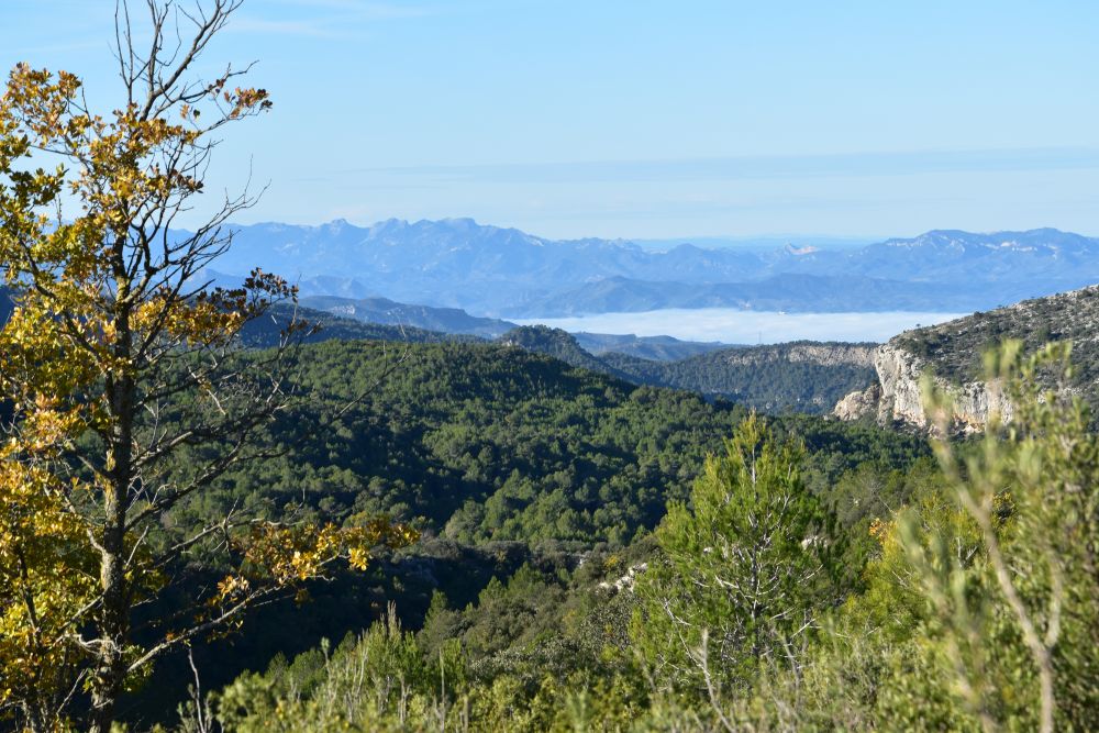
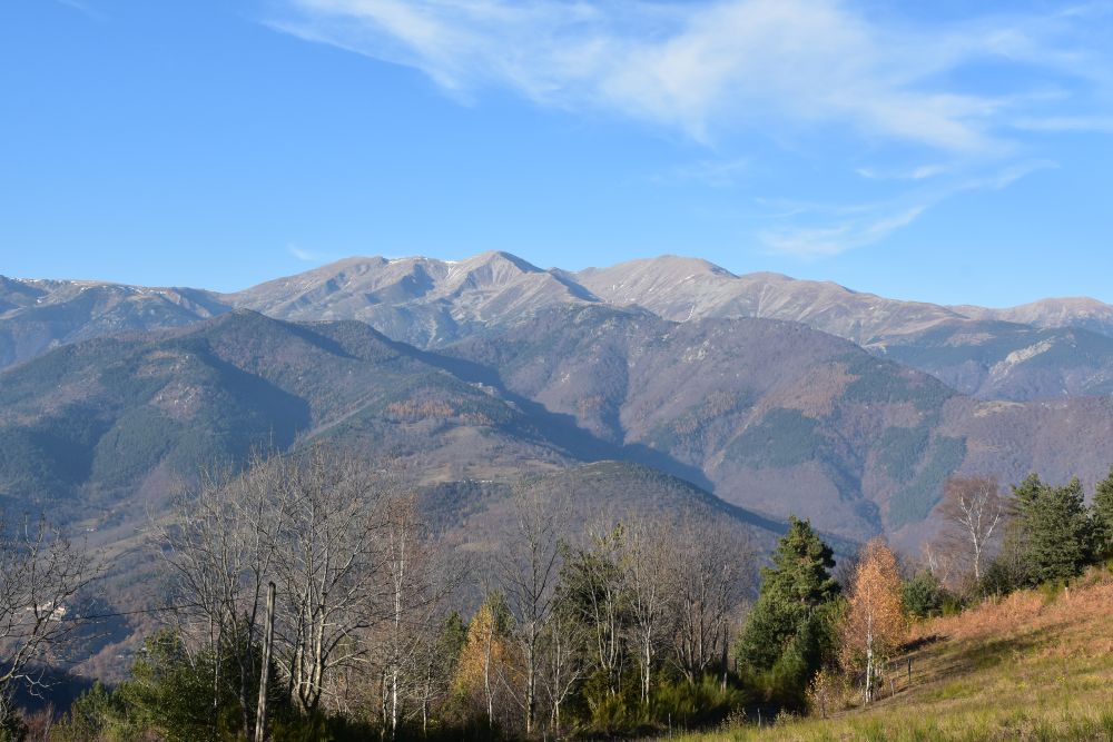
From the hint for photographers, there is a great view of the Spanish-Catalan Pyrenees…

… with the great late autumn/early winter atmosphere.

Also on the French side, the trees shined yellow…

… and we could see THE mountain of the Catalans, the Canigou.

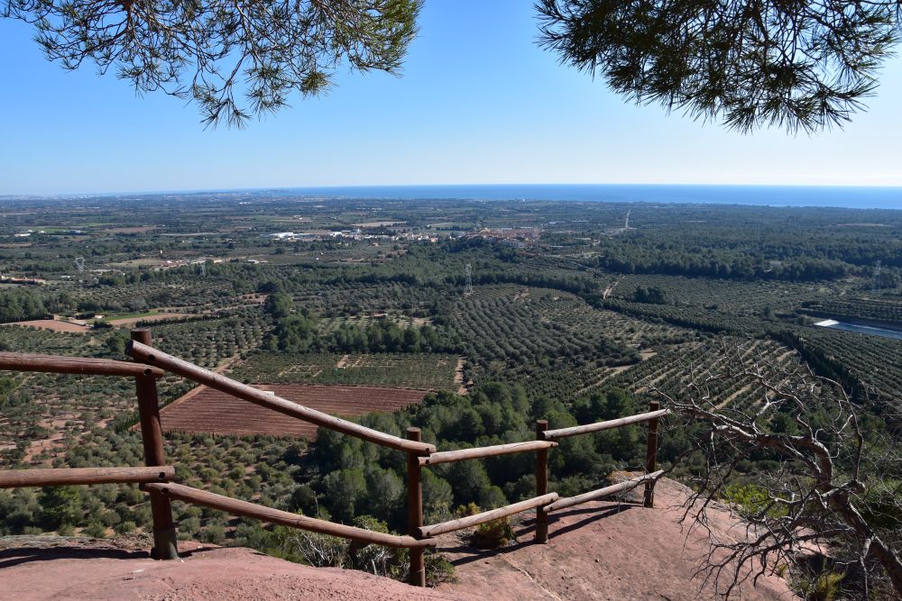
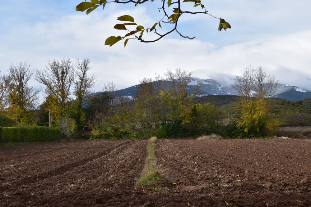
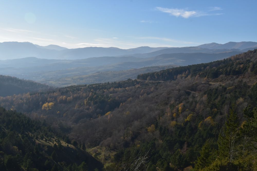
Now, end November 2019, on our third tour to the Coll d’Ares, we again have a good view of the Spanish Pyrenees south of us,…

… while clouds are coming in from the north, from the French-Catalan side.

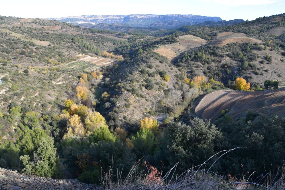
Let me now tell you about Ripoll and St. Joan de les Abadesses south of the Coll d’Ares, in Spanish-Catalonia and then let us turn to the north, to the French side of Catalonia with Prats-de-Molló.


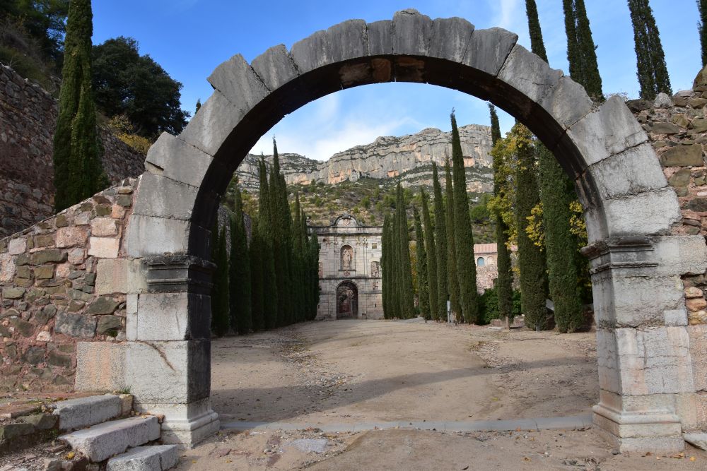
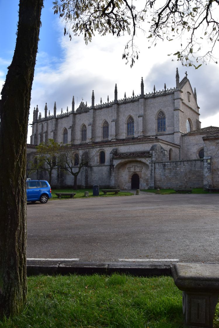
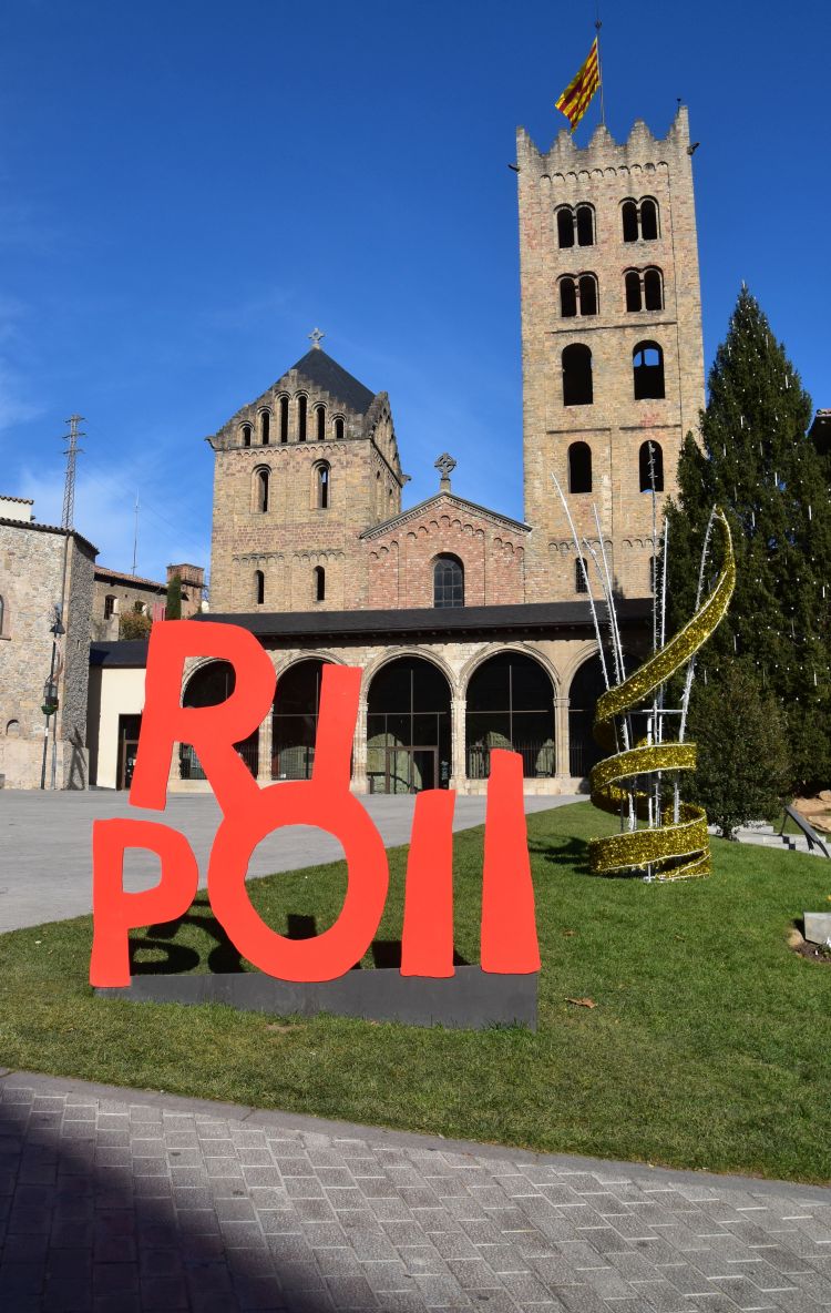
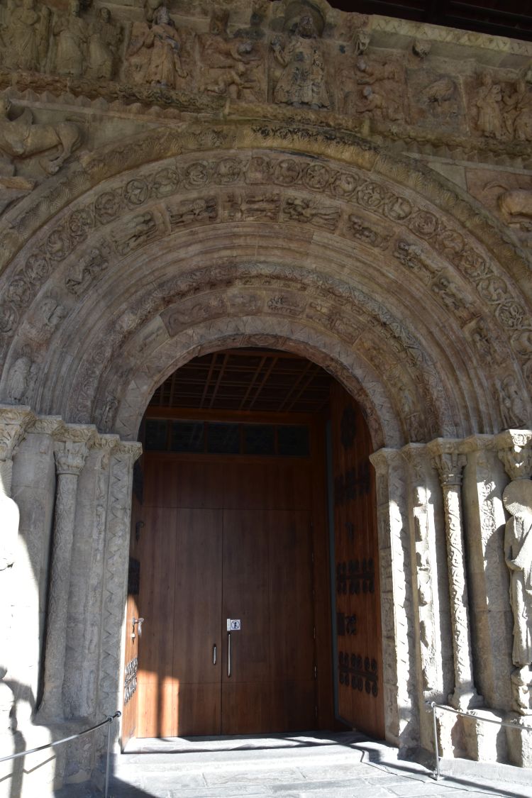
South of the Coll d’Ares: Ripoll with its gorgeous portal of the monastery church, explored in 2017

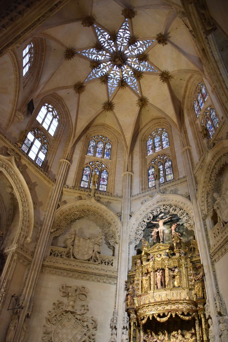
In 879 Duke William the Hairy (Guifré el Pelos) founded the Benedictine monastery Santa Maria de Ripoll, after having conquered the area from the Moors. William was then buried here. Soon a town emerged around the monastery. Around 1000 AD, it was an important intellectual centre of Catalonia, with the support of the famous abbot Oliba who took new ideas about the architecture of churches from Rome back to Catalonia. He had the church of Ripoll built by the model of early Christian Saint Peter of Rome. An earthquake in 1428 (terratrèmol de la candelera) destroyed the church and the monastery. In 1835 revolting people looted and burnt it.

Around 1895 the church was reconstructed in historicized style. I like the sober atmosphere of the Neo-romanesque nave.

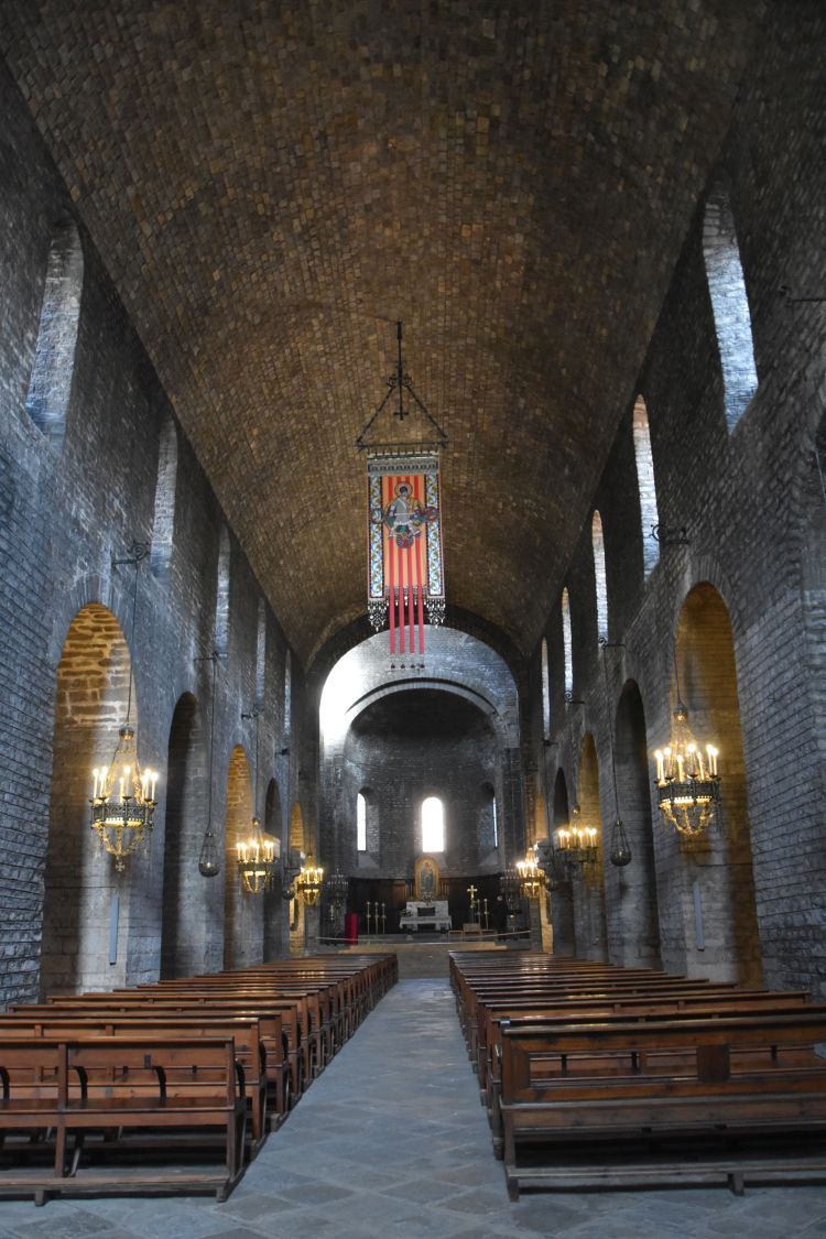
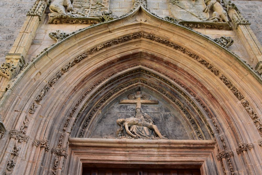
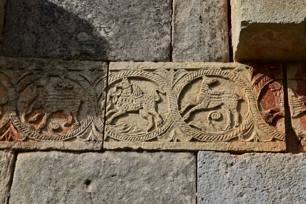
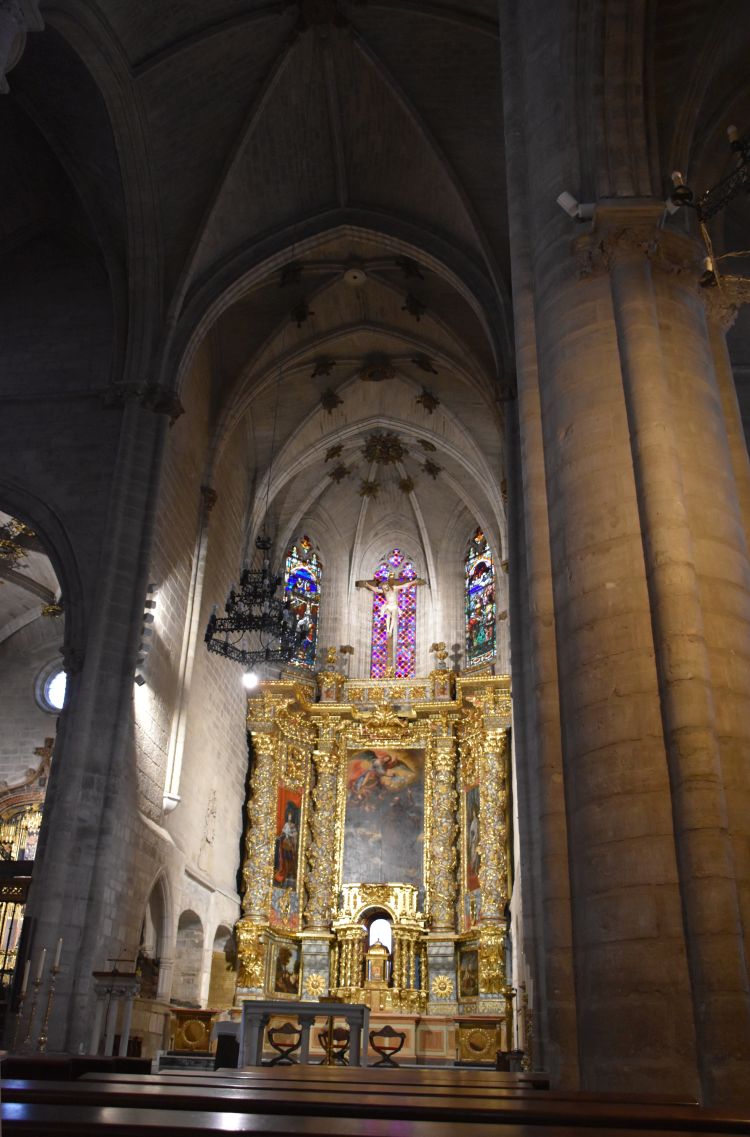
Fortunately the magnificent Romanesque west portal from the 12th century has been preserved. It is now protected by a narthex. Bongässer (p.44) says that this bible in stone is unprecedented. Not only the portal, but also the flanks are covered with sculptures referring to the Old and the New Testament, with Christ as Pantokrator above the arch of the portal. As it was in the 12th century that the south of Catalonia had been reconquered, Bongösser thinks that this portal expresses the triumph of Christianity.

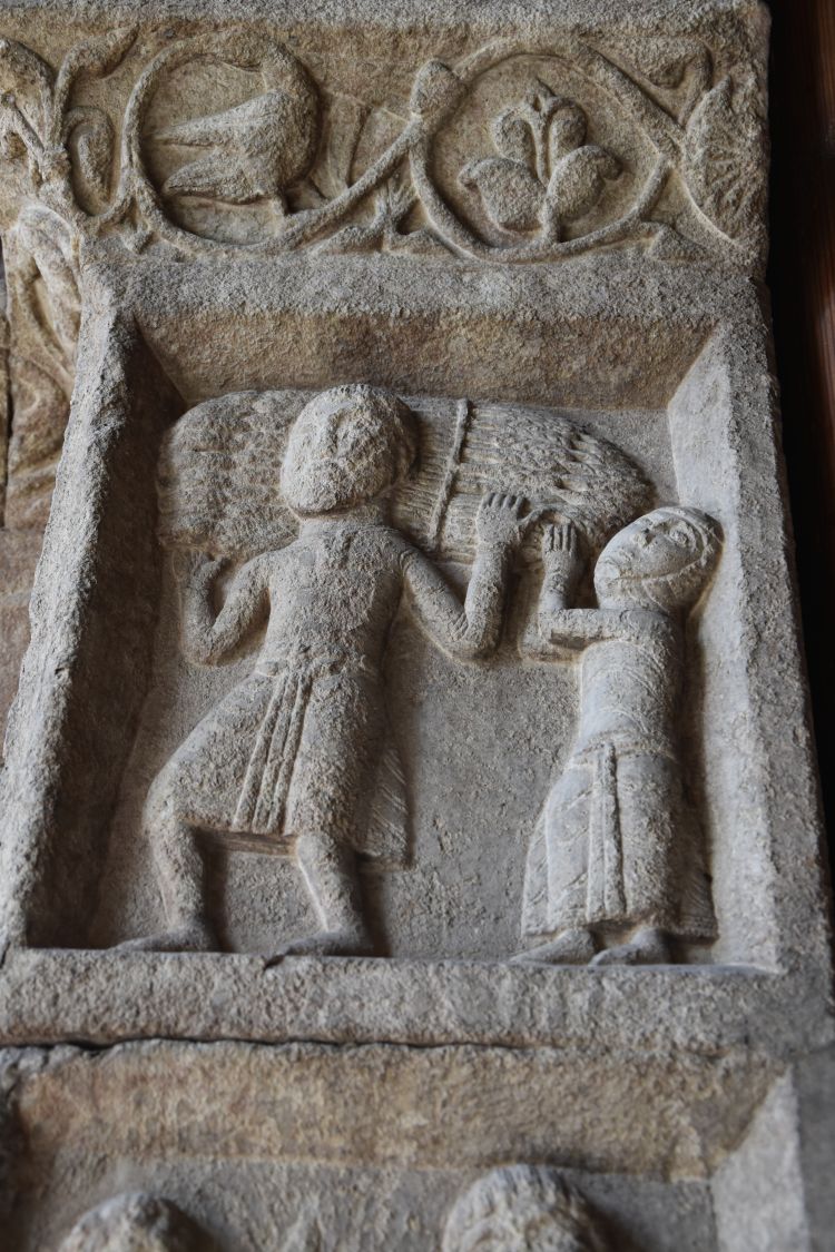
From the series of monthly pictures showing the cycle of the year I like the harvesting of corn…

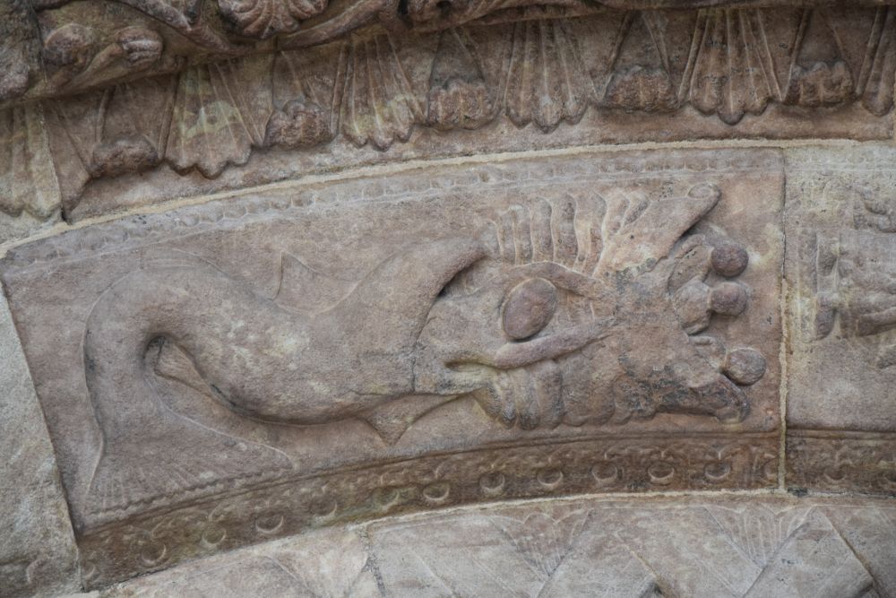
… and from the bible scenes this striking Jonas being spat out by the whale.

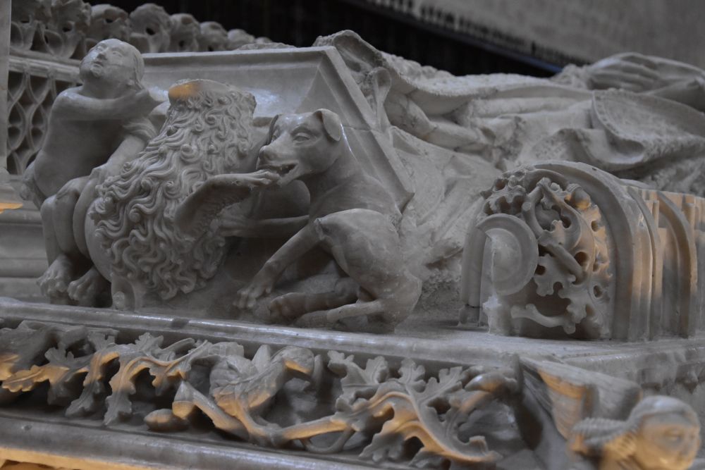
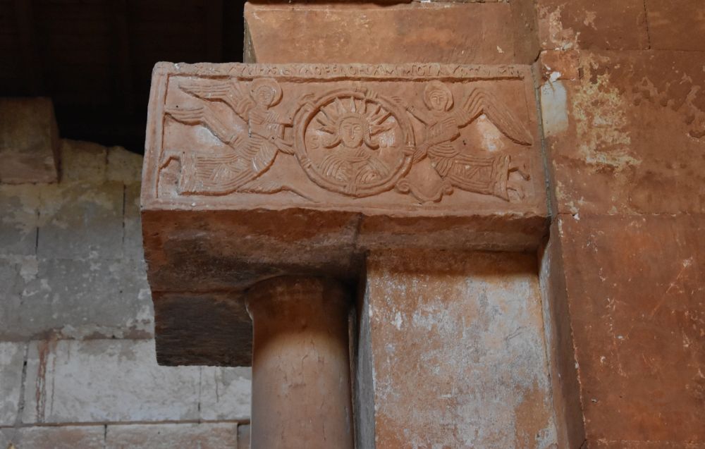
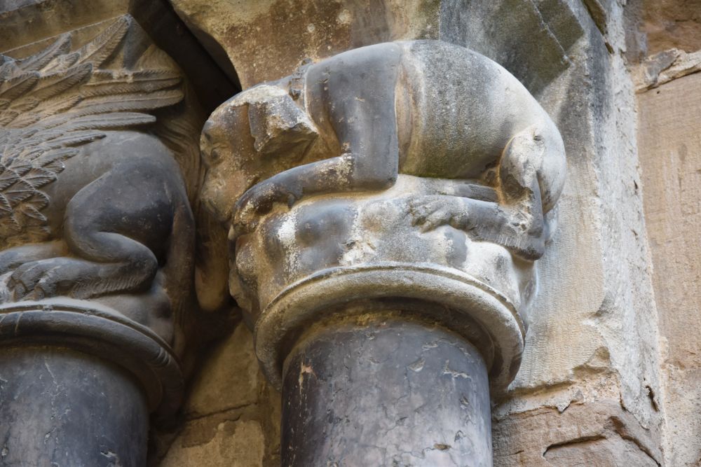
In the cloister with the ground level dating from the 12th century, many of the capitals are well preserved and…

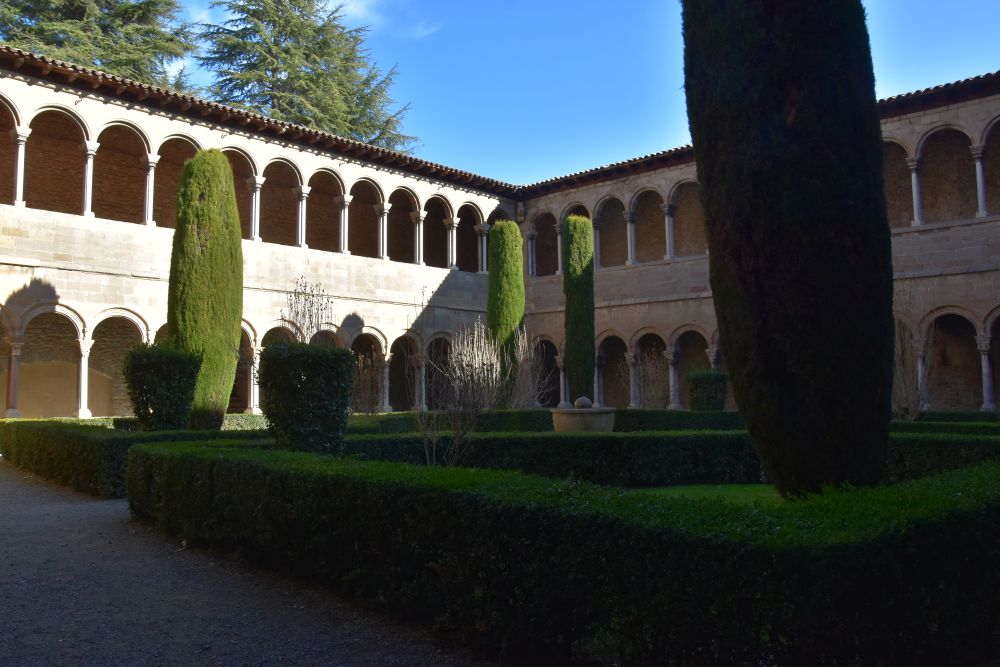
… from the animals found here, this dog is my favorite.


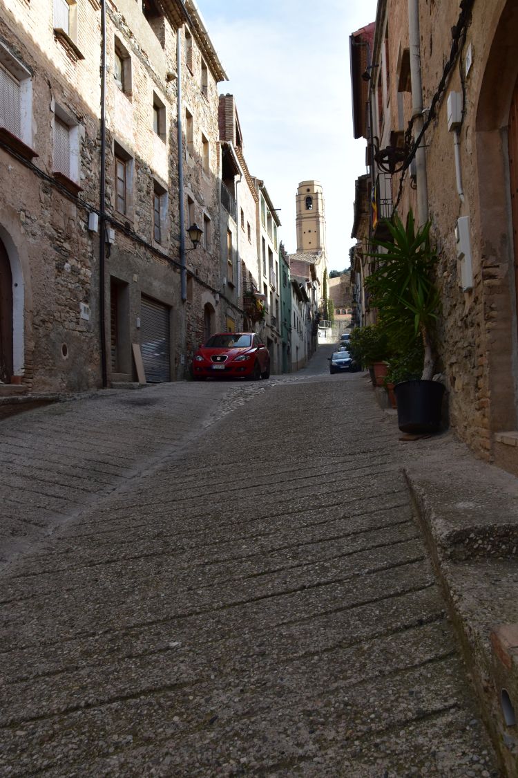
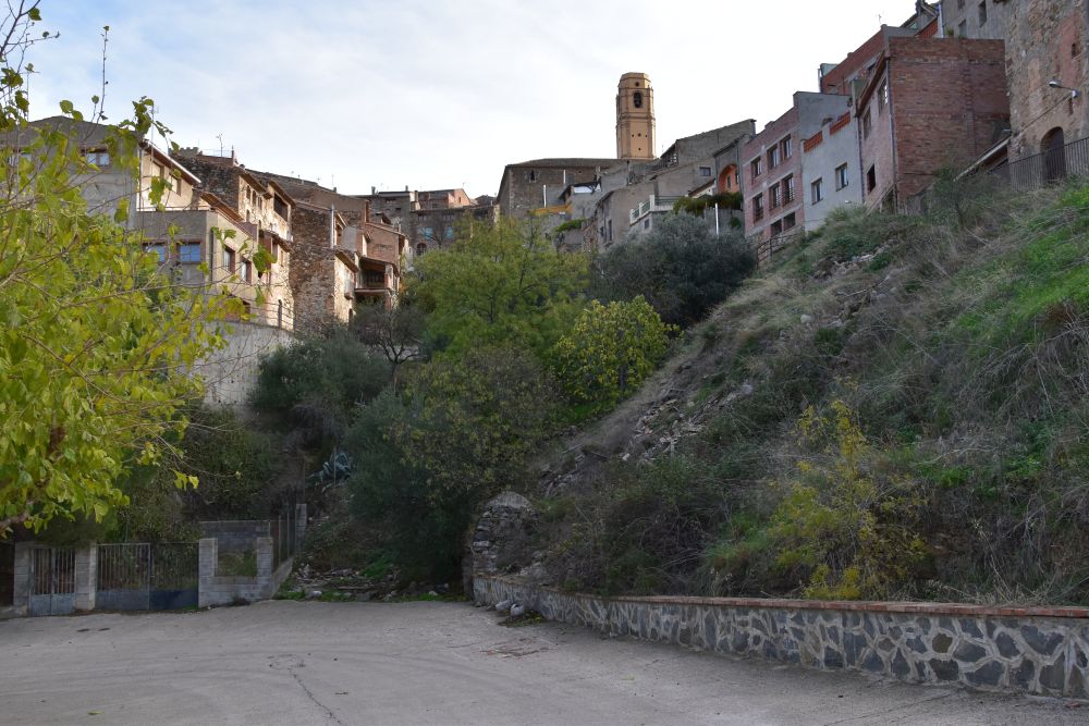
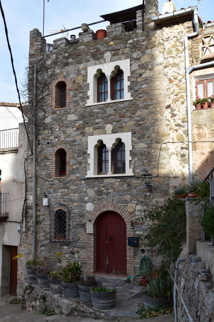
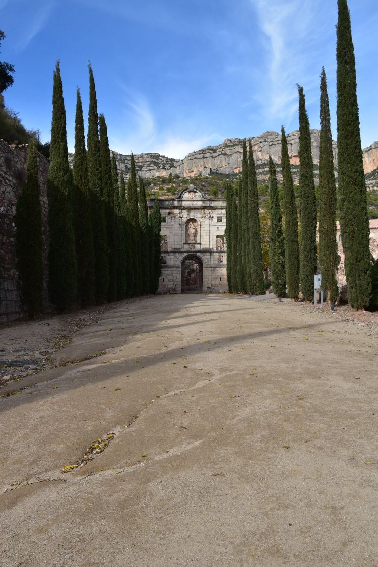
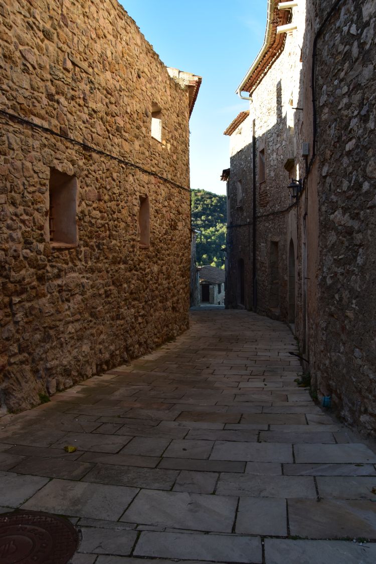
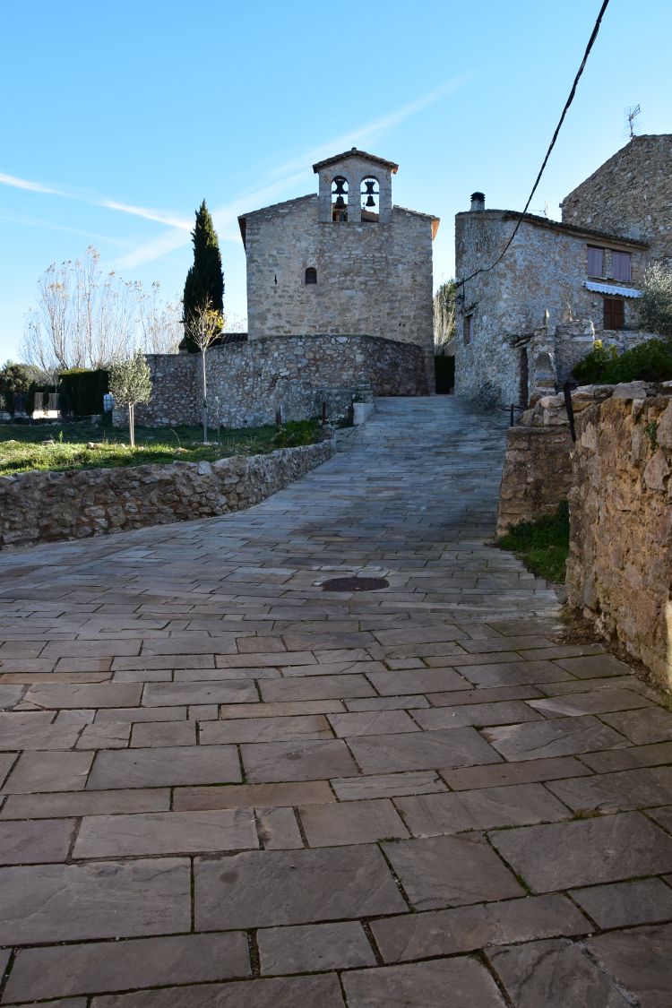
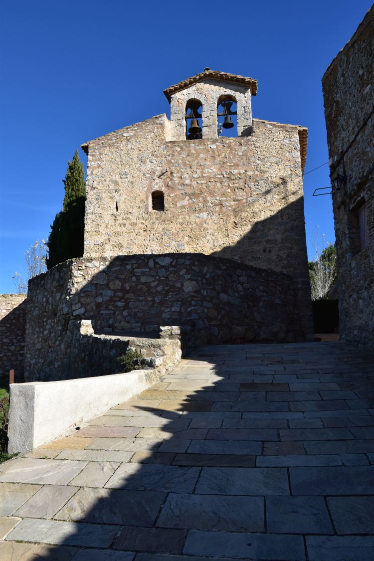
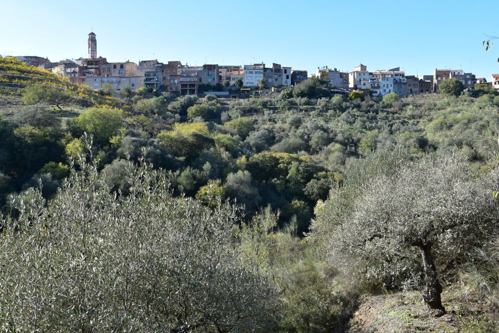
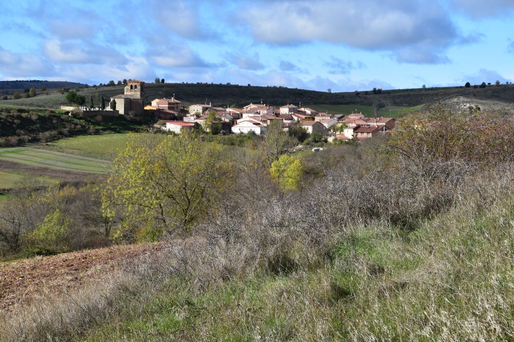
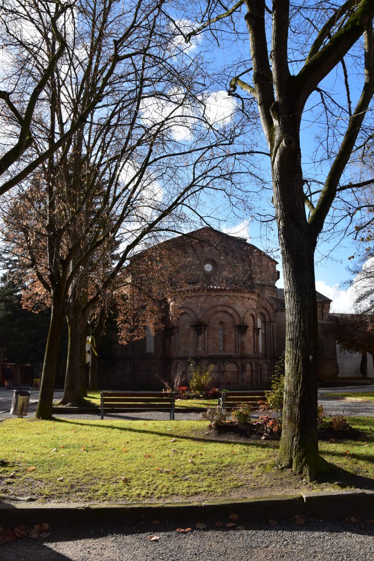
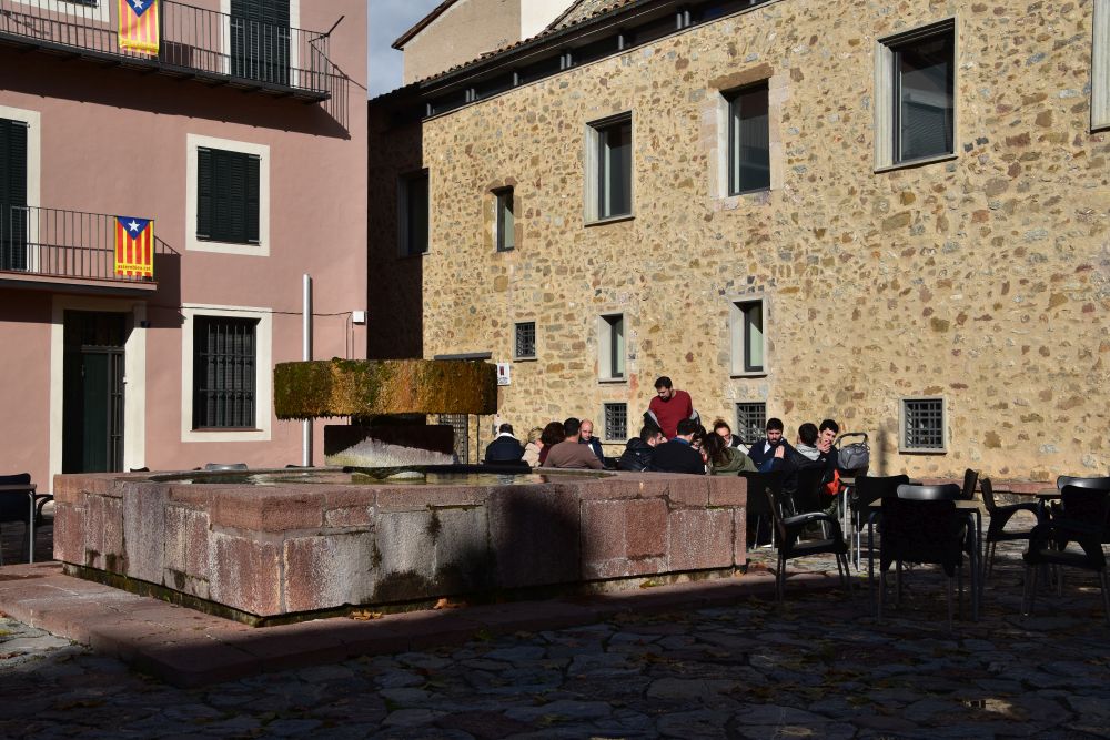
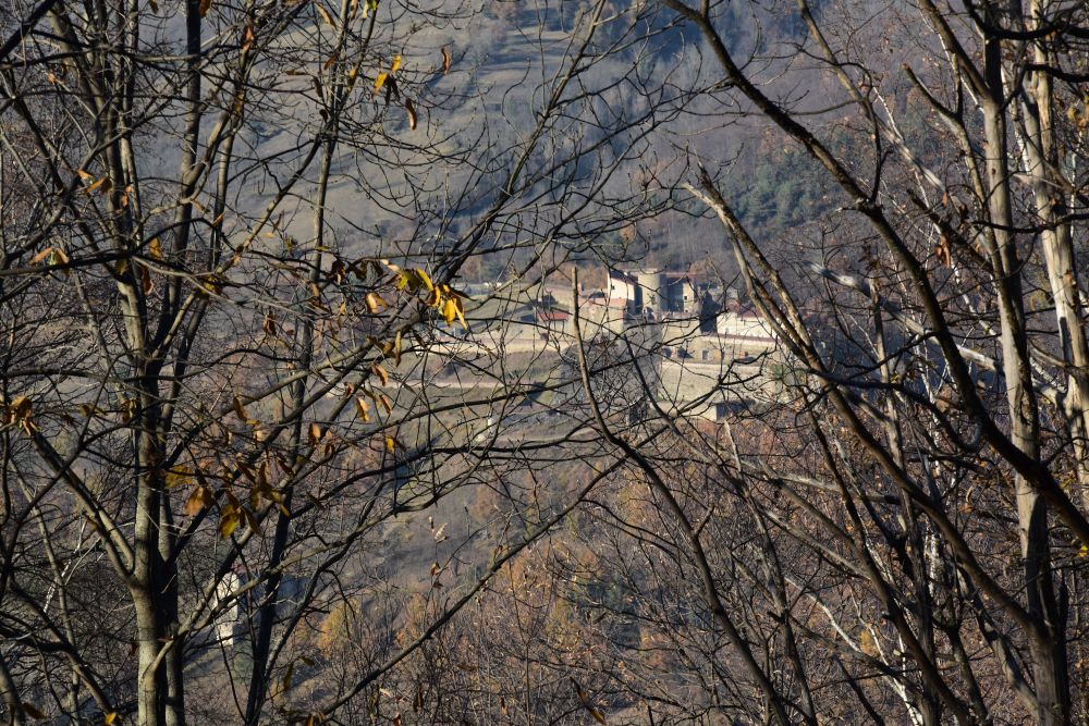
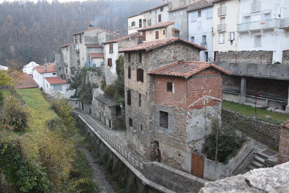
Also south of the Coll d’Ares: St. Joan de les Abadesses, Romanesque church and welcoming mountain village (2019)

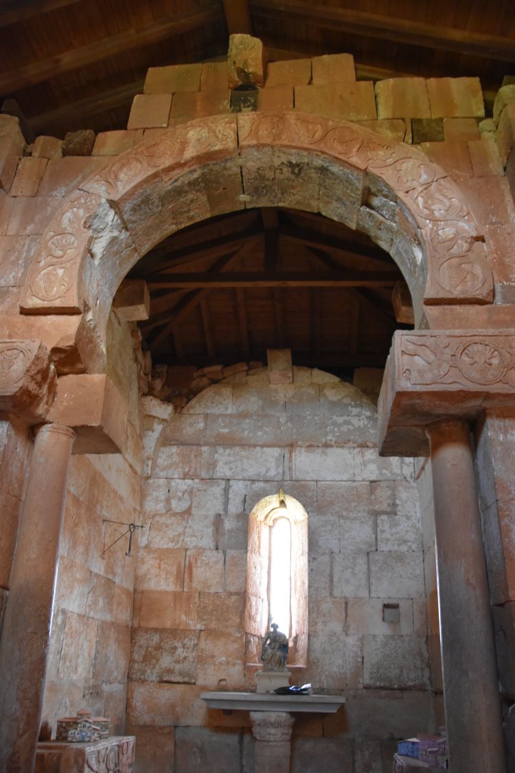
In November 2019, we have a short break in the mountain village St. Joan de les Abadesses. We find the Romanesque church with the same name.

Some capitals around the choir are preserved. The Dumont says that they take up islamic patterns from southern Moorish Spain.

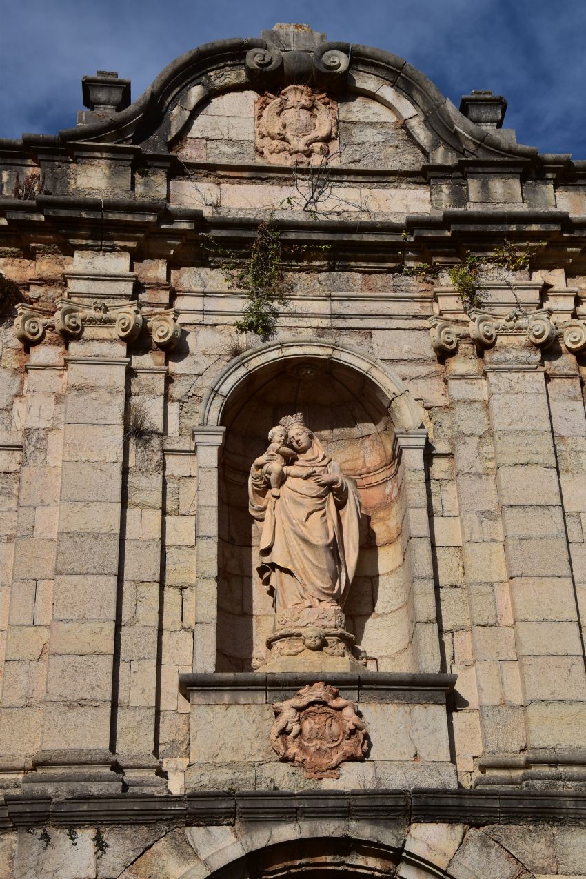
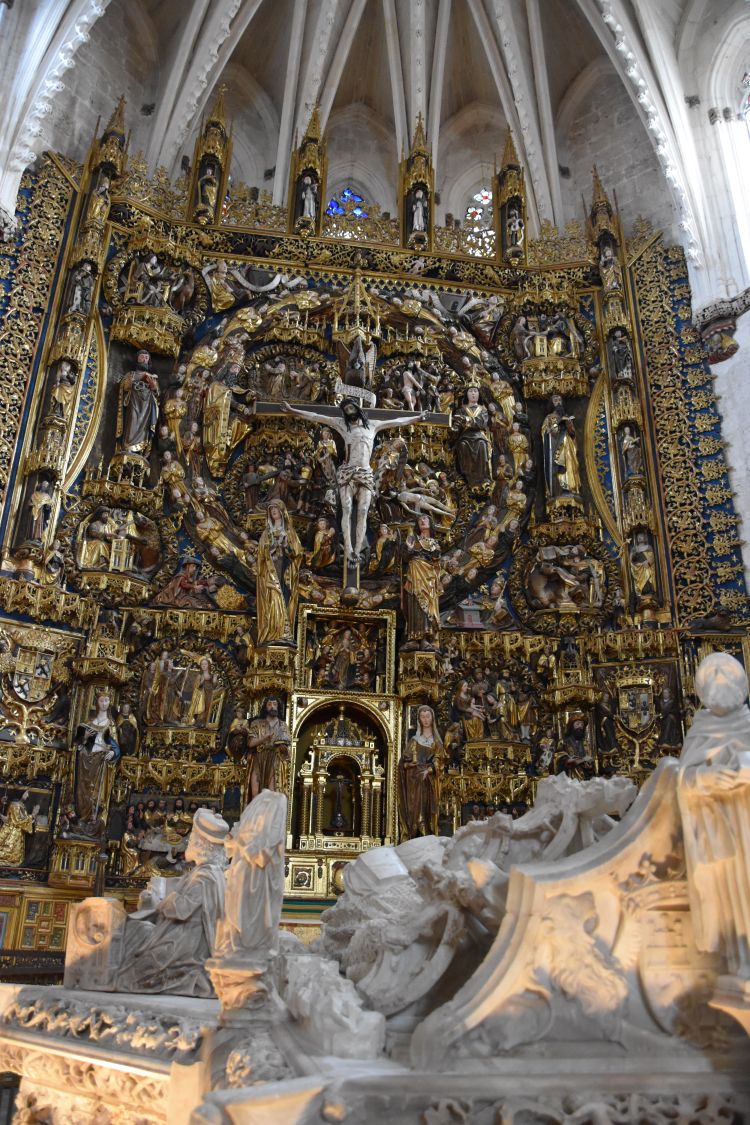
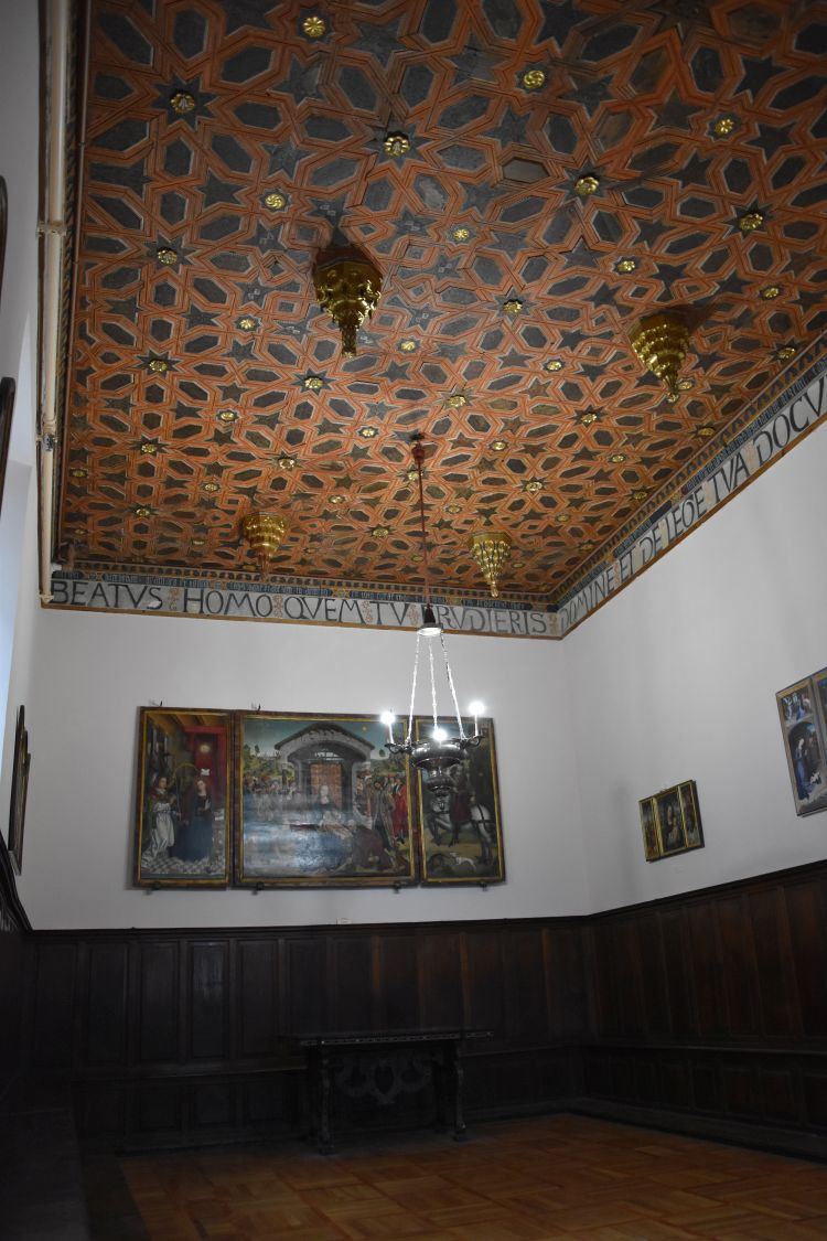
The Benedictine nun monastery Sant Joan de les Abadesses thrived from the 9th to the 11th century.  Like Ripoll it was founded by William the Hairy. His daughter was the first abbot. In the 12th century the Augustins took over the monastery. With them, the monastery thrived again and the church that we see today was constructed. The earthquake of 1428 also damaged this church (like Ripoll).  Around 1900, Josej Puigi Cadalfach restored the place (Cadalfach is an important Modernista architect of Catalonia; he documented and restored some of Catalonia’s cultural inheritance). Our art books praise the church because of the ambulatory around the choir, unusual for Catalonia, and because of the amazing deposition of the cross from the 12th/13th century. But everything is closed now, we will have to return to see the deposition.

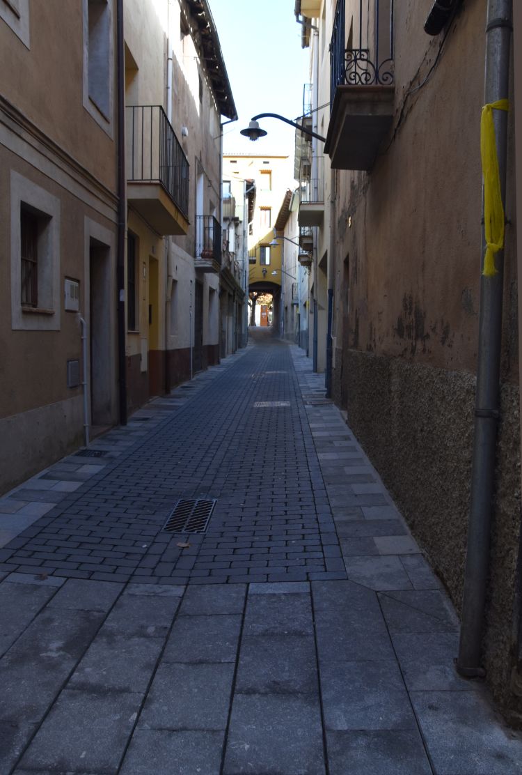
We slender through the narrow streets and have a coffee.

It is about one o’clock, time to have the aperitif outside on this sunny and warm autumn Sunday.

The trees have kept some golden leaves around the old corn mill of the village.

We continue our way – Sant Joan de les Abadesses was a nice mountain village and its cultural treasures will make it worth to return.


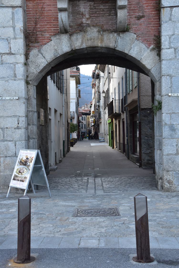
North of the Coll d’Ares: Prats-de-Molló, pedestrian-friendly and well fortified French-Catalan town

When descending north from the Coll d’Ares to France, the Vauban fortification of Prats-de-Molló appears behind the trees.

Yes, Vauban carefully assured the frontiers here, as Louis XIV had gained the Roussillon (or French Catalonia) in the Treaty of the Pyrenees of 1659.

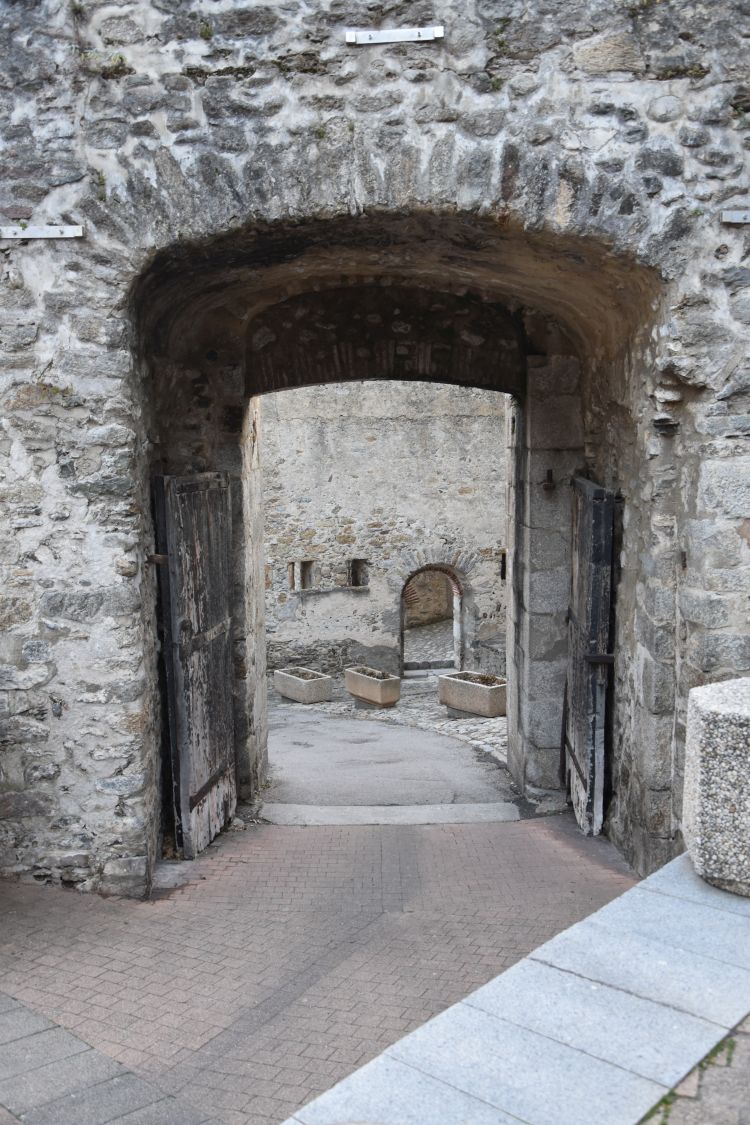
In November 2017, we stopped at Prats-de-Molló and entered the medieval small town through the main gate. Inside the wall only pedestrians are allowed.

The church Sainte-Juste-et-Sainte-Ruffine with a Romanesque tower marks the highest point above the roofs of the small town.

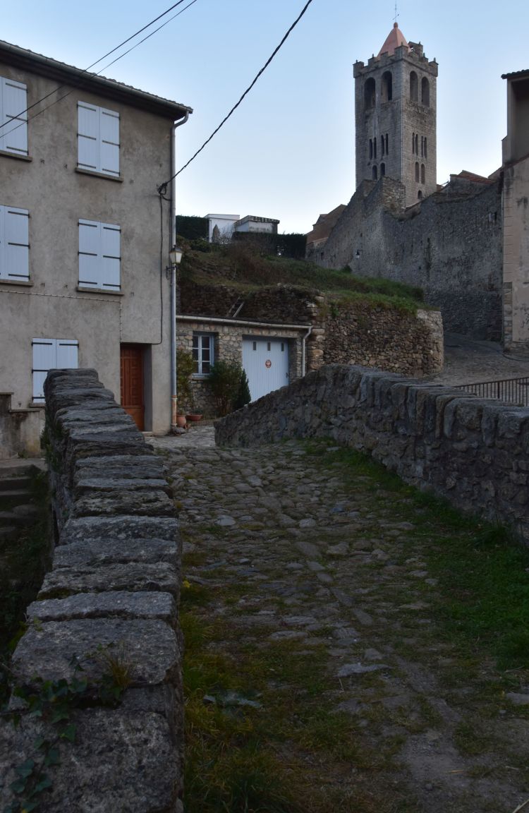
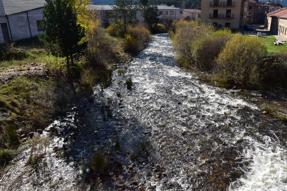
The river Tech is nascent. The town has about 1200 inhabitants.

The town wall surrounds the city and the gates are well-fortified.

We stop in a bookshop that has a nice selection of books for children and about cooking. We ask the owner, whether he is Catalan or French. “French”, he says immediately, “yes, primarily French, but then in addition Catalan”. We want to know, how he pronounces “Prats-de-Molló”, the French or the Catalan way. He says, “of course I say it the French way, I say “Prats-de-Molló””… and he pronounces each letter clearly and the “ll” not like l-l (as the French would say it), but softly as “ly” (or “lj”), as the Catalans (and the Spaniards) say it. We smile, because we like his French AND Catalan, attitude.


In 2019 we continue our way along the canyons of the river Tech to the Mediterranean coast and to Narbonne which I will talk about in my next blog.

Sources: Fritz René Allemann und Xenia v. Bahder, “Katalonien und Andorra”, DuMont Kunst-Reiseführer, Köln 1980; Thomas Schröder, “Katalonien”, Michael Müller Verlag – individuell reisen, Erlangen 2015; Barbara Bongässer, “Katalonien, Kunst, Landschaft, Architektur”, Könemann, Köln 2000; Ralf Nestmeyer, “Südfrankreich”, Michael Müller Verlag – individuell reisen, Erlangen 2015.

On the road to Spain – visiting Vilella Alta and Escala Dei in the Priorat

It is November 2019. We are spending two weeks in the appartment of our friends at L’Hospitalet del l’Infant. Some days ago we had already visited the Priorat to walk in the vineyards of Bellmunt. On a sunny day, we now return to the Priorat to visit another wine village, Vilella Alta, where we buy some wine in the bodega Vilella de la Cartoixa de Montsalvat. In addition, we look at the ruins of the former Carthusian Monastery Escala Dei.

Source: Googlemaps


Steep vineyards in the Priorat aound Gratallops

Just before arriving at Gratallops we stop to have a coffee in the restaurant La Cassola with the amazing view of the small town perched on a mountain edge…

… and with the view of these steep vineyards above the river Siurana.

This is an amazingly steep vineyard with very loosely planted vines that shine golden in the sun.

And here is the view of the Siurana valley with the table mountain Montsant in the background.

Gratallops is the wine village, where in the 1980’s the Priorat started to revive (Vinos de España, p. 171). Gratallops is pretty and worth a visit, but today, our target is Vilella Alta.


Vilella Alta, wine village perched on a rock, and the welcoming Cellers Vilella de la Cartoixa de Montsalvat

Vilella Alta is another pretty Priorat village perched on a steep hill. The streets are narrow. This is the Carrer Major with the view of the church.

Here we stand below the small village and look uphill.

In one of the small streets, we find this beautifully restored house. with the carefully arranged plants in front of the main entry.

I look for the Cellers Vilella de la Cartoixa de Monsalvat. I walk down this street, almost to the end of it. Ursula stops in front of the door arch of the small house on the right hand side. “Come back, the celler is here”, she says.

Yes, Ursula is right, here it is, the bodega Cellers de Vilella de la Cartoixa de Montsalvant that I have looked for, based on the hints found in “Vinos de España”, p. 172 and in “Més d’enlla del vi – DOQ Priorat”, p. 123. The Montsalvant is a small family owned bodega. This unpretentious entry in the narrow street reminds me again of how different the DOQ Priorat is from the second Spanish DOQ Rioja, where some bodegas have been constructed by star architects and are visited by hords of tourists. Here we are alone… almost…

According to “Més d’enlla del vi”, Francesc Sánchez-Bas, has founded the bodega de la Cartoixa with two friends in 1995, and he took it over ten years later, when one of his companions became president of the Conseil Regulador de la DOQ Priorat. 1995, this was almost 25 years ago. We count back – yes we were in our forties then, and hence Francesc Sánchez-Bas must be in his early sixties now. Is this him, rushing through the large door just below where we stand?

Yes, it is him. He is about to leave for Tarragona, but nevertheless finds time to prepare two bottles of his best red Montsalvat (2006, mainly Carignena, aged 18 months in barrels and made from old vines) and one bottle of white Montsalvat 2016 (made from Trepot Blanc, Macabeu and  Garnatxa Blanca, two months in barrel… I am particularly interested in the Trepot Blanc, an autochthonous Priorat grape that is new to me). Francesc gives us “identity cards” of his wines and apologizes that he does not have the time to show his bodega to us.

Well, we might return to this friendly place next year. We say good-bye and hope, the bodega helps to build a future for the children of Francesc, as he said in “Més enllà del vi”.

We take another photo of the surroundings of Vilella Alta…

… and admire some fragmented slate that is favorable for the wines of the Priorat. On his wine identity card, Francesc talks about “granite and quartzite shards”, which might be the better term coined by engineers in agronomy.

Next we continue to the monastery Escala Dei.


The Charterhouse Escala Dei – the nucleus of the Priorat, now a ruin

The ruins of the Carthusian monastery or charterhouse of Escala Dei are in a gorgeous location just below the table mountain Montsant. The monastery was the nucleus of the Priorat. It owned the nine villages that now form the DOQ wine region Priorat and – being a monastery – gave the area the Name: “Priorat”. The monastery was built, where a shepherd once saw a ladder with angels climbing to heaven. “Escala Dei” means “ladder  of God”. It was the first Carthusian monastery in Spain and for centuries it was an important cultural center. Now, it is even not mentioned in my art guide books, neither in Dumont’s “Katalonien und Andorra” nor in Barbara Bongässer’s “Katalonien – Kunst – Landschaft – Architektur”. The formerly wealthy monastery, reconstructed in baroque and neoclassical style from the 16th to the 18th century, has been destroyed effectively in the beginning of the 19th century. However, the monastery is well worth a visit, due to the amazing location and the restoration efforts that started in 1989 and illustrate life in the former monastery.

Entering Escala Dei is just stunning. The Montsant massif watches over the line of three gates and the alley of cypresses. This is the second gate…

… and the Santa Maria portal leading to the center of the monastery.

The style of the Santa Maria portal looks baroque to us, with Maria standing in a niche.

The small Romanesque cloister has been reconstructed with the elements excavated. A film in the former refectorium documents the process of reconstruction. The ladder to heaven or “Escala Dei” is engraved on the fountain.

The ladder of God is also on the tableware in the reconstructed living area of the monks. There is a room for study and praying, a second room for cutting wood, a third room for handcrafting and this is the room for eating and sleeping. All rooms are arranged around a small garden, it is just like a small “atrium house”. Through a small, “curved” window, the  monk received his meal from a laybrother that could not see the monk through the pass-thorugh.

Behind the “atrium house”, there is a double garden on two levels. This is the upper level. The monk planted his herbs and vegetables in these gardens.

A complex system provided water to the monastery. Above the monastery, spring water was captured in a cistern and distributed to the individual cells (or “atrium houses”). Each “atrium house” had its system of tubes and fountains. First the upper garden received water (top level in the scheme), second the water continued to the fountain in the lower garden (middle level in the scheme), and third the water arrived at the lowest level, the “atrium house”, where the monk lived (lowest level of the scheme). At this lowest level, an underground tube collected the water.

This is the fountain that carries water to the lower garden.

And this is the (reconstructed) lowest fountain that the monk used in his small “atrium house”, for his personal needs.

We look back to the refectory in front of the Montsant massif and say good-bye to the charterhouse Escala Dei.

We have lunch in the small restaurant near the monastery and then return to Hospitalet to enjoy our balcony with the view of the Mediterranean Sea.

Sources: Sebastiano Albo, “Més enllà del vi – DOQ Priorat”, Barcelona 2011; “Vinos de España”, Larousse, Barcelona 2008; Thomas Schröder: “Katalonien, Michael Müller Verlag, Erlangen 2015 (for the monastery Escala Dei) and explanatory plates in the monastery Escala Dei.


On the road to Spain – hiking to the Miranda in the Llaberia mountains

We spend November 2019 in Spain. We are now in the appartment of our friends at L’Hospitalet de l’Infant. One day, the weather forecast announces blue sky and we decide to drive to the village Llaberia in the Llaberia mountains and to walk to the La Miranda peak with its great view.

Source: Googlemaps

Llaberia is a small village, located in the middle of the Llaberia mountains on 700m. It is an almost perfectly restored village with narrow streets, but now, in late autumn, it is a ghost village. It is mainly inhabitated during summer, as the leaflet tells us that we have received at the tourism office in Pratdip (Consorci de la Serra de Llaberia, La Serra d’Almos). There is a museum, only open in summer, where visitors can learn more about traditional packsaddles and transportation methods in Catalonia (Museu del Bast). Interesting, I have never thought that such a museum would attract visitors, but considering the steep mountains of Catalonia, it may be well worth remembering traditional methods of transportation. Llaberia, this now empty village, used to live from farming and their cattle grazed in the hills around the village. Today, they have installed a photovoltaic power plant that can be visited on request, as our leaflet says.

The leaflet proposes a circular walk of 6km to the La Miranda and back to the Llaberia village. Near the Romanesque church Saint John the Baptist (12/13th century) the trail starts.

As we climb higher, the view to the west opens up. This is the  Ebro valley with Móra d’Ebre, still hidden in the fog.

The Llaberia mountains have been classified as an area of national interest with their Mediterranean vegetation such as holm oaks (quercus Ilex) and pine trees. In shady places, there is a Eurosiberian vegetaion with yew groves (Eibe in German).

Our target is the radar station of La Miranda on 918m.  The metallic “ball” appears between the trees above us…

… again and again.

Now we have reached the Miranda. A plate on the side wall of the meteorologic radar explains that it has been co-financed by the EU. La Miranda is one of four weather stations of the meteorologic service of Catalonia. and belongs to the community Tivissa-Llaberia. Our leaflet says that the station is useful to give insights into the storms from south and southwest that can cause abundant rain. And, with the twinkle of an eye, the leaflet adds weather singnals that we should not forget to take note of such as “when the aunt takes earth out of its nest, fix the leak and flee from the river” or “when you see a fish jump out of the water, hang out the laundry, good weather will come.”

We look south east against the eleven o’clock sun. The Mediterranean Sea shines under the blue sky with some dispersed clouds.

The panoramic view from the La Miranda is gorgeous. To the north east we can see the small village Colldejou and the Prades mountains in the direction of Tarragona.

To the southwest are the Tivissa-Vandellós mountains and, farther away, the Parc Natural del Ports and Terra Alta…

Now the mountains to the southwest are zoomed in; Ursula is fascinated by these rows of rugged mountains – one after the next. Cumbersome to cross, going up and down and up and down. Yes, that is, what the Museu of Bast of the Llaberia village could tell us more about – traditional methods of transportation in such ruggy mountains.

In the meantime, the fog in the Ebro valley near Móra d’Ebre has almost dissipated. Just in front of the light mist we identify the flat hill range, where the Iberian village near Tivissa is located, with its strategic view of the Ebro valley. (Two days later, we walk to the Iberian village and can identify the round ball of the Miranda metereologic station from there).

We walk back to the Llaberia village. The roundwalk ends at the Romanesque church of Saint John the Baptist.

The sun warms us up. We take off our jackets at the main square with the mulberry tree.

The tree invites us to play with the sun and the shade.

We say good-bye to the Llaberia village.

We stop for lunch in La Cuina d’en Carlos at the Ermitá Santa Marina, where we have been before. I love their salad with the goat cheese and Ursula loves their cannelloni which are also a specialty of Catalonia (that once had possessions in what is Italy today).

Then we return to our cosy apartment in L’Hospitalet de l’Infant.


On the road to Spain – Ebrodelta and Amposta

It is November 2019. We are spending two weeks in the appartment of our friends, at L’Hospitalet del Infant.

Once more we visit the Ebrodelta. We have been in the delta before and it is always worth a visit. In addition we explore Amposta, a small town that we have passed by so far.

Source: Googlemaps


Ebrodelta: l´Encanyissada

After two very stormy days, the wind has stopped, but there are still clouds in the sky. We drive to the Ebrodelta and to the Casa de Fusta at the l’Encanyissada pond. From the Fusta viewpoint, we look at the Montsía mountains with the clouds above them.

This is the zoomed-in view of the Montsía mountains with San Carlo de la Rápida.

Igrets are all over… looking for a tasty fish meal.

We switch to another viewpoint at the l’Encanyissada pond. The clouds reflect in the channel.

Above the water of the l’Encanyissada pond, Ursula detects a kingfisher perched on to reed grass. It is the first time that we come across a kingfisher in the Ebrodelta.

More igrets – this one sits on the harvested rice field.

Swarms of glossy ibis are in the sky (called “Brauner Sichler” in German) and more of them sit in the harvested rice field – they look like black dots.


Ebro delta: The Salines de la Tancada 

Where are the flamingos? In spring, half a year ago, we found them standing in the Salinas de la Tancada. We drive there, and indeed, here they are, a pink stripe at the horizon.

One individuum decided to look for food all alone and much closer to us.

In the background, we can again see the Montsía mountains, now with fluffy cirrus clouds above them.

After having bought some of our favourite “Bomba” rice and some bottles of olive oil in the Case de Fusta, we decide to have lunch at Amposta.


Lunch and stroll through Amposta, the capital of the Ebrodelta

Amposta is the capital of the Ebrodelta and of the Comarca Montsía which is the southern most Comarca of Catalonia. The small city with about 20’000 inhabitants is very proud of their Suspension bridge across the Ebro. It has been constructed from 1915-1921 to replace the former ferry. The engineer was inspired by the Brooklin Bridge of New York , and his bridge was the second suspension bridge built from armoured concrete worldwide. In 1938 (during the civil war) the bridge was destroyed, and one year later it was inaugurated again. The ropes hang on arches built in German historizing style, as I read on the Webpage.

We stroll through the pedestrian zone and find one square after the next – we suppose that on hot summer days all these squares are joyfully busy. We also find welcoming restaurants such as this one selling hot “small dogs” (perritos calientes) that the parents can eat calmly, while their children play on the motor cycle.

Not far from the townhall, we settle in the bar Il Viale and enjoy a well prepared meal  with stewed veal and crema Catalana.

Amposta is not a pretentious town with overly restored houses. It has an old history though. Historians suppose that Amposta was an important Celtiberian settlement. Then the Romans were here. The name “Amposta” is said to derive from Latin “amnis = river” and “imposita” seems to refer to a guesthouse that was located on the rocks above the river Ebro.

Around 1150, the king of Aragon reconquered Amposta from the Moors. He gave it to the Order of Saint John of Jerusalem. The flag of Amposta contains their cross. With the castle on the rock above the Ebro, Amposta thrived. In 1465 the castle was destroyed during the civil war in Catalonia. Not much is left of the castle today; this is the view from the suspension bridge.

Only in the 17th century, Amposta slowly recovered, when cultivation of the Ebro delta started. Today, Amposta is the regional center that lives primarily from agriculture in the Ebro delta, from the related mechanical industry and from tourism in the Ebro delta and in the near mountains.

In the early 20th century, some modernist houses were constructed. A congestion of them is on the street to San Carlos de la Rapita, such as this house with elegant oriels…

… a second one with pretty balconies,…

… and a third one made from red bricks.

When walking through the small streets, we find more modernist houses,…

… and, sorely, some of them are at the brink of decay.

We say good-bye to Amposta, this small town located on the rocks above the Ebro and return to our apartment in Hospitalet to enjoy the balcony.

On the road – mysterious ermità on a red rock and Bellmunt in the Priorat

We spend the whole month of November 2019 in Spain. Now we are staying in the appartment of our friends in L’Hospitalet de l’Infant. One day we go for an excursion to Montroig del Camp (where we buy leather bags from our favourite leather workshop) and then drive through the Llaberia mountains to the Priorat, to Bellmunt. On the way, we stop at the Ermità de la Mare de Déu.

Source: Googlemaps


La Ermità de la Mare de Déu de la Roca – spectacular location

So far we have always ignored the signs pointing to the Ermità de la Mare de Déu de la Roca, when driving through the Llaberia mountains. This time, we turn left and arrive under this sandstone rock with the mysterious building on top. It is the Ermità de la Mare de Déu de la Roca, and I can understand, why this ermità is called “de la Roca”.

The ermità is closed. Turismo of Montroig  shows, what it looks like inside. Their site explains that the ermità, going back to the 13th century, has been ingeniously integrated with the red rock. Yes I agree, But – red rocks? Now I understand, why the village Montroig del Camp is called “Redmountain” (in Catalan “roig”, pronounced “rotsh/rotsch”, means red and “mont” is “mountain”): Montroig lies in the fields at the foot of the red sandstone mountains.

We enjoy the view towards Tarragona, with olive groves, forests and the Mediterranean Sea.

Then we climb up to the viewpoint with the pictoresque sandstone formations shaped by wind an water.

From the “sandy” rock, we look back to the ermità. Gorgeous place and very secluded.

We continue on curvy roads across the picturesque Llaberia mountains to reach Bellmunt in the Priorat.


Bellmunt – quiet village of winegrowers in the Priorat

Bellmunt stretches along a mountain edge above the river Suirana.

The table mountain Monsant can be seen in the background.

The village is surrounded by vineyards,…

olive groves,…

… and almond trees.

Bellmunt belongs to the wine area Priorat, one of the two highest Quality or DOQ wine areas of Spain. A panel at the village parking shows the nine wine producing villages of the Priorat.

Casa Gran del Siurana is one of the bodegas of Bellmunt. According to their website, the bodega was founded in 2000 and belongs to the Peralada Group, a family owned commercial conglomerate from the Empordà (Catalonia).

This bodega is named after a large house or “casa gran” located on the banks of the river Siurana; it once was inhabited by Carthusian monks from the monastery Scala Dei that owned all nine Priorat villages and introduced vines here in the 12th century.

We slender through the vineyards of Bellmunt that shine in autumn colours…

… and cross a small affluent of the river Siurana.

We admire the elaborate terraces made from stone and…

… carved into the steep mountain slopes.

We return to the village…

… and stroll through the narrow streets with the laundry hanging on the windows.

The village was vivid, when we arrived, as it was full of joyful children returning from school. The smell of lunch was in the air. Now the streets are empty and quiet, it is siesta time. We even do not find a bar open to have a coffee.

We decide to return to our appartment in Hospitalet by driving through the hills of the Montsant DO. We take a foto of this Monsant vinyeard near El Guyamets. The DO Montsant wine region forms a ring around the DOQ Priorat and in general, the Montsant vineyards are less steep and the vines planted more densely. Some innovative villages and wine growers also make excellent Montsant wines, one of the most successful being the Celler of Capçanes.


Some backgorund Information about the DOQ Priorat

Having arrived in L’Hospitalet de l’Infant, we stop at the city library, where we find an excellent book about the villages and winegrowers of the Priorat, written by Sebastian Alba : «Més enllà del vi – DOQ Priorat », Barcelona 2012. It gives general information about the Priorat wine area and each winegrower of the Priorat has a chapter of his own to talk about his background and about his bodega. Though the book is written in Catalan, we understand pretty much of it, as we speak both French and Spanish. From this book we learn:

  • The Carthusian monks of the monastery Scala Dei (ladder of God) introduced vines to the Priorat in the 12th century. They owned what is today the DOQ area of Priorat, and the name “Priorat” still reminds of the monastery.
  • The fate of the village Bellmunt is connected with their plumb mines. They were closed in 1972 which caused an exodus of inhabitants. The mines can now be visited and a museum tells all about them.
  • In the late 1990’s and beginnings of 2000 seven bodegas were established in Bellmunt, mostly family enterprises. The vineyards of one of them, La Gran Casa de Siurana, I have photographed, and another one, Rosa Maria Bartolomé Vernet, is the offspring of a family that immigrated from Andalusia to work in the mines. When the mines closed down, this family stayed. They started their wine growing business in 1997.

“Vinos de España”, Editions Larousse 2008 tells us more about the Priorat. The Priorat is mostly hills, some very steep – up to 30-40%, called “costers”. The best wines come from slate fragmented ground that is called “licorello” here. The Priorat wines have been almost forgotten in the 20th century and revived in the 1980’s thanks to four innovative winegrowers. In 2001 the Priorat received the label DOQ. Today about 22 winegrowers produce Priorat wine that is renowned in the large wine markets of the world and can be ordered in the best restaurants. The Priorat vineyards comprise just 1600 ha in all. 1600 ha… compare that to Rioja, the second of the two DOQ wine regions in Spain: Rioja comprises 48’000 ha. The total of vineyards of the Priorat makes just 3.3% of the total of the vineyards of Rioja. Rioja being so close to France has evolved since the 19th century, when the French turned to the Rioja area, after having been hit by Phylloxera. Rioja is stunning with some prestige winegrowers that have engaged the best architects of the world to build enormous bodegas. The Priorat is more modest with its nine villages crouched on hills among steep vineyards, where vines grow uncongestedly on terraces; the bodegas are sober and functional, mostly owned by families some of which have relations to larger companies from other Spanish wine areas.

Rioja and Priorat – both DOQ regions have their own charm, though being very, very different.

On the road to Spain – driving around the Moncayo and returning to Catalonia

It is November 2019. We are travelling in Spain. Now we leave Soria and return to Catalonia. On the way, we stop in the Moncayo area.

Source: Googlemaps


The Moncayo mountain and the wine area Campo de Borja

We have looked at the Moncayo from the window of our room in the Posada de Soria. It reaches about 2300m and is covered with snow.

The Moncayo is located east of Soria. We are travelling eastwards today, to Catalonia, and the shortest way means driving around the Moncayo – first north of it, than east of it. And east of the Moncayo is the DO Campo de Borja wine area. The Moncayo creates a microclimate that allows to grow wine here. The Campo de Borja belongs to Aragón and we have already reached the Ebro valley, west of Zaragoza.

We stop at a small bodega, Prados Bodega Pagos del Moncayo in Vera de Moncayo. The bodega is young and family owned. It produces wines from the grapes Garnacha and Syrah, and their “Fusion” is a blend of the two grapes. We speak with the son. He shows us his cellar and tells us that they use traditional methods to make their wine, mostly working manually. He also mentions a wind, called el cierzo. I later find that the “cierzo” comes from the north or northwest from the Cantabrian mountains into the Ebro valley and towards Zaragoza drying out the area which is beneficial for the grapes. We feel welcomed and I buy a bottle of Garnacha and a bottle of Syrah Privé, the latter being their most valued wine.

Then we look at the mountains of the Moncayo massif from the east…

… most of which is now – like from the other side, from Soria – hiding in the clouds.

We drive down to the Ebro river. I can see the snowy Moncayo massif in my rear mirror almost up to Zaragoza. We continue our way to Lleida and Flix – through the Catalan mountains and down to L’Hospitalet de l’Infant on the Mediterranean coastline, where we reach the small apartment of our friends. Here we will rest from two weeks travelling and may continue to explore the area.

Source: “Vinos de España”, Edition Larousse, Barcelona 2008, p. 201.

On the road to Spain – brave Celtiberans in Numantia and friendly Soria city

It is mid November 2019. We wake up in our luxury room of the Parador de Soria and see snow outside. The Moncayo has disappeared in the clouds. We are on about 1100m above sea level here.

The – still young- river Duero reflects the trees. Golden autumn colours shine amidst white snow.

We admire the view from our room in the Parador de Soria. Then we put on warm clothes and drive to Garray, located some 9kms north of Soria, to visit Numantia.


Numantia – the brave Celtiberan village

The Celtiberians founded the oppidum Numantia on the hill called “Muela de Garray” in the 3rd to 2nd century BC. It was the times of the Punic Wars between Carthage and Rome, which ended with Carthage being defeated and with the Celtiberians being subdued.

Numantia withstood the attacks of the Romans twice. In 153 BC, the Numantians threw stones at the elephants, which – frightened – trampled down the Roman camps. The Numantians resisted once more to the next Roman attack in 141 BC. Is Albert Uderzo really convinced that Asterix and Obelix lived in Gaul? They would also have been worthy representatives of Numantia (or perhaps the Numantians were their ancestors, as Gaul was conquered later).

Finally, in 134 BC, Scipio the Younger besieged the village by surrounding it with fences and fortresses. The citizens had no longer access to the surroundings of their oppidum. After 13 months, they burnt their oppidum down, before surrendering. It is said that they even committed suicide, because they did not want to end as slaves of Rome. Later the Romans built a small city here, but without the public buildings typical of Roman cities

We arrive on the “Muela de Garray”, where the reconstructed Celtiberian gate welcomes us. Dark clouds are above us and a chilly wind is blowing.

The archaeological site has been well prepared for visitors. A video explains the history. Some buildings have been reconstructed to illustrate, how the Celtiberians and the Romans lived here. This is the Celtiberian house with a fragment of the town wall (a snow flake was on my lens…).

This is the Celtiberan living and working room, or it is, how the archaeologists imagined it. There is even a sofa, Ursula notices.

From the wall, the Numantians could well observe the surroundings and discover enemies from far.

This is the reconstructed Roman house…

… with the kitchen.

On the more sunny southern slopes, the archaeologists have uncovered the remains of larger Roman villas that disposed of courtyards and porticos. The archaeologists have erected some of the columns found.

In the background, we can see the snow covered Sierra de la Demanda and Pico Urbión, where the Duero starts its long journey to Portugal and to the Atlantic.

We return to Soria to visit the museum about Numantia.


The Numantine Museum in Soria

The Museo Numantino shows the items found in Numantia. The most famous artifact is this charming horse, a fibula. Many souvenirs in Soria are decorated with this pretty horse.

This fine piece of silver work has been enlarged under a magnifying glass. I do not recall, what it was.

This charming dog was another fibula.

Much earthenware is on display – I particularly liked the fish platter.

In addition, the museum shows tools and weapons made out of iron uncovered in Numantia. The Celtiberians mined iron in the near Moncayo mountains.

The museum lays out the whole history of the area from prehistoric up to modern times. It is well worth seeing.


Round-up walk in Soria

We go for a round-up walk through the pedestrian zone of Soria. We stroll through the Zapatero street,…

… enjoy the windows such as this gourmet shop…,

… and we say hello to the poet in front of the traditional Casa de la Amistad. It is the center for culture in Soria.

On the Plaza Mayor, we admire the town hall or Casa de Los Doce Linajes, where the twelve noble families met until the early 19th century.

In front of the Iglesia de Nuestra Señora de la Mayor, this charming woman offers a seat to passers-by.

We notice that there are more shops open than one and a half years ago and that the pedestrian zone is being enlarged.  The city seems to have thrived. It is now our third time here. The former time it was a short stop over, when we visited the unparalleled cloister of the Monasterio San Juan de Duero. There is more to discover in Soria. It could well be that we will return once more, like the storks.

It IS cold today. Now we are happy to return to our Posada with the gorgeous view of Soria and the mountains that surround it. The Posada of Soria is the red building amidst trees, not really a gem from outside, but very comfortable inside.

Tomorrow we will continue our way to Catalonia.


On the road to Spain – the Cartuja Miraflores, the church Santa Maria de Lara and Fuente de Berro

It is November 2019. After having spent four days in Burgos, we continue our journey through Spain. We drive via the Cartuja of Miraflores to the Visigothic church Santa Maria de Lara, then we look for the source of the river Duero and find the source of its short affluent Berro. We arrive in Soria, where we have booked two nights in the Parador of Soria with the great view of the white Montcayo in the mountains called Sistema Ibérico.


Cartuja de Miraflores or Miraflores Charterhouse

The Carthusian Monastery of Miraflores is located just 4km outside of Burgos. It is our first stop. In 1442, the monastery was founded by the parents of Queen Isabella I of Castile (called the Catholic). Her parents were John II and his wife Isabella from Portugal. This is the church of the charterhouse from outside.

The church is of late gothic style, built with just one nave. Gates divide the one nave into several consecutive sections.

The choir is decorated with the gothic altar of Gil de Siloé. He completed it at the end of the 15th century. He broke with the strictly rectangular structure of most former altars. His altar is organized around the circle with Christ in the middle and with the scenes from his Passion grouped around him. I like the airiness of this altar that breaks with traditional rules.

The parents of Isabelle are buried in front of the altar. Their alabaster tomb is decorated with many fine sculptures. I like the dog and the lion at the feet of Isabella’s mother.

There is a strong smell of incense in the church which makes me feel sick (my only allergy, since I have been a child). I leave the church and sit down on the steps of the porch. Here I listen to the monks singing solemnly – they are somewhere behind a thick wall, in seclusion.

Above me is Maria mourning under the cross decorated with the moon and the sun.

The sun accompanies us, while we continue our way eastwards.


Santa Maria de Lara – the church of the Visigoths built before the Islamic invasion

Our next stop is the mountain village Quintanilla.

About 700m away from Quintanilla, we find the Visigothic church Santa Maria de Lara (also called Santa Maria de Quintanilla de las Viñas). The church has been built around 700, before the Islamic invasion that happened a few years later.

Next to the church is a small wooden house. The gatekeeper is in that house, waiting for visitors. He shows us round and opens the church for us.

The bricks have been laid with precision and without using plaster. Three bands with elegant reliefs decorate the outside walls of the church.

Some are abstract symbols, some are animals.

We enter the church. Only the choir and part of the aisles are left. The horsehoe shaped arch is typical of the Visigoths.

The columns on the sides are decorated with the moon and the sun that are carried by angels. This is the sun.

The gatekeeper knows the Visigothic church San Pedro de la Nave that we have seen in Zamora. We have also seen Pre-Romanesque churches in Oviedo (Santa Maria del Naranco and more), and in the Empordá we have visited the tiny Visigothic church Sant Julia de Boada. I am always impressed by these early manifestations of Christian life.


Dinos were here before – much, much earlier

Just below Quintanilla we have noticed signs pointing to this shelter.

Petrified tracks of dinosaurs have been found here. They are marked with white chalk.

On the way to Soria we see more signs pointing to traces of dinosaurs or announcing museums that talk about dinosaurs. There must have been a dinosaurs’ land here,


Looking for the source of the Duero, ending up with the source of Duero’s little brother Berro

At Duruelo de la Sierra, we meet another old friend of ours, the river Duero. This stone shows the long route that the Duero takes from the source in the mountains of the Sierra de la Demanda at the Pico de Urbión to the mouth at Porto in Portugal.

A sign points to the source of the Duero in 11km. We feel like seeing the source of the Duero and follow the sign. 11km is not a long detour, we think. After about 6km we find this source on 1600 to 1700m above sea level.

We understand that this is not the “real” source of the Duero, but the source of one of its early affluents called Berro.

The real source of the Duero is located on 2140m just below the Pico de Urbión and it requires a real hike to get there. We are not prepared for that. We return to Duruelo de la Sierra. The Duero is still small here.

At Molinos de Duero, just before the dammed lake, the Duero is already larger.

We follow the Duero until Soria.


Settling in the Parador of Soria above the Duero with the view of the Montcayo

In Soria, we settle in the Parador high above the river Duero. Our window has a wonderful view of the mountains in the east…

… and in particular of the Moncayo (2314m) that is covered with snow. The Moncayo massif belongs to the Sistema Ibérico.

Again we notice, how rough the north of Spain is. From everywhere we see mountains that are covered with snow – already in autumn and still in spring.

Sources: Marion Golder, “Nordspanien und der Jakobsweg”, Dumont Reise-Handbuch, Ostfildern 2018; leaflet of Santa Maria de Lara; leaflet of the Cartuja Santa María de Miraflores (Burgos); “Burgos, Artística y Monumental”, Edilera 2018.

On the road to Spain – cathedral, churches, and monasteries in Burgos

In rainy November 2019, we spend four days in Burgos. We stroll through the charming city center and we visit the Cathedral, the Monastery Las Huelgas and various churches. I am now telling about us discovering the cultural-religious side of Burgos.


The Cathedral of Santa Maria – overwhelming treasures

The fine towers of the Cathedral Santa Maria in Burgos have been built by Hans von Köln who had been influenced by the plans for the Dome of Cologne (Köln). The Cathedral was built and inaugurated in the 13th century, whereby constructions continued for 300 years more.

We enter the Cathedral through the southern porch. Christ, the judge, is surrounded by the four evangelists. Below are the twelve apostles. A bishop stands in the middle of the porch.

Inside, the overview of the nave is impeded by the choir that, as in most Spanish churches, has been placed in the middle. I walk around it and enjoy these fine stairs with the golden balustrade (escalera dorada). The king used them to enter the Cathedral through the western porch which is higher than the main floor, as the Cathedral has been built into the castle hill of Burgos.

Above the stairs, I locate Papamoscas, a figure made from iron sheet that opens the mouth, when the bells ring. Papamoscas means “catch-flies”. There is room for humor in the Catholic religion – nice.

The graceful cupola tops the intersection of the naves. The fine pattern has a Moorish appeal, I believe. The grid of the choir (located in the middle) is pointing to the cupola. El Cid has been buried just in front of the choir and under the cupola. .

This is the chapel of the Condestable Pedro Fernandez de Velasco (ca 1425-1492). He was crown commander and died during the conquest of Granada. The Flamboyant-Gothic chapel has been constructed by the son of Hans von Köln, Simon. It is from the end of the 15th century. The noble grave of the crown commander has been made from Carrrara marble.

The crown commander and his wife look up to the altar in Renaissance style…

… and into this elegant cupola – it is like a heaven with stars.

The small dog sleeps at the feet of the commander’s wife.

Around the cloister are many, many treasures. My take aways are the Mudejar ceiling in the chapter house…

… and the wall hanging that shows Adam and Eva in Paradise being seduced by the snake to take the apple.


The Monastery de Las Huelgas – a wealthy church with Mudejar chapels and the flag captured from the Moors

From our hotel, it takes us half an hour along the promenades of the river Arlanzón to reach the Monastery Las Huelgas. “huelga” today means “strike”. But no one is on strike in this monastery. Once the Castilian king had a hunting palace here. “Hunting” was leisure and, in Spanish, “holgar” is one of the synonyms for “descansar” or “to have a rest”. In the 11th century, king Alfonso VIII (1155-1214, married to the daughter of the king of England, Eleanor) decided to reuse his leisure palace for a Cistercian monastery. It was then named “Monastery of Santa María la Real de Las Huelgas”. The nuns originated from noble families, the first abbot being the youngest daughter of the king. Furthermore, the abbey was used as a wedding and burial place for the Castilian royal family. Today 30 nuns live in the monastery.

This large square with the fountain is part of the monastery and can be accessed freely through the solid gate.

Only guided tours are possible in the monastery. No photos are allowed, except in the cloister. This is the elegant cloister surrounded by double columns…

… with mostly floral decoration as well as some architectural representations such as this one.

We buy the “Guía Santa María Real de Huelgas – Burgos” which will remind us of all the treasures seen in this monastery.

The church contains Royal tombs of the kings of Castile from the 12th to the 14th century. Also the founder of the monastery, Alfonso VIII and his wife, Eleanor, are buried here.

In the church, the entrance to the choir shows the battle of Navas de Tolosa of 1212, where the confederated kings of Navarra, Aragón, Castile and Portugal defeated the Moorish Almohads decisively. We had come across this battle in Roncesvalles, where king Sancho VII the Strong is buried. Lead by him, the Navarrese broke the ring of slaves that were chained together as bodyguards of the Almohad calif (it is said that for this reason Navarra’s flag contains chains). The calif flew and so did his army leaving their treasures on the battlefield. One of these treasures, the standard (pendón) is hanging in the chapter house of Las Huelgas.

I very much like the Mudejar chapels of Ascension and of Santiago as well as the Mudejar ceilings in one of the cloisters. The visit closes with the exhibition of clothes from the 13th and 14th century – most of them are in perfect condition.


The gorgeous alabaster altar in the San Nicolas church

San Nicolas de Bari is the name of the church just opposite of the Cathedral of Burgos. This carved door gives access to it.

The gem inside is the alabaster altar made by Hans von Köln (who had already worked for the Cathedral of Burgos). 465 figures can be found here, mostly telling the life of Saint Nicolas. He stands in the middle of the altar. Above him is the Coronation of Maria occurring in a ring of angels – interesting, how the rectangular structure of the altar is broken up by circles and half circles.

Thinking about Saint Nicolas… when I was a child, he came from the Black Forest on 6th of December, was also called “Santi Niggi Näggi”, and he brought gifts, but also punished the nasty children, even taking them home to the Black Forest to peel carrots for a year (that was what we children were told – we then calmed him down by singing for him). When traveling to Turkey, I discovered that Saint Nicolas actually was bishop of Myra (Asia Minor) in the 4th century… Myra is called Demre in Turkey today and it is located not far from Antalya. Saint Nicolas was said to have distributed his wealth amongst the poor. Saint Nicolas later became patron of the seafarers, because he is said to have stopped a storm near Myra and saved the life of the sailors in distress at sea. Therefore, the altar shows scenes with boats and sailors.

Before the Seljuks conquered Asia Minor, Italians transfered the relics of Saint Nicolas to Bari. Now I understand, why, this church is called “Saint Nicolas de Bari”. (Source: Wikipedia)

The life of Christ and Maria are also represented on the altar such as this Annunciation and Last Supper.


Church San Gil – charming gothic with filigree pulpit 

To the north east of the city center and built into the town wall is the smaller church San Gil, also gothic in style from the end of the 13 to the 14th century. Later a series of chapels were added, the most famous of them holding the Christ of Burgos. The altar is Renaissance and tells about Maria and her son.

My favourite item in this church is the wooden pulpit, finely carved and adorned with a pigeon under the cupola. May the Holy Spirit inspire the priest and his speech.

I could not find any explanations about this outstanding pulpit.


The church Saint Stefan or San Estebán

The last church we visit is Saint Stefan or San Estebán, not far from the Cathedral. The church is from the 13th century. In the 1980’s, the church was converted into the museum for altars and treasures that have been collected from churches decaying in the province of Burgos. In addition, the original altar dedicated to Saint Stefan has been kept in the choir. The altars are mostly from Renaissance and Baroque. Many of the altars on display are dedicated to martyrs. It is not allowed to take photos. The Website of Saint Stefan gives an impression of the overwhelming wealth shown in this church. We are overwhelmed and have our welfare dinner in the friendly and cosy restaurant Rincón de España.


Good-bye Burgos, our next target will be Soria.


Source: Marion Golder: “Nordspanien und der Jakonsweg”, Dumont Reisehandbuch, Ostfildern 2018; “Guía Santa María la Real de las Huelgas – Burgos”, Reales Sitios de España 2014.


On the road to Spain – Santo Domingo La Calzada and city strolling in Burgos

Mid November 2019 we drive from Pamplona to Burgos with the first stop over in Laguardia and Elciego and with the second stop over in Santo Domingo de la Calzada. We then settle in Burgos, where we have booked the hotel for three days.

Source: Google Maps


Stop over in Santo Domingo de la Calzada – with hens in the Cathedral

Santo Domingo la Calzada is a small town with a Cathedral. “Calzada” means “paved road”. In the 11th century, Santo Domingo noticed that the trails of the Way of St. James were bad, and he spent his life repairing them. In addition, he built a bridge, a hostel and hospital here. For fixing trails, Santo Domingo received the surname “Calzada”.

Santo Domingo de la Calzada is not far from the mountains, as the window of the nice pastry shop shows.

The hospital is now the Parador of Santo Domingo La Calzada. We have coffee here to warm up.

We enter the Cathedral. Around 1100, the king of Castile had the church of Santo Domingo built that later became the Cathedral of a newly created bishopric. The choir has been freed from the altar, which allows to admire its Romanesque structure.

Santo Domingo de la Calzada’s tomb is near the choir. He is buried in the crypt.

The attraction of this cathedral is the beautifully forged cage with one hen and one coq. The animals are being replaced regularly.

The cage goes back to the legend of a German couple that pilgrimaged with their son Hugonell. In the hostel of Santo Domingo de la Calzada, the daughter of the host fell in love with Hugonell who did not return her affection. She hid a silver cup in Hugonell’s luggage. Her father, the host, noticed that one of his silver cups was missing and he asked the police to chase Hugonell. Because the cup was found in Hugonell’s luggage, the poor boy was hanged. The parents continued their pilgrimage, and, when they returned, they found their son still alive. He said that Santo Domingo had supported him all the time. They all returned to the hostel. The host said that he would only believe that Hugonell was innocent, when this coq would come to life again – it was steaming on his table ready to be eaten. The coq became alive again – and the coq and the hen in the cage of the Cathedral remind us of the miracles around Hugonell.

The cloister is a museum with sacral artifacts. The children love the large Christmas crib built out of Playmobil elements.


Burgos – we settle in NH hotel, enjoy the view of the Cathedral and eat in the Restaurant Rincon de la España

In Burgos, we settle in the NH Collection Hotel Palacio de Burgos that formerly was the Merced Monastery – a charming setting.

From our room we can see the Cathedral of Burgos named after Santa Maria. Even in these rainy and chilly November days, the sun comes out from time to time and the filigree towers shine in white.

We cross the road and enter the city center through the gate of Santa Maria (called “Arch”) .

Under the Arch of Santa Maria, the view of the mighty Cathedral of Santa Maria is overwhelming.

We have dinner in the restaurant Rincón de España near the Cathedral. It serves meals already at seven pm – all other restaurants open only at 8:00 or 8:30 pm. In the Rincón, the oven with the tiles creates a cosy atmosphere.

I have delicious veil cheeks with a tasty Rioja Ardanza Reserva from the Bodega Rioja Alta.

At night, the Arco de Santa Maria is illuminated. Carlos V of Habsburg (or Carlos I of Spain) is surrounded by the founder of Castile and by El Cid who is venerated for having fought the Moors (though the historical facts say that he sometimes also fought WITH the Moors).

The woman selling chestnuts sits in front of the gate watching the citizens and tourists walk by.


Walking around the pretty city center 

Burgos stretches along the river Arlanzón.

Parks with promenades invite to walk along the river…

… and various pedestrian bridges cross the Arlanzón.

We climb up to the castle hill to get an overview of the city. Burgos has emerged around this hill with the castle from the 9th century. The castle is now a ruin for having burnt down in the early 18th century. It is snowing and raining, when we look down at the city with the Cathedral and the church San Estebán.


Strolling through the pedestrian zone of the city center

The city center of Burgos is a large zone for pedestrians.

It is so quiet that you can carelessly read in the pedestrian streets.

In this inviting shop, Ursula finds the elegant shoes she has been looking for already for a long time.

We find the old-style shoe shop with the carton piles at the Plaza Mayor.

It is an evening offering nice dawn photos of the Plaza Mayor with the Cathedral in the background.

Later, red stripes appear in the sky above the Cathedral.

This is the townhall at the Plaza Mayor…

… the columns of which indicate that the river Arlanzón has flooded this area twice in June, once in 1874 and once in 1930.

I can hardly believe that the tame Arlanzón, now flowing calmly in its riverbed, can swell to inundate the city.

The stroll through the pedestrian city center ends at the square of El Cid. His statue is nick named “bat”, because of his “flying” coat.


The Museum of Human Evolution (Museo de la Evolución Humana)

North of Burgos is the Sierra de Atapuerca, about 1000m above sea level and about 7km long, with a karst network of galleries. Since at least 1.3 million years, human beings and their antecessors as well as animals have lived here in the karst caves.  They left their traces in sequential layers and archaeologists, uncovering meticulously one layer after the next, gained new insights into human evolution in Europe. The most famous discovery was this front jaw (mandibula). It belongs to a human being that lived about 1.2 Mio ago and was found in the Elephant Cave in 2007. These are the oldest remains of human beings found in Western Europe. The type of hominids has been named “Homo Antecessor”.

We have come to see this jaw, but it was not on display. It has been given to an institute for further investigation. Nevertheless, we found the museum exciting. It is well curated. In the basement floor, they show the excavations in the various karst galleries, the Elephant Cave being one of them. The bones and tools found are on display. The next floors explain the history of mankind and I learn that before the emergence of Homo Sapiens Sapiens some 100’000 years ago, the evolution of hominids began in Africa between 6 and 7 Mio years ago. Many varieties of hominids emerged and disappeared again. The museum displays life-sizes statues of some of them. With the twinkling of an eye, it lets the visitors become one of their human antecessors.

We decide to stay four days instead of three in Burgos. It has much to see and, above all, it is a charming city.

Source: Marion Golder: “Nordspanien und der Jakobsweg”, Dumont Reisehandbuch, Ostfildern 2018; Material seen and received in the Museum of Human Evolution.