Discovering treasures, while being forced to just walk around Basel
As from April to August some surgeries forced me to stay at home, I walked and walked discovering and rediscovering gems around Basel. Here are some of them in the southeast of Basel, starting with a first selection.
This map shows the hill of Wartenberg (between Muttenz and Pratteln) and the long stretched mountain plateau of the Gempen southeast of Basel. The Gempen belongs to the Tabular Jura.
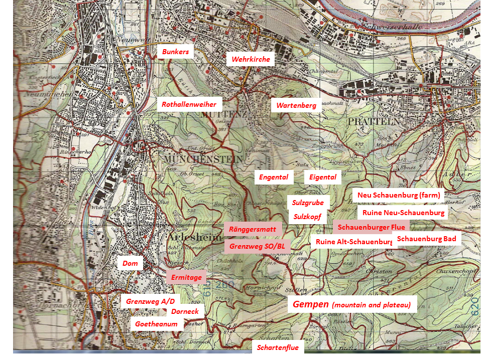
Source: Bundesamt für Landestopographie 213T – Basel
.
The Ermitage – the romantic landscape garden near Arlesheim
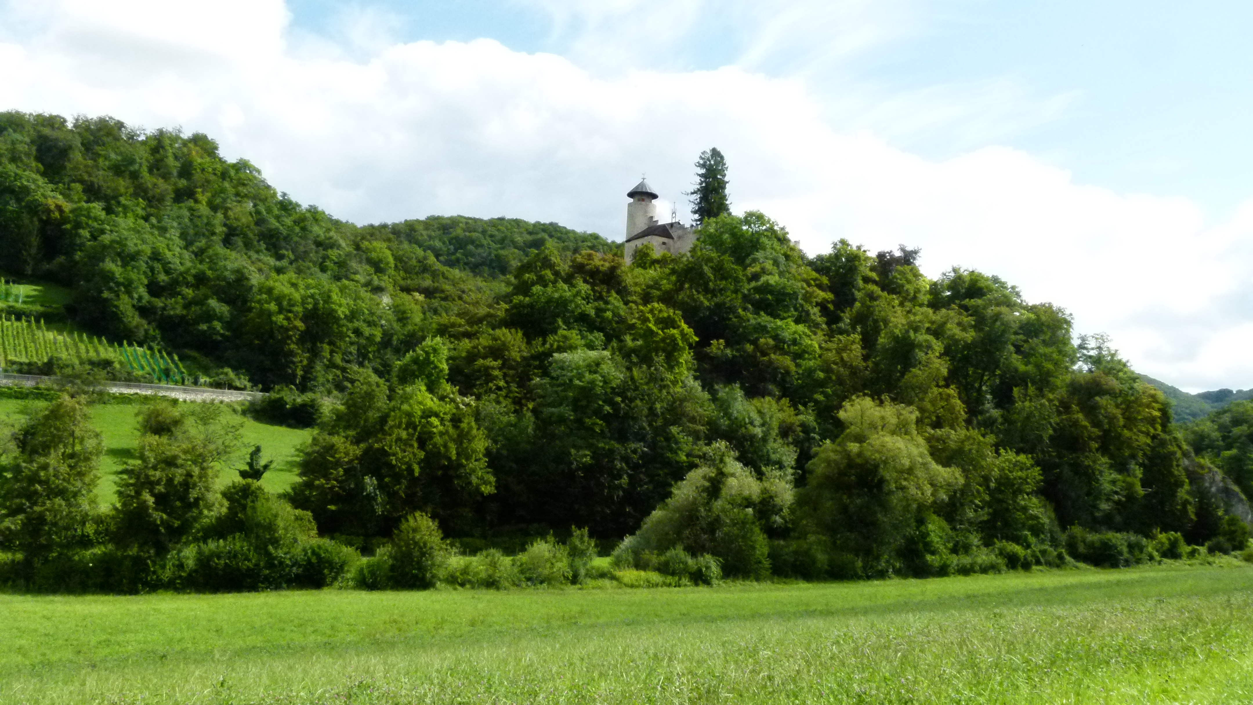
The Ermitage is a romantic English style landscape garden in the Gobenmatttal above Arlesheim (in English also: Hermitage). The garden dates from 1785, was destroyed by Napoleon in 1793, and has since been renovated repeatedly. The Birseck castle (also destroyed by Napoleon) is part of the garden.
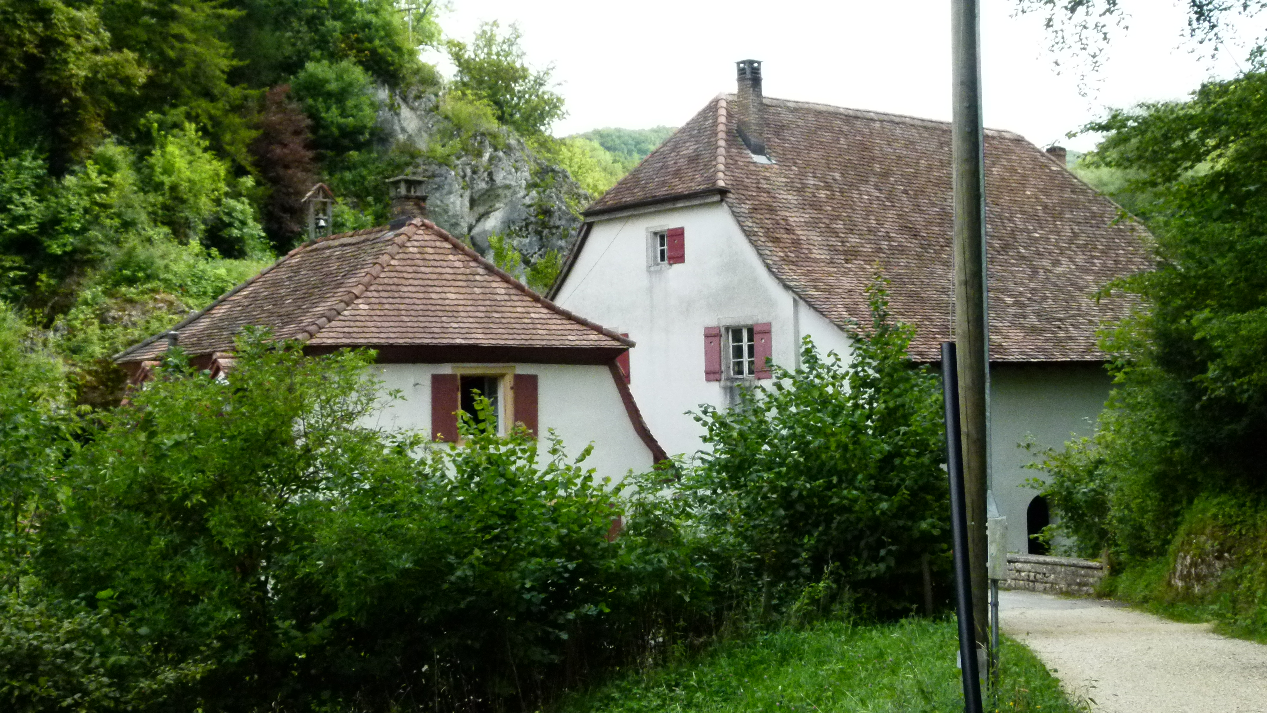
Along the Gobenmatt creek, there are a few houses. The entrance is marked by an aqueduct, the former mill and the house of the gardener with the annex that was used to produce tobacco for some time (“Tabakstampfe”).
There are three ponds. The first pond is small…
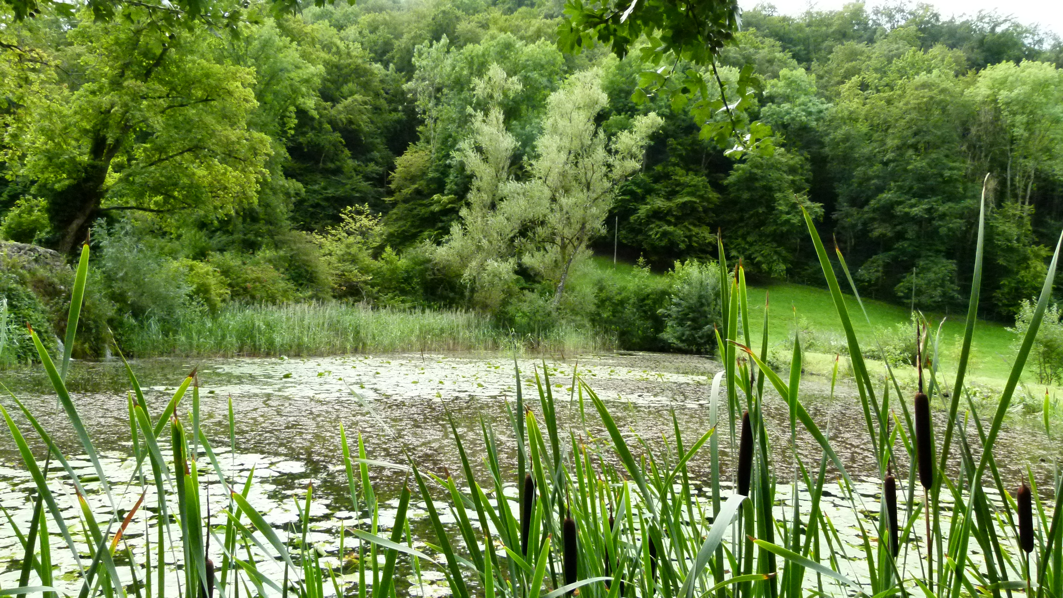
… and it is fed by a small rocky waterfall.

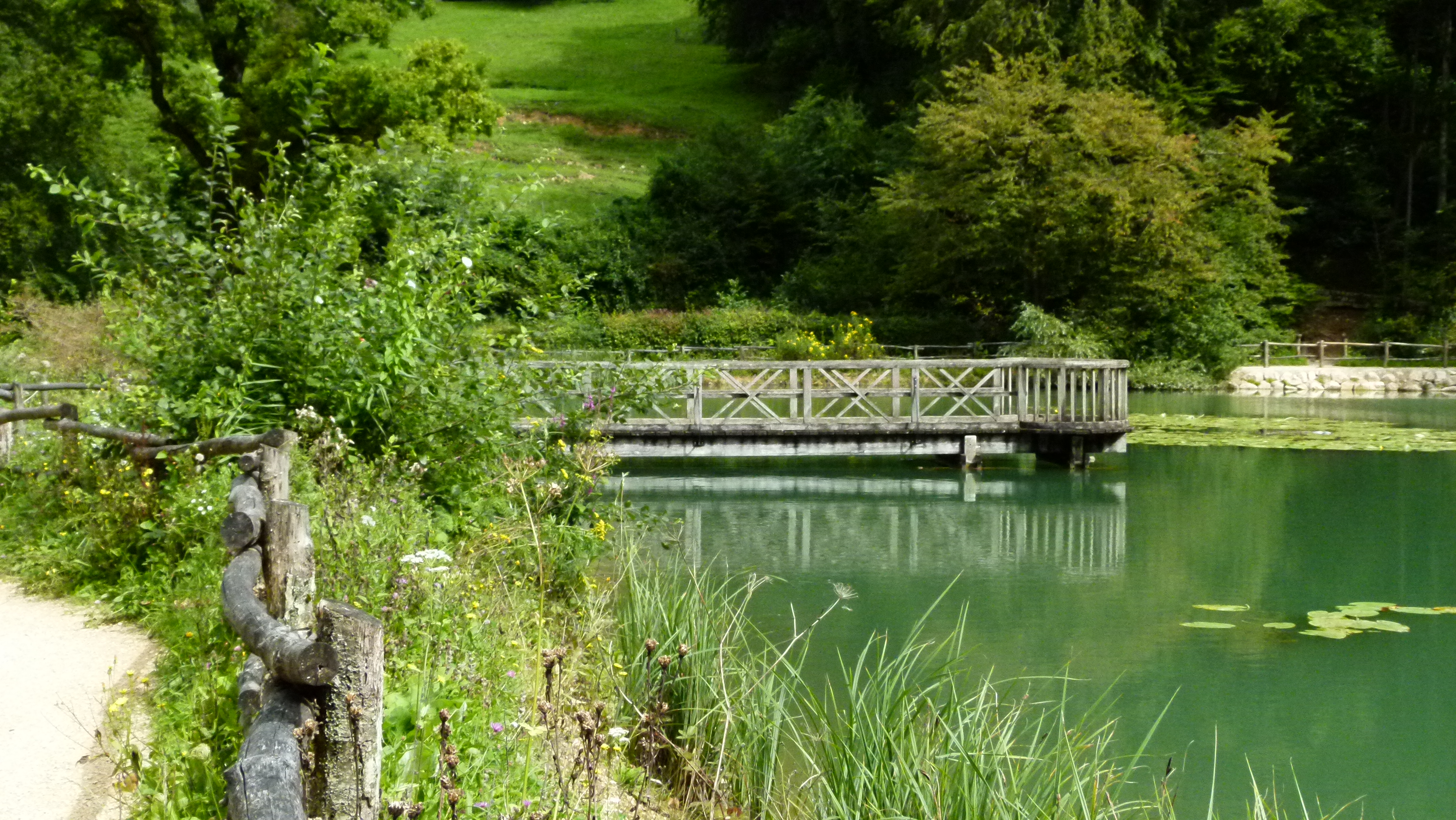
The second pond is larger. It is full of memories for me. When I was a child, my grandmother often took me to the Ermitage. In her huge bag she always carried old bread, and we stood on this wooden platform to feed the carps. I was surprised to find the wooden platform unchanged, but feeding the carps is no longer allowed. What do kids do today – do they play carp feeding on their iPhones?
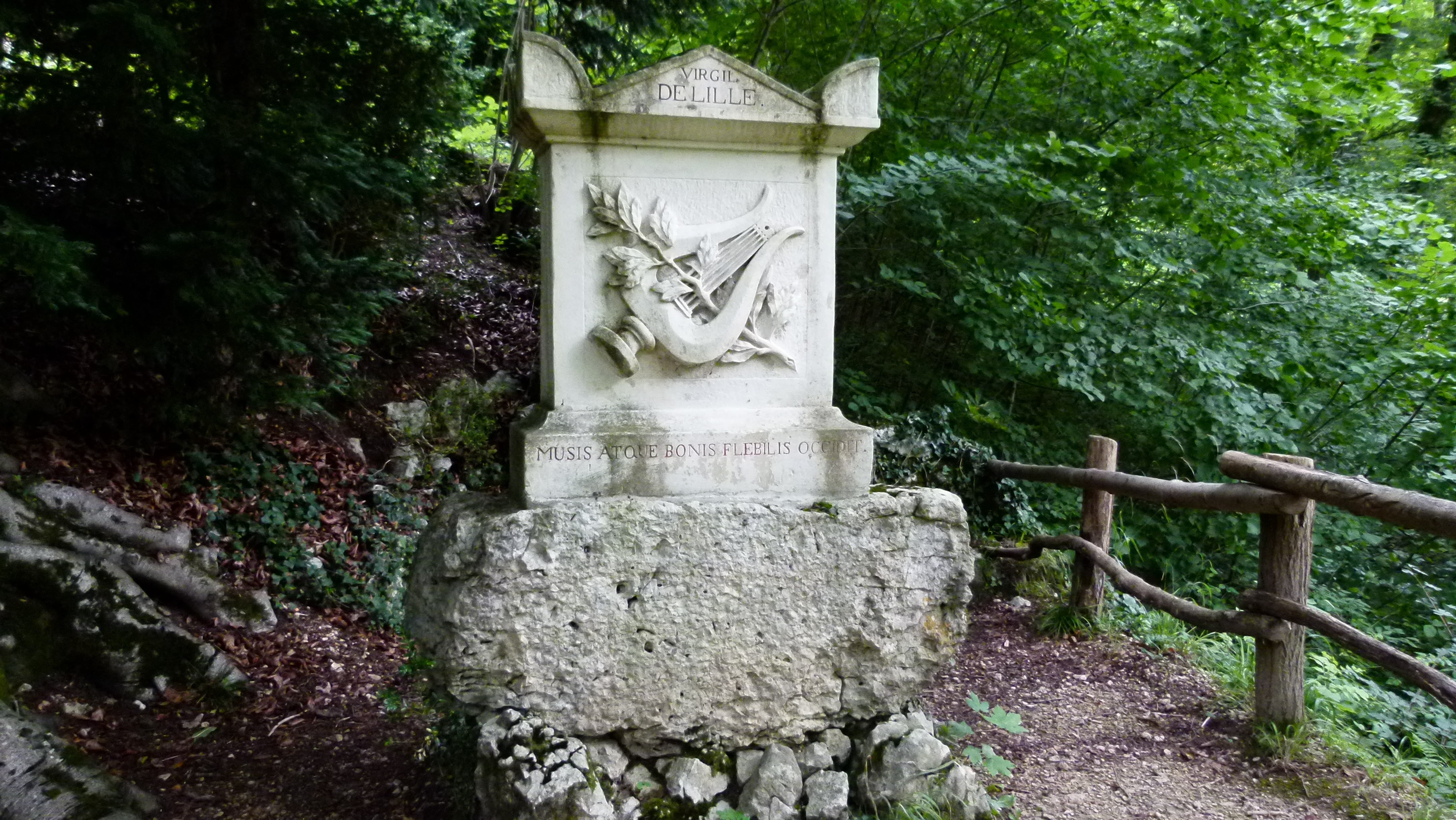
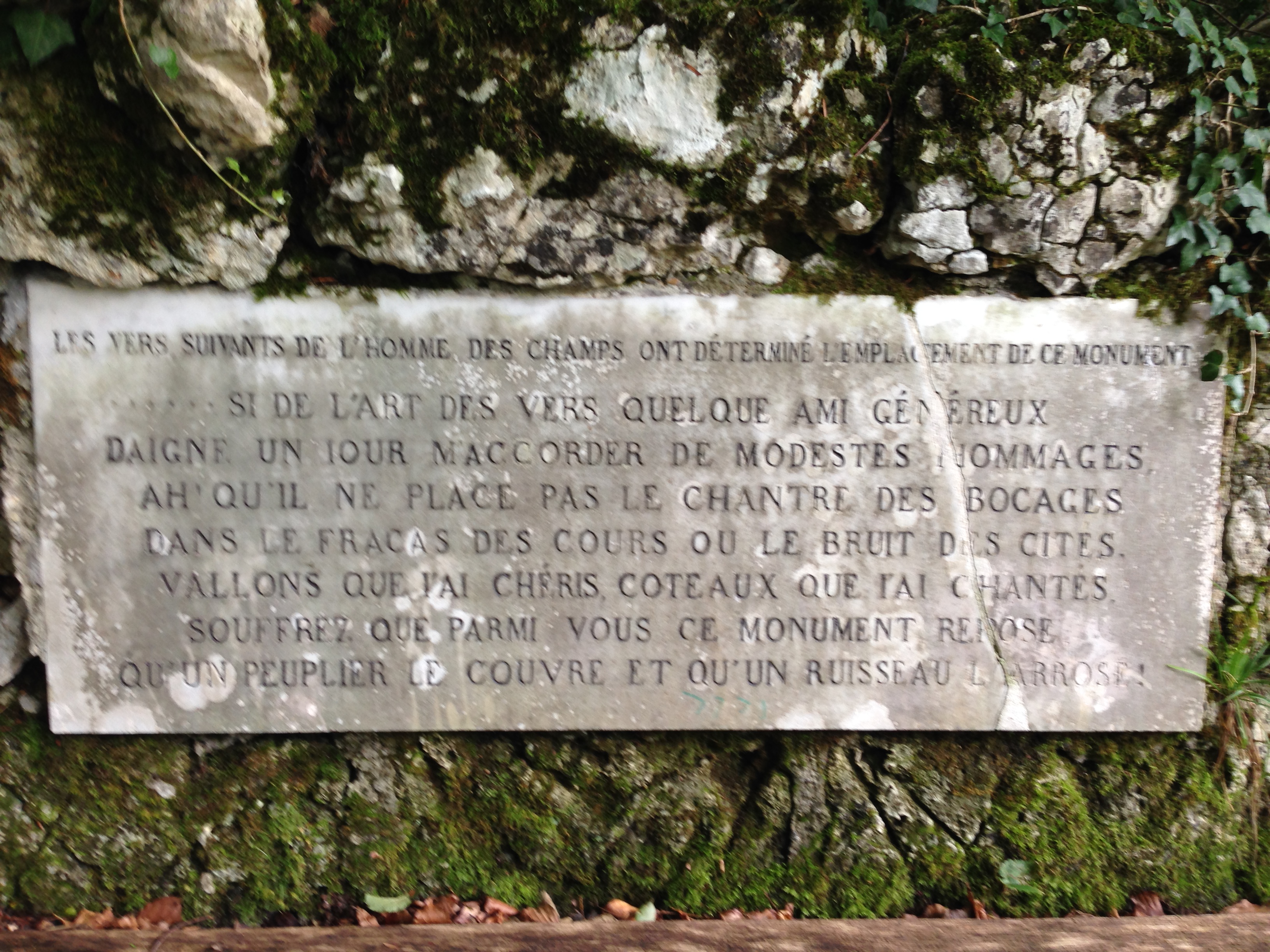
The rocky hill under the castle Birseck hosts attractions such as caves and hermits cells – I visited the monument for Jacques Delil (also called Virgil de Lille). He translated Virgil and he was a nature poet. After the revolution in France, he emigrated to Basel and wrote “les hommes du champs” that contains this wish: “If anyone would devote a monument to me, it should be under a poplar and near a creek.” He returned to France later and died in Paris in 1814 (Wikipedia ). Basel remembered his wish and erected this monument below the castle ruins..
His wish is written on a slab that stands behind the monument
It was the two Austrians with their Nordic Walking group that took me back to the Ermitage after many, many years. Arlesheim makes a nice target point with its magnificent cathedral (Dom). Our group enjoyed lunch in the friendly restaurant Rössli.
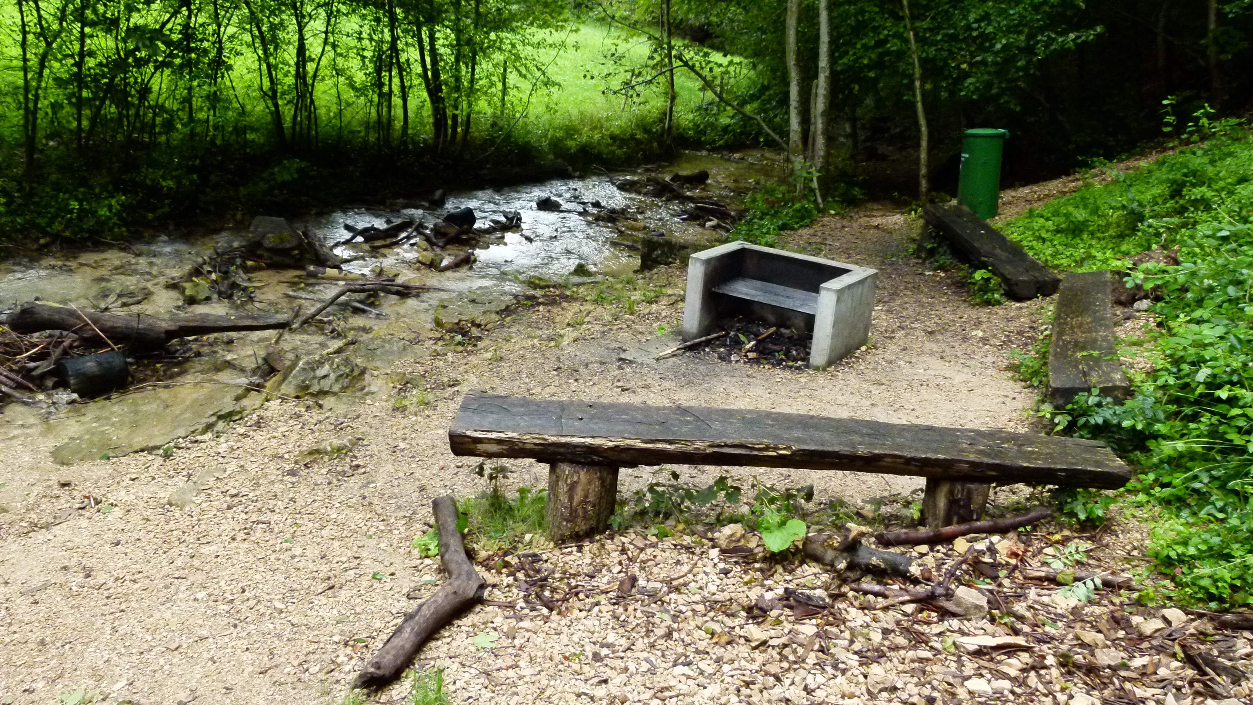
In case it would stop raining (it has been raining all July and August this year), I propose this picnic spot – it is just above the Ermitage in a romantic setting bordering the Gobenmatt creek. Of course it provides a luxury barbecue grill, as most barbecue places around Basel do.
On the way to Schönmatt: The farm that looks like a boat: Ränggersmatt.
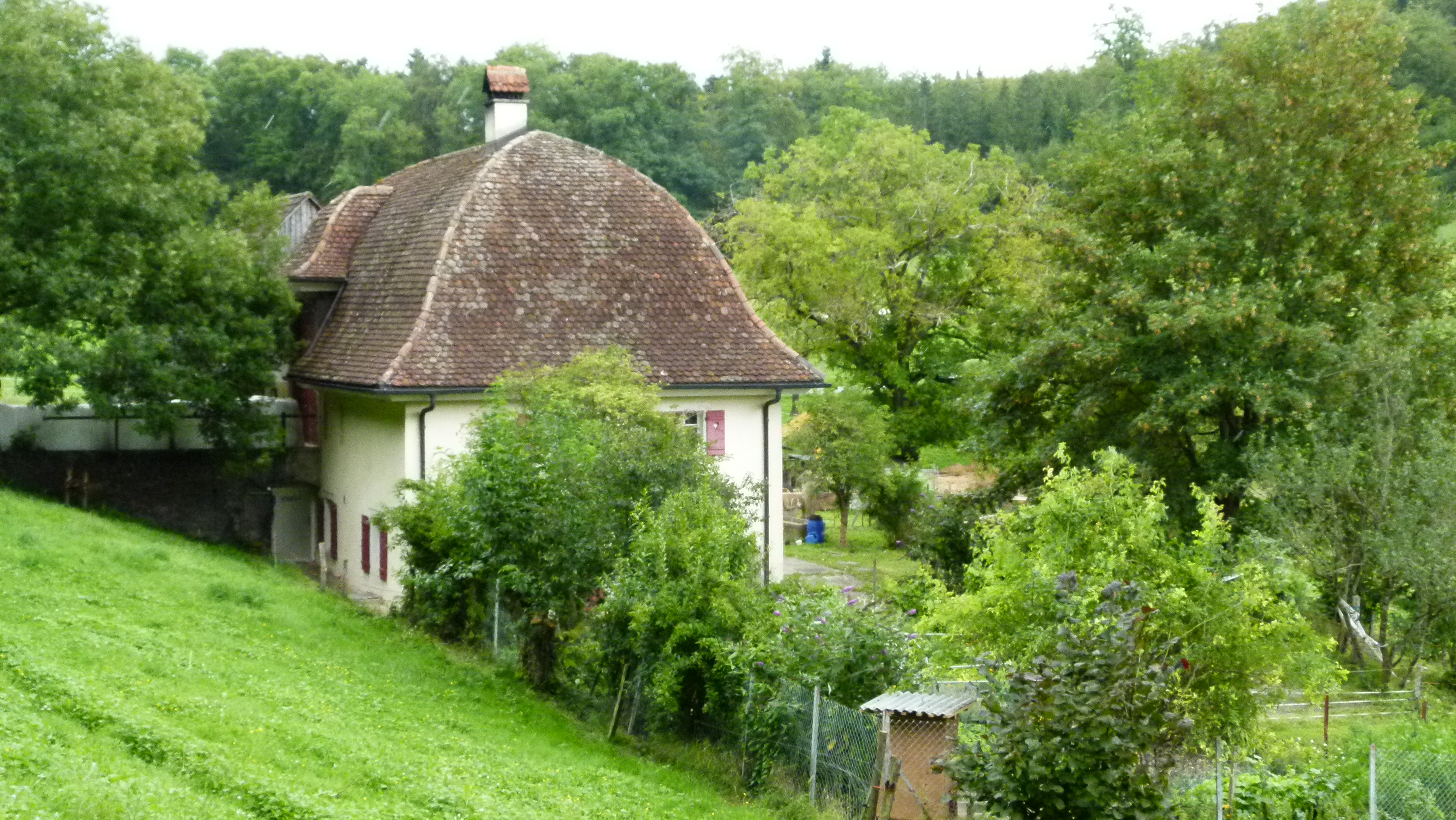
A third class road (Schönmattstrasse) leads from Arlesheim to the Schönmatt on the Gempen plateau. On the way there is the farm “¨Ränggersmatt“. In the late 18th century a man called Renker owned a small house on this meadow. In 1821 Conrad von Andlau built the farm with this hipped roof (Walmdach) that reminds me of a boat.
Behind the Ränggersmatt I find another great picnic area… the wood is already waiting to be used for the next barbecue.
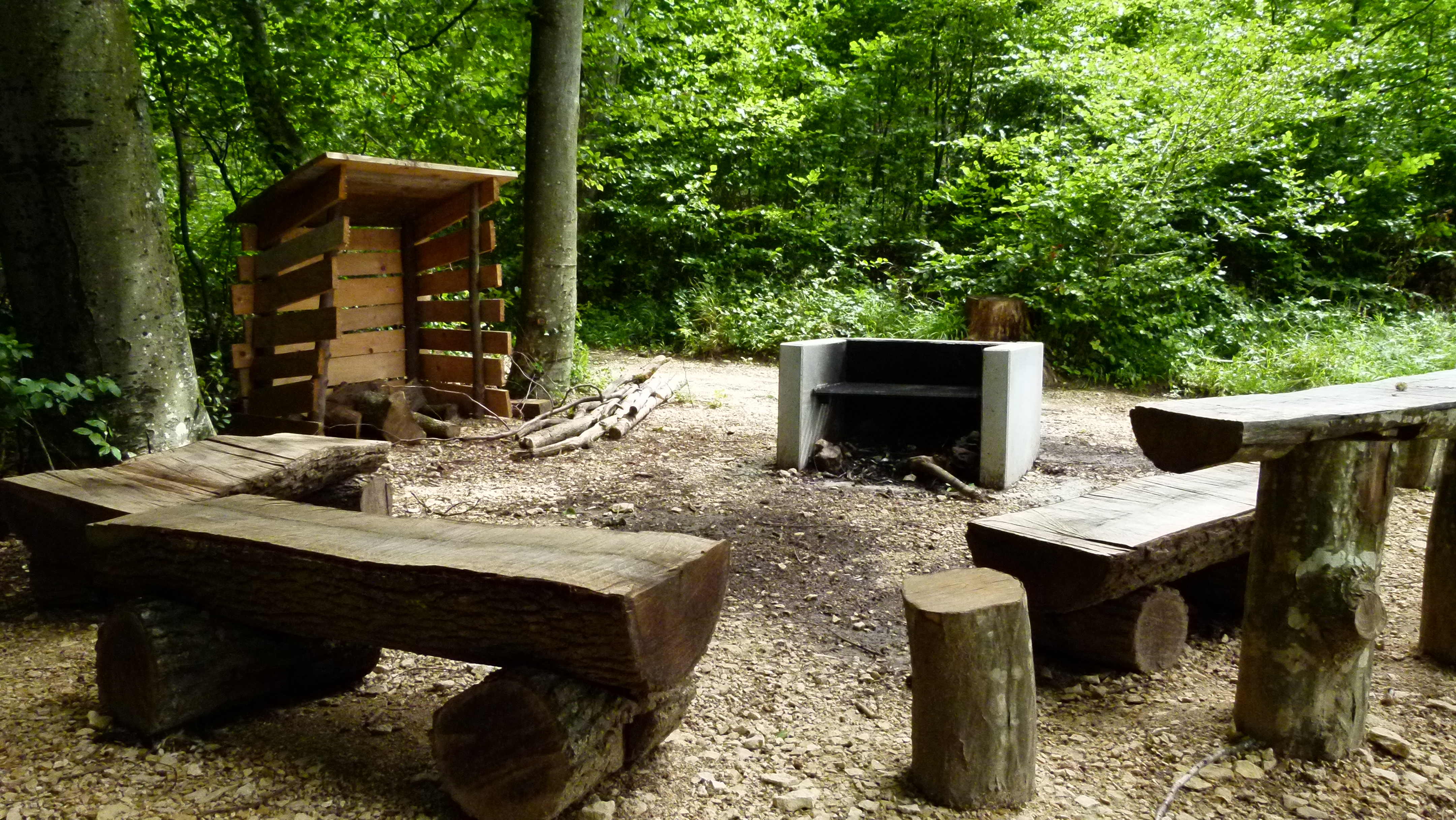
And behind this picnic spot the Grenzweg (“border trail”) to the Schauenburg starts.
.
The trail following the border between two cantons and leading to the Schauenburger Flue
Yes, I have been on this trail before. I always came here with Ernst, and we balanced our mountain bikes over wet blocks of stone, when heading to the Gempen (Schartenfluh). I then always wondered, what these “stone blocks” were, but we never stopped to look at them more closely. The trail was slippery and needed caeful attention from us bikers. When I came here as a Nordic Walker, guided by my friends from Austria, they pointed out to me that this is the border between the canton of Rural Basel (Baselland) and the canton of Solothurn.

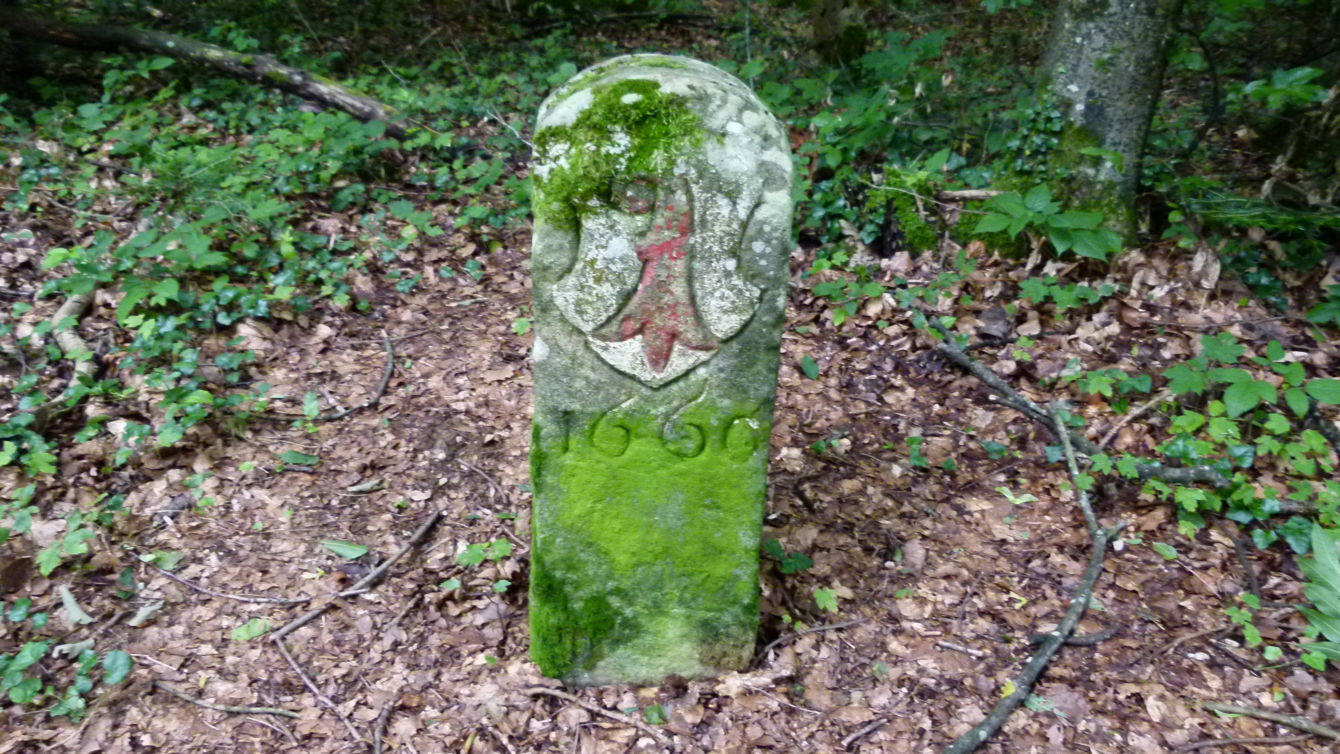
And they showed to me that some of these boundary stones are old… this one is from 1660. 1660 – this was long before 1833, when Basel split into Basel Town (Baselstadt) and Rural Basel (Baselland), when the farmers revolted. In 1660 there was just one canton of Basel ruled by Basel Town. Hence, the boundary stone shows the emblem of Basel Town: It is a bishop’s crook with the handle looking left – and it is black on white (the color has faded here).

The emblem of Rural Basel is also a bishop’s crook, but the handle looks to the right and is red. The inhabitants of the two Basel will vote about being reunified soon. Some parties in Rural Basel are against the reunification, as the red (rural) bishop’s crook on this poster says defending himself against the black crook attacking him.

Wait a minute, what has happened to the emblem on this boundary stone of 1667. Also 1667 was long before 1833. Hence the crook has to be of “Basel Town” with the handle pointing left. Yes, the crook’s handle is directed to the left, but someone has painted it red to make it look more like Rural Basel, But it is not quite right… Rural Basel would have to exchange all border stones….
.
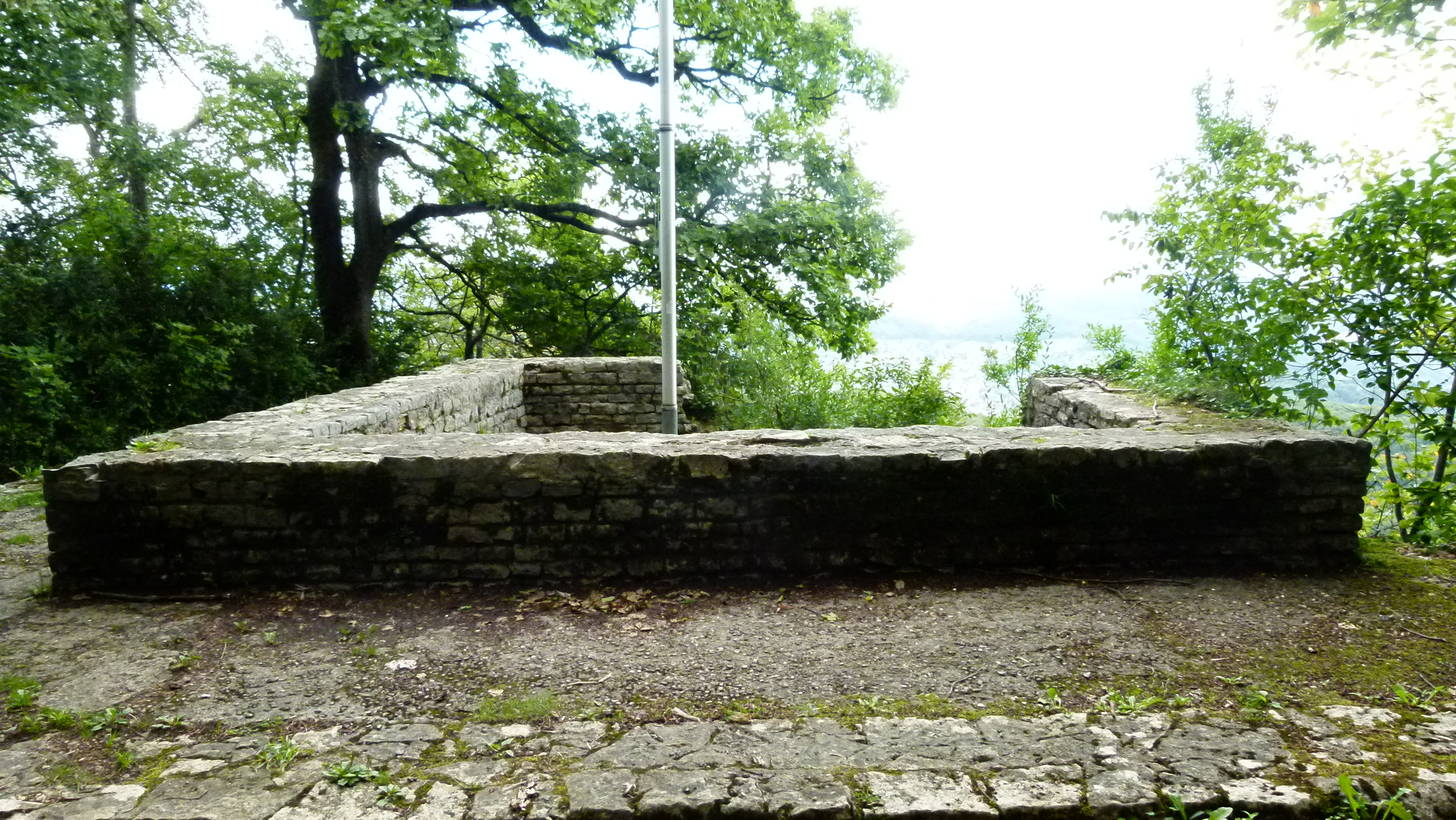
A Gallo-roman temple on the Schauenburger Flue
Another Nordic walking tour with Andreas took me to the Schauenburger Fluh above Frenkendorf. On the edge of the rock (Fluh in German or Flue in Swiss German) was a Gaelic and later a Roman temple. Not much is left of it.
On www2.rzgm.de, I find the detailed history of temples made for circumambulation (Umgangstempel) that could be found in Roman towns and also in salient locations such as wells, lakes or hills – the temple on the Schauenburger Fluh being one of the most extreme examples – built directly above the rock. This is what historians think it looked like.
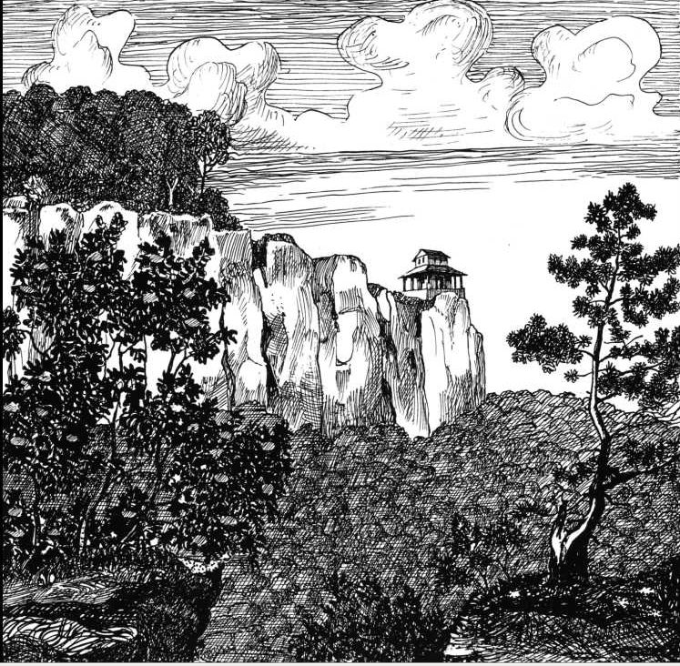
Source: www2.rzgm.de
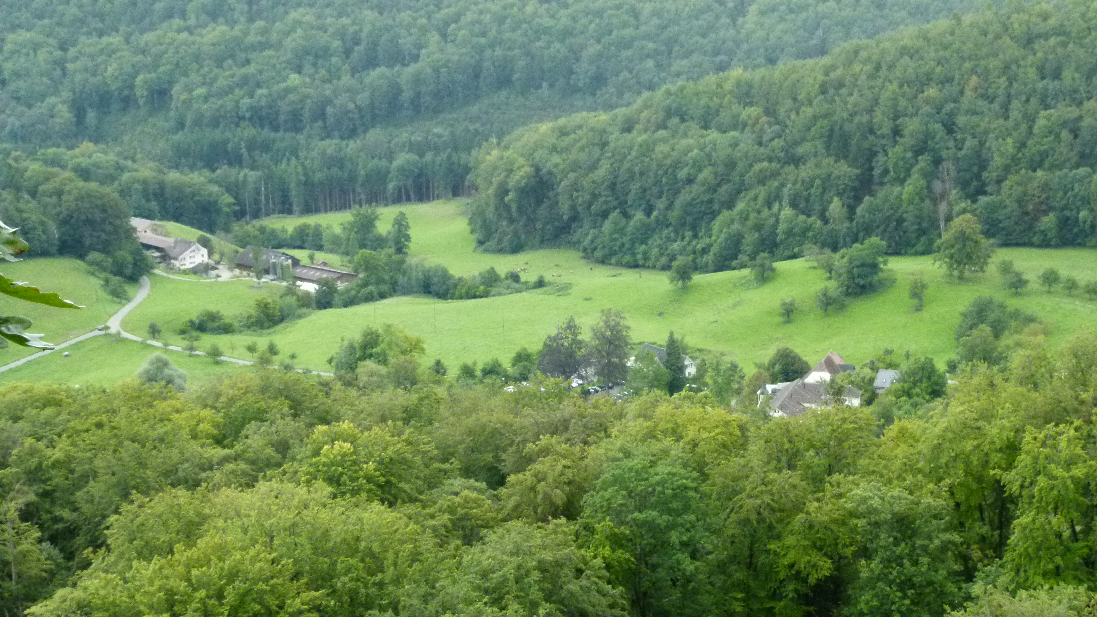
And this foto shows the cliffs from below (from Alt Schauenburg).

Below the cliff is the hotel and restaurant Bad Schauenburg. When working for Ciba-Geigy and Roche in the 1980/90s, I spent some time here participating in brainwaves, enjoying the excellent food and the hotel in this quiet setting.
.
There are more treasures around Basel
These were some of the treasures southwest of Basel. There are more… and I will continue to write about them. Looking back I just wonder why I knew so little about my homeland.

Danke Petra, Griessli, Helga
Euch gebührt das Dankeschön, denn Ihr habt mir so viel gezeigt. Petra
Einfach wunderschön, und sehr beeindruckend beschrieben! Vielen Dank für so viel liebevolle Klein-Ode und Aufmerksamkeit!
Barbara
danke,Barbara, es freut mich, dass Dir mein Blog gefällt. Es gab so viel zu entdecken, da wo ich zu Hause bin.
[…] clearly with the Swiss yellow rhombus and guides hikers safely to the Fluh (see my earlier blog). Also the way to Schauenburg Bad is clearly highlighted. But to find the ruins and understand […]