Boundary stones tell stories. Where I live, they tell us about the history of the Regio Basilienis. One example are the historical boundary stones along the “Eiserne Hand” (“Iron Hand”) at Riehen.
The “Iron Hand” looks more like a finger. It belongs to Riehen and reaches into Germany, between Lörrach-Stetten and Inzlingen. The “Iron Hand” is about 1.7km long and 50m-300m wide. The boundary line encompasses 3.5km overall (red line around “Herrenwald” and “Maienbühl”).
Source: Swiss Topo and my own photos
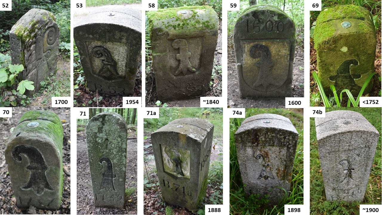
More than 40 boundary stones mark the border along the “Eiserne Hand”. I show some stones on the map above. The oldest stone is from about 1500.
The oldest boundary stone with the red bishop’s crook, about 1500
The oldest boundary stone (#61, about 1500) is nicknamed “Bischofstein“ (Bishop’s Stone). In 1500, the Bishop of Basel resided in Basel, and Riehen was one of his possessions. The stone shows the red bishop’s crook on the Swiss side. It is the only red bishop’s crook along the “Eisernen Hand”. The black bishop’s crook below is the coat of arms of the CITY of Basel that we will see on all the other boundary stones.

Coats of arms of the Schönau family NORTH of the “Iron Hand”
On the German side of the Bishop’s Stone #61 from about 1500, we see the coats of arms of the noblemen of Schönau.
Stone #61 is on the northern border of the “Eisernen Hand” (towards Stetten which is located north of the “Iron Hand”).
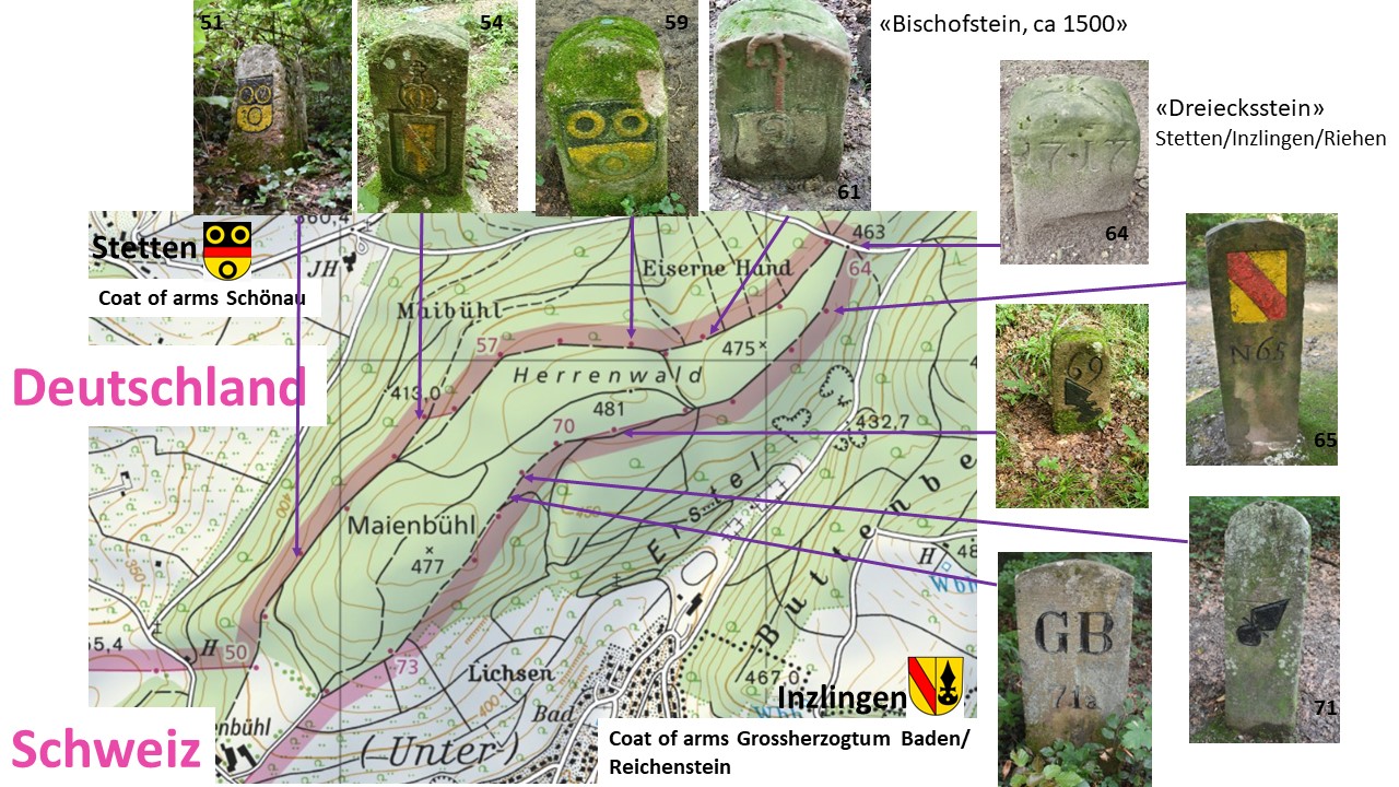
Towards the north, the Schönau family marked more boundary stones, such as #51 from the year 1600,…
… and stone #59 from 1700.

The Schönau were a powerful noble family in the Black Forest. The city of Stetten uses the three rings of the Schönau family in their coat of arms today.
Coats of arms of the Reichenstein family SOUTH of the “Iron Hand”
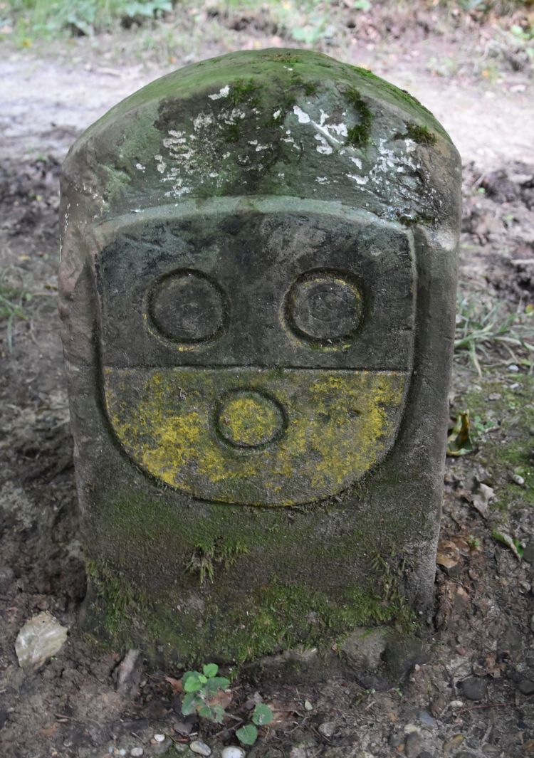
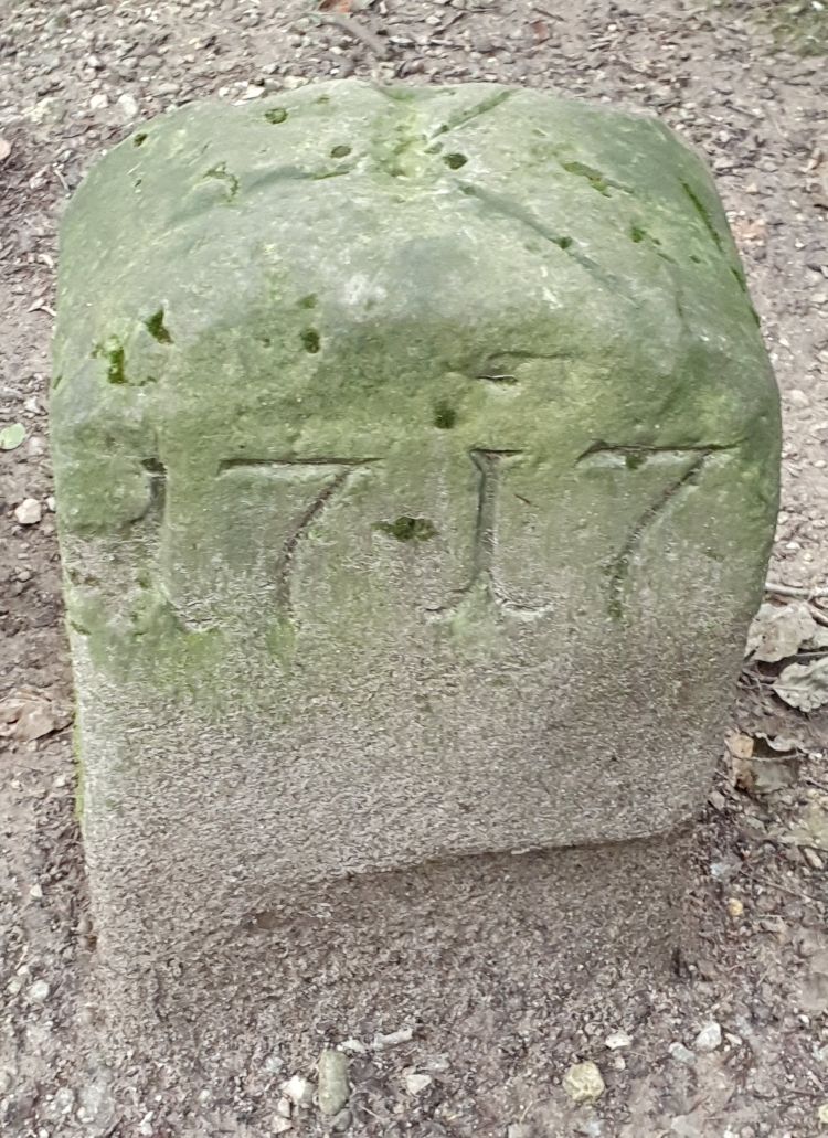
Along the southern border of the “Eiserne Hand” (towards Inzlingen, located south of the “Iron Hand”), I find five stones with the coats of arms of the noblemen of Reichenstein. They owned Inzlingen as a fief. The years I identified are 1717, 1737 und 1752.
Examples are the stone #69, with no year, …

… the stone #70 from 1737, …

… and the stone # 71 from 1739.

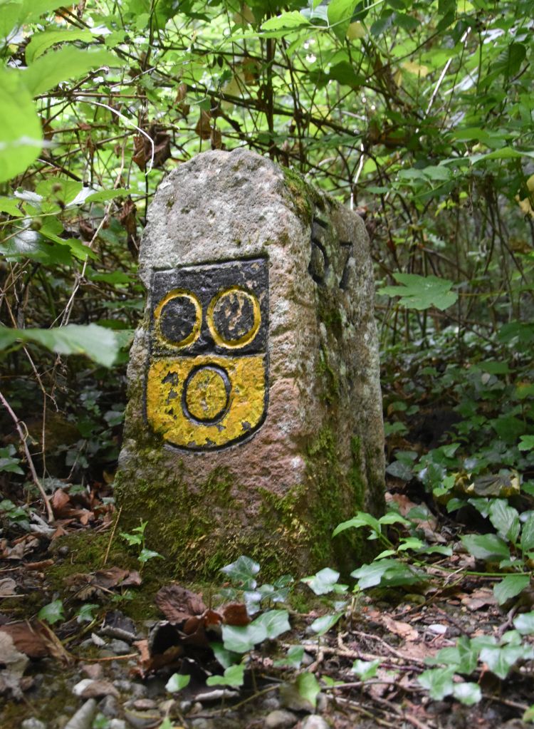
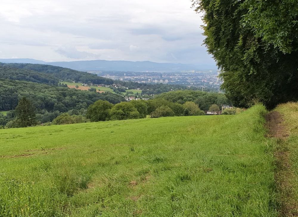
This is the view of the German settlement Inzlingen that once belonged to the Reichenstein family; I took the photo from the path aolng the border of the “Iron Hand”, in the rain.
By the way: The coat of arms of the Reichenstein family can also be found along the boundary path behind the Chischona and on Reichenstein Castle at Arlesheim.
Boundary stones marked by the Grossherzogtum Baden (Grand Duchy of Baden) (1806-1918)
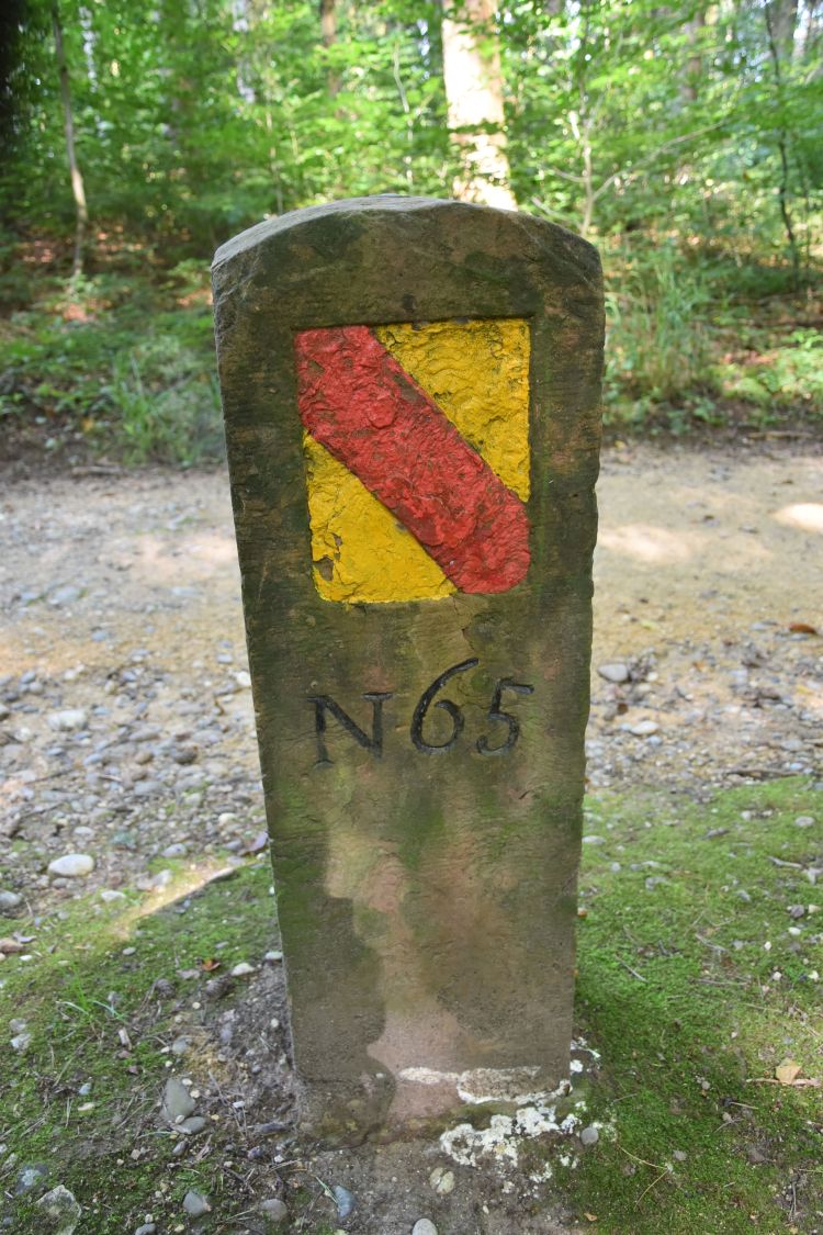
From 1806 to 1918, the German area bordering the “Eiserne Hand” was called Grossherzogtum Baden (Grand Duchy of Baden). That is why we find the coat of arms of the Grand Duchy with the slanting red bar on yellow background (years I found are 1830/40/42/48/56).
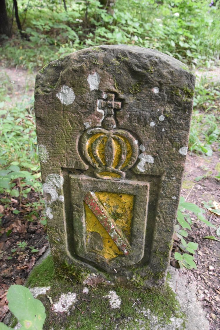
The most beautiful boundary stone is #54 from 1842 with the crown.
The other stones just show the red bar on yellow background such as #65 (no year, I assume mid 19th century).
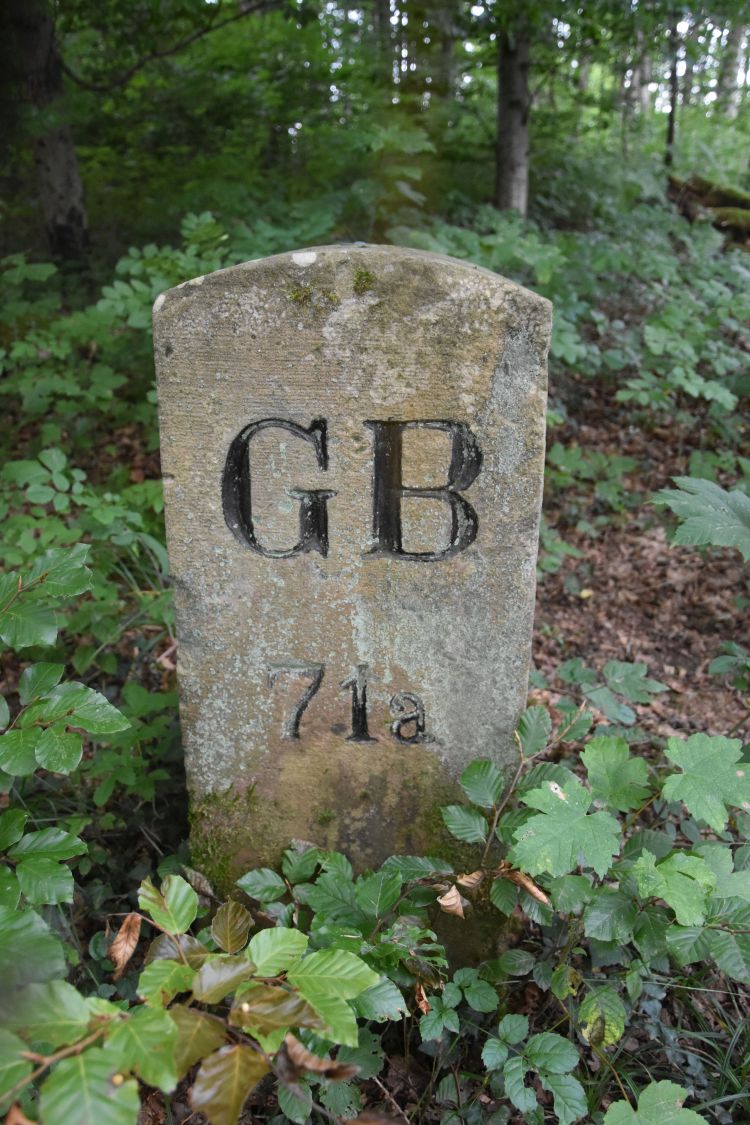
Later the Grand Duchy invested less effort and marked their stones just with “GB” for “Grossherzogtum Baden”. I found nine stones with “GB” with the years 1888, 1898 and 1900 engraved. This is stone #71a from 1888.
By the way, boundary stones with the red bar or the letters “GB” are found along all the borders of Basel with Germany, for instance also on the Chrischona.
Republic of Baden from 1918 to 1945
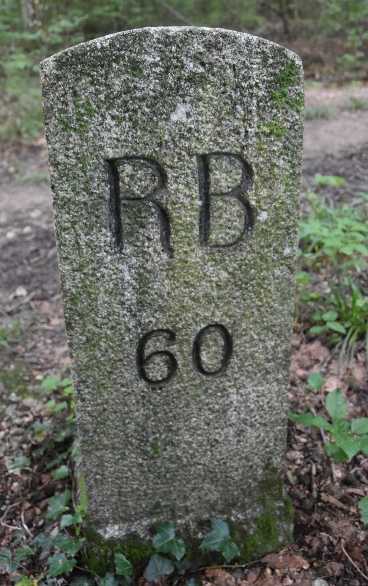
From 1918 to 1945, Baden was a Republic; from this time, I found one boundary stone, #60, marked with „RB“ (“Republic of Baden).
Unified as Baden-Württemberg from 1952
In 1952, the German area bordering the “Eiserne Hand” was unified to Baden-Württemberg. I found two boundary stones from 1954 showing a plain “D” on the German side.

The “turning point” marked by the “Dreieckstein” (“triangle stone”)
The “turning point” of the Eiserne Hand is marked by the so-called “Dreieckstein“ (“triangle stone”), stone #64 from 1717. Here the German communities Lörrach-Stetten and Inzlingen meet the Swiss community Riehen.
The black bishop’s crook of the City of Basel on the Swiss side
On the Swiss side, Riehen was acquired by the bishop of Basel in1270. After the reformation of 1529, Riehen remained with the city of Basel. The city of Basel has always marked their side of the “Eiserne Hand” with the (black) bishop’s crook, and the crooks vary in shape. Here are some examples.
The city “owning” the black bishop’s crook can be seen from the boundary path along the “Eiserne Hand”.
Boundary stones tell stories; they tell us about history
Boundary stones tell stories. Where I live, they tell us about the history of the Regio Basilienis. One example are the boundary stones along the “Eiserne Hand” or “Iron Hand”: On the German side they mark the evolution from the possesions of the noblemen of Schönau and Reichenstein (family coats of arms) to the Grand Duchy of Baden (elaborate representations of the coat of arms – slanted red bar on yellow background – and plain “GB”). Later the duchy became the Republic of Baden (RB). Now we border the German state of Baden-Württemberg (plain “D” on the stones). On the Swiss side the stones illustrate the evolvement of Basel as the bishop’s residence (with the red bishop’s crook, before 1529) to the protestant city of Basel (with the various black bishop’s crooks).
The “Iron Hand” is just one example of historical boundary stones. There are may more examples, such as the Benkenspitz (border with France), the trail to the Schauenburger Fluh (border between Basel and Solothurn) or the border of the Prince Bishopric of Basel such as above Biel-Benken. And – there are many more boundary stones waiting to be explored.
May some of you decide to discover the stones of the “Eiserne Hand” and later turn to the borders with other cantons, with France, with Germany or check, where the historical Prince Bishopric of Basel has left marks. The small monuments are hidden in forests and fields around Basel and they speak to us. We just have to listen to them.
Sources:
- Wiki entries about the Eiserne Hand, about Stetten, about the Grossherzogtum and the Republic of Baden
- Homepage of Stetten and Baden,
- Information website of the Wasserschlosses Inzlingen,
- Working material (Arbeitsmaterialien) Heimatkunde Riehen.