On the road – discovering treasures around Basel: To the southeast (III)

Discovering treasures, while being forced to just walk around Basel

As from April to August I was forced to stay at home, I walked and walked discovering and rediscovering gems around Basel. Here is the third set of gems in the southeast, on the Gempen and the Wartenberg.

This is the map showing the mountain/hill of Wartenberg (between Muttenz and Pratteln) and the long stretched mountain plateau of the Gempen. The gems that I am talking about in this blog are highlighted in grey: The bunkers, the Rothallenweiher and the Sulzkopf with the Sulzgrube. In addition I found more background information about the Wartenberg being a valley and not really a mountain.

Kartenba

Source: Bundesamt für Landestopographie 213T – Basel

.

Trying to understand why the Wartenberg is not a mountain, but a valley

In the former blog “discovering treasures around Basel: To the southeast II“, I remembered that my geography teacher always told us: “The mountain Wartenberg is a valley” and he also showed us the signs of the Rheintalflexur under the cascades of the Birs near the “Schänzli”. I found a document of H. Laubscher from the ETH (Rheintalflexur und Tafeljura) that helps me to come closer to understanding this paradoxon of the “mountain Wartenberg that is a valley”. I borrow one figure from this document:

Rheintalflexur

The Wartenberg is a ditch; it slid down, as the figure shows. Hence it is a “valley”. It was also bent, as it hit the brick wall of the Sundgau near St. Jakob. This “flexur” has been uncovered even more, when building the Schänzli motorway tunnel  (Rheintalflexur). The Wartenberg slid down and was lifted up at the same time – becoming the “mountain” with its southwards facing slopes that host the vineyards and give us the wine that we keep as a secret for us…  I also have some bottles of Jauslin  wines in my cellar.

IMG_0634

.

The bunker forest

From the Birs and the “Rheintalflexur” near St. Jakob, a steep path  leads to the Rütihard. The forest is full of deactivated bunkers from the first and second World War. They now serve as platforms for sprayers. Here are two examples, one with the bishop’s crook of Basel Town (Baselstadt) and one with some more abstract forms.

P1060396

P1060394

There are also many picnic places here. I can smell that families with their children are roasting “Klöpfer” (traditional sausage/cervelat of Basel) on the open fire.

.

Rothallenweiher (Pond of Rothallen): Deep water full of legends în the nature reserve “Rothallen”

A small path leads to the pond of Rothallen. A wooden trail surrounds the pond and protects the fragile vegetation of mushrooms and moss. A wooden platform allows accessing the pond.

P1060401

The pond belongs to the network of nature reserves in the  trinational area around Basel.

P1060397

According to the explanations, the Rothallenweiher is a doline filled with water. It is extremely deep – we ignore how deep it is. Legends tell that knights fell into the pond and their souls sometimes resurge from the water. In the 1990s Muttenz cut some beech trees around the shore to let the sun in and add some water plants. Insects and amphibians live here. This is a place to come back to in spring to observe the animals.

.

Sulzkopf (or Sulzchopf) with Sulzgrube

The Sulzkopf is the most well known picnic place around Muttenz.

P1060410

There is also a hut here that can be rented.

P1060443

The view of Basel and bordering Germany and France is superb (we call this trinational area “the corner of three countries” or “Dreiländereck”).

P1060411

The vineyards and the three fortifications of the Wartenberg are just vis-a-vis. Basel, the Black Forest and the Vosges are often in the haze – also today.

P1060407

“Sulz” is a medieval term for salt water and appears in place names (toponyms) in Southern Germany, Switzerland, Alsace and Austria (wikipedia). Just below the Sulzkopf, the Rhein Salinen AG extracts salt near the farm “Eigental”. As the name “Sulz” shows, our ancestors knew about the salt here!

Below the Sulzkopf is the Sulzgrube. This is an old quarry abandoned in 1918. Now it is a nature reserve that hosts rare plants, e.g. 12 orchids, as the community of Muttenz explains proudly.

P1060413

The Sulzgrube is just pure nature.

P1060441

The access is not highlighted. I find a steep trail not far from the Engental that takes me to the Sulzgrube – and, but this is not straighforward at all – eventually to the Sulzchopf, just behind the hut.

  .

There are more treasures around Basel

This was the third selection of treasures from southeast of Basel. There are more treasures around Basel and I will continue to write about them. I love to travel and discover cultures far from mine, and now I enjoy diving deeper into my roots at home while recovering more and more.

On the road – discovering treasures around Basel: To the southeast (II)

Discovering treasures, while being forced to just walk around Basel

From April to August, I walked and walked discovering and rediscovering gems around Basel. Here is the second selection of gems in the southeast, on the Gempen and the Wartenberg.

This is the map showing the hill of Wartenberg (between Muttenz and Pratteln) and the long stretched mountain plateau of the Gempen.

Karten_deutsch_wartenberg

Source: Bundesamt für Landestopographie 213T – Basel

.

Gorgeous town centers of Muttenz and Pratteln

Both Muttenz and Pratteln have taken care of their romantic village centers with the fortified churches. Below is the fortified church of Muttenz.

P1060169

Both Muttenz and Pratteln boast of nice small restaurants that are great target points for our Nordic Walking group guided by my friends from Austria.

.

Just half an hour and 200m above Muttenz: The Wartenberg with three fortifications

On the Wartenberg – 200 meters above the village – there are three castles that watch over Muttenz. The three castles can also be found on the emblem of the community. Until 1300 Muttenz and the castles belonged to the canonry of Strassburg, then changed owners several times, until they were acquired by Basel in the 16th century.

This is the northern or anterior ruin of Wartenberg. It is the largest of the three castles. It  is said to be from Carolingian times (around 800 –Wikipedia ).

P1060173

From here I enjoy a great view to the east or High Rhine valley (in German: Hochrhein).

P1060171

And this is the castle that sits on the highest point in the middle between the two other ruins. The residence tower dates probably from the 12th century.

P1060177

From here there is a great view of Muttenz and Basel. In the background to the left are the Vosges and to the right the Black Forest.

P1060180

This is a third fortification farther south, called the posterior ruin. It was probably used as a refugium for the inhabitants of Muttenz.

P1060210

Vast meadows cover the Wartenberg plateau. Gallaway cattle are grazing here. My brother-in-law keeps Gallaway cattle in the Bernese Alps producing excellent bio beef meat.

P1060182

Watch out, there are also areas, where the Swiss men practice shooting – this is mandatory for those serving in the militia army.

P1060206

Vineyards benefit from the sun on the south facing slopes. Muttenz grows some excellent wine here that we keep for ourselves in Muttenz and around Basel – sorry.

P1060186

When I went to school in the 1960’s, our geography teachers took us out to explore the Wartenberg. Near the ruins we looked for fossils. Our teacher also pointed out that the Wartenberg is not a mountain, but a ditch. I do not really understand this, but I find various documents on the internet that study the risks of the Wartenberg ditch for a waste disposal site (Wartenberg-Graben, Studie für Deponie) and for the railroad shunting yard (Wartenberg-Graben, Studie für Rangierbahnhof). The “artificial” mountain in a ditch does not seem to be very stable: There was a devastating landslide in 1952 (report): 300’000 m2 slid down and destroyed buildings (even a solid concrete bunker) and the vineyards. The people from Muttenz repaired the slopes and the vineyards are back in place.

.

A monastery above Muttenz: Built in the 13/14th and abandoned in the 16th century (after the reformation)

Andreas, my friend from Austria, guides our group of Nordic walkers to the Engental above Muttenz. He points to a line of trees and a field and says: “This was once a monastery”. The nuns had selected a unique place for their monastery: The view from here to the Rhine valley and the Black Forest is wonderful (it is a little hazy today).

P1060222

P1060216

We can hardly believe this. But, Andreas shows the memorial board that confirms the monastery from 1268 to 1525. About 12 nuns lived here.

P1060193

After the reformation, the monastery was abandoned and decayed. The Muttenz chronics of the 18th century mention that nature has almost fully conquered the monastery, and today nothing is left.


The wonderful local history website of Muttenz includes a painting of the monastery that I borrow to show the difference between the field today and the monastery that was here around 1500.

Kloster Engental

Source: heimatkunde-muttenz.ch

.

Next to the Engental is the Eigental with the Eigental farm that now has been reused to retrieve salt

It was a few months ago that Andreas (my friend from Austria) showed the Engental monastery to me. In the meantime, my head had confused Eigental and Engental. After all – those two valleys are just next to one another. When I came back to take pictures, I first looked for the monastery place in the Eigental – and made an unexpected discovery: Construction is going on here. Caterpillars have churned up the earth around the farm buildings. Is the farmer renovating his farm? No – surprise – the Swiss Rheinsalinen AG is extracting salt  – high above Muttenz and in a farming area.

P1060195

There is a salt block of 50m under the Eigental farm that had caught the attention of the Rheinsalinen AG. Had I not messed up the valleys “Eigental” and “Engental”, I would not have found out about this salt extraction. This reminds me of Kairos and the princes of Serendip that I blogged about half a year ago.

.

There are more treasures around Basel

This was my second selection of treasures southeast of Basel. There are more… and I will continue to write about them. And looking back I keep on wondering why I have ignored so many gems and their background in my homeland so far.


On the road – discovering so much around Basel: To the southeast (I)

Discovering treasures, while being forced to just walk around Basel

As from April to August some surgeries forced me to stay at home, I walked and walked discovering and rediscovering gems around Basel. Here are some of them in the southeast of Basel, starting with a first selection.

This map shows the hill of Wartenberg (between Muttenz and Pratteln) and the long stretched mountain plateau of the Gempen southeast of Basel. The Gempen belongs to the Tabular Jura.

Kartenbc

Source: Bundesamt für Landestopographie 213T – Basel

.

The Ermitage – the romantic landscape garden near Arlesheim

The Ermitage is a romantic English style landscape garden in the Gobenmatttal above Arlesheim (in English also: Hermitage). The garden dates from 1785, was destroyed by Napoleon in 1793, and has since been renovated repeatedly.  The Birseck castle (also destroyed by Napoleon) is part of the garden.

P1060138

Along the Gobenmatt creek, there are a few houses. The entrance is marked by an aqueduct, the former mill and the house of the gardener with the  annex that was used to produce tobacco for some time (“Tabakstampfe”).

P1060140

There are three ponds. The first pond is small…

P1060141

… and it is fed by a small rocky waterfall.

P1060145

The second pond is larger. It is full of memories for me. When I was a child, my grandmother often took me to the Ermitage. In her huge bag she always carried old bread, and we stood on this wooden platform to feed the carps. I was surprised to find the wooden platform unchanged, but feeding the carps is no longer allowed. What do kids do today – do they play carp feeding on their iPhones?

P1060142

The rocky hill under the castle Birseck hosts attractions such as caves and hermits cells – I visited the monument for Jacques Delil (also called Virgil de Lille). He translated Virgil and he was a nature poet. After the revolution in France, he emigrated to Basel and wrote “les hommes du champs” that contains this wish: “If anyone would devote a monument to me, it should be under a poplar and near a creek.” He returned to France later and died in Paris in 1814 (Wikipedia ). Basel remembered his wish and erected this monument below the castle ruins..

P1060146

His wish is written on a slab that stands behind the monument

IMG_0629

It was the two Austrians with their Nordic Walking group that took me back to the Ermitage after many, many years. Arlesheim makes a nice target point with its magnificent cathedral (Dom). Our group enjoyed lunch in the friendly restaurant Rössli.

In case it would stop raining (it has been raining all July and August this year), I propose this picnic spot – it is just above the Ermitage in a romantic setting bordering the Gobenmatt creek. Of course it provides a luxury barbecue grill, as most barbecue places around Basel do.

P1060165


On the way to Schönmatt: The farm that looks like a boat: Ränggersmatt.

A third class road (Schönmattstrasse) leads from Arlesheim to the Schönmatt on the Gempen plateau. On the way there is the farm “¨Ränggersmatt“. In the late 18th century a man called Renker owned a small house on this meadow. In 1821 Conrad von Andlau built the farm with this hipped roof (Walmdach) that reminds me of a boat.


P1060150

Behind the Ränggersmatt I find another great picnic area… the wood is already waiting to be used for the next barbecue.

P1060156

And behind this picnic spot the Grenzweg (“border trail”) to the Schauenburg starts.

.

The trail following the border between  two cantons and leading to the Schauenburger Flue

Yes, I have been on this trail before. I always came here with Ernst, and we balanced our mountain bikes over wet blocks of stone, when heading to the Gempen (Schartenfluh). I then always wondered, what these “stone blocks” were, but we never stopped to look at them more closely. The trail was slippery and needed caeful attention from us bikers. When I came here as a Nordic Walker, guided by my friends from Austria, they pointed out to me that this is the border between the canton of Rural Basel (Baselland) and the canton of Solothurn.

P1060160

And they showed to me that some of these boundary stones are old… this one is from 1660. 1660 – this was long before 1833, when Basel split into Basel Town (Baselstadt) and Rural Basel (Baselland), when the farmers revolted. In 1660 there was just one canton of Basel ruled by Basel Town. Hence, the boundary stone shows the emblem of Basel Town: It is a bishop’s crook with the handle looking left – and it is black on white (the color has faded here).

P1060157

The emblem of Rural Basel is also a bishop’s crook, but the handle looks to the right and is red. The inhabitants of the two Basel will vote about being reunified soon. Some parties in Rural Basel are against the reunification, as the red (rural) bishop’s crook on this poster says defending himself against the black crook attacking him.

P1060242

Wait a minute, what has happened to the emblem on this boundary stone of 1667. Also 1667 was long before 1833. Hence the crook has to be of  “Basel Town” with the handle pointing left. Yes, the crook’s handle is directed to the left, but someone has painted it red to make it look more like Rural Basel, But it is not quite right… Rural Basel would have to exchange all border stones….

P1060161

.

A Gallo-roman temple on the Schauenburger Flue

Another Nordic walking tour with Andreas took me to the Schauenburger Fluh above Frenkendorf. On the edge of the rock (Fluh in German or Flue in Swiss German) was a Gaelic and later a Roman temple. Not much is left  of it.

P1060162

On www2.rzgm.de, I find the detailed history of temples made for circumambulation (Umgangstempel) that could be found in Roman towns and also in salient locations such as wells, lakes or hills – the temple on the Schauenburger Fluh being one of the most extreme examples – built directly above the rock.  This is what historians think it looked like.

Umgangstempel_Schauenburg

Source: www2.rzgm.de

And this foto shows the cliffs from below (from Alt Schauenburg).

P1060238

Below the cliff is the hotel and restaurant Bad Schauenburg. When working for Ciba-Geigy and Roche in the 1980/90s, I spent some time here participating in brainwaves, enjoying the excellent food and the hotel in this quiet setting.

P1060164

.

There are more treasures around Basel

These were some of the treasures southwest of Basel. There are more… and I will continue to write about them. Looking back I just wonder why I knew so little about my homeland.


On the road – discovering so much around Basel (to the southwest)

Discovering treasures, while being forced to just walk around Basel

From April to August this year some surgeries forced me to stay at home. So I walked and walked and walked around my hometown Basel. Almost every day, I started at my house – alone, with a group of Nordic Walkers guided by two Austrians, with friends or with family members. Often it were foreigners that unveiled new treasures to me that I had not noticed before, though have lived in Basel since three years old.

After having blogged about the treasures of the Bruderholz south of Basel, let me continue with the hill of Allschwil/Binningen and the creek “Birsig” in the southwest.

Kartenb

Source: Bundesamt für Landestopographie 213T Basel – 1:50’0000

.

Friedrich Oser – a priest and a poet in Biel-Benken

Just above Biel-Benken there is a memorial for Friedrich Oser who became a priest here in 1884. Friedrich Oser wrote poems that were set to music and are well-known with German speaking choirs. Friedrich Oser is a very local celebrity, and he has a memorial just above Benken…

P1060131

… with a great view of the Blauen, part of the “Faltenjura” or Jura mountain range with folded layers (as opposed to the “Tafeljura” or Jura consisting of plateaus, sometimes called “Tabular Jura”).

My friends from Austria showed to me that it takes just a 90 minutes to walk from my home to Biel-Benken, and they introduced me to Frîedrich Oser.

P1060134

Biel-Benken is a charming twin village (Biel and Benken) that has kept its rural character. There are two excellent restaurants, Heyer and Zihlmann. We shared an excellent lunch in the quiet and shady garden of Heyer.

.

The “Löliwald” or literally “dumbass forest” near Biel-Benken (then I find out “Löli” means “grove” and not “idiot”) 

A friend from England, Adrian, invited me to walk from Oberwil to Biel-Benken – he knows a romantic path through the wheat and rape fields along the creek Birsig.

P1050964

The path crosses the Löliwald, and ends in Biel-Benken, where all streets are labeled “Löli”: Löliring or Lölimattweg etc.

P1050973

I laugh out  loudly. “What is so funny about “Löli”, what does it mean?”,  Adrian asks. “Hm, something like “idiot” or “dumbass””, I answer, “and “Löli” is different from “Glünggi” – do you not know the famous song of Mani Matter  “Schimpfwörter sy Glüggssach“.  Later I find the toponomastic reason for the name “Löli”: It is said to relate to “Loch” (German) or “Lucus” (Latin) =”Grove” (in German: “Hain”) describing a light forest of oak and beech trees. I also find a bleak story about a murder in the Löliwald that happened here in 1913. The Internet tells me, there are more “Löli”-forests in Switzerland, and they must all be groves – no, there is no congestion of Löli or idiots in them.

.

French lunch culture in a cosy garden in Neuwiller

From Biel-Benken, Adrian and I continue our walk through the forest to France. On the French side, we oscillate on a muddy path that vanishes in a swampy meadow. Guided by two ladies with a mastiff, we eventually find the path that takes us to the village of Neuwiller. In the garden of  the Auberge de Neuwiller , we celebrate a great French lunch – three courses and  an Edelzwicker (blended white wine from the Alsace). I feel like being far, far away from Basel and Switzerland. And an hour later, we are back in Oberwil and in Switzerland – a straight hiking trail connects the two villages (no border check points here).

P1050996

P1050997

Later I come back to Neuwiller with Barbara, enjoying a lovely zander fish with Riesling sauce accompanied by a glass of Alsacian Riesling. We notice there is a “Grenzwaggle” (border walk) of 12km around Neuwiller that I might explore later.

P1050994

With Barbara I walk back the 2.5km from Neuwiller to Biel-Benken. Now I easily find the muddy path that vanishes in the swampy meadow and I guide a group of lost hikers through it. Half an hour later, we reach the hill above Biel-Benken and the lovely view of the mountain range Blauen and the ruin of Landskrone in the south.

P1050999

.

The nature reserve Herzogenmatt – a small gem

While walking on the hill of Allschwil/Binningen, I also came across the Herzogenmatt. This is a nature reserve close to Allschwil. The website tells proudly about the rare species of amphibians living here.

This romantic path leads through the nature reserve Herzogenmatt. We count seven wooden bridges crossing the creek.

P1050976

An artist has created this scuplture – maybe dwarfs are protected here as well?

P1050977

The path ends near this pond with white and pink water roses and with water lillies.

P1060084

The Herzogenmatt is a small gem just half an hour away from my home… and I only discover it this summer.

.

A short walk from Herzogenmatt to the water tower of Allschwil

From far, I had always admired the elegant water tower of Allschwil. With my 1:25’000 Swiss topo map, I find it tucked away in the forest. It is not far from Herzogenmatt. It was built in the 1970’s and is open in the afternoon on weekends .

IMG_0479

.

Vo Schönebuech bis Ammel

Vo Schönebuech bis Ammel ” – this is the song of the Baselbiet or “rural Basel” (Baselland). Schönenbuch is on one edge of it and Ammel is on the other edge (Rural Basel separated from Basel Town in 1833 – there was a revolution of the farmers against the patricians in town).

Schönenbuch is a two hours’ walk from my home and a short hour from the watertower of Allschwil.

P1050984

On the way to Schönenbuch (or in Swiss German “Schönebuech”), there is a romantic bridge across the Mühlebach. Note the yellow signs marking the official hiking trail. There is a dense network of well marked hiking trails in Switzerland.

P1050986

I have never been at Schönenbuch before. I find a quiet village on a hill. There are farms, mansions, family homes, a restaurant and a small church.

P1050993

Watch out for cats in this idyllic village – please drive slowly, this road sign says.

P1050989

One of the farms sells freshly picked cherries. I buy some cherries and eat them sitting at the table in front of the farm.

P1050992

The green ordinary Basel town bus 33 connects Schönenbuch with Allschwil and Basel.

.

More treasures – the footpath along the Mühlebach (mill creek) leading to the Mühli in Allschwil

My friends from Austria unveil another secret to me. Not far from the Allschwil water tower there is a romantic footpath along the Mühlebach to the center of Allschwil. The Mühlebach is the creek that drove water mills.

P1060087

We reach the gorgeous village center of Allschwil with its timbered houses and the restaurant Mühli , where the millwheel is still turning. There is a garden behind the watermill. I remember that 13 years ago I had an excellent dinner in a restaurant near a watermill – this was in Homs in Syria where the watermills uplifted water to the fields high above the river. Are the mills of Homs still turning? Maybe I should plan a dinner in this garden, when the summer rainfalls of this year will stop to remember my evening in Homs and think of the people in Syria.

P1060089

Our target for lunch today is the Jägerstübli, one of the rustic restaurants at the center square (Dorfplatz) of Allschwil.

.

There are more walks around Basel…

These are some highlights I found on the hill of Binningen/Allschwil. I discovered more great places and treasures around Basel, and I will continue to tell about them.


On the road – discovering so much around Basel (to the south)

Discovering treasures, while being forced to just walk around Basel

From April to August this year some surgeries forced me to stay at home. I was allowed to walk and I walked and walked – starting with the Bruderholz. This is where I grew up in the fifties and sixties. As a child I strolled here with my parents, played in the woods, sledged or took my first efforts on skis. Now I rediscovered the treasures of the Bruderholz in more detail –  and I am telling about them. Now that I fell better, I started to take pictures to illustrate my stories.

.

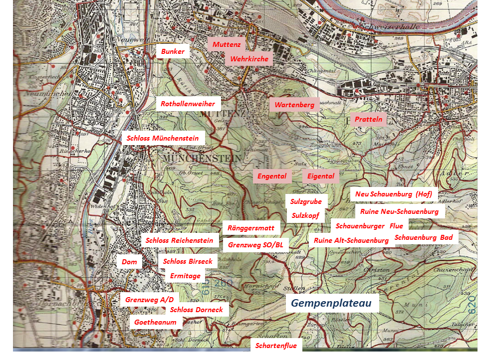
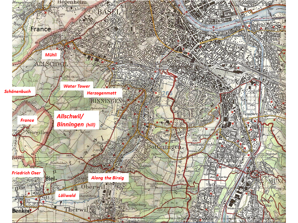
The Bruderholz – south of Basel

The Bruderholz is an extension of the Alsacian/French hills called Sundgau. It is a plateau about 150m above Rhine level bordered by forests. On the plateau, loess enables agriculture. The farms sell their products. Legend says that the forest brothers  (or hermits) lived in the forests surrounding the plateau –  or perhaps there were just three hermits that lived near Klosterfichten – legends are never precise. The name “Bruderholz” is derived from the legend of the forest brothers (Bruder = brother, and Holz = wood) – perhaps.

Kartena

Source: Bundesamt für Landestopographie “Basel 213T” – 1:50’0000

.

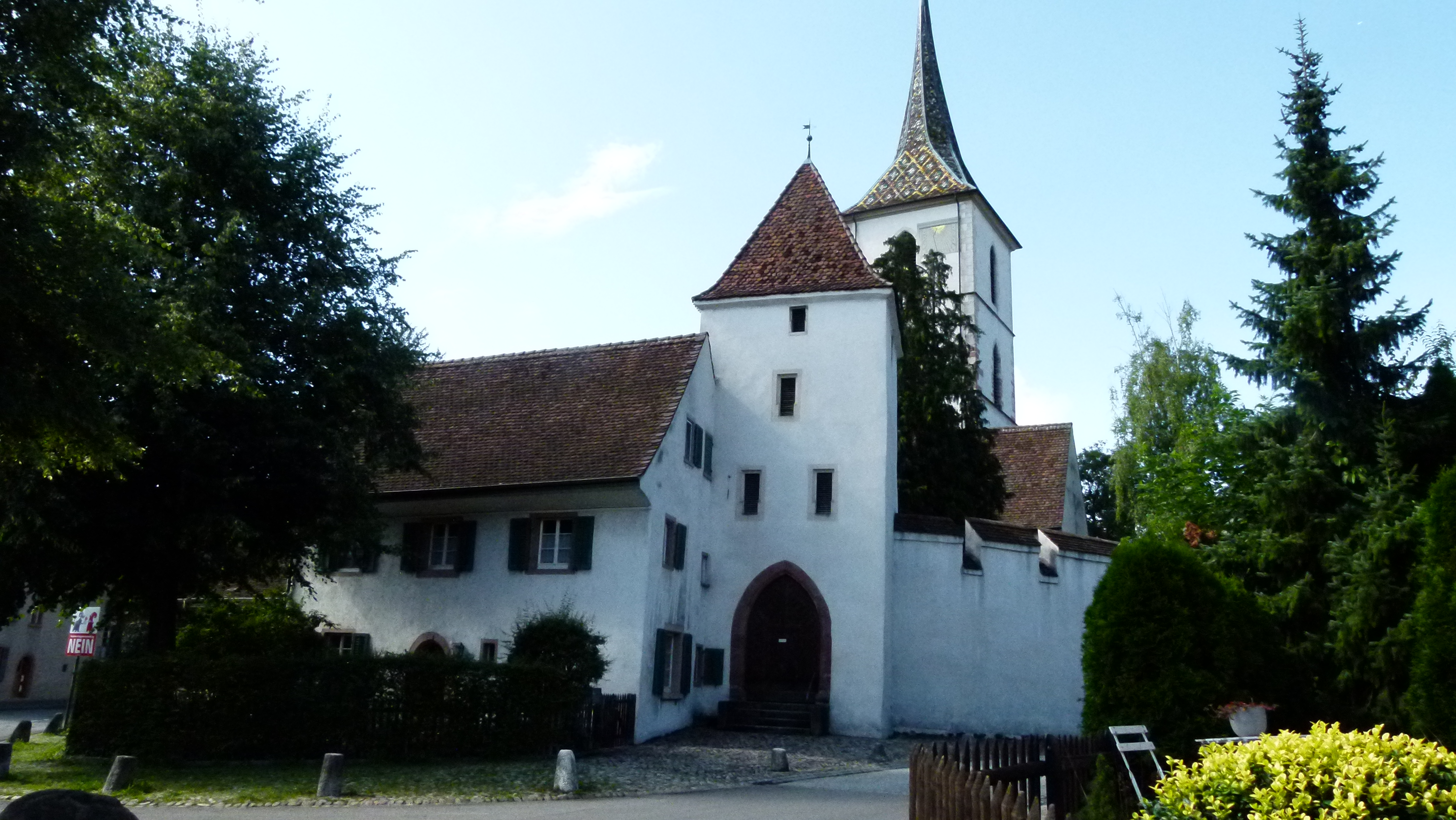
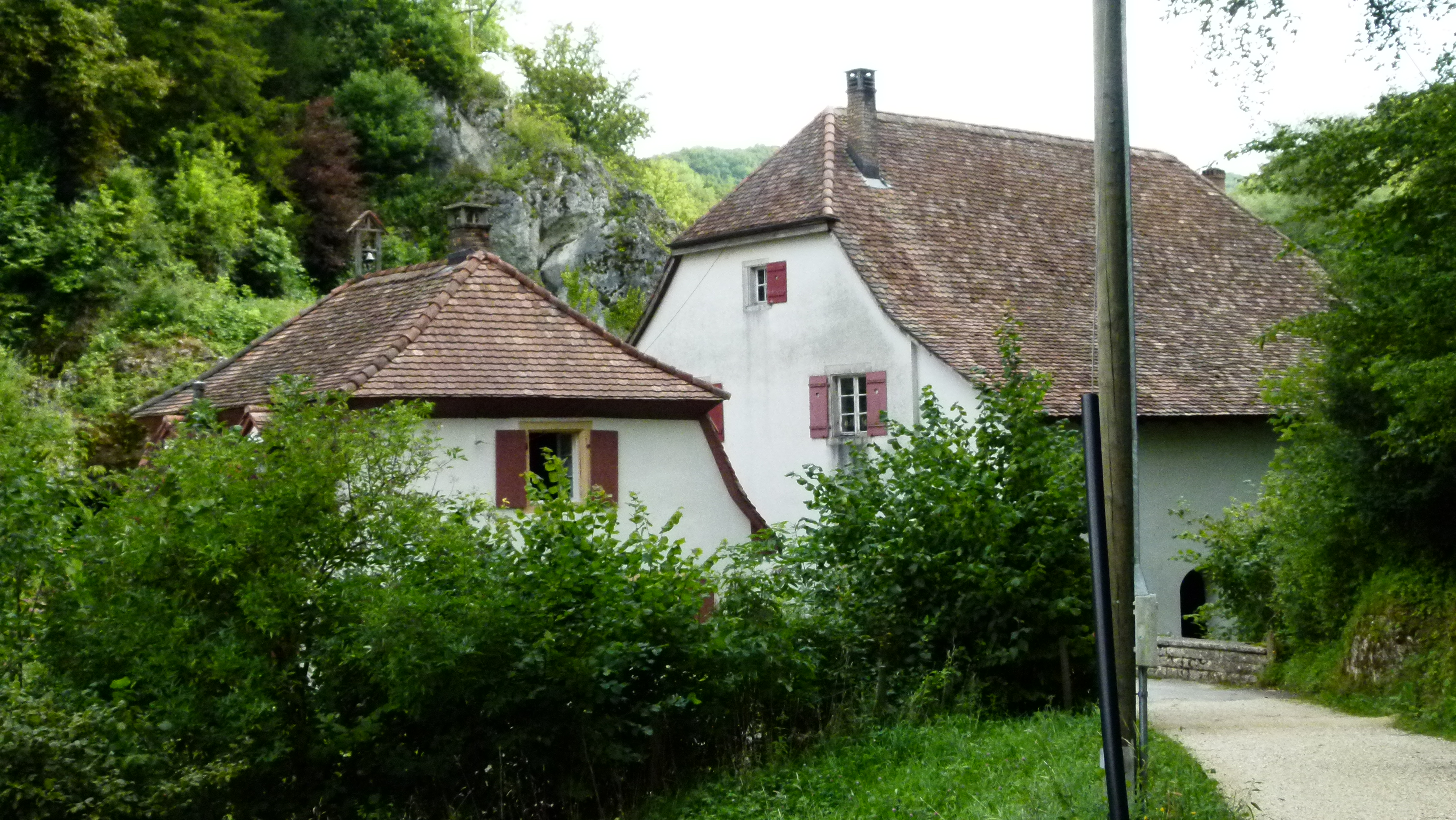
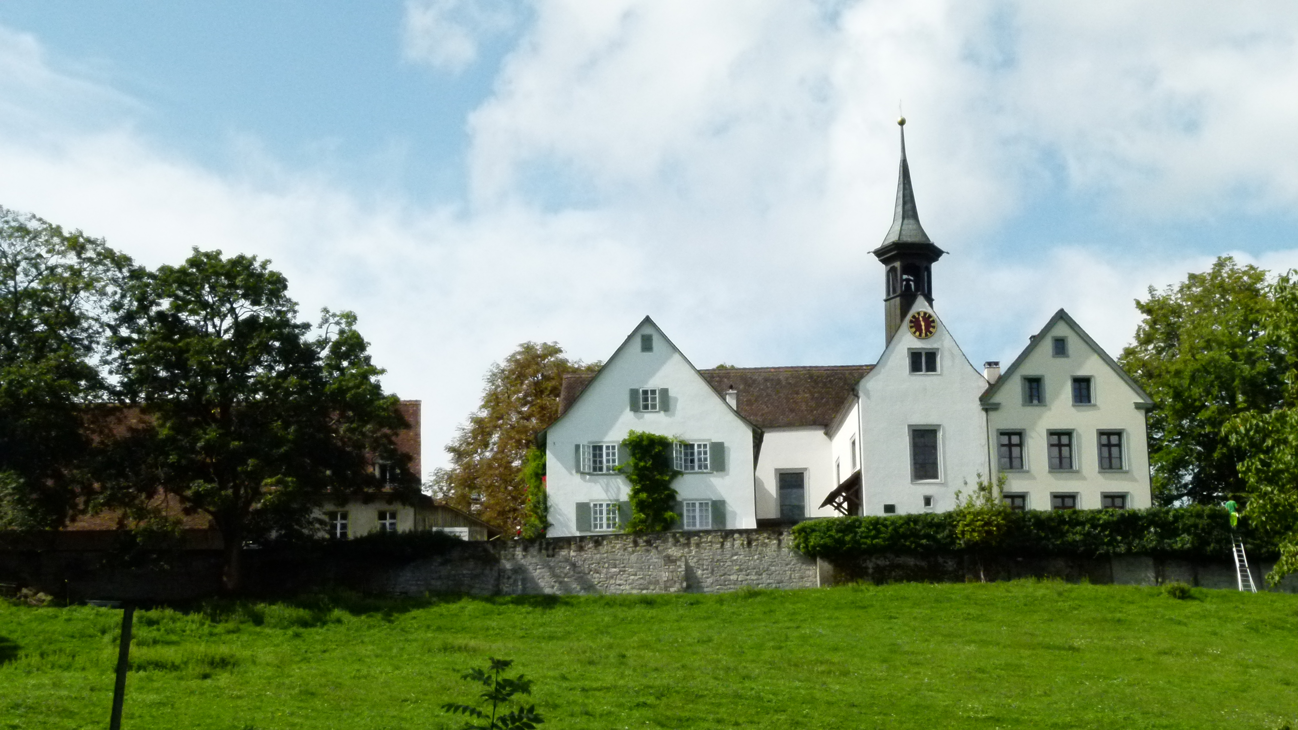
St. Margarethenkirche – Saint Margarethe Church

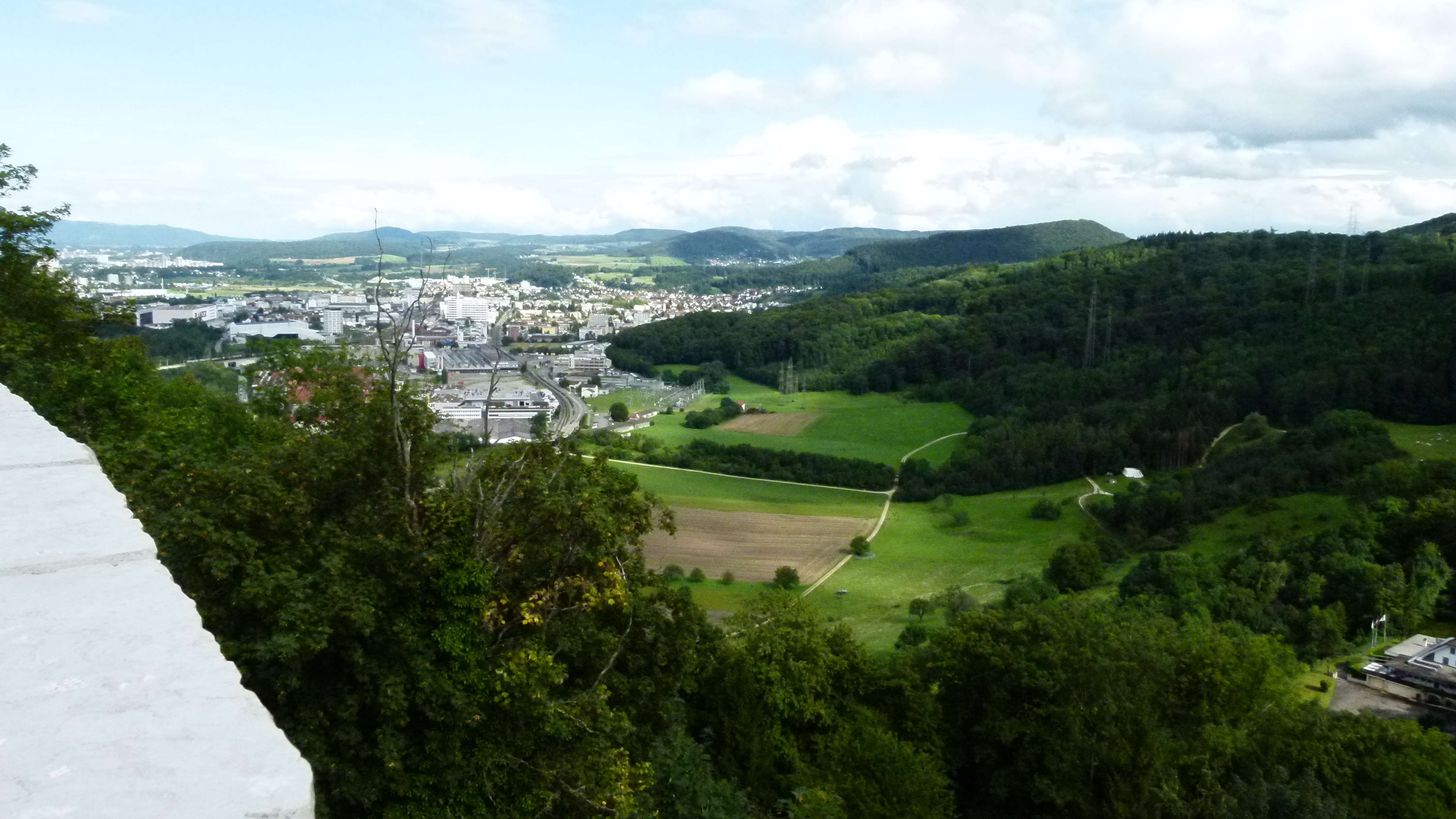
St. Margarethenkirche is a protestant church overlooking Basel. I like the terrace offering a great view of Basel, the Black Forest and the Vosges. I sometimes attend the service of the singing priest of Binningen, Tom Myhre. He sings his (down to earth) sermons and plays the guitar. When I was a child, my grand mother told me proudly that as a young girl she was allowed to play on the organ. This must have been the organ from 1884 that has been replaced later in 1964.

The origin of the St. Margarethenkirche is full of legends: Three sisters, Margarethe, Ottilie and Chrischona, built three houses of prayers in the 3rd or 4th century: Saint Margarethe on the Bruderholz, Saint Ottilie on the Tüllinger Hügel north across Basel and Saint Chrischona on Chrischona to the north east across Basel. At night their lamps burnt to greet one another and the people in the valley below them. Later these houses of prayer became churches.

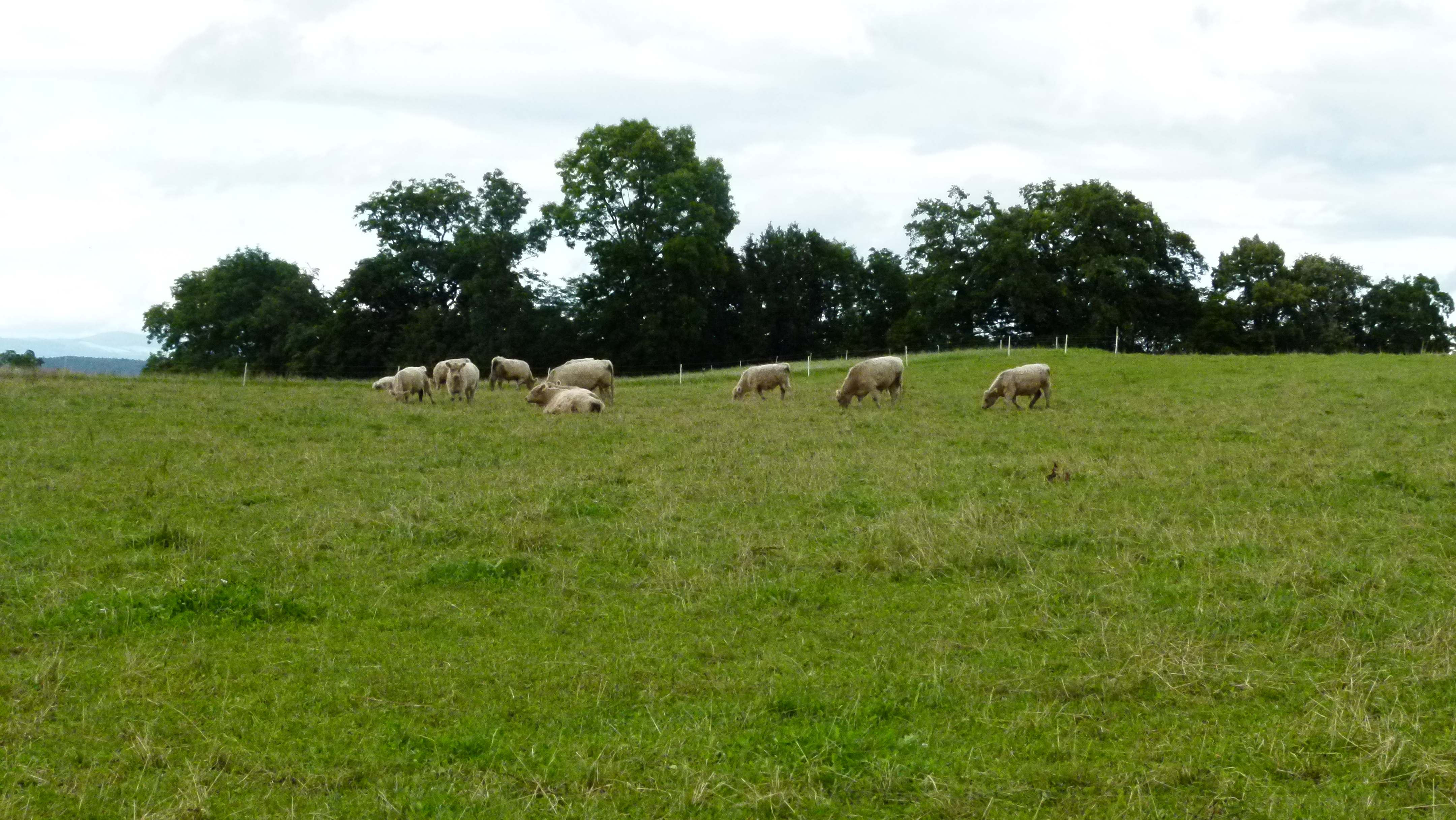
The Margarethe church has been confirmed to exist in the 13th century. It has been renovated several times and has received the current right angle shape  (Winkelhakengrundriss) in the 17th century. A farmhouse is connected with the church. Cows graze on the meadow below Margarethen…

P1060121

… and there is also a vineyard of 2200 square meters on the west slope that gives 2500 half liter bottles. The wine can be tasted here in the restaurant Schällenursli located in the rick of the farm.

P1060124

.

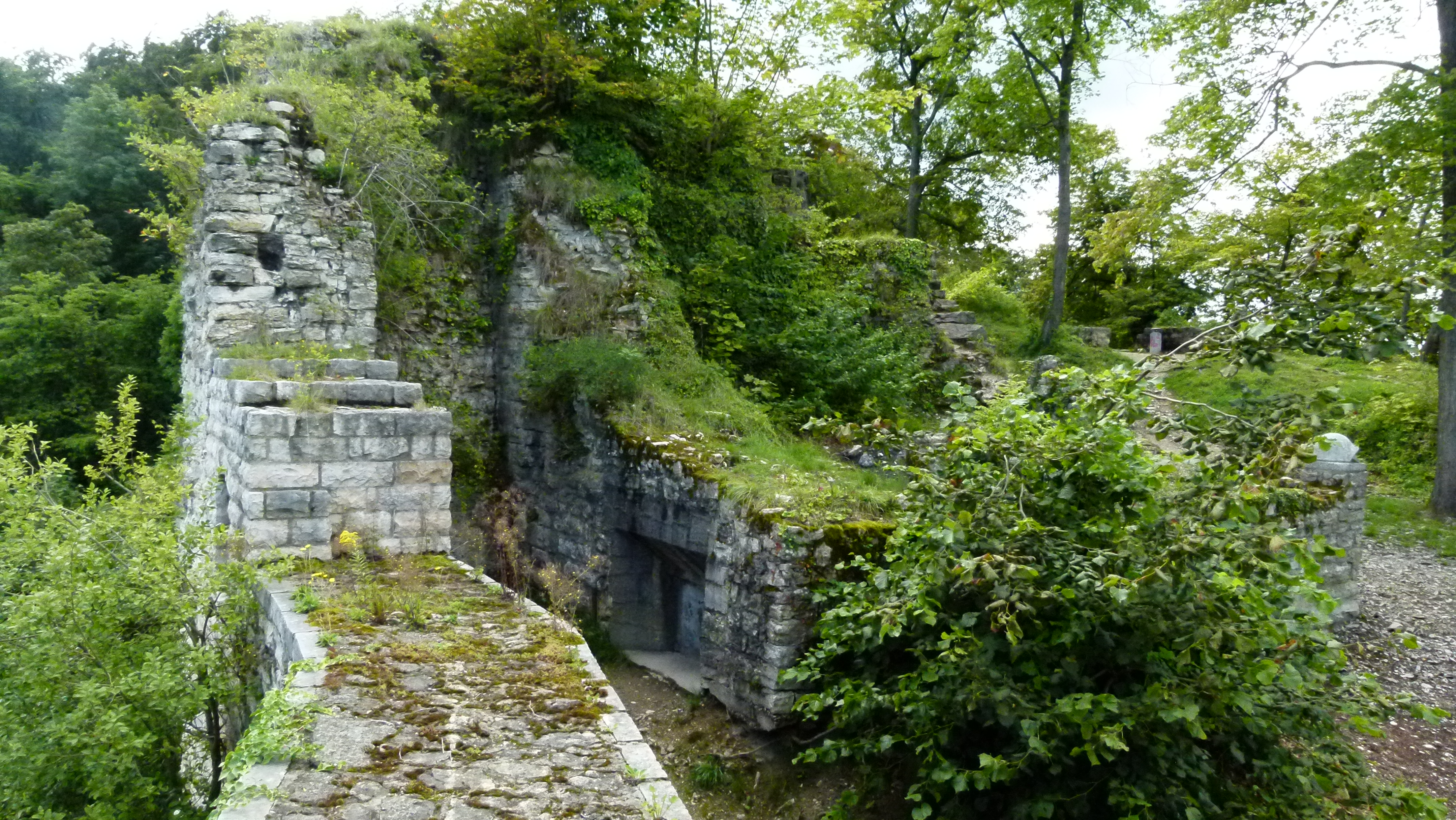
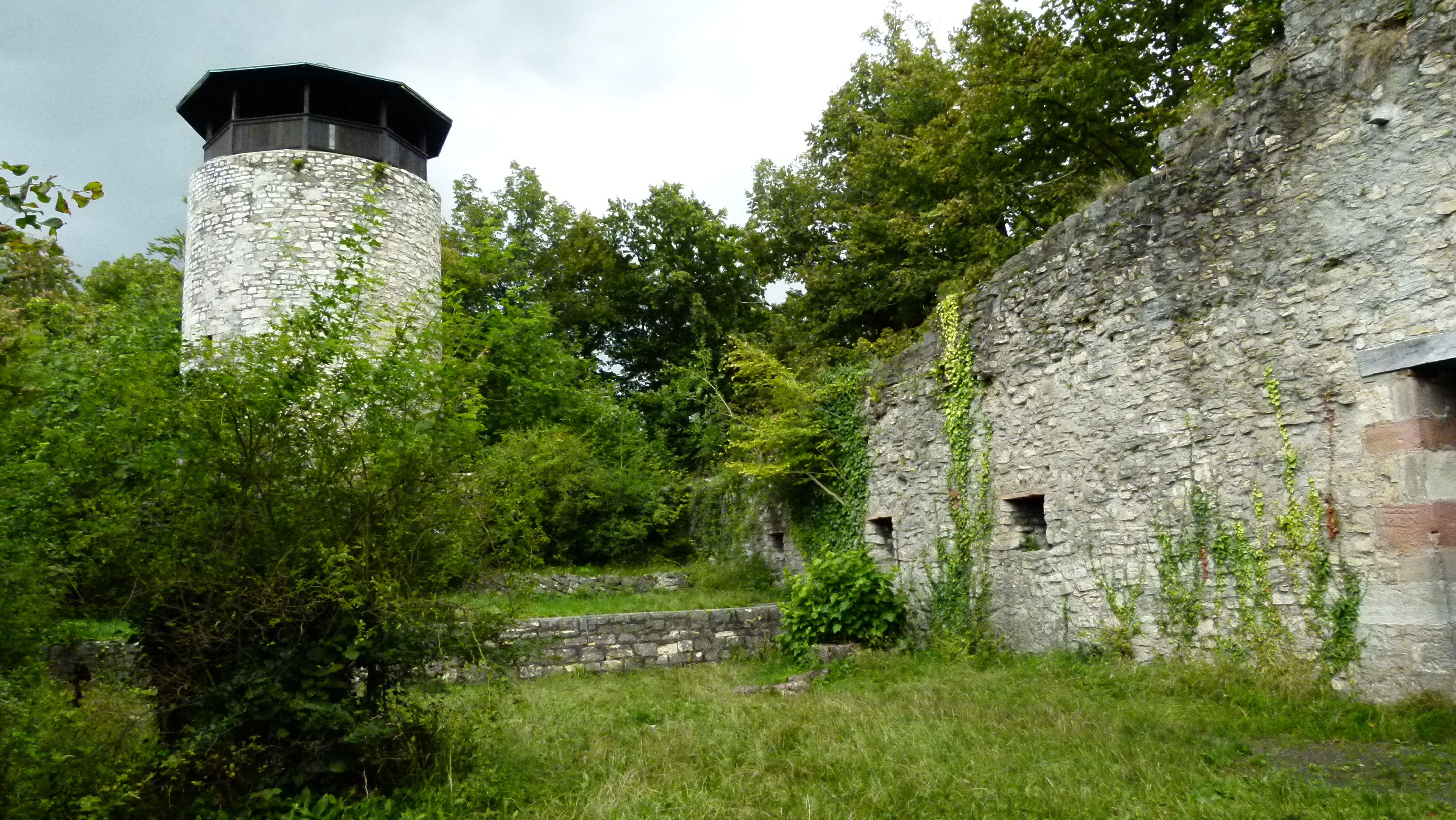
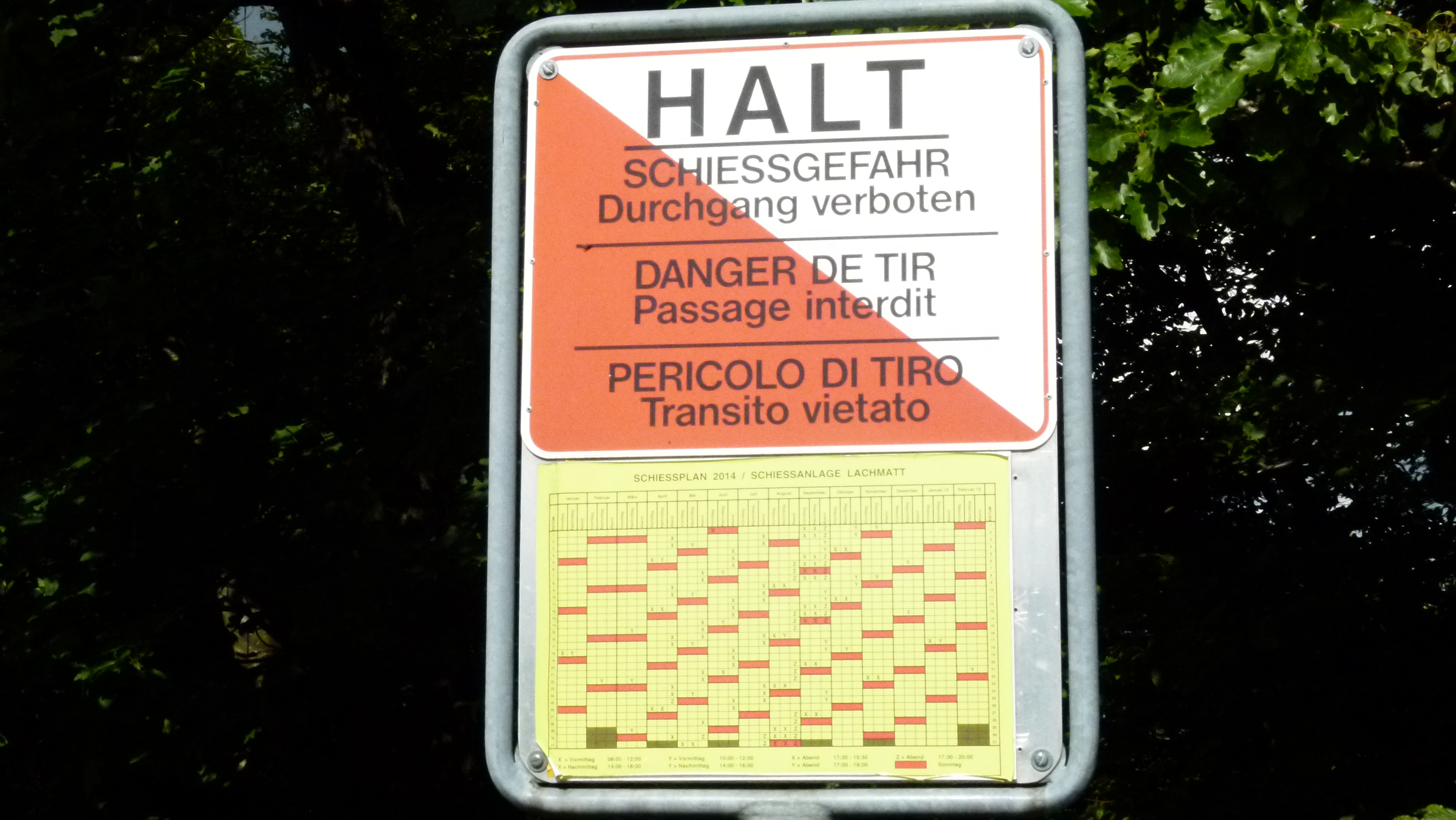
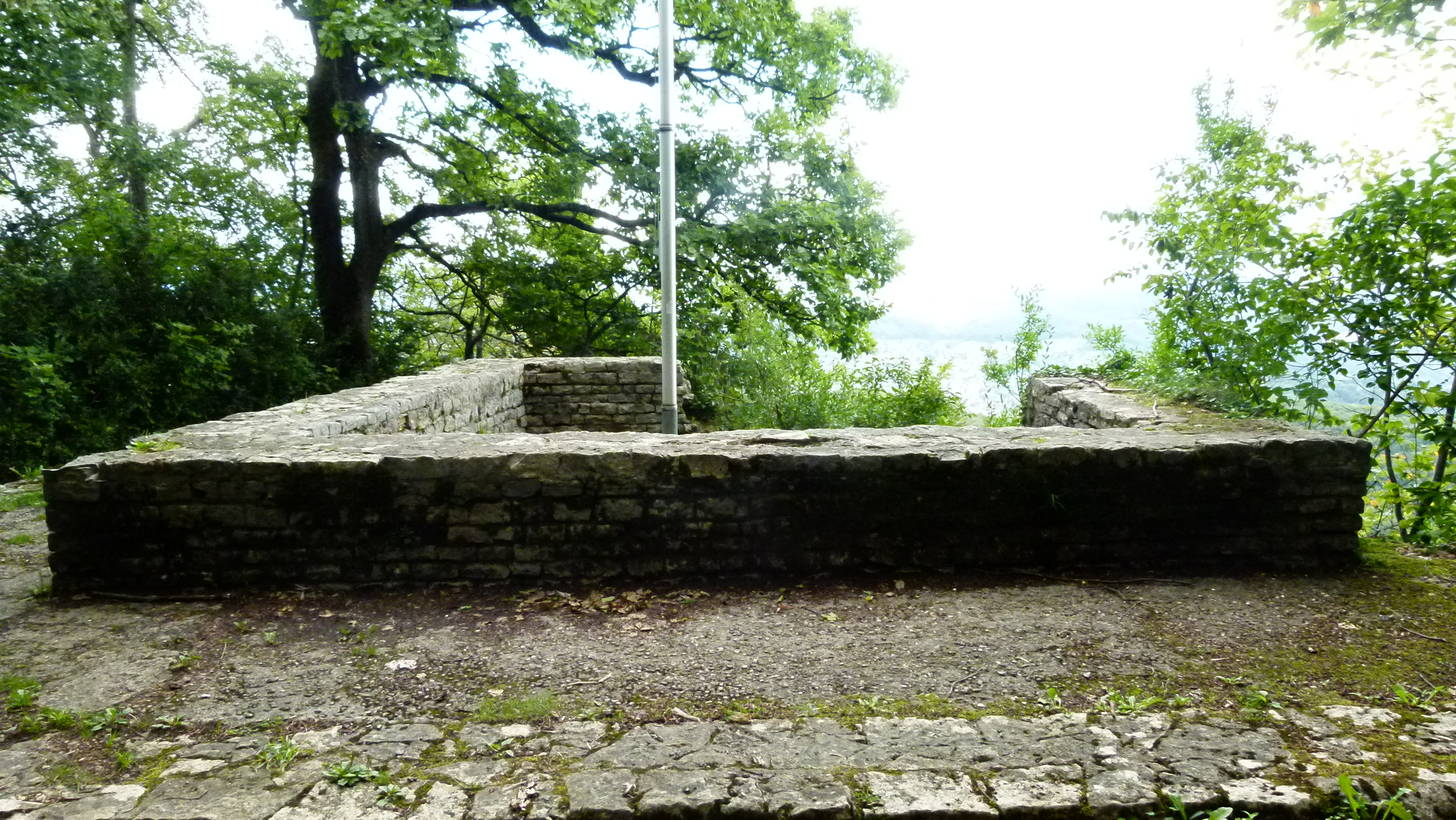
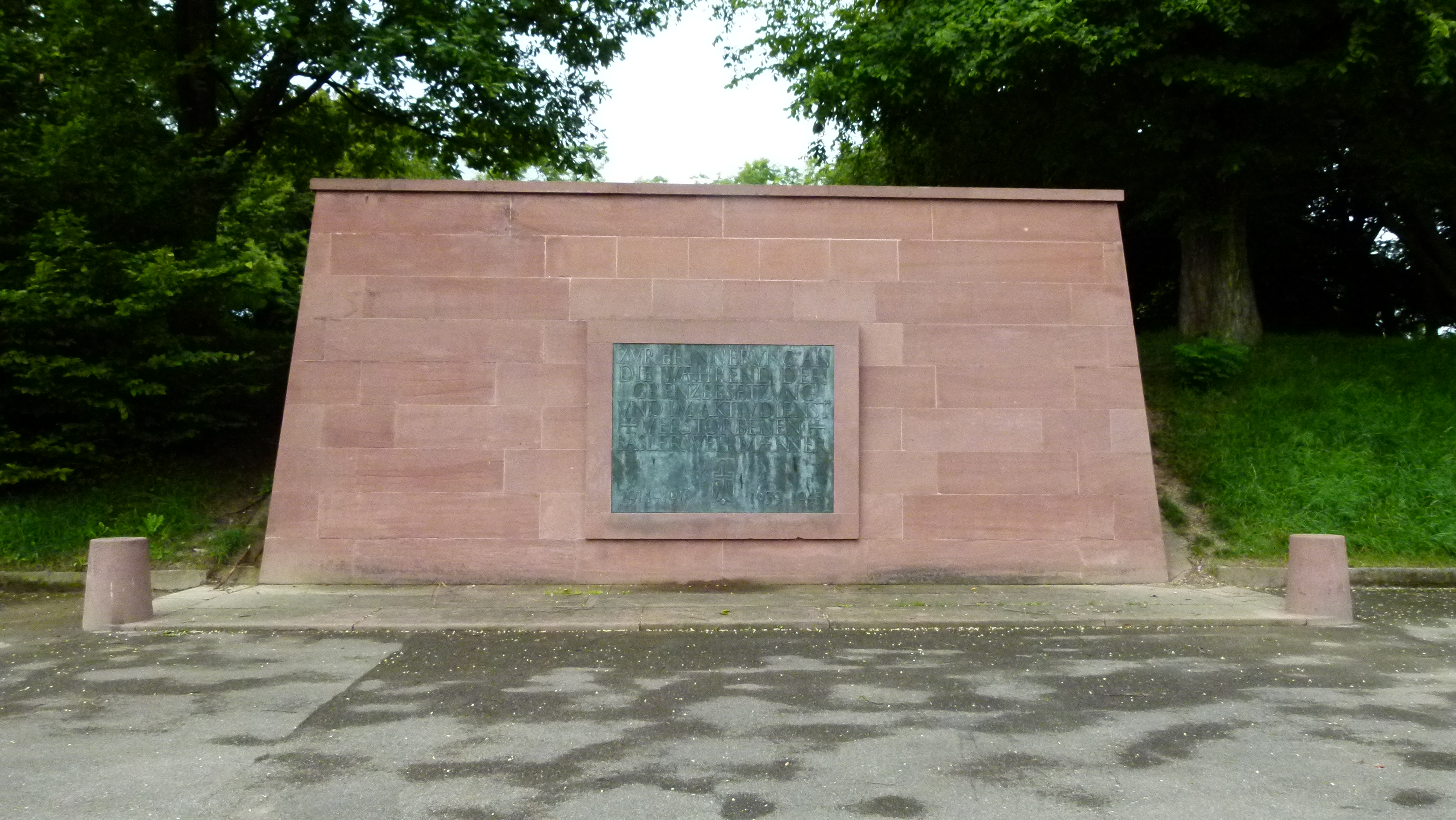
The Battery built in 1815 to defend Basel

The Battery is a popular target for people taking their dogs out. As a child I wondered what the “Battery” has in common with electrical batteries. Dr. Google says about the Battery: Around 1815 Basel was being shot at from the fortification of Huningue (on the French frontier bordering the Rhine). Basel erected fortifications and one of them was our Battery located at 365m. It is a quadratic entrenchment for heavy canonry and was called “La Superbe”, and later “Battery”.

In the two World Wars 1914-1918 and 1939-1945, the Battery was used again to host the Swiss border troops. The “Wehrmännerdenkmal” (monument for the soldiers) was erected north of the Battery to commemorate that.

P1060010

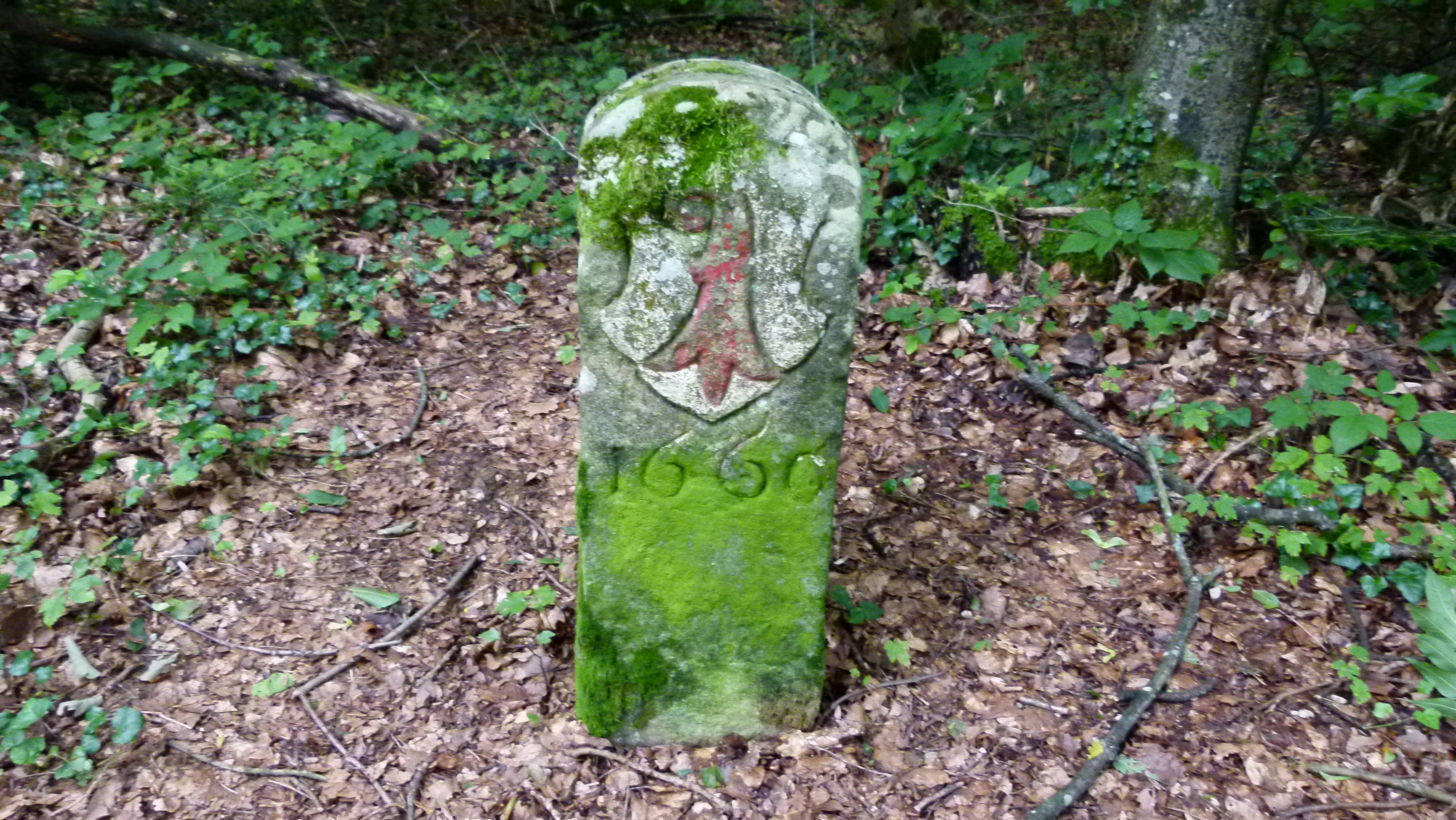
The border between Basel town and the village of Bottmingen divided the Battery. When the revolution of 1833 had separated Basel town and rural Basel, Bottmingen also split off from Basel town to join rural Basel. The border between the two cantons of rural Basel and Basel town now divided the Battery. This odd situation was corrected in 1954 and since then the Battery has fully belonged to Basel town.

After 1945 trees have grown on the Battery. Since then children have come here to play – biking, hiding and running in summer and sledging in winter. I was one of those children in the 1950’s and 1960’s.

P1060012

Once per year there is a warlike scenario like before 1945: On first of August (the Swiss National Day), the giant Bruderholz firework is shot off from the Battery.

.

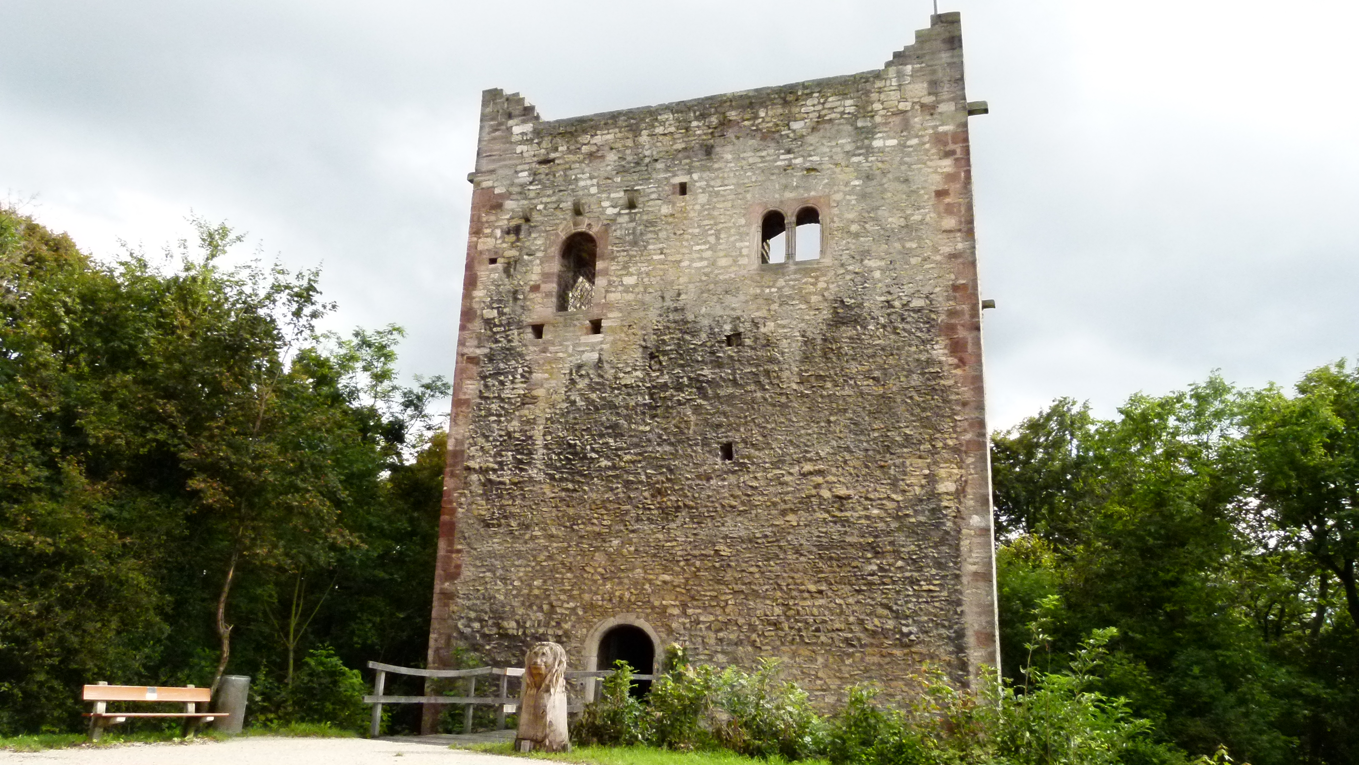
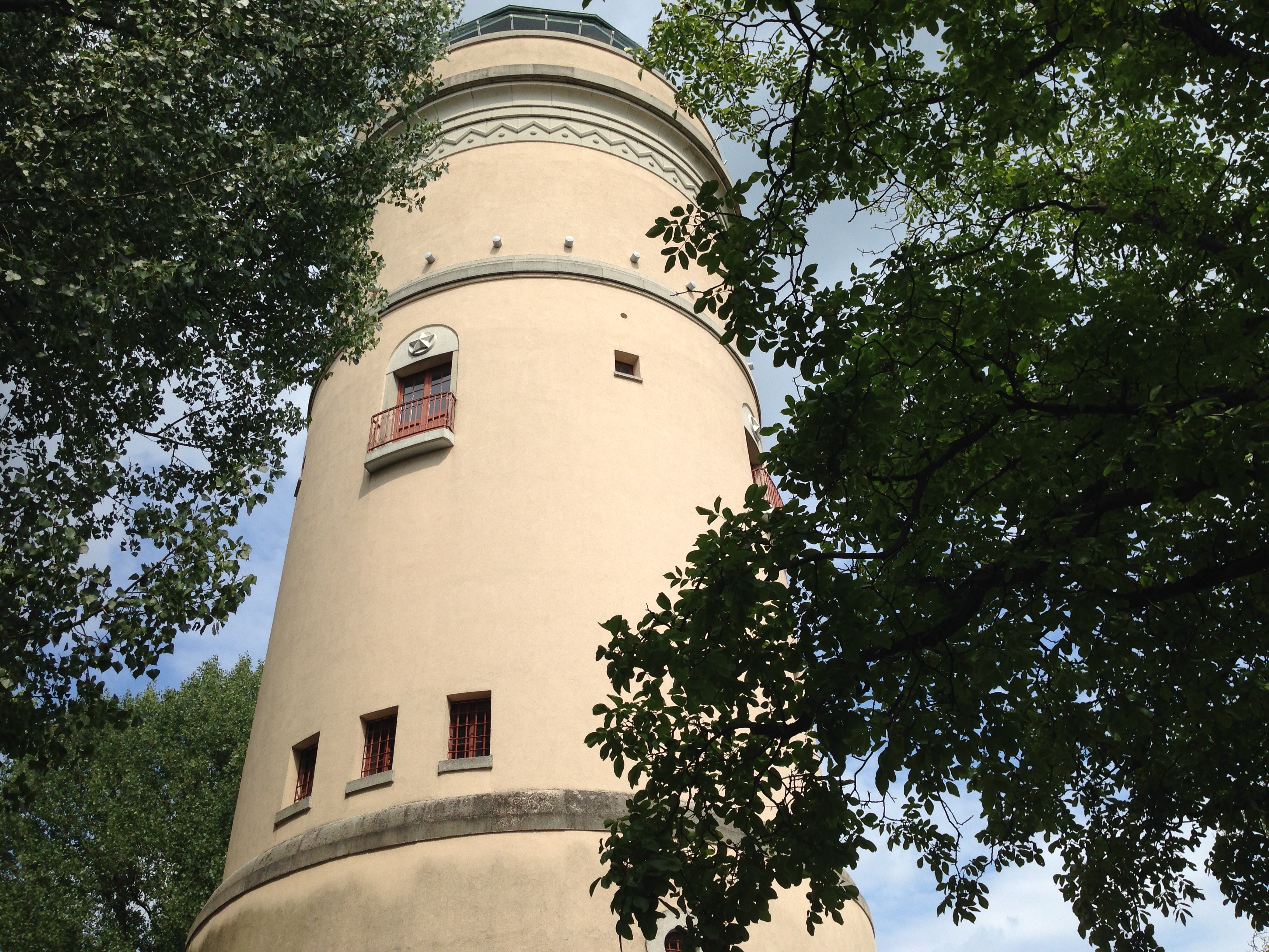
The Bruderholz water tower

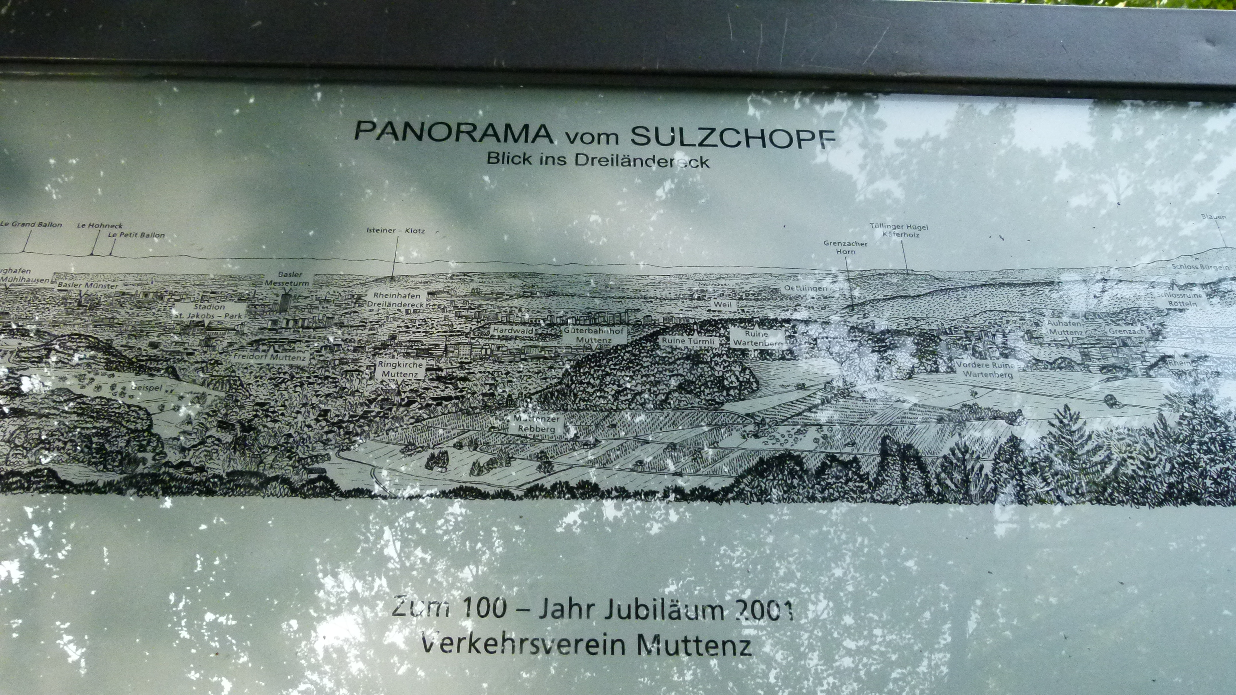
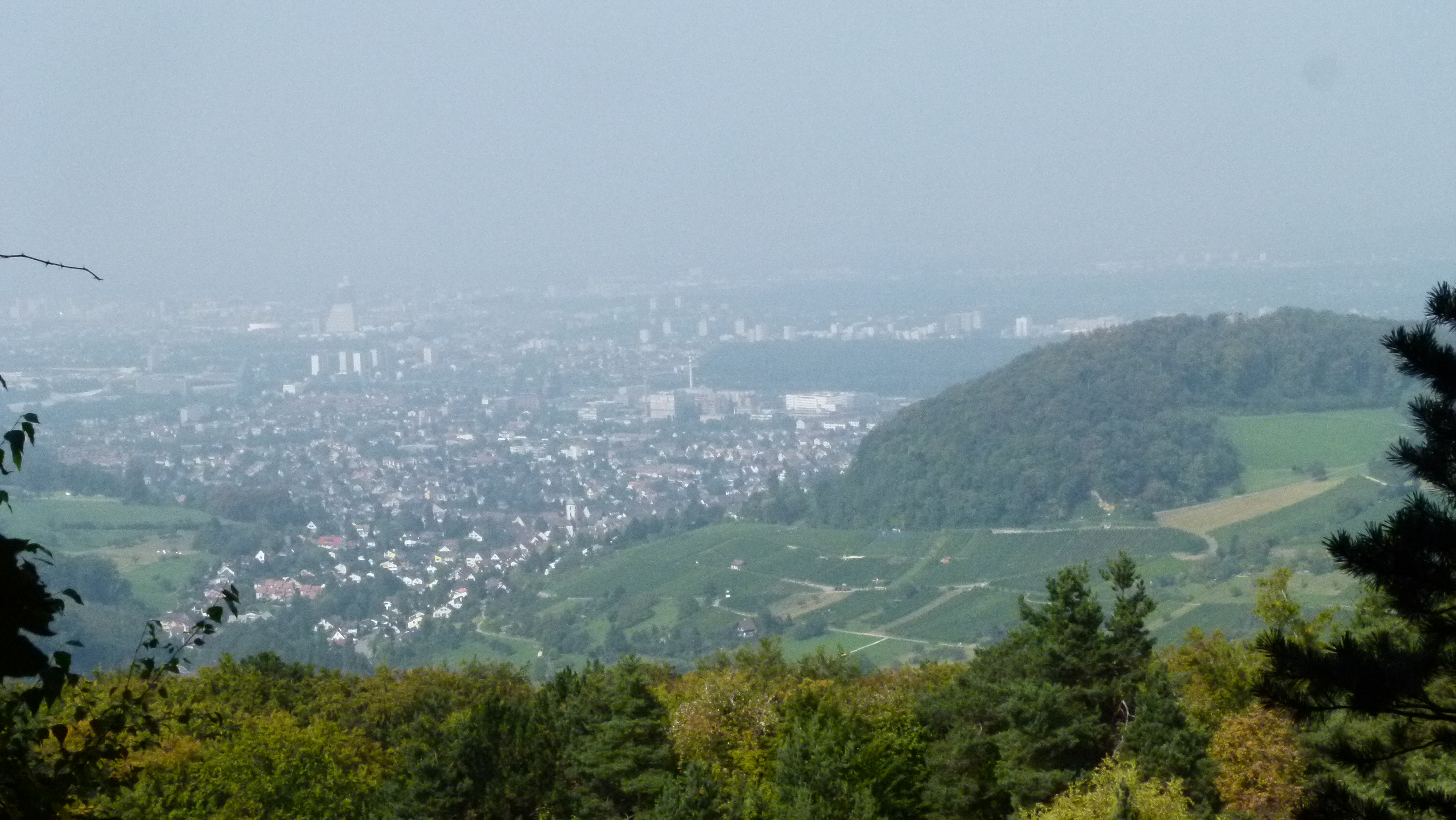
Not far from the Battery the water tower  offers a spectacular view from the top – over Basel to the Black Forest, the Jura, the Sundgau and the Vosges. The water tower was built in 1926. There are two parallel staircases leading to the middle level  (with the balconies) and from here one wooden staircase goes to the top. This was a wonderful playground for us; as children we used to play catch for hours. Four or five of us would fit into one compartment of the revolving door at the entrance (we had to drop 10 Rappen or .1 Franc to enter the tower).

IMG_0496

.

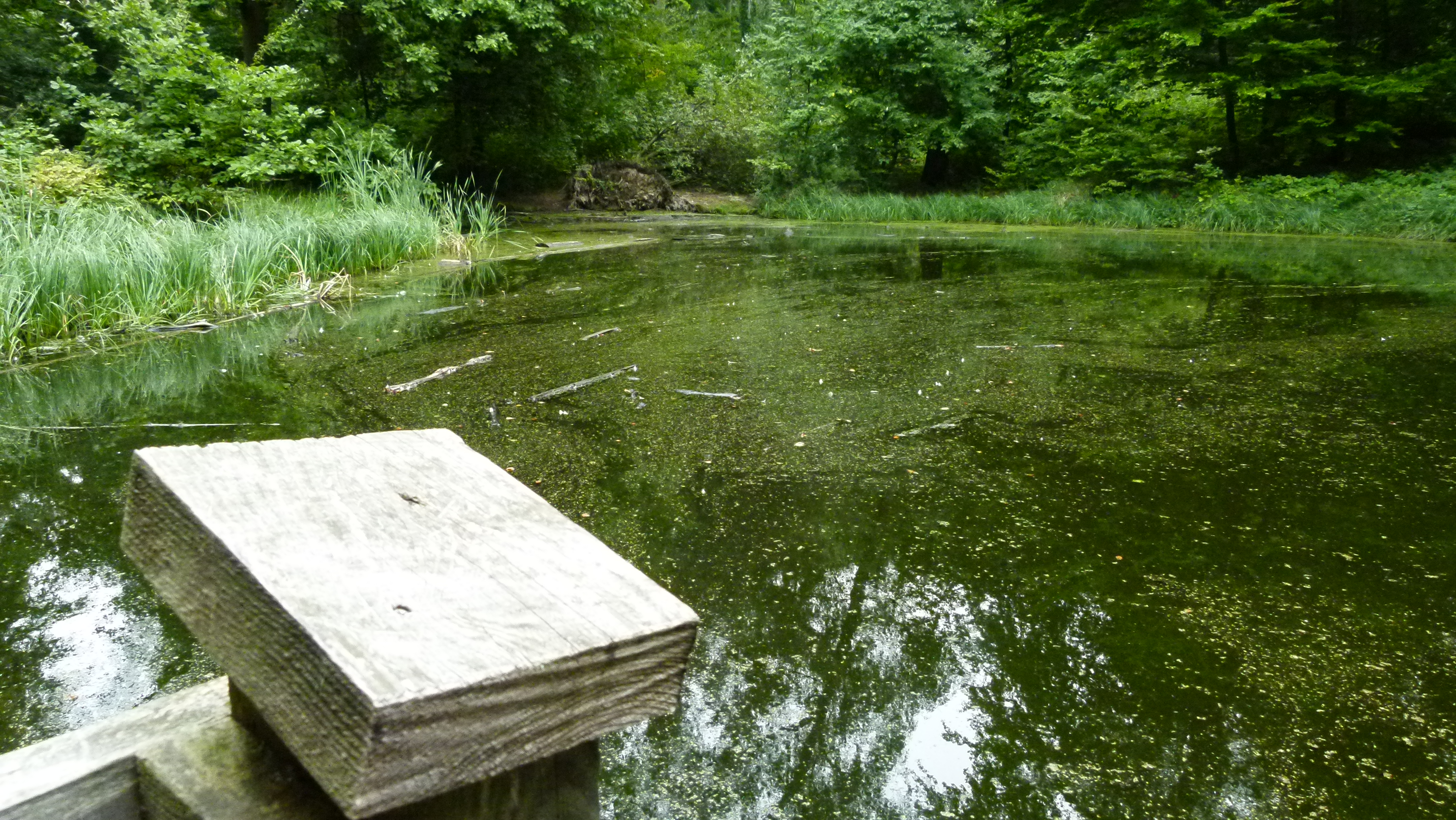
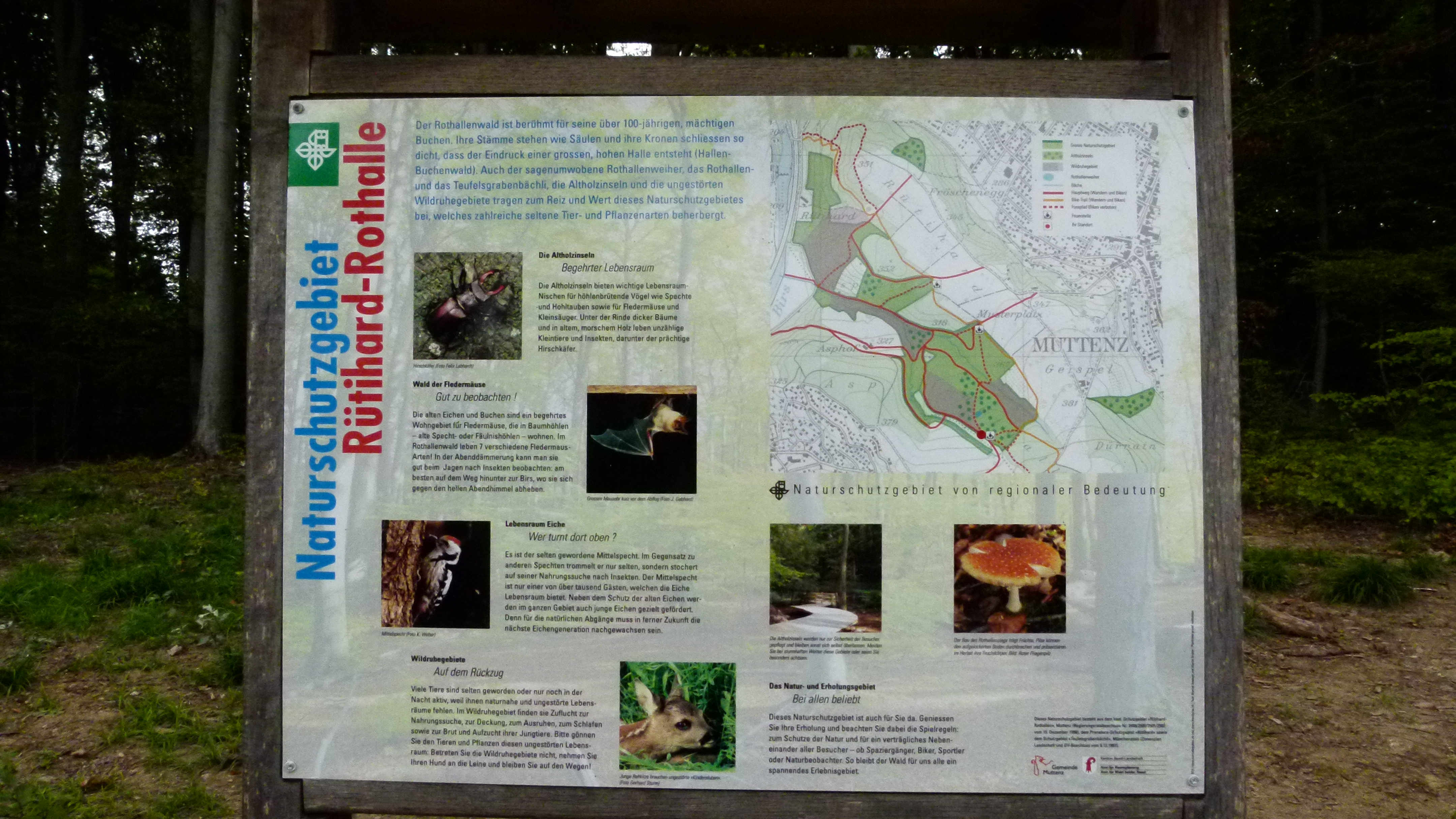
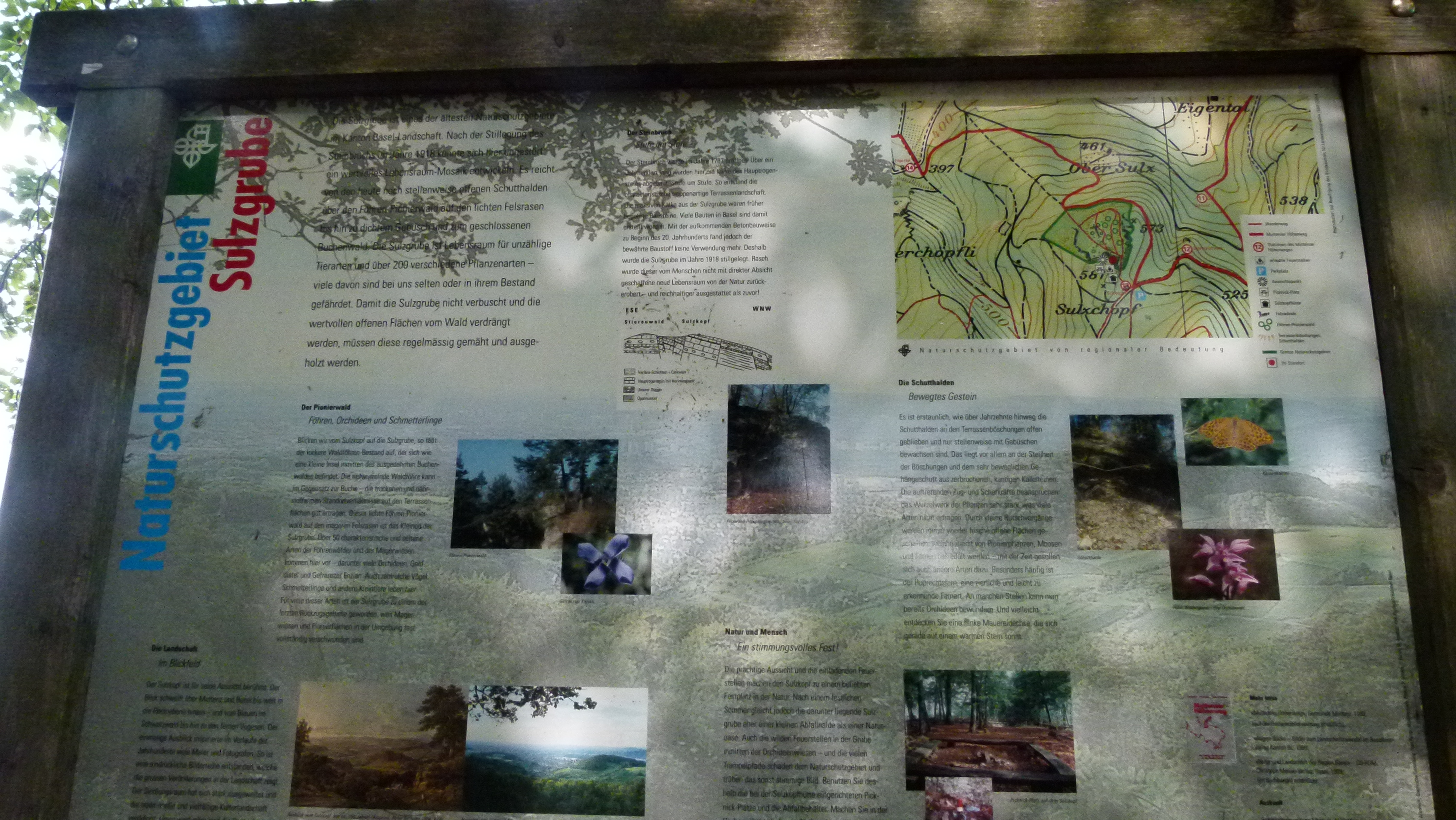
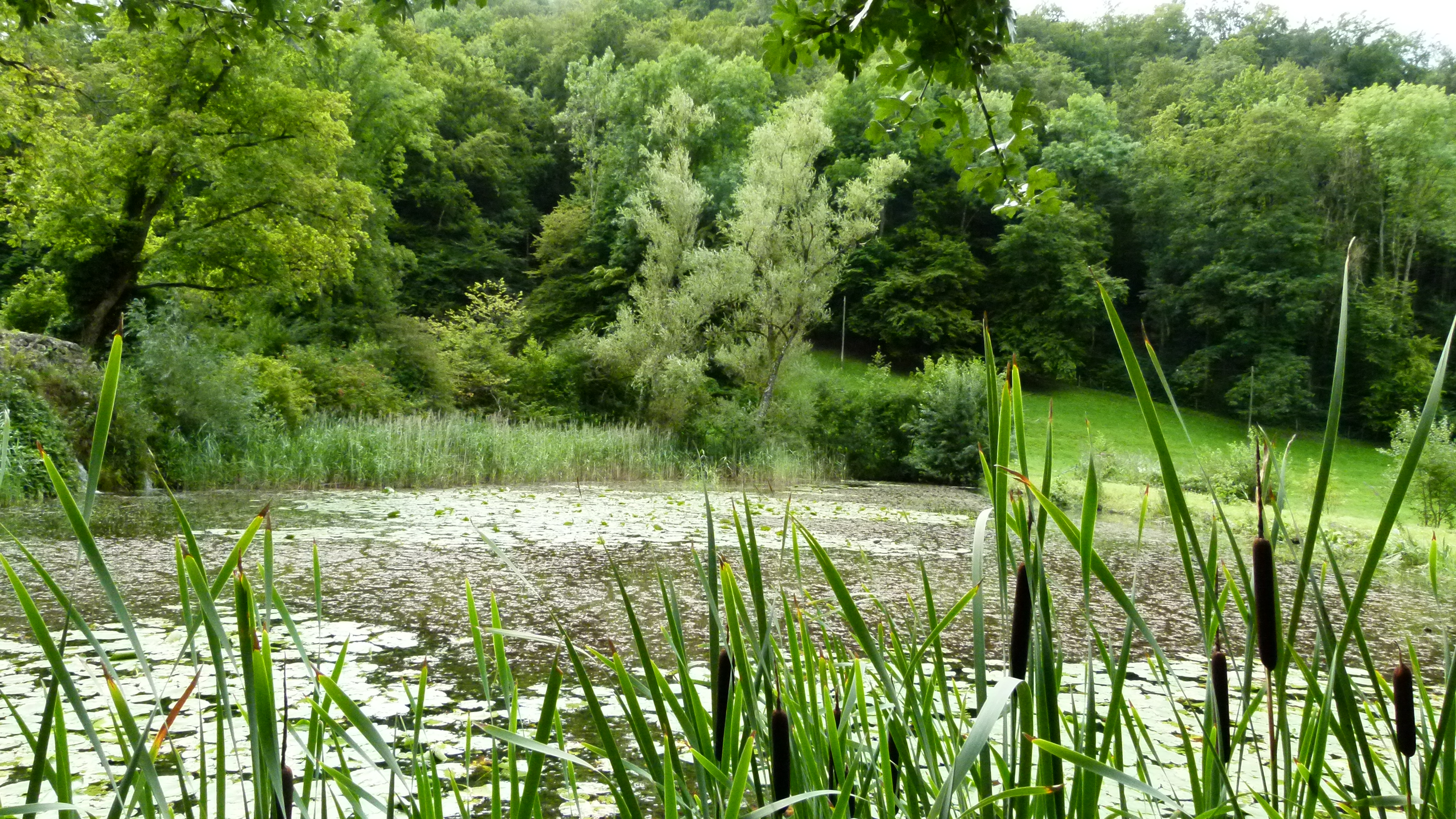
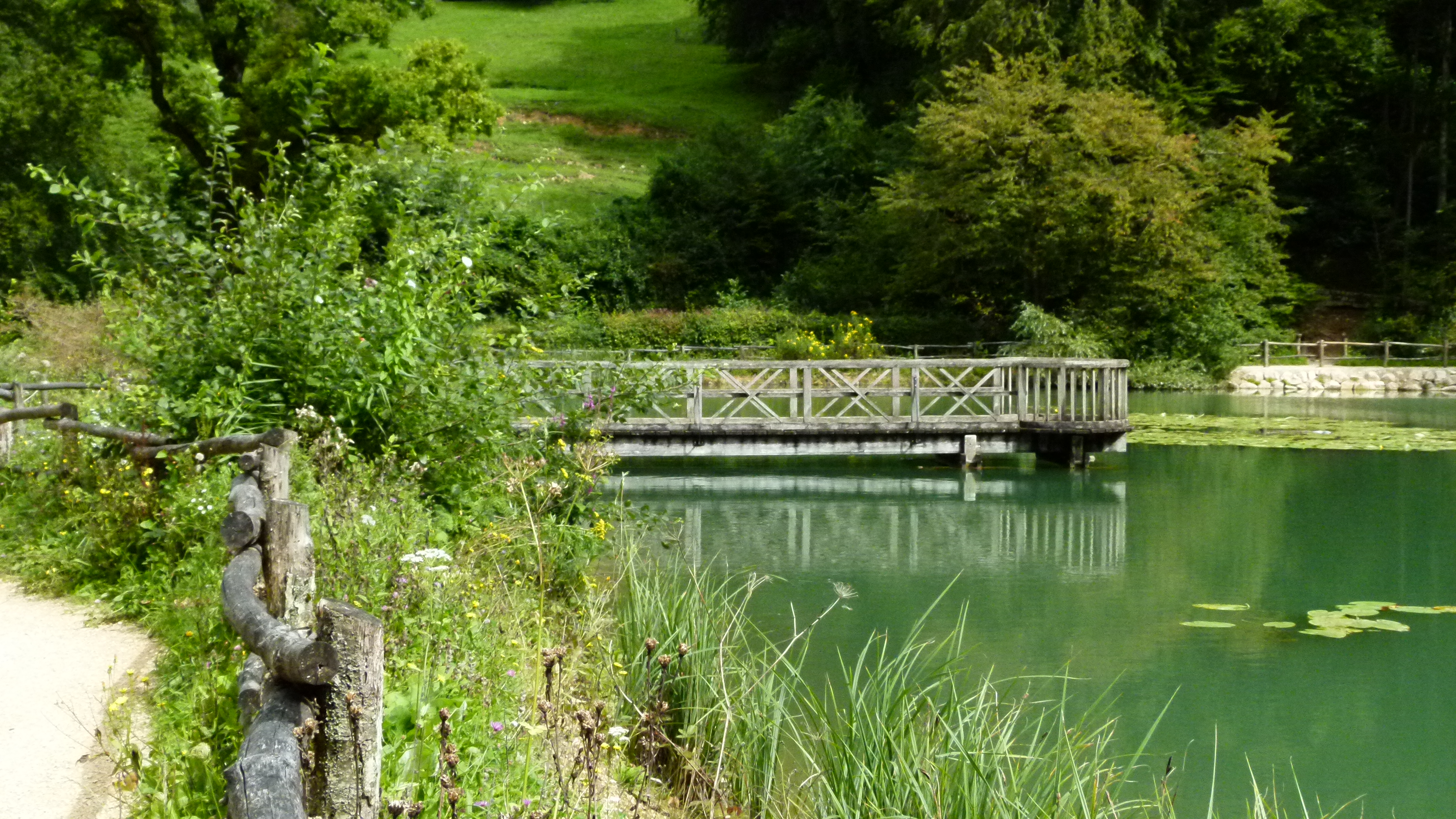
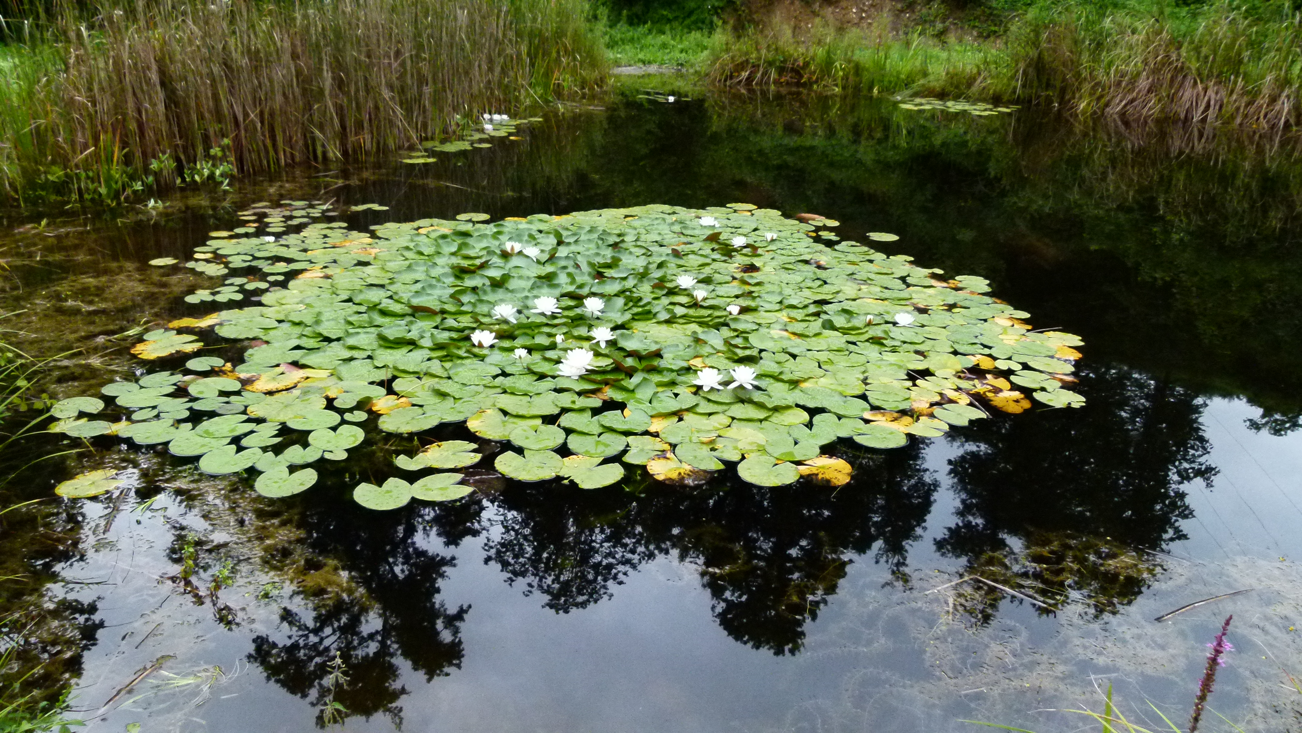
Some small ponds and nature reserves

The Bruderholz hides some small ponds and nature reserves. Here is one example: This pond is near the hospital (Bruderholzspital).

P1060066

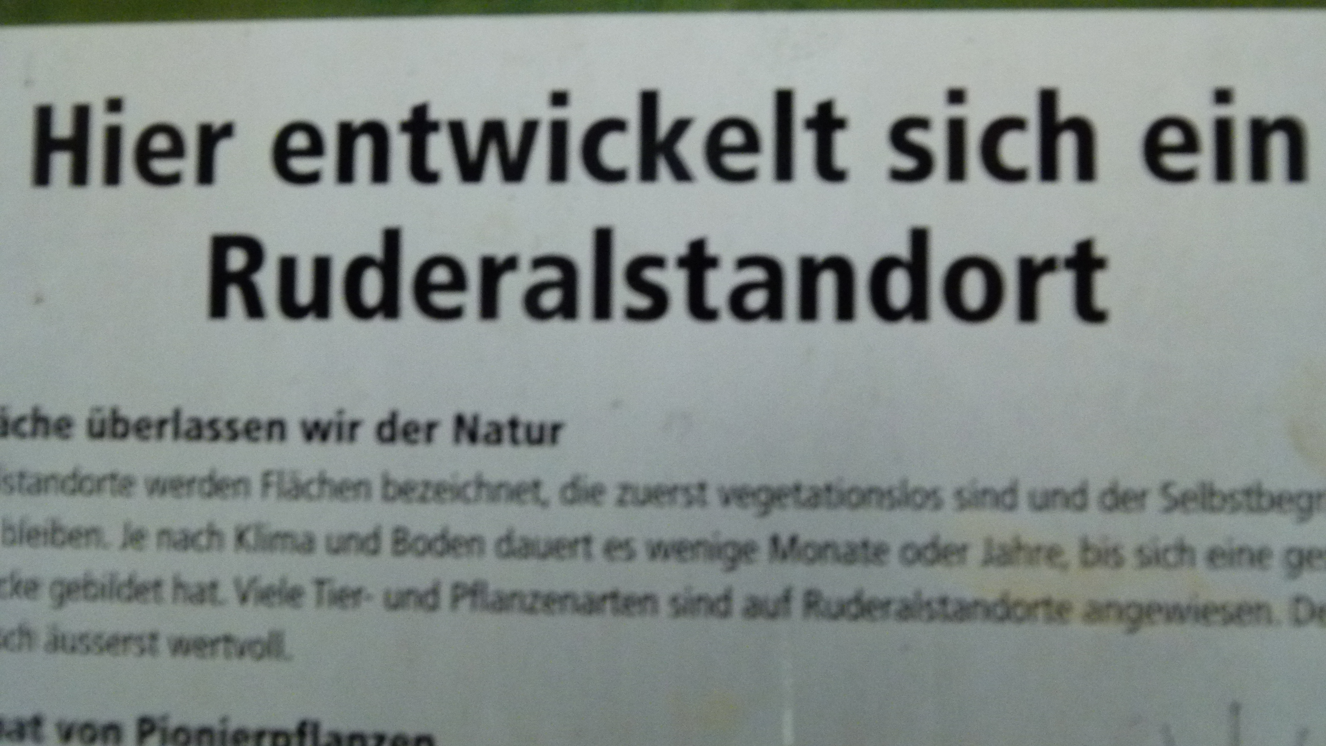
And this is another interesting example: On the roof of the Froloo reservoir it was decided to let nature take over the former reservoir construction place, with no further human intervention. This is called a “Ruderalstandort”  or “ruderal area“).

P1060048

These are the ruderal plants that have taken over so far  without any human intervention (the path may have needed some human intervention, nevertheless).

P1060049


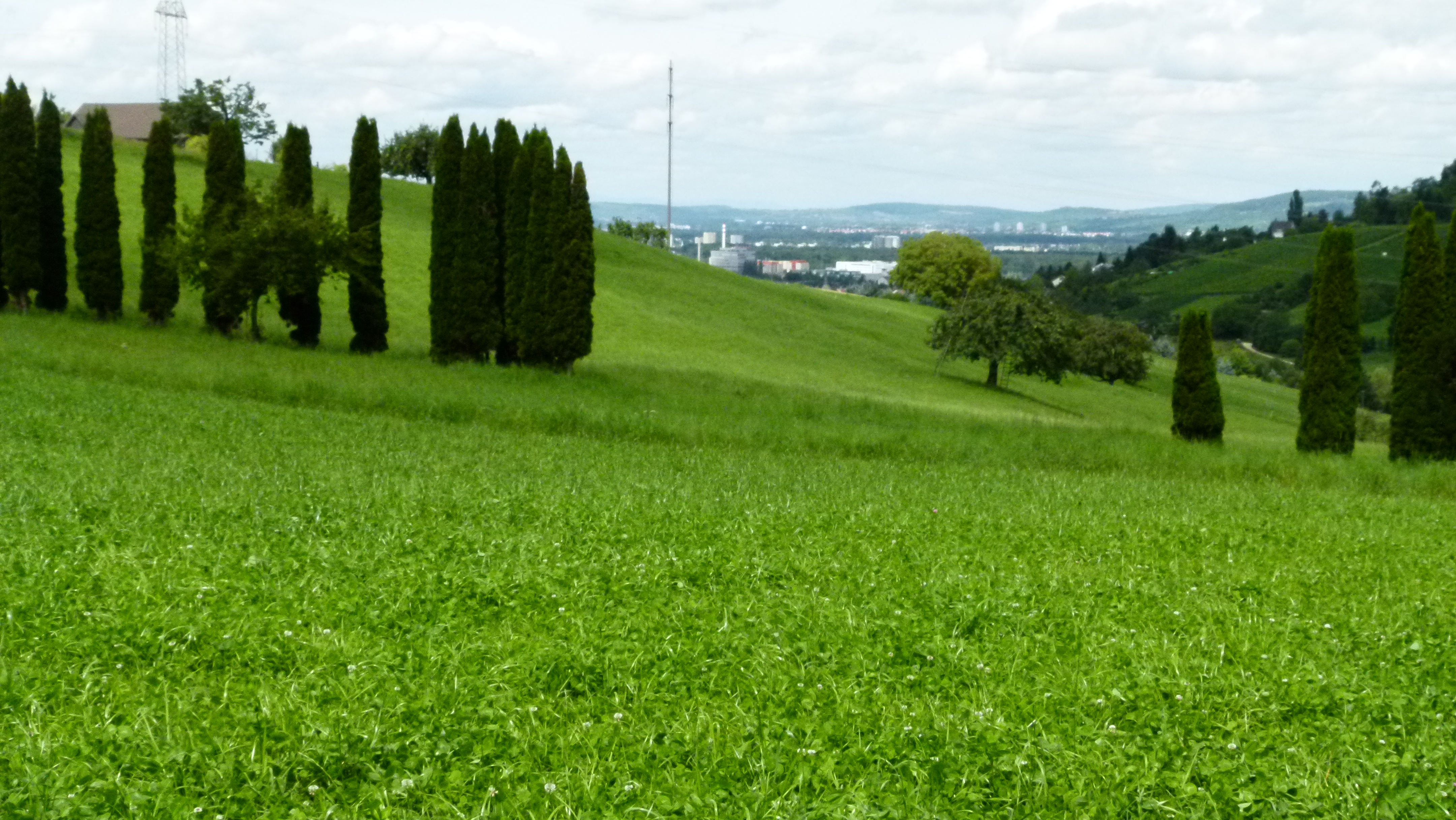
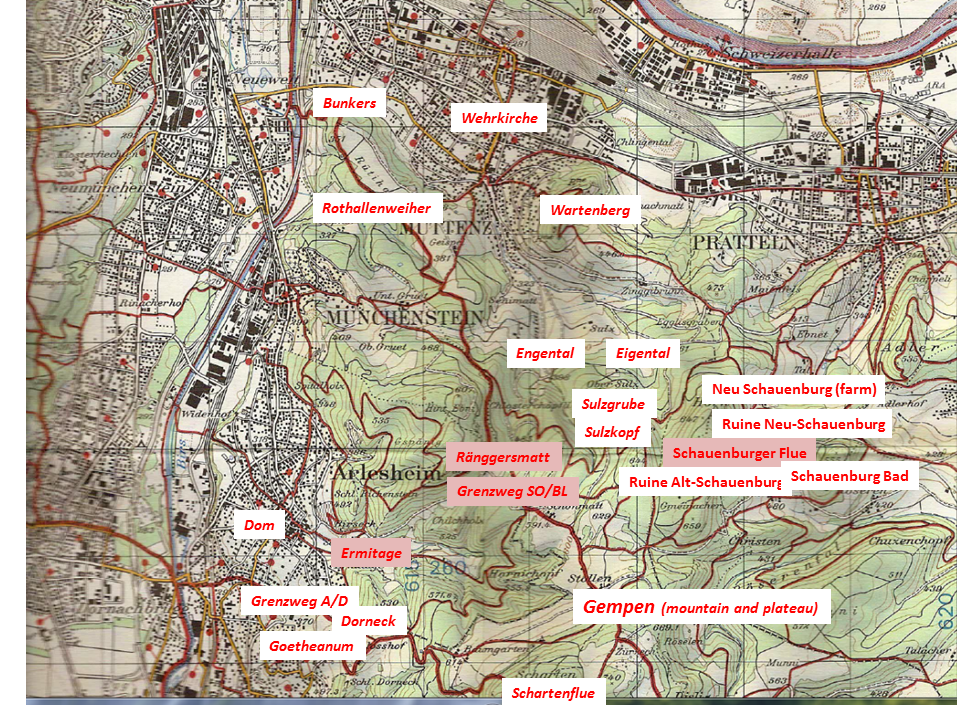
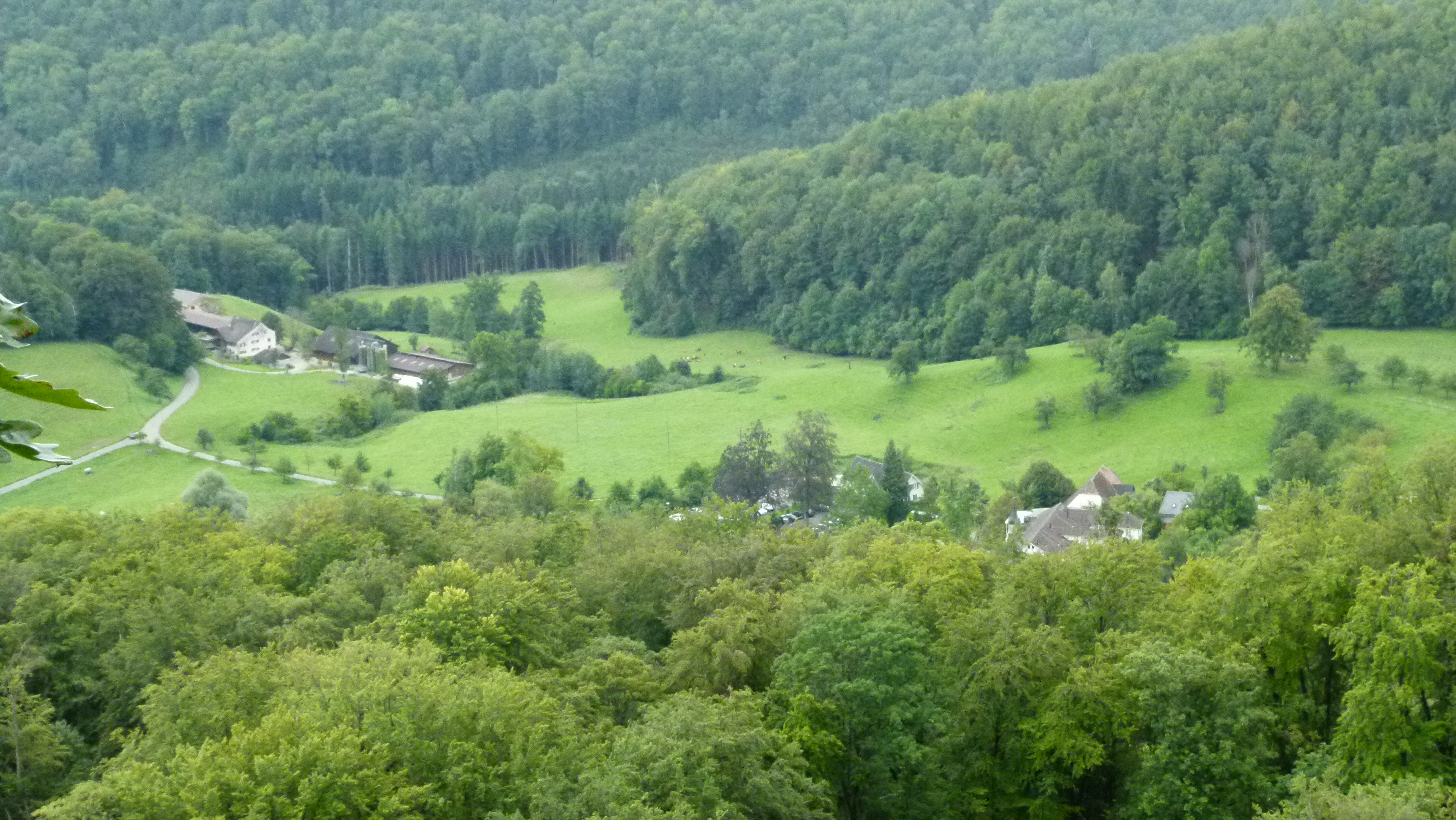
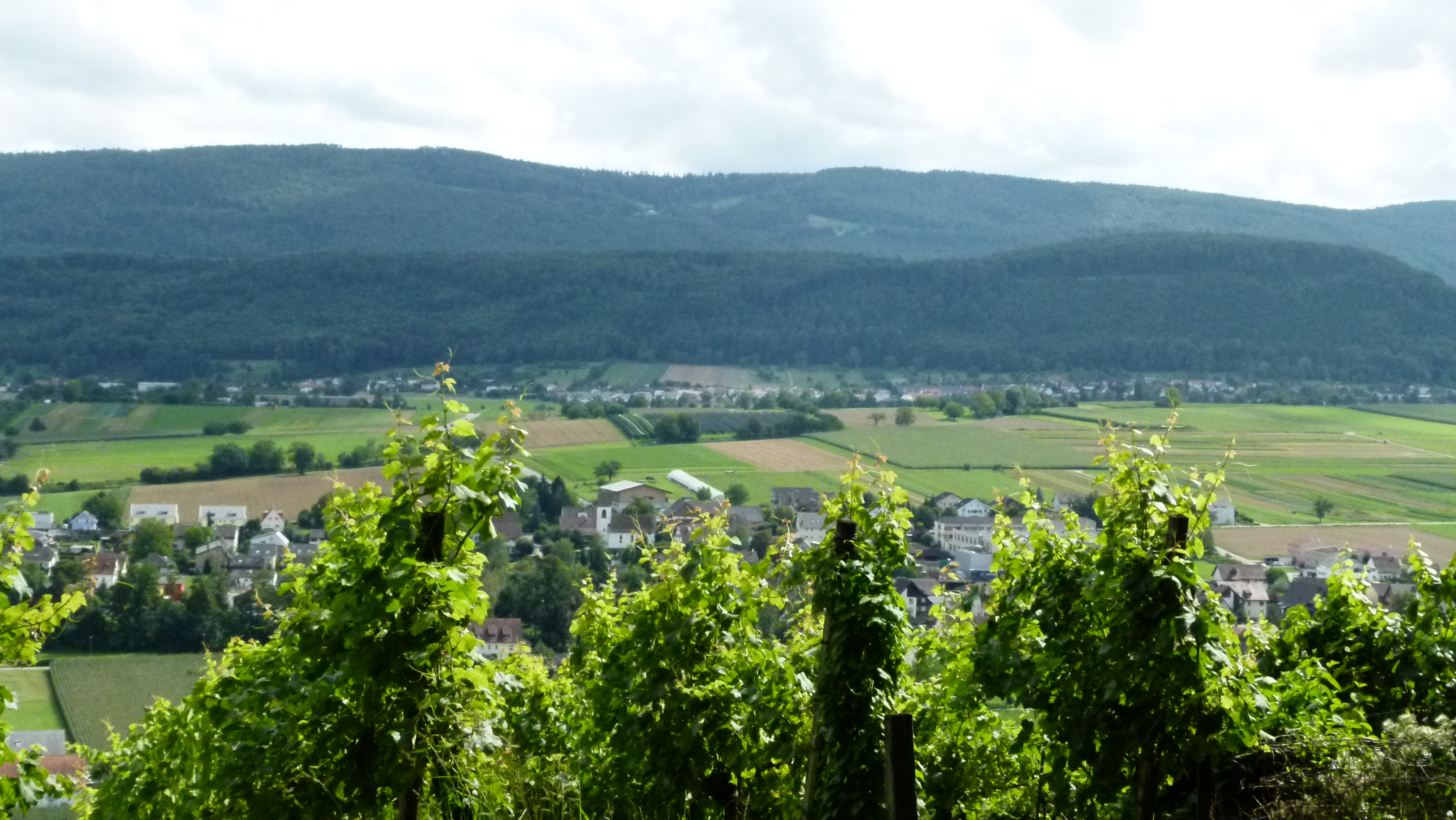
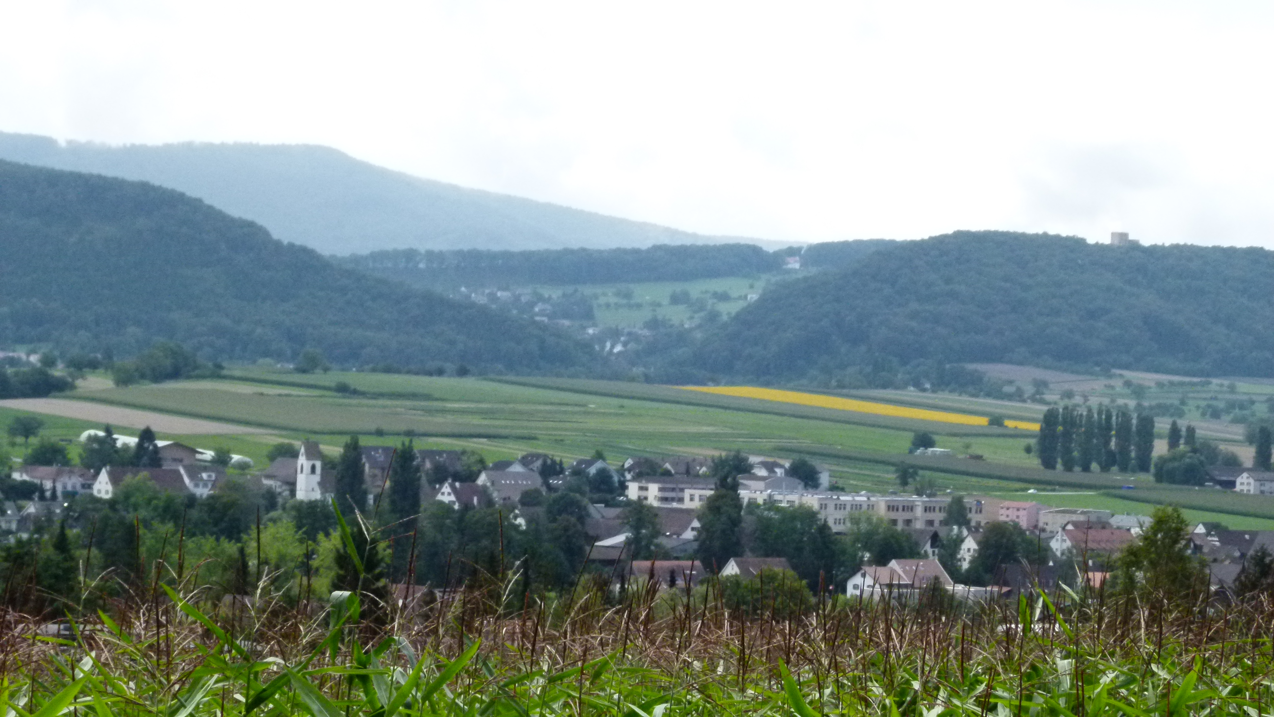
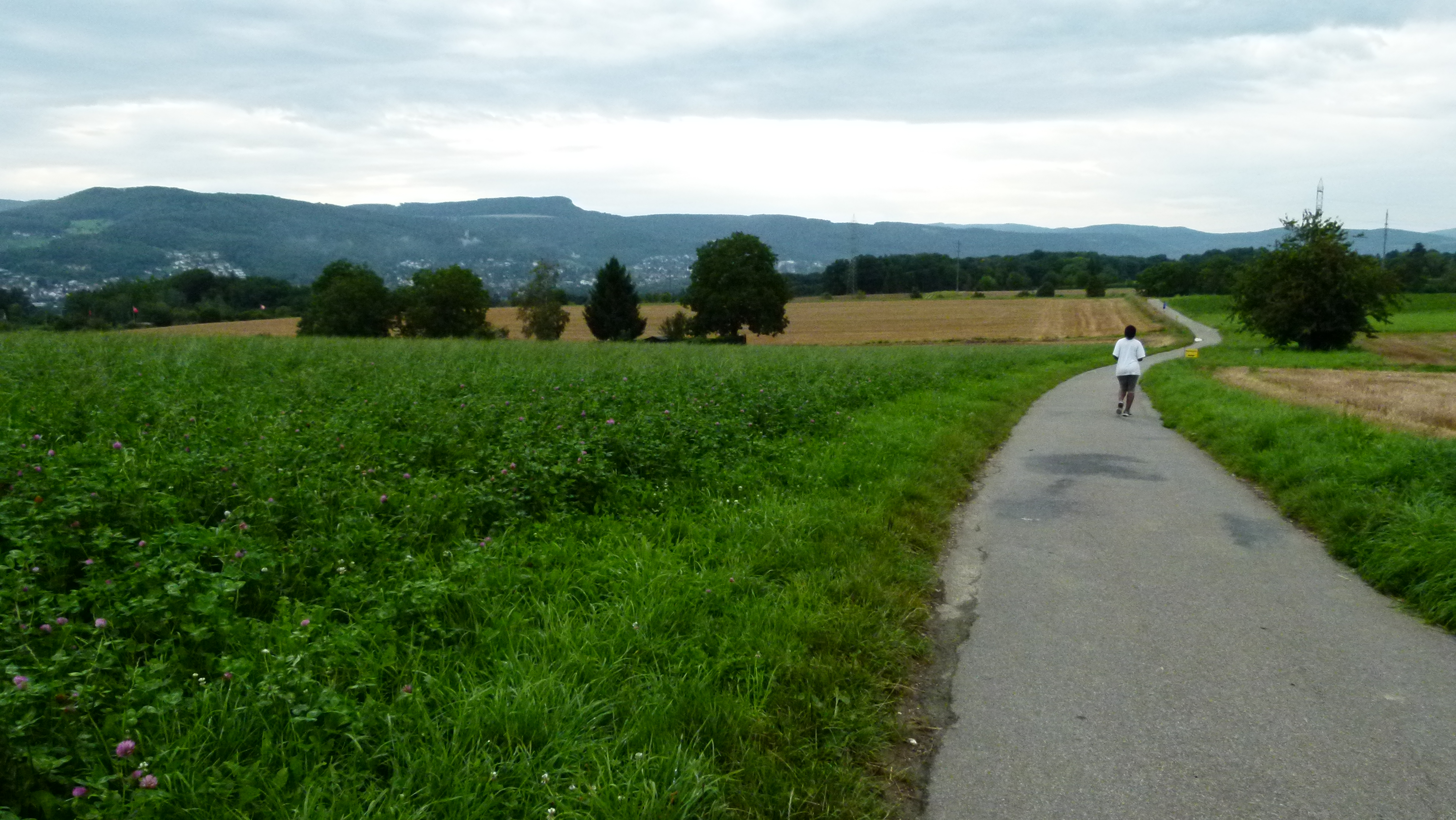
On the plateau the loess is fertile and enables farming and garden centers

The rather flat plateau of the Bruderholz is fertile. There are wheat -, corn and vegetable fields as well as cherry and apple trees, overlooked by the Jura mountains (on this picture we can see the Gempen).

P1060017

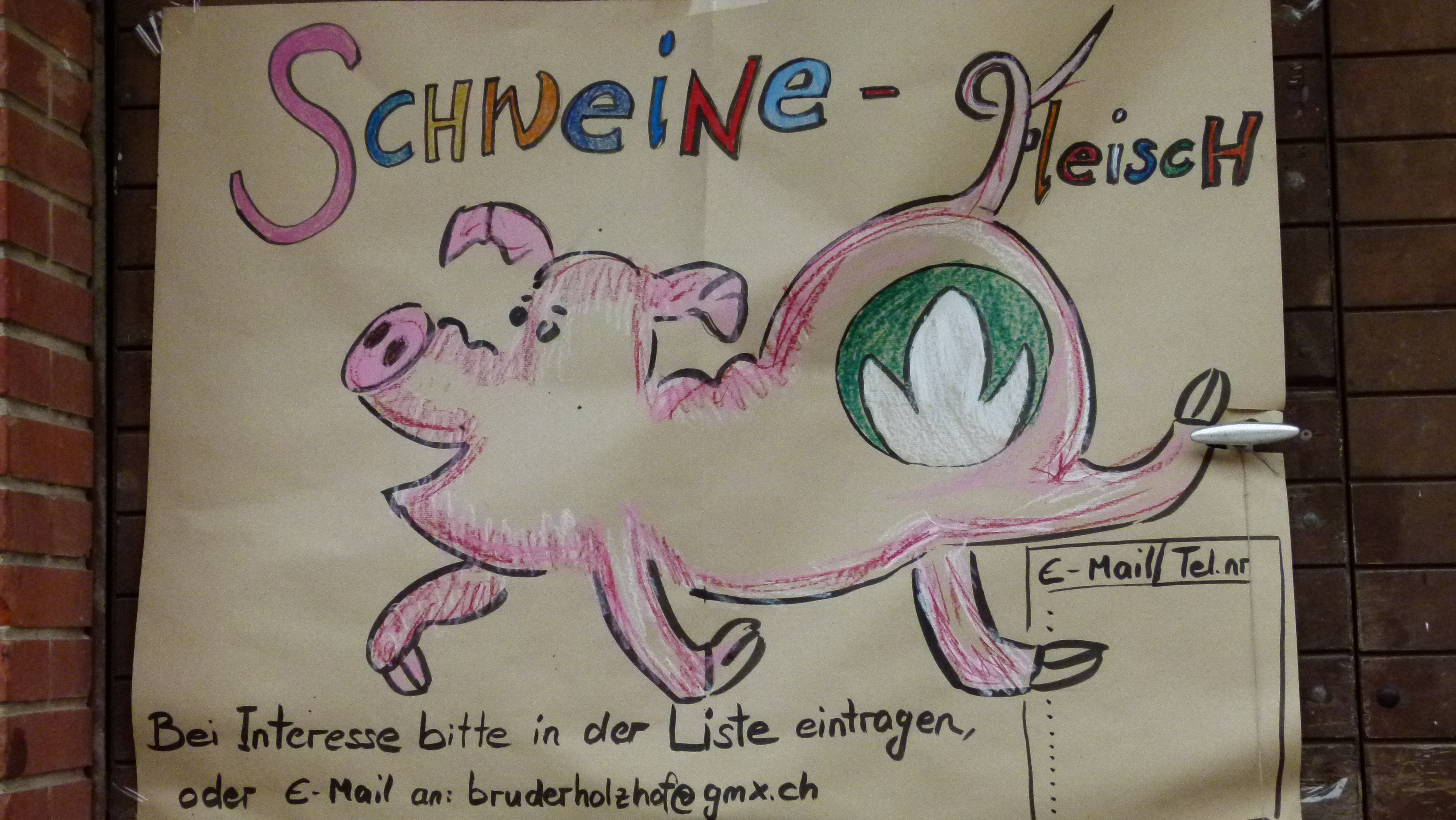
The farms sell their products – for example the Bruderholzhof .

P1060053

Among other things, the Bruderholzhof sells porc meat. Note the green and white Bio but – this is eco meat.

P1060057

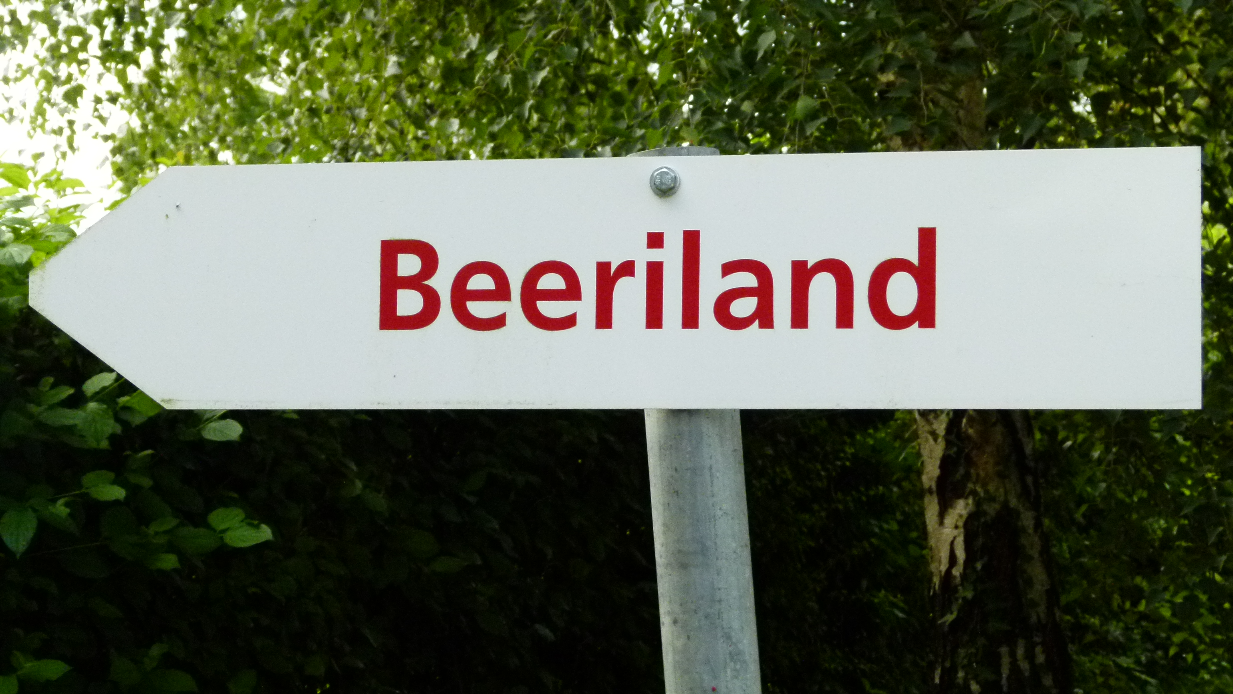
Some farms offer self picking berries – such as strawberries, blackberries or raspberries “Beeri” is what we Swiss say for “berries”).

P1060060

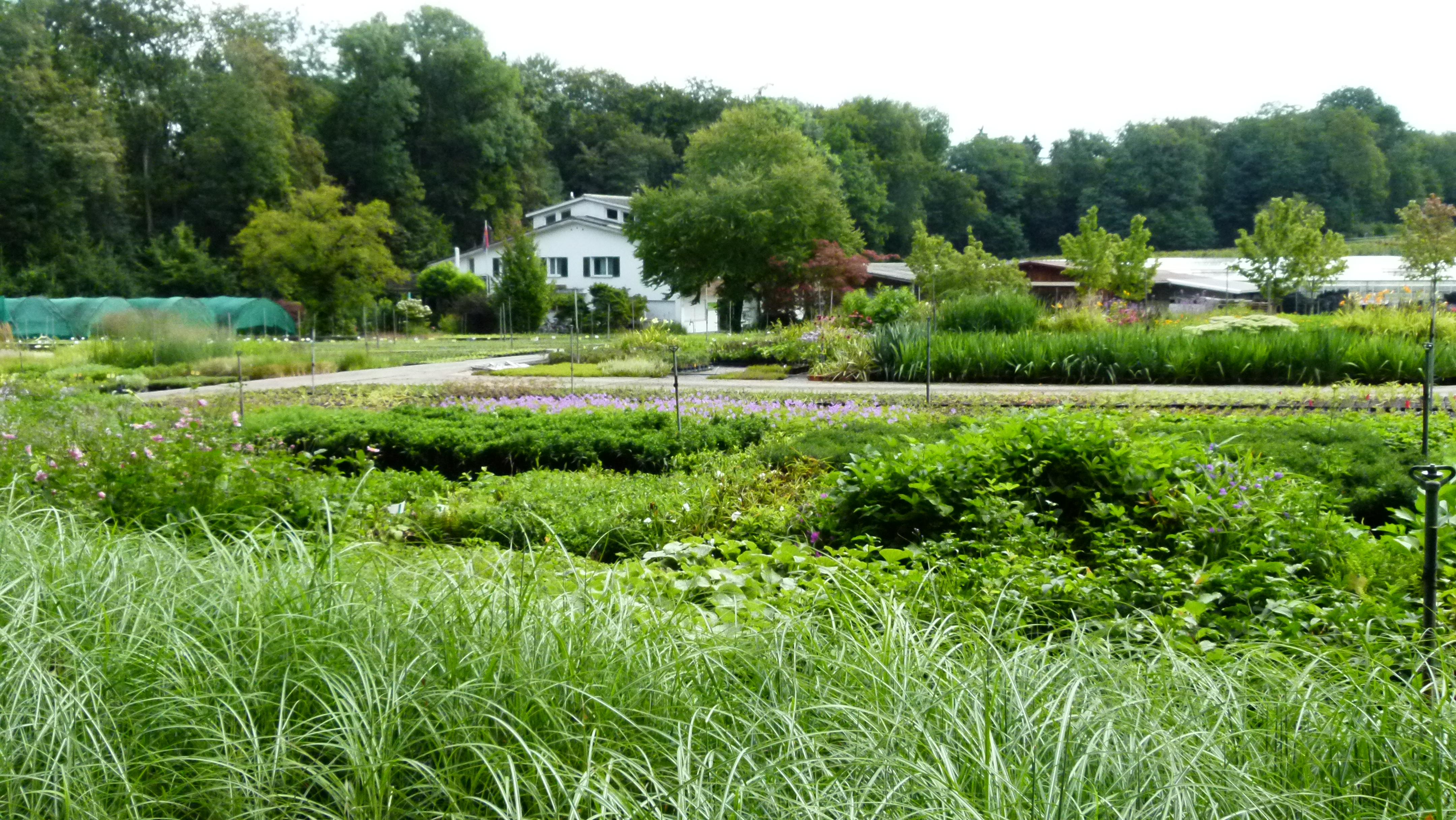
I often shop in the garden center “Bauer” that grows and sells flowers and trees on the Bruderholz plateau.

P1060061

.

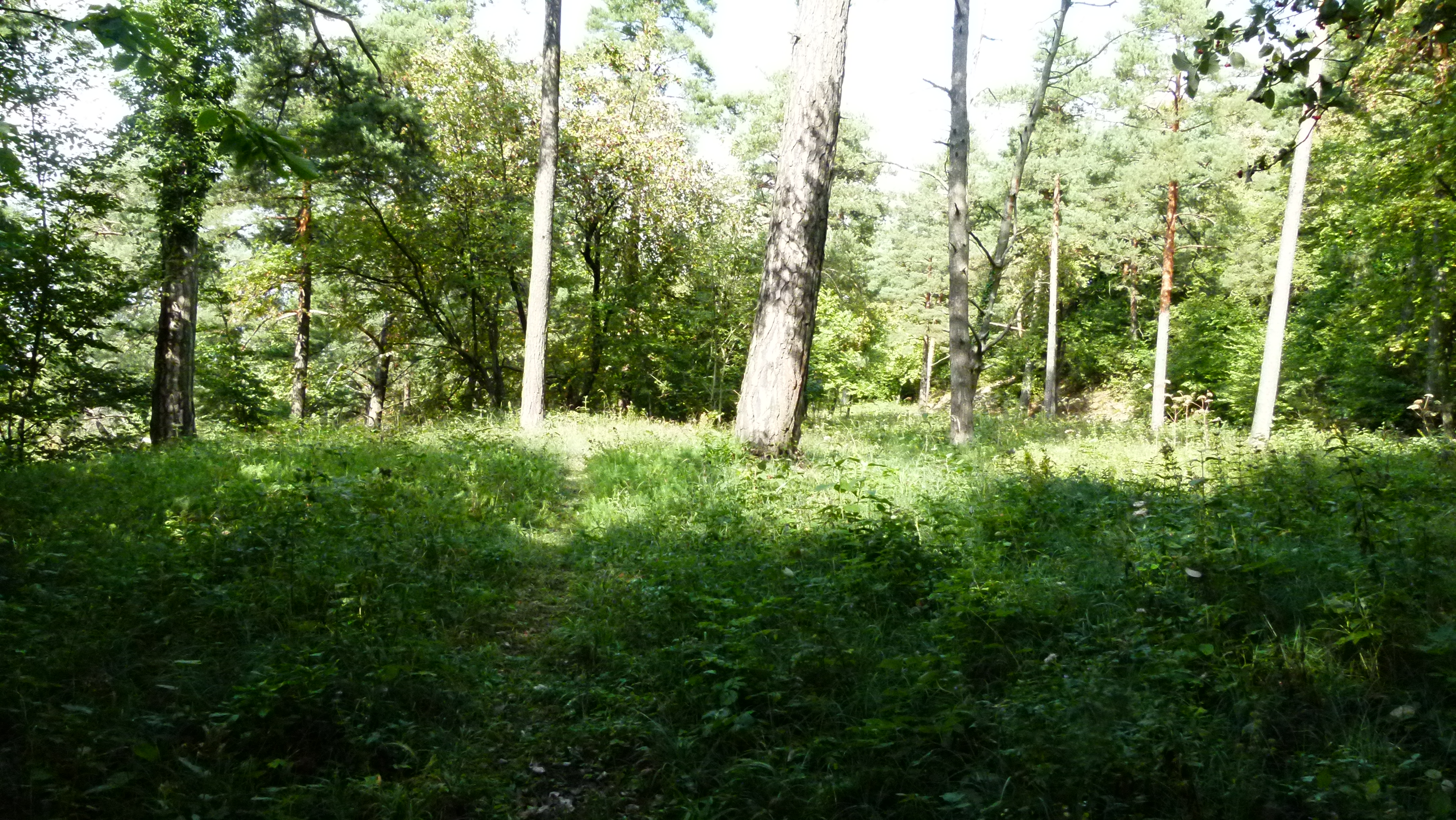
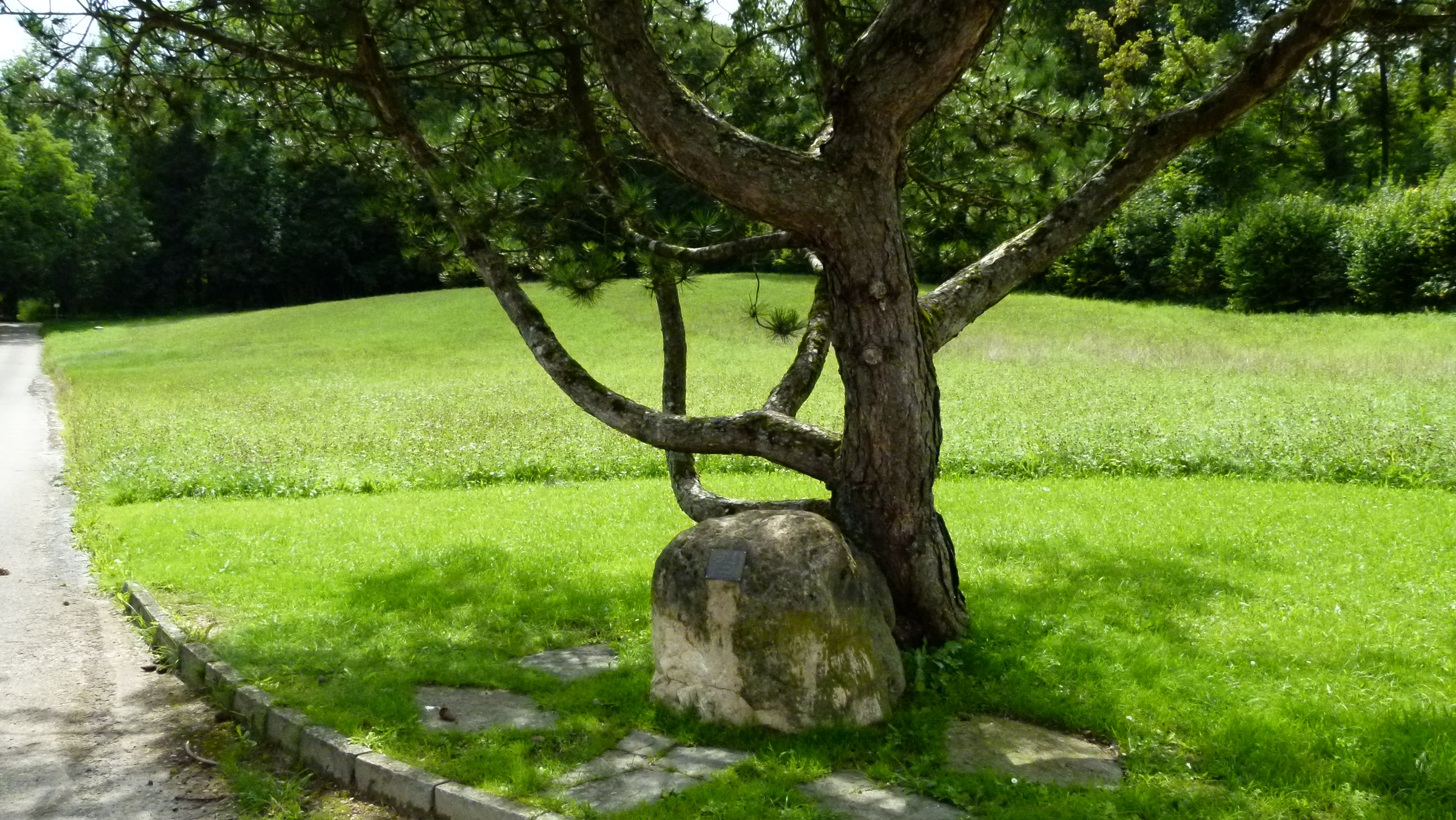
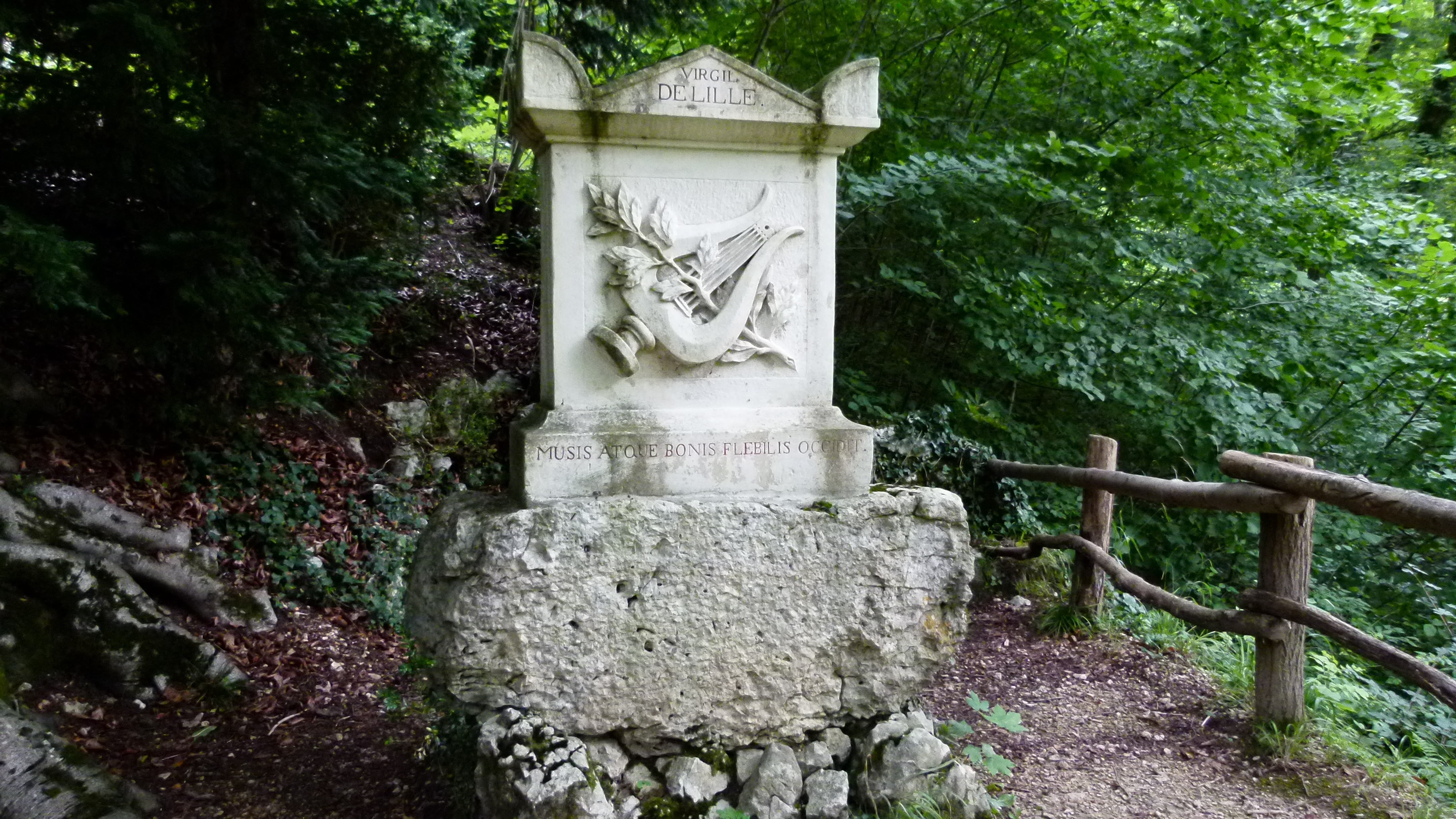
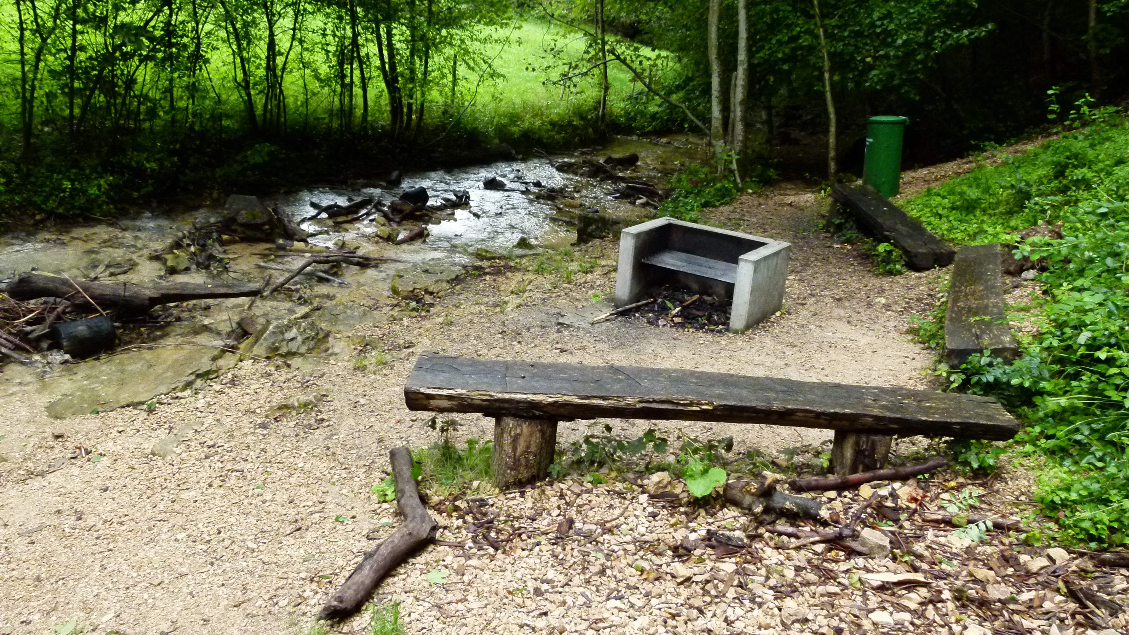
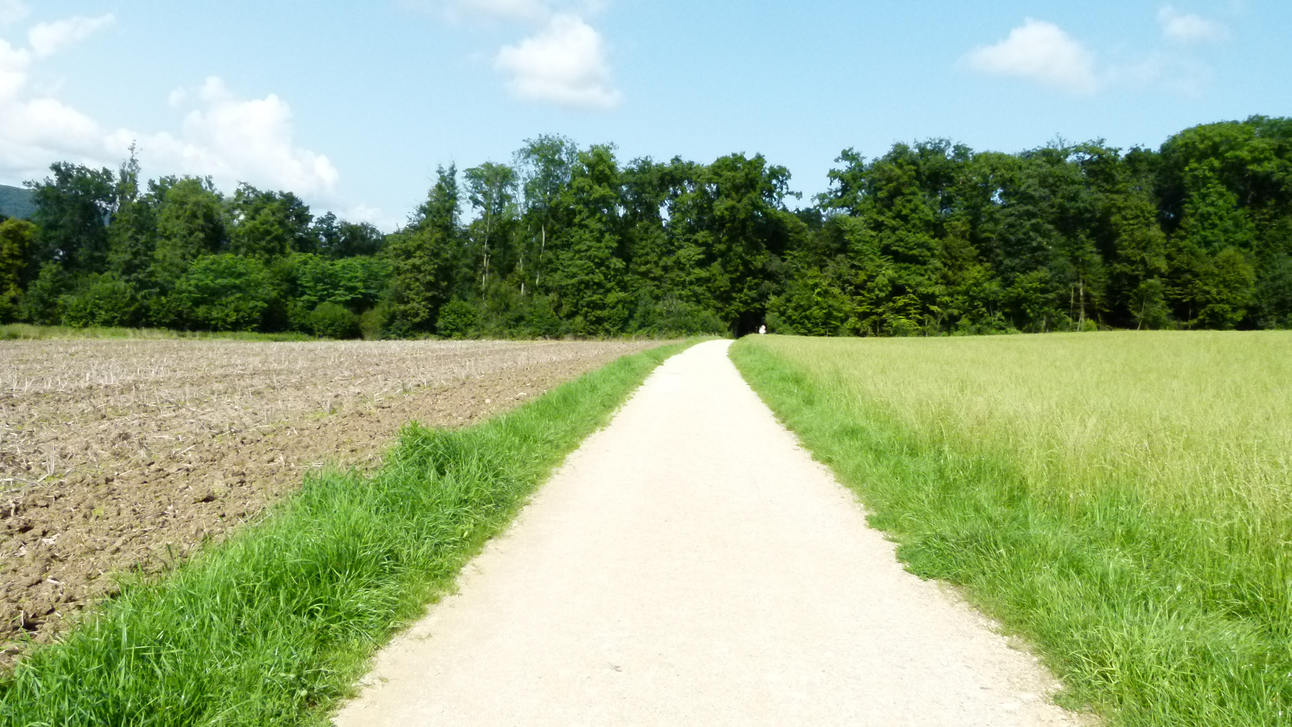
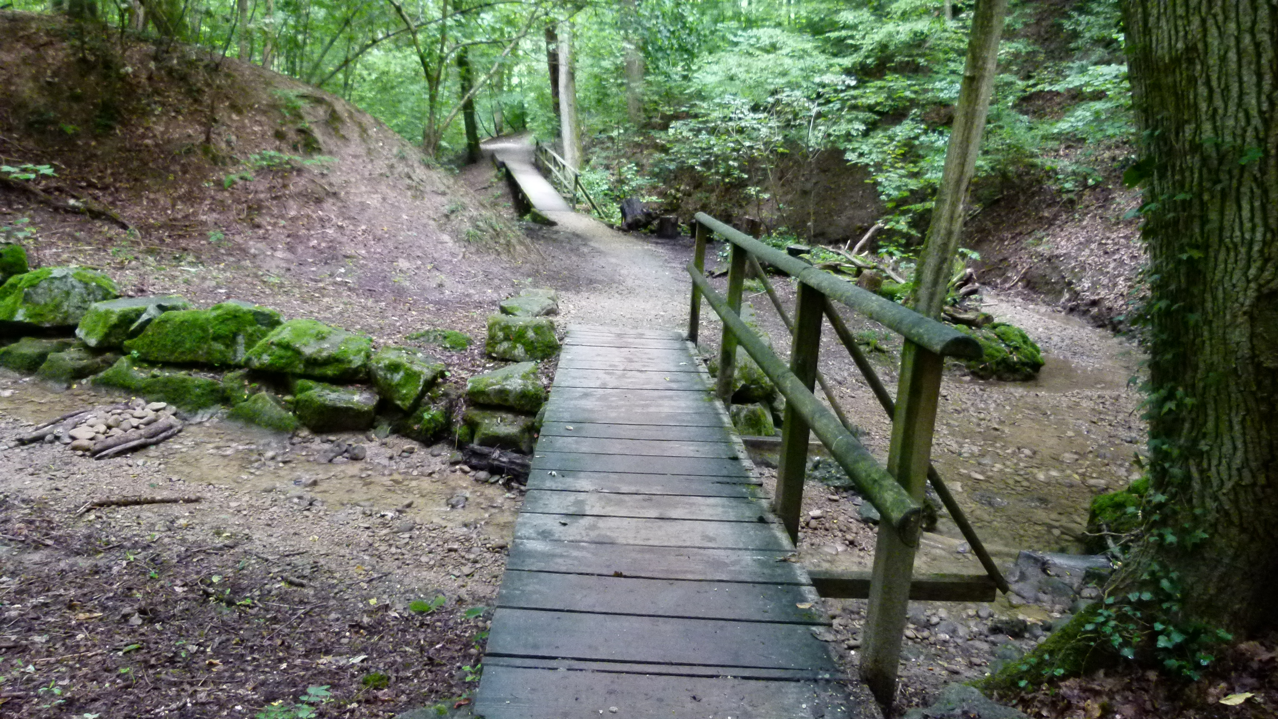
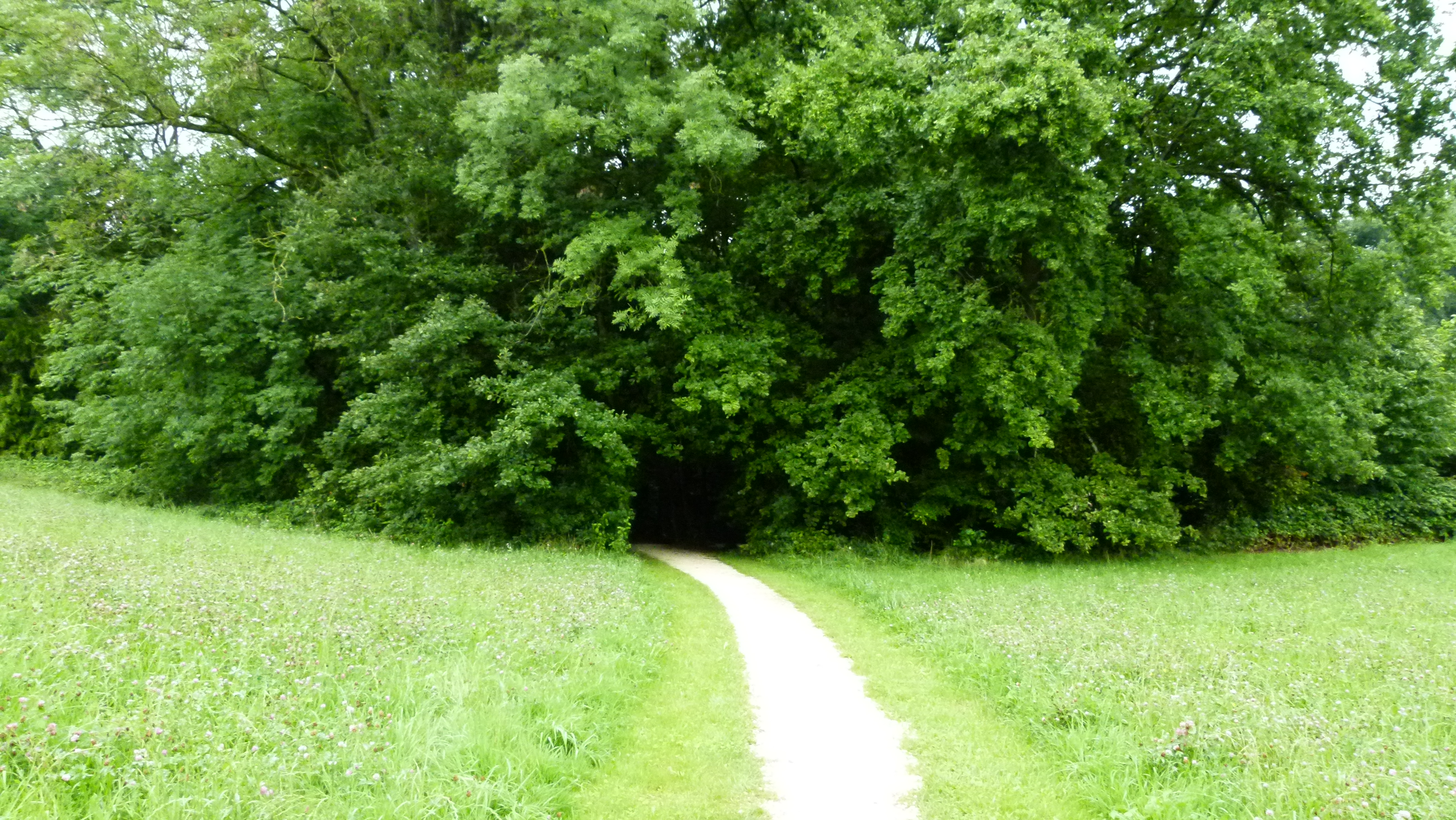
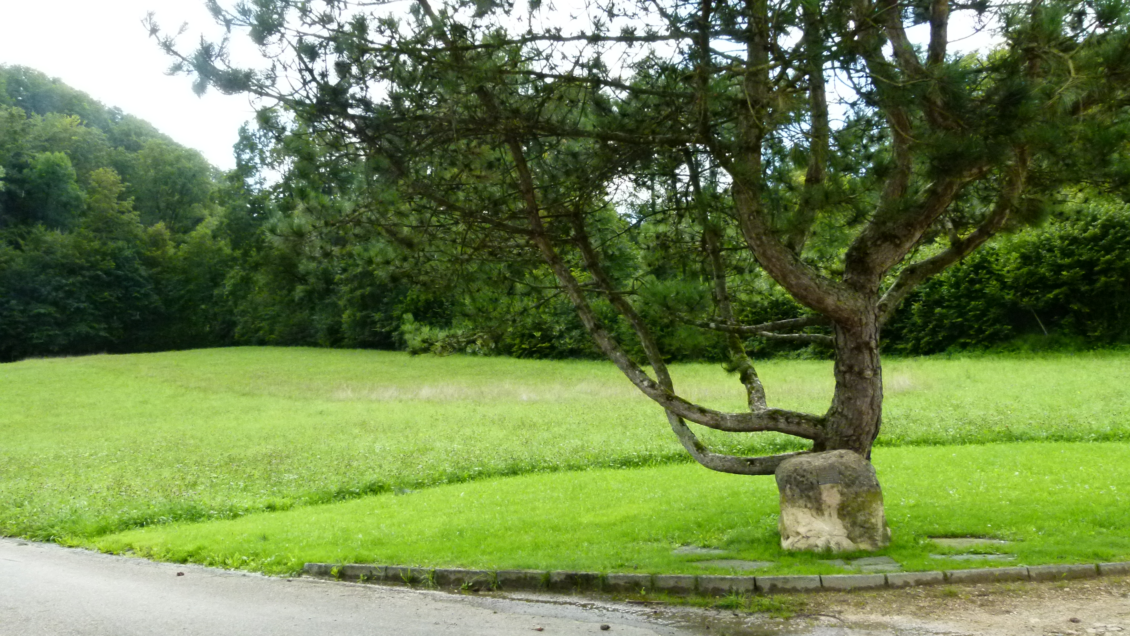
Following the forest brothers on very hot summer days

On very hot summer days, I walk along the slopes of the Bruderholz plateau. The slopes are covered with forests that protect from the sun. This is where the forest brothers lived that are said to have given the Bruderholz its name.

I enter the forest near Münchenstein…

P1060019

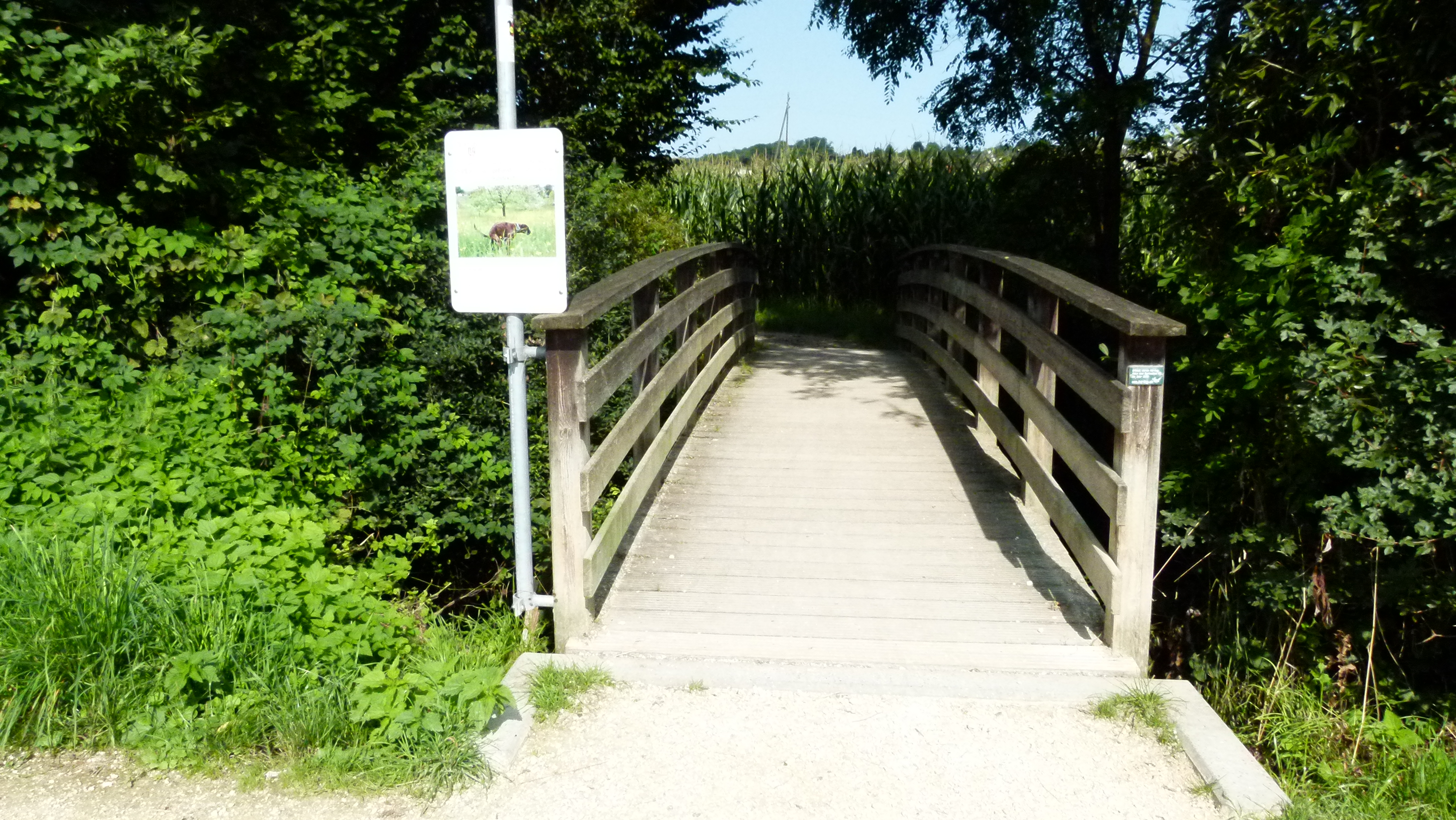
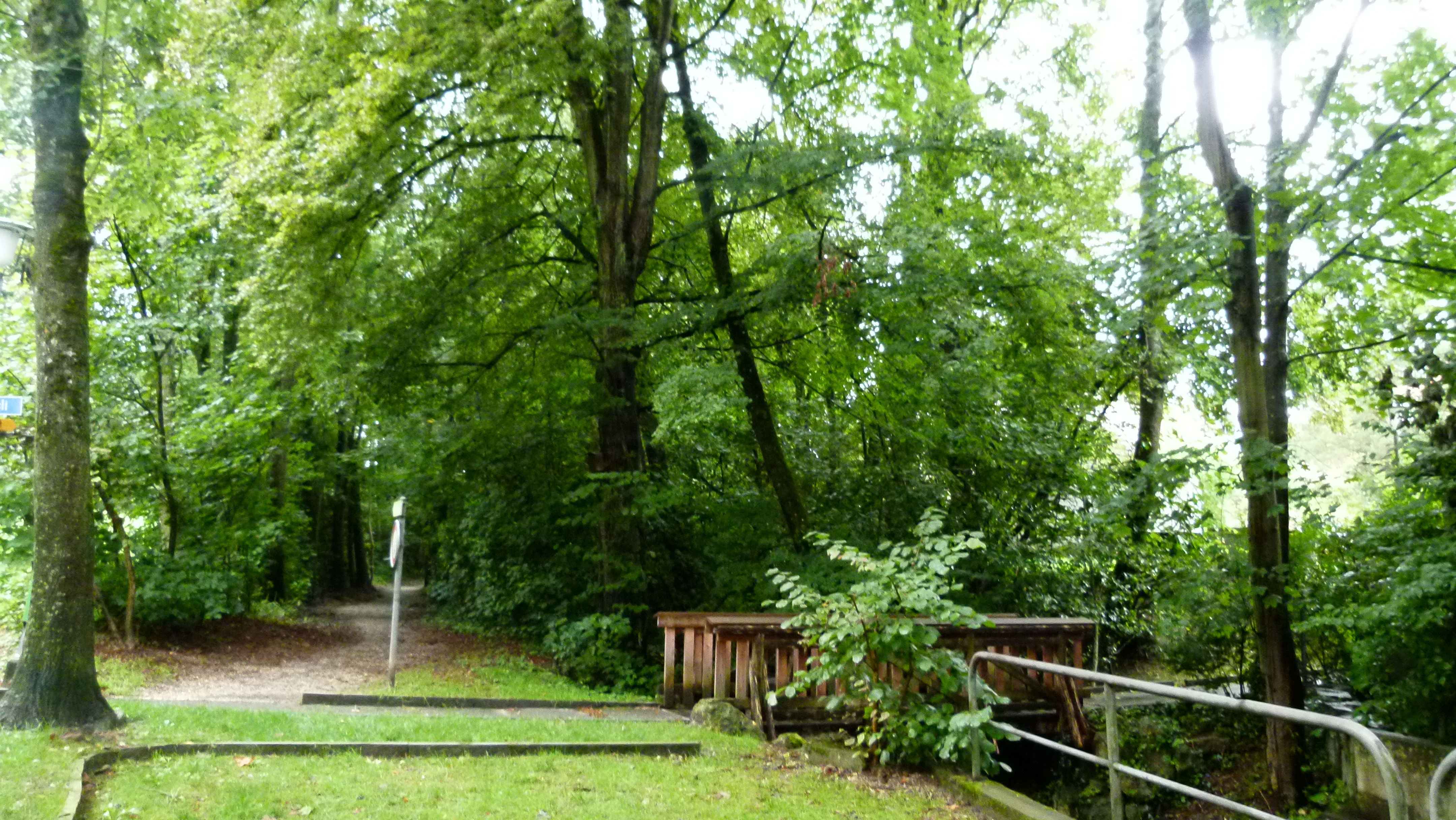
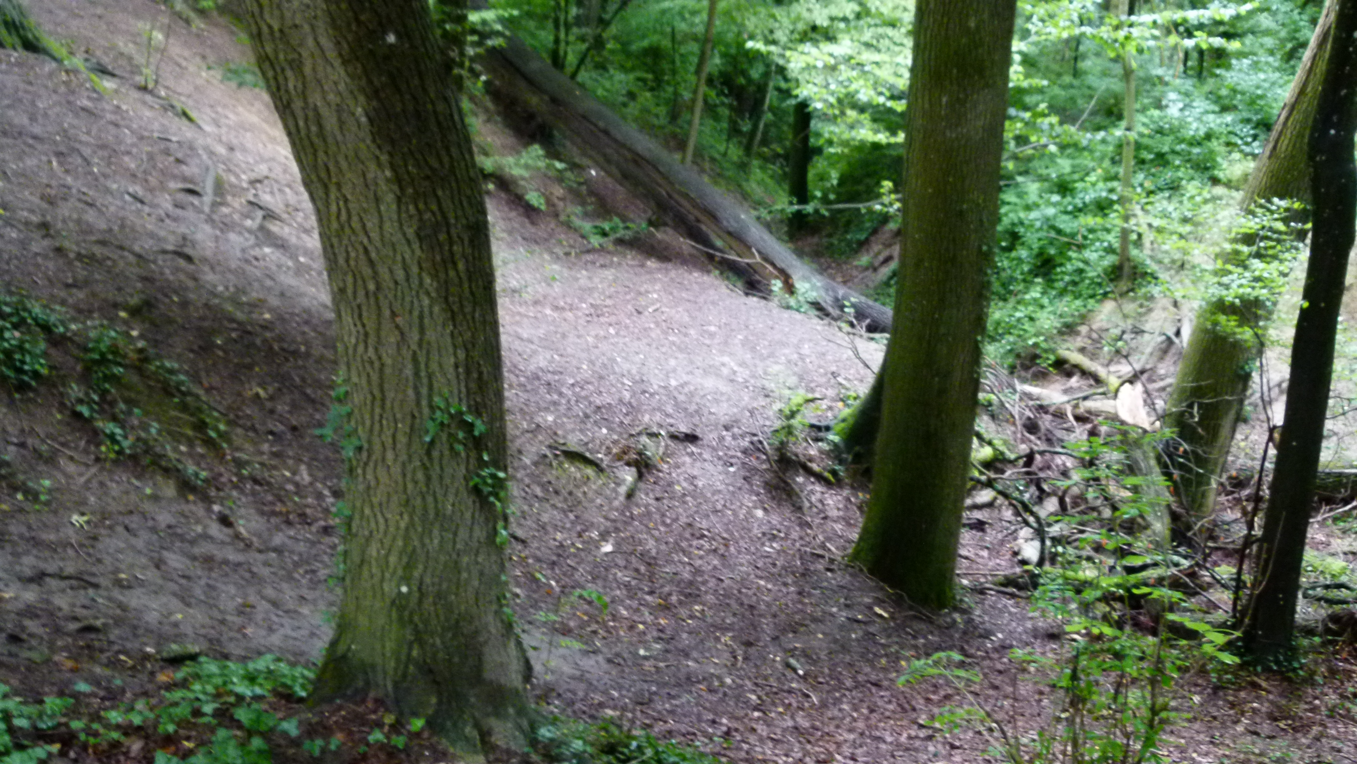
… I find romantic creeks along the steep slope…

P1060021

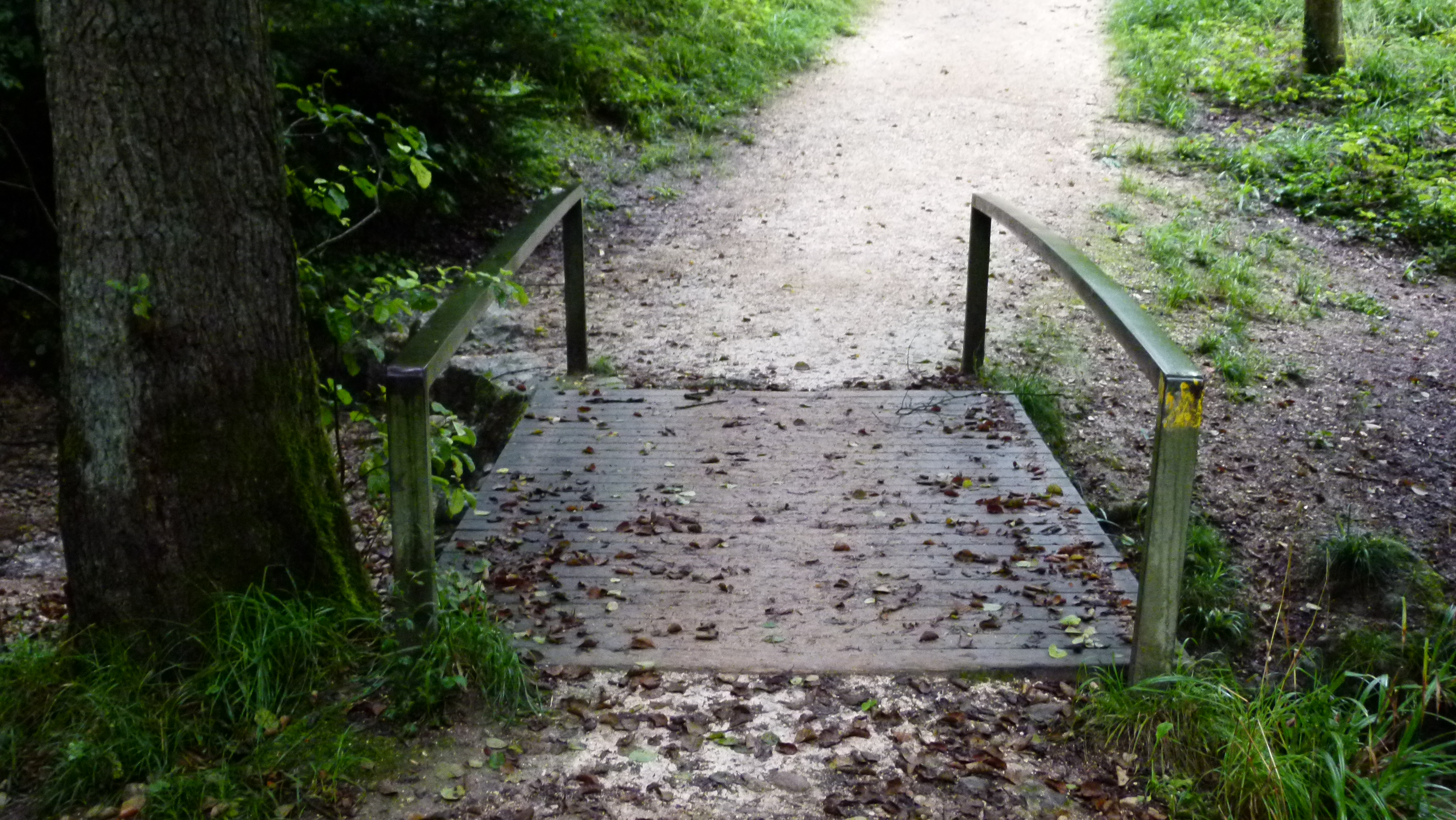
… and small bridges…

P1060030

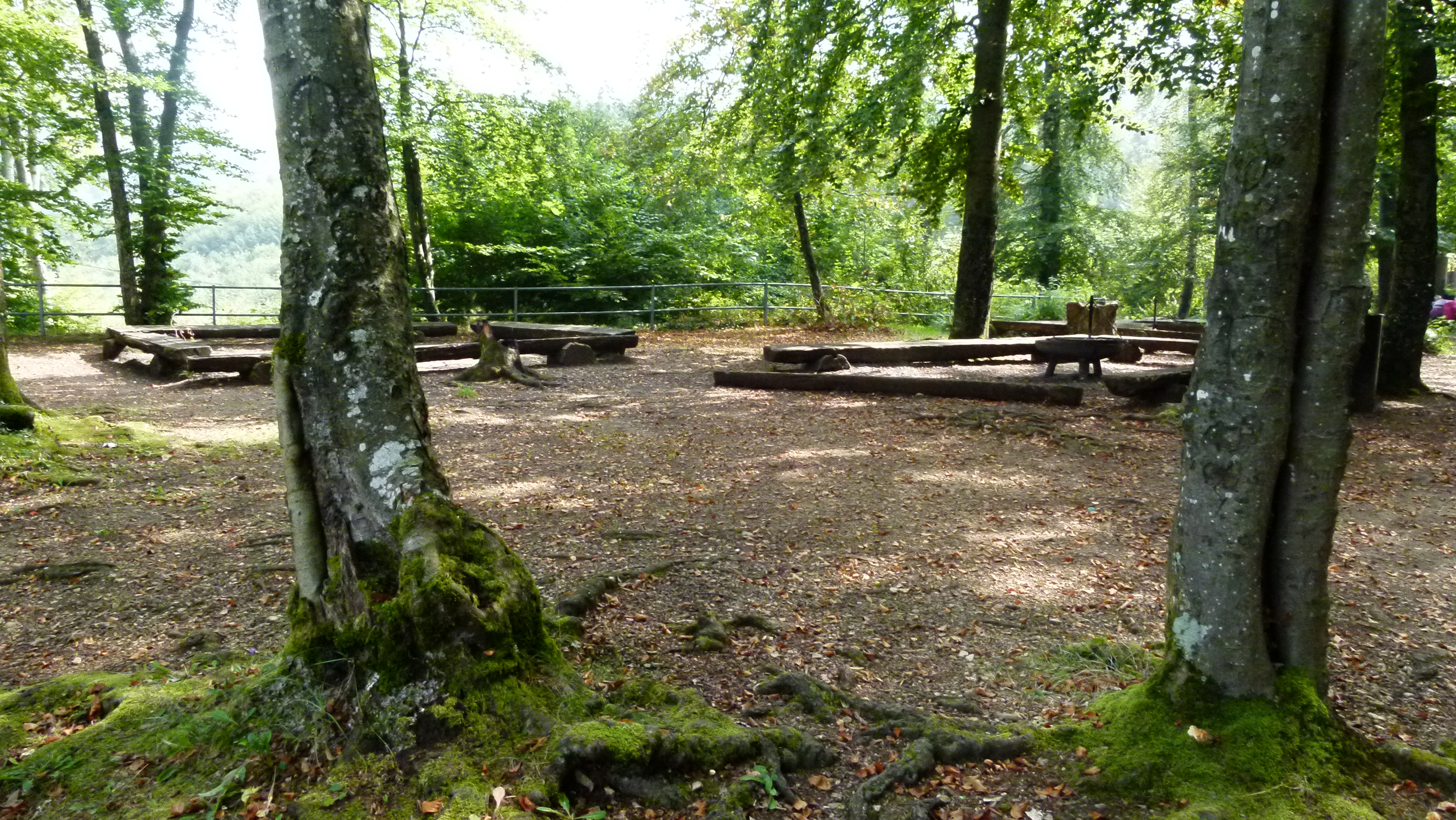
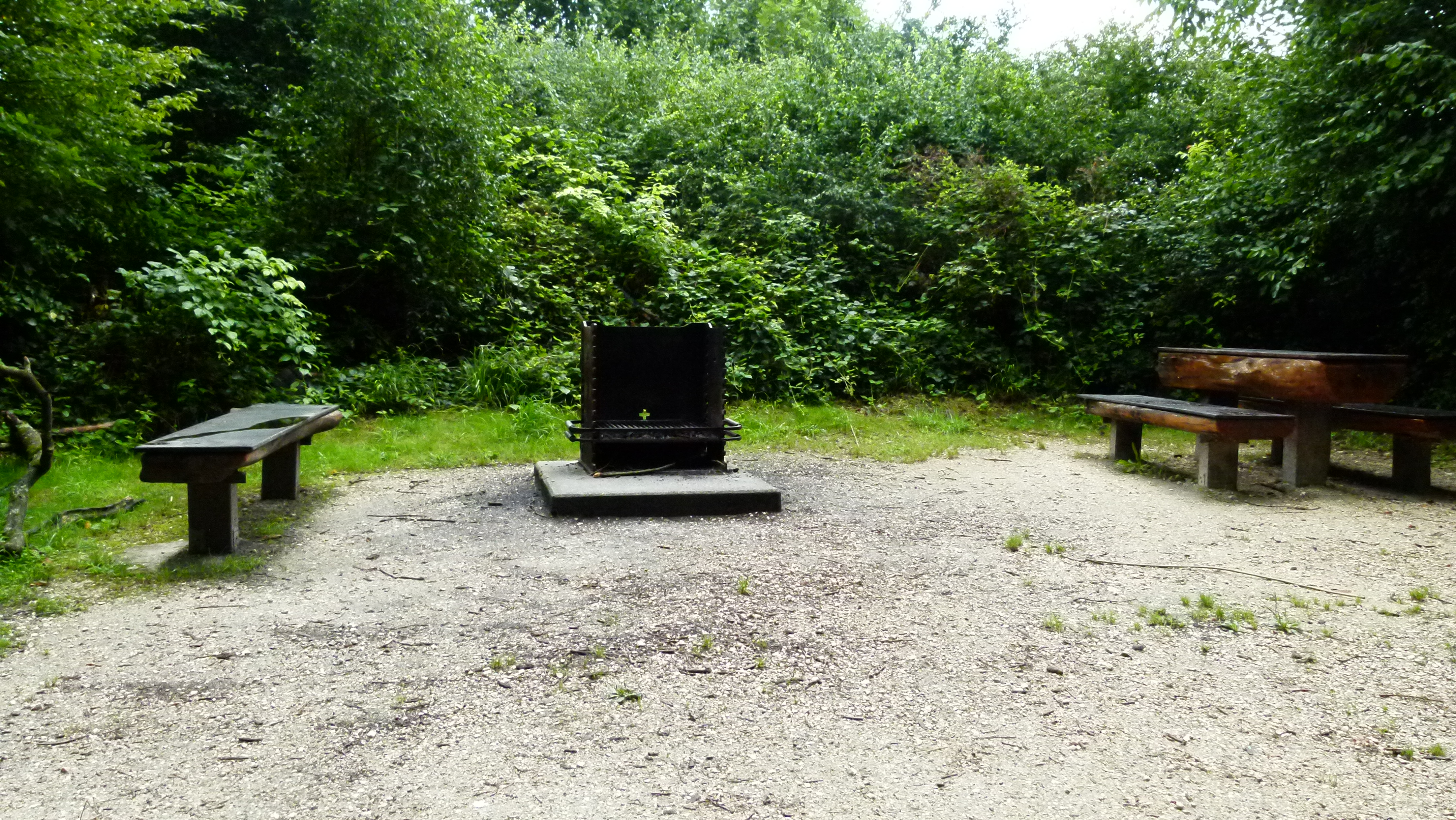
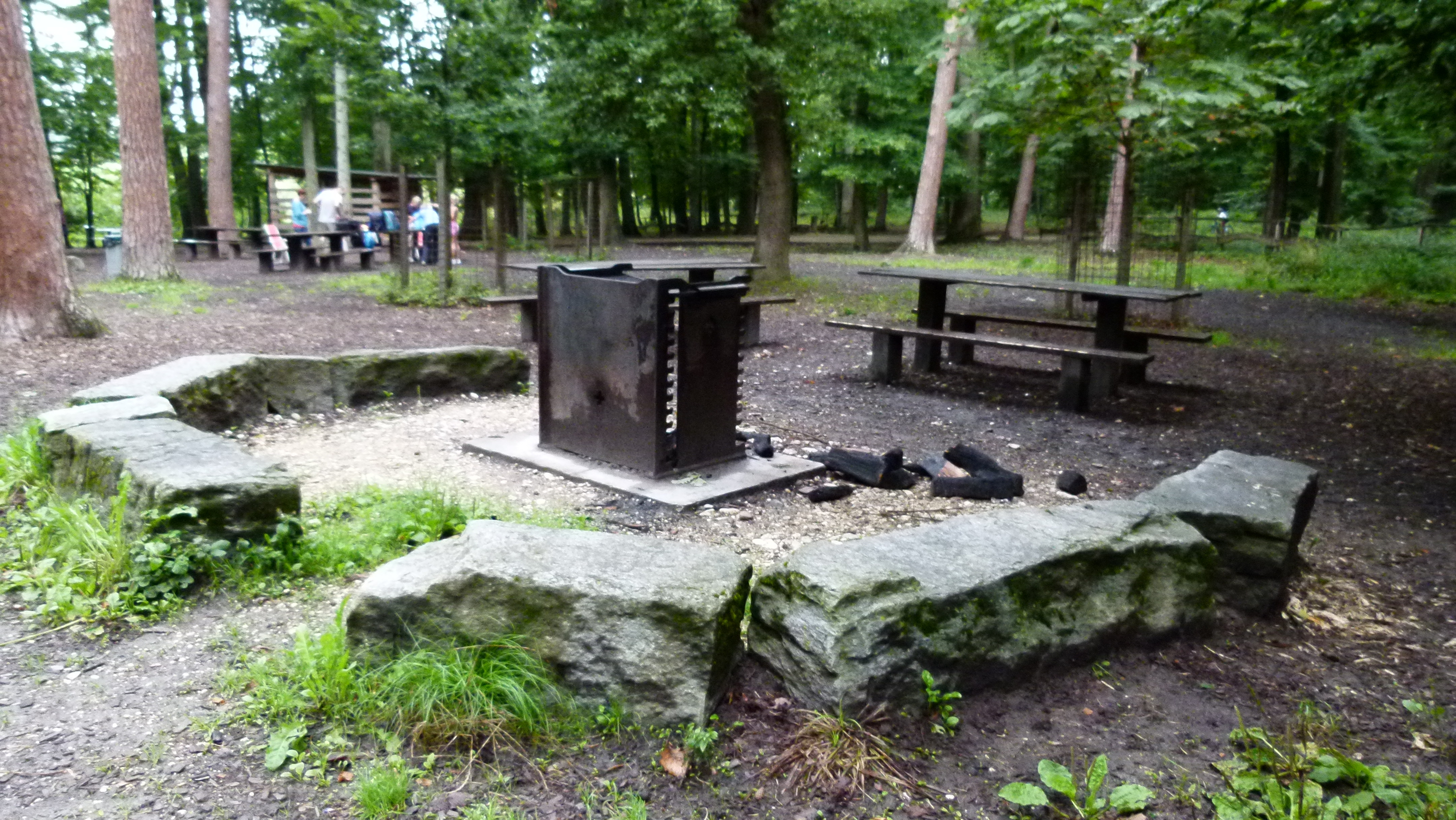
… and lots of picnic spots with elaborate barbecue grills…

P1060023

.

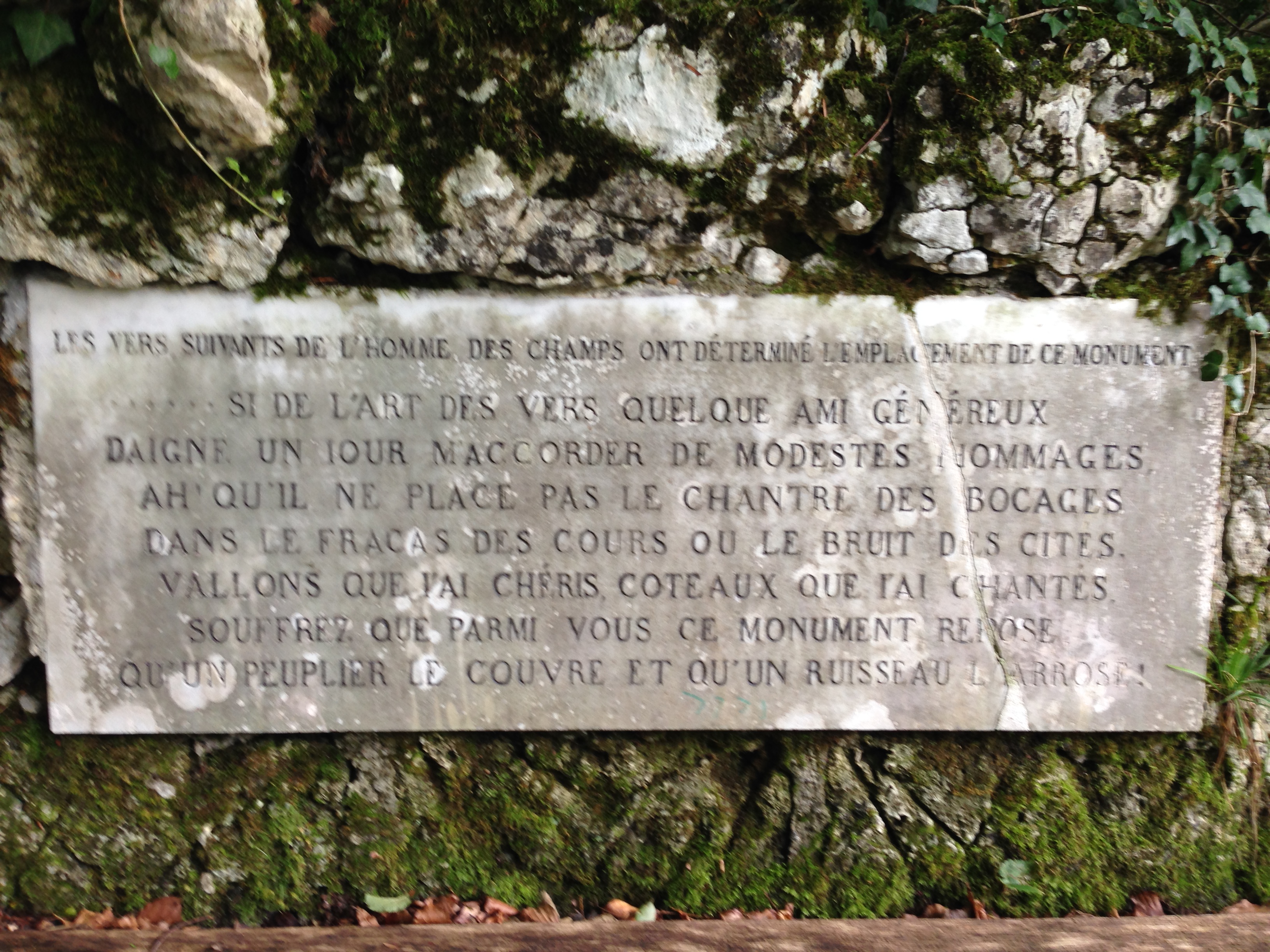
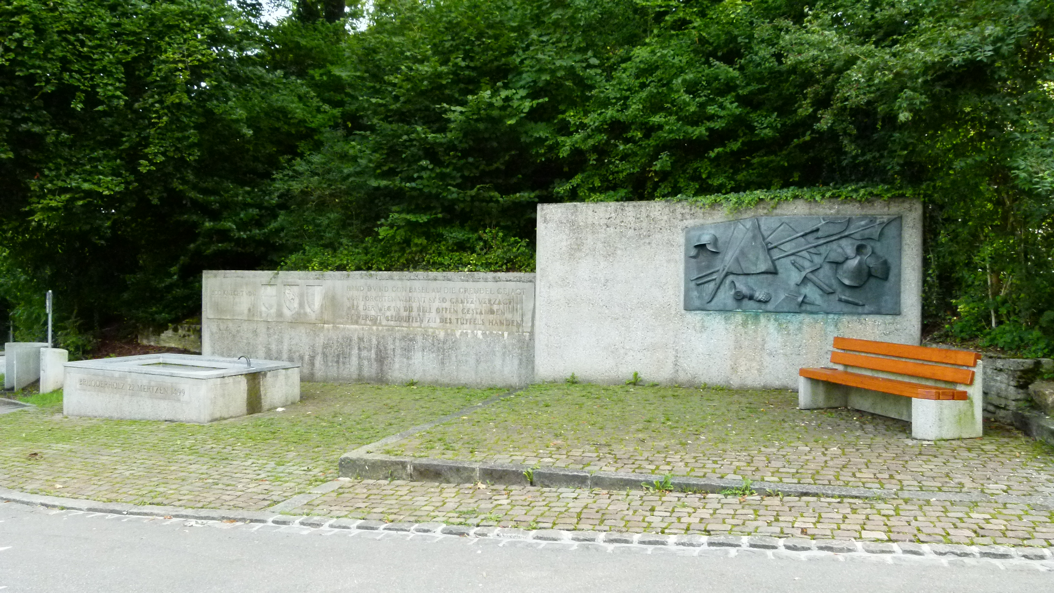
Battle of Bruderholz – 1499

A small detour to Reinach takes me to the monument reminding of the Battle of Bruderholz.

P1060095

The Habsburgian rulers of the German empire intended to limit the freedom of the Swiss Confederacy (Eidgenossen). On March 22nd 1499 the Swiss defeated the German army at the Battle of Bruderholz during the Swabian War. Later in the same year the Swiss defeated the Swabian League again near Dornach. In the peace treaty signed in September in Basel, the Swiss Confederacy became largely independent from the German empire (ruled by Maximilian I of Habsburg) and Basel joined the Confederacy two years later in 1501.

.

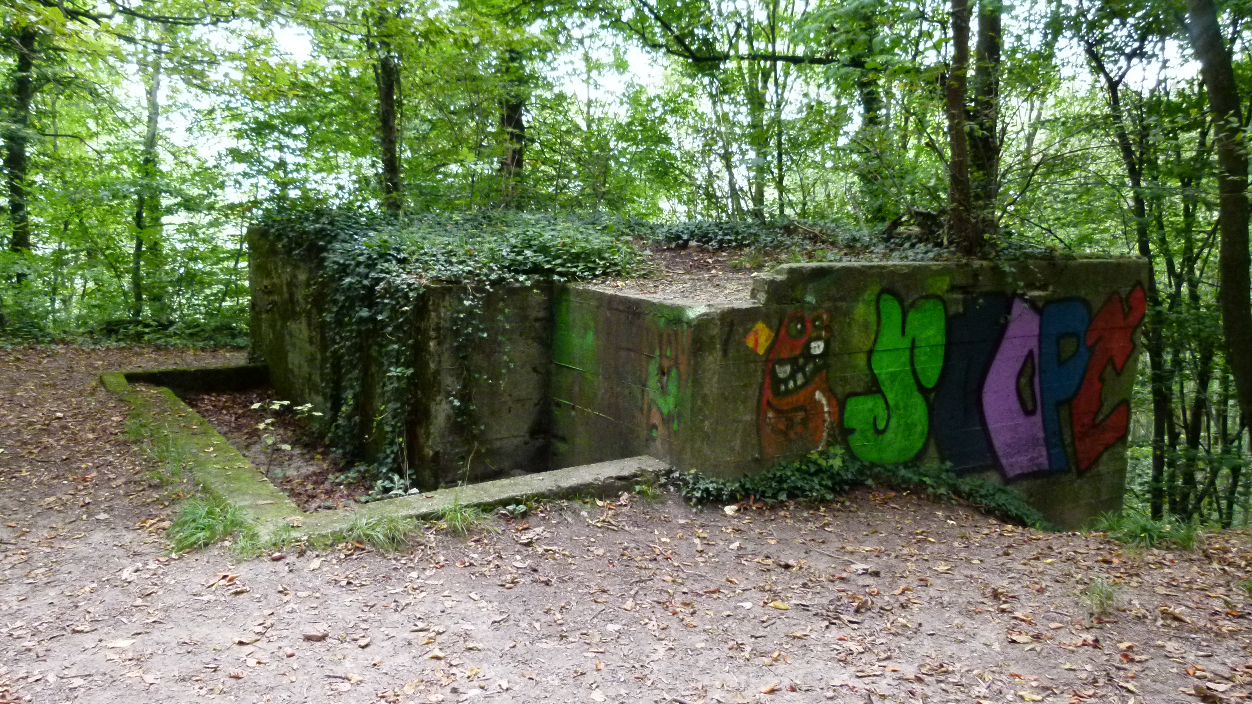
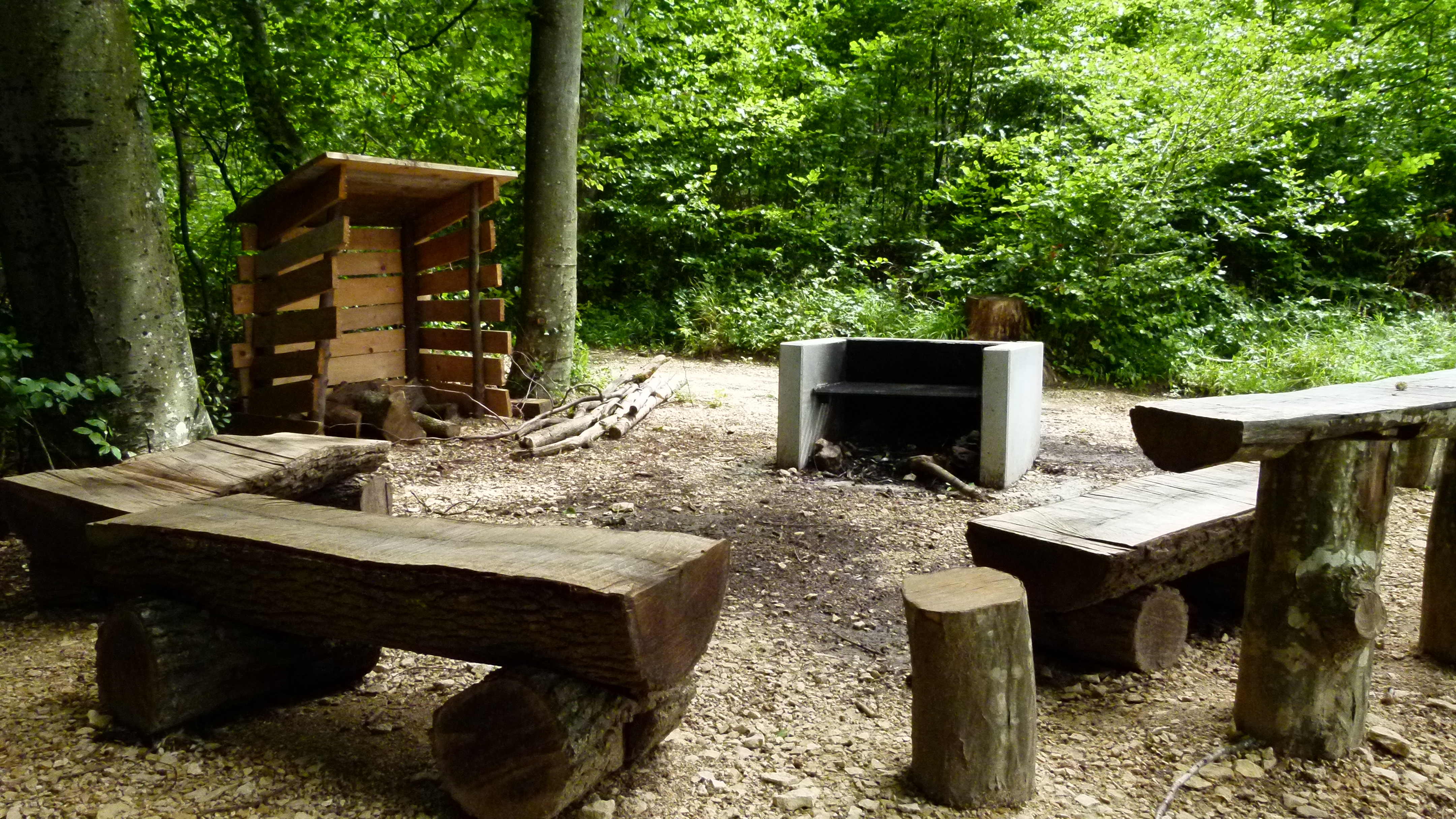
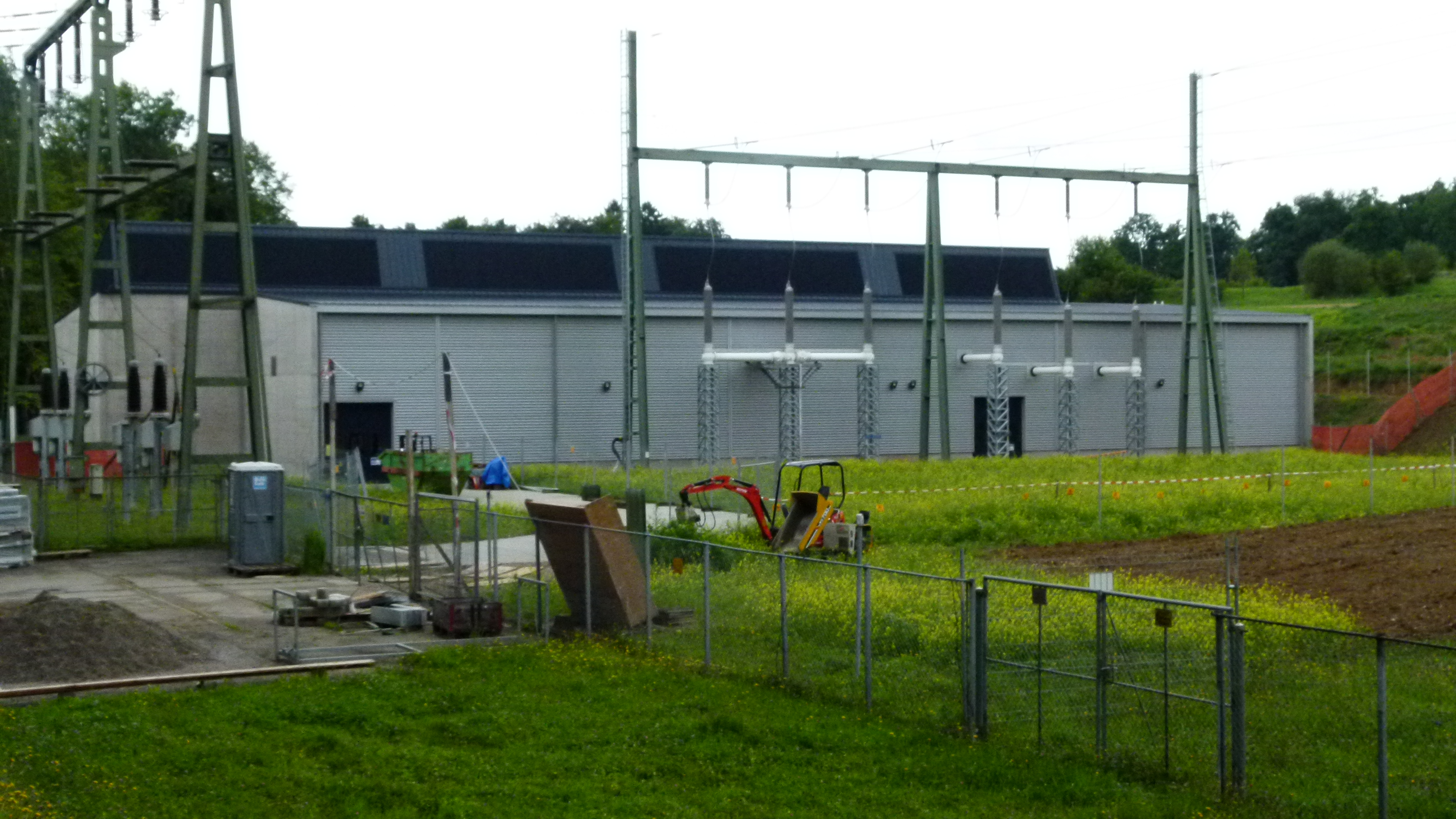
Froloo – the electricity hub, the water reservoir and the picknick area

The Froloo disposes of an electricity hub, a water reservoir  and a huge picknick area with a barbecue grill and a cottage.

The electricity hub is one of the most important hubs in the North West region of Switzerland. It is being overhauled now. There will be a new transformer packed into a building which frees up 7000m2. Also some power supply lines will move underground.

P1060041

The water reservoir Froloo is one of four drinking water storage tanks in the area. They are fed by eight ground water fountains. The other three reservoirs are Rebberg, Hollen and Bielhübel.

P1060042

The picnic area is large and boasts of a luxury barbecue grill – like all barbecue spots on the Bruderholz.

P1060034

.

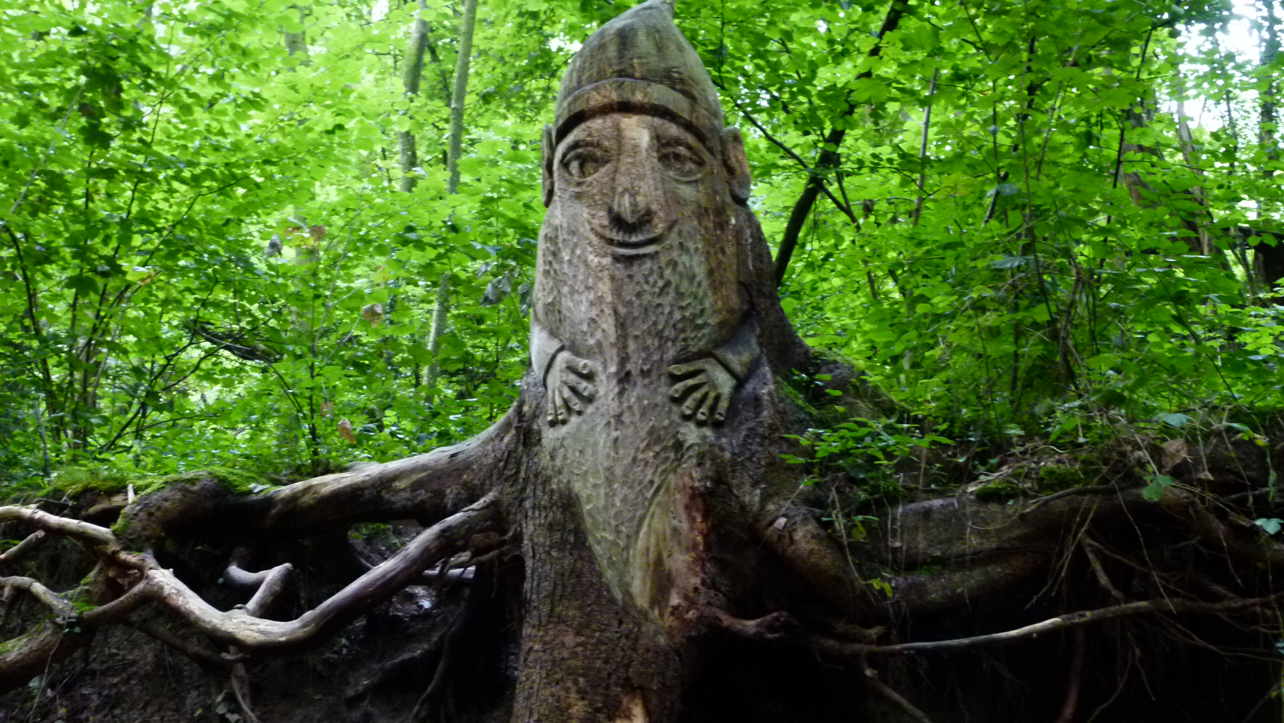
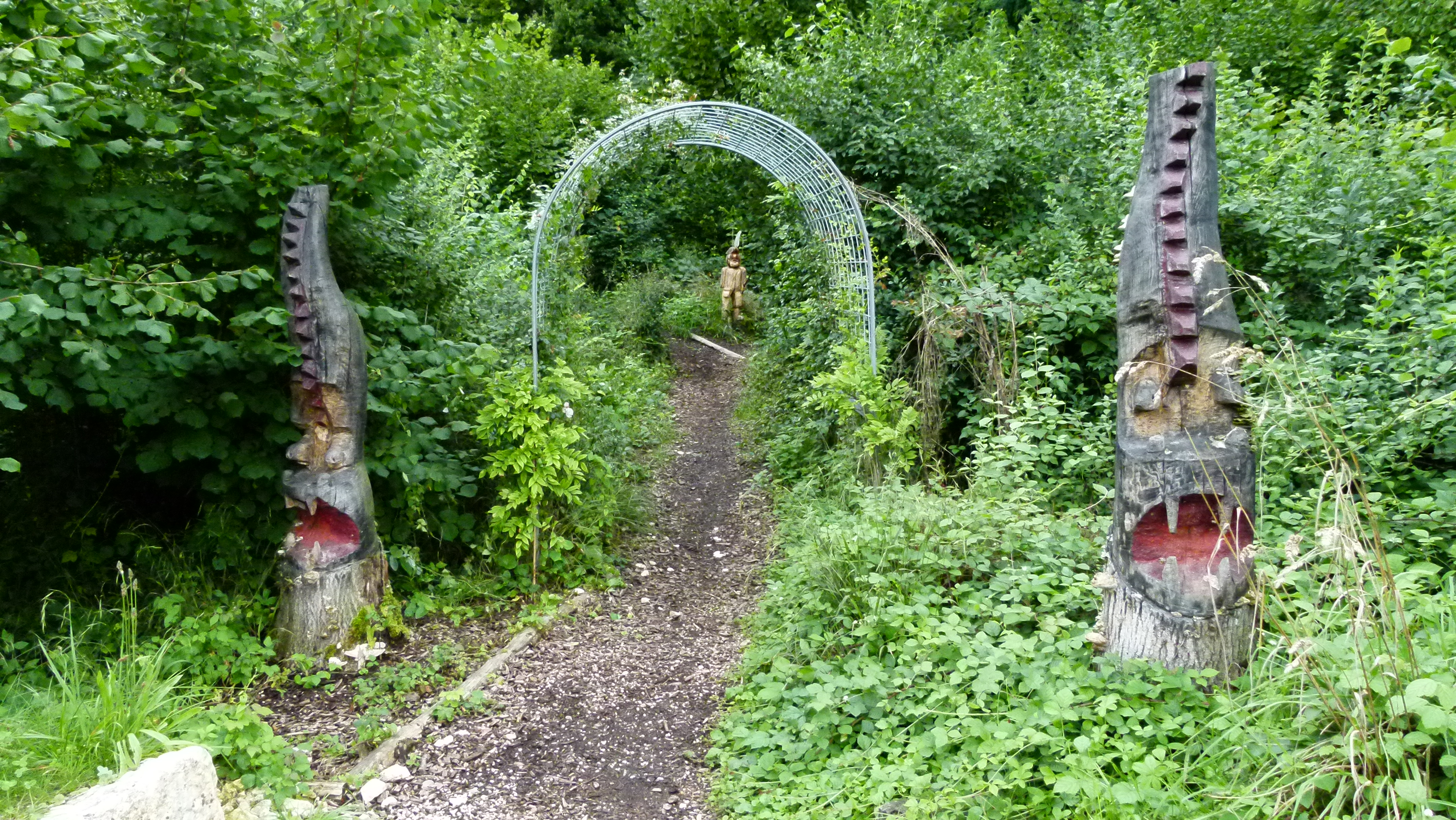
Leywald – the nature amd sculpture trail

South of Reinach there is the Leywald. I wonder, what kind of forest the “Leywald” is, and Dr Google says “Ley” is a cliff or escarpment (Loreley in Germany is a dangerous cliff above the river Rhine). Hence I expect to find the Leywald-forest climbing up a hill. Understanding “Ley” makes it easier for me to find this forest, as I saw no signposts pointing to it.

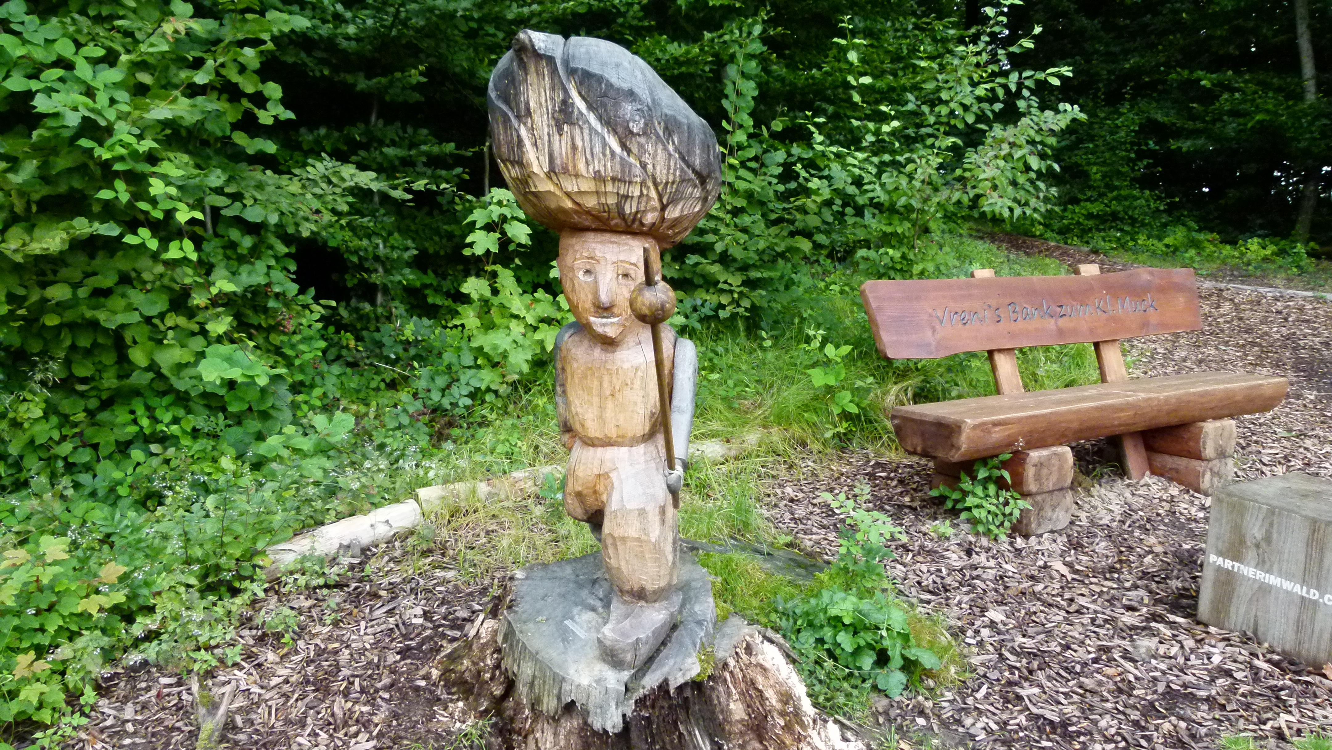
The Leywald hosts a trail that combines learning about the forest and wooden sculptures near a barbecue area .

P1060101

I recognize fgures from fairy tales like “der kleine Muck” or “little Muck” (“Muck” is a name). The sculpture trail is a great place to visit with children. My Austrian friends take their grand-child here, and this is how I heard about the trail. Why is it always foreigners that know my country better than I do?

P1060107

Because this is also a forest trail, bushes and trees are labeled. This is a great place to learn or teach about the forest.

P1060111

.

Orthography is a matter of luck – Orthografie ist Glückssache

P1060125

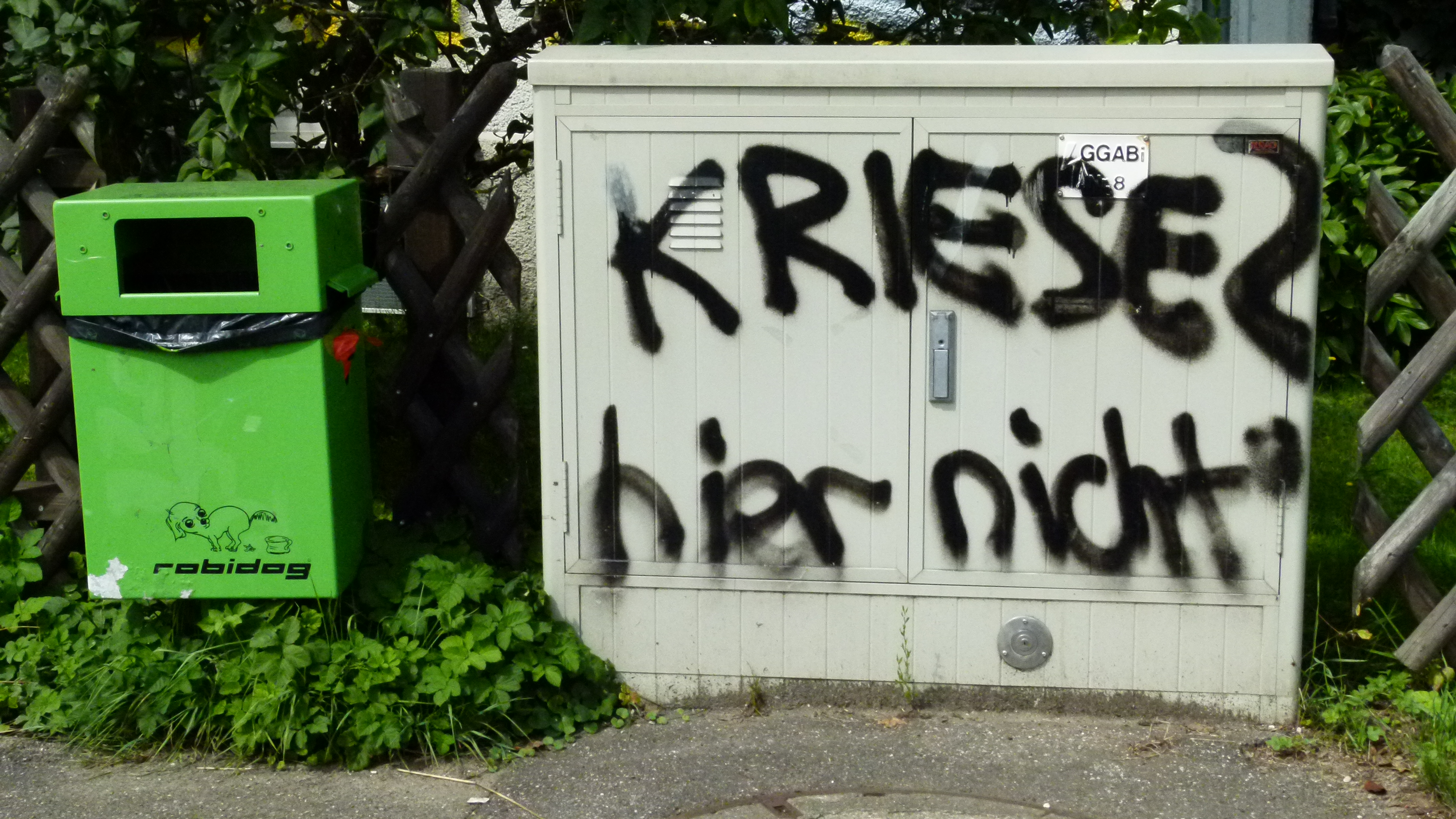
“Krise”=crisis and  “hier nicht”=not here. But someone wrote “Kriese” instead of “Krise”… yes, orthography is a matter of luck and I always smile, when I walk by this electricity hub.

Then – Switzerland tries to stay clean. People who take out their dogs have to retrieve little plastic bags at the “robidog” dispenser, pick up all the dog leaves on the way and throw away the small plastic bags after having tied them up carefully.  These dog toilets are called “robidog”, because it is Robi AG that has provided the box and the plastic bags. They even provide apps to find the robidog dispensers. Bravo is another provider that prevails in Basel town. Basel blyb suuber – Basel stay clean!

.

There are more treasures around Basel

These were some of the treasures south of Basel. As I extended my walks to the southwest, southeast and north of Basel, I will continue to write about what I discovered and rediscovered here.


On the road – a great Sunday trip from Basel to Zurich

Traveling abroad is out for me right now. However – from the point of view of Basel, we say that we go “abroad”, when we go to Zurich. This Sunday, Ursula invites me to come to Zurich and see the cartoons of Zen master Sengai.

Zen master Sengai in the museum Rietberg in Zurich

One of the finest museums of German speaking Switzerland is in Zurich. It is the Rietberg museum, founded in 1952 in an old villa located in a wonderful park and enlarged in 2007 by an underground building. I love to visit their special exhibitions of artworks from Asia or Africa. Right now, their special exhibition is about Sengai from Japan.

Sengai (1750-1837) was a monk and the abbot of a Zen momastery. After having retired, he produced modern looking ink sketchings full of humor and wisdom. One example: A small monk is reading the books, but does not understand what he is reading.  Sengai’s comment: “Holiness is without holiness and great wisdom is non-wisdom; he reads the sutras all day and does not understand their meaning.“ Another sketch shows a circle that can be the universe, and Sengai adds this comment: “Eat this and drink a cup of tea” poiniting to the fact that the circle could also be a cake that can be enjoyed with tea. His sketch of a frog is announcing the exhibition – the comment: If by sitting you become Buddha, then the frog would become Buddha as well. Another cartoon I very much liked was the old man pointing his finger to the moon; with a smile he hands over his wisdom to his young pupil.

Sengai Rietberg

“Dear moon, how old are you” is Sengai’s comment here. Source: Postcard bought in the Rietberg museum shop (there is a nice collection of post cards and also beautiful books and souvenirs in the shop).

On display there are more cartoons of grim looking teachers who use a whip or a stick to teach wisdom – a method not recommended by Sengai. A film shows the life of the Zen monks that get up at four in the morning to pray, sing and study. After having retired, Sengai taught his wisdom with the twinkling of an eye.

In the adjacent rooms the museum has arranged their treasures from China – bronze and pottery artwork from 3000 years ago – from the Shang and Shou dynasties and porcelain as well as sculptures from the Qin up to the Quing dynasties. I especially liked the the graciously dancing women (sleeves covering their hands) from the Tang period, the Buddhist sculptures from the 6th to the 9th century and the camel led by a Mongolian with his pointed hat.

A hearty welcome at Zurich

In the morning, I took the express train from Basel to Zurich. When arriving in Zurich after one hour, I found the train station packed with people. What attracted them was the underground renovations that had just been completed this weekend to transform the dead end Zurich train station into a through station for the major train and urban connections. The renovation was a great achievement: It had been completed on time and on budget.

While I walk through the town, a cyclist overtakes me and shouts in his broadest Zurich dialect: “Daas glaaub iich joo nüüd, by däre Hiz en Rukchsakch.” Sorry? To whom do you talk? Oh, he talks to me. He cannot believe (iich glaaub daas joo nüüd) that I carry a backbag (Rukchsakch) though it is very hot today. Hm. Yes, he is right I carry a tiny 10kg backbag instead of a handbag. I am tempted to answer, but then I refrain from that, because he would immediately understand that I am from Basel and would make more strange comments, as Basel and Zurich have a peculiar (but not seriously bad) relationship with one another ;-).

Ursula prepares a delicious light lunch with chicken wings, taboulet, and, as a dessert, baked peach slices with ham and rosemary needles. The baked peaches are a delicious surprise. I will remember them.

Yes, I had a hearty welcome in Zurich.

The river Limmat, the lake and the hiking trail

To get to the Rietberg museum, we take the Limmat boat at the railway station. The boat lies flat on the river to fit under the bridges crossing the Limmat. I stop to breathe to make sure we do not touch the bridge while sliding under it. Our boat enters the lake and drops us at Enge. Through the beautiful park we walk up to the Rietberg museum.

Coming back we take the hiking trail along the lake and the Schanzengraben that crosses the botanical garden. We are in the middle of busy Zurich, but completely off the traffic and amidst the Zurcher that enjoy their Sunday.

The best mezze in Switzerland

We complete our day in Le Cedre. This is a Libanese restaurant at Badener Strasse that serves the best mezze in Switzerland – they are as delicious as I remember them from Damaskus and Aleppo in Syria some ten years ago. The mezze are small plates with hummus (chickpea cream), smoked aubergine cream, falaffel, taboulet and secrets wrapped up in pastry. With the mezze we drink a mint tea made from fresh mint leaves. And we top it all with a libanese coffee.

Waaaaaaaaaaaaaaauuuuuuu

Waaauuuu, this is the roaring sound that we hear while walking to the main railway station. It is shortly before eight on June 15th. Right – the world championship – Switzerland and Ecuador… now we know for sure that Switzerland has won this game. Later I understand, the Swiss team scored the decisive goal in the very last minutes. The game ended 2 – 1.

Back to Basel in the train

There is a joke in Basel: The best place in Zurich is their railway station, because from here  you can return to Basel. Well, I like to return home. But – I enjoyed this Sunday in Zurich. And I envy Zurich for the Rietberg museum, the river Limmat, the lake and the hiking trail through the city center.