The area around Basel is full of secrets.
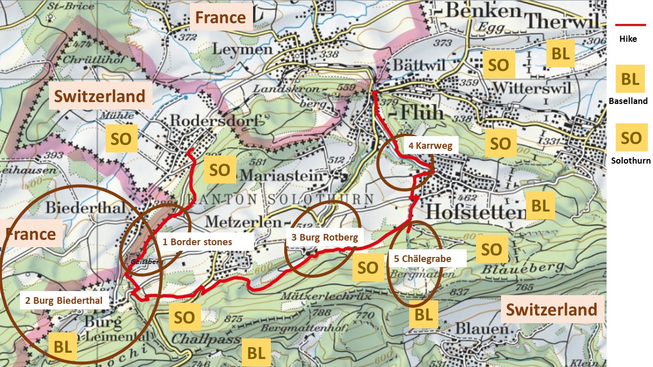
Source: Swiss Mobile (with my notes added)
In October 2020, I hiked from Rodersdorf to Flüh (red line), and discovered five secrets:
- Historical border stones from the years 1817, 1890 and 1951 between France and Switzerland – why from 1817? And can you see the “D” (Germany or “D”eutschland) hidden “behind” the “F” for France?
- Biederthal and its castle, Burg (Biederthal) – why are they separated by the border between France and Switzerland?
- Why does the canton of Solothurn (SO) “own” an exclave within Basel (BL)? What can the Burg Rotberg tell us about this?
- Why did the Romans dig a cart road (“Karrweg”) into the rocks to get from Flüh to Hofstetten – avoiding the valley?
- The Chälegrabe above Hofstetten – why is this spectacular gorge called “Chäle”-Grabe”?
In this blog, I will start with secrets #1 and #2, while leaving the other secrets for the next blogs.
1 The historical border stones between Metzerlen and Burg
Where the (car) road from Rodersdorf up to Metzerlen reaches the highest point of the pass, it touches the border between France and Switzerland.
The hiking signs to the Remel (or Raemel in French) are on the French side.
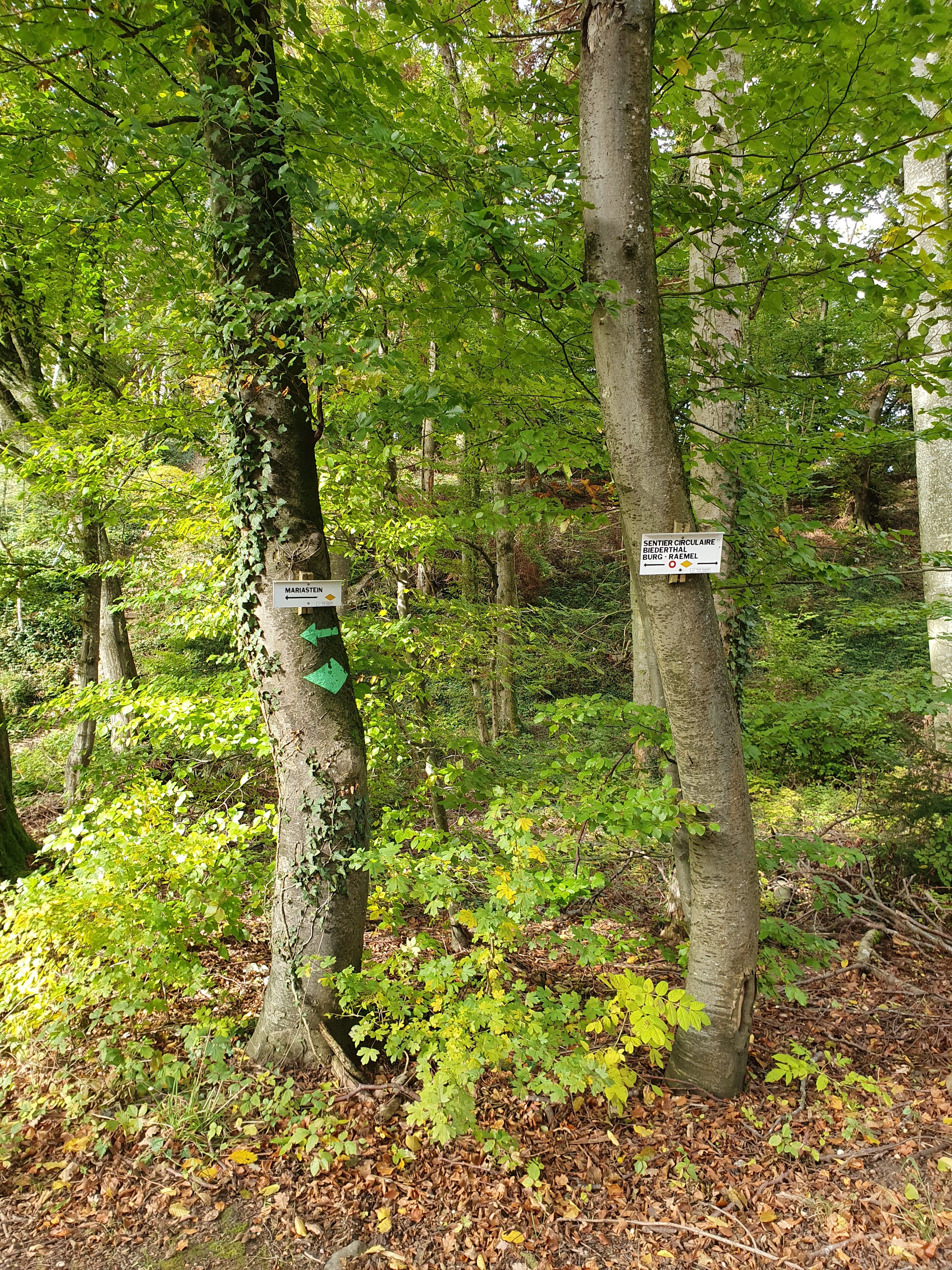
Here we find stone #109 that is from 1890. It shows the edge of the French/Swiss border pointing to the wooden steps,…
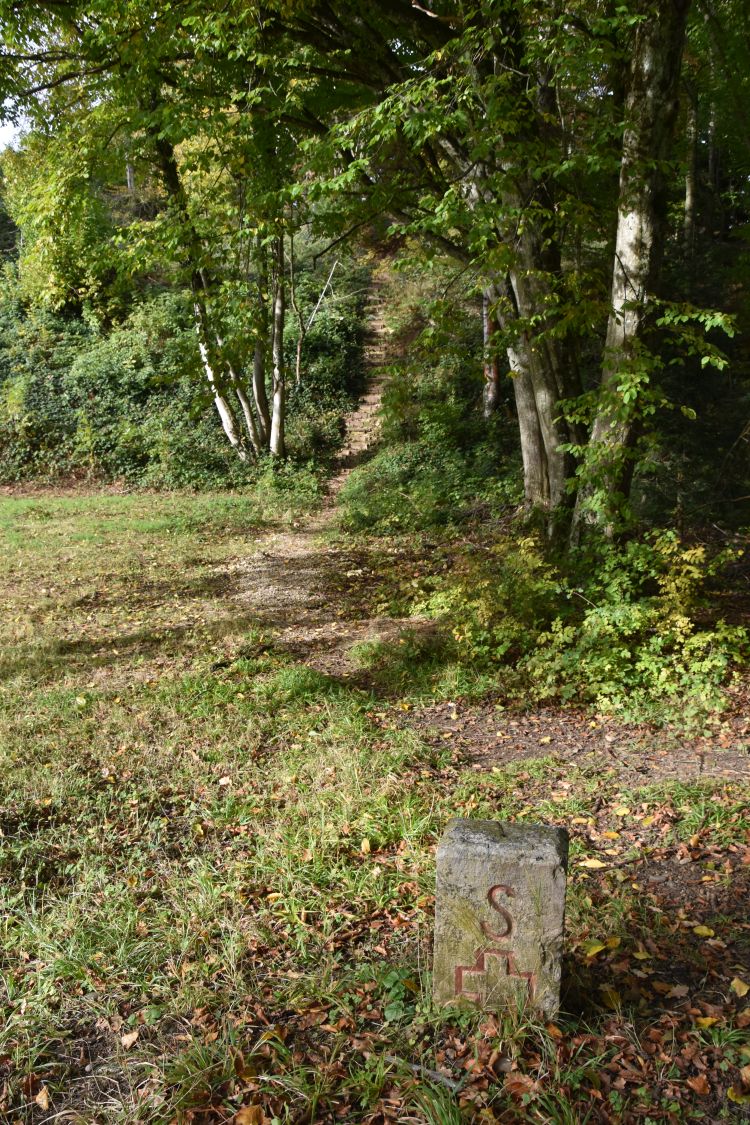
… where the path lined with more historical border stones starts. The stones are either
- from 1817 (just after the Congress of Vienna, 1815),
- from 1890 (the Alsace belonged to Germany since 1870/71) or…
- from 1951 (which happens to be my year of birth).
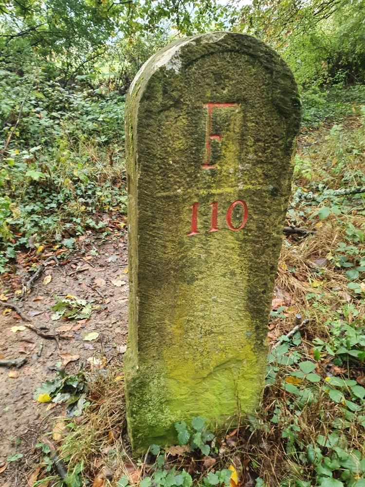
After having climbed the wooden steps, we come across stone #110 from 1817. Why 1817? At the Congress of Vienna, in 1815, statesmen and diplomats had reorganized Europe, which needed to be documented.
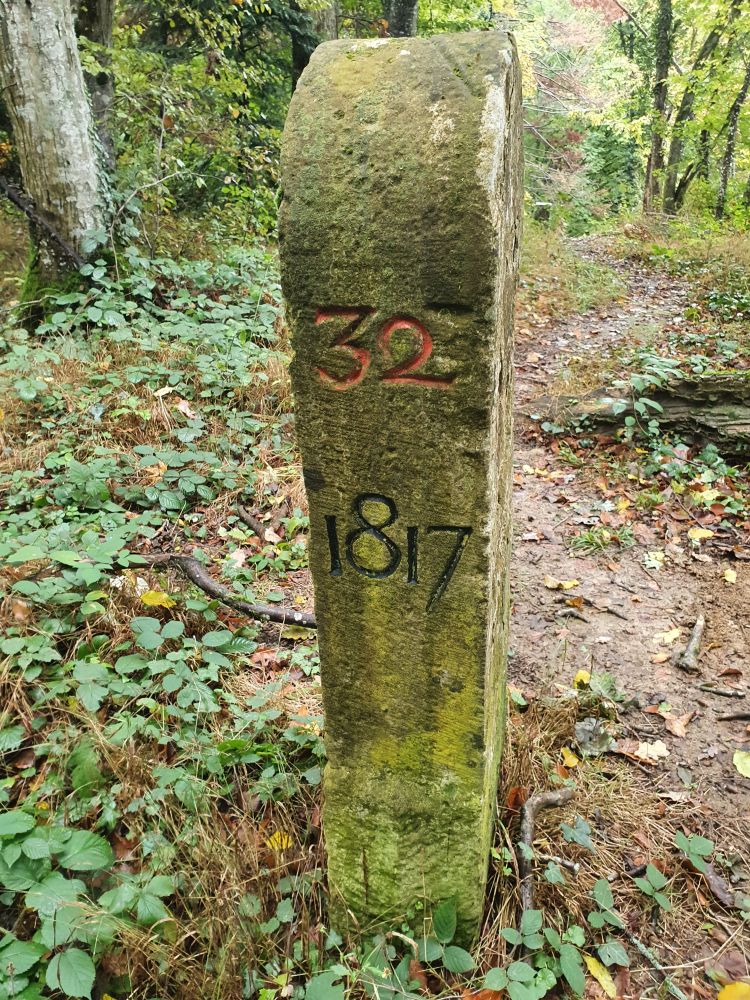
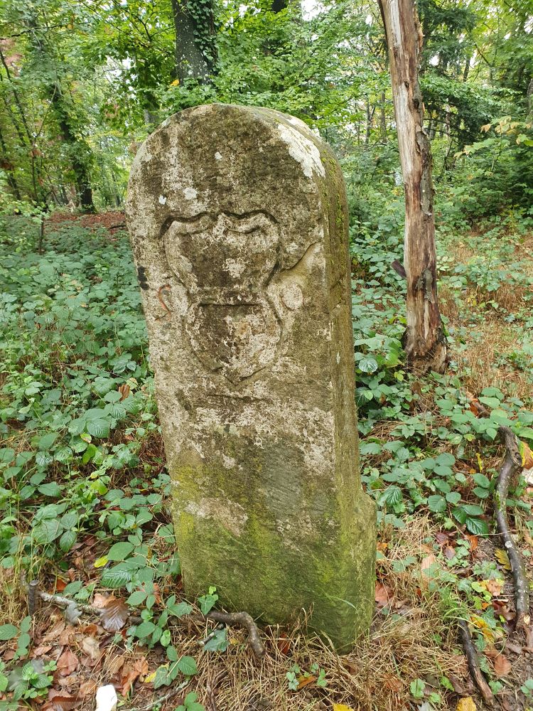
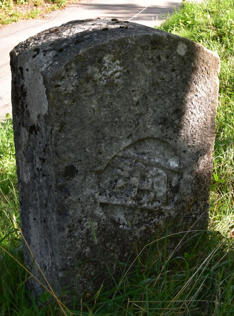
All border stones from 1817 show the coat of arms of the Swiss canton Solothurn with S and O engraved to the sides.
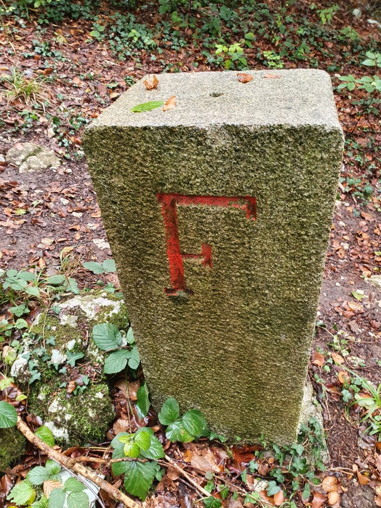
On the French side, the French engraved the fleur de Lys. After 1870/71, the Germans, having conquered the Alsace, removed the flower to replace it with “D” for Germany. After World War I (1918), the Alsace became French again, and the French changed the “D” into the “F” for France, but the “D” can still be seen (border stone #110).
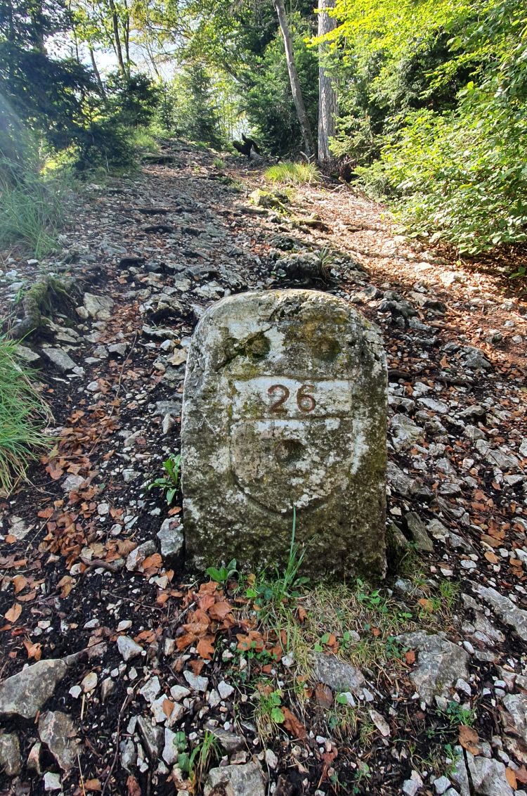
There must have been an inventory of the country borders in 1890. The Alsace was still part of Germany and Bismarck had just resigned. The 1890 stones have an “S” with a cross engraved on the Swiss side (stone #116).

The stones from 1951 have been produced more “efficiently”: A plain “S” and a plain “F” mark the countries (stone #115).
The pretty path with the border stones winds through the forest and crosses the romantic Y-shaped canyon of the Geissberg above Biederthal.

At Burg, we leave the canton Solothurn. We are now in the former Prince-Bishopric of Basel.
2 Biederthal and its castle Burg (Biederthal) – why are they separated by the border between France and Switzerland?
In 1168, Friedrich Barbarossa, the one with the red beard, gave the area to the Habsburgians, as a fief. They built the castle or Burg Biederthal in 1250 to watch over their tithe courtyard Biederthal (Dinghof). In 1269, the archbishop of Basel bought just the castle/Burg of Biederthal, without its tithe courtyard Biederthal, which remained with the Habsburgians and later became part of France. This is why the country border separates the castle from “its” village. Burg now became a village of its own.
In 1946, Burg selected this coat of arms.

Source: wiki entry for Burg
Where does the coat of arms come from? The answer: The archbishop of Basel granted Burg as a fief to the noblemen von Wessenberg. They owned it from 1401 to 1793. Around Burg we can find the historical border stones of the Wessenberg. One well-kept stone is a few meters below the summit “Remel/Raemel” above Burg. From the Wessenberg, the community of Burg took the coat of arms in 1946.
In 1815, the Congress of Vienna decided to merge the former Prince-Bishopric of Basel with Switzerland; Burg became part of the canton of Bern, belonging to the district Laufental. Later, in 1993, the Laufental (with Burg) voted to join the canton of Baselland instead. Nevertheless, many border stones around Burg have kept showing the coat of arms of Bern, the bear. This stone with the bear of Berne marks the border with France, just below Burg.
Border stones from 1817, 1890 and 1951 and a castle separated from “its” village by the border of France and Switzerland – yes, the area around Basel is full of secrets that can be discovered hiking.
Sources: https://www.baselland.ch/politik-und-behorden/gemeinden/burg-il/unsere-gemeinde/geschichte-wappen

Herzlichen Dank!
Liebe Grüsse
Helga und Andreas
Gesendet von Mail für Windows 10
Von: Petra Peters Gesendet: Montag, 26. Oktober 2020 17:36 An: andre.schmidt@bluewin.ch Betreff: [New post] Around Basel: Historical secrets on the hike from Rodersdorf to Flüh
peterspetra posted: ” The area around Basel is full of secrets. Source: Swiss Mobile (with my notes added) In October 2020, I hiked from Rodersdorf to Flüh (red line), and discovered five secrets: Historical border stones from the years 1817, 1890 and 1951 between F”
[…] have talked about secret #1 and #2. Now I continue with secrets #3 and #4 (leaving secret #5 for a later […]
[…] #1/#2 to #3/#4 are covered in two former […]