On the Road to Spain: Roncesvalles, where Roland was ambushed

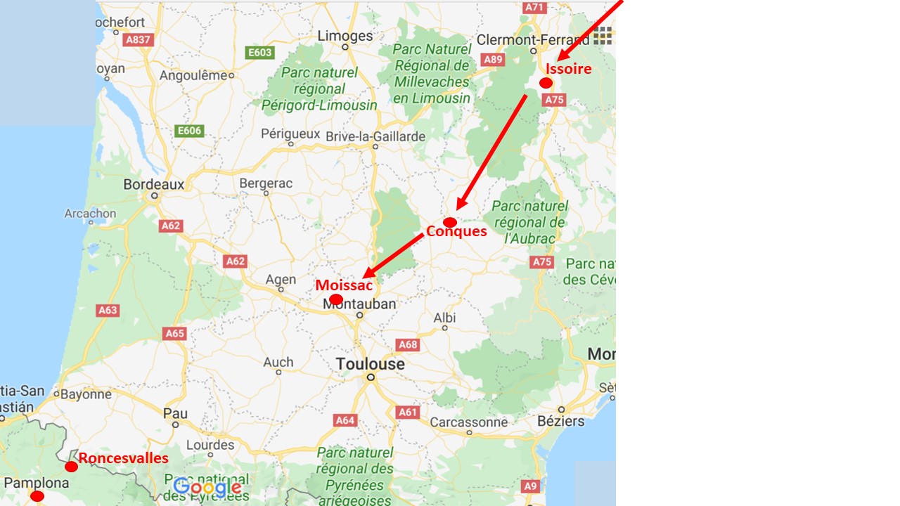
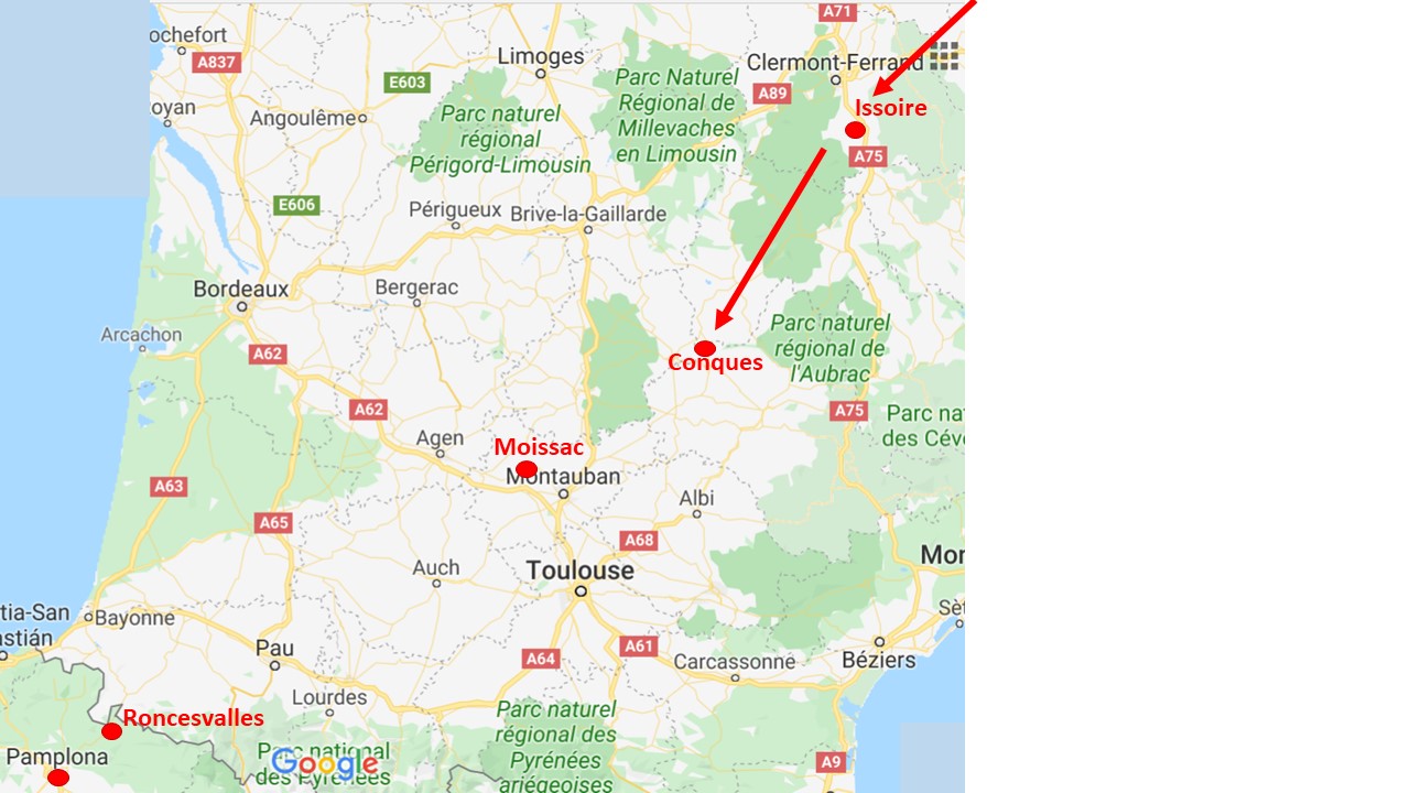
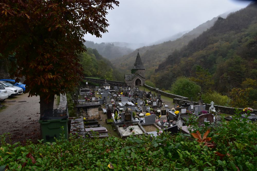
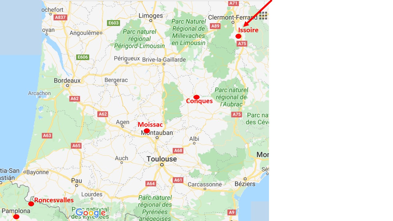
In November 2019 we drive from Moissac to Saint-Jean-Pied-de-Port, then up to the pass Ibañeta and to Roncesvalles, where Roland was ambushed in 778 and where pilgrims stay overnight on the Way of St. James (Via Podiensis).


Saint-Jean-Pied-de-Port

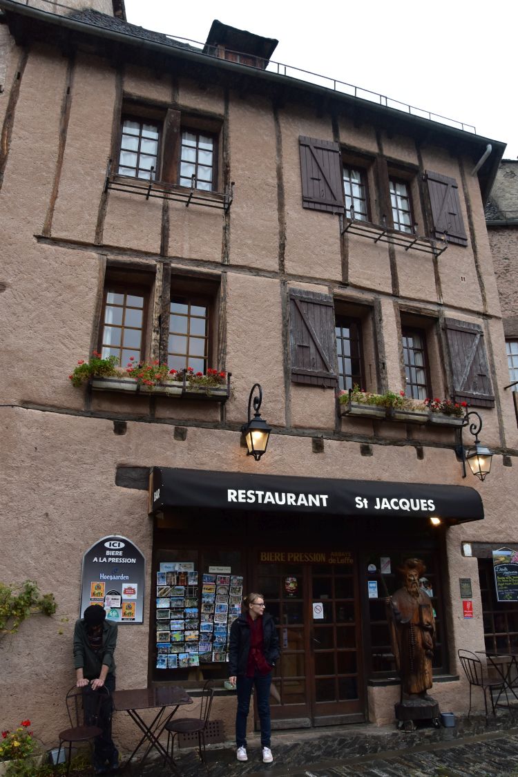
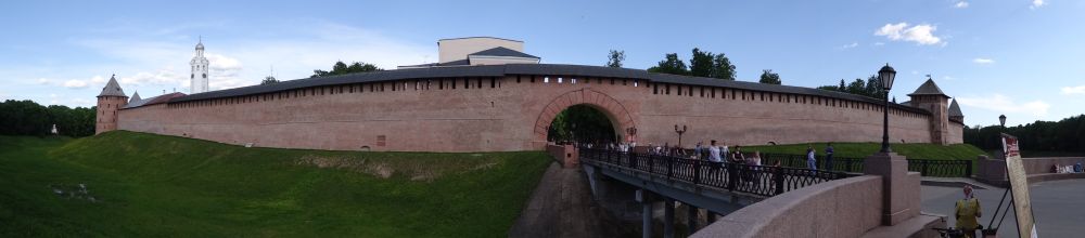
Saint-Jean-Pied-de-Port is a fortified small town on the river Nive de Béhérobie.

We stroll through the narrow streets, climb up to the town wall and look at the half-timbered houses from the backsides, with lush gardens.

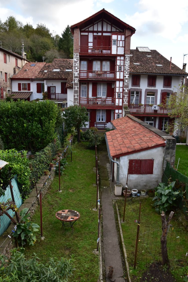
Saint-Jean-Pied-de-Port is the last larger stop on the French side of the Pyrenees, located at about 200m above sea level. From here our car climbs up into the Pyrenees.


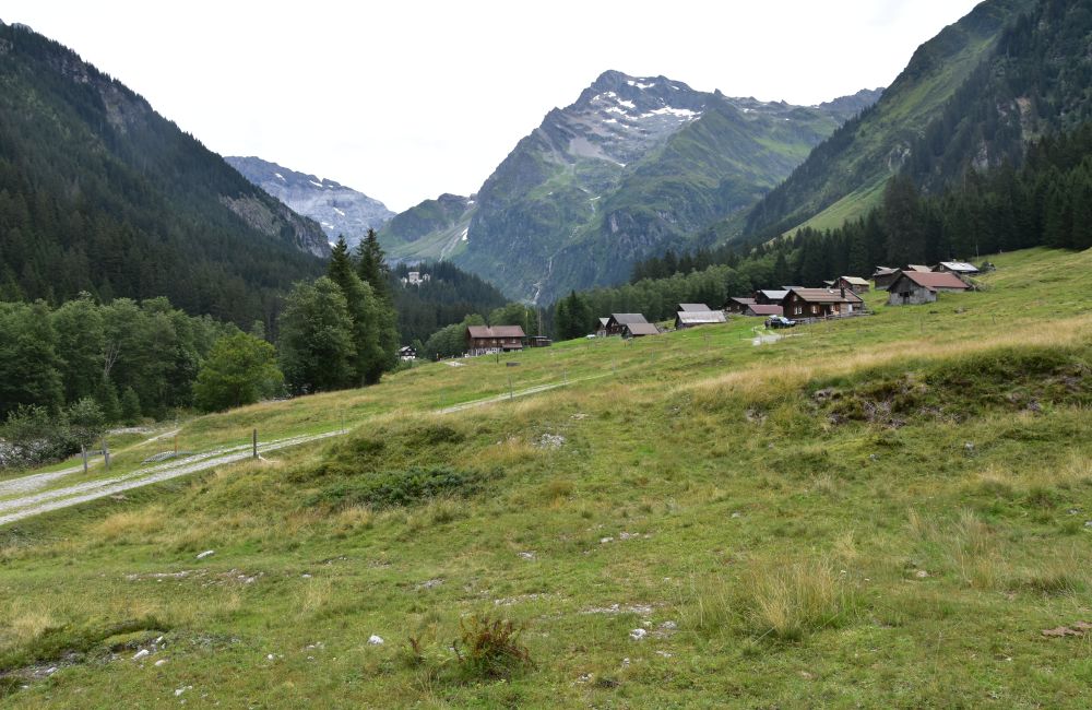
Puerta de Ibañeta (1057m)

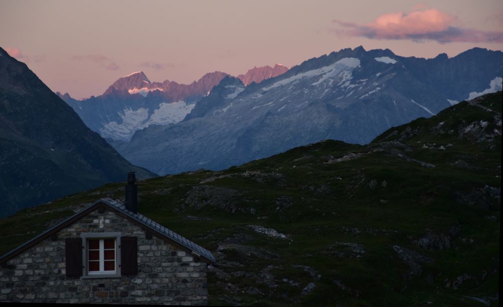
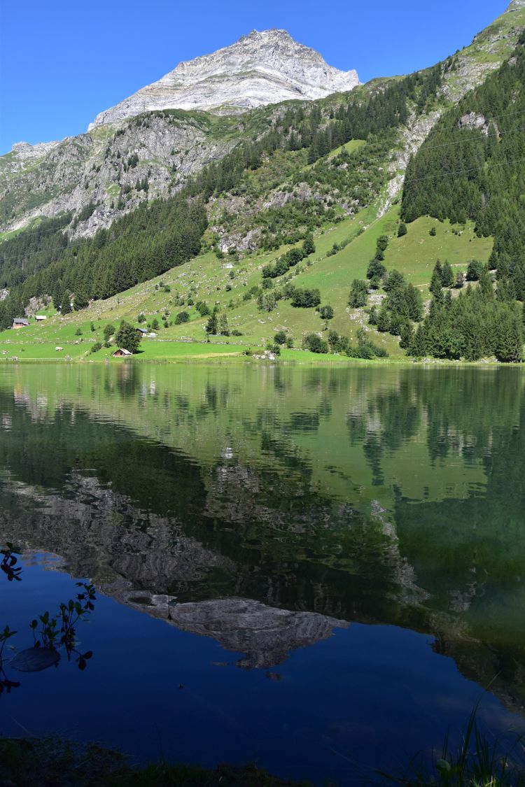
We reach the pass of Ibañeta on 1057m and look back north towards Saint-Jean-Pied-de-Port, where we came from (Valcarlos). Two young pilgrims from South Korea reach the pass at the same time. They look exhausted and thankfully accept the lift to Roncesvalles in our car.

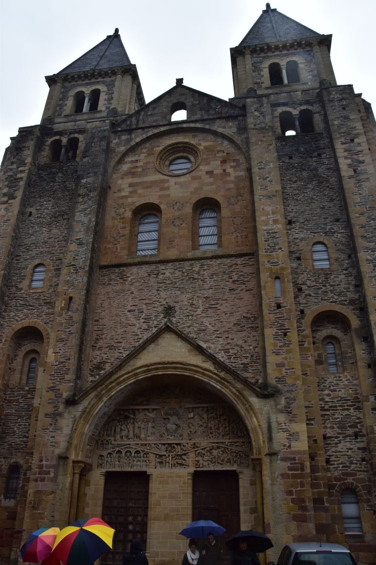
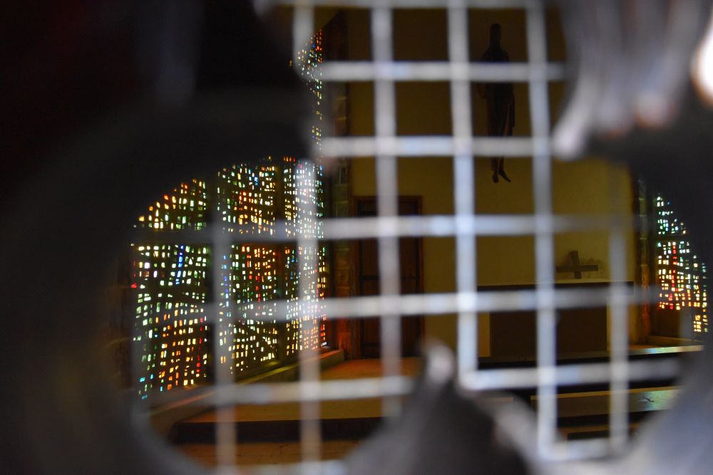
A small and modern chapel greets the pilgrims on the pass. The legend goes that monks used to ring the bell of the chapel to make sure, they do not lose their way in the fog. The chapel is locked. We look through the tiny hole. It is full of atmosphere with the colored windows and the sober altar.

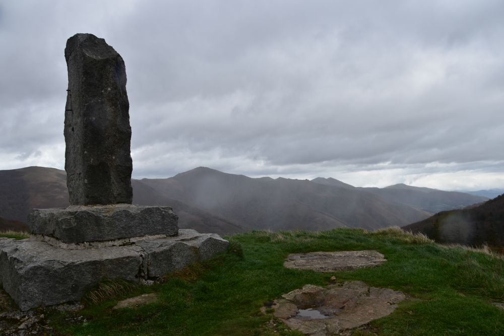
Above the chapel, the Roland monument reminds us that he has been ambushed somewhere here in 778, when returning with Charlemagne from their campaign to Spain. Charlemagne had been called by the governors of the northern Islamic principalities to support them against the Emir of Córdoba. When returning to France, Charlemagne had Pamplona destroyed, before leading his army up to the Puerta de Ibañueta. The Basques revenged the destruction of Pamplona by ambushing the Franconian rear guard led by Roland, governor of the Breton March. This is the monument – the rain has started again.

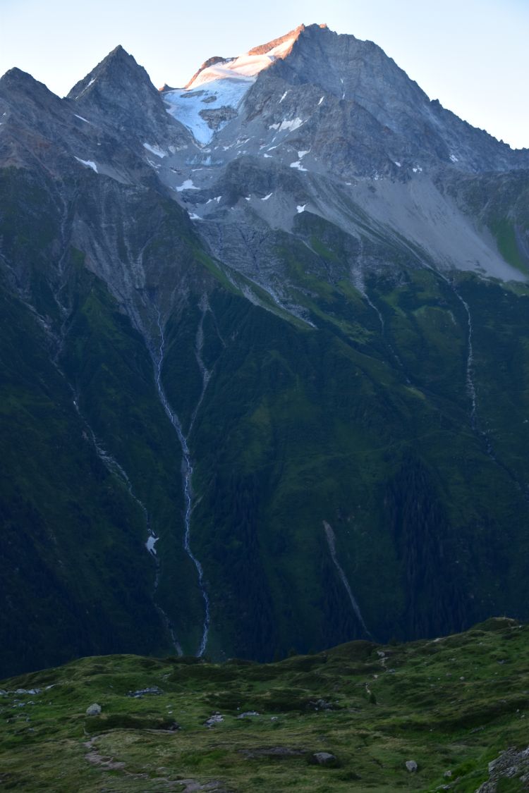
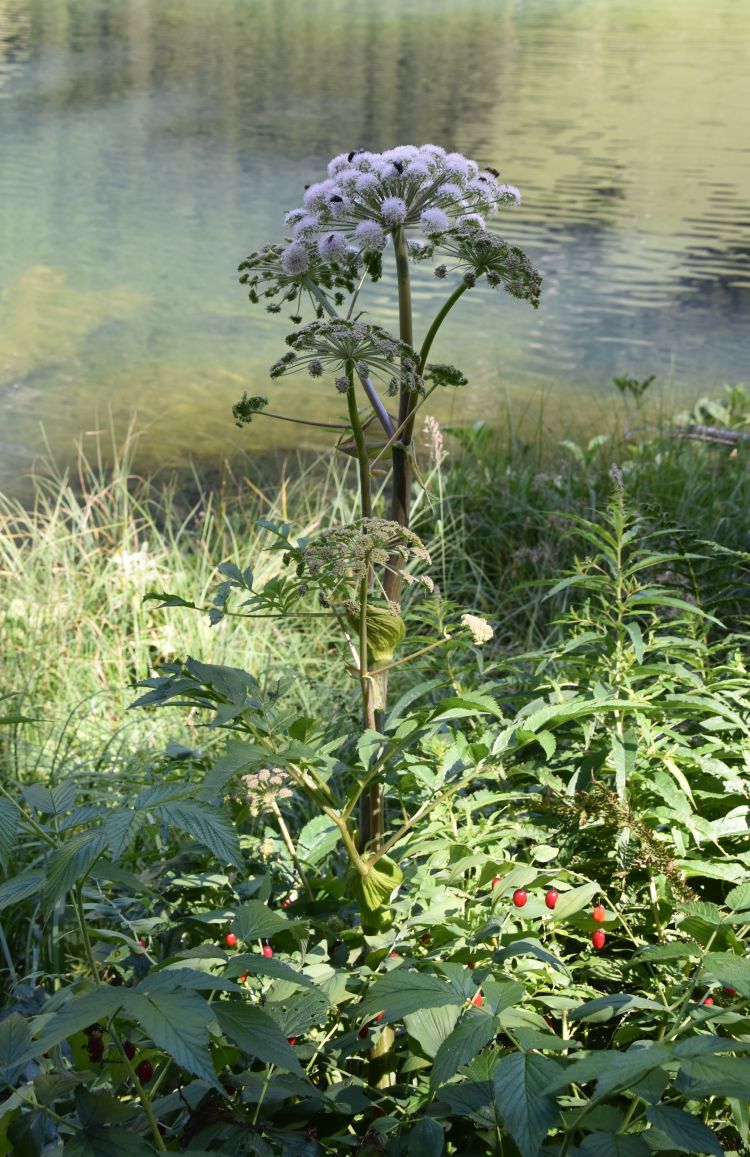
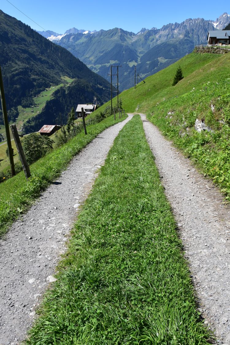
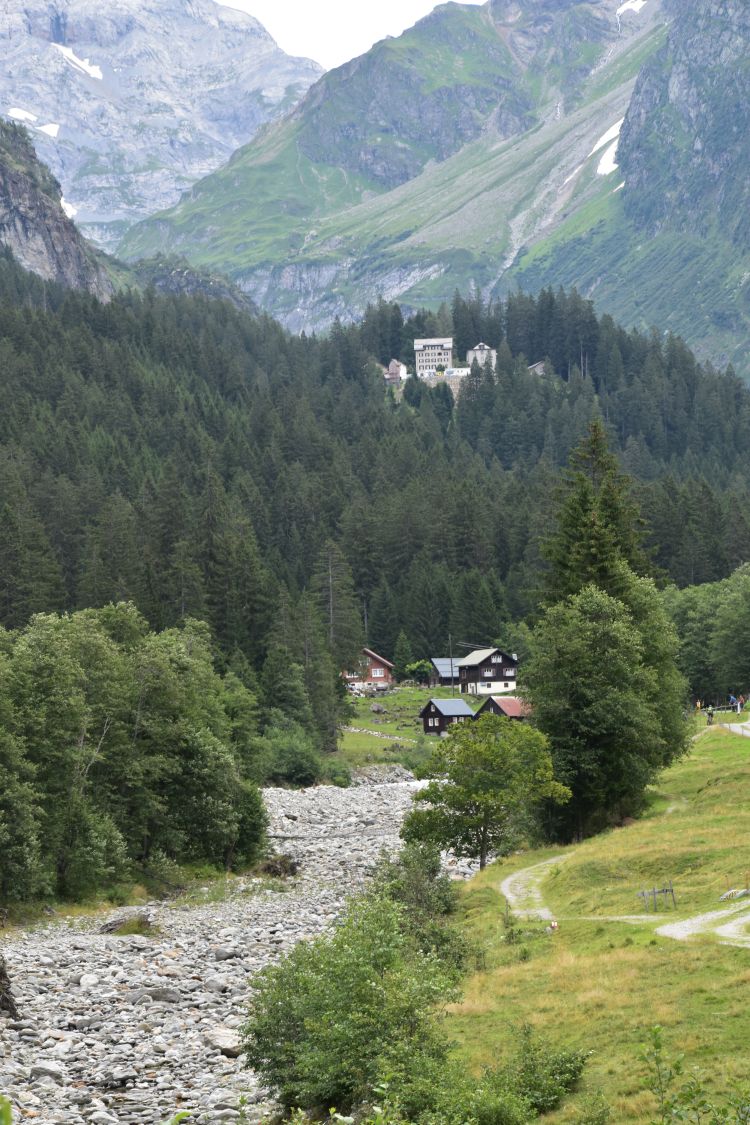
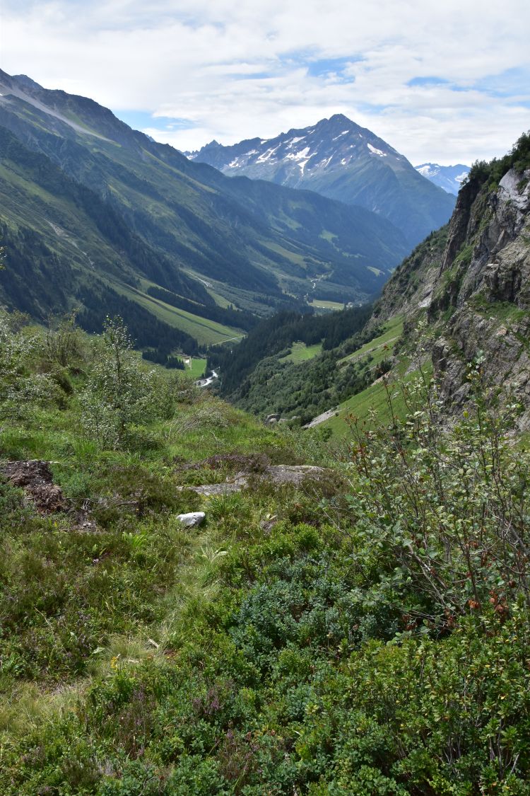
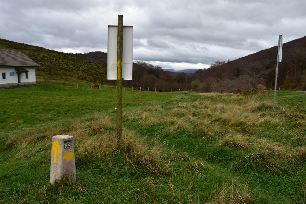
The hikers on the Way of St. James are directed to use this path down to Roncesvalles, which is at a 2kms’ foot walk from here.

Our exhausted pilgrims happily jump into our car and we drive to Roncesvalles. We settle in the Hotel Roncesvalles. They continue their way to another hostel.

.

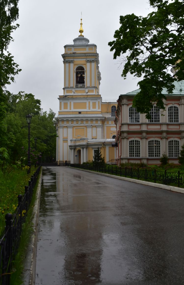
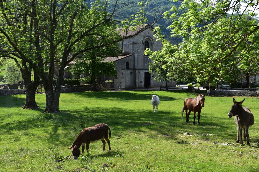
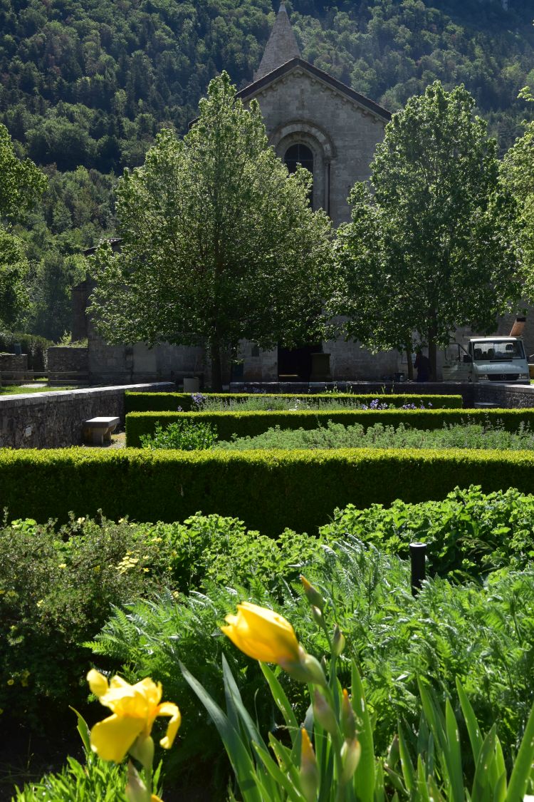
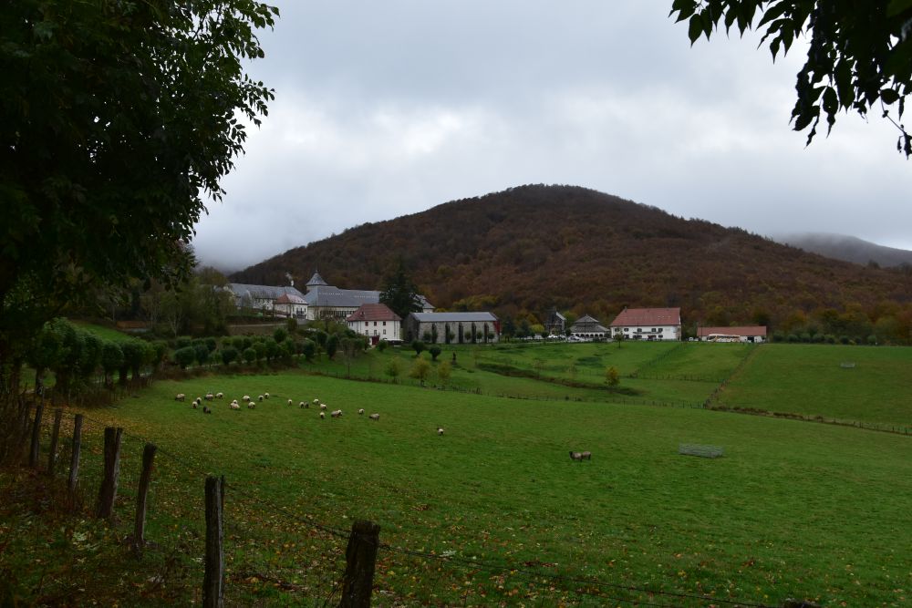
Roncesvalles (Orreage in Basque)

We spend two nights in the cosy Hotel Roncesvalles. Roncesvalles means “valley of thorny bushes”.

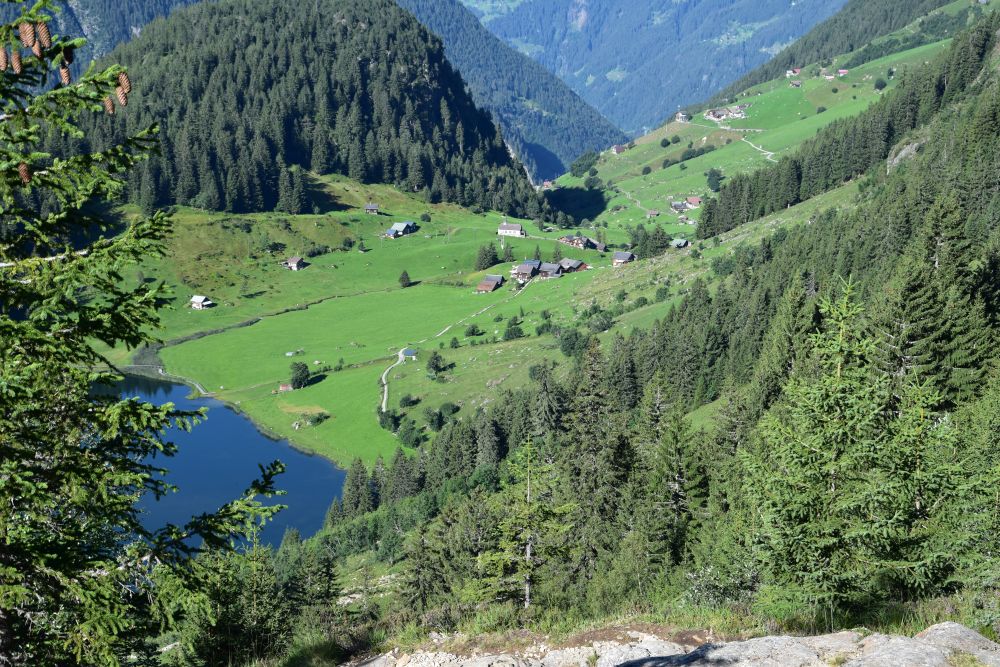
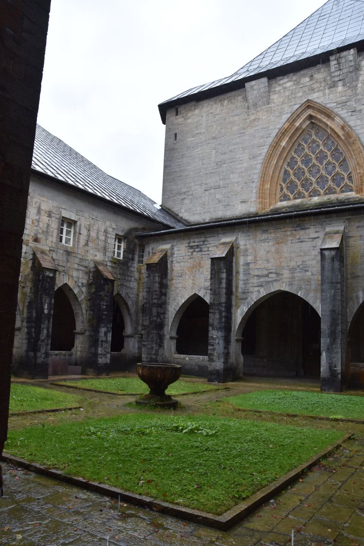
The complex of the former Augustinian monastery from the 12th century is beautifully located below green hills and on green meadows.

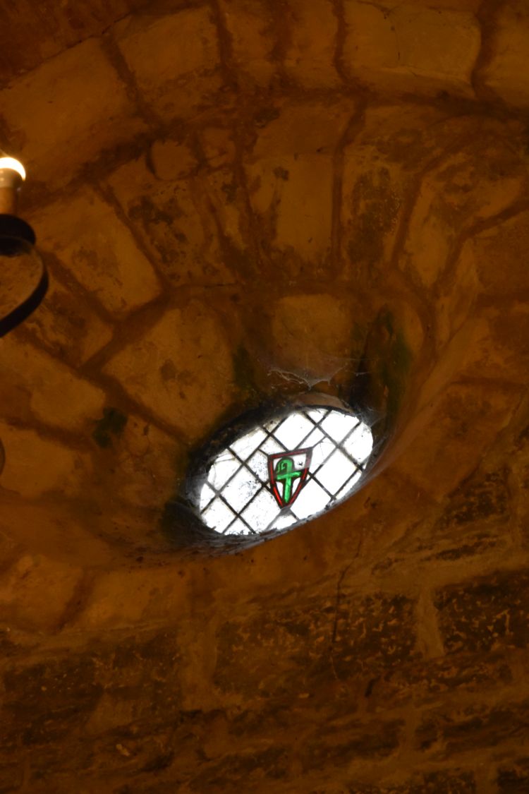
The emblem of Roncesvalles is the green bishop’s crook. It is present all over here, in windows, on fountains, tombstones, doors, ground slabs etc.

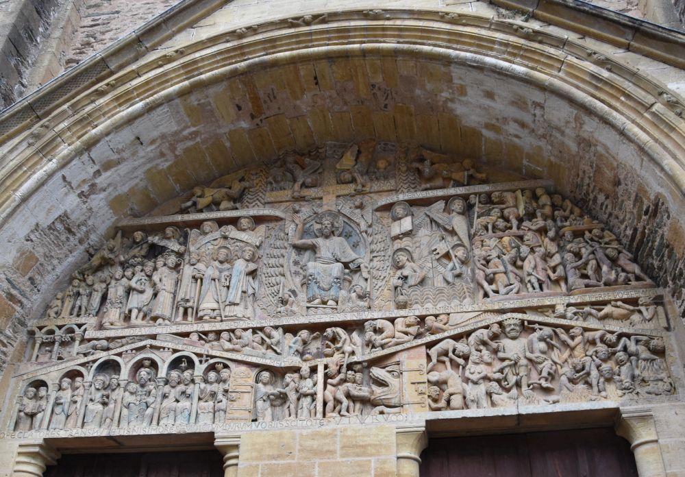
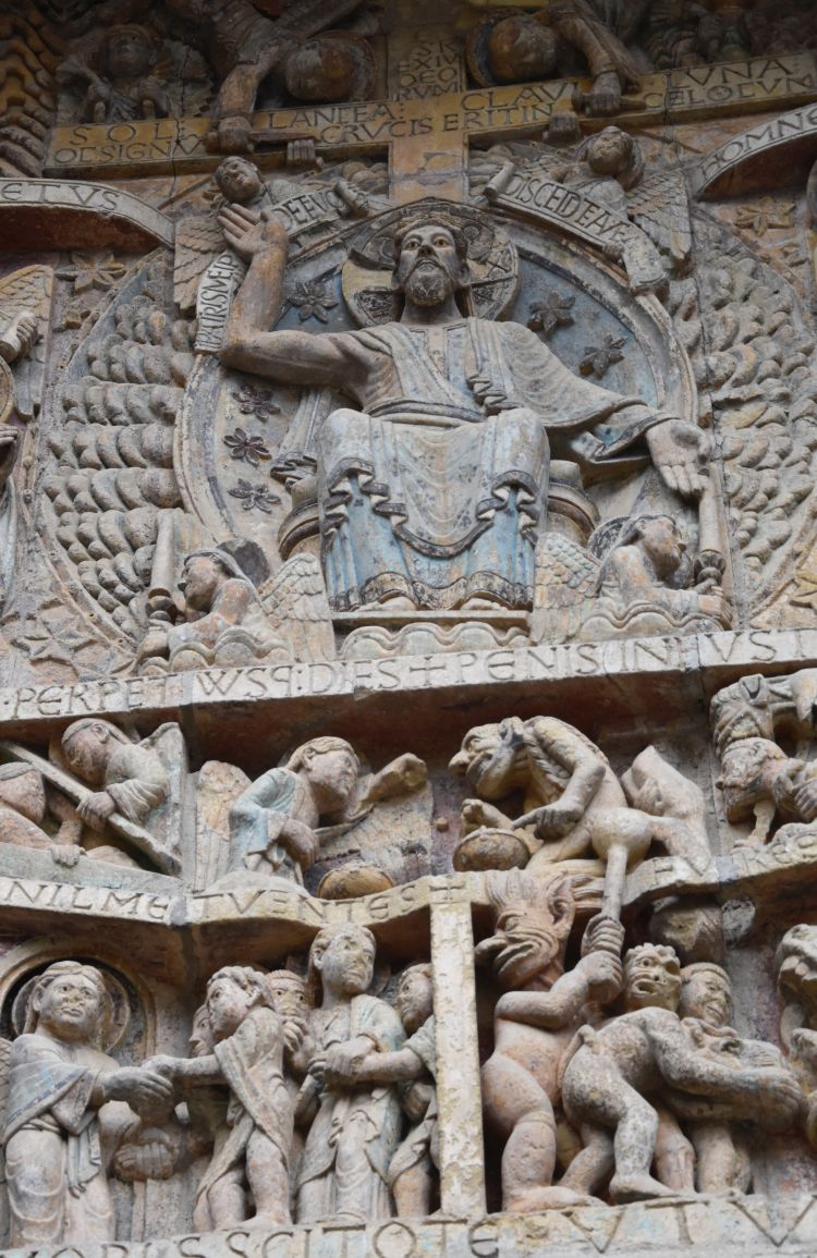
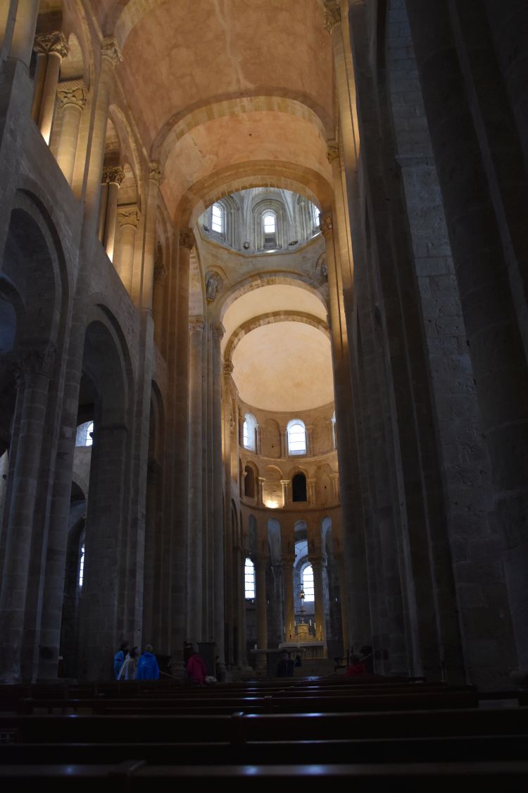
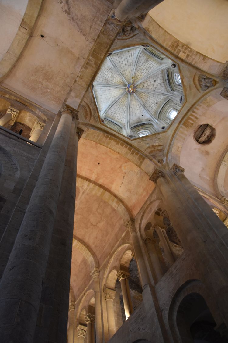
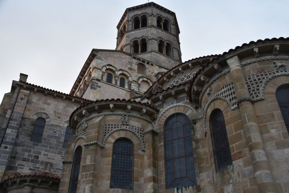
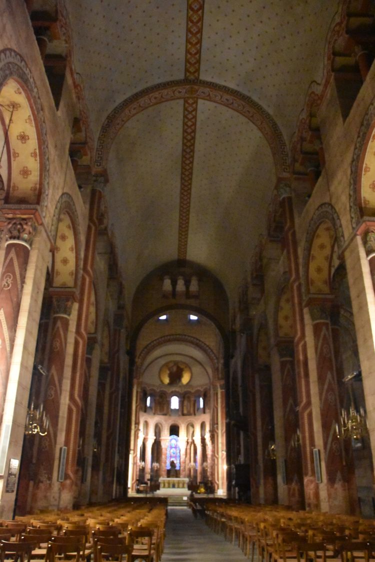
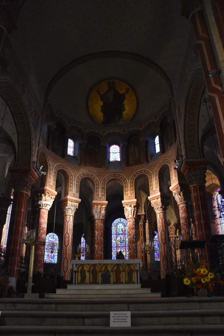
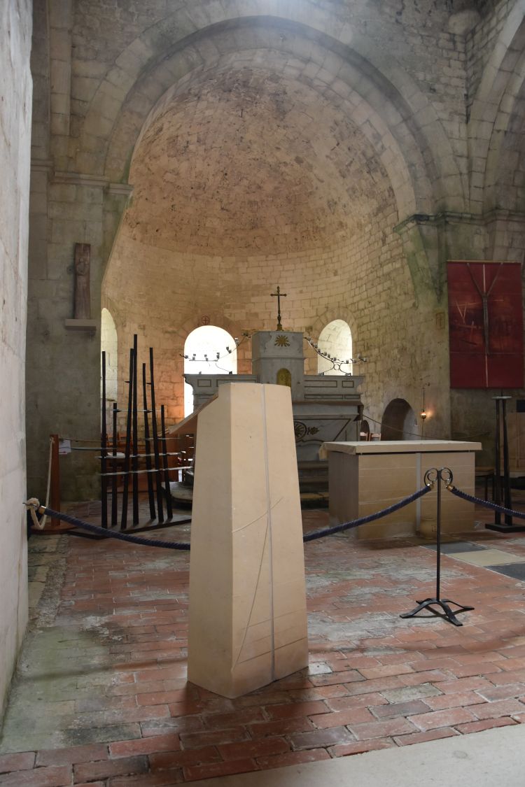
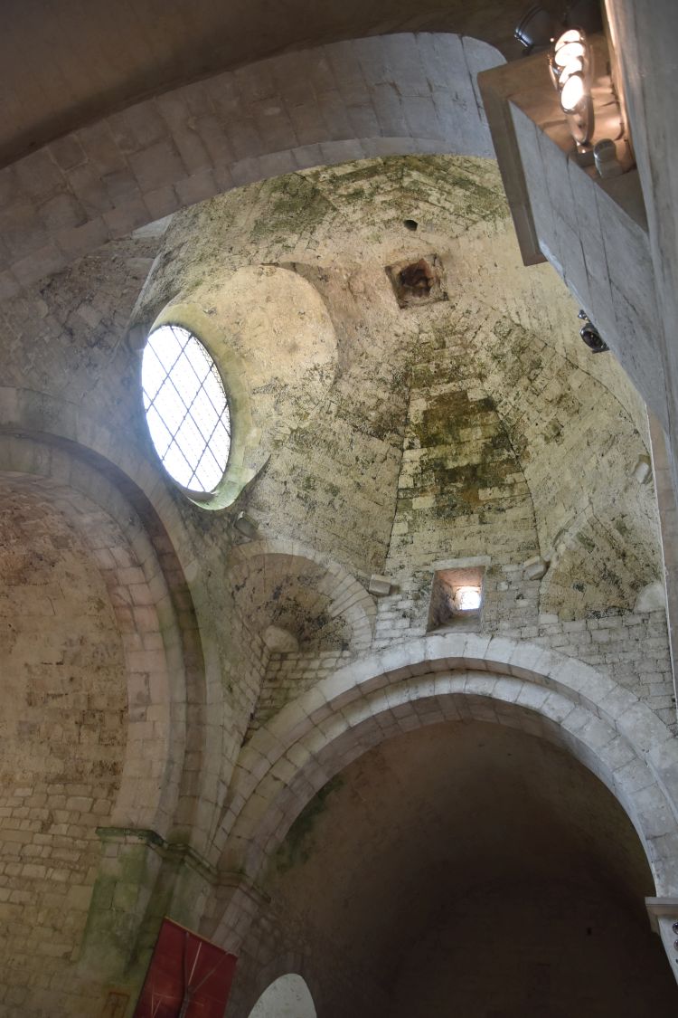
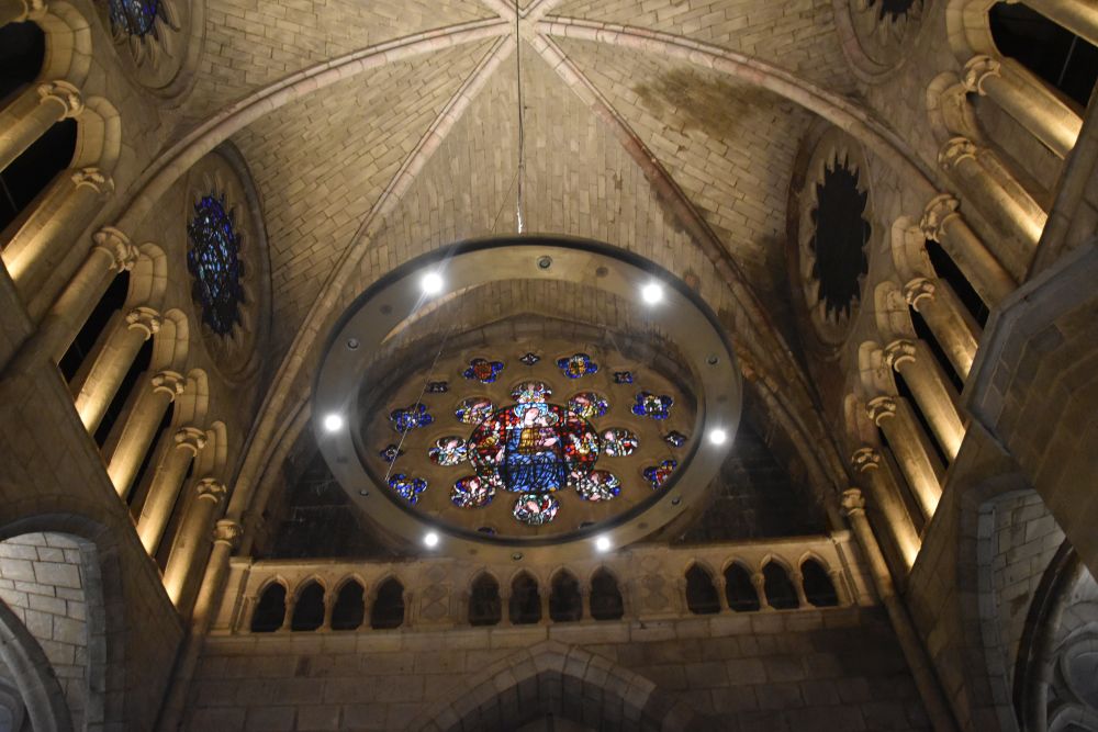
The Collegiate Church Santa Maria is of Gothic style (the construction followed the model of Notre Dame in Paris).

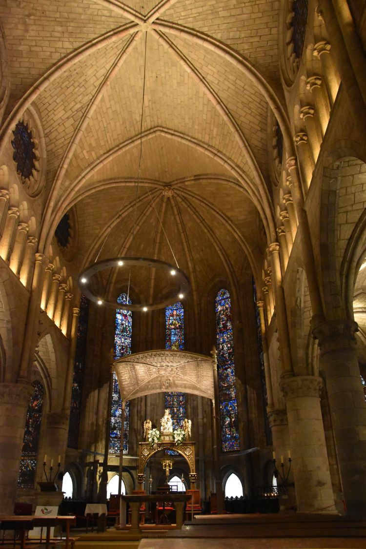
The choir holds the much venerated Virgen de Roncesvalles from the 13th century. It is said that a shepherd found her.

The cloister has been rebuilt after heavy snow falls that made the old gothic cloister collapse.

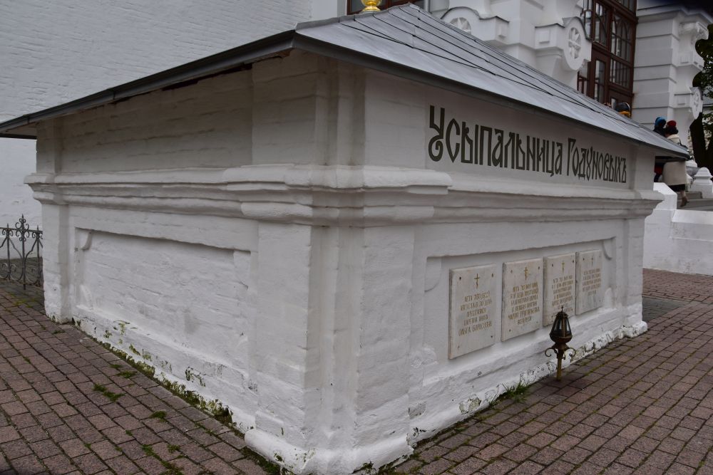
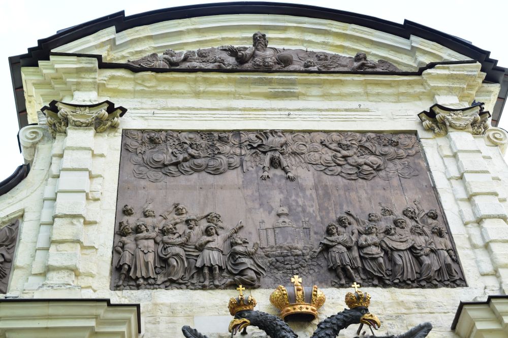
Sanchez VII, king of Navarra (1194-1234) has been buried here. He is known for the battle of Las Navas de Tolosa (1212) which was decisive for the further course of the Spanish Reconquista.

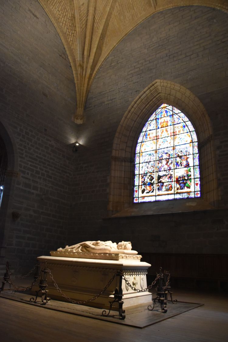
The window above his tomb tells about the battle of Las Navas de Tolosa.

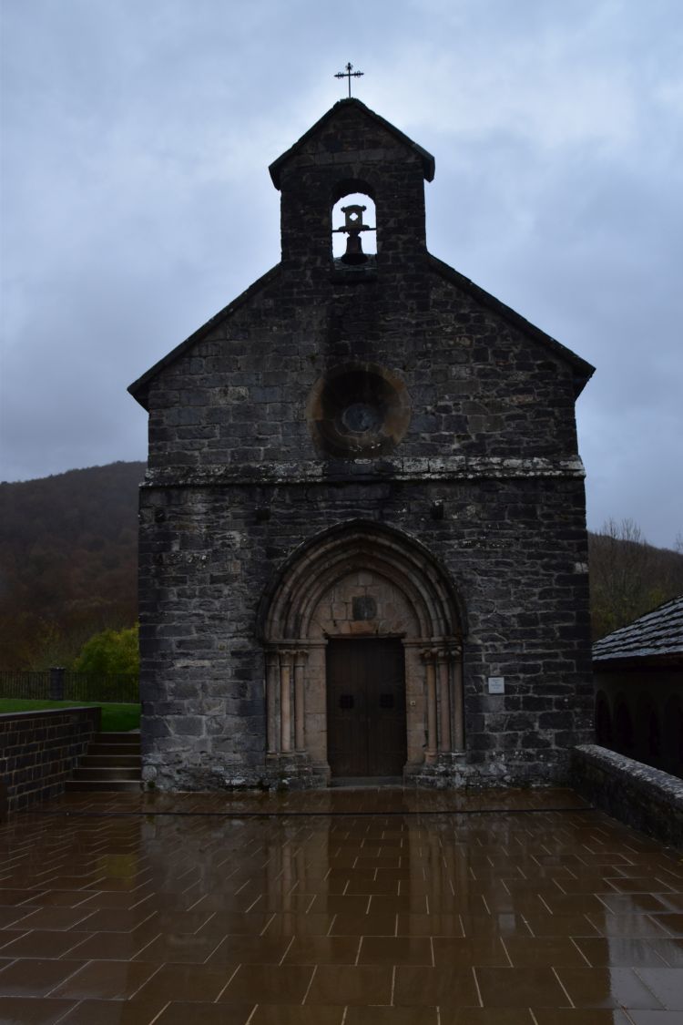
The Chapel of St. James from the 12th century reflects in the ground slabs that are wet from all the rain of the last days.

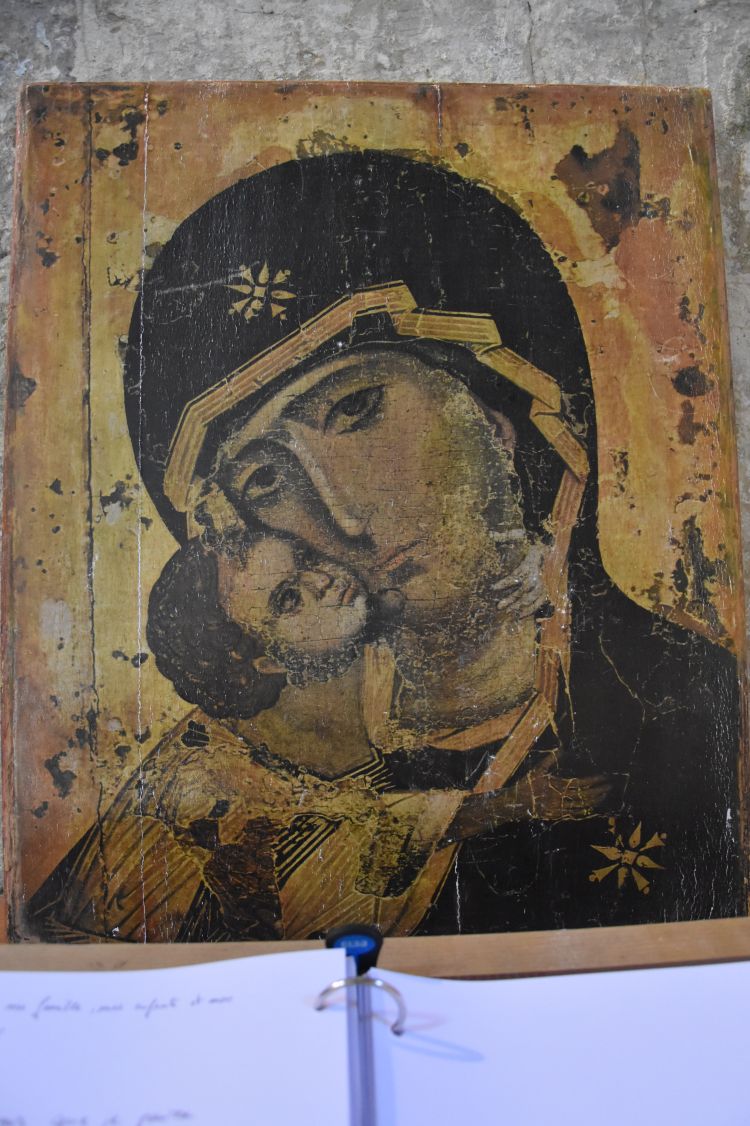
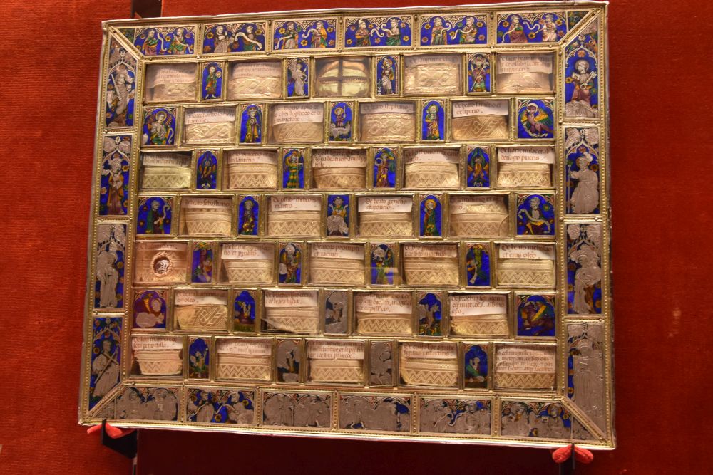
In a guided tour, we visit the Museo-Tesorio. Amongst the treasures, we admire the so-called chessboard of Charlemagne. It is not a chessboard, because it has only 63 fields. Furthermore it is not from around 800 (when Charlemagne lived), but it is a beautiful work of email from gothic times (14/15th century). But – it is known as the chessboard of Charlemagne.

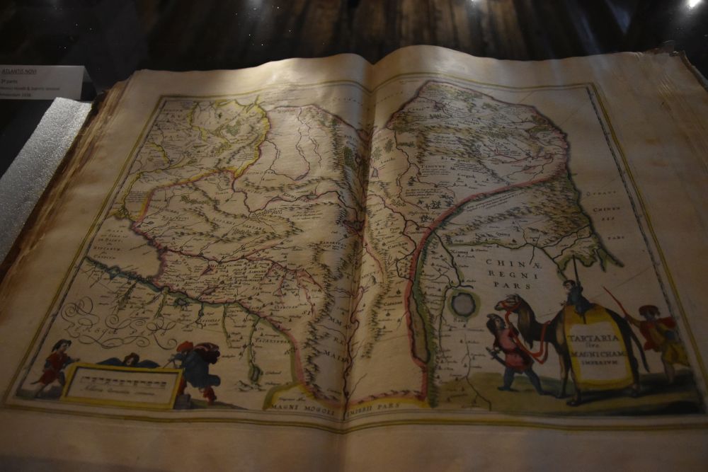
As I have just come back from Usbekistan, this map from the early 17th century fascinates me. It shows Central Asia with the country of the Tatars. In the very east, China is presented as a relatively small country, separated from the Tatars by their Chinese Wall.

The sheep of Navarra have black legs, black tails and black faces. There are many of them here. The cheese made from them is called Roncal.

We say good-bye to Roncesvalles and continue to Pamplona.

Marion Golder: “Nordspanien und der Jakonsweg”, Dumont Reisehandbuch, Ortsfildern 2018.

On the road to France: To Moissac with the Abbey Saint Pierre

On second of November 2019, we continue our way to Moissac.

Source: Google Maps.

We have booked a room in the centrally located Maison Lydia, where friendly Beatrice welcomes us with a refreshing drink.

Immediately we set out to explore the famous cloister of the Abbey Saint-Pierre.

88 columns dance around the meadow and the huge cedar, alternating between single and double columns. The capitals are richly decorated. This is the baptism of Christ…

… and this is the dinner of Herod, when John the Baptist was killed – here he is in prison about to be decapitated.

In the middle and at the egdes are larger columns, mostly with portraits of apostles or prophets such as this Petrus.

.

The capitals are damaged and difficult to see in the misty, rainy weather. See, how the rain is running down from the roof.

We escape to the side rooms, where we find a well curated museum with films that explain the works of art, in particular the beautiful porch. With what we learnt here, we look at the porch.

This is the tympanon with Christ in the middle above eight rosettes.

Around him are the twenty-four Elders of the Apocalypse, all turning their heads towards Christ, while playing an instrument.

The right hand side of the porch shows the life of Christ. The top relief has to be read from right to left: Simon holds Christ on his arms tenderly looking at the child. Then there is Joseph, who is told by an angel that he should take Maria and her son to escape to Egypt. They escape with Maria and her child on the donkey and reach Egypt, where the former gods fall down from the walls.

The left hand side is dedicated to a variation of the Last Judgement: In the top panel, a rich couple eat and drink eagerly. They live in luxury, while sick Lazarus is about to starve outside – a dog licks his wounds. But then, the rich man dies and falls into Hell, while an angel takes Lazarus to Paradise, where he sits in the Bosom of Abraham.

In the center of the porch (trumeau) there are statues of St. Peter, St.Paul and the Prophet Jeremy, the latter being Ursula’s favorite: Jeremy stands, his legs crossed and his head bent down to the side, with his eyes looking “inside”.

Animals creep up on the sides of the portal. My favorite is this dog.

Inside the church, we find more works of art from the 12th and the 15th century such as the Romanesque Christ or the Gothic Holy Family on the way to Egypt. A panel explains that Saint Cyprien, bishop in Carthago (Africa), was martyred in 258 and his relics were transfered to Moissac in 1122. This is, how he became the patron saint of Moissac.

Building the monastery has been completed in 1100. The golden times of this Benedictine monastery were in the 11th and 12th century. It was related with Cluny.

We return to our Maison Lydia to warm up  from the rain. Then we have a delicious dinner near the Abbey.

Tomorrow we will continue our way to Roncesvalles. We expect more rain. Though traveling in our car, we feel a  bit like pilgrims.


Sources: Presentation at the cloister of the Abbey Saint Pierre; Thorsten Droste: “Romanische Kunst in Frankreich”, DuMont Kunstreiseführer, Köln 1992; Chantal Fraïsse: “Die Abtei Saint-Pierre von Mossaic”, Yann Le Chevalier, 2019.

On the road to France: Conques in the mountains

First of November 2019, we drive through the mountains of the Auvergne to Conques. 

Source: Google Maps

The weather is misty and rainy. We drive through the Aubrac. Through chestnut trees, the road takes us down to the Lot valley.

We cross the river Lot, reach Conques and settle in the Auberge Saint Jacques.

Conques became an important pilgrim place, after the relics of Saint Foye had been moved here (the story goes that a monk from Conques had stolen the relics in the monastery of Agen, where they had been located before).

The Abbey Church of Sainte-Foye was built from the middle of the XIth to the early XIIth century.

The main portal is decorated with the beautiful tympanon showing the Last Judgment (late Romanesque style). About 120 figures populate the tympanon. It can still be recognized that the Last Judgment was originally painted in colors.

Christ sits in the middle. To his right is Paradise (his right hand up), to the left is Hell (his left hand down ).

Below Christ, Archangel Michael and the grinning devil are facing one another. Between them is a set of scales, and the devil is touching one of the pans. Farther below, Petrus welcomes those that enter Paradise and a devil throws the condemned subjects into the gorge of a wild animal – this is the entry to Hell.

In Paradise, all is fine and people are arranged around the Bosom of Abraham.

Above to the right of Christ (seen from his viewoint), there are the donator and the founder of the abbey with Charlemagne lead by the hand.

I feel overwhelmed, when entering the church. The nave is 22m high and seems to reach into heaven. The decoration is sober which adds to the solemnity.

A colored medaillon decorates the top of the crossing. To the sides of the naves are galleries with double openings.

Next to the church is the cemetery, for All Saints’ Day beautifully decorated with flowers.

Across the church is the exhibition of the rich treasure of the abbey with the statue of Sainte Foye (no fotos allowed).

The small Museum of Joseph Fau has been carefully arranged and shows tapestry from the early 17th century such as this representation of the three women at the empty sepulcher of Christ.

It is pouring with rain. We see some pilgrims with short trousers wrapped up in their rain capes. I shiver and admire them for undertaking this long, long walk along the Way of St. James to Santiago de Compostella. We imagine, how dangerous this was in medieval times, especially here in the rough mountains of the Auvergne. We return to our cosy hotel named after St. James and have dinner.

The next morning we return to the church and the cloister. I discover this fountain with the conch of St. James in the middle and with the reflection of the Abbey Church ornated with the coins thrown into the fountain.

We look back and say good-bye to Conques.

Our next target is Moissac.

Sources: Noël Graveline: “Die romanischen Schätze in der Auvergne”, Edition Debaisieux, 2006 und Thorsten Droste: “Romanische Bauten in Frankreich, DuMont Kunstreiseführer Köln 1992.


On the road to France: Issoire with its Paroisse

It is late autumn 2019. With Ursula, I travel to Spain with stop overs in France. The weather is rainy and chilly. Our first stop is in Issoire, where we spend one night in the convenient IBIS hotel.

Source: Google Maps

We visit the Paroisse St. Austremoine. Austremoine was a preacher that christianized Clermont around 250 and the church of Issoire is named after him.

The Paroisse is famous for the choir that has been freshly renovated. We admire the fine patterns created by black basalt, grey granite and yellow arkose. We are in the area of the volcanic Puys around Clermont-Ferrand.

We like the reliefs of the astrological signs. Here are Virgo and Libra.

This is Capricorn.

And this is my astrological sign, Gemini. It is the third relief, as the series start in March, with Aries.

In the 19th century, the church has been painted inside. This creates the solemn atmosphere that existed in Romanesque times, though the painting is not authentic. Ursula discovers maize plants on some columns… definitively not authentic for the XIth or XIIth century.

The choir is decorated with eight columns. The ambulatory allows to walk around the choir.

Here, the Last Supper circles around the capital. I have never seen this before.

We leave the Cathedral. We may have to return once more to see the parts that are now under renovation.

It is around six in the evening – already dark. We take a last foto of the Bell Tower near the Republic Square.

Then we return to our IBIS hotel and have a light dinner. Tomorrow we will continue our way to Conques.

Sources: Noël Graveline: “Die romanischen Schätze in der Auvergne”, Edition Debaisieux, 2006 und Thorsten Droste: “Romanische Bauten in Frankreich, DuMont Kunstreiseführer Köln 1992.

On the road – sightseeing at Moscow: The Metro

On our way from the Red Square to the Moskwa river, we get caught in the pouring rain and escape to the next metro station. Rain is a good opportunity to admire the underground palaces of Moscow.

The first lines of the Metro opened in 1935. New lines are added even today. The Moscow metro is one of the most efficient metros that I have ever come across. No Russian would run in their palaces to catch a train. There is just no need, because the next train is sure to come in about one minute.

Long escalators take the Muscovites into the underground. When I stand on them, I always hear the poem-song “песенка о московском метро” by Bulat Okudzhava (1924-1997):

“Порядок вечен, порядок свят.
Те, что справа, стоят, стоят.
Но те, что идут, всегда должны
держаться левой стороны.”

“The order is eternal, the order is holy.
Those on the right side, they are standing, they are standing.
However, those that are going (or walking), always have to
keep to the left side.”

(I have the cult vinyl record of Bulat Okudzhava that was edited in the sixties or early 70s by “le chant du monde“).

We visited some of the most beautiful metro stations.

.

Komsomalskaya  or Комсомольская

We start with the Komsomalskaya station on the ring. It was built in 1952 and received a prize at the Expo 58 in Brussels.

The hall is illuminated by chandeliers and is decorated with mosaics.

There are also mosaics on the ceiling. They show some heroes of Russian history such as Nevsky (who conquered the Baltic Sea and Karelia for the republic of Novgorod) or Donskoj (who defeated the Mongols for the first time). This is Alexander Nevsky.

At the end of the gangway, we find the mosaic “МИР” which means both “peace” and “world” in Russian.

.

Majakowskaya or Маяковская

The Majakoswkaya Station has been completed in 1938. The ground is stable here, and hence the columns could be built slimmer, which gives the station a “dancing airiness”. The station won the main prize at the New York exhibition in the same year.

The cupolas are painted with various scenes showing sports such as this ski springer.

We leave the metro here through the exit built into the Tchaikoswky Concert Hall and we have coffee with cake in the cosy attached restaurant. A performance for children ends in the Concert Hall and the young connoisseurs of art fill the restaurant with joy and laughter.

.

Square of Revolution or Площадь Революции

My favourite metro station is the Square of Revolution (Ploshchad Revoluzij). A line of Soviet heroes forms a guard of honour for the Muscovites rushing by. And there are some statues that shine such as this dog’s nose. The passer-bies quickly touch this nose and utter a wish that will be fulfilled – for sure!

This is statue of the Soviet hero Nikita Karazupa with his dog Indus – he was a frontier-guard.

Also this coq accompanying the handsome, strong woman, seems to bring luck and is therefore shining.

.

Arbatskaya or Арбатская

Arbatskaya was the last station we visited. It was built in 1953, another solemn palace.

The entry building of the Arbatskaya forms a star.

.

Turning to the Arbat

The rain has stopped. We leave the Arbatskaya station and stroll through the Old Arbatskaya Street.

Bulat Okudzhava is here. I say hello to him who wrote and sang the poem about the metro of Moscow.

I also like his ode to the Arbat, called “песенка об Арбате” that ends with the words: “Ах Арбат, ах Арбат, ты моё отечество” – “Ach Arbat, ach Arbat, you are my homeland.” Yes, in the late 19th and in the early 20th century, the Arbat was the area, where artists and intellectuals lived. Also Bulgakow made “Master” live here – he is the protagonist of his wonderful novel “Master and Margarita” written in the 20’s and 30’s of the XXth century.

We select a Georgian restaurant in the Arbat and have a delicious dinner with a glass of red Saperavi wine.

On the road – sightseeing in Moscow: Red Square, GUM and Kremlin

With three friends, I spend a few nights in Moscow. We stay in the pricy and friendly hotel Matreshka (Матрёшка), conveniently located in a dead-end street between the Bolshoi Theatre (Большой Театр) and the Lubyanka (Лубянка).  It is end of September, chilly and wet.

.

The Red Square – the Center of Moscow

First we visit the Red Square (Красная Площадь) which is the center of Moscow. The pavement shines in the sun that from time to time breaks through the heavy rain clouds. Saint Basil’s Cathedral is at the end of the square, to the right is the Kremlin wall and to the left the department store GUM. I remember, when I entered the Red Square in 2002 with Ernst, he kept on saying “this guy is crazy, this guy is crazy.” He was alluding to the German pilot that landed his Cessna here in 1987. Well, I believe the Red Square is large enough to land a small plane here – it measures 300mx70m.

The Red Square is called Красная Площадь in Russian, and originally, krasny (красный) meant “beautiful”. Later красный changed its meaning to “red”. Indeed, the red wall of the Kremlin really makes this “Red Square” look “red” and “red” was also the color of the communists.

We visit the many chapels of Saint Basil’s Cathedral (Собор Василия Блаженного, building started around 1600 under Ivan IV, the Terrible). We enter all the  chapels and find some wonderful singing at various places. Then we are surprised by more rain, as the photo taken from the Cathedral to the Russian State History Museum and to the department store GUM shows.

In the evening, we want to see the Red Square from above, enter the Hotel Ritz at Tverskaja, “glide up” to the top floor and have a good glass of wine.

From our chairs, the view down to the ground floor is breath taking.

On the balcony, we find this gorgeous view of the Russian State History Museum with the statue of Zhukow, the Red Square, Saint Basil’s Cathedral and the Kremlin. (Zhukow invaded Berlin in 1945 and accepted the surrender of the Germans).

.

The traditional department store GUM

From the pouring rain, we escape into the GUM (Государственный (Главный) Универсальный Магазин). This department store was built in 1893. It is huge with its 200 stores on three levels spread over 250m versus 88m. We buy criminal stories written by B. Akunin in one of the stores. I look forward to reading them.

We have lunch on the terrace under the umbrellas.

We watch a fairy tale teller with a group of children. Very lively, she talks about the bandit (разбойник) that, indeed, suddenly appears round the corner. The kids give him some money (it is a chocolate coin of ten rubles). And, because this is a good bandit, he does not keep the “money”, but hands it over to me… we all laugh together. Russians are excellent at entertaining children; even grown-up tourists enjoy that.

.

The gorgeous cathedral square in the Kremlin – worth seeing a third time

On the second day, we visit the Kremlin with its splendid Cathedral Square. It is my third time here, and it IS worth seeing it again. This a good overview that I found in the Internet.

The Dormition Cathedral (Успенский собор, the main and oldest cathedral) 

The Dormition Cathedral (Entschlafenskathedrale) celebrates, what we call “Maria Himmelfahrt”. It is the oldest Cathedral of the Kremlin, built in 1475-1490 by Aristotele Fioravanti. It mixes Russian traditional and Italian Renaissance architecture. The five golden cupolas shine, when the sun breaks through the clouds. Inside is the throne of Monomaxos alluding to the dynastic link of Iwan IV with Byzantium – he used this throne to pray (“Betstuhl”).

Next to the Dormition Cathedral we enter the small Church of the Deposition of the Robe (when Maria died and was accepted in Heaven, she left her robe in the grave, Церковь Ризоположения Пресвятой Богородицы)). No photos allowed in the pretty church with its frescoes. Behind the church are the joyful, slim cupolas of the Terem Palace, which used to be the main residence of the Russian Tsars.

.

Annunciation Cathedral (Благовещеский собор, house church of the Tsars)

Now, we have to stand in line with a large group of Chinese tourists to enter the Annunciation Cathedral. After having entered, I see Jonas just to the left. I stop to breathe: I remember, when I was here with Ernst and we enjoyed looking at Jonas being swallowed and spat out again by the whale. Inside we admire the solemn iconostasis with the works of Andrei Rublew, Teophanos the Greek and the School of Moscow. The Cathedral was built by masters from Italy and Pskow between 1484-1489. In 1560 Iwan IV renovated the church and since then, it has had nine cupolas, because conquering Kasan lasted nine days. These churches are full of symbols.

.

Dormition Belfry (Успенская звоница)

The Belfry was built by an Italian architect from 1505-08. It is 81m high. The cupola has been added by Boris Godunow and his name is written there. The belfry is also called Dormition Belfry, because a dormition chapel was added later and then transformed to a bell wall (звоница). In Russia, bell walls are used to make music with the bells – beautiful, I have experienced that in the monasteries on the Golden Ring around Moscow.

.

Archangel Cathedral (Archangel Michael, Архангельский собор)

Also, the Archangel Cathedral (Erzengel Kathedrale) has been built around 1500 (1505-1508) by the Italian architect Aloisio Lamberti de Montagnana (called Alevis Nowy). Inside it is a Russian church forming an equilateral cross. The grand dukes and the Tsars up to Peter I the Great are buried here. Their wives are in the crypt. From Peter I the Great on, all Tsars are buried in Petersburg. Only Boris Godunow is in Sergiyev Posad. Outside, the horizontal structure of the facade and the conch like shapes show Italian (Venetian) Renaissance influence.

Again and again, the sun defeats the clouds and the cupolas shine golden, just for some minutes. We cannot leave this place – it is too beautiful.

.

Tsar Cannon (Царь пушка)

Behind the Cathedral Square, there are two more attractions. The first is the Tsar Cannon. I remember, how Ernst laughed, when he saw the cannonballs. “These cannonballs have never been used for THIS gun”, he said. And I do think that he was right, they are just too large for this gun. Do you not agree?

.

Tsar Bell (Царь-колокол)

The Tsar Bell is one of the hugest bells ever casted in the world. But when taken out of the casting pit, it broke. Hence it has never been used, but being so large, it has been placed in the Kremlin and has served as an attraction since 1836. I admire the courage of the Russians – I think, they show that sometimes you have to give it a try, even if not being always successful.

We look back to the Belfry, the Dormition Cathedral and the Archangel Cathedral with their golden cupolas.

We leave the Kremlin  to have lunch – a borshch (Борщ) and dumplings  in one of the traditional Soviet Restaurants that now can be found all over in Moscow, the Varenichnaya.

.

Sure, whenever I get a chance to go to Moscow again, I will visit the Kremlin and the Cathedral Square again. It will be my fourth time then, and it will be worth it

Sources: Christine Hamel: “Russland – von der Wolga bis zur Newa”, Dumont Kunstführer 1998. Hubert Faensen: “Siehe die Stadt, die leuchtet”, Koehler und Amelang, 1989. Eva Gerbeding: “Moskau”, Dumont Reisetaschenbuch 2018, and various Wiki-entries.

On the road again – studying Russian history to get ready for Moscow

In September 2019 I am on the road to Moscow. To get ready, I update my knowledge about Russian history. Here is, how I understand, how Russia emerged (I am not a historian).

This is my summary of Russian history in a nutshell

  • 9th-11th century: Russia has two roots, the Wikings (founding the Kievan Rus’) and Byzantium (Christianity and dynastic reference).
  • 1132-1598: In 1132, the Kievan Rus’ collapses and disintegrates into many principalities. Novgorod becomes a successful republic of its own. To its east, Moscow, ruled by the Rurikids, rises steadily collecting “the Russian Earth”, though being under Mongolian rule from 1240 to 1480. In 1480, the Rurikids of Moscow adopt the title “Tsar”. After 1480, they expand beyond Russia, to Siberia. The dynasty of the Rurikids ends in 1598, after 700 years.
  • 1598-1612: Troubles (Smuta) – Russia, in search of a Tsar, is about to collapse under foreign pressure, until the army of volunteers from Nizhny Novgorod frees Moscow from Poland.
  • 1613-1762: The new dynasty, the Romanows, consolidate Russia, get Kiev back, expand to the west (Petersburg and Karelia) and continue the expansion to Siberia.
  • 1762-1918: The dynasty of Romanow-Holstein-Gottrop proceed expanding to the west and to the south (Krim and Central Asia), until being stopped in 1905. The autocratic tsars underestimate the power of the uprisings in their country that leads to the revolution of 1917 and to the abdication and death of the last Tsar.
  • 1917-2000 Revolution, Soviet Union and Russian Federation.

.

9th-11th century: Russia has two roots, the Wikings (founding the Kievan Rus’) and Byzantium (Christianity and dynastic reference).

  • The Wikings and the Kievan Rus’: Wikings settle in Novgorod, which becomes the capital of their empire. The Rurik dynasty emerges. Around 900, the Rurik ruler Oleg unifies 14 Slavic tribes and moves his capital to Kiev. The Kievan Rus’ exists until 1132. Somehow this can be considered to be the craddle of Russia.
  • Byzantium and the Byzantine emperors: From Byzantium, Kyrill and Method bring Christianity to Moravia and Bulgaria and invent the Cyrillic alphabet to teach the Slavs in their language. In 988 Wladimir adopts Christianity for the Kievan Rus’, along with the Cyrillic alphabet. One of his successors, Vsevolod (1078-1196), marries the daughter of the Byzantine emperor, Anastasja Monomaxos. This creates the first dynastic link to Byzantium. This reference will be duplicated by Iwan III (1462-1503) who will marry the niece of the last emperor of Byzantium (after Byzantium has been conquered by the Turks in 1453). The Russian emperors thus see themselves as legal successors of Byzantium and indirectly even of Rome. The monomaxos throne and the momonaxos cap can be seen in Moscow’s Kreml.

The Cathedral of St. Sophia in Novgorod, built in 1045-50. Also Kiev has its Cathedral of St. Sophia. Sophia means “wisdom” and this name is based on the tradition of the Hagia Sophia in Byzantium.

.

1132-1598: In 1132, the Kievan Rus’ collapses and disintegrates into many principalities. Novgorod becomes a successful republic of its own. To its east, Moscow, ruled by the Rurikids, rises steadily collecting “the Russian Earth”, though being under Mongolian rule from 1240 to 1480. In 1480, the Rurikids of Moscow adopt the title “Tsar”. After 1480, they expand beyond Russia, to Siberia. The dynasty of the Rurikids ends in 1598, after 700 years.

  • In 1132, Kiev loses its primacy and the Kievan Rus’ disintegrates into many principalities.
  • In 1320, the Kiev principality becomes part of the Polish-Lithuanian Commonwealth. (Kiev will join Russia again in 1654; it is said that they wanted to avoid having to adopt the catholic religion).
  • 1136-1478, the republic of Novgorod is the principality that establishes a success story of its own: It becomes a European Great Power trading successfully with the Hanse. Their educational system is a good foundation for that. In 1240 Alexander Newsky from Novgorod defeats the Teutonic Orden (mostly part of Poland today) and the Swedes. He integrates the Baltic Sea along with Karelia. (In 1478 Moscow will subdue the republic of Novgorod, and around 1700, Peter the Great will refer to Alexander Newsky, when conquering the Baltic Sea and Karelia again, now for Russia; today the Newsky Prospekt is the main business street in Sankt Petersburg, and it ends in front of the Alexander Newsky Lavra, one of the most important monasteries of Russia).
  • In 1147, Juri Dolgoruki founds Moscow. In 1321 the Metropolit of the Orthodox Church moves to Moscow. Moscow will be the nucleus of the “new” Rus’.
  • In 1240, the Mongolians under Batu Khan (the grand-son of Genghis Khan) conquer the Russian principalities and Kiev. Their rule lasts until 1480. In 1480, the Russians fight their last battle for freedom. It is not a battle at all; the two armies are facing each other for several months, until the Golden Horde retreats.
  • Until 1480, while most Russian principalities are under Mongolian rule, Moscow subdues one principality after the other. In 1328, Grand Duke Iwan I calls this “collecting the Russian Earth”. This collection program culminates in subduing Novgorod in 1478. In 1480, Iwan III calls himself Tsar; he has married the niece of the last emperor of Byzantium. Moscow and his dynasty, he deems, is the successor of the Byzantium and hence of the Roman Empire; Moscow is called “third Rome”.
  • 1480-1598, after having freed themselves from the Mongolian rule, the Rurikids continue collecting the Russian Earth.  Iwan IV (the Terrible, 1547-1584) expands further to Siberia (the Stroganoff family have told him that this will pay off, as he will find basic materials and fur there). Iwan IV dies in 1584. His mentally retarded brother becomes Zar, but it is Boris Godunow who reigns for him. Iwan has yet another son, Dmitri; he probably died in 1591 at the age of nine years).

The Kreml illustrates well the importance of Novgorod. It was the capital of the successful economic power that traded with the Hanse (foto taken by Ursula in 2017).

The Alexander Newsky Lavra in the rain. It is one of the most important monasteries in Russia. Peter the Great dedicated it to the successful leader of Novgorod who was his role model (my photo taken in Saint Petersburg in 2017).

.

1598-1612: Troubles (Smuta) – Russia, in search of a Tsar, is about to collapse under foreign pressure, until the army of volunteers from Nizhny Novgorod frees Moscow from Poland.

  • 1598-1605: Boris Godunow (who has reigned for the mentally retarded brother of Iwan the Terrible before) is elected Tsar of Russia. He dies in 1605.
  • 1605-1610: The first “False” Dmitri (“false” son of Iwan IV), supported by Poland, reigns, then followed by a nobleman, supported by Sweden.
  • 1610: Poland conquers Moscow and intends to establish their own Tsar. Sweden conquers Novgorod and proposes a different Tsar. Russia is about to collapse.
  • 1612: An army of volunteers from Nizhny Novgorod frees Moscow. The army has been collected by Kusma Minin and lead by Prince Dmitri Pozharsky.  Today their monument in front of Saint Basil’s Cathedral reminds us of their achievement.

The family grave of the Godunows in the Trinity Lavra of Saint Sergius at Sergiyev Posad (my foto taken in 2019).

.

1613-1762: The new dynasty, the Romanows, consolidate Russia, get Kiev back, expand to the west (Petersburg and Karelia) and continue the expansion to Siberia

  • 1613-1645: The first Romanow Tsar, Michail I, grand-nephew of Iwan IV, consolidates Russia again.
  • 1645-1676: Alexei I accepts the loyalty oath of Kiev and Eastern Ukraine against Poland that has cut back the privileges of the Kosacks and, being Roman Catholic, might threaten the orthodox religion of Kiev (1654).
  • 1682-1725: Until 1687, it is the half-sister Sofia of later Peter I the Great that reigned in Peter’s name (and in the name of his mentally disabled brother Iwan). In 1689, at the age of 17, Peter I intends to take over power, but the Streltsy conspire with his sister and he escapes to the the Lavra in Sergiyev Posad. His mother later reigns for him, until in 1696, aged 24, he becomes the sole ruler of Russia. In 1697/98 he travels to Europe and studies shipbuilding in the Netherlands and city building in England. He tries to travel incognito, but measuring more than 2 meters, he could simply not hide. When back, Peter modernizes Russia, introducing Western life style (clothing, no beards, Julian calendar, promoting the economic development and educational systems and making the church report into government). In addition, he modernizes the army, which includes building up the Russian navy. From the Swedes, Peter I conquers access to the Baltic Sea and founds Saint Petersburg in 1703 (beginning with the Saint Paul and Peter Fortress). In 1708, the Swedes march towards Moscow, are halted by Peter I, and instead invade the Ukraine. Here, south east of Kiev, Peter I defeats the Swedes at the battle of Poltawa in 1709. This marks the end of Sweden’s status as a Great Power. In 1710, Peter I makes Saint Petersburg the capital of Russia. It is his “window to the west”. He marries in 1712. In 1725, he dies without a successor and his wife becomes Tsar Catherine I (until 1727).
  • 1727-1762: After various tsars, it is the daughter of Peter the Great, Elisabeth, that takes over in 1741. The expansion to Central Asia starts, and Russia participates in the War of the Polish Succession.

Above the entrance gate to the Saint Peter and Paul Fortress in Saint Petersburg, a relief shows Petrus throwing the heretic Simon Magus down to earth, after Simon had lifted himself up into the air by sorcery. Peter I the Great has defeated the King of Sweden, Charles XII, as Petrus had defeated Simon Magus before (my photo taken in 2017).

Peter I the Great, statue at Saint Peter and Paul Fortress by Mihail Chemiakin (photo taken by me in 2017).

.

1762-1918: The dynasty of Romanow-Holstein-Gottrop proceeds expanding westwards and southwards (Crimea and Central Asia), until being stopped in 1905. The autocratic tsars underestimate the power of the uprisings in their country that leads to the revolution of 1917 and to the abdication and death of the last Tsar.

  • 1762-1796: Catherine II the Great is the German born wife of Peter the Great’s grandson. She obtains the crown of Russia and Peter’s grandson is murdered. Catherine the Great follows in the footsteps of Peter the Great. She promotes the economy of Russia and asks foreigners to settle in Russia. She founds schools for basic and higher education and reforms the administration of her country. At the cost of the Turks she obtains access to the Black Sea and conquers the Crimea in 1783. During the partition of Poland she acquires a large share here. She has many lovers, the most famous of them being Potemkin. Her son Paul I reigns for five years, until he is murdered in 1801.
  • 1801-1825: Alexander I fights against Napoleon invading Russia and then participates in the wars that lead to the fall of Napoleon. He is a major influencer at the Congress of Vienna in 1815, when Europe is being reshaped. Russia expands its territory acquiring more parts of Poland, Finland, Georgia, Shirvan near the Caspian Sea and Bessarabia (today Moldavia and Ukraine).
  • 1825-1894: The Tsars Nicholas I, Alexander II and Alexander III suppress uprisings in Russia and expand into Central Asia, creating the administrative area Turkestan with the capital Tashkent (they have to demarcate their line of influence from the Britains that are about to colonize India). Alexander II liberates Russia’s serfs and sells Alaska to the US.
  • 1894-1917: Tsar Nicholas II tries to enlarge his empire even more, but is halted in 1905 by Japan (they destroy the Russian Navy almost completely). Furthermore, Austria-Hungary and the Turks prevent him from unifying the Slavs in the Balkans. In the first World War, the Russian Army has no chance and quits in 1917. This is also the year of the October Revolution. The Tsar has to abdicate and is murdered with his family in 1918.

Catherine the Great, monument at the Newsky Prospekt in Saint Petersburg (photo taken by me in 2017)

Source: Diercke Westermann: Russlands Aufstieg zur Grossmacht – Russia’s rise to Great-Power status.
(https://diercke.westermann.de/content/russlands-aufstieg-zur-gro%C3%9Fmacht-1462-%E2%80%94-1914-978-3-14-100770-1-132-1-0#)

.

1917-2000 Revolution, Soviet Union and Russian Federation.

  • 1917: Lenin returns to Russia and leads the October Revolution that ends with the Bolschewiki and Lenin at power.
  • 1922: The Soviet Union is founded as the community of the Russian, Transcaucasian, Ukrainian and Byelorussian Republics.
  • 1924-1953: After the death of Lenin, Stalin takes over power. He enforces collectivization and promotes industrialization to catch up with the West. In 1933-36, the Great Terror eliminates 20% of his military cadre. The War against the Germans begins in summer 1941 and ends in May 1945. In 1950, the Cold War starts and the Iron Curtain divides Europe. The first surrogate war takes place in North Korea (1950-53).
  • 1953-1964: Khrushchev follows, after Stalin has died. He starts to reform agriculture and economy, he builds 4 storey houses for the people (called Khrushchevki), gives the Crimea to the Ukraine (1954) and suppresses uprisings in Europe (Hungary 1956, German Democratic Republic 1953). In 1961, Khrushchev “allows” Ulbricht to build the wall in Berlin. The Soviet space program is very successful with Sputnik I in earth orbit in 1957, followed by the first man, Gagarin, in 1961.
  • 1964-1982: Brezhnev takes over, first governing together with Kossygin and Podgorny, then alone. His regime is again stricter than Khrushchev’s. He suppresses the “spring” in Prague (1968) and he gets into fighting in Afghanistan (1979-89).
  • 1985-1991 After the short reign of Andropov and Chernenko, Gorbachev takes over. He introduces reforms that are called Perestroika and Glasnost. He did not succeed in renovating the Soviet Union, but instead the Soviet Union disintegrated after the coup of the communists in 1991.
  • 1991 The Russian Federation takes over the Soviet Union’s rights and duties based on international law. Most of the former Soviet Republics join the Commonwealth of Independent States that later loses of importance. Yeltsin has the economy privatized to the benefit of the oligarchs.
  • 2000 The era Putin starts.

https://marx-forum.de/Forum/index.php?thread/309-russland-und-der-westen-von-alexander-ii-bis-putin/

The rocket flies high into the air and into the earth orbit at the VDNKh (ВДНХ) in Moscow (photo taken by me in 2019). In 1957, the Soviets are ahead with their Sputnik, and I remember, how my dad told me, this is the start of a new area, and you will see more of this in your life. At the VDNKh, the Soviets showed the success of their economy and the exhibition area remains until today.

When very young, in 1968, I read the Karamazov Brothers by Dostoevsky. I was impressed and decided to learn Russian, based on the TV program “Russian for you/русский язык для Вас”. I continued in August 1968, despite the suppressed “spring” in Prague, and I have enjoyed Russian culture and the beauty of the Russian language ever since. I visited Staraya Russa in 2012, where the novel of the Karamazov Brothers plays (photo taken by me in 2012).

Sources: Christine Hamel: “Russland – von der Wolga bis zur Newa”, Dumont Kunstführer 1998. Hubert Faensen: “Siehe die Stadt, die leuchtet”, Koehler und Amelang, 1989. “Der Grosse Plötz, Atlas zur Weltgeschichte”, Komet, 2008 and various Wiki-entries.

A walk in the Maderanertal, a rough valley that has been shaped by glaciers: Sunday

On  Saturday and Sunday, August 17th/18th 2019, we went for a two day photo excursion to the Maderanertal.  It is Sunday now, where we captured impressions from the early morning and from walking around the lake.

.

Early Sunday morning: The moon is in the west

I get up shortly after six in the morning. The sky is clear. It is almost full moon.

While it is dawning, the fountain in front of the Windgällehütte atrracts me.

.

The mountain peaks start to be touched by the sun

Some red clouds in the west have appeared above what I think is the Susten. The Galenstock shines fully in the sun.

Also what I think is the Oberalpstock above the Maderanertal starts to glow.

.

The sun rises

The sun takes its time and I feel cold. Shortly after seven o’clock, the sun appears above the glacier Hüfi Firn, just for a moment, disappears again and reappears in the next gap of the rock to accompany us for the rest of the day.

Now, we enjoy the excellent breakfast of the Windgällen hut, even with fresh yoghurt. By the way, the Windgällenhütte  is not an SAC hut, but it is owned by the AACZ which is the Academic Alpine Club of Zurich, as I have learnt in the meantime.

.

Saying good-bye to “our” hut and walking down to the Golzeren lake

The family that had slept in the same room with us, is starting for the geology excursion provided by the Windgällenhütte. A documentation hangs around the neck of the husband. He hopes to find some crystals on the way. Back at home I take out my “Die Geologie der Alpen aus der Luft” by Kurt Rüwe and Ruedi Homberger (Weishaupt Verlag 2011) and find a chapter about the Windgällen massif (p. 246/47). The book explains that the top of the Chli Windgälle is made from (older) crystalline basement (kristallines Grundgebirge) and neighbouring Gross Windgälle from (younger) mesozoic sediments. At the Chli Windgälle, the (older) chrystalline basement layer is above the mesozoic (younger) layer. This must be a fascinating excursion.

We say good-bye to the family and to the Windgälllen hut and descend to the Golzeren Lake. It is a pretty walk. While my friend takes photos, I eat blueberries – the first ones I find this year.

We reach the forest and can see the lake Golzeren and the village Seewen below us.

In Seewen we meet many Sunday tourists that have come up by cable car from Golzern Tal. We join them and walk to the lake.

.

Surrounding the romantic Golzeren lake

A panel explains to the tourists that the Golzeren lake originated by filling the depression, where the retreating glacier left a block of ice that melted later. The village Seewen is located on the end moraine. The lake contains dead wood which provides the habitat for fish and other water creatures. The lake is a paradise for anglers, as young fish are put out regularly, trout and perch, recently also crayfish that eat carrion.

I first focus on mountains and trees reflecting in the lake. This is the Oberalpstock with the stone in the foreground,…

… with the little duck…

… and with some plants. There is a slight wind that changes the image of the reflections.

We reach the eastern shore, amidst swimmers and sunbathers that enjoy the small beach. Great idea to take a swim here. I enjoy the view towards Susten, also reflecting in the lake.

Next I turn to “water games”. There are pebbles,…

… a dead tree (hard to see, yes),…

… a dead wood log that looks like a dog to me (a small rhyme)…

… some water plants and…

… the bear’s breech that is visited by beetles.

.

Saying good-bye to the Golzeren lake and walking down to Golzern Tal

I take a foto of the Chli Windgälle with its (older) crystalline peak above the (younger) mesozoic layers,…

… look back east to the Maderanertal, where we have been…

… and a look ahead west, where a very steep descent down to Golzern Tal is expecting us… we will be zigzagging down some 500 or 600m.

When we arrive in the valley, I feel my legs – perhaps we should have taken the small red cable car that shuttled up and down above our heads.

While waiting for the bus, I have a bowl of blueberry ice cream, freshly made by the Alpenkiosk. With many other Sunday tourists we take the bus to Flüelen and change trains twice to reach Basel. We have experienced two dry and mostly sunny days with great photo spots and a friendly hut. When back at home, I see a very bright lightning around ten at night – with it two days of rain are ahead of us.

Thank you for having taken me out to this valley that I had not known before!


A walk in the Maderanertal, a rough valley that has been shaped by glaciers: Saturday

A good friend of mine, Swiss with Hawaiian background, proposed a photo excursion to the Maderanertal. I had never been there before and I was impressed by the beauty of this steep valley in the canton Uri.

On Saturday, we started at Golzern Tal (about 800m, lower left hand corner of the map), followed the creek Chärstelenbach to Balmenegg, climbed up to Tritt (1744m, upper right hand corner of the map) and continued to the Windgällenhütte (hut at 2031m), where we stayed overnight. On Sunday, we walked down to the romantic Golzerensee (lake, 1411m) and descended to Golzern Tal. In all we walked about 18km, up and down about 1250m .

Source: Schweiz Mobil

The most impressive places for photos I found, when crossing the waterfalls on the way to Tritt, when staying at the Windgällenhütte (sunset and sunrise) and when surrounding the lake Golzeren.

.

Starting along the Chärstelenbach

We started our walk in the valley strolling along the Chärstelenbach. I am not sure, whether this wooden gangway really carries two tons…

The wildly churning Chärstelenbach offered the first opportunities for taking photos.

We reach Alp Stössi and see Balmenegg still far away in front of us.

Now I have zoomed in Balmenegg, which is a hotel-restaurant surrounded by trees.

.

Crossing many, many soothing waterfalls on the way to Tritt

After having reached Balmenegg, we climb up to Tritt. It is very, very noisy from the soothing waterfalls on both sides of the valley. I do like the sound of soothing waterfalls.

We cross one waterfall…

… after the next. Here I stand on a metallic bridge. The rocks are polished above the bridge…

… and below the bridge.

Sometimes the water rests before continuing its way down.

We steeply climb up to Tritt and look back into the Maderanertal. I think of my mum who was a geologist – has she ever seen this valley shaped by glaciers?

.

Arriving at the Windgällenhütte, with all sorts of animals

The Windgällenhütte is an SAC mountain hut (Swiss Alpine Club). It is a very busy weekend that the hut team manages with a friendly smile in their faces. I had a delicious home-made chocolate ice cream to recover from the ascent.

The hut  is located at the foot of the Windgällen massif and above this swamp. Cows are grazing,…

… accompanied by some joyful alpacas.

Water enters the swamp and creates puddles.

A huge spider has woven its elaborate cobweb in front of the window.

We have dinner – delicious spaghetti with various sauces and the best nut cake that I have ever eaten.

.

The setting sun illuminates the clouds

After dinner,  we watch the sun set. The sun is hidden by clouds. It illuminates patches of some mountain slopes…

… and makes the clouds glow. I recognize the Galenstock which is the left-most peak in the background. I know it from a ski tour, many years ago.

The clouds appear as stripes above the Chli Windgälle….

… and glow intensely farther west,…

… where the sun is setting.

It is soon dark and we go inside. In the hut library, I find a book about the history of the Gotthard Pass during the Napoleon wars. Well written, with an objective view of the facts. Unfortunately, I have not written down the title. The book describes the historical events adding the viewpoint of the people from the mountains that suffered during the war around 1800. After having been successful in Italy, Suworow crossed the Gotthard in 1799, arrived too late in Altdorf, because Napoleon had already defeated the Austrians near Zurich. Suworow had to evade, crossed the Chinzig, the Pragel and the Panixer Pass and, with part of his army, he succeeded to return to Russia. In the book I found a black and white copy of Surikow’s painting – here is my photo of the original in the Russian Museum of Petersburg. Swiss mobile suggests the Via Suworow, an eleven day hike following the route of Suworow from Airolo to Ilanz. Perhaps this would be an idea for another hike?

Good-night! Until Sunday morning!


Léoncel near Valence – Romanesque church

On Wednesday, 5th of June 2019, we drive back to Switzerland, with a break in Léoncel in the Vercors mountains.

.

Approaching the Vercors mountains

After an overnight stay in the practical IBIS hotel of Valencia, we cross the Rhone valley and the Vercors mountains are ahead of us.

The Vercors mountains belong to the Western Pre-Alps. Their highest peak reaches 2341m. The mountains consist of four districts that are separated by cliffs and canyons. These rough mountains were one of the strongholds of French resistance in the Second World War. Now it is a natural reserve that tourists come to for hiking, climbing, cross country skiing and skiing.

.

Looking back into the Rhone valley around Valence

Our car climbs uphill, hairpin bend by hairpin bend. We look back down to the Rhone valley around Valence…

… hiding behind grass and blue flowers.

.

Reaching the high lands of the Vercors

We definitively leave the Rhone valley at the Col des Limouches – at 1086m above sea level.

We are now in the Vercors. Meadows around us and in the background more steep mountains.

.

Approaching Léoncel

In these secluded and rough mountains, the Cistercians founded a monastery in the 12th century.

Donkeys and horses welcome us on the meadow in front of the church.

The well-kept garden with yellow lilies leads to the entry gate.

We enter the church.

.

Inside the church of Léoncel

As it is typical for the Cistercians, the church is sober inside. Five ribbed vaults in the nave. Some adornments on the chapters of the columns. The oculus above the choir symbolizes God. Or, as the panel in the church says, it is to remind us that we adore one single God. The arch that partially hides the oculus, remains from the former one nave church that ended there.

In front there is a modern ambo that has been selected with care. A panel explains that the stone comes from Tavel. Engraved is a curved cross, giving it a dynamic aspect.

An octagonal cupola covers the crossing.

We find some artefacts such as this icon of the Madonna and her Son.

In the church we had noticed the tomb slab of an abbot that froze in the cold winter of the Vercors. Indeed, the Cistercians have selected a rough place for their monastery.

Near the entry I find this religious panel written in French. It is difficult to translate the elegance of the French language.

Let me try nevertheless:

What did you come to see in Léoncel?
A lost place wiped by the wind?
Well, what did you come to see?
Stones placed harmoniously
on top of one another?
But much more than stones!
Will you be able to hear them breathe
conveying the singing and silence of a thousand years?
Will you be able to find the praying and the belief of the men
hidden in each of them?
Will you try to detect which Presence lives in them?
Will you not drink from the source of the Word of God?
If you would like to understand,
it is this Word that the stones testify.

.

Leaving Léoncel

The sun enlightens the pentagonal central apsis, the two smaller apsides and the tower from the south east – it is still morning.

I walk around…

… and uphill.

I say good-bye to this church that has withstood the obstacles of the Vercors mountains for a thousand years.

.

Driving home with one last lunch stop in Voiron

We continue driving north and have our last lunch stop in Voiron (Département Isère). The Rossignol skis are produced in Voiron, as I learn. We have a light meal – salad with fish – in the Café de l’Europe. The friendly servant says that the manager speaks German and does not like to write menu cards – that is why they do not have any… and indeed, the manager comes from the Black Forest and has lived here in France for many years.

We spend one last night with our friends in Monthey in the Valais – and then, after more than five weeks, we are back at home to unpack, to wash and to meet neighbours and friends.