Berlin – the Berlin City Cleaning Service twinkles with one eye

Again, at Berlin in August 2022, I enjoy their eye twinkling. One example is the BSR, the Berlin City Cleaning Service (Berliner Stadtreinigungsbetriebe). They are orange, and they do twinkle with at least one eye.  

This garbage collection truck is called “Rollmüllpschen”. The City Cleaning Service BSR has created this word. 

Rollmüllpschen? “Müll” stands for garbage, “müllpschen” sounds a bit like “rülpsen” (“to burp”). Perhaps the truck burps, when “rolling up” garbage, – perhaps, I am not sure. Anyway, “Rollmüllpschen” sounds somewhat friendly with the diminutive “schen” at the end.

Later, I come across “Abfuhr mit Happy End”. This is a German play of words. “Abfuhr” means “garbage collection”, but it can also indicate that a lover has refused his/her partner creating an unhappy end. However, this refuse disposal of BSR creates a happy end by leaving the street clean, after having collected the garbage.

Garbage collections usually come every week. “Wannse’n wir uns wieder? Na, jede Woche.” = “When do we see one another again? Well, every week”. However, “Wannsee’n wir uns” is a phonetic transcription; the correct spelling would be “Wann sehen wir uns….”. “Wannsee’n wir uns” alludes to the Wannsee of Berlin, a Berlinese transcription thought up by one of the BSR employees. 

When exploring eye twinklings last year, I came across the “Räumschiff” alluding to a Raumschiff (=space shuttle).”Räumen” means clearing, hence this is a “clearing shuttle”. Another German play of words.

In addition, the BSR runs vacuum cleaners for the streets, and, very appropriately, this one announces “Ich bin die mit dem Putzfimmel”, which translates to “I am the one with the mania for cleaning”.

Another hobby of the Berlin Garbage Service BSR are the wastebins. This “Kippendiener” or “fag servant” is very full and waits to be emptied. 

All waste bins in Berlin have a humorous label inviting passers-by to throw their rubbish away carefully.

Curious, I google for the Berliner Stadtreinigungsservice BSR and land on their orange home site https://www.bsr.de/ , where they lay out their services and fees. In addition, they have some shops. The BSR shop https://www.bsr.de/bsr-shop-19869.php sells waste disposal products and their Second Hand Shop Nochmall sells things you would throw away (nochmal = once more, with “mall” alluding to a shopping mall (https://www.nochmall.de/ ). They even sell the Keinachtsbaum https://keinachtsbaum.de/unser-shop/ (“kein Weihnachstbaum” abbreviated to “Keinachtsbaum” =“not a Christmas tree”).

Such a clever Website full of humour is provided by the City Cleaning Service BSR! And you come across their orange humour everywhere in the city. This is also Berlin.

To Berlin – on the tracks of the Nebra sky disc

In August 2022, we travel to Berlin, with stops at Riedlingen, Ulm, Rothenburg ob der Tauber and Nebra. Now, we are at Nebra and learn about the Nebra sky disk.


The oldest known representation of the sky: The Nebra sky disk was found by bandit archaeologists

This is the Mittelberg in Sachsen-Anhalt, 252m high, near the village Nebra, where bandit archaeologists found the Nebra sky disk in 1999.

They found the disk near the white lookout tower. I took the photo in front of the museum Arche Nebra that points to the Mittelberg.

The location of the find has been marked with this sky mirror.

The Nebra sky disk is the oldest known depiction of the cosmos, created around 3000-4000 years ago. It is made out of bronze with a decoration in gold.

At the same place, the bandits found two swords made out of bronze, hatchets, chisels and bracelets, as displayed in the window of the Arche Nebra museum below the Mittelberg.  

It has been built by Holzer Kobler Architekturen.


The detective story – how the Nebra sky disk returned to Sachsen-Anhalt

According to the law of Sachsen-Anhalt, archaeological finds belong to the state. Nevertheless, the bandits sold their finds to a dealer at Cologne. Until 2001, it changed owners several times. As it soon became known that the disk was the property of Sachsen-Anhalt, it was worthless for the legitimate art market. 

In January 2002, an agent tried to sell the disk to the state archaeologist of Sachsen-Anhalt. The state archaeologist pretended to be interested. In February 2002, he met the agent at the hotel Hilton of Basel pretending to verify the authenticity of the find and buy it. The Swiss Police confiscated the disk. The finder, the receivers and the agent were sentenced.  

In April 2002, the Nebra sky disk was exhibited in the Prehistoric State Museum of Halle.


Interpreting the Nebra sky disk

What I can understand on the disk are the crescent moon next to the Pleiades shown as a cluster of seven spots. The big golden circle is indicated as representing either the full moon or the sun.

The Pleiades and the crescent moon mark the moments for seeding and harvesting, also at that time. 

The two peripheral arrows added later indicate the summer and winter solstice dates.


Approaching the Nebra sky disk

The sky disk made Nebra famous. Though the original disk is in the Prehistoric State Museum at Halle, the village Nebra and its suburb Kleinwangen have set up an infrastructure to attract and inform interested tourists at the place where it all happened.

The Hotel Waldschlösschen at Kleinwangen receives guests and…

… makes it clear: Here we are close to the findspot of the Nebra sky disk, close to the Mittelberg.

Just behind the hotel, the path to the Mittelberg starts – with this souvenir dispenser. 

It has faded a bit. I am not sure, whether it has been used a lot. We did not try. 

500m above the hotel, the museum called Arche Nebra invites to explore the Nebra sky disk. 

I was here in the evening and looked at the crescent moon above the Arche.

The coming morning, we climbed the Mittelberg, where the findspot of the disk is, as indicated by the mirror.

The tower nearby is split to illustrate the solstice dates marked on the sky disk.

We climb the tower and enjoy the view.

From the tower platform, we can see the local museum Arche Nebra in the south. It points uphill to the location, where the disk was found.

We walk back down again. It is a beautiful round tour. We visit the museum Arche Nebra to learn more about the disk. However, we decide to postpone seeing the original disk at Halle; the State Museum has just sent the original to Holland.

We say good-bye to the animals at the back garden of the friendly hotel Waldschlösschen with its emus (look at their offspring)…

… and the dwarf goats that climb around with agility.

What a charming backyard.


The sun observatory Goseck – a good complement to the Nebra sky disk

Some 20km away, we stop near the sun observatory of Goseck. It is 7000 years old.

The palisades appear behind a field of sun flowers.

In 1991, archaeologists discovered the ring ditch (Kreisgrabenanlage) from the air. They investigated it and reconstructed it with 1758 tree trunks.

We access the ring ditch.

The diameter is 70m. The panel shows, how the winter and summer solstice dates as well as the spring festival of May 1st can be observed…

… based on the “holes” in the palisades, just as on the Nebra sky disk.

Enough prehistory. Now, we head north. 


To Berlin with a wet stop in the Wörlitz park

On our way to Berlin, we make a short stop at the Wörlitz park. As we leave the car, it pours with rain. Immediately, we are wet through. We have a quick look…

… and postpone exploring this park for better weather. 

We arrive at Berlin. The city is dry. The Grunewald is burning behind the AVUS. The AVUS highway to Charlottenburg is closed. Ahead of us are dry and warm summer days in my mother town.


Sources: Panels in the Arche Nebra museum and at Goseck.

To Berlin -stop over at Rothenburg ob der Tauber

In August 2022, we travel to Berlin, with stops at Riedlingen, Ulm, Rothenburg ob der Tauber and Nebra. On our way from Ulm to Nebra, we have our lunch break at Rothenburg ob der Tauber.


A hundred years ago, my grand-father was at Rothenburg ob der Tauber

My wish was to find the place that my grand-father Hermann Radzyk painted about a hundred years ago. 

I found the place: It is the Siebersturm (city gate) and the Plönlein ( a slightly slanting half-timbered house). Rothenburg tourism says, this is probably the most photographed landmark of Rothenburg.


A short stroll through the medieval streets of Rothenburg

Rothenburg, located on a rock above the river Tauber, was a flourishig free city that lost its importance after the War of 30 Years (1618-1648). It preserved its old city image until today. It is a tourist hot spot.

The wall with the gates surround the city. We walk outside the wall (I believe this is the Klingentor) to have a picnic under a shady tree.

We continue to the Burggarten with the wonderful view of the Tauber valley and… 

… we enter the city through the Burgtor.

We stroll through the Herrngasse with the half-timbered houses.

The teddy from the Teddyland Shop greets us.

We feel hot, The temperatures are at about 35 degrees and the sun burns. We eat an ice cream in the shade. Just too hot to walk in the streets now. I would like to return and explore the treasures of Rothenburg ob der Tauber, when temperatures are cooler.


Good-bye Rothenburg ob der Tauber

We return to our car. We want to get to Nebra today. A ride of three and a half hours is ahead of us.


Sources:

Website of Rothenburg ob der Tauber Tourismus https://www.rothenburg-tourismus.de/ and https://www.rothenburg-tourismus.de/entdecken/top10-sehenswuerdigkeiten/das-ploenlein/ 

To Berlin – staying overnight at Ulm

In August 2022, we travel to Berlin, with stops at Riedlingen, Ulm, Rothenburg ob der Tauber and Nebra.


Friendly hotel Zehntstadl at Gögglingen near Ulm

We stay overnight at Ulm, or more precisely at the suburb Gögglingen. We have booked our room in the hotel Am Zehntstadl. It is a quiet place with a friendly manager and welcoming staff. This cute shoe wiper (Schareisen or Schooryse) illustrates the ambiance perfectly.

We have a wonderful dinner at the Pizzeria Romantica. The cook is from  Sardinia. He DOES know, how to prepare delicious antipasti.


Walking along the Danube

After dinner, we walk along the Danube (Donau),…

… enjoy the evening…

… and wonder, whether the starlings are already getting ready to fly south.


Quick stop at Ulm

In the morning, we have a quick look at Ulm. 

Ulm is located on the Danube, where the creek Blau, split into two arms, joins the Danube.

We park our car in the Fischerviertel and cross the two arms of the creek Blau. The ducks cool down here.

The weeping willow hangs over the Blau.

We stroll through the  streets of Ulm. Saint Christopher welcomes us travellers. 

Ulm has been known since 854. It was a royal palace that was later fortified. The first bridge across the Danube was built in 1174.

Located at the junction of trade and pilgrim routes, it became  a free imperial city in 1184. The city flourished until about 1500.  

In 1397, the “Grosser Schwörbrief” (Great Oath Letter) defined the duties of the mayor, the guilds and the patricians. The Schwörhaus (Oath House) was erected as the place, where the oath was to be renewed every year.

The power of Ulm culminated around 1500; it owned large territories north and south of the Danube and was a the political leader of Swabia. It was a trading spot, e.g. for iron, textiles, salt, wood and wine. In addition it was a major center of arts.

The decline started in the 16th century and in 1770, the city went bankrupt. It had to sell some of its territory. In 1802, Ulm and its territory was integrated in Bavaria and in 1810, Ulm, with its territories north of the Danube, became part of Württemberg. Ulm was now a border city between two kingdoms, Bayern and Württemberg. Ulm was deprived of its main economic basis south of the Danube: For instance, the dockyards, the wood trading centers and factories, the landing places for the rafts or major agricultural areas for Ulm were all in the territories south of the Danube.

In the middle of the 19th century, Ulm recovered. After having been attached to the railway system, industrialization evolved. For instance Leube rediscovered production of cement, forgotten since late antiquity and founded the first cement factory in Germany. 

Starting in 1944, bombings destroyed 80% of the old city centre. It was rebuilt mostly in the style of the 1950’s and 1960’s. In 1967 the university of Ulm was founded. 


The Minster with the highest belfry worldwide

Construction of the Minster started in 1377 and ended in the 19th century, when the city recovered. In 1890, the belfry was completed; it is the highest belfry worldwide.

I could not find out who the figure is above the solar clock. 

The gothic Minster was mostly spared from the bombings of the Second World War. 

The freso on the quire arch is from 1471 and shows The Last Judgement. I can see the four evangelists on the gothic vaults.

Above the baptismal font of 1474, we notice the pelican that feeds his offspring with its own blood; it is a symbol for Christ. 


The City Hall

Construction of the City Hall started in the 14th century. Its appearance today is mainly early Renaissance. The bombings mostly spared the façades with its paintings from the16th century.

The astronomical clock is from 1520. It is said to be one of the most complex astronomical clocks of Southern Germany. It shows the current zodiac, and it has additional clock hands for the sun and the moon. 

This window at the eastern façade is from the early 15th century and shows Charlemagne.


The Kornhaus

The Kornhaus was a granary, built at the end of the 16th century. The paintings pretend bricks. The bombings did not destroy the façades.

Today the Kornhaus is used for exhibitions and concerts.


The sparrow of Ulm

At Ulm, we come across sparrows again and again. For instance, at the Hafengasse, it invites to go shopping. It carries a branch in its bill.

The people from Ulm venerate the sparrow, beause it taught them, how to lay the beams on to the cart that they needed to build their minster: not crosswise, but lengthwise. That is why, a sparrow with a branch in its bill decorates the roof of the Minster. Also the children’s and youth choir of Ulm is called “Ulmer Spatzen” (sparrows of Ulm); it has gained many awards.


Good-bye Ulm

We leave the city centre at the Metzgerturm.

An artist has installed some white cables to decorate the Metzgerturm.

We walk along the Danube. Boats are on the Blau, where it joins the Danube.

We return to the parking house and continue our way north to Rothenburg ob der Tauber and to Nebra.

Sources: Wikipedia entries for Ulm, its minster, its city hall with the astronomical clock and the Kornhaus.

To Berlin – stop over at Riedlingen

In August 2022, we travel to Berlin, with stops at Riedlingen, Ulm, Rothenburg ob der Tauber and Nebra.

Our first stop over is at Riedlingen on the Donau, located at the southern border of the Schwäbische Alb. It is a pretty place on the river Donau. 

It is hot and people cool down in the still young river Danube.

The small city is proud of their half timbered houses.

Riedlingen is part of the German route of half timbered houses (Deutsche Fachwerkstrasse).

It is a popular stop on the Donau cycling route.

This is Saint George’s Church, located above the village.

The market square tells us that this small city, known to exist since 835, was a market place on the medieval Donau route. In 1680, it became part of Vorderösterreich and in 1805, it was integrated in Württemberg.

Amidst many cyclists on their tour along the Danube, we find a table in the shade and have an ice cream.

Refreshed we continue our way north.  

Our next stop will be at Ulm, where we plan to stay overnight.

Sources: Wiki entry about Riedlingen and home  site of the city.

Berlin – the Bäke from Kleinmachnow to the Havel (Glienicke) (cted)

In June 2022, I was at Berlin again, for five weeks. Berlin is my mother town. I explored some corners off the beaten tracks. So far, we have looked at the Rüdesheimer Platz and at the Fichtenberg at Steglitz. Furthermore, we have followed the tracks of the Bäke at Steglitz.  

Now we will continue to follow the Bäke from Kleinmachnow’s Bäkemühle (mill) to Glienicke near Potsdam.


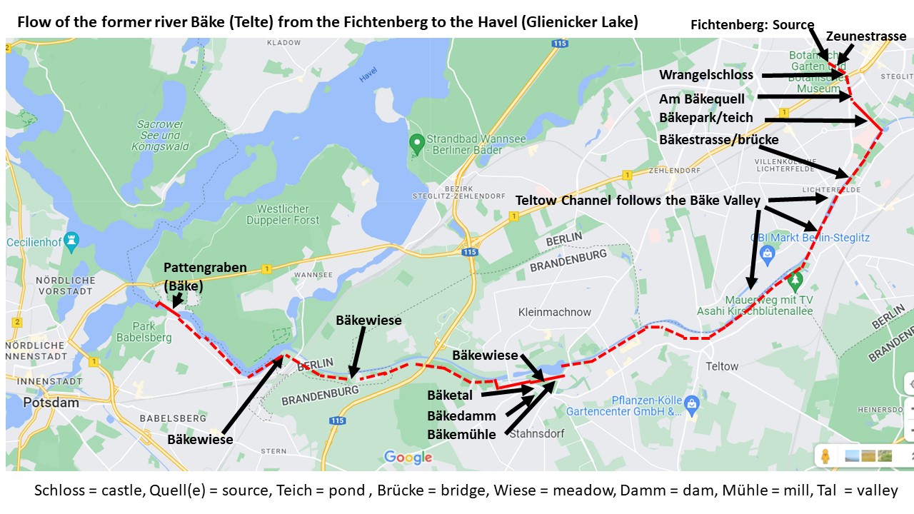
Review: The marks of the Bäke from the source, along the Teltow Channel and up to the Havel near Potsdam (Glienicke Brücke)

The Bäke starts at the Fichtenberg, appears in the Bäkepark, “enters” the Teltow Channel that took over the former valley of the Bäke, reappears at Kleinmachnow (Bäketal, Bäkemühle), appears again at Kohlhasenbrück (the two Bäkewiesen) and at Klein-Glienicke (Pattengraben). 

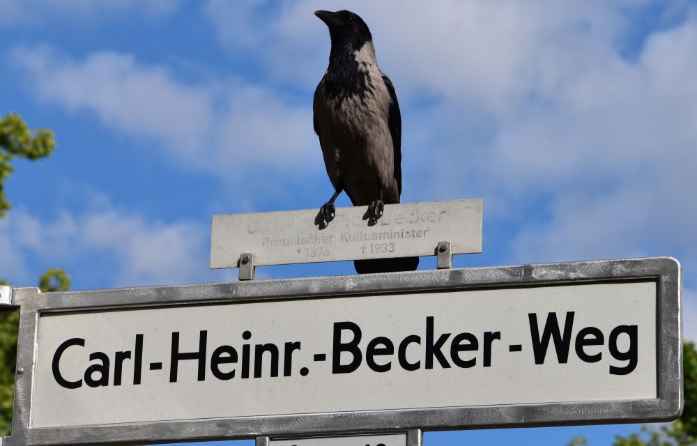
With a cousin of mine, I will now follow the Bäke from the Bäke mill at Kleinmachnow to the Pattengraben at Klein-Glienicke.


The Bäke reappearing at Kleinmachnow

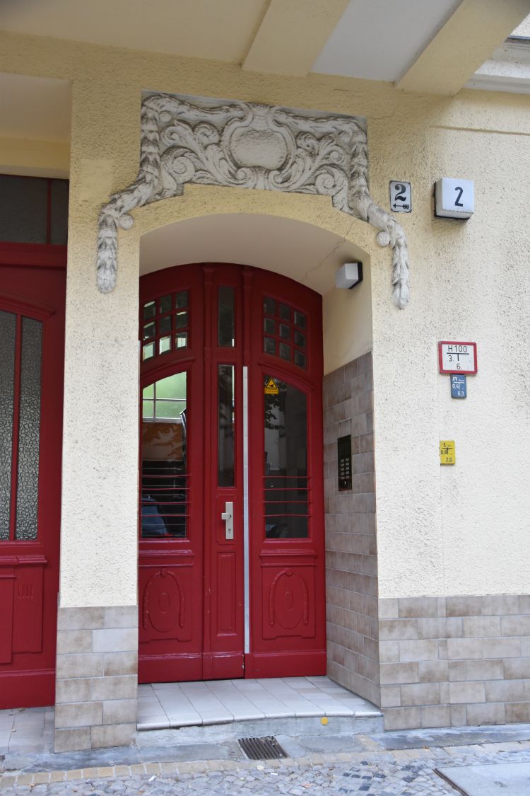
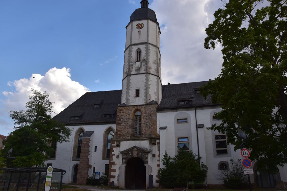
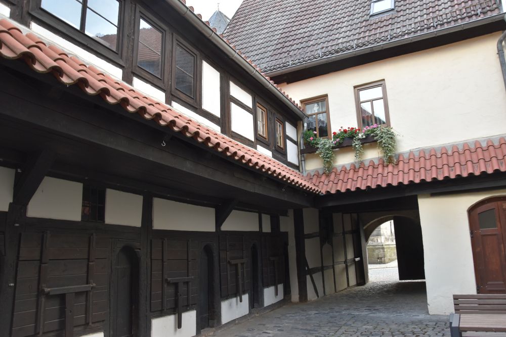
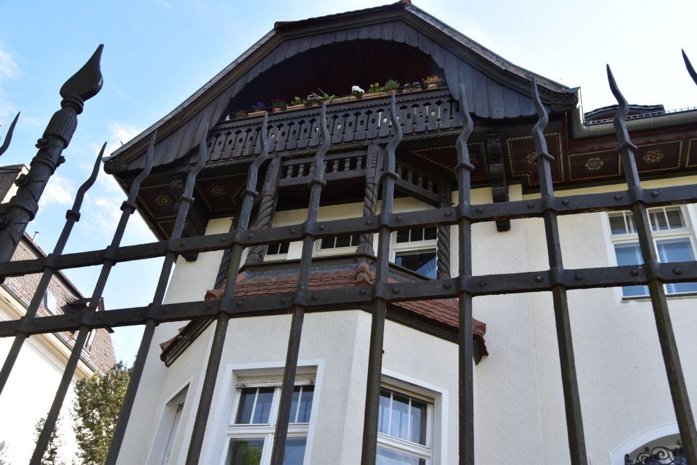
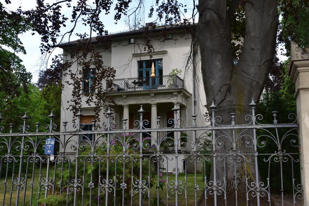
The Bäke mill (Bäkemühle) has been documented since 1695. The building of today is from 1862. It belonged to the noble family von Hake, as the three hooks (hook = Haken) in the coat of arms indicate. The ruins of the von Hake castle is just north of the mill, and so is the church with the tombs of the von Hake family (in the church of the von Hake family, the Dorfkirche Kleinmachnow, my parents married on 4th of March 1941). 

The mill was a restaurant until 2013. In 2017, two medical doctors, father and daughter, took over the mill and had it renovated. It is now a doctor’s practice. 

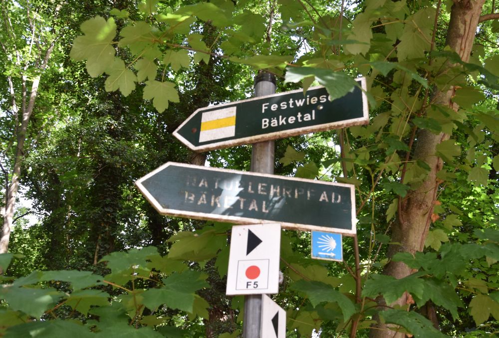
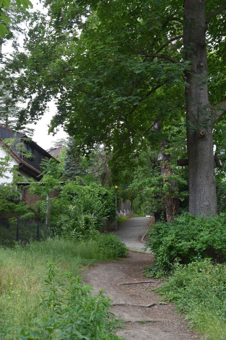
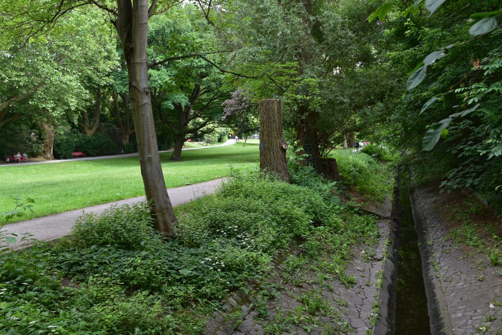
The Bäketal is a beautiful nature reserve north of the street called Bäkedamm.  

We enter the park near the mill. We reach the bridge that once belonged to the park of the von Hake family; the bridge has recently been restored.

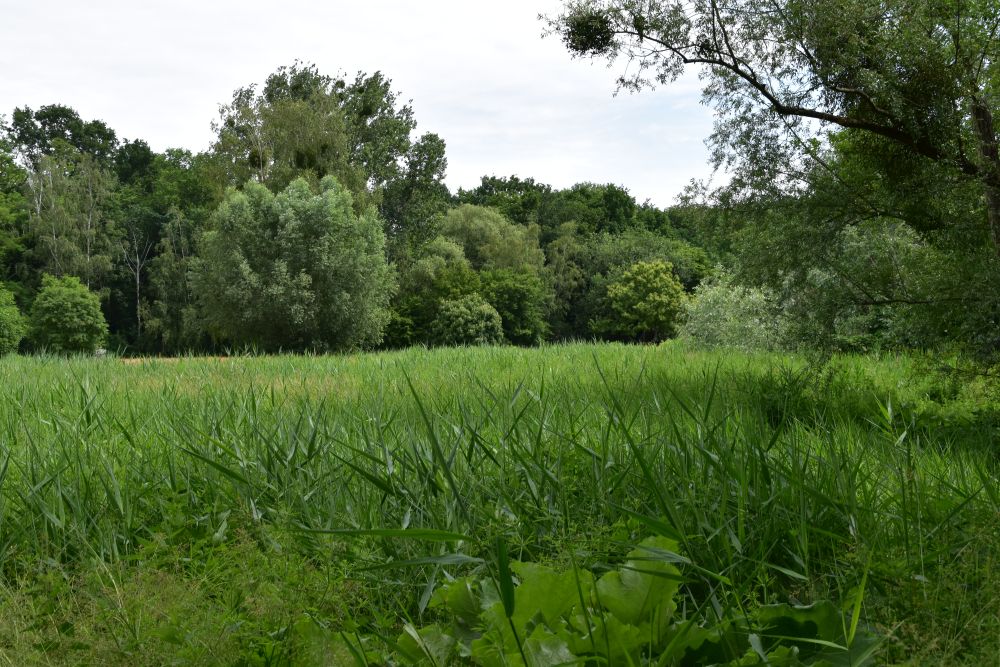
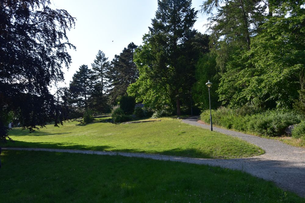
The forest opens to this meadow. On the map, it is called “Festwiese” or “party meadow”.

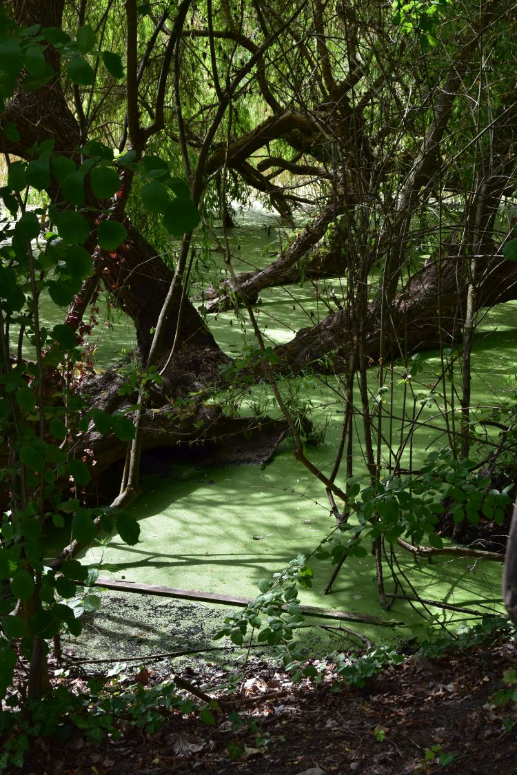
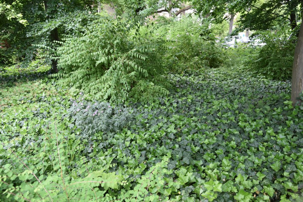
Near the  church of the von Hake family, we enter the forest again and come across boggy places that show…  

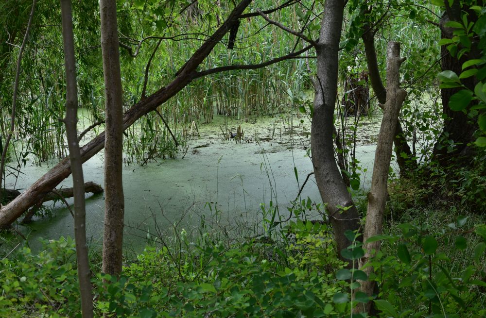
… what the wetlands of the Bäke once might have looked like. Difficult to access, indeed.

Just below the sluice, the Kleinmachnow Bäke arm “enters” the Teltow Channel.

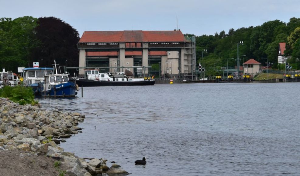
The sluice of Kleinmachnow (Kleinmachnower Schleuse) was built to overcome the height difference of 2.70 meters between the Havel near Potsdam and the Spree at Köpenick (Bernstengel, p. 35).


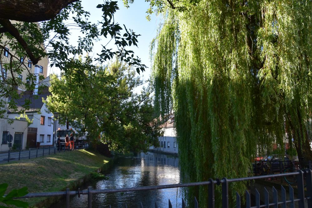
Strolling along the Teltow Channel that has taken over the Bäke again

On a small foot path, we walk along the Teltow Channel. The Bäke has again been taken over by the Teltow Channel. Far ahead of us we can see a bridge. 

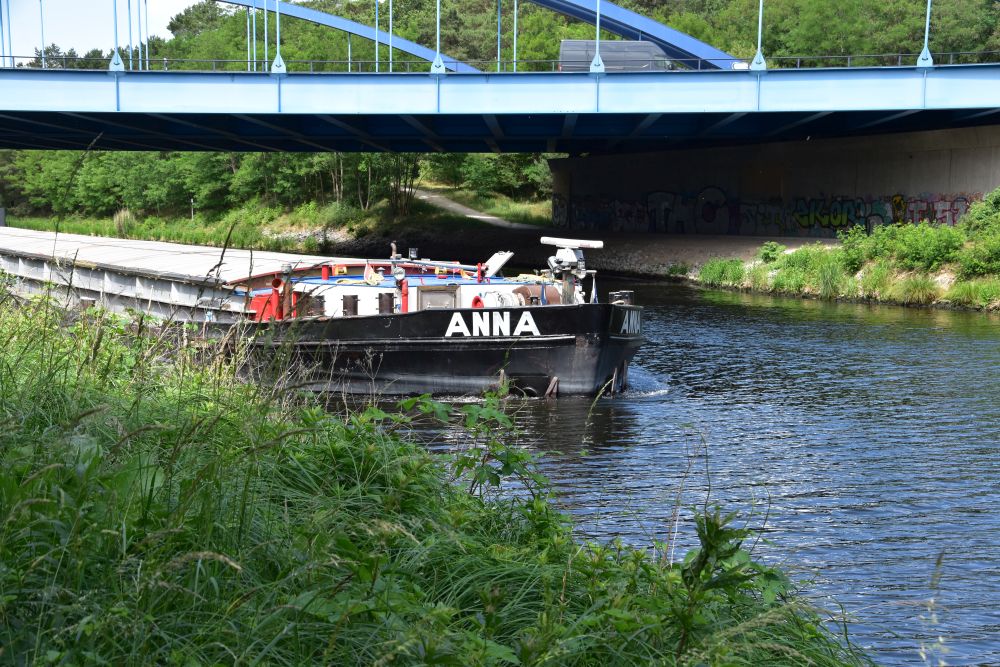
I propose to walk up to that bridge and then cross the channel. The closer we come, the noisier the bridge is – “swish – swish – swish”. My cousin laughs: “I do not believe that we can cross this bridge on foot, let us take a photo of the boat that carries the name of my daughter!” I check google maps on my smartphone, and now I understand: This is the highway A115. I usually cross this highway bridge by car, entering Berlin from the south – swish – swish – swish. You are right, my cousin, we cannot cross the channel here!

We continue on our small footpath. Two ugly pillars appear on both sides of the Teltow Channel. Bernstengel, p. 33, tells me that this was the so-called cemetery train (Friedhofsbahn) from Wannsee to Stahnsdorf (south of Kleinmachnow). The train was removed, when the wall separating Berlin from the GDR was built.  Just two pillars are left – this is one of them.

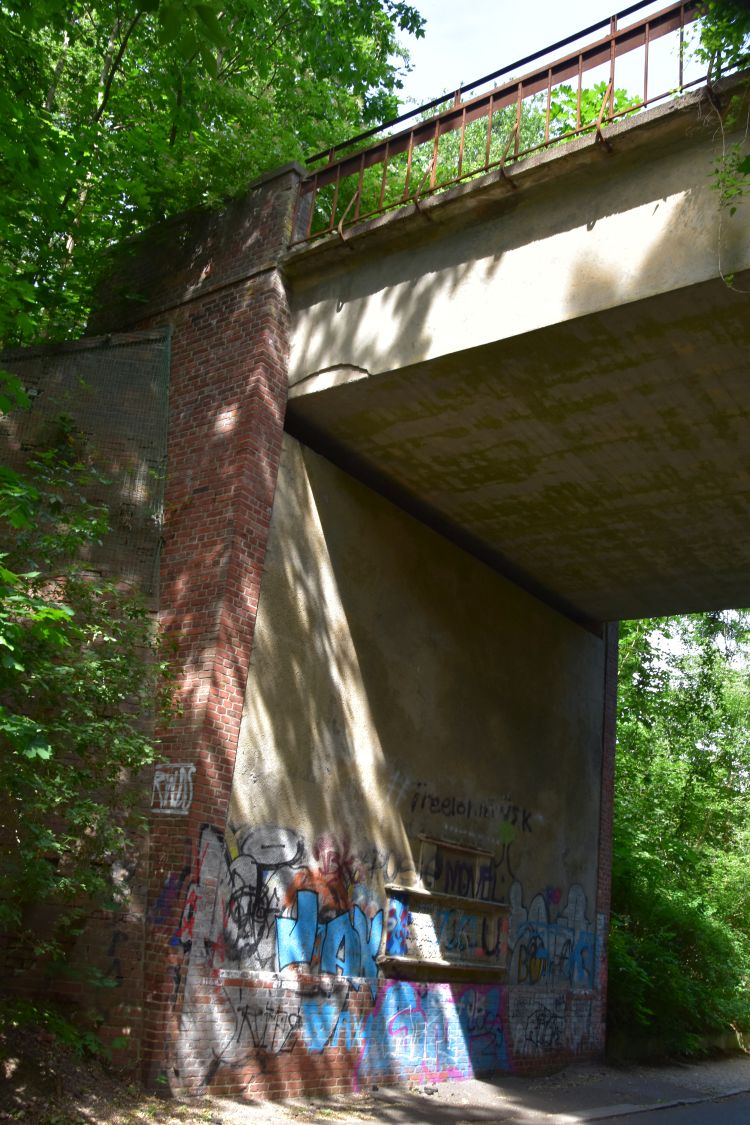
We carry on walking on our small footpath and pass under a bridge with trees on it (look at the photo on the link). It is the old highway A115. Later, I learn from Bernstengel, p. 31, that we could have crossed the channel here, as the bridge is solid. We did not know then and continued on our small footpath south of the Teltow Channel.

Why the old highway A115? Matters were complicated here: The channel formed the border between Berlin (West) and Brandenburg (GDR): A patch of (West) Berlin was south of the channel and a patch of Brandenburg (GDR) was north of the channel. The former highway A115 crossed this patch of West Berlin south of the channel and entered Brandenburg again north of the channel. To avoid crossing West Berlin and re-entering the GDR, they moved the highway east, and they built the new customs facilities Dreilinden to check the transit traffic through the GDR. 

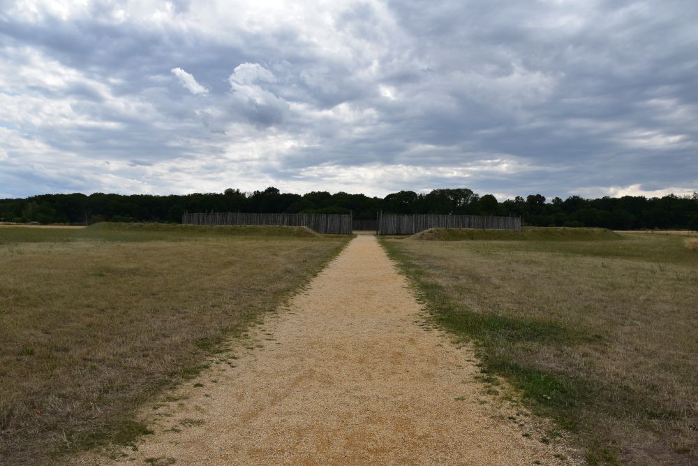
Panels explain the wall separating Berlin (West) from Brandenburg (GDR). We are on the so called Wall Route.

In the small patch of Berlin south of the Teltow Channel, we enter Albrechts Teerofen. In GDR times, only one small road allowed to access this place from West Berlin. 

At Albrechts Teerofen, there were ovens that produced tar from the pine trees rich in resin. In 1680, the place was mentioned under the name “tar production Kohlhasenbrück”. In 1767, the owner of the oven was called Albrecht (Bernsteigel, p. 31 and wiki entry for Albrechts Teerofen). Today it is a small settlement with a few houses. Here, the camping site for children and young people is called “Bäkewiese” – the Bäke creek turns up again.

The Owl Estate (Landgut Eule) was built by the Prussian kings. The guards of the royal hunting area “Parforce Heide” stayed here. 

The Parforce Heide has its name from the parforce (medieval) hunting that was performed by the Prussian kings and by nobility: Dogs chased the animals, until they were tired and could be shot by the hunters. 

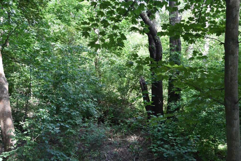
Just near Kohlhasenbrück, we come across the first railway line Berlin – Potsdam, inaugurated in 1838, the so-called “Stammbahn”. This railway has been out of service since 1945. Nature has taken over.

Still south of the Teltow Channel, we enter Kohlhasenbrück, a suburb that is part of Berlin. At the Bäkestrasse, we consider taking the bus. However, we decide to carry on walking. 

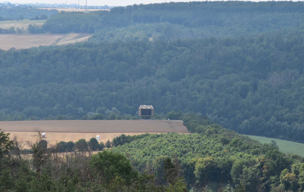
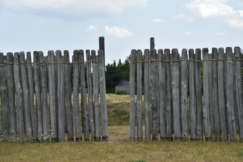
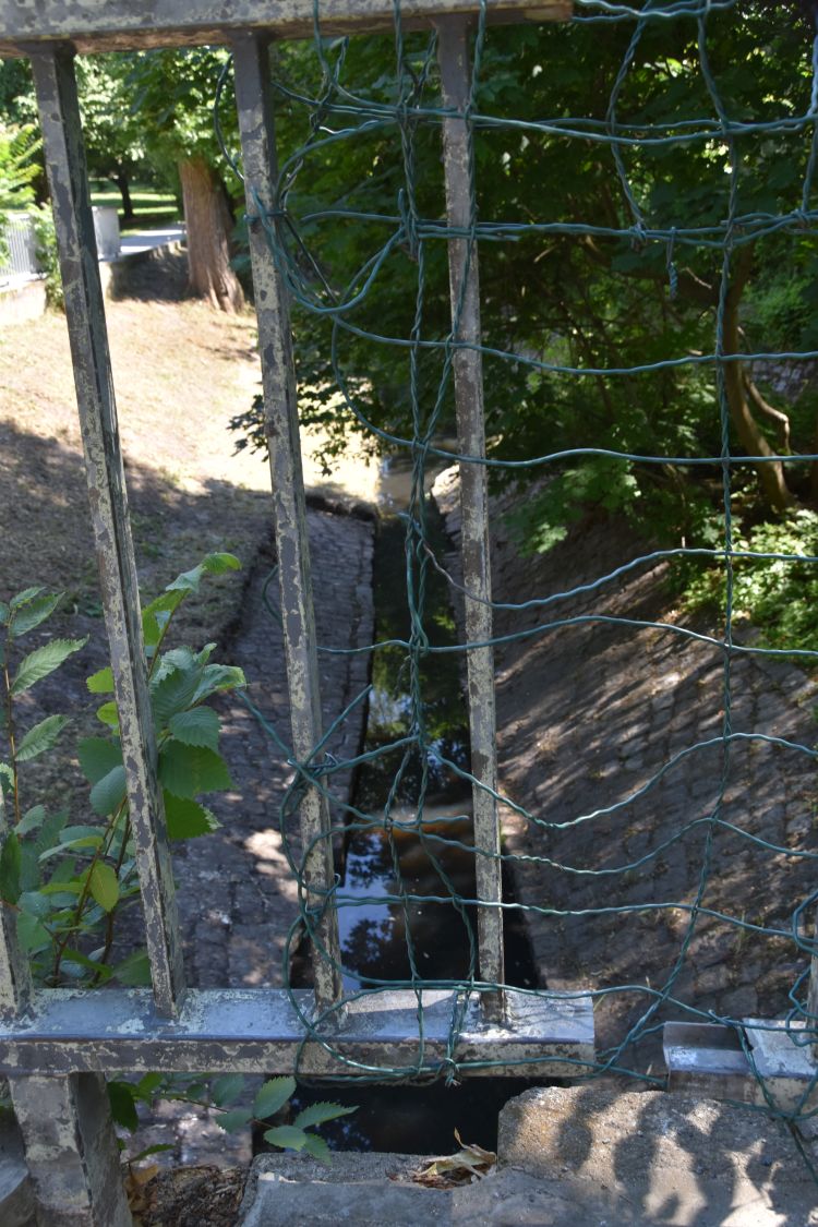
At Neue Kreisstrasse, we see signs pointing to the Bäkewiese. It is a natural park that cannot be accessed. I take a photo looking over the fence. 

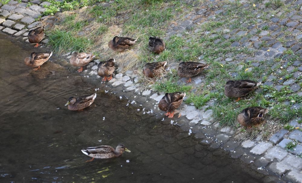
The Nature Reserve (NSG) Bäkewiese has been set up in 1988 to preserve this piece of the former Bäke wetlands with their fauna and flora. Frogs and toads live here, cranes, various kinds of woodpeckers and cormorans as well, and in addition wild boars, foxes, and raccoons. The Bäke is now called “Kohlhasengraben”.

We cross the bridge and stop at a restaurant with a large balcony. The take away service is open today, and I have Bockwurst with potato salad. The Bockwurst reminds me of the 1960’s, when I was at Berlin for the first time.

From our table, we can see the nature reserve Bäkewiese across the Teltow Channel.

We next climb a mountain, Moritzberg, almost 95m high. This was a garbage dump set up in a former quarry in 1954. The garbage dump was closed in 1982 and secured (see blog of Antje). The woods are dense, and I cannot imagine, that I am walking on a garbage dump.

We head for Klein-Glienicke, where we will come across the Bäke again… and in addition we will experience a daunting surprise.


Klein-Glienicke: The Bäke Creek, now called Pattengraben, with the Swiss Houses

At Klein-Glienicke, an arm of the former Bäke flows between the Griebnitz Lake and the Böttcherberg (67m).  This tamed Bäke arm is called “Pattengraben”.

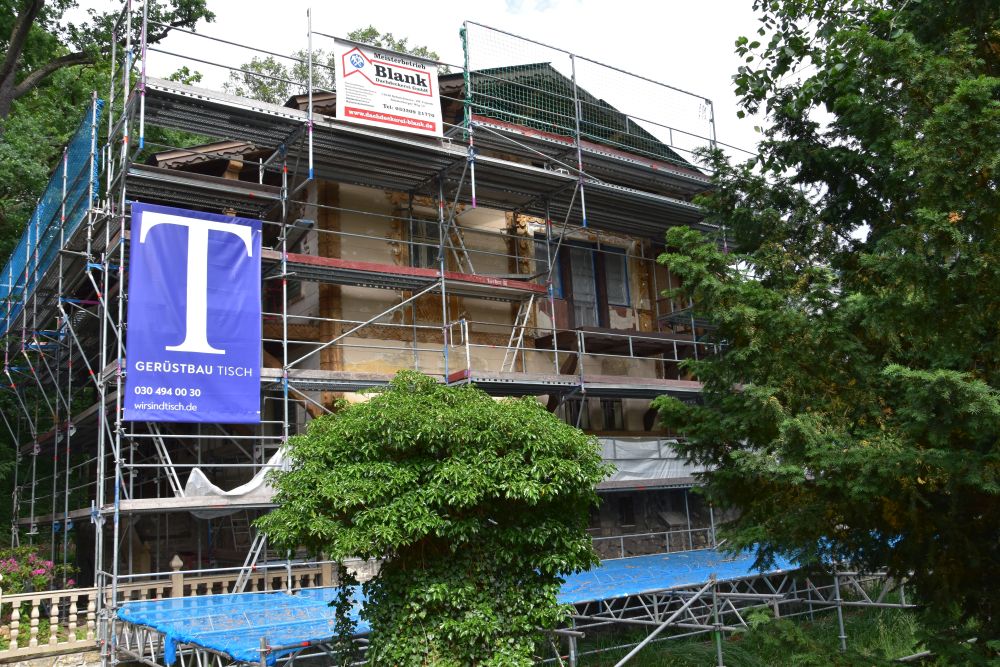
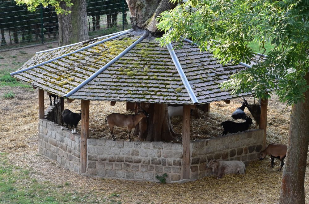
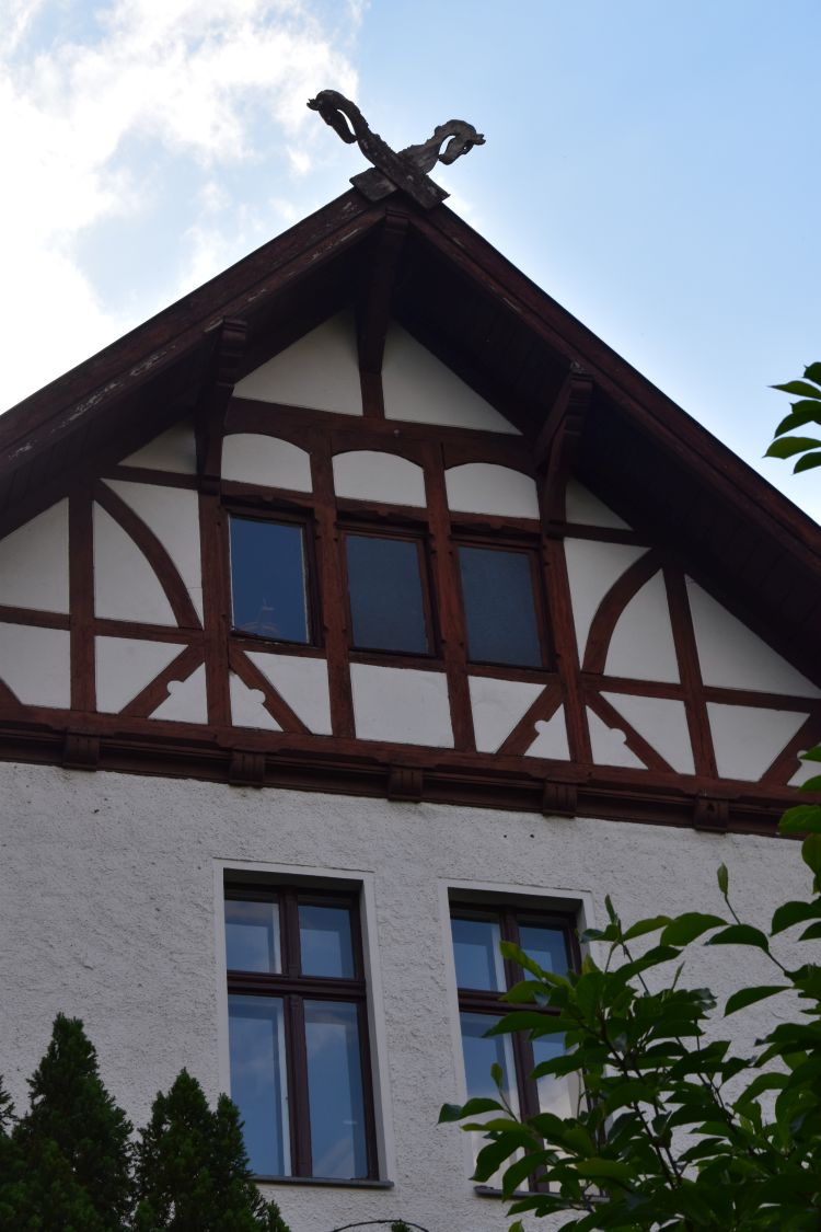
Above the Pattengraben, there are some Swiss Chalets. This one is undergoing renovation. 

Surrounded by green meadows, the next chalet seems to stand somewhere in the Bernese Oberland.

Ten Swiss Chalets were built between 1863 and 67 to echo the artificial rocks at the Böttcherberg above them; four of the chalets are left today.


Daunting memories of the wall separating West Berlin from the GDR at Klein-Glienicke

Entering Klein-Glienicke, we walk down this road which descends with green meadows and trees on both sides. A peaceful and quiet area. 

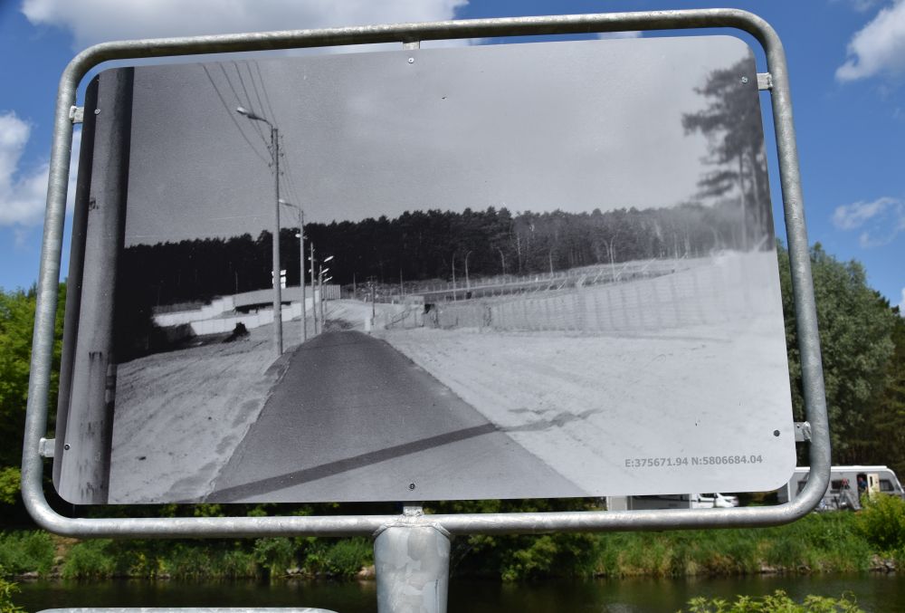
I notice this information plate and understand, it has not always been peaceful here. The road belonged to the GDR, the area left and right of it was part of West Berlin. This road was a small passage between two gloomy walls.

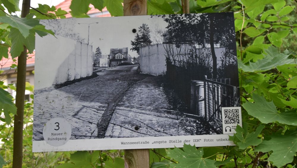
There is a box with maps under the information plate. The map shows the odd boundary line and the narrow passage. 

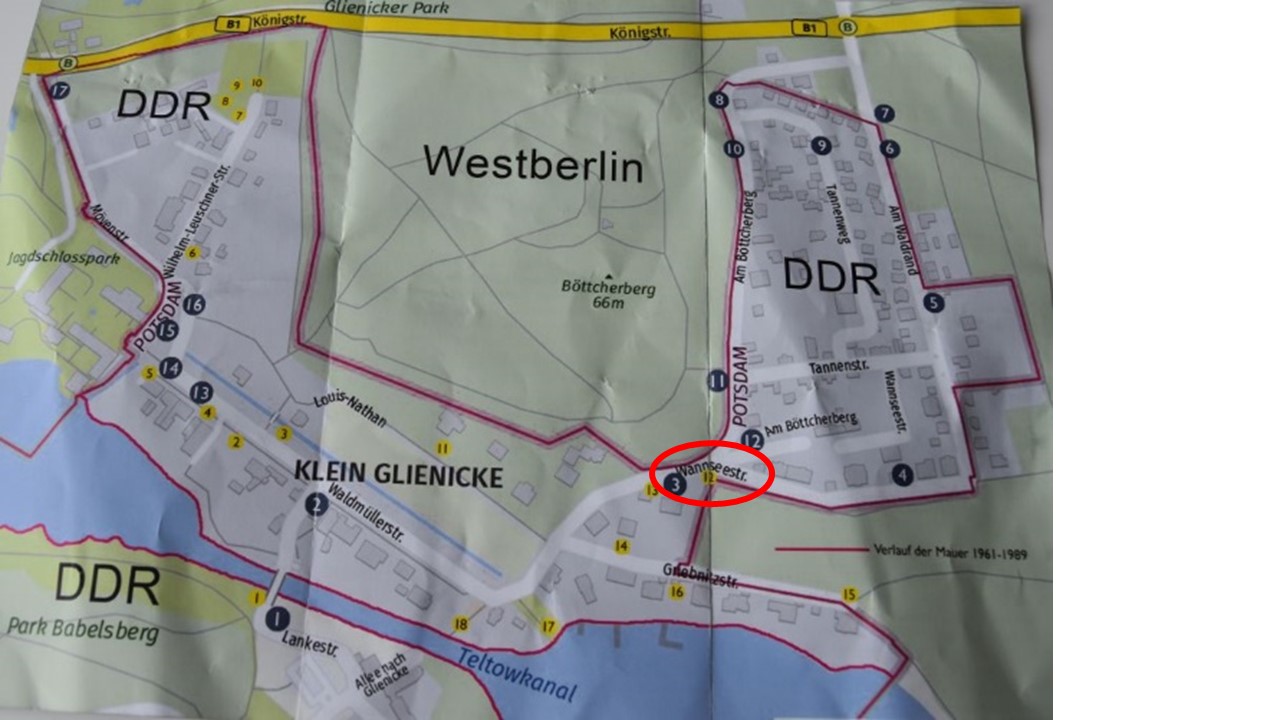
I have marked the narrow passage with a red oval. I look around me: This peaceful and quiet place once looked that daunting? I feel scared. 


The Glienicker Lake and the Hunting Castle Glienicke

West of Klein-Glienicke, we arrive at Glienicke. We pass this inviting gate with two griffins to enter the park of the Glienicke Palace. 

It was the summer residence of prince Carl of Prussia. The architect Schinkel remodelled the former estate in the year 1825, in neoclassic style. 

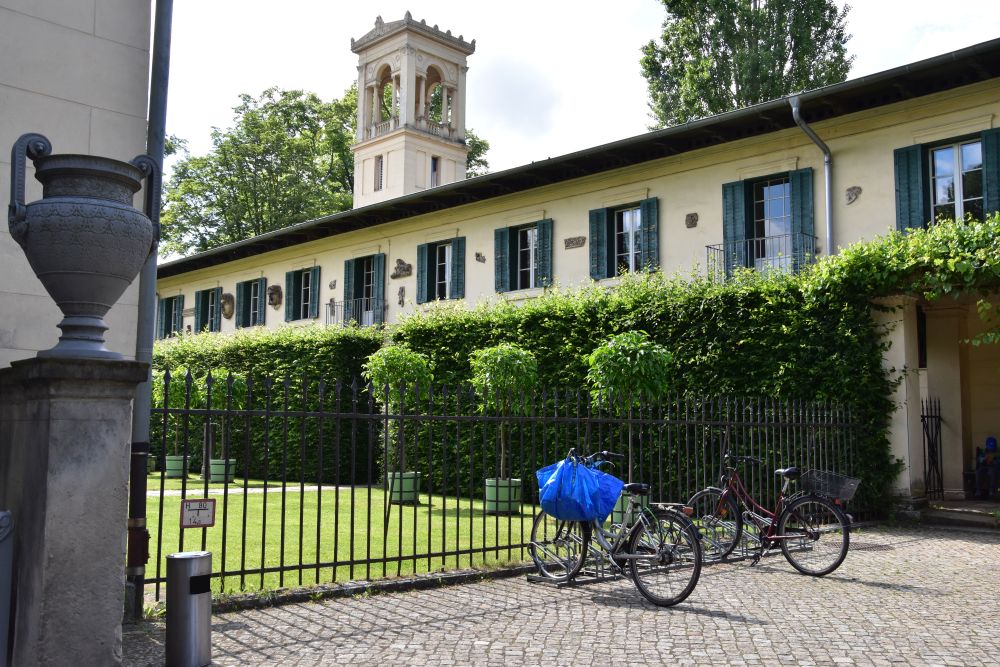
Modern Ikea hanging oddly on a bike meets the tradition and nobility of the palace.

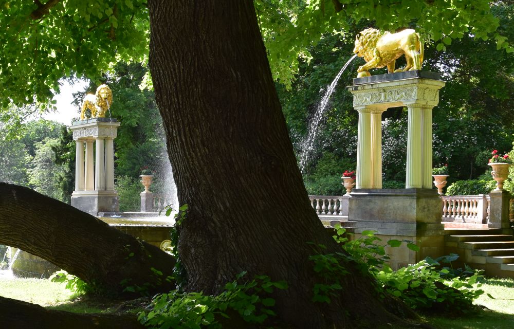
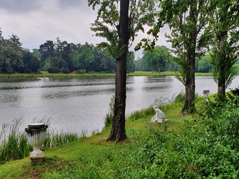
The beautiful park along the Havel has been designed by Peter Joseph Lenné.   

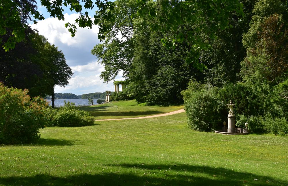
It is a beautiful park with tall trees and many eye catching corners.

We leave the park and walk over to the Glienicker Brücke. It was closed for 40 years, as the border between GDR and West Berlin was in the middle of this bridge. I tell my cousin about my impressions from 1966, when my mum took me here (as described in my blog about our tour of seven lakes)

It is here, where the Bäke and the Teltow Channel end; we have reached the river Havel. 

We take the bus back to the S-Bahn station Wannsee, leave the suburban train at Charlottenburg and have a lovely dinner at the Georgian restaurant Salhino at Waitzstrasse 1, just next door to where my mother was born in 1916, at Waitzstrasse 2.


Bäke, you old faithful – good-bye for now

Bäke, you old faithful, I do thank you for having opened my eyes for your former wetlands. And in addition you have opened my eyes for the history of the Teltow Channel and how important this channel was for the development of the south west districts of Berlin and its suburbs. 

Bäke, good-bye for now, I will return.


Sources:

Berlin: The Bäke creek from the Fichtenberg to the Havel

In June 2022, I was at Berlin again, for five weeks. Berlin is my mother town. I explored some corners off the beaten tracks. So far, we have looked at the Rüdesheimer Platz at Steglitz and at the Fichtenberg.

The Bäke is our next topic. The Bäke is a creek that has its source at the Fichtenberg. Bäke meant “Bach” or “creek”  in medieval Low German (see Wille, p. 45). 

Before the year 1900, the Bäke meandered forming wild, largely impassable wetlands, 250 meters wide. The natural reserve Bäketal at Kleinmachnow shows, what the Bäke wetlands once might have looked like. Impassable, indeed.

After having meandered for about 20km, the Bäke joined the river Havel near Potsdam. 

Around 1900, the Bäke wetlands the Teltow Channel was built and took over the bed of the Bäke. However, some marks of the Bäke are left.


Overview: The tracks of the Bäke from the source, along the Teltow Channel and up to the Havel near Potsdam

At the Fichtenberg, the Bäke has its source, under the ground (dotted red line). The Bäke shows up above the ground in the Bäke park (solid red line) and “disappears” in the Teltow Channel (again dotted line)The Bäke continues to live in the names of streets, bridges, parks, meadows and buildings, as indicated on the map.

The Teltow Channel was inaugurated in 1906. Ernst von Stubenrauch managed the construction. His objectives were to create a navigable water channel, to provide drainage for the rapidly growing settlements south of Berlin, to dry the wetlands to allow further settlement and to set the basis for further economic development of the Teltow district. By the way, the name “Teltow Channel” is based on the second name for the Bäke, which was “Telte”.

We will follow the tracks of the Bäke and investigate the area, now up to the Bäkestrasse/brücke, later from Kleinmachnow to the Havel near Potsdam.


The Bäke emerges at the Fichtenberg, I cannot find the source

The source of the Bäke is below the platform on the right hand side of the photo; however, I cannot find the source. 

Does the trough in the meadow indicate the former bed of the Bäke?

Looking downhill from the same spot, I can see this trough continue.

I do not know, whether the Bäke is under the meadow here or whether the start has completely dried out.


The Bäke underground

The Bäke is said to continue under the Zeunepromenade steeply leading down to Steglitz (I look uphill here).

This path is called after Johann August Zeune who founded his school for blind and visually impaired people in 1806.

In 1914, Betty Hirsch initiated education for people that turned blind in the war, together with Paul Zille, as the plate next to her and her dog explains.

The Bäke fed a pond surrounding the neoclassical Wrangel castle; the pond has disappeared (Seeger/Zimmermann, p. 89). 


Field marshal Wrangel set up his summer residence in the Wrangel castle in 1853. The Steglitz station of the new train from Potsdam to Berlin became busier and busier, and Wrangel asked it to be closed to stop all that noise. The station was reopened in 1869, when Wrangel stopped staying at his castle regularly (Seeger/Zimmermann, p. 89).  The annexe of the Wrangel Castle is now a small theatre (Schlosspark Theater) with an excellent reputation. 

Across the castle, the street is called “Am Bäkequell” or “at the source of the Bäke”. 

The Bäke is still under the ground here. It crosses the suburban train (S-Bahn) and continues under the Oberlinweg. 

Behind the suburban train, there once was a comfortable swimming pool of 900 square meters, with a restaurant, a park and a bowling alley. The owner Pantzier replaced the water supply from the then dirty Bäke by water from the Berlin channel system; he deemed hygiene to be important. The swimming pool has disappeared today; the last remaining buildings were pulled down in the 1960’s (Seeger/Zimmermann, p. 91f). 


The Bäke shows up in the Bäke Park

The Bäke Park is a green reserve.

Under the bridge of the Haydnstrasse, the Bäke appears from under the ground.

It is not a beautiful place, not at all worthy for the old faithful Bäke.

Strictly tamed, it flows in a narrow channel through the Bäkepark. This small creek once fed wetlands 250 meters wide?

At the end of the Bäke Park, the Bäke is “allowed” to spread out as a pond. 

As a matter of fact, this pond is a collecting tank to control the amount of water that the Bäke feeds into the Teltow Channel after heavy rainfall (Bernstengel, p. 60).


The Bäke taken over by the Teltow Channel

The Bäke Park and the open flow of the Bäke end at the Teltow Channel. The Teltow Channel, starting at Köpenick, seems to “swallow” the Bäke here.

Across is the Port of Steglitz. It is a “leftover” of the Bäke that made a wide turn to the west here; this eased the construction of the port. Around the port, there were a powerstation and storage place for coal. Now there is a museum about the production and distribution of electricity (Bernstengel, p. 58).

I follow the Teltow Channel, pass the Bäke Bridge and end my walk at Emil-Schulz-Brücke, as it starts to rain heavily.

I take the bus back home. 

Let us continue looking for marks of the Bäke at Kleinmachnow in the following blog.


Sources:

Berlin: The pine tree mountain or Fichtenberg, 69m high

In June 2022, I was at Berlin again, for five weeks. Berlin is my mother town. I explored some corners off the beaten tracks. In my previous blog, we were at the Rüdesheimer Platz, now it is the Fichtenberg (literally “pine tree mountain”). 

Yes, you find mountains at Berlin, and the Fichtenberg at Steglitz is one of them.


The Fichtenberg IS a mountain, 69m high

The Fichtenberg IS a mountain. Look at the traffic signs and trees leaning uphill. The man is working hard pulling up his trolley. Kurt Pomplun says that the steep inclination of 1:12 is a problem for the garbage removal men (p. 76).

Oh yes, I know, mountains are steeper in Switzerland. Berlin, however, is flat, and I am always astonished, when I see some inclination here.

More than a hundred years ago, the Fichtenberg rewarded climbers with a gorgeous view from the top: In 1892, they could see Potsdam and the Havel mountains as well as the suburbs Lichterfelde and Zehlendorf (Pomplun, p. 75).

Today, we see trees from the top, beautiful tall trees. There is a platform topping the Ruth-Andreas Friedrich Park. Dogs run around on the meadows, sportsmen jog uphill and take a rest on the platform.

Behind the platform, there must be the entry to the subterranean bunker tunnels of the Second World War that Seeger and Zimmermann mention in the 1980’s (p. 108). The stone slab marking the entrance was still visible then. Access was forbidden. The tunnels collapsed under the street. The street had to be barred. 40 years later, I found no signs indicating this gloomy past.

Below the platform, the Bäke creek has its source (Olaf Seeger et al, p.89). I cannot find the spring tapping, though. It is said to have dried out.

Yes, the Fichtenberg IS a mountain – it even has its creek! We will follow the Bäke creek up to the Havel near Potsdam later.


The best maintained garden of Berlin: The Botanic Garden

The western part of the Fichtenberg is the best maintained garden of Berlin, as Pomplun proudly points out.  It is the Botanic Garden of Berlin, with paths and roads winding up and down.

There are greenhouses with tropical plants.

More than 20’000 plant varieties grow on about 40 ha. It is one of the largest botanic gardens of Germany. It was laid out between 1897 and 1910, as the site of the Botanic Garden explains.

Even the grapevine snails enjoy life at the Botanic Garden. They find enough food here.


Sumptuous villas, the oldest from the late 19th century

The Fichtenberg was a wild area, until Frederic the Great cultivated it: In the middle of 18th century, he mandated to plant pine trees here. In the late 18th century, wine was grown here. In the 19th century, the silk factory owner Heese planted mulberry trees. In 1841, the Prussian government acquired the mountain. In 1871, it subdivided it into lots and started to sell them. The first villa was built in 1874, and more followed (Olaf Seeger et al., p. 100).

Let us look at some of the sumptuous villas. Just some of them, there are many more beautiful villas .

Some villas hide behind defensive fences  – this is Schmidt-Ott Strasse 11a, built by the architect Endell. 

Bishop Dibellius lived here in the 1930’s (Olaf Seeger et al, p. 105). Endell also built the Hotel am Steinplatz near Savignyplatz (In Berlin zu Hause, p. 46f).

Other villas hide behind trees.

I do not know details about this villa number 11b.

This is the villa Anna at Schmidt-Ott Strasse 14, built out of bricks, with a slim and pointed tower attached, behind the trees.  

Pomplun says, the villa seems to have been built with elements of “Richters Ankersteinbaukasten” (p. 76).

The Ankersteinbaukasten was a construction kit for children made at Rudolstadt from 1884 to 1963; production was reinitiated in 1995, as I learn from Wikipedia. As a child, I used to play with such a construction kit, when staying with my grand-mother; now I know, what it was.

The former water tower, now the FU Institute of Space Sciences and Meteorology at the Schmidt-Ott-Strasse 13, was built in 1886 (Free University=FU).

In former times, you could climb the tower for ten pfennig and enjoy the view at 40m above street level (Pomplun, p. 75.)

Despite the trees, the owner of this neo-classical villa has decided to install a red umbrella which nicely matches the green and white colours.

This is Schmidt-Ott Strasse 21, the oldest villa at the Fichtenberg: The registrar Mancke had settled here in the year 1874 (Pomplun, p. 74 and Olaf Seeger et al., p. 100).

Pomplun says that this palais was built by the architect Paul Baumgarten (senior) for the merchants’ family Henoch in 1912.

When looking for the name Henoch, I see that for members of this family stumbling blocks (Stolpersteine) have been set up at Berlin, Sybelstrasse 29 – here they are.

I feel guilty, when looking at these reminiscences.

Schmidt-Ott-Strasse 17 is this beautiful villa built in the 1930’s style of new objectivity (Neue Sachlichkeit).  

Someone later lacked the feeling for taste and tradition. He added this ugly supposedly modern house, probably in the 1960’s.

Like two unequal brothers, this ugly building and the architecture gem of new objectivity are attached to one another.

Across the street, at Schmidt-Ott-Strasse 6, I like this neo-classic villa. The villa belonged to the merchant Degener.

The façade is divided into three parts with four ionic columns in the middle forming the basis for the balcony (Olaf Seeger et al., p.103).

Next door, number 4, is the Evangelisches Jugend und Fürsorgewerk (EJF). In the garden, the bull gives audience to his friend, the grey cat with sparkling green eyes.

The bull is called Heinz, after the actor Heinz Hönig. Since 2003, Heinz has organized instructive journeys for children, as the notice says.  Wiki tells me that Heinz Hönig was born in Bavaria in 1951. His foundation “Heinz der Stier” has invited traumatized children and young people to Mallorca and to the Harz to show them new horizons for their future.

I do not know more details about the beautiful cat. It looked at me for a short moment and run away.

The EJF hosts the Ringelbande (“Ringel” gang). It is  a day care facility for children and a house for small researchers. Maybe they have performed some research about millipedes. 

The large property belonged to the paper factory owner Max Krause. He made money, because he had the brilliant idea to sell envelopes in combination with stationery. His slogan was: «Schreibste mir, schreibste ihr, schreibste auf MK-Papier (whether you write to me or you write to her, you will write on MK stationery)» (Olaf Seeger et al., p. 100)

The villas are full of history and histories. Many of the street names commemorate personalities that once lived here. Carl-Heinrich Becker, for instance, was a Prussian minister and professor of orientalism that lived in the area.

What the dun crow and I see from this point is the eyesore of Steglitz. 

This ugly tower at the foot of the Fichtenberg and near the Steglitz city hall seems to undergo construction now and may be completed one day.

I prefer not to further look at the eyesore, and I turn right to Lepsiusstrasse, where there are more beautiful houses,…

… and this beautiful gable that reminds me of the Spreewald.

I descend the Fichtenberg, walk along Lepsiusstrasse and sit down in the small and family-owned restaurant la Piccola Perla to enjoy some delicious pasta. It was a wonderful afternoon. I will return to identify more architecture gems on the Fichtenberg.


Post Scriptum 1: Flee markets are a good source for books about Berlin

Flee markets are a wonderful place to buy books that invite you to explore Berlin beyond the “usual” touristic sights. I came across Pomplun’s “Berlin und keine Ende” on the Sunday market at Steglitz (Hermann Ehlers Platz) and later I found two more books on the Sunday market at the Kupfergraben near the museums island:  Olaf Seeger’s and Burkhard Zimmermann’s “Steglitzer Geschichten” as well as Klaus Dieter Wille’s “Spaziergänge in Steglitz”.


Post Scriptum 2: Visiting Kurt  Pomplun

Kurt Pomplun is buried at the cemetery of Wilmersdorf.

Thank you, Kurt Pomplun, for telling me so much about Berlin.


Sources:

  • Kurt Pomplun, “Berlin und kein Ende», Berliner Kaleidoskop Band 26, Verlag Bruno Hessling Berlin 1977
  • «In Berlin zu Hause», B History, das Berliner Geschichtsmagazin, Nr 4/2022
  • Olaf Seeger und Burkhard Zimmermann, «Steglitzer Geschichte(n), Berliner Reminiszenzen No 56, Haude & Spenzer, Berlin 1985
  • Klaus Dieter Wille, “Spaziergänge in Steglitz”, Berliner Reminiszenzen No 60, Haude & Spenzer, Berlin 1989
  • Ingrid Nowel, «Berlin, die alte neue Metropole. Architektur und Kunst, Geschichte und Literatur», Dumont Kunst Reiseführer Ostfildern 2007
  • Website of the Botanic Garden of Berlin https://www.bgbm.org/de
  • Wikipedia entry for Heinz Hönig https://de.wikipedia.org/wiki/Heinz_Hoenig
  • Wikipedia entry about Anker-Steinbaukasten https://de.wikipedia.org/wiki/Anker-Steinbaukasten

Berlin: Lively Rüdesheimer Platz

In June 2022, I was at Berlin again, for five weeks. Berlin is my mother town. I explored some corners off the beaten tracks. One of them is the Rüdesheimer Platz at Steglitz.


Under ground start: The metro station “Rüdesheimerplatz” (Rüdesheim square)

Let us start under ground, at the metro station U3, Rüdesheimer Platz. The decoration alludes to wine growing, as Rüdesheim is a wine village on the river Rhine, north of Frankfurt.

So far, I had always been under the ground here, using the metro. Now I was curious, what Rüdesheimer Platz looks like above the ground. On a sunny and warm evening, I walk along Rüdesheimer Strasse. Some murmuring is getting louder and louder, as I am approaching the Rüdesheimer Platz.


The Weinbrunnen (wine fountain) at the Rüdesheimer Platz

I arrive at the Rüdesheimer Platz. The murmuring is loud now. In the shade of the trees, many people have congregated chatting, with glasses of wine in their hands. Some stand in line at the stand called ”Weinbrunnen” (wine fountain) which sells wine from the Rheingau. Rüdesheim belongs to the Rheingau (Hessen).

The site of the Bezirksamt Charlottenburg-Wilmersdorf tells me: The “Weinbrunnen” has been a tradition for more than 50 years. Various wine growers from the Rheingau sell their wine by the glass and by the bottle. People bring their own food. I observe one  lady selling home-made onion pie. Consuming wine from the “Weinbrunnen” is restricted to the platform above the Siegried fountain.

Above the wall, the crowds are drinking wine. In the fountain, people are cooling off.

Emil junior Cauer had created this fountain in 1911: Siegfried tames his horse Grane, flanked by lady Nahe (or Mosel, unclear which) and Old Father Rhine. 


In 2016, I was at Rüdesheim and also visited the two ladies Nahe and Mosel

In 2016, we crossed Old Father Rhine to get to Rüdesheim – the vineyards are above the village. 

Also the rivers Nahe and Mosel  are renowned wine areas.

Lady Nahe impressed me with the spectacular Rotenfels (202m high) and the vineyard Bastei, where the grapes ripe marvellously just below the rocks and above the water. 

Also of lady Mosel, I keep great memories from 2016. Here we walked above Piesport looking back at the vineyard Goldtröpfchen. 

Now, six years later, I think of Old Father Rhine and the ladies Nahe and Mosel at the Rüdesheimer Platz.


The playground and garden behind the Siegfried fountain

On the playgrounds and meadows behind the fountain of Siegrid, people relax and enjoy the early summer evening. This is the view from the fountain to the east and towards Landauerstrasse. 

Now I am looking back to the Siegfried fountain. The gardens are well maintained. 


Around the Rüdesheimer Platz

At Rüdesheimer Platz, Hertz runs a wine shop that promises a great drinking experience – perhaps his wine will give you wings to fly to the clouds.

This little and beautifully crafted house may be needed after so many drinks. It is nick named “Café Achteck” (Achteck = Octagon).

In the beginning of the 20th century, the architects carefully designed the houses around Rüdesheimer Platz and along Landauerstrasse; the  half-timbered façades should resemble English cottages.

The houses have front gardens here.

The ambiance reminds me of the villages in the Rheingau. This is the famous (and touristy) Drosselgasse at Rüdesheim, where I was in 2016.


Joining the Weinbrunnen party with a glass of wine

I return to the Rüdesheimer Platz later to have a glass of dry Riesling. Currently Abel, a winegrower from Oestrich, sells his wines. My Riesling is from “Oestricher Lenchen”. I pay and look for a seat.

All seats are taken. Above the Siegried fountain, I  find a place to stand. I put my glass on to the wall. A couple joins me with a pizza from the pizzeria nearby, where I had noticed a long waiting line. A slim athletic looking man in his sixties joins us. I learn that he is from Frankfurt, that he has worked at Berlin, that he sails on the lakes around Berlin and also navigates his motor boat through the channels of the German channels and rivers.

I feel like being in a mediterranean country. But no, I am at Berlin, in Northern Germany, and people enjoy their lives here, too. I really start to feel at home at Berlin, my mother town.


Sources:

Delémont – more reminiscences of the bishops and a look at the museum

In April 2022, I discovered charming Delémont:

  • the welcoming atmosphere with enticing shops, a small market, traditional restaurants, all mirrored in Renaissance fountains,
  • the medieval city centre with reminiscences of the Prince-Bishopric of Basel, 
  • the jurassic museum (Musée Jurassien d’Art et d’Histoire), curated with a twinkle in the eye. 

After having presented my first impressions of the welcoming atmosphere of Delémont and the Renaissance fountains, I will turn to some more reminiscences of the Prince-Bishops and to the jurassic museum. 

Have you noticed this coat of arms with the lions and the bishop’s crooks at the castle of Delémont? What does it tell us? 

It tells us who built this castle – see below…


Recapitulation: The map of the city centre of Delémont

This is the map of the medieval city centre of Delémont with some of its main sights.

Source: SwissMobile with my own additions


The château (castle) of Delémont was the summer residence of the Prince-Bishops; it is now a school

Delémont was the summer residence of the Prince-Bishops, and they lived in their castle here.

Prince-Bishop Johann Konrad II von Reinach-Hirtzbach (1705-1737) reconstructed the castle of Delémont in Baroque style (1716-1721). 

His coat of arms confirms that above the entry gate…

… and also inside the castle.

The Prince-Bishop tells us: “I am Johann Konrad von Reinach-Hirtzbach, and I have constructed this castle.”

His lions appear on some border stones marking the Prince-Bishopric of Basel.

I have come across this border stone above Ettingen (Prince-Bishopric of Basel) at the border to Hofstetten (canton of Solothurn).

Interesting to see this plastered Turk inside – the orient was a dream destination at that time, even for the catholic Prince-Bishop.

The castle is now a school. The inventive caretaker has craft skills. This is how he avoids that scooters lie around in the corridors.

In addition, he installed a self-service “lost-property office” for “objets trouvés” meaning “items found”, such as keys, caps, shoes or T-shirts. 

From the castle terrace, there is a gorgeous view of the mini Versailles garden (now very sober) and of the Jura hills surrounding Delémont.

The coat of arms of Delémont shows the hills of the Jura, just below the white bishop’s crook.


The church Saint Marcel – neoclassical

The church Saint Marcel was built in Neoclassical style (1762-67), under Prince-Bishop Simon-Nicolas de Monjoie-Hirsingue.

I will have to return to find his coat of arms in the church. Like other prince-bishops, Monjoie has marked his borders, for example, in the forest on the Bruderholz, between Bottmingen (then city of Basel) and Oberwil (Prince-Bishopric of Basel). 

Look for this coat of arms in the church Saint Marcel; it shows two keys and two bishop’s crooks.

The belfry, added later (1850) is slightly slanting and is called “Delémont’s leaning tower of Pisa”. 

Or should we rather say “Pisa’s leaning tower of Delémont”?

Just across the church, some tomb slabs have been reused for the sidewalk. 

Very sustainable construction.


The hospital that has never been a hospital

Prince-Bishop Wilhelm Jakob Rinck von Baldenstein (1693-1705) built this hospital. 

According to his opinion, it resulted to luxurious to be just a hospital. The city of Delémont gave the building to the Ursuline nuns to open a school for girls.

The hospital has never been a hospital, though the address is “Rue de l’Hôpital”.  

It is here, where the fountain with Saint Henry stands (emperor Henry II) (see the former blog about the fountains).


Chapelle Saint Michel in the cemetery of Delémont

Just above the Place de l’Étang, I find the chapel of Saint Michel, built in 1614, in late Gothic style mixed with Renaissance. 

It has been constructed under Prince-Bishop Wilhelm Rinck von Baldenstein (1608-1628, perhaps we can find his coat of arms here…).

Inside, the atmosphere is sober, the main decoration being the baroque altar of 1618.


The Musée Jurassien d’Art et d’Histoire – it is well worth a visit

The Burgenfreunde organised a short guided visit to the Musée Jurassien d’Art et d’Histoire. 

The museum has been curated with a twinkle in the eye. When the managers renovated their museum, they hired a historian, a cartoonist and a photographer and carefully rearranged the exhibits around the seven main clichés that the Jura is known for, such as “au bout du monde” (at the “end of the world”),…

Source: Claude Hauser, p. 38

… “La Tête de Moine” (the cheese from the monastery of Bellelay; alluding to the history of the catholic church and the prince-bishops),…

… “Jurassique: identités sous-sol” (Jurassic: identities under the ground referring to the geological era called “Jura”)…

… or l’heure de la décolleteuse” (hinting at the turning machines and the industrialization in the Jura canton; watches, knives “Wenger”, and even my favourite chocolate bars Ragusa are from the Jura).

Not to forget the fight of the Jura to become a canton of its own, symbolized with this new “number plate” replacing the old ones from Bern.

“79 BE” (for a bicycle) and “0000” (somewhat for a car)- two more twinkles! 

Now the Jura is a canton of its own. Until about 1800, the Jura belonged to the Prince-Bishopric of Basel. In 1815, the Congress of Vienna added it to the canton of Bern. In 1978, the Swiss citizens voted and approved the new canton Jura, making the “BE79” number plates for bicycles obsolete. 

The museum displays pieces of identity of the youngest canton of Switzerland, one of them being the fruit brandy Damassine. 

Did you know that Damasson rouge is a plum that only grows in the Jura (and adjacent France)? It makes an excellent fruit brandy! Last December, I tasted it at Saignelégier (also part of the canton Jura) after a long and chilly day of cross country skiing in the Franches Montagnes. It did warm me up and helped digest the excellent dinner we had at our hotel. 


I will surely visit Delémont and the museum again

The Musée Jurassien d’Art et d’Histoire is worth a visit. I intend to explore it in more detail. Furthermore, I would like to look for more coats of arms that the prince-bishops left and for more wild men holding the coats of arms of Delémont. 

And, furthermore, just enjoy the welcoming atmosphere of the charming city of Delémont. I was here for the first time, but surely not for the last time. 


Sources: