To Berlin -stop over at Rothenburg ob der Tauber

In August 2022, we travel to Berlin, with stops at Riedlingen, Ulm, Rothenburg ob der Tauber and Nebra. On our way from Ulm to Nebra, we have our lunch break at Rothenburg ob der Tauber.


A hundred years ago, my grand-father was at Rothenburg ob der Tauber

My wish was to find the place that my grand-father Hermann Radzyk painted about a hundred years ago. 

I found the place: It is the Siebersturm (city gate) and the Plönlein ( a slightly slanting half-timbered house). Rothenburg tourism says, this is probably the most photographed landmark of Rothenburg.


A short stroll through the medieval streets of Rothenburg

Rothenburg, located on a rock above the river Tauber, was a flourishig free city that lost its importance after the War of 30 Years (1618-1648). It preserved its old city image until today. It is a tourist hot spot.

The wall with the gates surround the city. We walk outside the wall (I believe this is the Klingentor) to have a picnic under a shady tree.

We continue to the Burggarten with the wonderful view of the Tauber valley and… 

… we enter the city through the Burgtor.

We stroll through the Herrngasse with the half-timbered houses.

The teddy from the Teddyland Shop greets us.

We feel hot, The temperatures are at about 35 degrees and the sun burns. We eat an ice cream in the shade. Just too hot to walk in the streets now. I would like to return and explore the treasures of Rothenburg ob der Tauber, when temperatures are cooler.


Good-bye Rothenburg ob der Tauber

We return to our car. We want to get to Nebra today. A ride of three and a half hours is ahead of us.


Sources:

Website of Rothenburg ob der Tauber Tourismus https://www.rothenburg-tourismus.de/ and https://www.rothenburg-tourismus.de/entdecken/top10-sehenswuerdigkeiten/das-ploenlein/ 

To Berlin – staying overnight at Ulm

In August 2022, we travel to Berlin, with stops at Riedlingen, Ulm, Rothenburg ob der Tauber and Nebra.


Friendly hotel Zehntstadl at Gögglingen near Ulm

We stay overnight at Ulm, or more precisely at the suburb Gögglingen. We have booked our room in the hotel Am Zehntstadl. It is a quiet place with a friendly manager and welcoming staff. This cute shoe wiper (Schareisen or Schooryse) illustrates the ambiance perfectly.

We have a wonderful dinner at the Pizzeria Romantica. The cook is from  Sardinia. He DOES know, how to prepare delicious antipasti.


Walking along the Danube

After dinner, we walk along the Danube (Donau),…

… enjoy the evening…

… and wonder, whether the starlings are already getting ready to fly south.


Quick stop at Ulm

In the morning, we have a quick look at Ulm. 

Ulm is located on the Danube, where the creek Blau, split into two arms, joins the Danube.

We park our car in the Fischerviertel and cross the two arms of the creek Blau. The ducks cool down here.

The weeping willow hangs over the Blau.

We stroll through the  streets of Ulm. Saint Christopher welcomes us travellers. 

Ulm has been known since 854. It was a royal palace that was later fortified. The first bridge across the Danube was built in 1174.

Located at the junction of trade and pilgrim routes, it became  a free imperial city in 1184. The city flourished until about 1500.  

In 1397, the “Grosser Schwörbrief” (Great Oath Letter) defined the duties of the mayor, the guilds and the patricians. The Schwörhaus (Oath House) was erected as the place, where the oath was to be renewed every year.

The power of Ulm culminated around 1500; it owned large territories north and south of the Danube and was a the political leader of Swabia. It was a trading spot, e.g. for iron, textiles, salt, wood and wine. In addition it was a major center of arts.

The decline started in the 16th century and in 1770, the city went bankrupt. It had to sell some of its territory. In 1802, Ulm and its territory was integrated in Bavaria and in 1810, Ulm, with its territories north of the Danube, became part of Württemberg. Ulm was now a border city between two kingdoms, Bayern and Württemberg. Ulm was deprived of its main economic basis south of the Danube: For instance, the dockyards, the wood trading centers and factories, the landing places for the rafts or major agricultural areas for Ulm were all in the territories south of the Danube.

In the middle of the 19th century, Ulm recovered. After having been attached to the railway system, industrialization evolved. For instance Leube rediscovered production of cement, forgotten since late antiquity and founded the first cement factory in Germany. 

Starting in 1944, bombings destroyed 80% of the old city centre. It was rebuilt mostly in the style of the 1950’s and 1960’s. In 1967 the university of Ulm was founded. 


The Minster with the highest belfry worldwide

Construction of the Minster started in 1377 and ended in the 19th century, when the city recovered. In 1890, the belfry was completed; it is the highest belfry worldwide.

I could not find out who the figure is above the solar clock. 

The gothic Minster was mostly spared from the bombings of the Second World War. 

The freso on the quire arch is from 1471 and shows The Last Judgement. I can see the four evangelists on the gothic vaults.

Above the baptismal font of 1474, we notice the pelican that feeds his offspring with its own blood; it is a symbol for Christ. 


The City Hall

Construction of the City Hall started in the 14th century. Its appearance today is mainly early Renaissance. The bombings mostly spared the façades with its paintings from the16th century.

The astronomical clock is from 1520. It is said to be one of the most complex astronomical clocks of Southern Germany. It shows the current zodiac, and it has additional clock hands for the sun and the moon. 

This window at the eastern façade is from the early 15th century and shows Charlemagne.


The Kornhaus

The Kornhaus was a granary, built at the end of the 16th century. The paintings pretend bricks. The bombings did not destroy the façades.

Today the Kornhaus is used for exhibitions and concerts.


The sparrow of Ulm

At Ulm, we come across sparrows again and again. For instance, at the Hafengasse, it invites to go shopping. It carries a branch in its bill.

The people from Ulm venerate the sparrow, beause it taught them, how to lay the beams on to the cart that they needed to build their minster: not crosswise, but lengthwise. That is why, a sparrow with a branch in its bill decorates the roof of the Minster. Also the children’s and youth choir of Ulm is called “Ulmer Spatzen” (sparrows of Ulm); it has gained many awards.


Good-bye Ulm

We leave the city centre at the Metzgerturm.

An artist has installed some white cables to decorate the Metzgerturm.

We walk along the Danube. Boats are on the Blau, where it joins the Danube.

We return to the parking house and continue our way north to Rothenburg ob der Tauber and to Nebra.

Sources: Wikipedia entries for Ulm, its minster, its city hall with the astronomical clock and the Kornhaus.

To Berlin – stop over at Riedlingen

In August 2022, we travel to Berlin, with stops at Riedlingen, Ulm, Rothenburg ob der Tauber and Nebra.

Our first stop over is at Riedlingen on the Donau, located at the southern border of the Schwäbische Alb. It is a pretty place on the river Donau. 

It is hot and people cool down in the still young river Danube.

The small city is proud of their half timbered houses.

Riedlingen is part of the German route of half timbered houses (Deutsche Fachwerkstrasse).

It is a popular stop on the Donau cycling route.

This is Saint George’s Church, located above the village.

The market square tells us that this small city, known to exist since 835, was a market place on the medieval Donau route. In 1680, it became part of Vorderösterreich and in 1805, it was integrated in Württemberg.

Amidst many cyclists on their tour along the Danube, we find a table in the shade and have an ice cream.

Refreshed we continue our way north.  

Our next stop will be at Ulm, where we plan to stay overnight.

Sources: Wiki entry about Riedlingen and home  site of the city.

Berlin – the Bäke from Kleinmachnow to the Havel (Glienicke) (cted)

In June 2022, I was at Berlin again, for five weeks. Berlin is my mother town. I explored some corners off the beaten tracks. So far, we have looked at the Rüdesheimer Platz and at the Fichtenberg at Steglitz. Furthermore, we have followed the tracks of the Bäke at Steglitz.  

Now we will continue to follow the Bäke from Kleinmachnow’s Bäkemühle (mill) to Glienicke near Potsdam.


Review: The marks of the Bäke from the source, along the Teltow Channel and up to the Havel near Potsdam (Glienicke Brücke)

The Bäke starts at the Fichtenberg, appears in the Bäkepark, “enters” the Teltow Channel that took over the former valley of the Bäke, reappears at Kleinmachnow (Bäketal, Bäkemühle), appears again at Kohlhasenbrück (the two Bäkewiesen) and at Klein-Glienicke (Pattengraben). 

With a cousin of mine, I will now follow the Bäke from the Bäke mill at Kleinmachnow to the Pattengraben at Klein-Glienicke.


The Bäke reappearing at Kleinmachnow

The Bäke mill (Bäkemühle) has been documented since 1695. The building of today is from 1862. It belonged to the noble family von Hake, as the three hooks (hook = Haken) in the coat of arms indicate. The ruins of the von Hake castle is just north of the mill, and so is the church with the tombs of the von Hake family (in the church of the von Hake family, the Dorfkirche Kleinmachnow, my parents married on 4th of March 1941). 

The mill was a restaurant until 2013. In 2017, two medical doctors, father and daughter, took over the mill and had it renovated. It is now a doctor’s practice. 

The Bäketal is a beautiful nature reserve north of the street called Bäkedamm.  

We enter the park near the mill. We reach the bridge that once belonged to the park of the von Hake family; the bridge has recently been restored.

The forest opens to this meadow. On the map, it is called “Festwiese” or “party meadow”.

Near the  church of the von Hake family, we enter the forest again and come across boggy places that show…  

… what the wetlands of the Bäke once might have looked like. Difficult to access, indeed.

Just below the sluice, the Kleinmachnow Bäke arm “enters” the Teltow Channel.

The sluice of Kleinmachnow (Kleinmachnower Schleuse) was built to overcome the height difference of 2.70 meters between the Havel near Potsdam and the Spree at Köpenick (Bernstengel, p. 35).


Strolling along the Teltow Channel that has taken over the Bäke again

On a small foot path, we walk along the Teltow Channel. The Bäke has again been taken over by the Teltow Channel. Far ahead of us we can see a bridge. 

I propose to walk up to that bridge and then cross the channel. The closer we come, the noisier the bridge is – “swish – swish – swish”. My cousin laughs: “I do not believe that we can cross this bridge on foot, let us take a photo of the boat that carries the name of my daughter!” I check google maps on my smartphone, and now I understand: This is the highway A115. I usually cross this highway bridge by car, entering Berlin from the south – swish – swish – swish. You are right, my cousin, we cannot cross the channel here!

We continue on our small footpath. Two ugly pillars appear on both sides of the Teltow Channel. Bernstengel, p. 33, tells me that this was the so-called cemetery train (Friedhofsbahn) from Wannsee to Stahnsdorf (south of Kleinmachnow). The train was removed, when the wall separating Berlin from the GDR was built.  Just two pillars are left – this is one of them.

We carry on walking on our small footpath and pass under a bridge with trees on it (look at the photo on the link). It is the old highway A115. Later, I learn from Bernstengel, p. 31, that we could have crossed the channel here, as the bridge is solid. We did not know then and continued on our small footpath south of the Teltow Channel.

Why the old highway A115? Matters were complicated here: The channel formed the border between Berlin (West) and Brandenburg (GDR): A patch of (West) Berlin was south of the channel and a patch of Brandenburg (GDR) was north of the channel. The former highway A115 crossed this patch of West Berlin south of the channel and entered Brandenburg again north of the channel. To avoid crossing West Berlin and re-entering the GDR, they moved the highway east, and they built the new customs facilities Dreilinden to check the transit traffic through the GDR. 

Panels explain the wall separating Berlin (West) from Brandenburg (GDR). We are on the so called Wall Route.

In the small patch of Berlin south of the Teltow Channel, we enter Albrechts Teerofen. In GDR times, only one small road allowed to access this place from West Berlin. 

At Albrechts Teerofen, there were ovens that produced tar from the pine trees rich in resin. In 1680, the place was mentioned under the name “tar production Kohlhasenbrück”. In 1767, the owner of the oven was called Albrecht (Bernsteigel, p. 31 and wiki entry for Albrechts Teerofen). Today it is a small settlement with a few houses. Here, the camping site for children and young people is called “Bäkewiese” – the Bäke creek turns up again.

The Owl Estate (Landgut Eule) was built by the Prussian kings. The guards of the royal hunting area “Parforce Heide” stayed here. 

The Parforce Heide has its name from the parforce (medieval) hunting that was performed by the Prussian kings and by nobility: Dogs chased the animals, until they were tired and could be shot by the hunters. 

Just near Kohlhasenbrück, we come across the first railway line Berlin – Potsdam, inaugurated in 1838, the so-called “Stammbahn”. This railway has been out of service since 1945. Nature has taken over.

Still south of the Teltow Channel, we enter Kohlhasenbrück, a suburb that is part of Berlin. At the Bäkestrasse, we consider taking the bus. However, we decide to carry on walking. 

At Neue Kreisstrasse, we see signs pointing to the Bäkewiese. It is a natural park that cannot be accessed. I take a photo looking over the fence. 

The Nature Reserve (NSG) Bäkewiese has been set up in 1988 to preserve this piece of the former Bäke wetlands with their fauna and flora. Frogs and toads live here, cranes, various kinds of woodpeckers and cormorans as well, and in addition wild boars, foxes, and raccoons. The Bäke is now called “Kohlhasengraben”.

We cross the bridge and stop at a restaurant with a large balcony. The take away service is open today, and I have Bockwurst with potato salad. The Bockwurst reminds me of the 1960’s, when I was at Berlin for the first time.

From our table, we can see the nature reserve Bäkewiese across the Teltow Channel.

We next climb a mountain, Moritzberg, almost 95m high. This was a garbage dump set up in a former quarry in 1954. The garbage dump was closed in 1982 and secured (see blog of Antje). The woods are dense, and I cannot imagine, that I am walking on a garbage dump.

We head for Klein-Glienicke, where we will come across the Bäke again… and in addition we will experience a daunting surprise.


Klein-Glienicke: The Bäke Creek, now called Pattengraben, with the Swiss Houses

At Klein-Glienicke, an arm of the former Bäke flows between the Griebnitz Lake and the Böttcherberg (67m).  This tamed Bäke arm is called “Pattengraben”.

Above the Pattengraben, there are some Swiss Chalets. This one is undergoing renovation. 

Surrounded by green meadows, the next chalet seems to stand somewhere in the Bernese Oberland.

Ten Swiss Chalets were built between 1863 and 67 to echo the artificial rocks at the Böttcherberg above them; four of the chalets are left today.


Daunting memories of the wall separating West Berlin from the GDR at Klein-Glienicke

Entering Klein-Glienicke, we walk down this road which descends with green meadows and trees on both sides. A peaceful and quiet area. 

I notice this information plate and understand, it has not always been peaceful here. The road belonged to the GDR, the area left and right of it was part of West Berlin. This road was a small passage between two gloomy walls.

There is a box with maps under the information plate. The map shows the odd boundary line and the narrow passage. 

I have marked the narrow passage with a red oval. I look around me: This peaceful and quiet place once looked that daunting? I feel scared. 


The Glienicker Lake and the Hunting Castle Glienicke

West of Klein-Glienicke, we arrive at Glienicke. We pass this inviting gate with two griffins to enter the park of the Glienicke Palace. 

It was the summer residence of prince Carl of Prussia. The architect Schinkel remodelled the former estate in the year 1825, in neoclassic style. 

Modern Ikea hanging oddly on a bike meets the tradition and nobility of the palace.

The beautiful park along the Havel has been designed by Peter Joseph Lenné.   

It is a beautiful park with tall trees and many eye catching corners.

We leave the park and walk over to the Glienicker Brücke. It was closed for 40 years, as the border between GDR and West Berlin was in the middle of this bridge. I tell my cousin about my impressions from 1966, when my mum took me here (as described in my blog about our tour of seven lakes)

It is here, where the Bäke and the Teltow Channel end; we have reached the river Havel. 

We take the bus back to the S-Bahn station Wannsee, leave the suburban train at Charlottenburg and have a lovely dinner at the Georgian restaurant Salhino at Waitzstrasse 1, just next door to where my mother was born in 1916, at Waitzstrasse 2.


Bäke, you old faithful – good-bye for now

Bäke, you old faithful, I do thank you for having opened my eyes for your former wetlands. And in addition you have opened my eyes for the history of the Teltow Channel and how important this channel was for the development of the south west districts of Berlin and its suburbs. 

Bäke, good-bye for now, I will return.


Sources:

Berlin: The Bäke creek from the Fichtenberg to the Havel

In June 2022, I was at Berlin again, for five weeks. Berlin is my mother town. I explored some corners off the beaten tracks. So far, we have looked at the Rüdesheimer Platz at Steglitz and at the Fichtenberg.

The Bäke is our next topic. The Bäke is a creek that has its source at the Fichtenberg. Bäke meant “Bach” or “creek”  in medieval Low German (see Wille, p. 45). 

Before the year 1900, the Bäke meandered forming wild, largely impassable wetlands, 250 meters wide. The natural reserve Bäketal at Kleinmachnow shows, what the Bäke wetlands once might have looked like. Impassable, indeed.

After having meandered for about 20km, the Bäke joined the river Havel near Potsdam. 

Around 1900, the Bäke wetlands the Teltow Channel was built and took over the bed of the Bäke. However, some marks of the Bäke are left.


Overview: The tracks of the Bäke from the source, along the Teltow Channel and up to the Havel near Potsdam

At the Fichtenberg, the Bäke has its source, under the ground (dotted red line). The Bäke shows up above the ground in the Bäke park (solid red line) and “disappears” in the Teltow Channel (again dotted line)The Bäke continues to live in the names of streets, bridges, parks, meadows and buildings, as indicated on the map.

The Teltow Channel was inaugurated in 1906. Ernst von Stubenrauch managed the construction. His objectives were to create a navigable water channel, to provide drainage for the rapidly growing settlements south of Berlin, to dry the wetlands to allow further settlement and to set the basis for further economic development of the Teltow district. By the way, the name “Teltow Channel” is based on the second name for the Bäke, which was “Telte”.

We will follow the tracks of the Bäke and investigate the area, now up to the Bäkestrasse/brücke, later from Kleinmachnow to the Havel near Potsdam.


The Bäke emerges at the Fichtenberg, I cannot find the source

The source of the Bäke is below the platform on the right hand side of the photo; however, I cannot find the source. 

Does the trough in the meadow indicate the former bed of the Bäke?

Looking downhill from the same spot, I can see this trough continue.

I do not know, whether the Bäke is under the meadow here or whether the start has completely dried out.


The Bäke underground

The Bäke is said to continue under the Zeunepromenade steeply leading down to Steglitz (I look uphill here).

This path is called after Johann August Zeune who founded his school for blind and visually impaired people in 1806.

In 1914, Betty Hirsch initiated education for people that turned blind in the war, together with Paul Zille, as the plate next to her and her dog explains.

The Bäke fed a pond surrounding the neoclassical Wrangel castle; the pond has disappeared (Seeger/Zimmermann, p. 89). 


Field marshal Wrangel set up his summer residence in the Wrangel castle in 1853. The Steglitz station of the new train from Potsdam to Berlin became busier and busier, and Wrangel asked it to be closed to stop all that noise. The station was reopened in 1869, when Wrangel stopped staying at his castle regularly (Seeger/Zimmermann, p. 89).  The annexe of the Wrangel Castle is now a small theatre (Schlosspark Theater) with an excellent reputation. 

Across the castle, the street is called “Am Bäkequell” or “at the source of the Bäke”. 

The Bäke is still under the ground here. It crosses the suburban train (S-Bahn) and continues under the Oberlinweg. 

Behind the suburban train, there once was a comfortable swimming pool of 900 square meters, with a restaurant, a park and a bowling alley. The owner Pantzier replaced the water supply from the then dirty Bäke by water from the Berlin channel system; he deemed hygiene to be important. The swimming pool has disappeared today; the last remaining buildings were pulled down in the 1960’s (Seeger/Zimmermann, p. 91f). 


The Bäke shows up in the Bäke Park

The Bäke Park is a green reserve.

Under the bridge of the Haydnstrasse, the Bäke appears from under the ground.

It is not a beautiful place, not at all worthy for the old faithful Bäke.

Strictly tamed, it flows in a narrow channel through the Bäkepark. This small creek once fed wetlands 250 meters wide?

At the end of the Bäke Park, the Bäke is “allowed” to spread out as a pond. 

As a matter of fact, this pond is a collecting tank to control the amount of water that the Bäke feeds into the Teltow Channel after heavy rainfall (Bernstengel, p. 60).


The Bäke taken over by the Teltow Channel

The Bäke Park and the open flow of the Bäke end at the Teltow Channel. The Teltow Channel, starting at Köpenick, seems to “swallow” the Bäke here.

Across is the Port of Steglitz. It is a “leftover” of the Bäke that made a wide turn to the west here; this eased the construction of the port. Around the port, there were a powerstation and storage place for coal. Now there is a museum about the production and distribution of electricity (Bernstengel, p. 58).

I follow the Teltow Channel, pass the Bäke Bridge and end my walk at Emil-Schulz-Brücke, as it starts to rain heavily.

I take the bus back home. 

Let us continue looking for marks of the Bäke at Kleinmachnow in the following blog.


Sources:

Berlin: The pine tree mountain or Fichtenberg, 69m high

In June 2022, I was at Berlin again, for five weeks. Berlin is my mother town. I explored some corners off the beaten tracks. In my previous blog, we were at the Rüdesheimer Platz, now it is the Fichtenberg (literally “pine tree mountain”). 

Yes, you find mountains at Berlin, and the Fichtenberg at Steglitz is one of them.


The Fichtenberg IS a mountain, 69m high

The Fichtenberg IS a mountain. Look at the traffic signs and trees leaning uphill. The man is working hard pulling up his trolley. Kurt Pomplun says that the steep inclination of 1:12 is a problem for the garbage removal men (p. 76).

Oh yes, I know, mountains are steeper in Switzerland. Berlin, however, is flat, and I am always astonished, when I see some inclination here.

More than a hundred years ago, the Fichtenberg rewarded climbers with a gorgeous view from the top: In 1892, they could see Potsdam and the Havel mountains as well as the suburbs Lichterfelde and Zehlendorf (Pomplun, p. 75).

Today, we see trees from the top, beautiful tall trees. There is a platform topping the Ruth-Andreas Friedrich Park. Dogs run around on the meadows, sportsmen jog uphill and take a rest on the platform.

Behind the platform, there must be the entry to the subterranean bunker tunnels of the Second World War that Seeger and Zimmermann mention in the 1980’s (p. 108). The stone slab marking the entrance was still visible then. Access was forbidden. The tunnels collapsed under the street. The street had to be barred. 40 years later, I found no signs indicating this gloomy past.

Below the platform, the Bäke creek has its source (Olaf Seeger et al, p.89). I cannot find the spring tapping, though. It is said to have dried out.

Yes, the Fichtenberg IS a mountain – it even has its creek! We will follow the Bäke creek up to the Havel near Potsdam later.


The best maintained garden of Berlin: The Botanic Garden

The western part of the Fichtenberg is the best maintained garden of Berlin, as Pomplun proudly points out.  It is the Botanic Garden of Berlin, with paths and roads winding up and down.

There are greenhouses with tropical plants.

More than 20’000 plant varieties grow on about 40 ha. It is one of the largest botanic gardens of Germany. It was laid out between 1897 and 1910, as the site of the Botanic Garden explains.

Even the grapevine snails enjoy life at the Botanic Garden. They find enough food here.


Sumptuous villas, the oldest from the late 19th century

The Fichtenberg was a wild area, until Frederic the Great cultivated it: In the middle of 18th century, he mandated to plant pine trees here. In the late 18th century, wine was grown here. In the 19th century, the silk factory owner Heese planted mulberry trees. In 1841, the Prussian government acquired the mountain. In 1871, it subdivided it into lots and started to sell them. The first villa was built in 1874, and more followed (Olaf Seeger et al., p. 100).

Let us look at some of the sumptuous villas. Just some of them, there are many more beautiful villas .

Some villas hide behind defensive fences  – this is Schmidt-Ott Strasse 11a, built by the architect Endell. 

Bishop Dibellius lived here in the 1930’s (Olaf Seeger et al, p. 105). Endell also built the Hotel am Steinplatz near Savignyplatz (In Berlin zu Hause, p. 46f).

Other villas hide behind trees.

I do not know details about this villa number 11b.

This is the villa Anna at Schmidt-Ott Strasse 14, built out of bricks, with a slim and pointed tower attached, behind the trees.  

Pomplun says, the villa seems to have been built with elements of “Richters Ankersteinbaukasten” (p. 76).

The Ankersteinbaukasten was a construction kit for children made at Rudolstadt from 1884 to 1963; production was reinitiated in 1995, as I learn from Wikipedia. As a child, I used to play with such a construction kit, when staying with my grand-mother; now I know, what it was.

The former water tower, now the FU Institute of Space Sciences and Meteorology at the Schmidt-Ott-Strasse 13, was built in 1886 (Free University=FU).

In former times, you could climb the tower for ten pfennig and enjoy the view at 40m above street level (Pomplun, p. 75.)

Despite the trees, the owner of this neo-classical villa has decided to install a red umbrella which nicely matches the green and white colours.

This is Schmidt-Ott Strasse 21, the oldest villa at the Fichtenberg: The registrar Mancke had settled here in the year 1874 (Pomplun, p. 74 and Olaf Seeger et al., p. 100).

Pomplun says that this palais was built by the architect Paul Baumgarten (senior) for the merchants’ family Henoch in 1912.

When looking for the name Henoch, I see that for members of this family stumbling blocks (Stolpersteine) have been set up at Berlin, Sybelstrasse 29 – here they are.

I feel guilty, when looking at these reminiscences.

Schmidt-Ott-Strasse 17 is this beautiful villa built in the 1930’s style of new objectivity (Neue Sachlichkeit).  

Someone later lacked the feeling for taste and tradition. He added this ugly supposedly modern house, probably in the 1960’s.

Like two unequal brothers, this ugly building and the architecture gem of new objectivity are attached to one another.

Across the street, at Schmidt-Ott-Strasse 6, I like this neo-classic villa. The villa belonged to the merchant Degener.

The façade is divided into three parts with four ionic columns in the middle forming the basis for the balcony (Olaf Seeger et al., p.103).

Next door, number 4, is the Evangelisches Jugend und Fürsorgewerk (EJF). In the garden, the bull gives audience to his friend, the grey cat with sparkling green eyes.

The bull is called Heinz, after the actor Heinz Hönig. Since 2003, Heinz has organized instructive journeys for children, as the notice says.  Wiki tells me that Heinz Hönig was born in Bavaria in 1951. His foundation “Heinz der Stier” has invited traumatized children and young people to Mallorca and to the Harz to show them new horizons for their future.

I do not know more details about the beautiful cat. It looked at me for a short moment and run away.

The EJF hosts the Ringelbande (“Ringel” gang). It is  a day care facility for children and a house for small researchers. Maybe they have performed some research about millipedes. 

The large property belonged to the paper factory owner Max Krause. He made money, because he had the brilliant idea to sell envelopes in combination with stationery. His slogan was: «Schreibste mir, schreibste ihr, schreibste auf MK-Papier (whether you write to me or you write to her, you will write on MK stationery)» (Olaf Seeger et al., p. 100)

The villas are full of history and histories. Many of the street names commemorate personalities that once lived here. Carl-Heinrich Becker, for instance, was a Prussian minister and professor of orientalism that lived in the area.

What the dun crow and I see from this point is the eyesore of Steglitz. 

This ugly tower at the foot of the Fichtenberg and near the Steglitz city hall seems to undergo construction now and may be completed one day.

I prefer not to further look at the eyesore, and I turn right to Lepsiusstrasse, where there are more beautiful houses,…

… and this beautiful gable that reminds me of the Spreewald.

I descend the Fichtenberg, walk along Lepsiusstrasse and sit down in the small and family-owned restaurant la Piccola Perla to enjoy some delicious pasta. It was a wonderful afternoon. I will return to identify more architecture gems on the Fichtenberg.


Post Scriptum 1: Flee markets are a good source for books about Berlin

Flee markets are a wonderful place to buy books that invite you to explore Berlin beyond the “usual” touristic sights. I came across Pomplun’s “Berlin und keine Ende” on the Sunday market at Steglitz (Hermann Ehlers Platz) and later I found two more books on the Sunday market at the Kupfergraben near the museums island:  Olaf Seeger’s and Burkhard Zimmermann’s “Steglitzer Geschichten” as well as Klaus Dieter Wille’s “Spaziergänge in Steglitz”.


Post Scriptum 2: Visiting Kurt  Pomplun

Kurt Pomplun is buried at the cemetery of Wilmersdorf.

Thank you, Kurt Pomplun, for telling me so much about Berlin.


Sources:

  • Kurt Pomplun, “Berlin und kein Ende», Berliner Kaleidoskop Band 26, Verlag Bruno Hessling Berlin 1977
  • «In Berlin zu Hause», B History, das Berliner Geschichtsmagazin, Nr 4/2022
  • Olaf Seeger und Burkhard Zimmermann, «Steglitzer Geschichte(n), Berliner Reminiszenzen No 56, Haude & Spenzer, Berlin 1985
  • Klaus Dieter Wille, “Spaziergänge in Steglitz”, Berliner Reminiszenzen No 60, Haude & Spenzer, Berlin 1989
  • Ingrid Nowel, «Berlin, die alte neue Metropole. Architektur und Kunst, Geschichte und Literatur», Dumont Kunst Reiseführer Ostfildern 2007
  • Website of the Botanic Garden of Berlin https://www.bgbm.org/de
  • Wikipedia entry for Heinz Hönig https://de.wikipedia.org/wiki/Heinz_Hoenig
  • Wikipedia entry about Anker-Steinbaukasten https://de.wikipedia.org/wiki/Anker-Steinbaukasten

Berlin: Lively Rüdesheimer Platz

In June 2022, I was at Berlin again, for five weeks. Berlin is my mother town. I explored some corners off the beaten tracks. One of them is the Rüdesheimer Platz at Steglitz.


Under ground start: The metro station “Rüdesheimerplatz” (Rüdesheim square)

Let us start under ground, at the metro station U3, Rüdesheimer Platz. The decoration alludes to wine growing, as Rüdesheim is a wine village on the river Rhine, north of Frankfurt.

So far, I had always been under the ground here, using the metro. Now I was curious, what Rüdesheimer Platz looks like above the ground. On a sunny and warm evening, I walk along Rüdesheimer Strasse. Some murmuring is getting louder and louder, as I am approaching the Rüdesheimer Platz.


The Weinbrunnen (wine fountain) at the Rüdesheimer Platz

I arrive at the Rüdesheimer Platz. The murmuring is loud now. In the shade of the trees, many people have congregated chatting, with glasses of wine in their hands. Some stand in line at the stand called ”Weinbrunnen” (wine fountain) which sells wine from the Rheingau. Rüdesheim belongs to the Rheingau (Hessen).

The site of the Bezirksamt Charlottenburg-Wilmersdorf tells me: The “Weinbrunnen” has been a tradition for more than 50 years. Various wine growers from the Rheingau sell their wine by the glass and by the bottle. People bring their own food. I observe one  lady selling home-made onion pie. Consuming wine from the “Weinbrunnen” is restricted to the platform above the Siegried fountain.

Above the wall, the crowds are drinking wine. In the fountain, people are cooling off.

Emil junior Cauer had created this fountain in 1911: Siegfried tames his horse Grane, flanked by lady Nahe (or Mosel, unclear which) and Old Father Rhine. 


In 2016, I was at Rüdesheim and also visited the two ladies Nahe and Mosel

In 2016, we crossed Old Father Rhine to get to Rüdesheim – the vineyards are above the village. 

Also the rivers Nahe and Mosel  are renowned wine areas.

Lady Nahe impressed me with the spectacular Rotenfels (202m high) and the vineyard Bastei, where the grapes ripe marvellously just below the rocks and above the water. 

Also of lady Mosel, I keep great memories from 2016. Here we walked above Piesport looking back at the vineyard Goldtröpfchen. 

Now, six years later, I think of Old Father Rhine and the ladies Nahe and Mosel at the Rüdesheimer Platz.


The playground and garden behind the Siegfried fountain

On the playgrounds and meadows behind the fountain of Siegrid, people relax and enjoy the early summer evening. This is the view from the fountain to the east and towards Landauerstrasse. 

Now I am looking back to the Siegfried fountain. The gardens are well maintained. 


Around the Rüdesheimer Platz

At Rüdesheimer Platz, Hertz runs a wine shop that promises a great drinking experience – perhaps his wine will give you wings to fly to the clouds.

This little and beautifully crafted house may be needed after so many drinks. It is nick named “Café Achteck” (Achteck = Octagon).

In the beginning of the 20th century, the architects carefully designed the houses around Rüdesheimer Platz and along Landauerstrasse; the  half-timbered façades should resemble English cottages.

The houses have front gardens here.

The ambiance reminds me of the villages in the Rheingau. This is the famous (and touristy) Drosselgasse at Rüdesheim, where I was in 2016.


Joining the Weinbrunnen party with a glass of wine

I return to the Rüdesheimer Platz later to have a glass of dry Riesling. Currently Abel, a winegrower from Oestrich, sells his wines. My Riesling is from “Oestricher Lenchen”. I pay and look for a seat.

All seats are taken. Above the Siegried fountain, I  find a place to stand. I put my glass on to the wall. A couple joins me with a pizza from the pizzeria nearby, where I had noticed a long waiting line. A slim athletic looking man in his sixties joins us. I learn that he is from Frankfurt, that he has worked at Berlin, that he sails on the lakes around Berlin and also navigates his motor boat through the channels of the German channels and rivers.

I feel like being in a mediterranean country. But no, I am at Berlin, in Northern Germany, and people enjoy their lives here, too. I really start to feel at home at Berlin, my mother town.


Sources:

Limburg with the colourful cathedral and Bonn – the former German capital

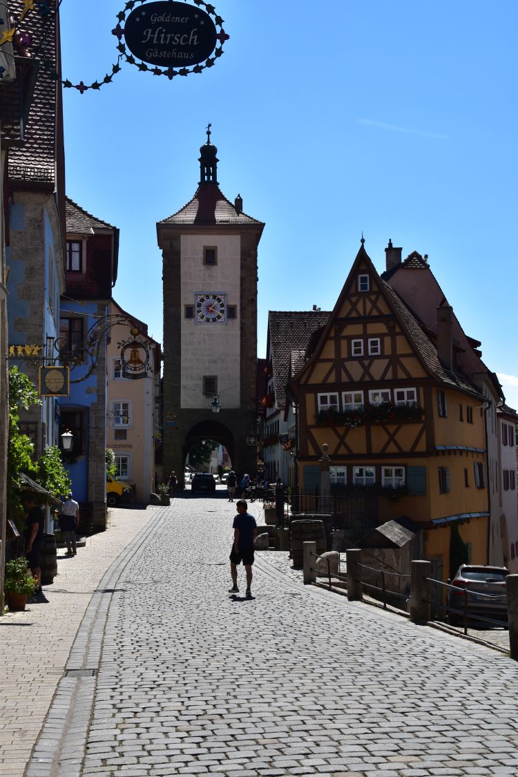
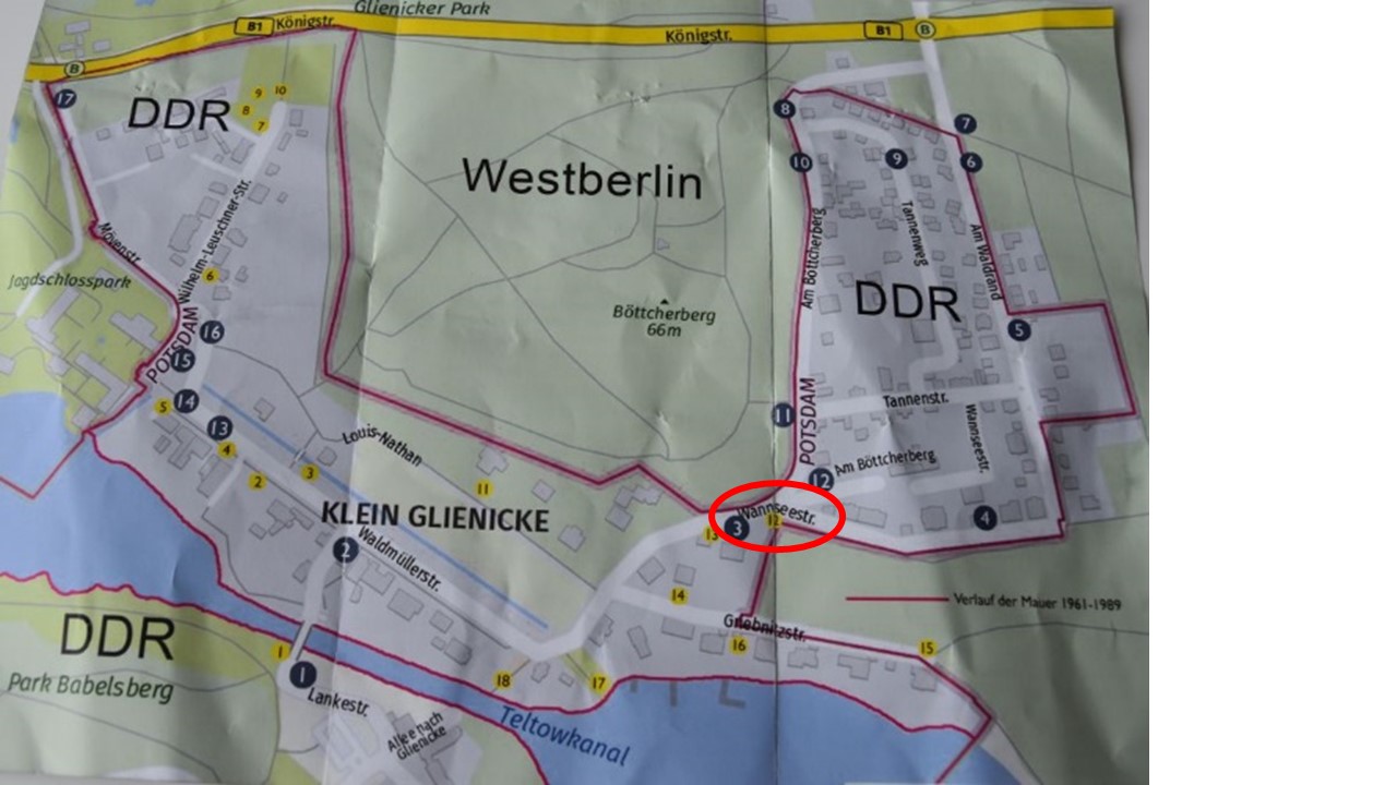
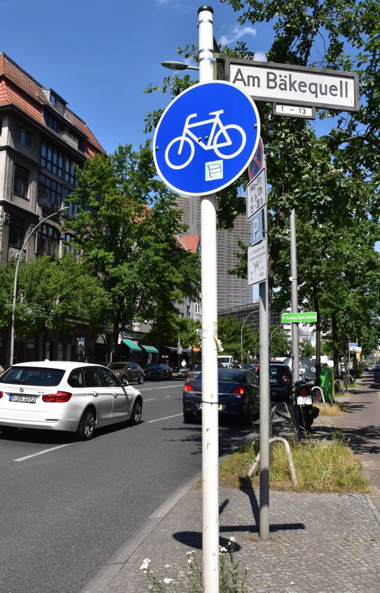
In November 2021, I make two stop overs. The first one was at Frankfurt. Now I visit Bonn, the former German capital and, on the way, I have lunch at Limburg with the beautiful cathedral. 


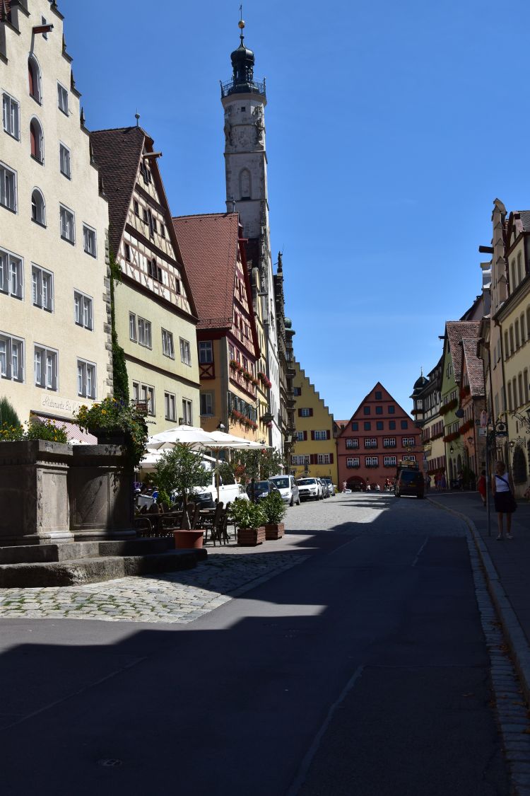
Lunch break at Limburg with the Limburg Cathedral

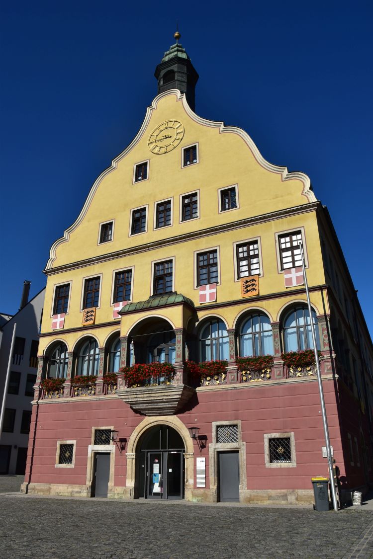
On the way from Frankfurt to Bonn, I have my lunch break at Limburg to see the cathedral. I am surprised to find such a colourful façade. 

I was here in summer 1965, at the age of 14 years, with my mother. I remember the cathedral to be grey, as on this postcard that I bought at that time.  

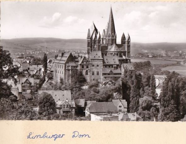
57 years ago, I pasted this postcard into my photo album adding the description “Limburger Dom”. 

I am puzzled. Now, in 2021, I do not recognize the cathedral at all. It was grey, and now it is colourful. From the wikipedia entry about the Limburg Cathedral, I learn why: “Between 1968 and 1972, the polychrome exterior was restored, using remains of the colour from the period before 1872 in order to reconstruct the old patterns”. Now I understand: In 1872, the medieval colours of the cathedral had been removed. The cathedral became grey, as I saw it in 1965. Three years later, in 1968, the medieval colours were restored to what they were before 1872. And this is why, I now find such a colourful cathedral.

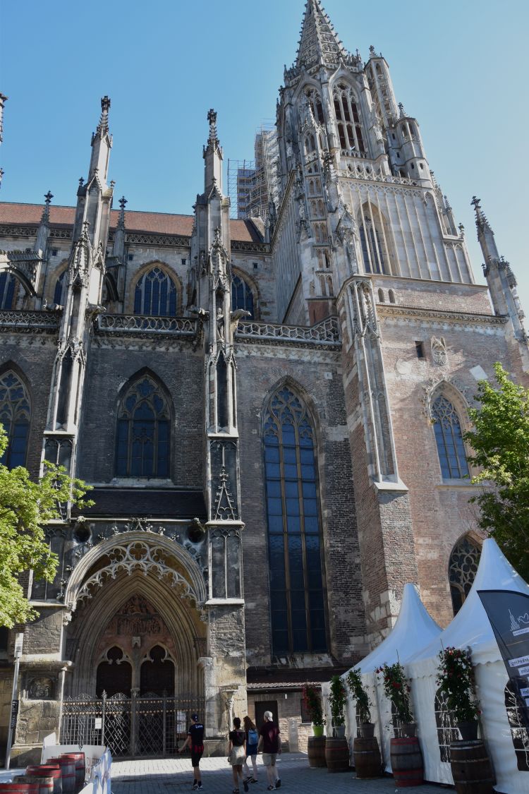
From outside, the cathedral with its seven towers has a Romanesque appearance. Inside, I recognize early Gothic elements.  

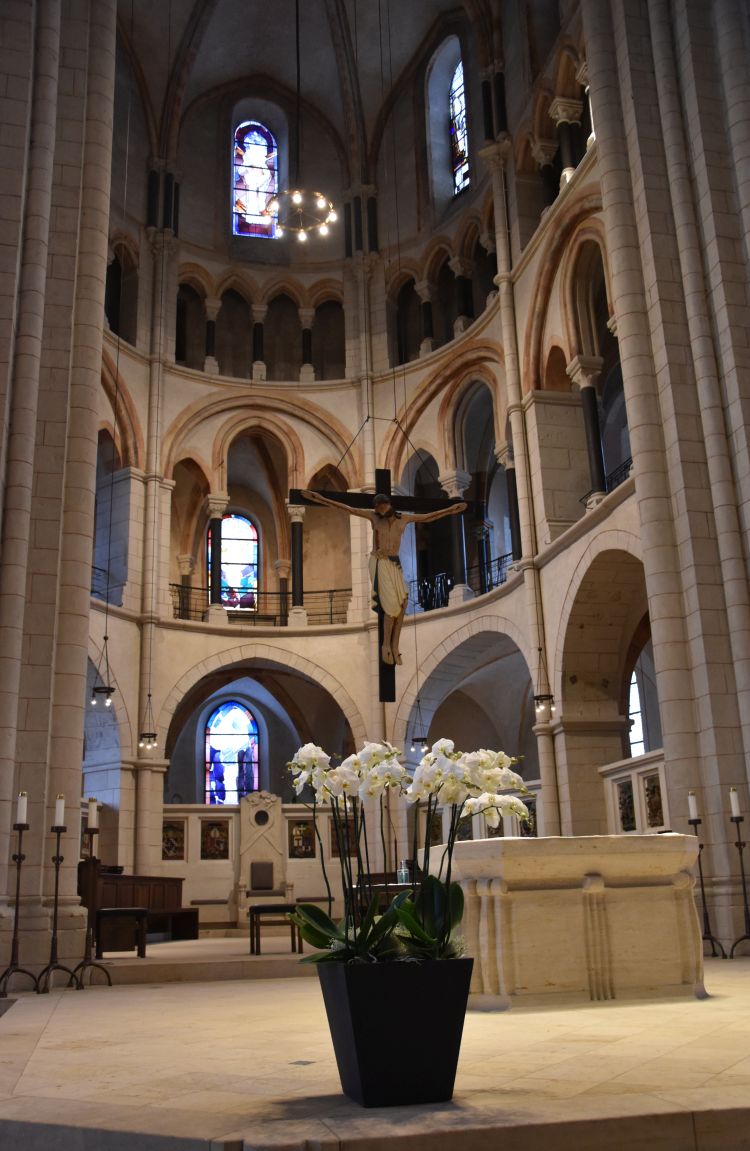
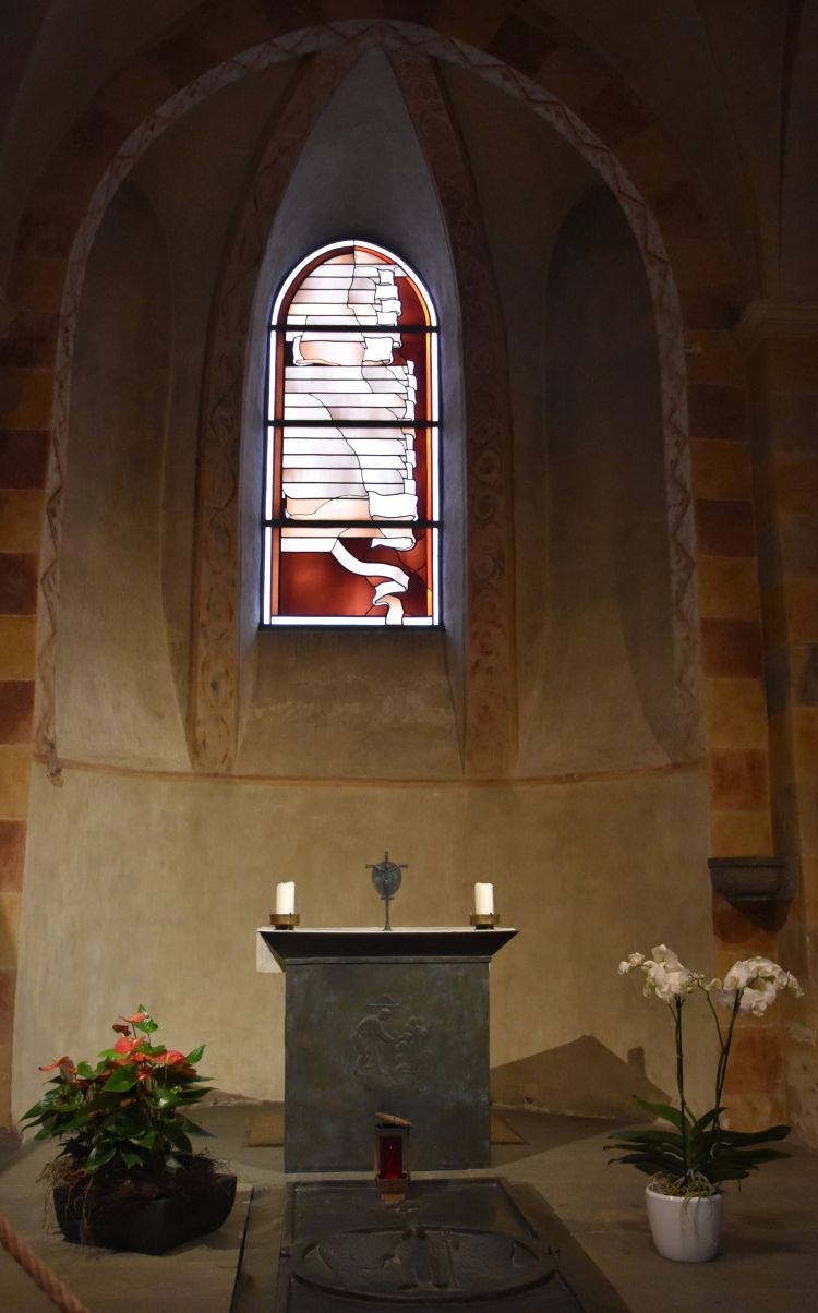
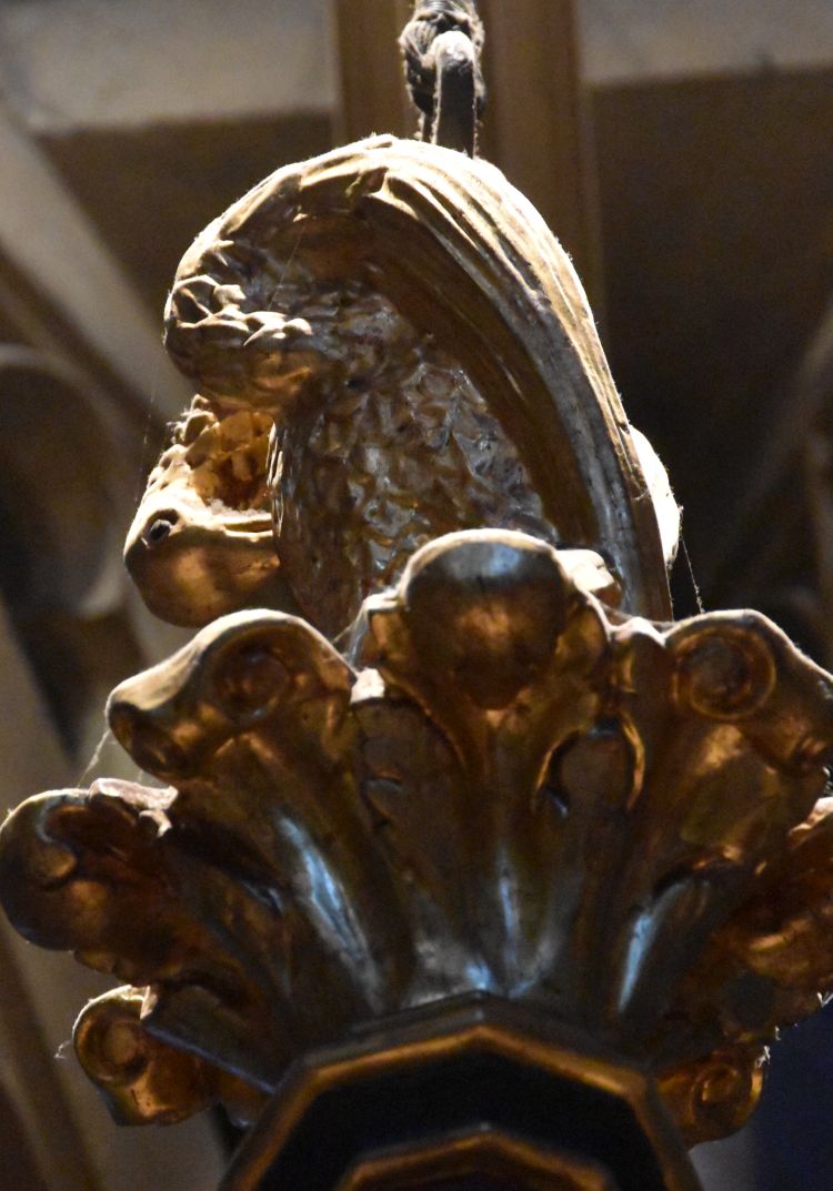
The cross above the altar is the copy of the “Crucifix of Walsdorf” from the 13th century. The original is in the museum of Wiesbaden. The former rood screen (Lettner) separates the ambulatory from the choir (Der Dom Limburg an der Lahn, p.13). The modern windows that we see in the choir have been made by Hubert Spierling (Der Dom Limburg an der Lahn, p. 18). 

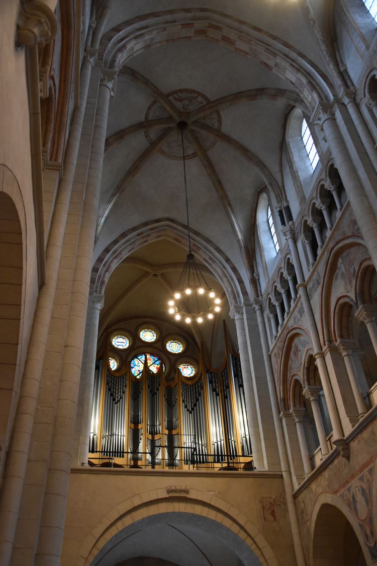
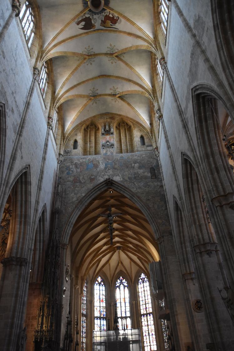
Building the present cathedral started at the end of the 12th century, in Romanesque style. While progressing with the construction of the cathedral, more  and more early Gothic elements were used. The Gothic appearance is reflected by elements such as the triforiums…

… or the vaults. 

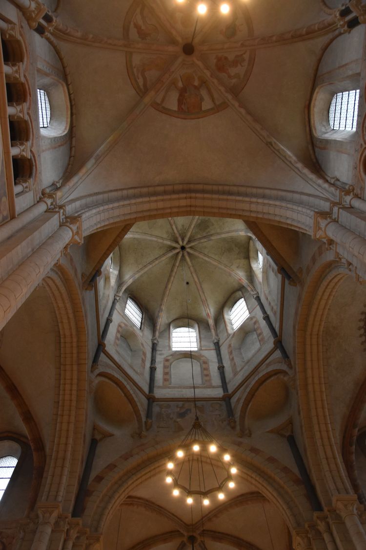
I look up into the cupolas. There is the fresco of the archangels Gabriel and Michael – if I understand correctly they are of Gothic origin.

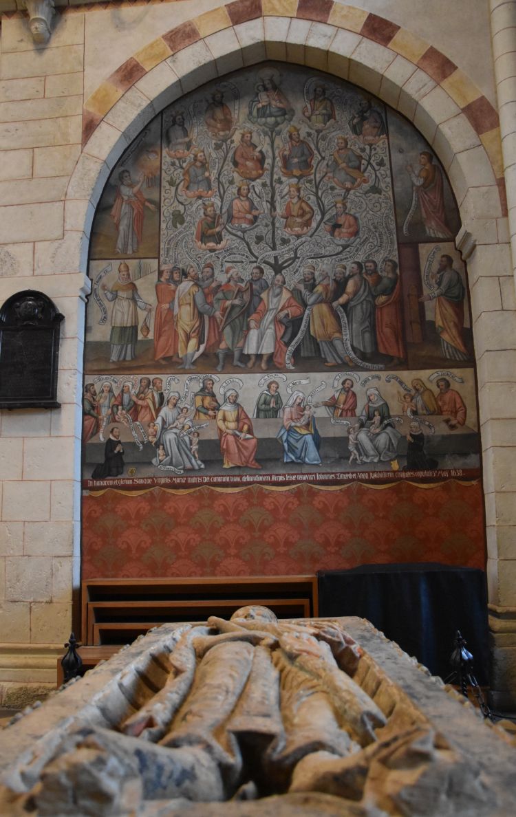
Konrad Kurzbold died in 948. This is his tomb slab from the 13th century. He is venerated in the cathedral, because he is considered to be the founder of the original church built here and devoted to Saint George.

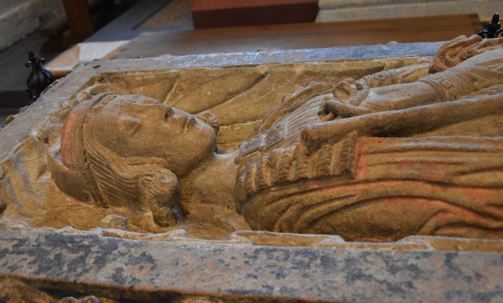
Around his tomb slab are guards such as this figure reading… 

… or the dog (I am pretty sure, this is a dog).

Behind Konrad’s tomb slab is the fresco with the roots of Jesus. It is from the year 1638 (Der Dom Limburg an der Lahn, p.15).

Also from the 17th century are the Hortus Deliciarum,…

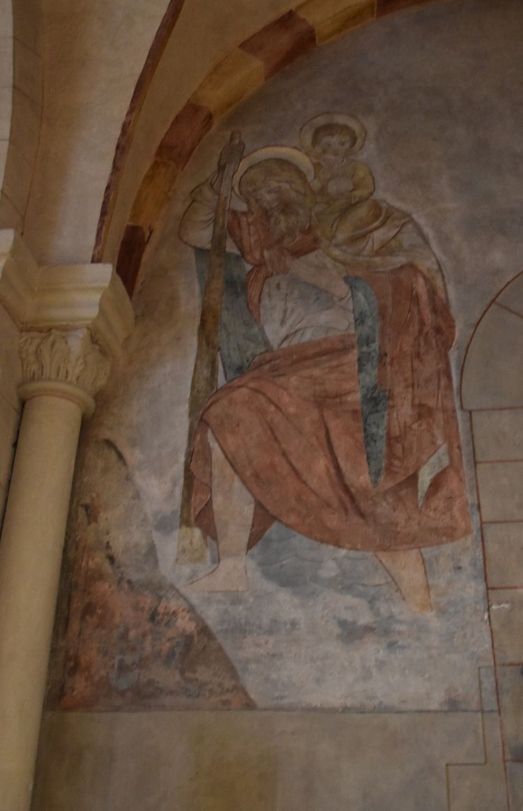
… Christophoros (repainted in 1935),…

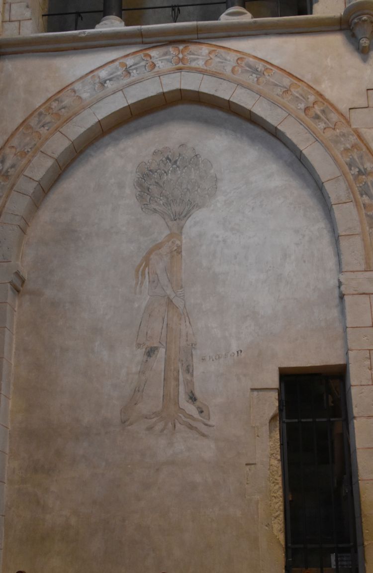
… and Samsung, pulling out a tree (Der Dom Limburg an der Lahn, p.12).

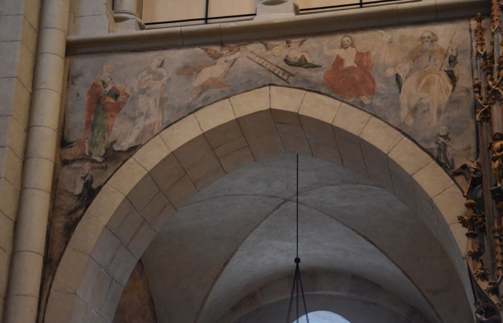
There are some frescoes from the early 13th and some from the 15th century. As an example, I take Christ at the tree of life from the 13th century (Der Dom Limburg an der Lahn, p.20). 

I like the play of light of this modern window with the plain and solemn altar, perfectly adorned with flowers that match the colours of the window. I cannot find out who the artists were.

I leave the cathedral and look back at it once more admiring the colourful façade.

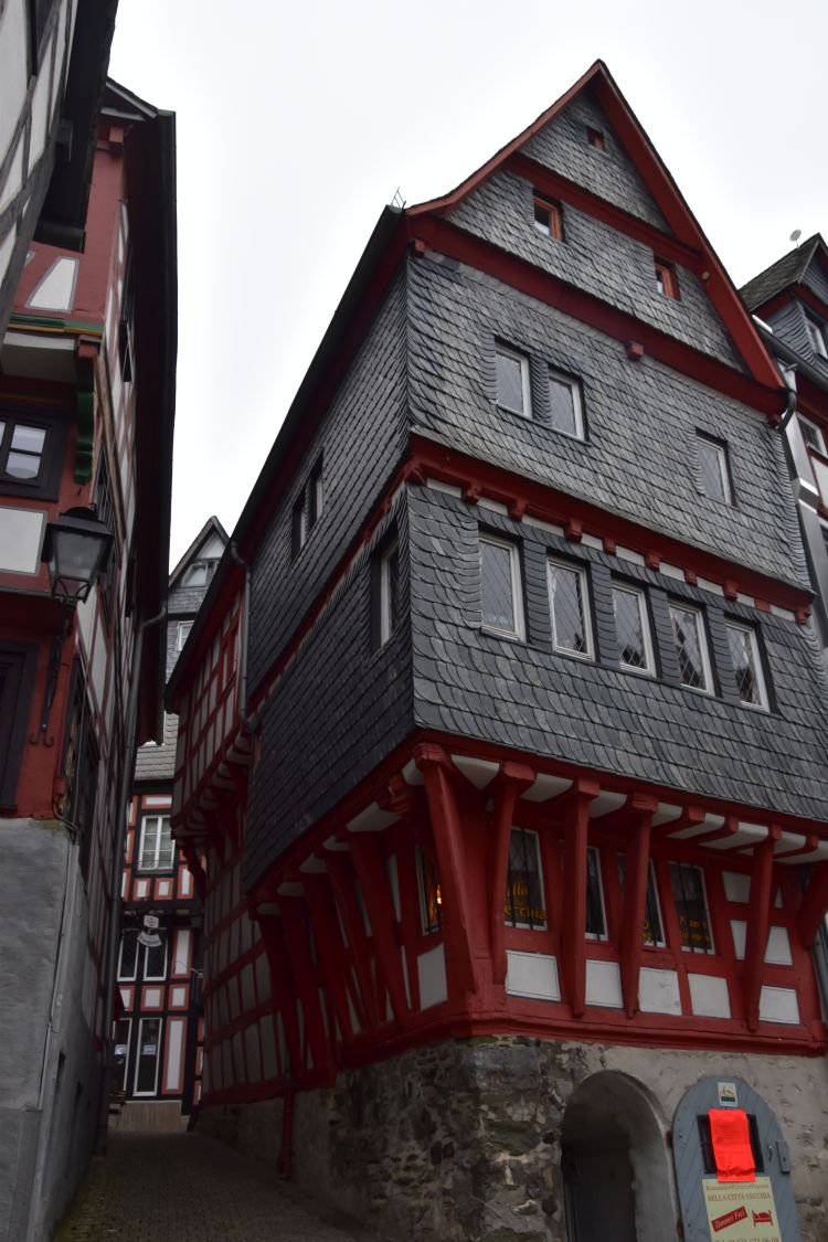
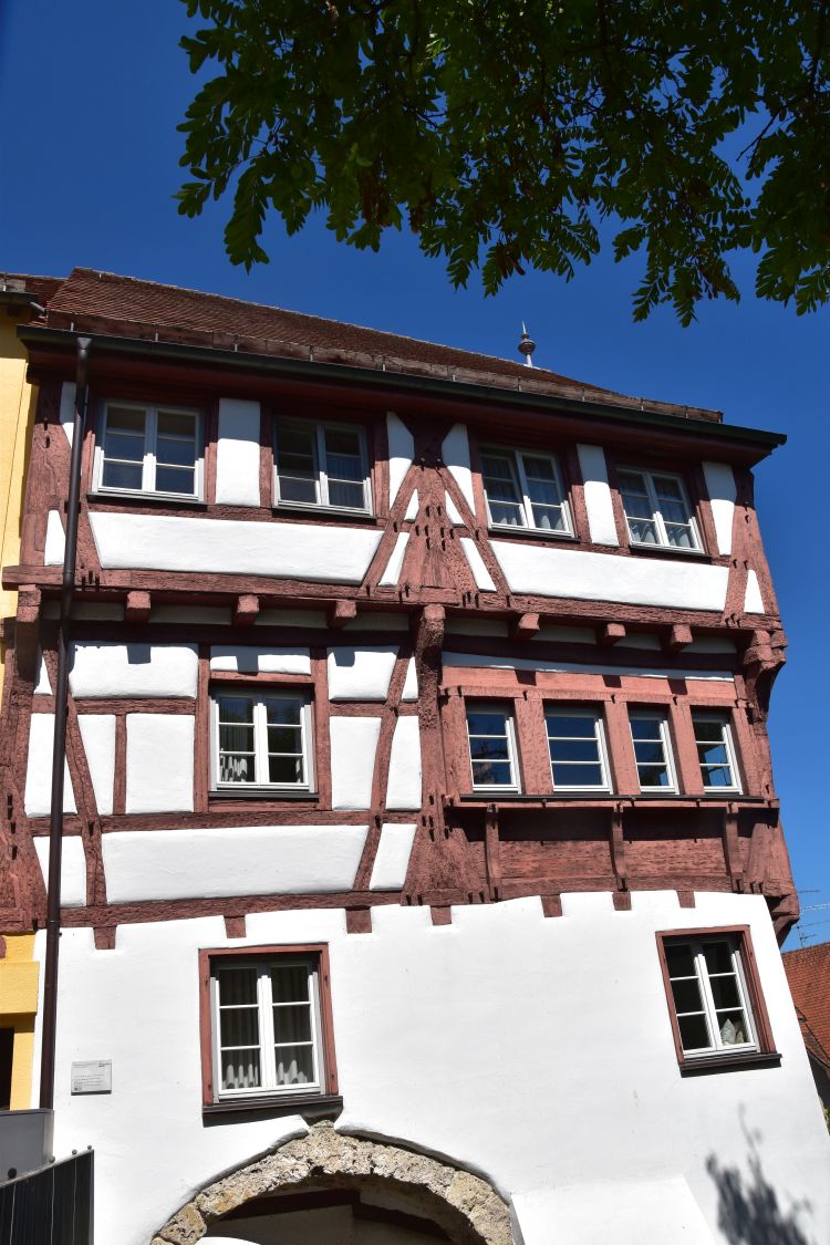
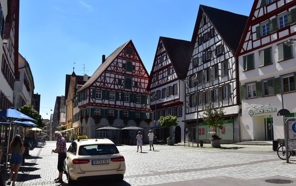
The cathedral is located on a rock above the Lahn river. I take the steep streets of Limburg to get down…

… taking with me some impressions of the medieval timbered houses.

I pick up my car, return to the highway and continue north to Bonn.


Arriving at Bonn to meet my cousin and his wife

My cousin Peter and his wife live near Bonn. I settle in my hotel and visit them in their house. I am invited for an excellent dinner.

We study our family trees. On my mother’s side, my grand-mother and his grand-father were cousins, as I understand. Furthermore one great-grand-aunt of my mother married the great-grand-father of my father. Hence we are “distant” cousins and we are cousins “twice”. It was in the unfortunate 1930’s that our grand-aunt Helene studied our family tree back to the year 1300. She took much care of her relatives – among them my cousin and me. We met at a family event and stayed in loose contact thereafter.

The next day, my cousin and I take the suburban train to Bonn. Without my cousin, I would have never had the idea to visit Bonn.


Bonn – the former seat of the elector and the former capital of the German Republic

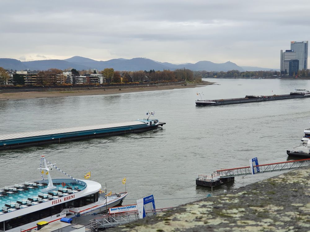
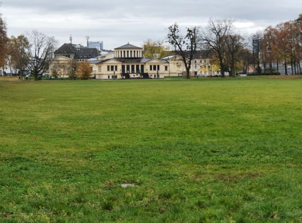
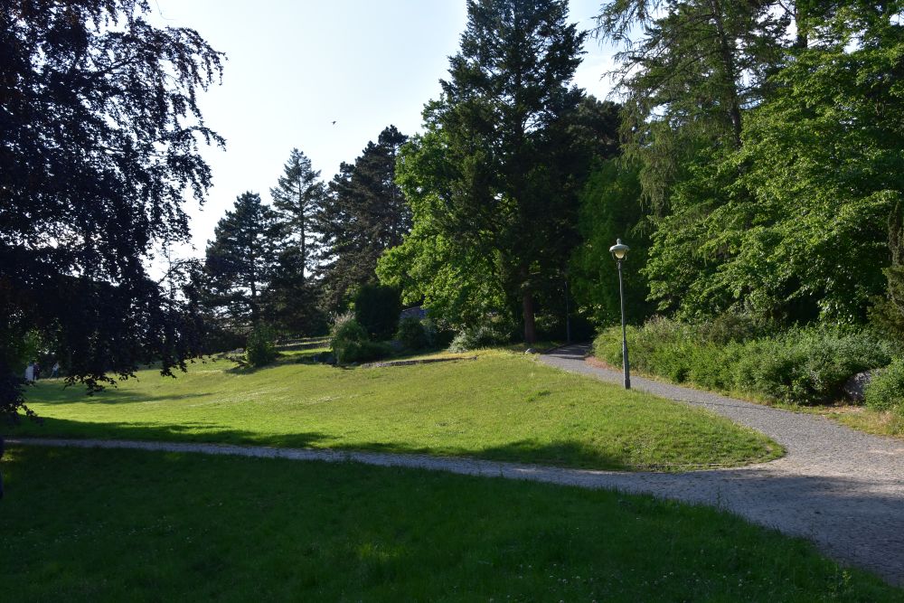
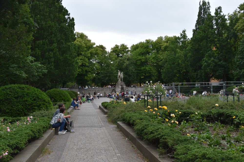
We start our visit on the left shore of the Rhine, at the “Alter Zoll” or bastion, the only part that remains of the former ramparts of Bonn. In the background we can see the Siebengebirge, a great recreation area for the citizens of Bonn.

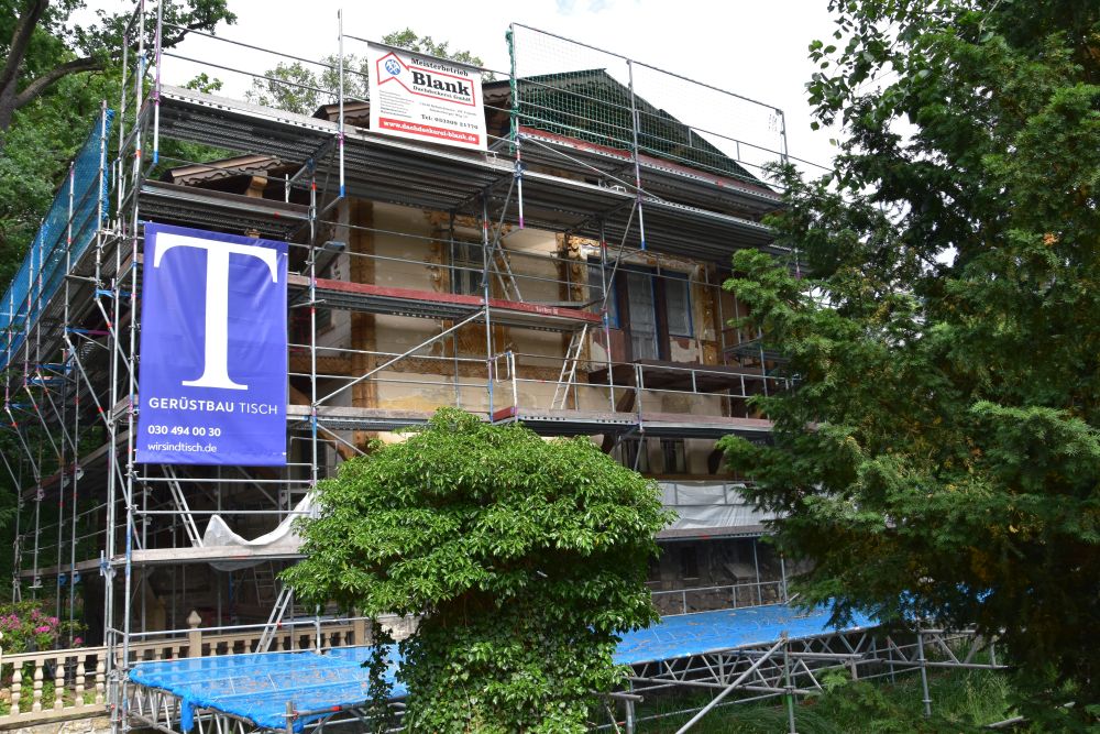
In the 13th century, the electors of Cologne (Köln) chose Bonn to be one of their seats. They built this magnificent electoral palace of Bonn; it is now part of Bonn’s university. 

Currently it is under renovation. The white tents and the construction barriers create an uncomfortable atmosphere, especially, when it is raining as it does today. I will have to return to see the palace, when the renovation has been completed.

The palace garden (Hofgarten) is a green meadow. The Academic Art Museum (Akademisches Kunstmuseum) presents Roman and Greek statues. It has been constructed by the Neoclassical Berlin architect Karl Friedrich Schinkel; I have come across more of Schinkel’s works at Berlin. 


There are many world-class museums at Bonn; there is even a “Museumsmeile”. However, today, I want to explore the city. 

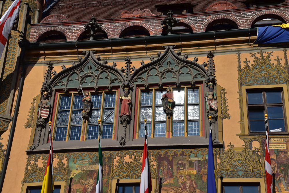
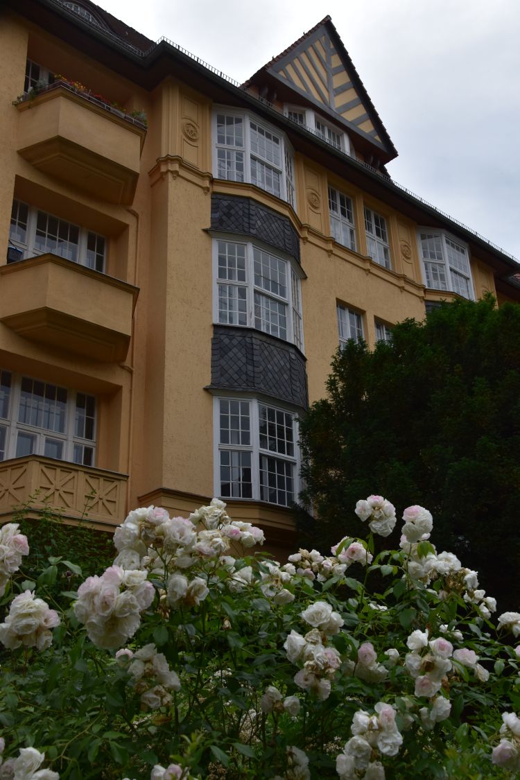
The Old Town Hall was built in Rococo style in the 18th century. It shines in pink and is decorated with gold. The last renovation took place between 2010 and 2011.

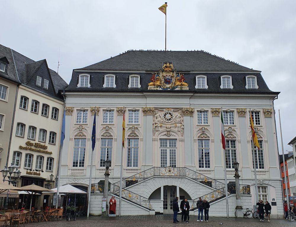
Various important persons stood on the gilded stairs, among them Charles de Gaulle, John F. Kennedy, and Mikhail Gorbachev.


The Minster of Bonn (Bonner Münster)

The Minster of Bonn (Bonner Münster) is nearby. The original church was devoted to the legendary Roman legionnaires Cassius and Florentius (both martyrs of the Theban Legion – like Mauritius who is famous in Switzerland). Building the minster started in the eleventh  century, in Romanesque style. Construction lasted until the middle of the 13th century, in early Gothic style. In 2017, the church was closed for total renovation. While the renovation is still going on, the church has just been reopened in October 2021.

In the nave, the lower arches are still Romanesque, the upper arches and the vaults are Gothic.

The representatives have ventured to combine modern art with the traditional Romanesque-Gothic architecture: Five modern artists present their works to underline the idea of “light and transparency” (see “Weiter Raum: Bonner Münster wagt Begegnung mit moderner Kunst“). 

I like the atmosphere created by the combination of modern and traditional art – a pity that the exhibition of the modern works will end in January 2022. 

I recognize him, this is Nepomuk (1345-1393), the priest that denied to tell king Wenceslaus IV of Bohemia  about the confessions of his wife, the queen, and that was sentenced and thrown into the Vltava (Moldau). He is present on so many bridges in Europe.

At the charming Romanesque cloister, we take a break from busy Bonn.

It is interesting to note that Emperor William II of Germany had his Kaiser Wilhelm Memorial Church in Berlin modelled after the Minster of Bonn.

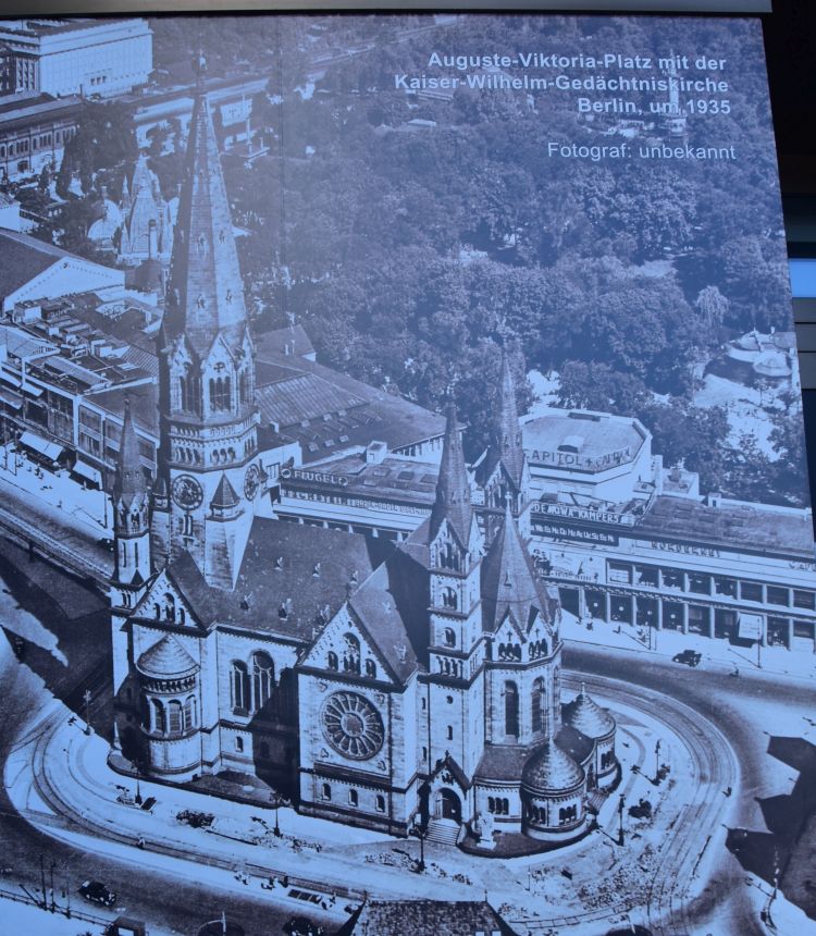
This photo of the Memorial Church at Berlin has been taken by me in 2019; I found it on a panel in the church museum. Today, the ruins of this church are a memorial and a modern church has been built around it.


Behind the train station, we say hello to the Neanderthal man who lived 40’000 years ago

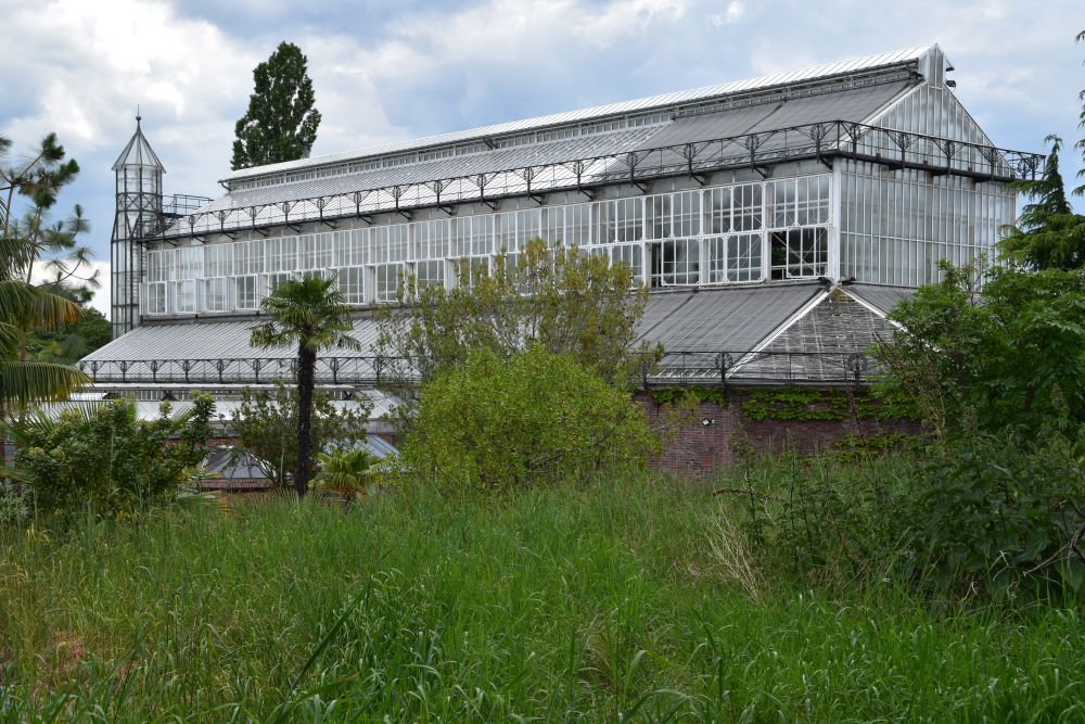
My cousin looks forward to showing me one gem of the museums of Bonn, the Rheinische Landesmuseum. Here, we say hello to our ancestor, the Neanderthal man (Neandertaler) who, 40’000 years ago, lived in the Neandertal and has resided in this museum since 1877.

The Neandertal was a beautiful canyon between Düsseldorf and Wuppertal (north of Bonn) that became a quarry in the 19th century. Workers detected some bones and threw them away. The owners of the quarry rescued 16 larger bones and handed them over to researchers who identified them as belonging to a stone-age hominid. Later, more bones were found in the area and three fragments complemented the bones found earlier by the workers – they complemented them exactly. The bones are in the glass case and a reconstruction of the Neanderthal man stands behind the bones. 

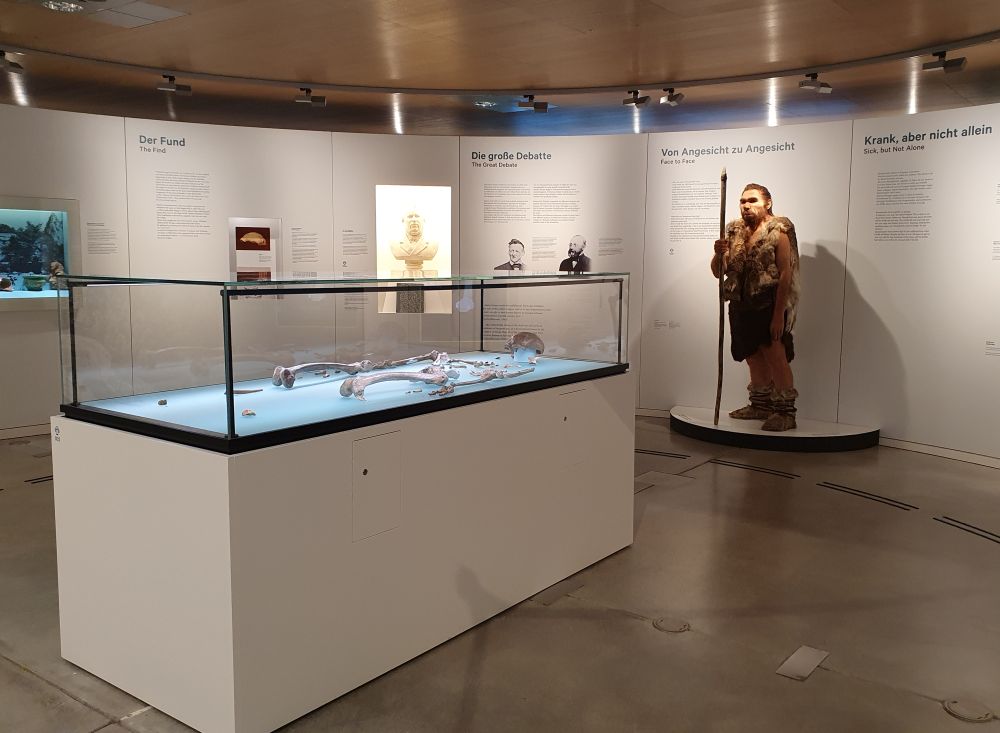
The Neanderthal man is being examined in a multidisciplinary project. DNA analysis shows that he has contributed about one to four percent to our genes, I read on the site of the Landesmuseum. 

The exhibition explains, how the Neanderthal man lived. One example is his ingenious way of gluing wood and flint to produce tools. He used birch pitch, as this sample demonstrates. 

We walk through the other departments that explain the history of the area, and we admire a lady teacher with her young pupils that listen with attention.

I want to come back to Bonn to explore more of its museums. Basel praises itself of being “the city of museums”, and now I have discovered a second such city, namely Bonn, with the Museumsmeile and many more museums. Beethoven was born at Bonn  in 1770, and also his house is a museum. 

We have lunch at the friendly Vietnamese restaurant Cay Tre in the city centre at Friedrichstrasse. In the evening, we share an excellent dinner at the Golf Club restaurant of Sankt Augustin.  Bonn is a somewhat hidden gem in Germany. 


Good-bye Bonn 

In the morning I enjoy the well prepared breakfast at my hotel, laughing with the napkin under my plate. 

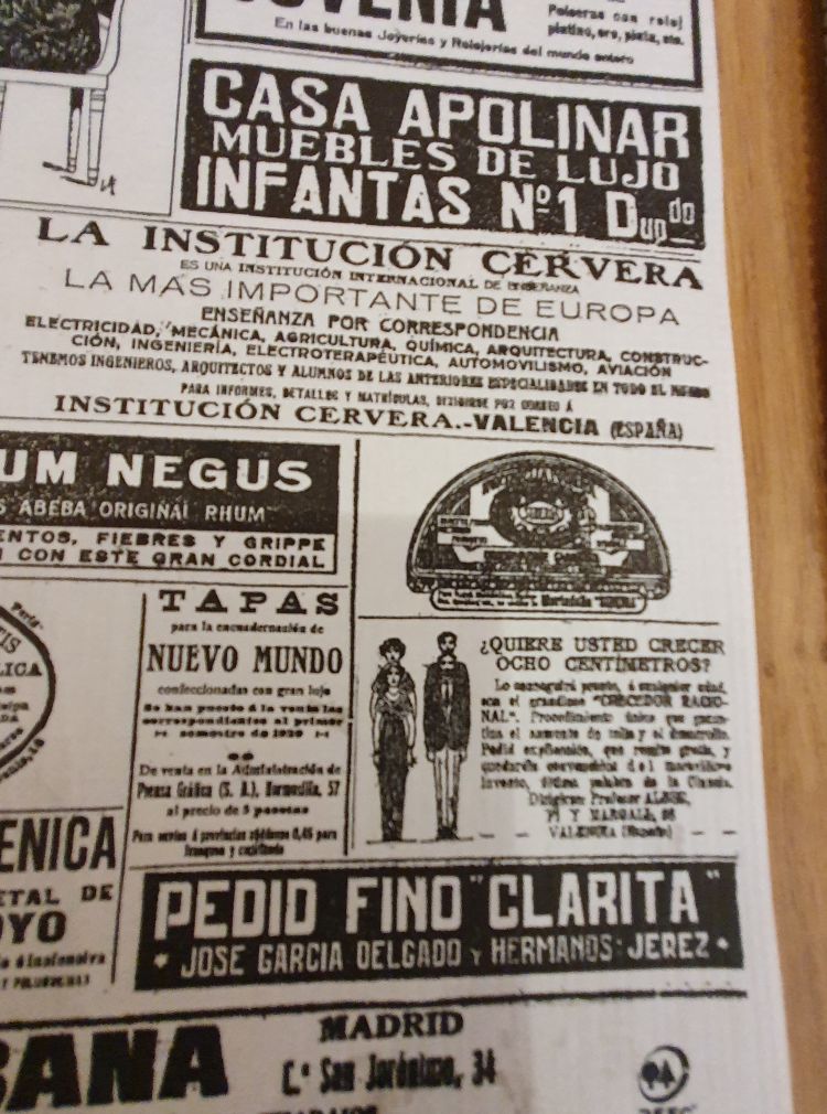
In the right hand lower corner I find the announcement “¿Quiere Usted crecer ocho centimetros? – … con el grandioso  CRECEDOR RACIONAL… quedará convencido del maravilloso invento, última palabra de la ciencia.” (Do you want to grow by eight centimetres? … with the great RATIONAL GROWER… you will remain convinced of the wonderful invention, the last word of science). The product is sold in Buenos Aires, Entre Rios 130. Or it WAS sold there, may be, it no longer is. Anyway, I am not sure, whether this “CRECEDOR” would work for me… and then – eight centimetres is not really the full size of a head, is it? I love to study my napkin during breakfast.

Good-bye Bonn and good-bye Peter, I thank you and your wife for your hospitality.


On the way to Berlin with a short stop near Helmstedt

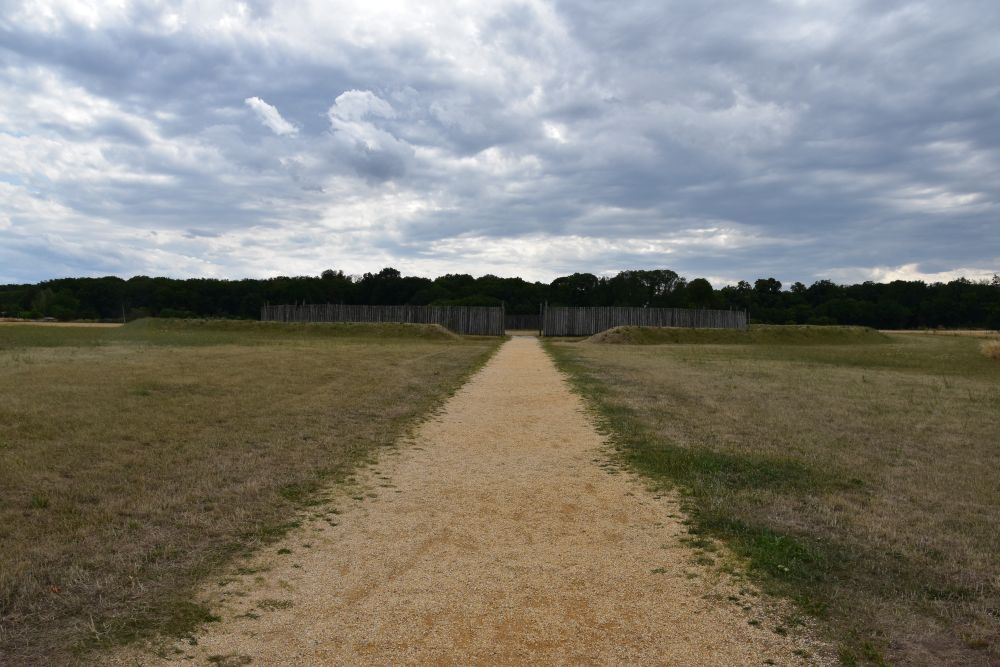
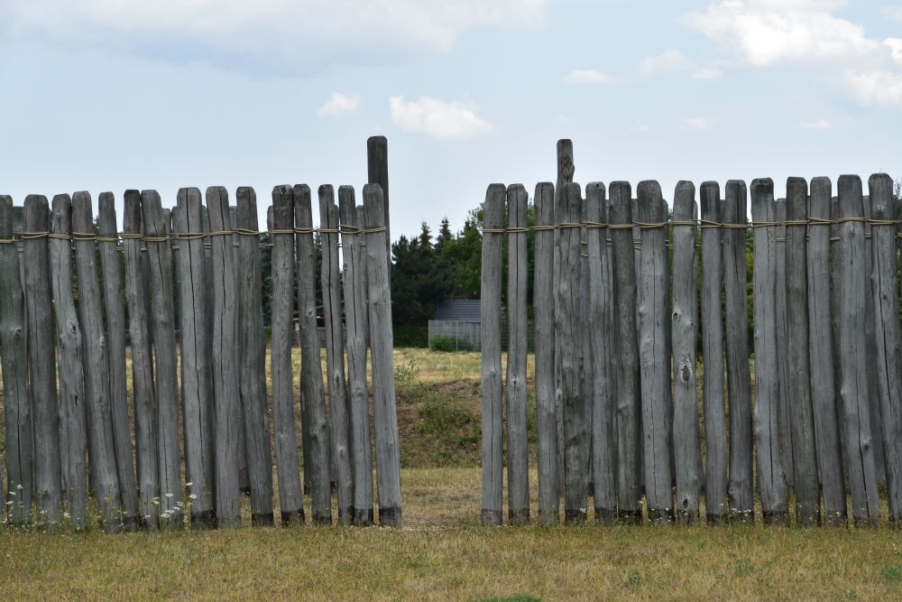
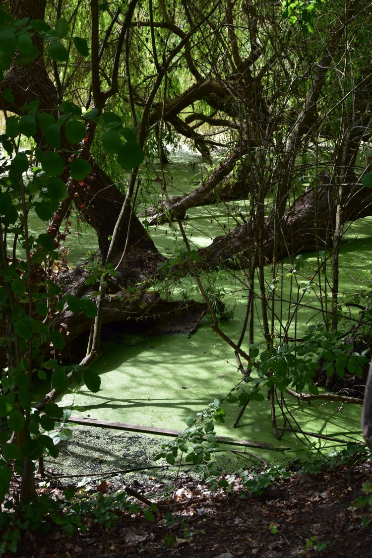
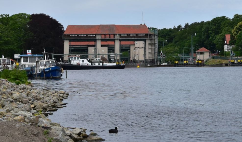
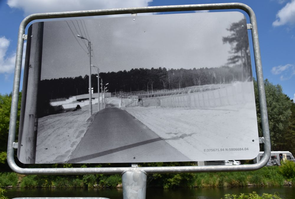
I leave the hotel and, on the highway, I reach the former inner German border near Helmstedt (ehemalige innerdeutsche Grenze 1945-1990). 

Then, in November 2021, I thought, such borders have disappeared completely, and I could not imagine that they have ever existed.

Now, it is March 2022, and, while writing my blog, I look at this photo with deep concern. Let us hope that these times do not return!


Sources:

Frankfurt – an old family friend is my guide

A long-year family friend at Frankfurt and a cousin at Bonn are both in their eighties. I want to visit them on my way to Berlin, mid-November 2021.

My first stop is at Frankfurt, the business capital of Germany on the Main river.

At Frankfurt, I have been invited by Dietrich and his wife. Our grand-parents were friends, after that our mothers were very close friends and now we, the grand-children, are friends. We are long-year family friends.

A hundred years ago, Dietrich’s grand-father had acquired some paintings of my grand-father-artist Hermann Radzig-Radzyk, for instance the Kirchberg at Schreiberhau, now Szklarska Poręba, in Silesia…

… and the valley at the county of Kłodsko (Glätzisches Land), also in Silesia.

Immediately, I feel at home in the house of Dietrich and his wife. I am surrounded by memories of my family, and the welcome is hearty.


Charming small Italian restaurant run by two sisters from Naples

We have dinner at the charming small Pizzeria La Paesana, run by two sisters from Naples. Their nephew made the pretty felt pizzaiolo that now decorates the pizzeria of his aunts. Well, the pizzaiolo has lost one eye – that makes him look even friendlier – he seems to twinkle at me.

The small restaurant is an excellent welcome to Frankfurt. I have tasty wild boar noodles with a slightly sparkling Lambrusco, my friends have pasta Carlo Magno with Gorgonzola – it is said that Charlemagne (Karl der Grosse or Carlo Magno) loved Gorgonzola, the sisters tell us. That was around the year 800 AD – what a cheese tradition! 
(According to the wiki entry about Gorgonzola, it is said that Gorgonzola was first produced in 879; but this could well have happened a little earlier, when Charlemagne lived, and if not, it is a nice legend).

We will meet Charlemagne later again in the city centre of Frankfurt. 


My first impression of the city – Hauptwache (main guardroom) and skyscrapers touching the morning clouds

Dietrich takes me to the S-Bahn. We leave the underground station at the Hauptwache (main guardroom). Saint Catherine’s Church appears behind the stairs. 

The baroque guardroom, built in 1730, was the headquarter of the city’s soldiers. It was also a prison. It was destroyed in the Second World War and reconstructed thereafter. 

The Hauptwache is surrounded by modern buildings, with the Commerzbank building fading in the mist of the late morning. 


The lifeline of Frankfurt am Main – the river Main

The lifeline of Frankfurt is the Main river. We approach it near the pedestrian bridge “Eiserner Steg” with the inscription in Greek saying “the sea has the colour of wine and, on this sea, we are sailing to meet other people” (auf weinfarbenem Meer segelnd zu anderen Menschen).

From here we can see the Commerzbank building again, now under blue sky in the sun, surrounded by many more modern buildings reflecting in the Main river . 

This is the Cathedral Saint Bartholomew, also reflecting in the Main river.

Across the Eiserner Steg we reach the urban district Sachsenhausen. We stroll along the waterside promenade and meet these two ducks, also citizens of Frankfurt, sleeping comfortably on one leg. 

The skyline, again with the Commerzbank tower, appears behind the island (Maininsel) that shines in golden autumn colours. 

Returning to the city centre using the Old Bridge (Alte Brücke), I make a photo of both the modern business skyline and the Gothic Cathedral of Saint Barthomolew. 

Frankfurt has charm, definitively, when seen from their lifeline, the Main river. 


Timbered houses at the Römerberg and the Old St Nicholas Church (Alte Nikolaikirche)

Away from the Main river, the old city centre is located on the Römerberg. It is bordered by timbered houses and the Old St Nicholas Church. 

We enter the Römerberg square under the banner that plays with German words: “Vieles geht besser, wenn die Maske jetzt sitzt” (translated literally: “much will “go” better, when the mask “sits” meaning”, when the mask fits – it is the times of COVID).  

On the Römerberg, the first fairs took place in the 11th century. Frederic the Second of Hohenstaufen granted the right to run fairs to Frankfurt in 1240. 

It is mid November, time to set up the Christmas tree in front of the old town hall. 

This is not the Standesamt (civil registry office), but the Standesämtchen. The ending “chen” combined with “ä” indicates that it is the “small” registry office which, in Southern Germany, adds a friendly and welcoming touch to it. Actually it is not a small civil registry office, but a restaurant that carries the name “Standesämtchen”. 

Modernity and tradition are joining. The Old St Nicholas Church reflects in the glass wall of the Evangelische Akademie (education institution and conference house). 

As a matter of fact, Frankfurt has been in ruins after the Second World War. The houses around the Römerberg, originally from the 15/16th century, have been reconstructed in  the 80-ies, except the Wertheim building nearby that survived the air raids. 

The late Gothic Old Saint Nicholas Church from the 15th century only suffered minor damage by the bombs of the Second World War.  


The Cathedral St Barthomolew behind the Römer

From the Römerberg, we can see the Cathedral of St Barthomolew.  

The cathedral can be seen from the Main river, too. 

The cathedral is also called “Kaiserdom” (Emperor Cathedral). Actually, it is a “Königsdom”, because the kings of the Holy Roman Empire were elected here since 1152 and crowned since 1562, until the Holy Roman Empire ceased to exist. No “emperors” were crowned here, kings were crowned here. Furthermore, the cathedral has never been a bishop seat, though it is called “cathedral”.

The present Gothic cathedral is mainly from the 14th and 15th century, reconstructed in the 1950’s after having been severely damaged in 1944. 

The modern organ matches the gothic vaults. 

Reading about the cathedral at home, I would like to return to explore the collection of altars from all over Germany and the chapel, where the elections of the kings took place. 


New Old City (neue Altstadt), reconstructed based on the medieval ground plans

Between the Römerberg and the cathedral of St Bartholomew, the old city has been rebuilt along the medieval ground plans – this is now called “neue Altstadt” or “New Old City”.

The area is not without charm. However, to me, the houses look a bit, as if they had been cut out of cardboard. 

They are neither really old nor really modern. 


Kaiserpfalz – meeting Charlemagne again, the emperor who enjoyed the Gorgonzola cheese

Here, he is again, Charlemagne who is said to have loved the Gorgonzola cheese. In a way, he is the founder of Frankfurt. That is why, I assume, he stands on the old bridge crossing the Main river. He looks downstream, severely frowning.

In 794, it was Charlemagne who was the first person to mention Frankfurt or “Franconofurd”. At that time, he held a synod of bishops and an imperial assembly here. 

Charlemagne was at Frankfurt in 794. However, later he probably never returned to Frankfurt. It is assumed that his grand-son, Louis the German, founded the first cathedral and made Frankfurt an important royal palatinate. The ruins of the palatinate are presented in the New Old City.

This is, what the royal palatinate (Königspfalz) might have looked like in the 9th century. 

The painting is on display in the museum.


Church St. Leonhard

The Church St Leonhard is bordering the Main river. The beginnings go back to the early 13th century, and the Romanesque structures have been largely preserved. In 1323, the church acquired a relic of Saint Leonhard which made it an important pilgrimage site. 

In the early 15th century, the choir was reconstructed in Gothic style while the Romanesque apses remained in place. Around 1500, the nave was enlarged.

The Gothic main altar was acquired around 1850. The middle part is from Swabian Bavaria. The predella is supposed to have been crafted at Memmingen in the late 15th century; it shows the martyrium of Ursula. The two candle holders are Baroque angels from 1614.

Late Gothic frescoes decorate the walls of the choir, to the left the Annunciation scene, to the right Christ carrying the cross. Some of the stain glass windows in the choir are from the 15th century. 

The altar of Marie comes from Antwerpen (about 1480). The centre part is dedicated to Marie (her death, her ascension, her coronation). The predella shows the Last Supper.

In 1944, the Church Saint Nicholas was only moderately damaged; sister Margarita prevented a devastating fire. Between 2011 and 2019 the church was completely renovated.

Reading the booklet acquired in the Church of St. Nicholas, I understand, there is more to see in this church, I would like to come back.


Goethe was born at Frankfurt

In this large, yellow house at the Grosser Hirschgraben, Goethe was born (1749-1832) . He lived in Frankfurt, until he left to study law at Leipzig in 1765.

Well, the yellow house was destroyed in 1944, and it was reconstructed after the war, exactly as it was before. 

Next door is the Frankfurter Goethehaus (House of Goethe) with the Deutsches Romantikmuseum (German museum of Romanticism). I liked the highly modern oriel interpretation. 

Again next door is the Volksbühne, a theatre, with two more modern oriels swinging along the façade.  


Town Hall and Local Court (Ortsgericht)

From the Goethe House we cross the busy Berlinerstrasse and reach the Local Court of Frankfurt (Ortsgericht), … 

… leaving it through the gate with the fresco showing the wine harvest. 

We now look at the rear side of the town hall, …

… with the town hall tower seen from under the Seufzerbrücke (Bridge of Sighs, a skywalk) at Bethmannstrasse. 


St Paul’s Church (Paulskirche)

Behind us, we can see the oval shaped classicist Saint Paul’s Church, completed in 1833. In 1848, the first German national assembly was held in Saint Paul’s Church. However, the attempt to found the German nation failed, as the Prussian king did not accept the emperor crown to reign over all German states. Nevertheless, the constitution elaborated by the assembly was accepted by most German states; it can be considered to be the roots of the German democracy (see Stadtführer, p. 38). 

The building was reconstructed after 1945 to become a national memorial. This is the new cupola seen from inside.

A monumental frieze makes the representatives of the 1848 assembly revive.


Sight seeing makes hungry – the Kleinmarkthalle (small market hall) is close

Around lunch time, I am usually hungry. We make a “pitch stop” at the Kleinmarkthalle (small market hall) near the city centre. 

We climb up the stairs to get an overview from the gallery.

We walk around and enjoy the stands with enticing pasta,…

… apple wine (called Ebbelwei here), …

… meat offered by a citizen of Frankfurt that is obviously from Turkish origin (I love to see the mixture of nations here),…

… beautifully arranged fish… and much more.

We join the waiting queue at Dietrich’s favourite sausage stand of Ilse Schreiber, where we buy two sausages from Hessen (the state that Frankfurt belongs to). We have to eat our sausages outside, because inside the building we have to wear masks, outside, we can take them off, which is much more convenient for eating sausages. 


Good-bye Dietrich, now I am heading north to Bonn, with a stop over on the Grosser Feldberg

Thank you, Dietrich, I have spent two wonderful days with you and your wife. I have learnt much about Frankfurt, and there is more to see in Frankfurt with its museums, with the modern business centres, with the carefully preserved or reconstructed medieval sights and with its lifeline, the Main river.

Now I am heading north to Bonn.

In the mist, I start driving to the Taunus mountains north of Frankfurt. My car climbs and climbs, and eventually, I am above the clouds. I stop on the local mountain of Frankfurt that is called Grosser Feldberg. I am on almost 900m. The view is superb. 

The Brunhildi’s rock (to the right of my shadow) is mentioned in a document of 1043. 

The rock is said to have been the “lectulus of Brunhilde” or “the little bed of Brunhilde”. Saint Hildegard of Bingen has spent one night here, and the rock has kept the imprint of her head, as legends tell. Around 1800, the rock was reinterpreted as the place, where Brunhilde was sleeping, until Siegfried liberated her. The rock became part of the German legend of Nibelungen. This is, what the panel near this peculiar rock says. 

I continue north – it is about two hours to drive to Bonn. On the way, I will have another stop at Limburg. 


Sources:

Berlin: The tour of seven lakes

In 2021, I visited my mother town Berlin four times. I very much enjoyed the tour of seven lakes starting at the Wannsee peer. It reawakened memories of sixty years ago. 

At the Wannsee peer we buy tickets from Reederei Werner Triebler. 

The captain will give us detailed information, while gliding along the lakes and channels. He asks for a tip in the “Quassel-Kasse” (palavering cash box).

Do not take the disinfectant bottle with you! Well, times are very special now, with Covid. 

With us travels this lovely butterfly – perhaps not the whole tour. 

This is the route of the “7 Seenrundfahrt” starting at the Grosser Wannsee, continuing to Jungfernsee, Glienicker Lake, Griebnitzsee, Stölpchensee, Pohlesee, kleiner Wannsee and at the end returning to the Grosser Wannsee.  

Source: Google maps and my additions

We start on the Grosser Wannsee, …

… looking back at the famous Strandbad (lido) Wannsee. In my heart I hear the 1951 song of Conny Froboess: “Pack die Badehose ein, nimm Dein kleines Schwesterlein und dann nüscht wie raus nach Wannsee” (pack your bathing trunk, take your little sister and after that it is time to go to the Wannsee).

Now, in September, the Wannsee beach is empty.

The villa of the Wannsee Conference “glides” by. 

Sailing boats in the sun. The Grunewald Tower, another bombastic oeuvre of Emperor William II, appears above the trees in the background. 

We pass by the Pfaueninsel with its small castle.

After that we see the protestant Heilandskirche (Church of the Redeemer) of Sacrow, built in Neo-Romanesque-Lombardian style in 1844.

Until 1989, Sacrow was part of the GDR; with my mother, I looked at Sacrow from the Pfaueninsel in 1966 and I remember the barbwire in the water that prevented us from getting there. My mother wrote in her 1966 diary: “(Across from the Pfaueninsel) is Sacrow on  the western shore (of the Havel) in the East Zone. I have often been at Sacrow.” The barbwires were a nightmare that, today, I cannot believe was once reality. 

The memories of the nightmare continue at the Glienickerbrücke (Glienicke bridge). The border between Brandenburg (formerly GDR) and Berlin (formerly West-Berlin) is in the middle of this bridge. Until 1989, the “west” ended east of this bridge. Still today, the Berlin part of the bridge is darker than the Brandenburg part. Across this bridge, agents were exchanged between the GDR and the BRD. 

In 1966, my grand uncle Ferdinand drove my mother and me to the Glienickebrücke, then closed and separating the GDR and West-Berlin.

My mother wrote in her diary: “Now I stand in front of this bridge that I had crossed so often. On this side of the Havel river, there is a policeman of West Berlin. He is allowed to go up to the middle of the bridge. On the other side of the Havel is the (eastern) Volkspolizei (member of the People’s Police). It is most distressing to look at the barricades on the other (eastern) waterfront of the Havel. Barbwire spirals reach into the water and cover the whole bank, up to the level of the bridgehead. In the water, there are buoys that mark the “border”. On the other (eastern) side, we cannot see one single person. All seems “icily calm”. On this (western) side of the Bridge of Unity (as they called it in the GDR), …, there is a considerable amount of people, even on this early afternoon of a weekday, that look at this scenery without understanding. Below the bridge West Berlin ends and here is the last station of the Stern- und Kreissschiffahrt: Glienickerbrücke…”

Today, we do not stop at Glienickebrücke. The impassable border has disappeared. Our boat passes under the bridge and into the former GDR waters; the gloomy scenery of 1966 seems unthinkable.

The Babelsberg palace appears on the right hand side. Babelsberg is now the centre of the German film industry.

We continue to the Griebnitzsee and turn north, where the Teltow channel starts . This channel was opened in 1906, is about 40 km long, borders Kleinmachnow and ends south of Köpenick.  

In the Griebnitzsee we watch these rowers move synchronously – beautiful.

In 1966, I was also here with my mother. We had taken a boat going south from the Wannsee to the Griebnitzsee, as far as West Berlin reached. My mother wrote in her diary that it was here, where for the first time, we saw the barbwire “mess” (“Gewirr”) at the southern bank of the Griebnitzsee, as half of this lake belonged to the GDR . 

We reach the Griebnitzkanal that connects the Griebnitzsee with the Stölpchensee. 

Now we have entered the Stölpchensee with the settlement Stolpe. 

The protestant church “am Stölpchensee” is from 1859, built in Neo-Romanesque style, whereby the tower has been adorned with four Neo-Gothic turrets which is a somewhat awkward decoration. 

“Stölpchen” is related to slawic “столб” or “stolb” which means pole. Perhaps it describes the shape of the small lake. 

The Alsenbrücke (Alsen bridge) with the Jugendstil handrail of 1906 crosses the Prinz Friedrich Leopold Kanal between Stölpchensee and Pohlesee. 

We enter the Kleiner Wannsee. On the eastern side, not far from this villa is the tomb of Kleist (Kleistgrab).  It was here that Kleist committed suicide in 1811, with his friend Henriette Vogel. It is only a short walk away from the S-Bahn station Wannsee. This is another place to visit, the next time that I will be in Berlin.

Still in the Kleiner Wannsee, we admire the former GDR state yacht Albin Köbis, in use until 1971, acquired and renovated in 2009 by a private person. 

This villa in the lush garden is hiding behind a weeping willow.

Our boat enters the Grosser Wannsee and soon thereafter, we leave it at the Wannsee peer. Thank you, Captain, it was a wonderful tour. You do deserve a tip for your “Quasselkasse”. 

Sources:

  • Diary of my mother, Dr. Marion Peters-Radzyk, Berlin, 1966
  • Various Websites linked in about the former GDR yacht, the Kleistgrab, the church am Stölpchensee and the Reederei Werner Triebler