Tuesday – this is our eighth day on the road in Germany. Today we visit the Donnerberg, the highest mountain massif of the Pfalz, 686.5m high. Some 2000 years ago, the Celts had built an oppidum here overlooking the Rhine plane and the Palatine mountain land. They protected the city with a wall including fields and meadows for cattle. Cesar conquered the area in 50 B.C. Now the remains of the wall of the Celtic oppidum form a 5km long footpath winding through the forest.
We park our car. Parts of the wall have been restored.
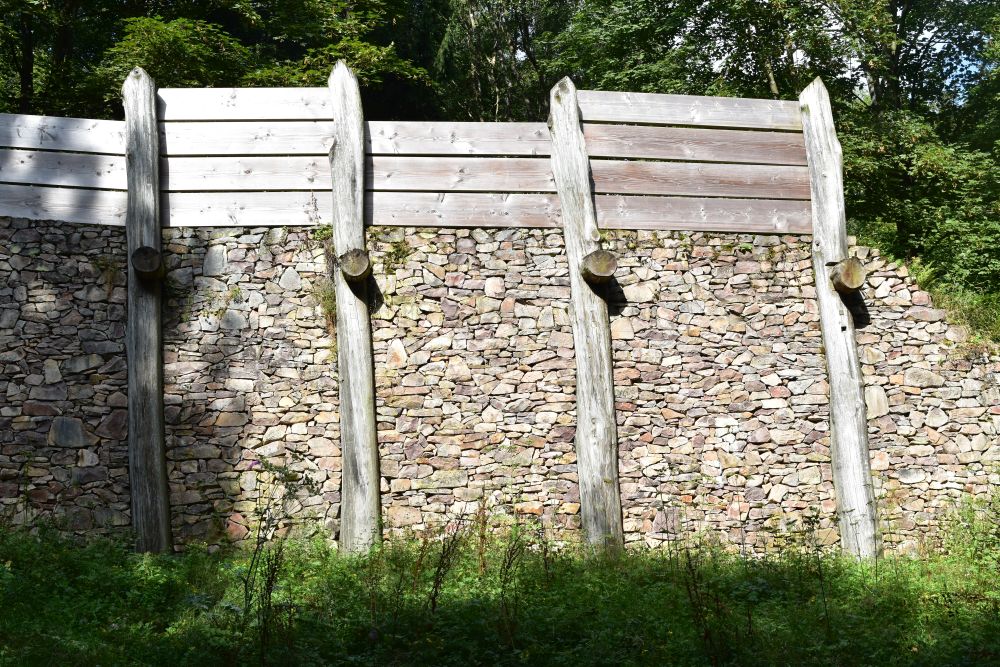
The wall was made from dry masonry using the local Rhyolit stones, about 2.5 to 3m high. Behind the wall the Celts had accumulated earth for better protection.
This sign will now guide us along the wall.

The sign represents the spokenail of the chieftain’s charriot. The head stuck out to make it clear to the members of the tribe: “Now the CHIEFTAIN is coming, get out of HIS way. “
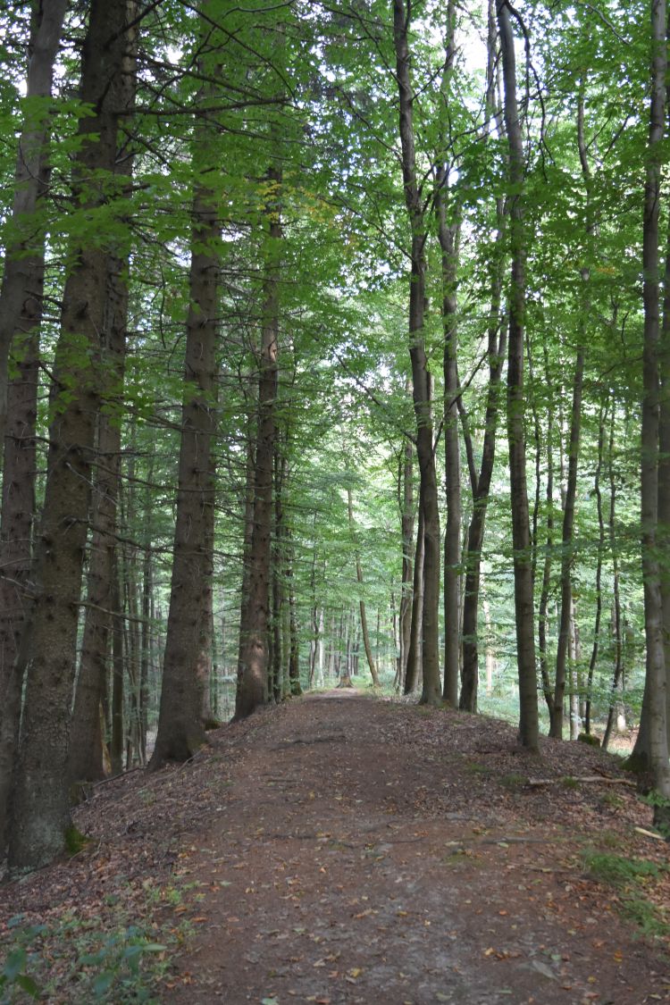
We walk on the wall for about three quarters of an hour,…
… until we reach a gate. This is what the gate once looked like.
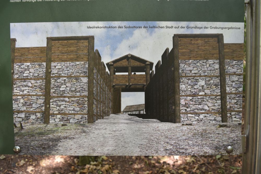
The pathway to the gate narrows down to ease attacking the enemy squeezed in here.
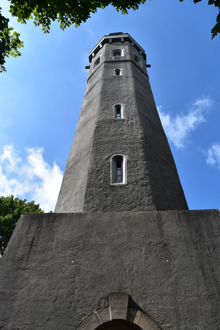
Behind the gate, we find the Ludwigsturm. Named after Ludwig II from Bayern, as this region once belonged to Bayern. A retired lawyer welcomes us with Mira, his friendly dog in front of this kiosk.
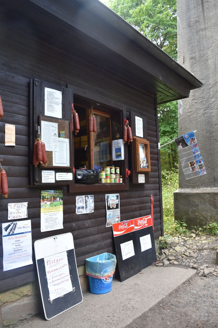
“You are lucky today that I am here, I have coffee and cake to offer and I have the key for the tower. Do you want to climb it?” Oh yes, great!
We climb up the winding stairs, open a heavy metal door, and enjoy the view of the Rhine plane with Worms, Mannheim, Ludwigshafen etc.

We then enjoy coffee and cake, learn about the spokenail of the chieftain and about Adolf von Nassau – he was defeated and killed by Albrecht of Habsburg not far from here in the late 1290-ies, while fighting for the crown of Germany.
Along the remains of the oppidum wall we continue our walk to the Königstuhl or Chair of the King. Here we learn that this mountain has been formed by volcanic activity, but the volcano did not erupt – it just lifted the Rhyolit stones from the magna to the surface of the earth where they solidified.

We continue to walk on the wall, until we reach another reconstructed piece of the wall. We continue along the next signpost… walk uphill… strange… uphill?… uphill?… and back we are at the Königsstuhl. One full circle… what has happened? We walk back down again, reach the reconstructed piece of the wall, identify one sign that led us back up again – oh no – and continued now on the right path to our car.
We return to the Klostermühle where we enjoy another delicious dinner and plan our next day with the destination Nahe valley.
