Today is 25th of September. Butrint and Gjirokastra are on the program. I do look forward to the excavations at Butrint and to the town in stone, described by Ismail Kadaré.
.
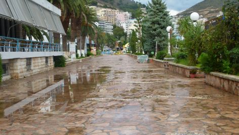
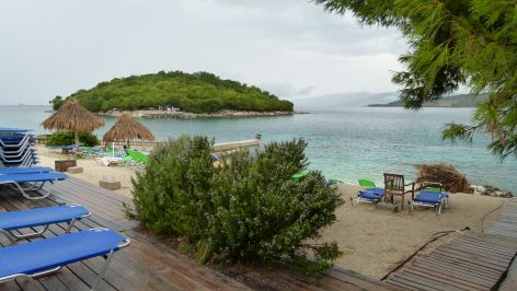
Saranda – early morning walk
It pours with rain at six in the morning, but when I get out a little later, the rain had stopped and I catch some early morning views – this is the tidy promenade along the bay.
.
Butrint – heavy rain and then dry weather
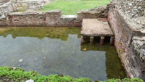
Butrint is located on the half island of a brackwater lake. South of Butrint, the Vivari channel connects the lake with the sea. When we arrive at Butrint, it pours with rain again.
At the entrance gate, a panel lays out the periods of Butrint: Chaonian/Epirus/hellenistic (inner circle, 4th century BC), Roman (outer circle, an aqueduct crossed the Vivari channel, as illustrated on Roman coins; until about 300 AD), early Byzantine (Baptistery and Basilika, until about 1200 AD), Medieval times with changing rulers (Venetian tower and museum building), around 1800 used as a fortress by Ali Pasha (he fought against Napoleon). I buy the book about Butrint by Çondi (on sale at the kiosk near the museum).
We enter the site. It has stopped raining. Lucky us. I am surprised to see the city center (agora and forum) under water. This may have been caused by the earthquake around 300 AD.
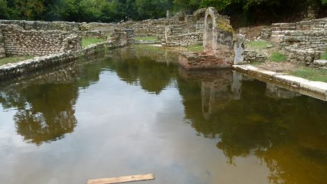
I recognize the Roman heating – the thermae were here. Such hypocausts have also been dug out in Augusta Raurica near Basel.
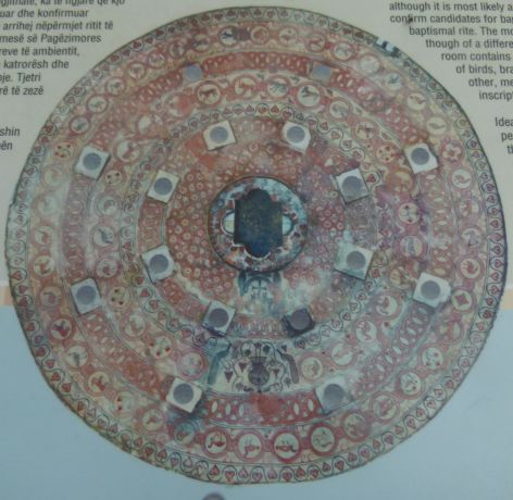
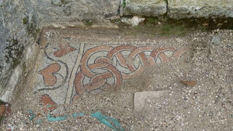
The baptistery is the place where Christians were baptized. Arranged in seven rings the mosaic contains symbols that illustrate, what becoming Christian means. For instance the fish are the symbol for the sinners that are being saved by Christ. (Condi, p. 85).
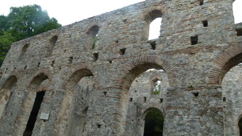
The basilica remaining from the early Byzantine times is relatively well kept.
The mosaic is covered with sand, but a small edge is free and gives an impression of its beauty.
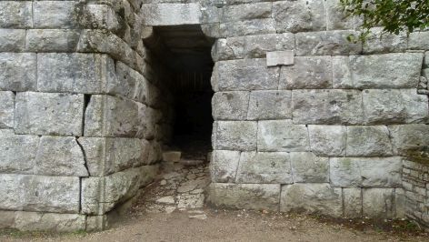
This is an Illyrian gate, almost hidden. I am impressed by the strength of these walls that withstood earthquake despite the damages. Like the Inca in South America, the Chaonians knew how to construct stable walls.
We pass the Lion’s gate, a fountain, and more sites, visit the museum (no photos allowed) and then – with the twinkle of an eye. I take this picture of a “Roman” Opuntia.
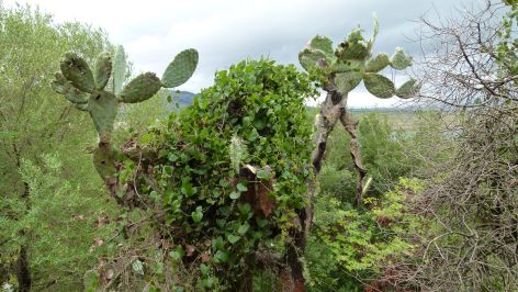
Butrint is full with tourists that follow their guides. The guides speak like water falls, and I can tell from the eyes of many of their followers that they are no longer listening. Perhaps we should hire the tour guide from Thun that challenges his followers by brainteasers. In Butrint, one such brainteaser could be: “Using the elements of the Opuntia, the Romans prepared a salad called Nopalae, right?” – Wrong – Nopales is a stunningly delicious meal in Mexico, but only after 1492 the Opuntia travelled to Europe and the Old World – whereby Nopales salad has not become widely known here.
.
Lunch at Ksamil village
We have lunch at the small restaurant Rilindja in Ksamil village. It has started to pour with rain now.
The place looks romantic and the chief prepares an excellent merluc (hake) with rosemary. I hear a French accent… it is a tourist from Strassbourg that has entered the restaurant. He owns a house on the Ksamil island. He spends some days here to prepare his boat for the winter.
.
Excursions around Saranda: the castle Lekures and the monastery of the 40 Saints.
The castle Lekures is located on top of a hill west of Saranda.
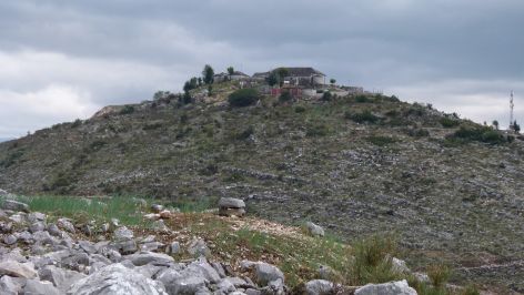
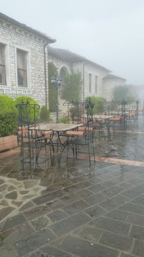
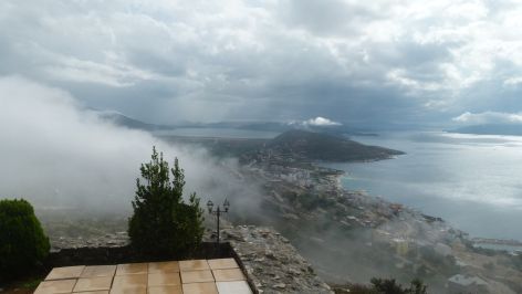
It is a restaurant. The deal with the owner seems to bee: You look after the castle and you can use it as a restaurant. It is foggy right now.
But then, the fog dissipates and gives way to the view of the bay and of Korfu.
The monastery of the 40 Saints (manastir 40 shenjtoret) is a ruin. The panel gives an idea of what it was before.

This monastery gave the name to “Saranda” which is “forty” in Greek.
.
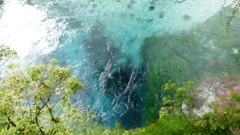
Crossing the mountains on the way to Gjirokaster – a stop at the Blue Eye Spring (Syri y Kalter)
The Blue Eye Spring is a favourite stop over for tourists and Albanians on the way to Gjirokaster. The spring really looks like a blue eye.
.
Gjirokaster – the town that I already know from Ismail Kadaré
We reach the fertile valley of the Drino.
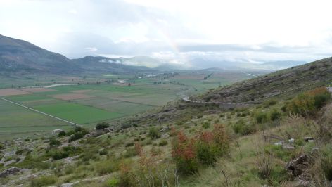
This is the valley of Gjirokaster, the town I already know from having read Ismail Kadaré’s “chronicle in stone”. The town has steep and narrow streets, and it is not a pedestrian zone. Cars are omnipresent. We look for our hotel Kalemi 1, land in Kalemi 2 first, have to drive backwards and turn around rectangular corners – I admire the driving skills of Ben.
My room is small and the toilet does not work. The manager is very kind and gives me a huge room with a great view of the town, the Drino valley and the Lunxhëri mountains.

Tomorrow we will follow the tracks of Ismail Kadaré’s “chronicle in stone”. I do look forward to that.
