My new mountain bike takes me to Pratteln and I discover who has been here before…
This year – 2015 – I bought a new mountain bike. I set out to explore more of the secrets around Basel to plan the nordic walking hikes that I am now guiding – with my eyes restored. My next target is Pratteln. This small town has published the excellent and very detailed “Heimatkunde Pratteln 2003” (Emmy Honnegger et alii) and a nice Website. I pick a few cherries that might add to the walking experience around Pratteln – I love to know more about the places that I am hiking to. And – any misinterpretations are my own fault – I am not a historian.
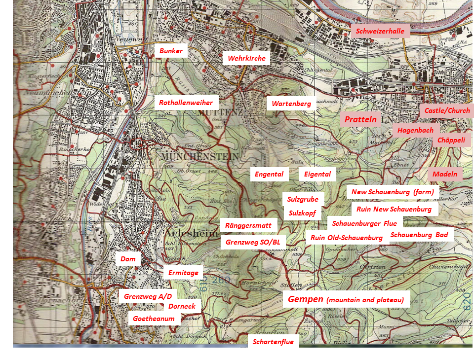
Source: Bundesamt für Landestopographie 213T – Basel
.
Pratteln – why are you called “Pratteln”? Ah, you were a “small meadow” near Roman Augusta Raurica
The name “Pratteln” comes from the Latin “Prattelum”=small meadow. Pratellum was a suburban service center for the Roman town Augusta Raurica, with farms and crafts business. It seems that, after the Roman empire had collapsed, the Alemanni did not settle here before the 7th/8th century, and the population continued to speak a Roman language. If the Alemanni had settled here earlier, the alemannic second sound shift would have transformed “Pratteln” to”Pfratzelen” (“Heimatkunde”) or “Pfrasseln” (wikipedia). I prefer “Pratteln” to “Pfratzelen” or “Pfrasseln”. We Swiss just say “Braddele”.
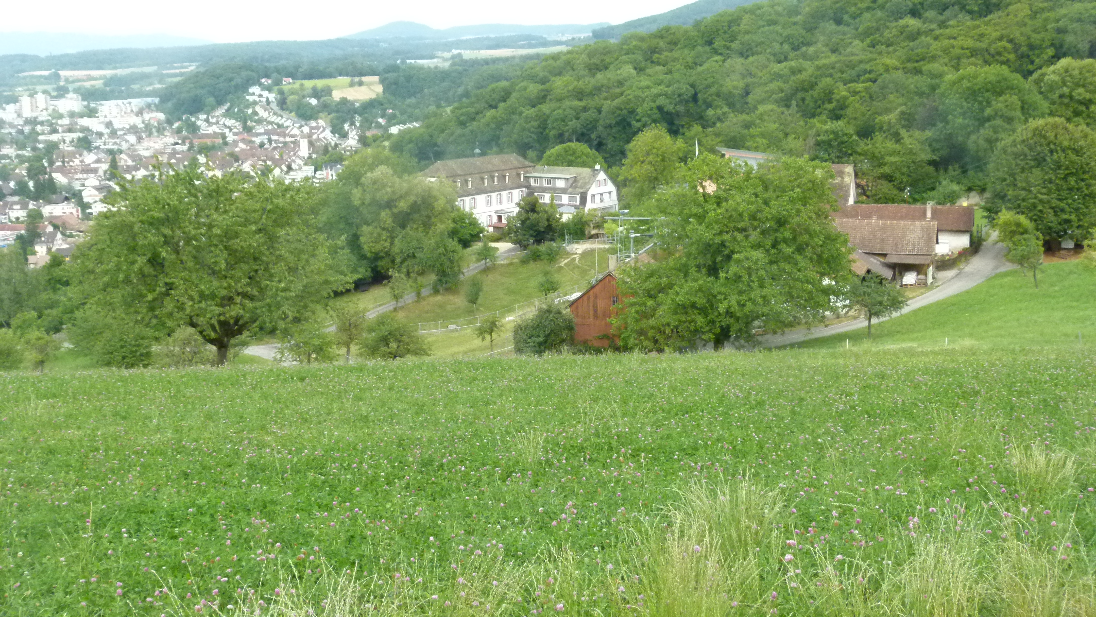
The large farms surrounding Pratteln today indicate that it must have been a beautiful service center for Augusta Raurica. Here is Mayenfels above Pratteln that is now a school.
.
There were settlements in Pratteln long before the Roman times – perhaps
To the south of Pratteln there is the “Hohle Gasse” – a very steep and even today mostly unpaved path that connects Pratteln with the “Chäppeli”.
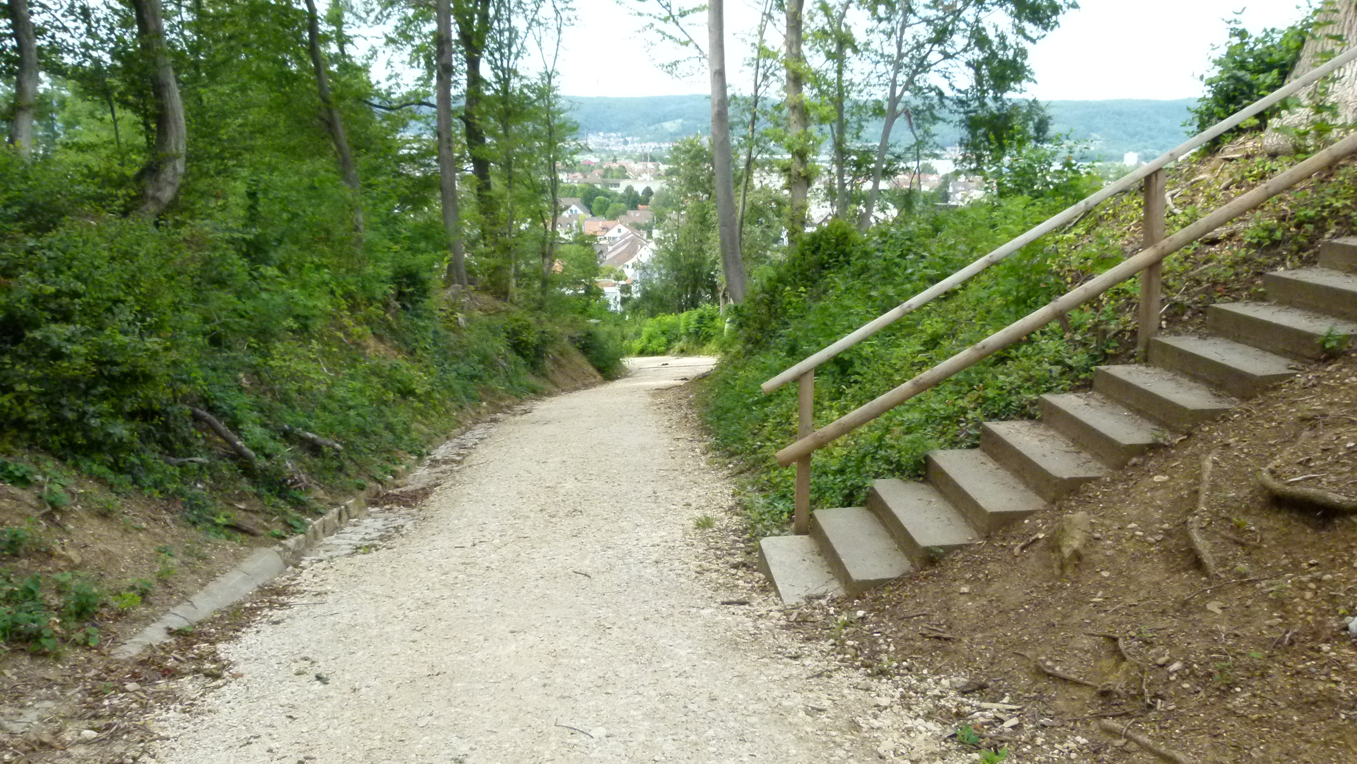
It was here that a school boy found a hand ax in 1974. The ax is older than any other ax found in Switzerland – the estimates I could find reach from 120’000 to 350’000 years (sources: “Heimatkunde”, p. 71 and Website of Kanton Basellandschaft). It is not clear, whether the glacier has transported the ax to this place or whether the owner really lived around Pratteln. Too long ago to know for sure.
Signs of settlements from stone, bronze and iron age have also been found around Pratteln (see Heimatkunde p. 72).
.
Medieval times: Monasteries and the noble family of Eptingen. Later owned by protestant Basel
Until around 900 AD the monastery of Murbach (Alsace) had possessions in Pratteln. Reminiscence today: The church of Pratteln is dedicated to Murbach’s patron, Saint Leodegar. The church was later sourrounded by a wall to protect it against the floods of the Talbach (Heimatkunde, p. 97, the wall is called “Kirchenbering”).

Other reminiscences of those early days can be found in the field names. For instance starting around 700 AD, forest areas were cleared to gain space for agriculture. These areas were then named Blözen (related with “entblössen”=to bare), Rüti (medieval German “ruiten”=to clear) or Stockmatt (when the thick roots (“Stock”) remained in the meadow (“Matt”)). Other names describe the topology: “Halden” is less steep than a “Rain” (Moderhalden and Blözenrain). “Goleten” points to a landslide that left stone blocks (My Ernst also said “Golete”). In the “Cholholz” – there was a charcoal burning site (Heimatkunde, p. 25f).
In the late 11th century the monastery of St. Alban, just east of the city gates of Basel, was given possessions in Pratteln. St. Albanstrasse and St. Albanmatte in Pratteln remind us of this today.
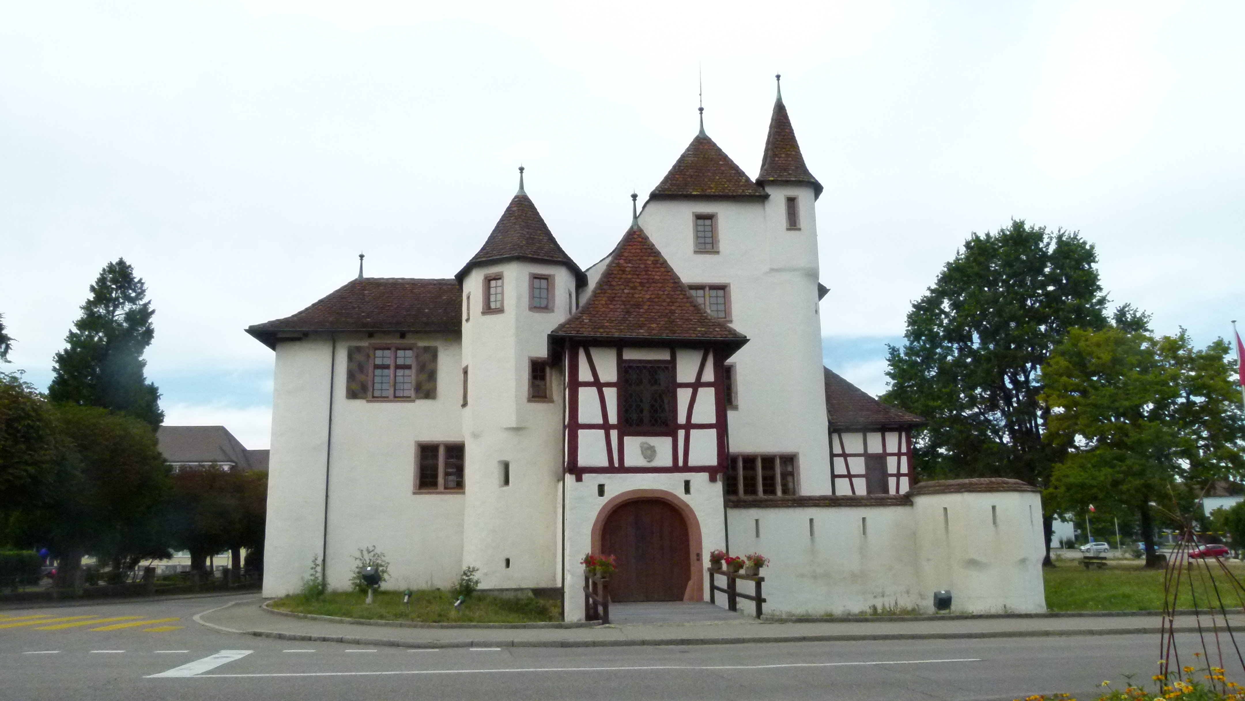
In the late 13th century the noble family Eptinger settled in Pratteln (presumably it was a feud from Habsburg). In the 13th century, they built two castles, one in Pratteln in the valley (surrounded by water) and a second one on the Madeln hill above Pratteln. After the 1356 earthquake, they rebuilt the castle in the valley. Owned by the government since 1773, it is no longer a water castle today, has been beautifully renovated in the 1960’s (see Ernst Zeugin) and is open for the public (guided tours).
The castle on the Madeln hill (Madlechöpfli) has not been rebuilt after the earthquake. Today only the ditches can be distinguished on the hill, the remains of the ruins have been covered up in the 1930’s to protect them from further decay. No spectacular ruins for today’s hikers on the Madeln summit – just another picknick spot in the dense forest. But, when having a picknick on Madeln, beware of the Madlejäger or hunter of Madeln. He comes with twelve white dogs, when the weather is changing. He has suffered until these days, because he had killed the owner of Schauenburg to marry the widow (Heimatkunde, p. 318). Below, the “bosky” highest point on the mountain range in the background is the Madeln hill.

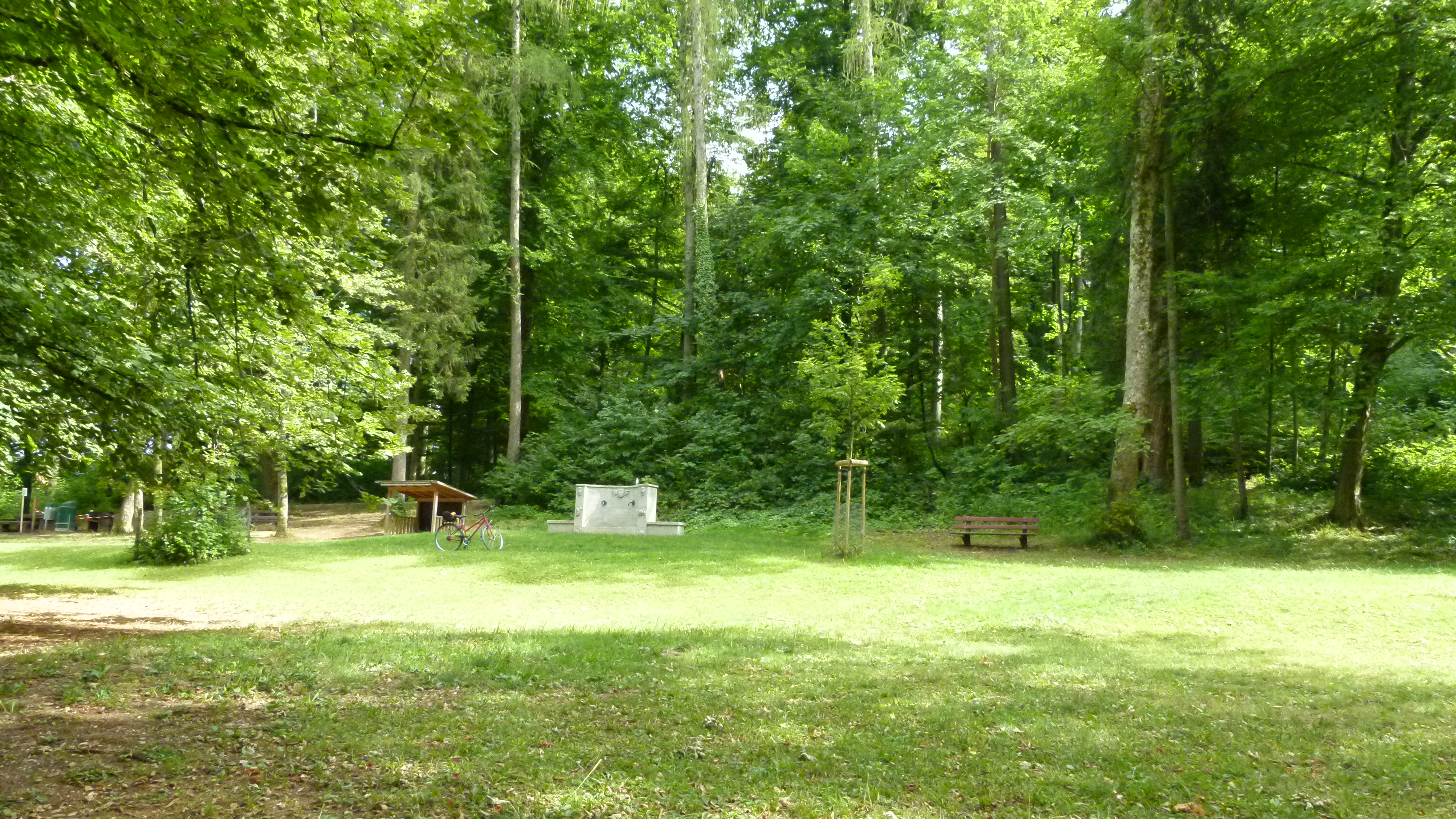
In the 15th century, Hans Bernhard von Eptingen built the monastery of Schauenburg and a chapel with a hospice in the Geisswald just above Pratteln. The place is called “Chäppeli” which reminds us of Hans’ chapel that does no longer exist – after the reformation (1529) the stones have been reused to build the parochial house of Pratteln. The fountain is said to give curative water and the Geisswald seems to be an energy spot emitting 8000 Bovis (“Geiss” pointing to what we call Kraftort in German). This was a good place for a chapel and now it is a good place for a vast picknick and play ground. The foto shows the area with the fountain in the background.
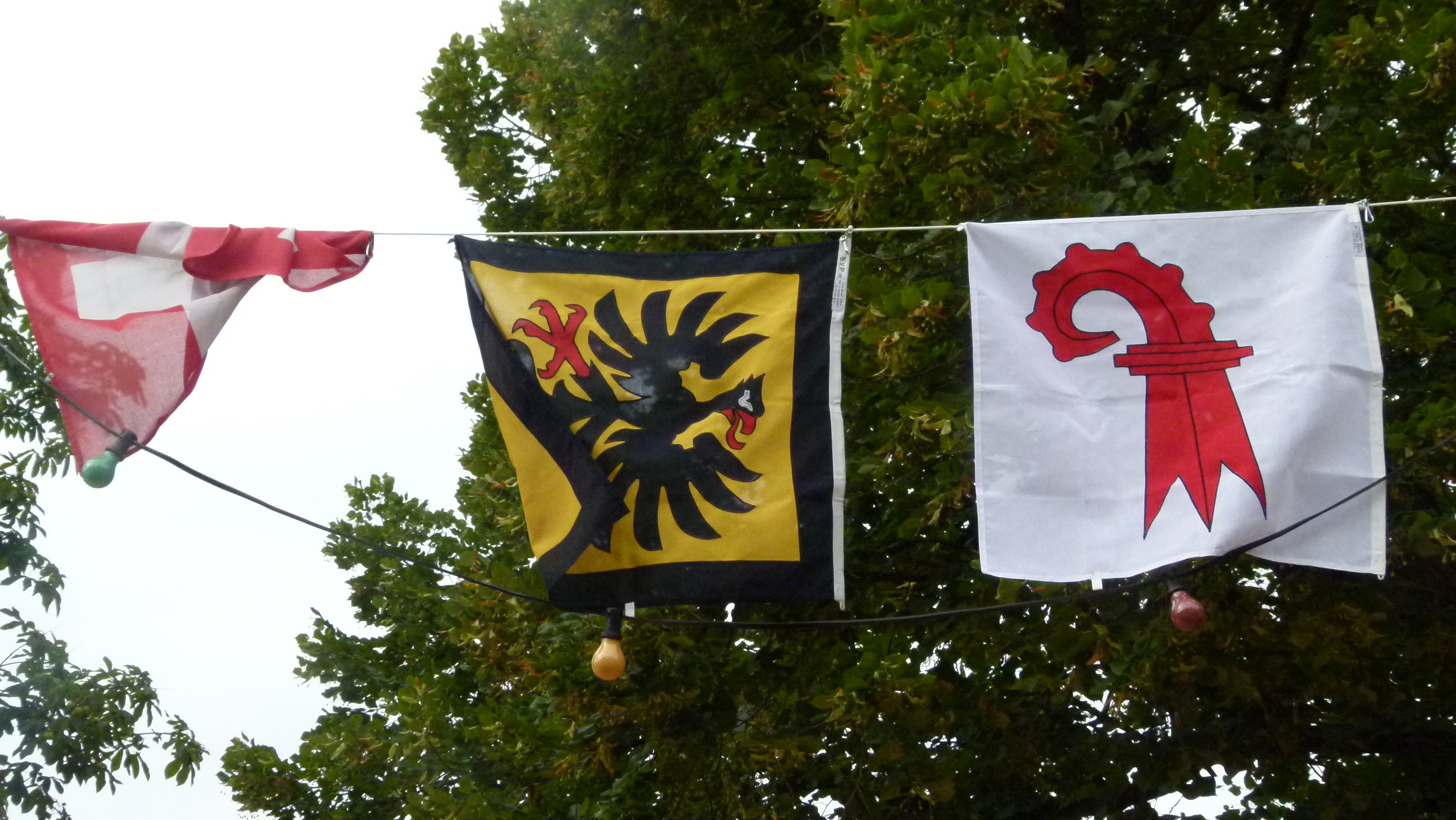
In 1521 the family Eptinger sold the castle and part of Pratteln to Basel – for 5000 Gulden. 1549 the Habsburgians gave up the rest for 3000 Gulden. However, with their coat of arms – an eagle with red tongue and red claws – the noble family Eptinger is omnipresent today, on banners, on the cars of the firebrigade, in gardens… everywhere. To differentiate their banner from the emblem of Eptingen (also a former possession of the Eptinger family), Pratteln has added a black frame.
I found the emblem on the little hut at the picknick spot “Chäppeli”.

and everywhere in the center of Pratteln that today, July 31st, is preapring for the Swiss national holiday on 1st of August.
.
Modern times – salt and industrialization… and taking care of the medieval village center
In the early 19th century salt was found near Pratteln. This started the industrial development.
Based on a geological map, Peter Merian forecasted the chance of finding salt on the shores of the Rhine. Carl Christian Friedrich Glenck dug, found salt in 1836 (116m under the ground) and a year later, he opened the first saline factory. Now the Swiss Rhine Salines produce 450’000 tons of salt a year in the valley and on the adjacent hills of the Plateau Jura, south of Pratteln and Muttenz.
The presence of salt as an important component attracted chemical factories. From the motorway, I have always seen the signs of the “Säurefabrik” (“acid factory”) – now I know, the Säurefabrik came here in 1918 to combine salt with iron sulfur which results in salt – and sulfur acid (Heimatkunde, p. 107). And Ciba, Novartis, Sandoz and many more national and international enterprises form the industrial complex of Schweizerhalle between the railway and the Rhine river today – this sight is taken from Google Earth.

Source: Google Earth
Despite the industrial evolution, Pratteln kept its charming historical center and makes it worth a visit.

.
Vineyards – first mentioned in 1284 and a pastor from the 17th century that must have loved the wine…
There are vineyards to the south of Pratteln. They were mentioned first in the books of the monastery of St. Alban in 1284. The production was then around 60’000 liters. In 1749 a historian praised the vines of Pratteln, “in particular the red wines are among the good and dense wines of our region (gut und kräftig).” (Heimatkunde, p. 170). In 1807 there were 47ha of vineyards (in the valley and on the hills). Now just about 6.7 ha are left, all on the eastward looking slopes of the Ebnet (see Weinbauverein Pratteln). There are two professional and 20 hobby wine growers producing about 60’000 bottles a year.
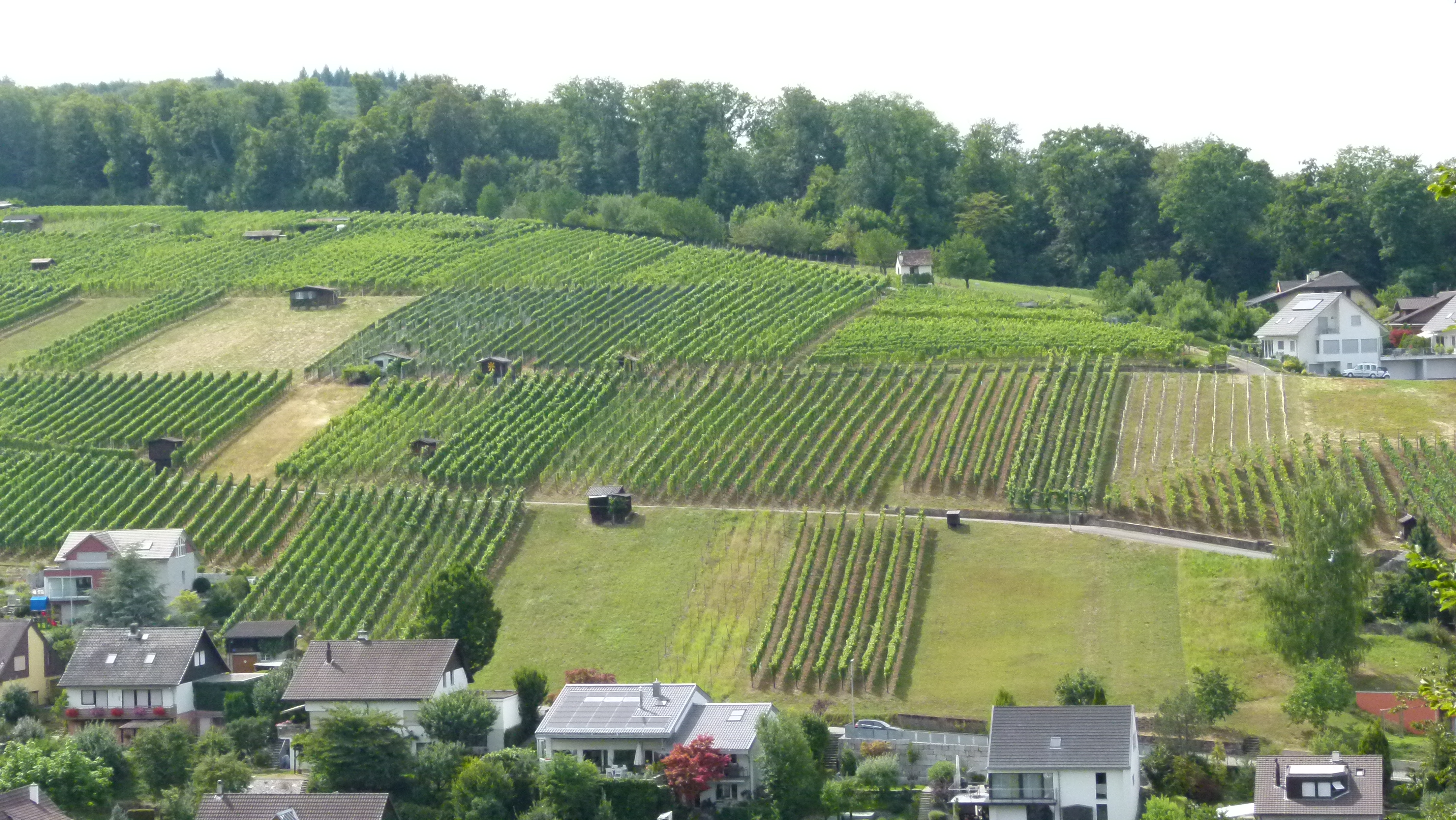
One of the two professional wine growers runs the Leuengrund. It has a small restaurant (open from October to February; this is a Straussen- or Meienwirtschaft, announced by a bunch of flowers, a custom based on Charlemagne (768-814)). Find below the Leuengrund with its gorgeous view. I will come back here in autumn, when the restaurant is open.

In the 17th century, the pastor Christoph Hagenbach (1596-1668) had a small half-timbered house built on the edge of the vineyards, overlooking the Rhine valley with the Black Forest and the Vosges. It was here that he prepared his sermons (perhaps the wine helped him find the right words). After him, this wonderful spot is called “Hagebächli”. Look at his cosy little house…

… and the view over Pratteln to the Dinkelberg beyond the Rhine river and the Vosges in the background to the left.

.
Well, I am impressed by the history of Pratteln. I love to share it with the nordic walking group, when hiking here. Andreas and Helga, thank you for having opened my eyes for the secrets of my home region around Basel.
