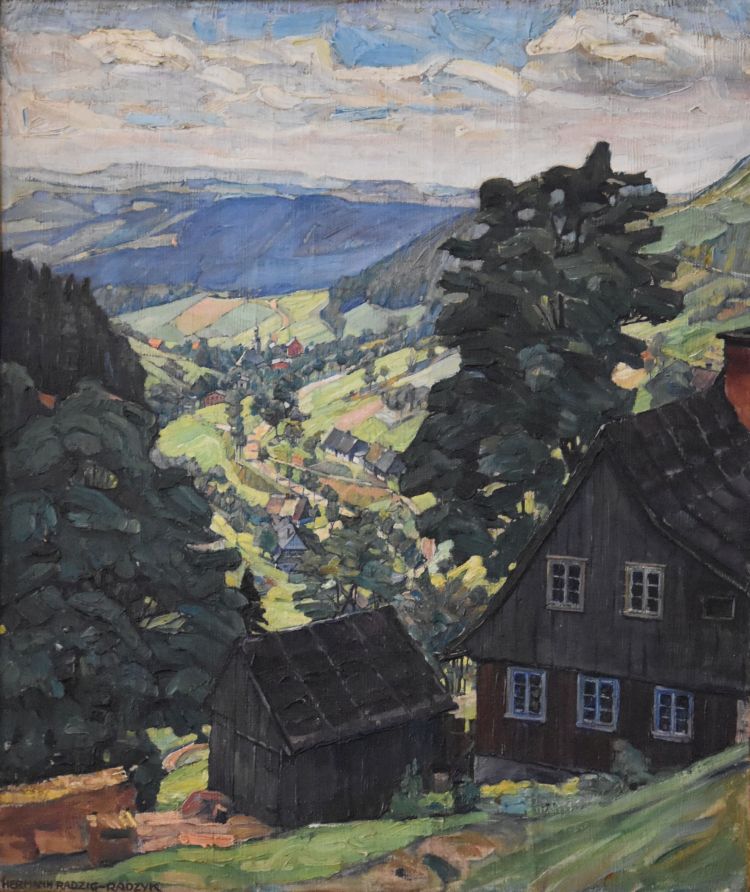
Exactly a hundred years ago, in 1924, my grandfather Hermann Radzyk painted this rack train viaduct in the Eulengebirge (Góry Sowie) in Silesia (now Poland).
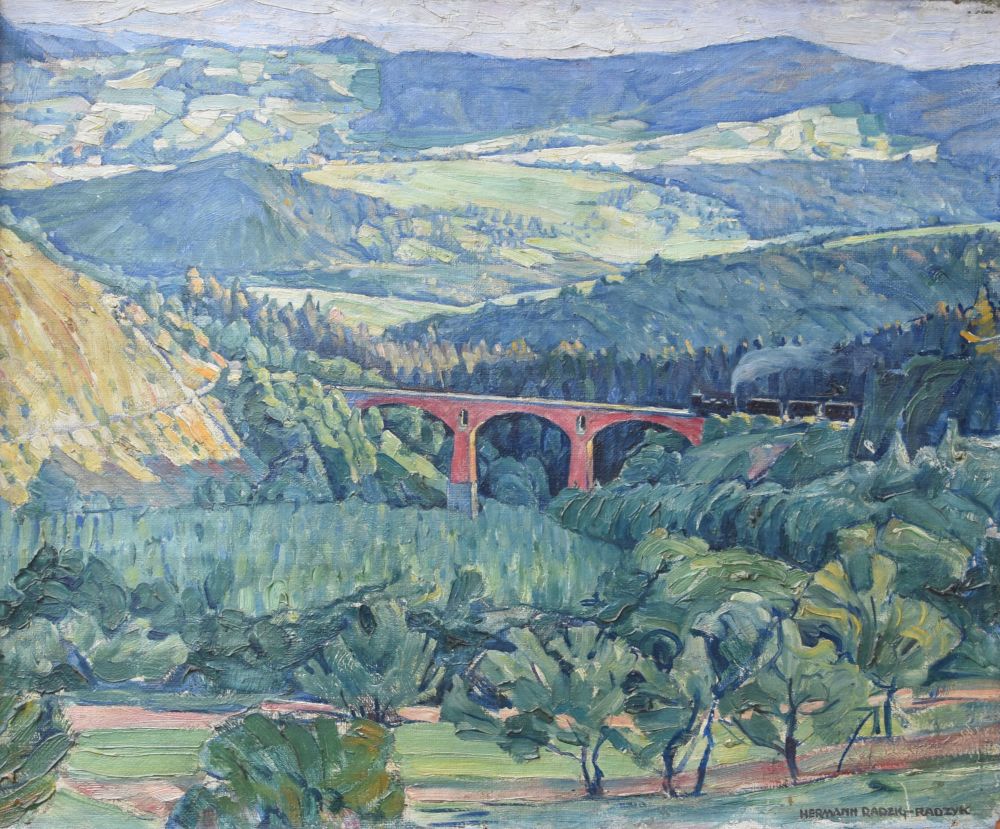
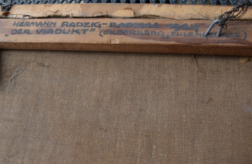
On the rear side, Hermann Radzyk wrote down the year and the name of his painting. He called it “Der Viadukt (the viaduct)”, and he added “Silberberg, Eulengebirge”. The painting is family-owned.
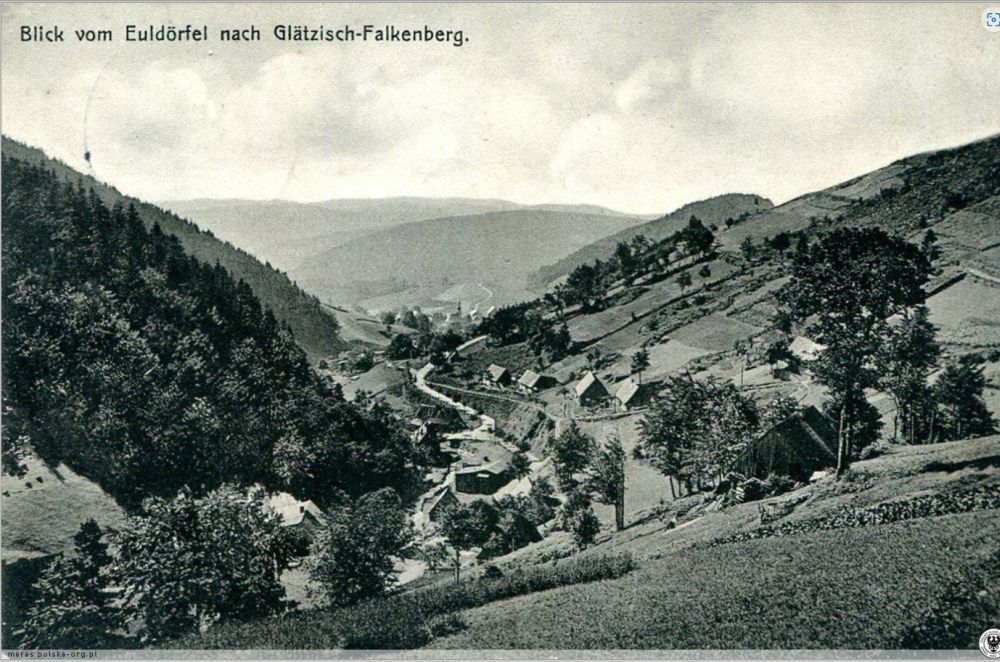
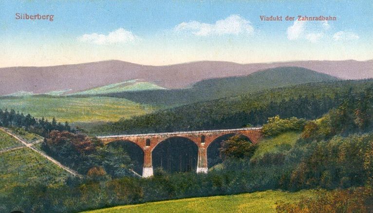
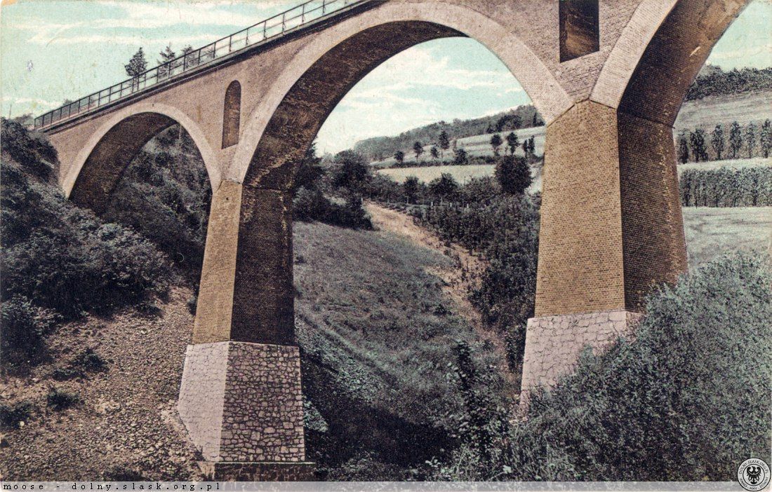
Look at the cone shaped hill behind the viaduct on this old postcard. It shows the same viaduct, the so-called “Silberbergviadukt” or, in Polish, “Wiadukt Srebrnogórski”.
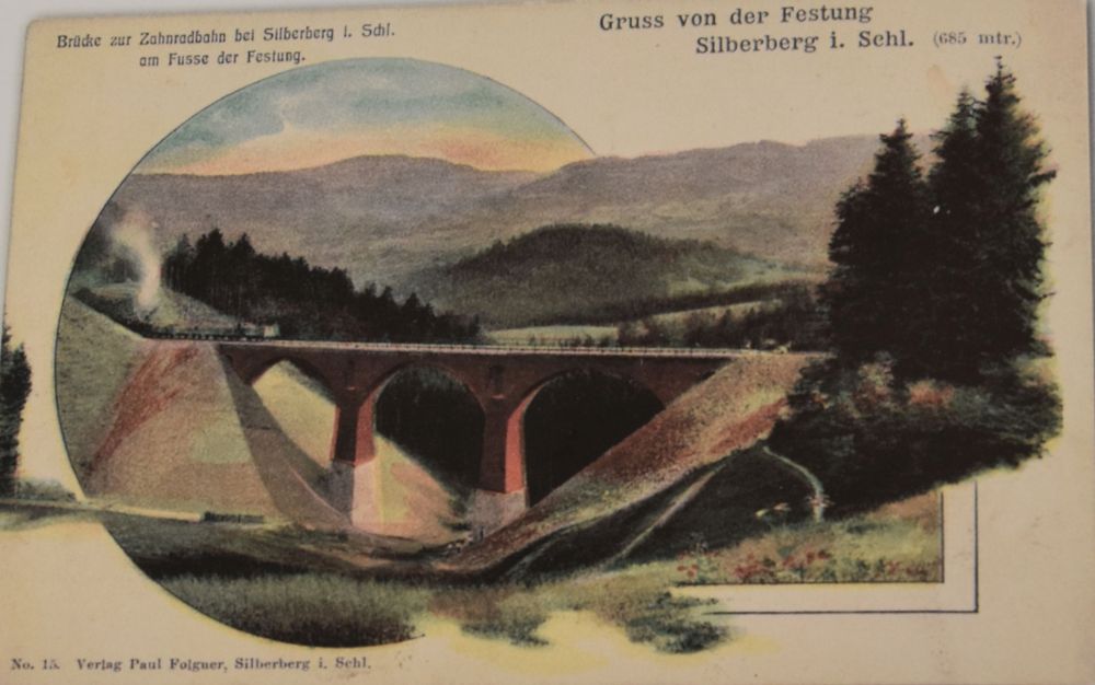
(Source: Jacek Gruzlewski and Tomasz Przerwa, p. 224)
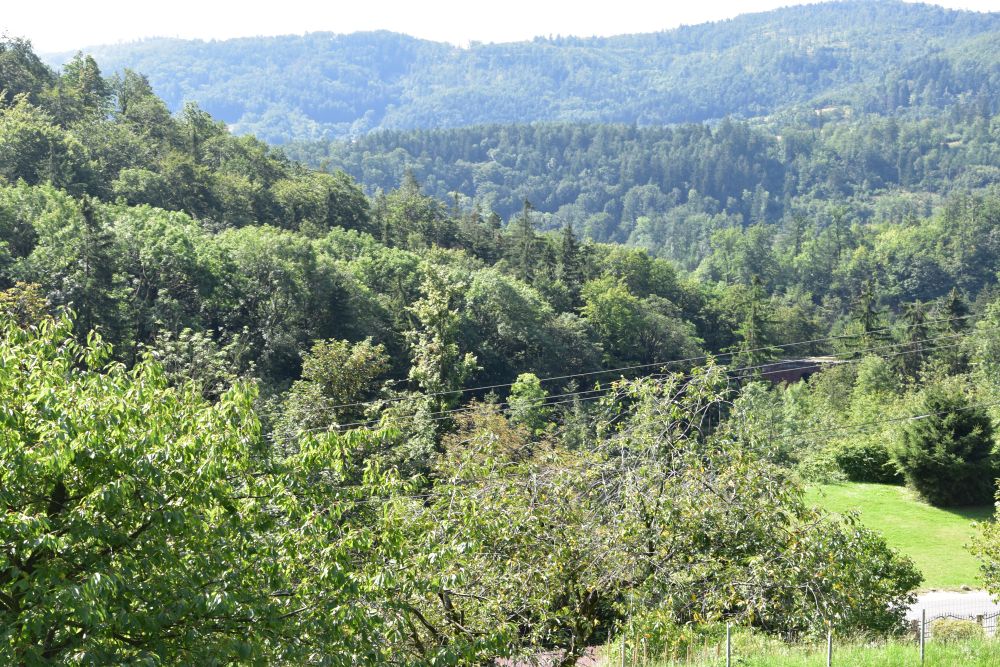
The easel of my grandfather stood on the Silberberg pass (Przełęcz Srebrna) above the viaduct. He looked south towards the valley of Herzogswalde (Zdanów) and the mountains of Wartha (Góry Bardzkie).
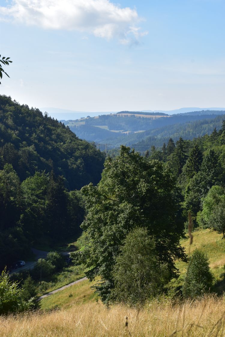
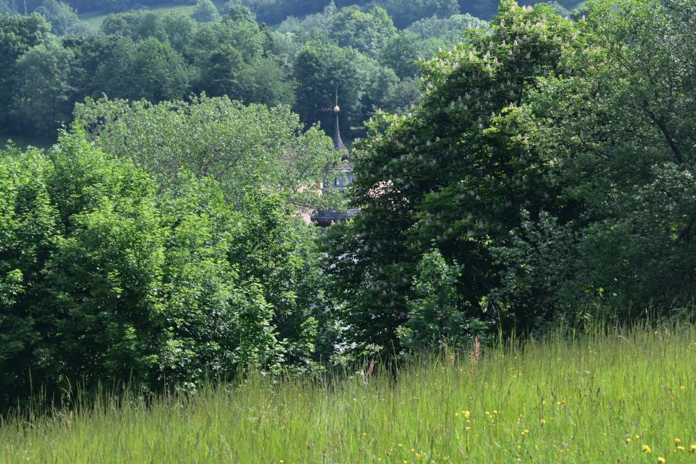
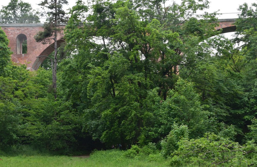
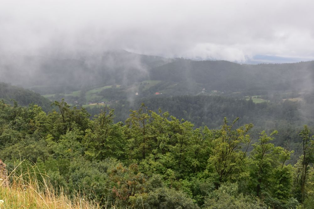
I only found two places, where I could see the viaduct from the Silberbergpass today. In summer 2023, I stepped into the high grass of the wild meadow above the viaduct. This is all I could see from the viaduct. I am a bit lower than the easel of my grandfather.
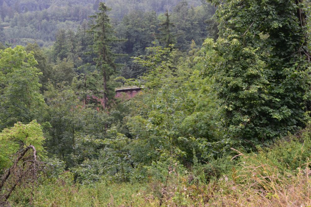
Along this wild meadow, there is a small footpath that leads down into the valley under the viaduct (see https://polska-org.pl/539823,Srebrna_Gora,Wiadukt_Srebrnogorski_Most_Katarzyny.html for a good description of the path from the car parking to the viaduct)
A hiking path crosses the viaduct. It was drizzling, when I was here.
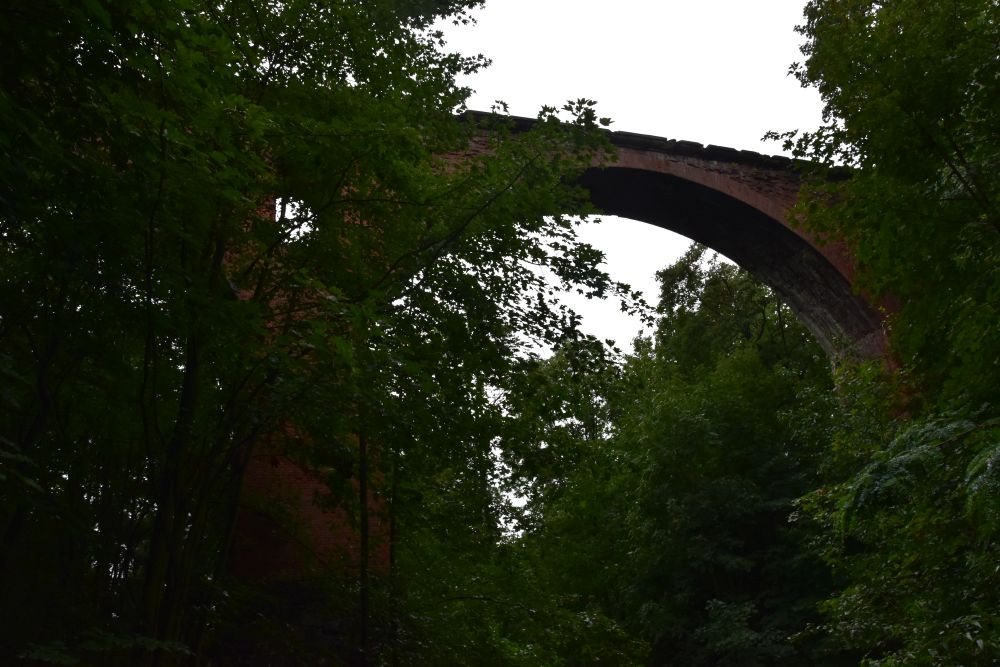
The second “window” was on the local street above the pass road (Warowna Street leading to Hahnvorwerk or Budzowska Kolonia), where the viaduct appeared once more between the trees.
However, the easel stood more to the right and not as high as I am now. Today, my grandfather Hermann Radzyk could no longer reproduce the painting of the viaduct.
I invested quite some detective work to identify the viaduct my grandfather had painted. This was an opportunity to get to know Silberberg and the Eulengebirgsbahn, the railway of the Owl Mountains. Let me tell you.
I will start with my detective work which comes in three steps: First, where in Europe is this viaduct? Second, found two viaducts, where are they “hiding”? Third, which of the two viaducts is on the painting? Closing it up, I wanted to make sure, that it was really not the Herzogswaldeviadukt that my grandfather painted, but it was the Silberbergviadukt.
First challenge: Where in Europe is this viaduct?
My sister owns the painting of the viaduct. In June 2024, I packed my tripod and drove to my sister’s house to take photos. We took her paintings down from the walls. Only then I found out about the description on the rear side: 1924, “”Der Viadukt”, Silberberg, Eulengebirge”. Knowing this before would have made my detective work easier. From the beginning, I would have looked for the viaduct in the Eulengebirge (Góry Sowie, Silesia).
But I was not aware of the description on the rear side, when early in 2023, I started to look for the viaduct. I had to guess, where in Europe this viaduct stands. The vegetation looked middle or northern European. Perhaps Silesia? I investigated all mountain railway lines in Silesia in the Internet and ended up discovering the two red brick viaducts in the Eulengebirge (Góry Sowie) near Silberberg (Srebrna Góra). They both are very similar and they both look like the viaduct on the painting of my grandfather, as the old postcards show.
(1) This is the “higher” viaduct just below the Silberberg pass, called Wiadukt Srebrnogórski (in German Silberbergviadukt).
(Source: https://polska-org.pl/539823,Srebrna_Gora,Wiadukt_Srebrnogorski_Most_Katarzyny.html)
(2) … and this is the “lower” viaduct just after Silberberg called Wiadukt Zdanówski (in German Herzogswaldeviadukt).
(Source: https://polska-org.pl/522602,Zdanow,Wiadukt_Zdanowski_Most_Dziewiczy.html)
It is clear to me, my grandfather has painted one of the two viaducts, but it is unclear to me, which of the two and from where.
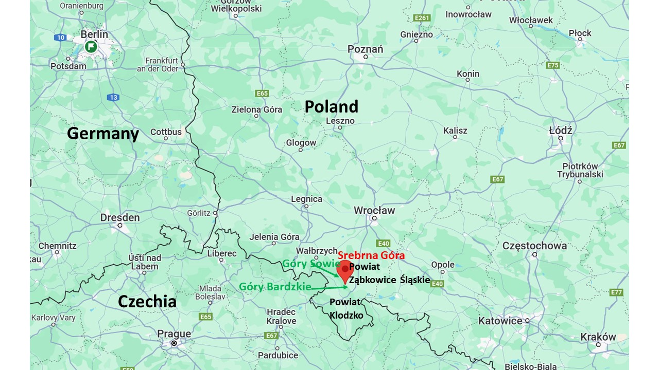
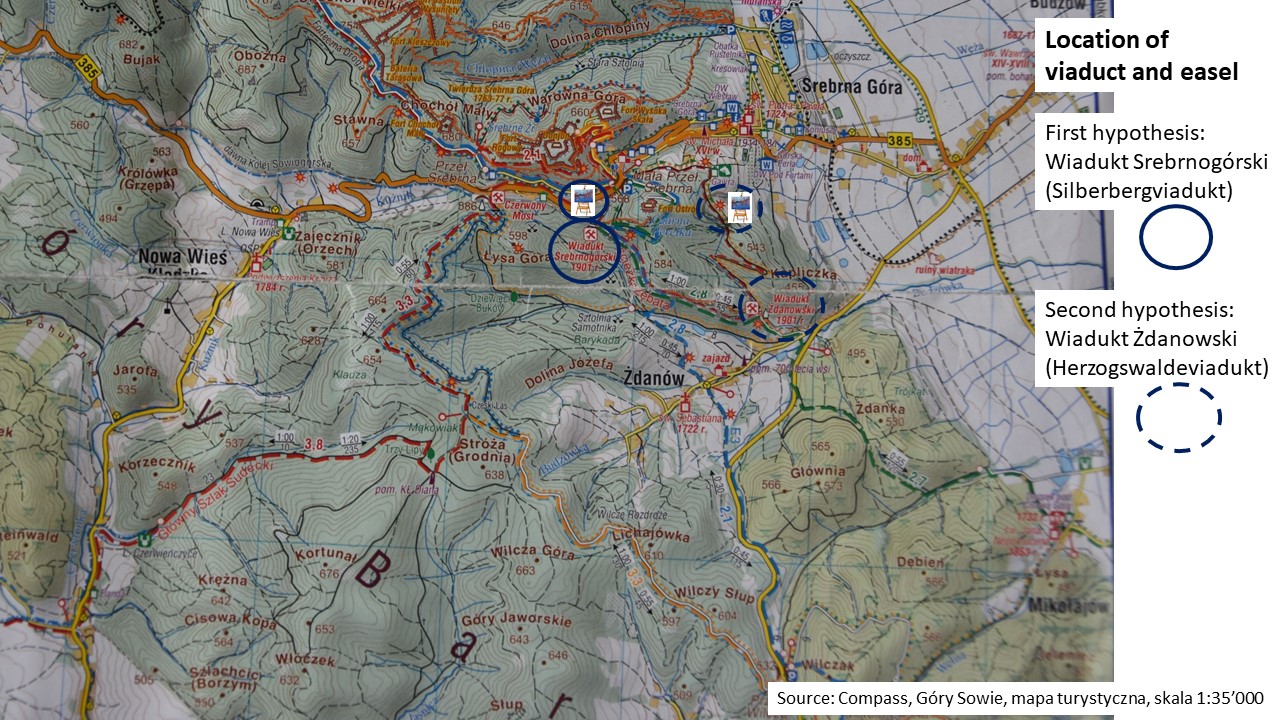
Let us check out, where we are: Srebrna Góra is in Silesia, part of the Powiat Ząbkowice Śląskie, located north of Powiat Klodzko at the south east edge of the Eulengebirge (Góry Sowie) and north of the Góry Bardzkie.
Source: Google maps and my additions.
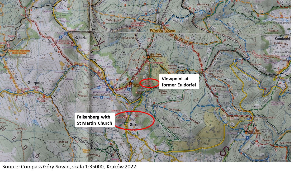
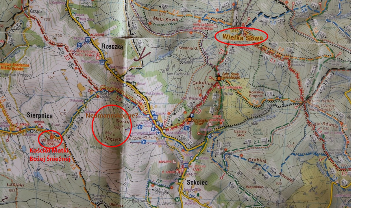
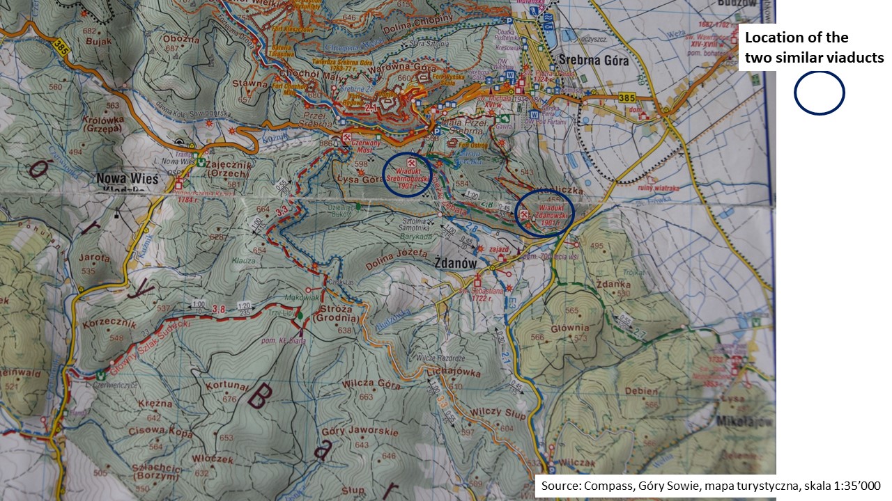
Second challenge in May 2023: Found two viaducts in the Owl Mountains in the Internet, now – where are they “hiding”?
On my hiking map, I marked the two viaducts.
To find the viaducts, I settled in the Lesny Dvor in Wolibórz near Srebrna Góra in May 2023, with a friend.
We drove to Zdanów (formerly Herzogswalde) and above Zdanów we looked north to where we knew, the viaducts should be. We could not see any viaducts, just trees and above the dense forest the Fortress of Srebrna Góra (the Srebrna Góra Twierdza). A friendly dog barked at us from a garden, wagging his tail. The owner came to the gate. “What are you doing here?” He and his wife invited us for coffee. They told us, that we can see the viaduct from the hiking path close to where the road to Srebrna Góra forks.
We drove to the fork. My friend left the car and her face brightened up, as she spotted one arch of the “lower” viaduct. We parked the car to walk there. We heard children laugh. We saw the “lower” viaduct, the Herzogwaldeviadukt, behind the trees.
A young man sat on a stone. He said that he is a mountain guide. A mountain guide? Here? But soon we understood. The viaduct is a climbing park now!
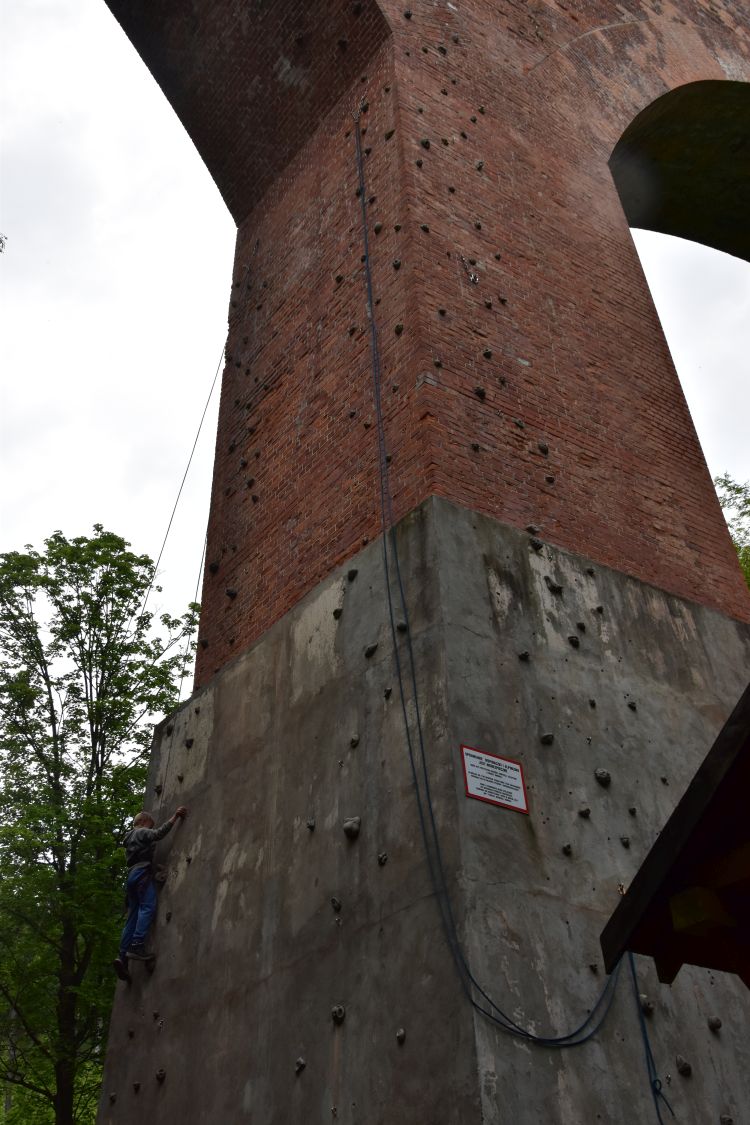
The children that we could hear laugh are here to learn how to climb. The viaduct has been “recycled”.
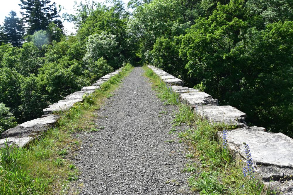
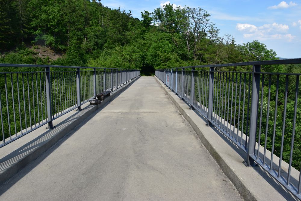
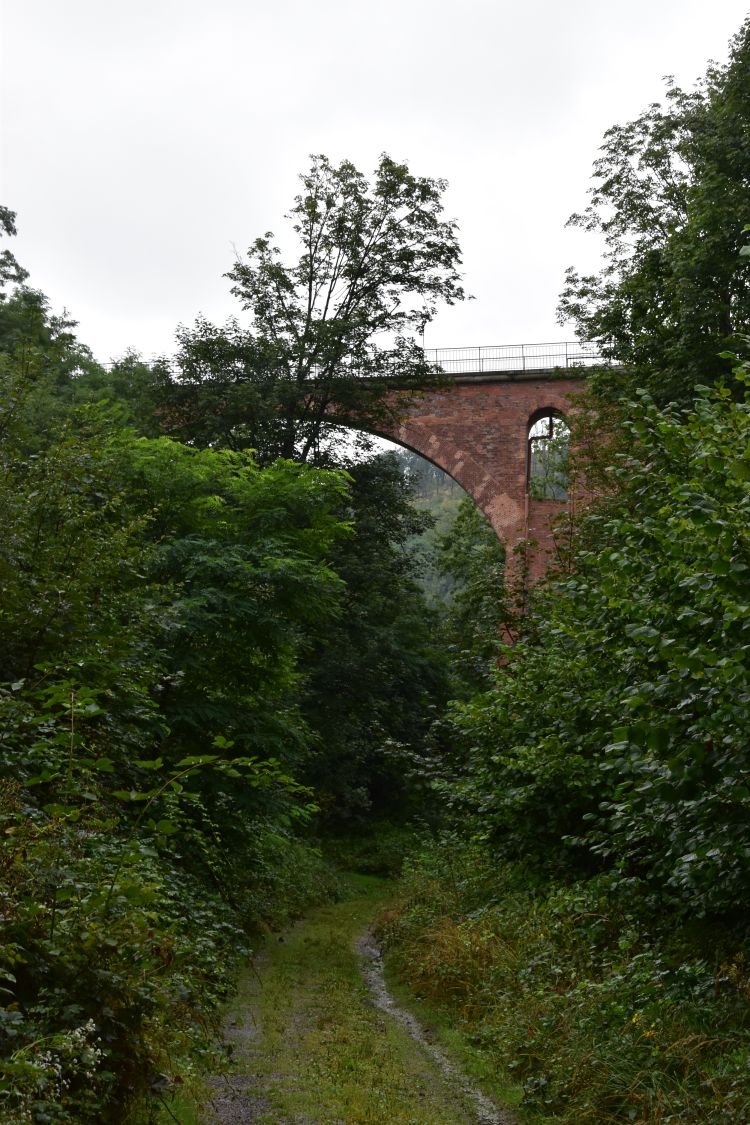
Later I drove to the parking above the Small Silberberg pass and, via Fort Ostrog (Spitzberg), I climbed down to the “upper” viaduct, the Silberbergviadukt. The area around the viaduct is very, very steep. I reached the top of the viaduct – it is now a hiking path. Not everyone might want to cross the viaduct. It looks dizzying.
Around the viaduct, it was not only steep, but also wet. I did not climb down to the bottom of the viaduct. Instead, I followed the old railway track to the “lower” viaduct, the Herzogswaldeviadukt.
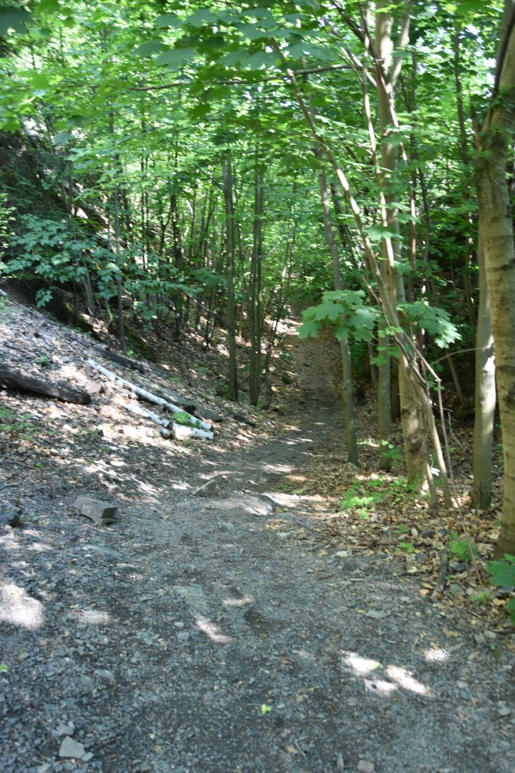
Very impressive. In some places, landslides cover the trench that the Germans had dug for the railway. The hiking pass across the Herzogswaldeviadukt is comfortable and less dizzying.
Still I do not understand, which of the two viaducts my grandfather has painted, the “upper” or the “lower”. They are so similar!
Third and final challenge in August 2023: Which of the two viaducts is on the painting and where was the easel?
I returned in August 2023 and settled in the Palac Kamieniec near Klodzko twice, once on my way to Kraków and again on my way back from Kraków. From talking to the friendly couple at Zdanów, I now understood that the easel stood north of the viaducts and Hermann Radzyk painted looking south to the valley of Zdanów and to the Góry Bardzkie. I had two alternative hypotheses for the location of the easel, one for the “lower” viaduct near Srebrna Góra and one for the “upper” viaduct near the Silberberg pass.
I do not remember, how often I walked around the two viaducts, until I understood clearly, it was the “UPPER” Silberbergviadukt that my grandfather had painted, and the easel stood on the Silberberg pass (Przełęcz Srebrna). In the meantime, I had acquired the wonderful bilingual book of Jacek Gruzlewski and Tomasz Przerwa about the history of Silberberg. The old photos were useful for my investigations.
Let us look at the painting again. The easel stood clearly ABOVE the viaduct on a meadow with bushes and not too far away from the viaduct.
The view behind the Silberberg viaduct is a good match with the background on the old postcard – there is the same cone-shaped hill behind the viaduct.
(Source: Jacek Gruzlewski and Tomasz Przerwa, p. 224)
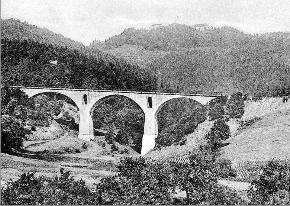
The photographer of this old postcard stood south below the Silberbergviadukt looking north to the meadow with the bushes, where the easel was.
(Source: Jacek Gruzlewski and Tomasz Przerwa, p. 224)
Now I am convinced, Hermann Radzyk painted the “upper” viaduct, the Silberbergviadukt and the easel was ABOVE the viaduct on a MEADOW, on the Silberberg pass.
Final check: “Lower” Herzogswaldeviadukt excluded – Hermann Radzyk did not paint the “lower” viaduct
I excluded the “lower” Herzogswaldeviadukt, first because already a hundred years ago, there were trees in the valley north of the viaduct, as this photo taken from the south shows. No meadow behind this viaduct to put down the easel.
(Source: Jacek Gruzlewski and Tomasz Przerwa, p. 221)
I excluded the Herzogswaldeviadukt, because second, in the valley north of it, I am always BELOW the viaduct. I verified that on site. I took my photo in the valley north of the Herzogswaldeviadukt and I am looking up to the viaduct. A little bit farther, the path turns behind the mountain and the viaduct disappears. No place here to look down to the viaduct.
It would have been inconvenient to put down the easel here, there are no houses in the wild valley behind the Herzogswaldeviadukt. The couple of Zdanów had suggested, the easel was higher up and closer to the Small Silberberg pass, but at that point, I am too far away and there are hills in the visual axis to the Herzogswaldeviadukt.
Yes, it is confirmed for me, the painting shows the “upper” Silberbergviadukt or, in Polish, the Wiaduct Srebrnogórsky. I am happy to have solved the puzzle of the viaduct.
Let us now learn more about the Railway of the Owl Mountains and about Silberberg and its fortress.
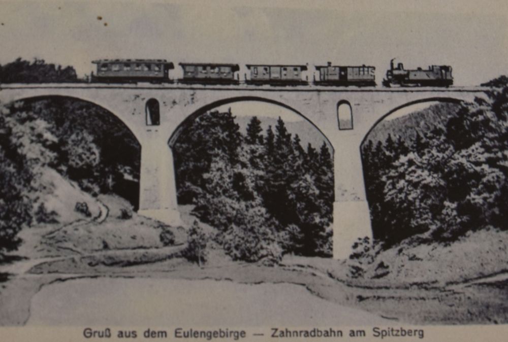
The Eulengebirgsbahn (Railway of the Owl Mountains) was built to speed up the transport of coal from Neurode to the weaving factories of Reichenbach
North East of the Eulengebirge (Góry Sowie) were the weaving factories, where the weavers’ rebellion took place in the year 1844. About this rebellion, the German author Gerhart Hauptmann wrote the play “die Weber (the Weavers)” in 1892 (we read it at school 60 years ago). The weaving factories around Reichenbach needed energy. Coal mining was at Neurode, on the other side of the mountains. The Eulengebirge (Góry Sowie) and the Warthagebirge (Góry Bardzkie) were in the way. The Germans decided to connect Neurode and Reichenbach by building a railway, the Eulengebirgsbahn, nick named “Eule”. The railway from Reichenbach to Silberberg was inaugurated in 1900. Two years later, in 1902, the Germans completed the section between Silberberg and Neurode. For this section, they had to overcome the Silber pass (Przełęcz Srebrna) that separates the Eulengebirge (Góry Sowie) from the Warthagebirge (Góry Bardzkie). They built the cog railway between Silberberg (Srebrna Góra) and Neudorf (Nowa Wieś). Crossing the two canyons between Silberberg and the Silber pass required constructing the two spectacular viaducts. The Herzogswaldeviadukt was 24m high and 90m long. The Silberbergviadukt was 27m high (Gruzlewski and Przerwa , p. 220 and p. 224) .
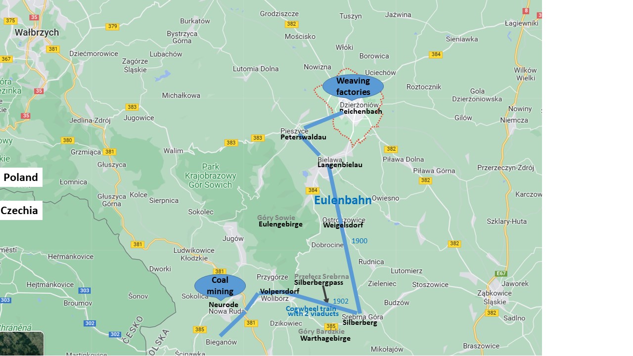
(Source: Google maps and my own additions to lay out the approximate route of the railway and the mountains)
The cog train became a tourist attraction. The journey was 4.2km long and lasted about 27 minutes to overcome 175m (Gruzlewski and Przerwa , p. 230). The viaducts were spectacular. The railway had to be cut into the mountains, the rocks were 18m high.
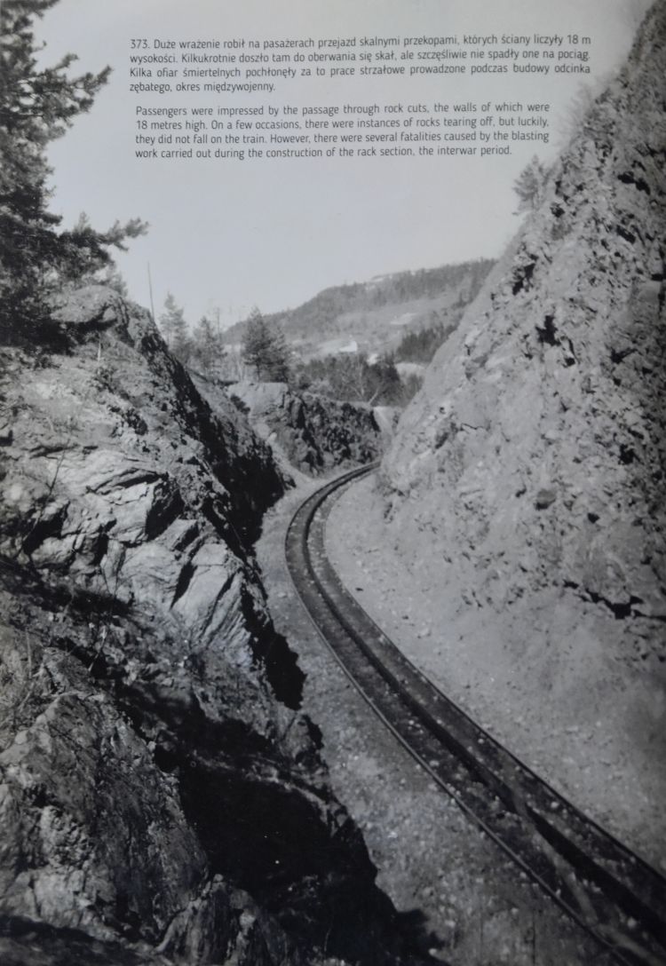
(Gruzlewski and Przerwa , p. 223).
In 1924, when my grandfather put down his easel on the Silberberg pass, he surely had arrived with his family by cog train and left it at the station on the Silberberg pass.
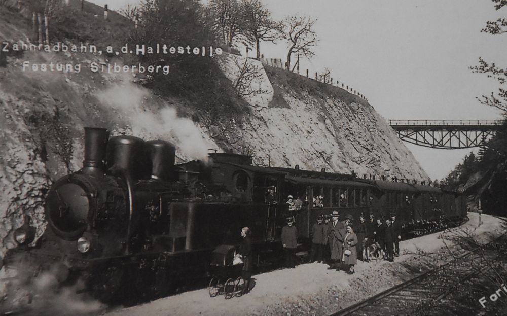
(Gruzlewski and Przerwa , p. 216).
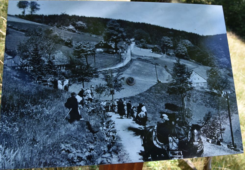
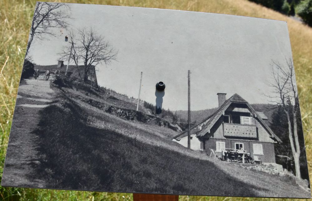
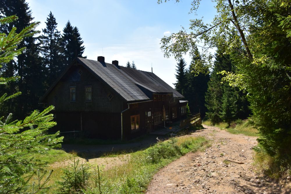
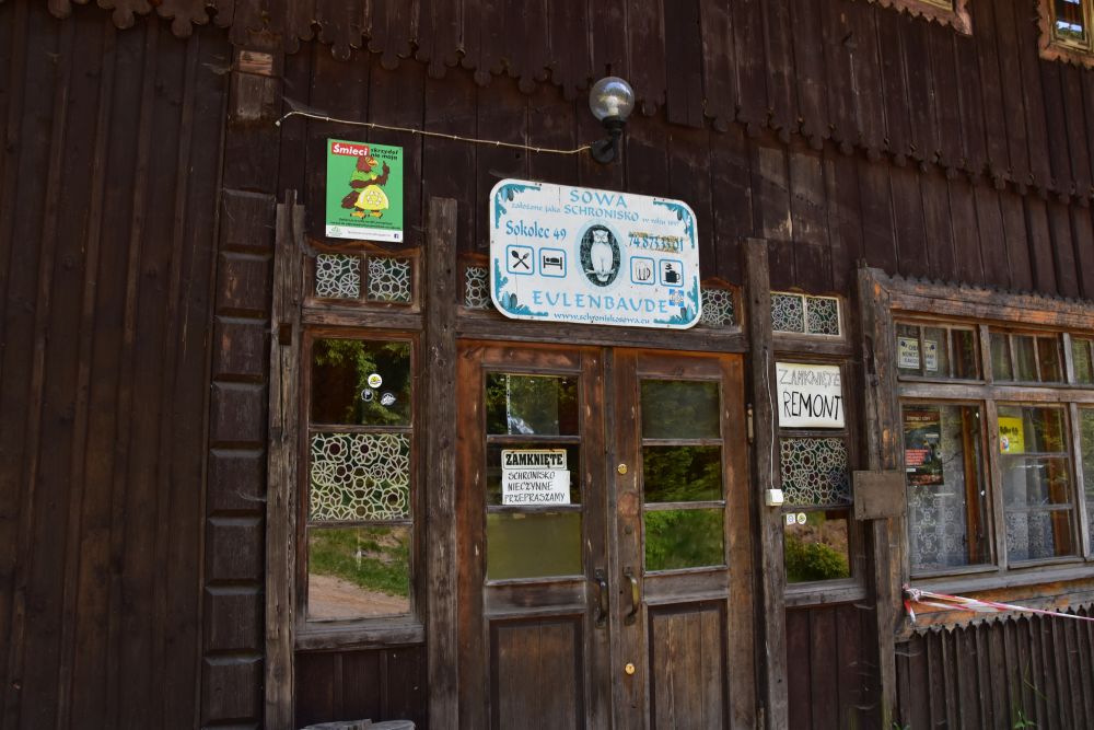
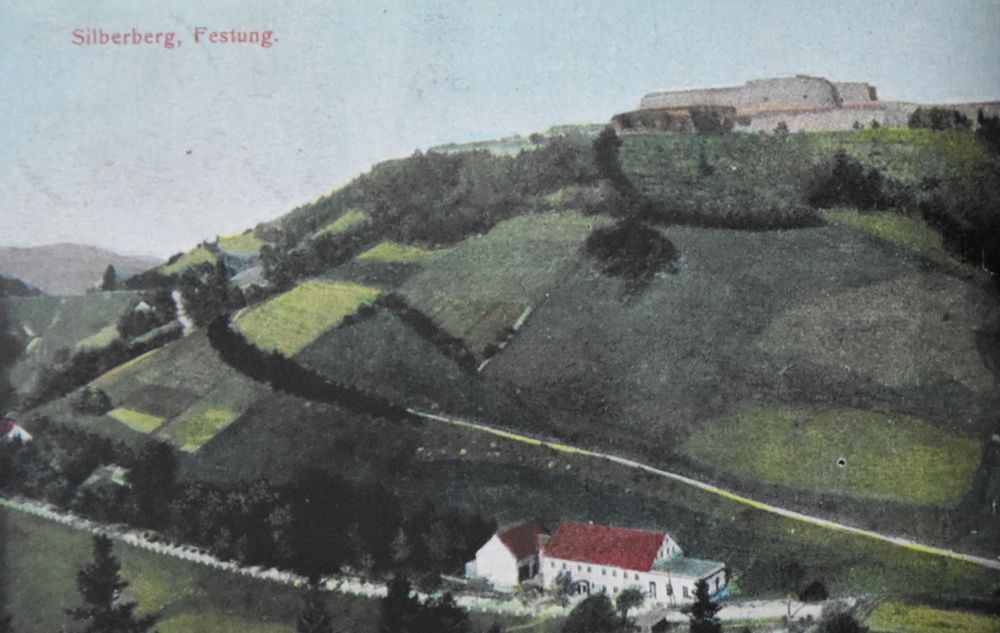
There were only a few tourist facilities on the Silberberg pass, the Waldfrieden (left hand side at the edge) and the Gasthaus zur Friedrichshöh (right hand side) (Gruzlewski and Przerwa , p. 58ff ). Probably my grandfather stayed in one of these facilities with his family.
(Gruzlewski and Przerwa , p.108)
Unfortunately, the cog wheel section had not been constructed carefully and was halted already in 1931. The last rack train travelled on October 11th 1931 (Gruzlewski and Przerwa, p. 228).
Today, the two viaducts belong to the cultural heritage of Poland, as indicated on the hiking map. The railway track has become the hiking path that I explored when investigating the viaducts. I came across quite a few hikers from Poland that enjoyed crossing the viaducts.
About the Silberberg Fortress built by the Prussians, now and before a tourist attraction
Today the Silberberg Fortress (Twierdza Srebrna) is the tourist attraction of Silberberg. I visited it in October 2022 on my first “detective tour”, then feeling desperate, because I had no idea, where to look for the places of the easel of my grandfather; I was even not aware of the viaducts below the Fortress. Almost one year later, in 2023, I knew about the viaducts. Again, I climbed up to the Fortress to get an overview of the western ridge of the Góry Bardzie that are on the painting of my grandfather. I could recognize the meadow behind Herzogswalde (Zdanów).
It was wet and rainy. Not as sunny as on the painting of my grandfather. Today, there are more trees, but the hills of the Góry Bardzkie are still the same.
In the souvenir shop of the Fortress, I found the wonderful book of Jacek Gruzlewski and Tomasz Przerwa (“Silberberg. A mirror of time – Srebrna Góra. Zwierciadlo czasu”, Srebrna Góra, Sova 2021). Back at the Palac Kamieniec in the evening, I read the book drinking a glass of good Polish wine. Good Polish wine? Be assured, you can find that.
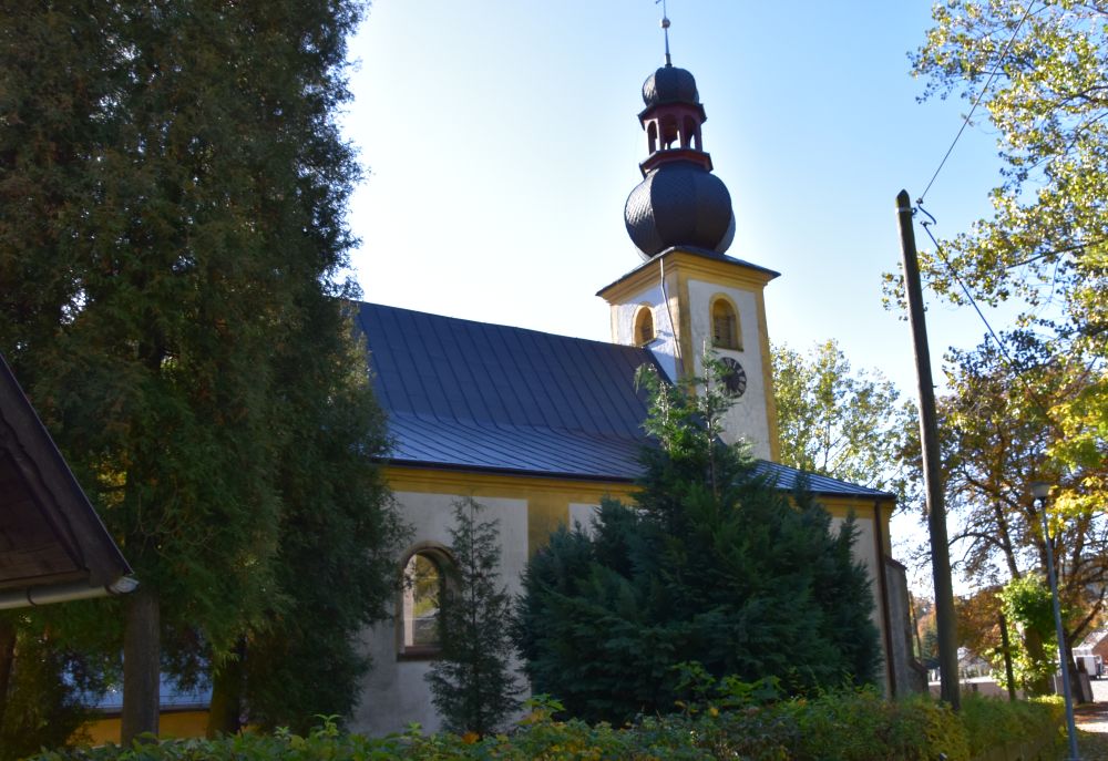
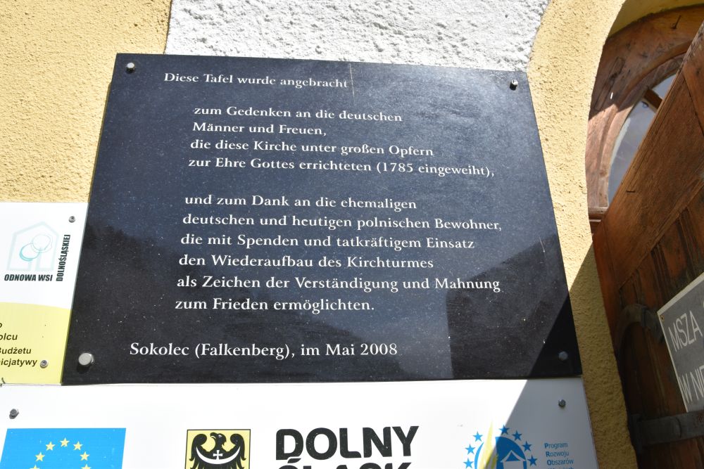
The Silberberg Fortress had been completed by Frederick II from Prussia in 1785. He had a complex of fortresses constructed on various hills above the Silberberg pass (Gruzlewski and Przerwa, p. 100).
After 1880, the Fortress became a tourist attraction (Gruzlewski and Przerwa, p. 106). In the time between the wars, about 60’000 tourists per year visited Fort Silberberg; they benefited from the railway station on the Silverberg pass (Gruzlewski and Przerwa, p. 130).
The fortresses have a gloomy past in the Second World War; the Nazi imprisoned Polish officers (p. 107) and there were also Finnish prisoners (p.174). I felt sorry for them. The vaults are very dark and wet, and I got lost in them.
The Silberberg Fortress is a touristy place today as well. On weekends the two car parkings on the small Silberberg pass fill up quickly. Most tourists are from Poland. In addition I could hear some German; the children and grand children of the Silesians that had to emigrate after 1945 are now coming to Silesia to find the houses of their ancestors; the houses are now inhabited by the descendants of the Poles that had to emigrate from former East Poland. A beautiful testimony of the events after 1945 is given the Karolyna Kuszik’s “Poniemieckie”.
The art scene at Srebrna Góra
Usually, my grandfather travelled to places with an active scene of artists. Gruzlewski and Przerwa included the chapter called “Artistically” on p. 239. They mention that plein-air painting arrived only shortly before the First World War; Carl Ernst Morgenstern had painted the fortresses and Max Leipelt’s company from Cieplice (Warmbrunn) published postcards based on these paintings. In 1921-1922, the printer Franz Otto moved to Srebrna Góra and produced a calendar with wood cuts about the area. Was Hermann Radzyk aware of this calendar, when he decided to visit Srebrna Góra? In the 1920’s, the artist Max Günther moved to Srebrna Góra. Was Hermann Radzyk in contact with him, when he came to Srebrna Góra in 1924? I do not know.
Srebrnra Góra and its rack railway – what a wonderful area
It was in October 2022 that I visited the Eulengebirge for the first time looking for the paintings of my grandfather, but not yet knowing any of the locations of the easel. I then drove along the south border of the Eulengebirge and was very surprised, when all of a sudden, the road went up steeply taking me to the Silberberg pass. In 2023 I returned three times to the area around Srebrna Góra and started to feel somewhat at home. The Poles I met off the beaten tracks asked me: “What are you doing HERE?” I showed them the painting of my grandfather – “I see”.
I thank the friendly couple at Zdanów that invited us for coffee. They spoke German and were the owners of a German diploma paper about Herzogswalde from the 1950’s. The owners of the Lesny Dvor proudly lent me their books about (German) Silesia, and German maps hang on the walls of their hotel. In addition the Palac Kamieniec is proud of their maps hanging on their walls. All that helped me to solve my puzzles about the paintings of my grandfather. And it gave me a feeling of reconciliation between Poles and Germans – this provides hope for the future.
Sources:
- Jacek Gruzlewski and Tomasz Przerwa (“Silberberg. A mirror of time – Srebrna Góra. Zwierciadlo czasu”, Srebrna Góra, Sova 2021
- https://polska-org.pl/522602,Zdanow,Wiadukt_Zdanowski_Most_Dziewiczy.html (old postcards of the Herzogwaldeviadukt)
- https://polska-org.pl/539823,Srebrna_Gora,Wiadukt_Srebrnogorski_Most_Katarzyny.html (old postcards of the Silberbergviadukt)
- Wikipedia entry about Gerhart Hauptmann. We read the play at school in the 1960-s
- https://www.wuestewaltersdorf.de/htm/eule/eulengebirgsbahn2-streckebau.htm